Flat 3
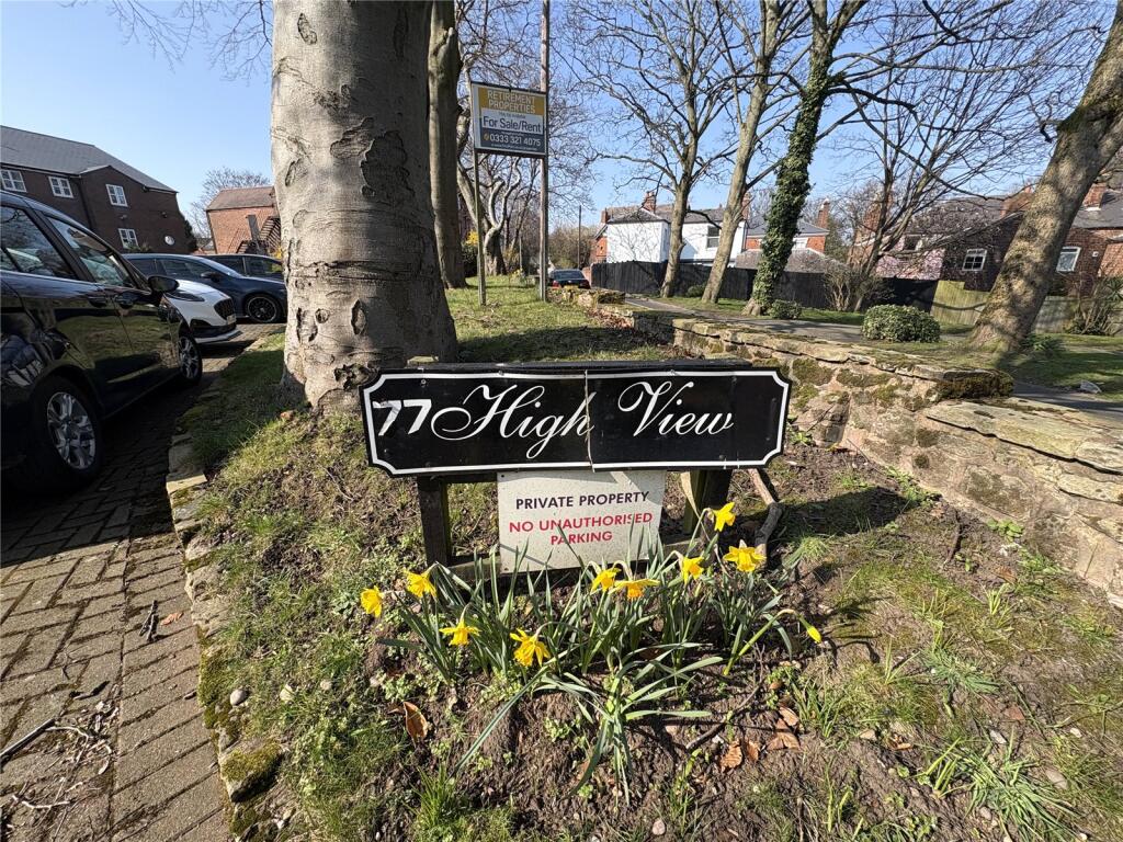
HIGH VIEW, 77, HIGHGATE ROAD, WALSALL, WEST MIDLANDS WS1 3JA
Property details
Tenure
LEASEHOLD (85 years remaining on lease)
Floor area
63 m²
Council tax band
B
Last sold
£68,000 Mar 2026
Local average
£116,227 (-39.8%)
Deprivation
Decile 1 (1,355 of 33,755)
Street crime
569 incidents within 1 mile (Apr 2026)
Key features
- Offered For Sale With No Upward Chain
- Over 55's Development
- No Upward Chain
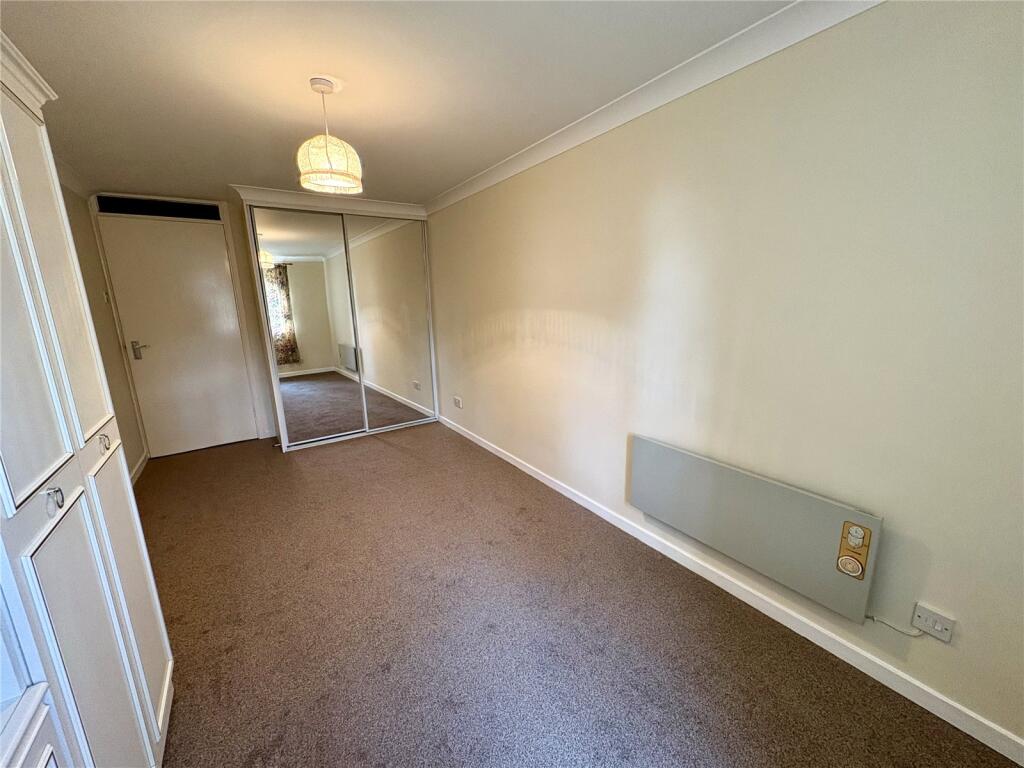
- Two Bedrooms And Shower Room
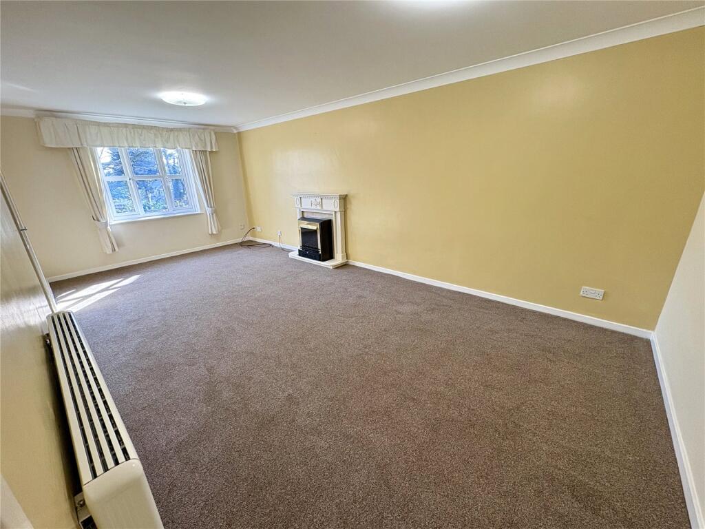
- Through Lounge With Feature Fireplace
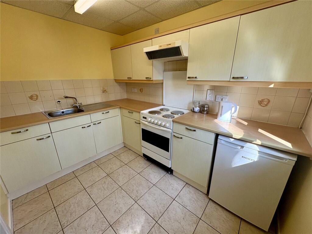
- Fitted Kitchen With Space For Appliances
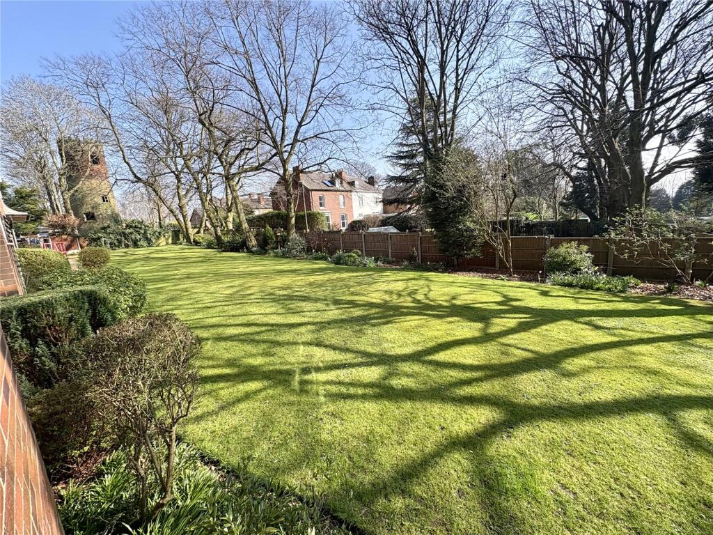
- Communal Car Park And Gardens
- Resident Facilities
- Viewing Is A Must
Additional details
- Electricity
- Mains supply
- Water
- Mains supply
- Sewerage
- Mains supply
- Heating
- Electric
- Parking
- Yes
Description
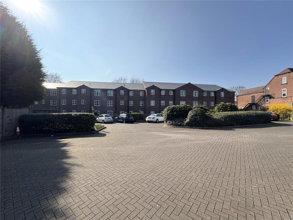
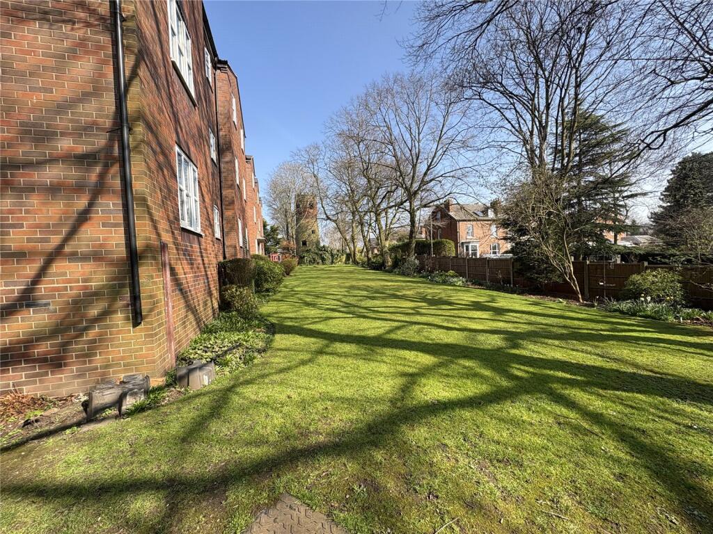
A rare opportunity to purchase a ground floor apartment situated in High View on Highgate Road, this over 55's property benefits from views over communal gardens. Highview offers facilities including a residents lounge, communal laundry facilities, lift to all floors, 24 hour emergency call system, guest suite, communal gardens and car parking.
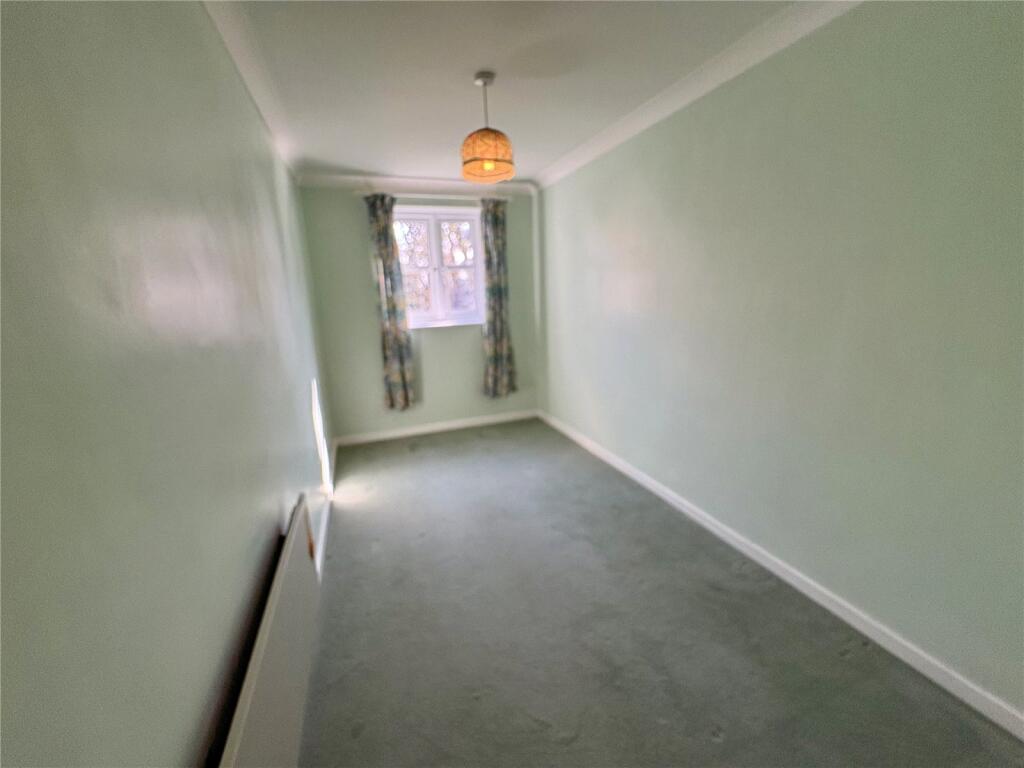
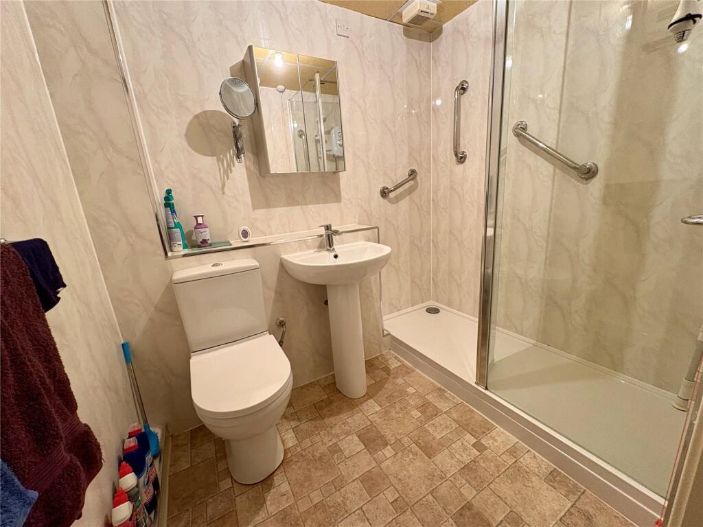
The accommodation in brief comprises of entrance hallway with storage, living room with feature fireplace, fitted kitchen with space for appliances. Shower room, two bedrooms, the property benefits from electric heating and double glazing.
The property is located in reach to local bus routes, road network and in reach to junction 7 and 9 of the M6 motorway, Walsall, Wednesbury and Great Barr.
Listed by
Walsall
Countrywide UK Sales - Connells
Reference: 160728881
EPC ratings on this postcode
We don't have a matched EPC for this property yet. Below are efficiency scores and details for other addresses on this postcode.
| Address | Current | Potential | Floor area | Age band | Type |
|---|---|---|---|---|---|
| 75 Highgate Road, WALSALL | 1 | 72 | 64 m² | England and Wales: before 1900 | Detached |
| 75A HIGHGATE ROAD, WALSALL, WALSALL | 64 | 75 | 226 m² | England and Wales: 1930-1949 | Detached |
| 75b, Highgate Road, WALSALL | 60 | 78 | 172 m² | England and Wales: 1950-1966 | Detached |
| 78b, Highgate Road, WALSALL | 41 | 68 | 117 m² | England and Wales: 1900-1929 | Flat |
| 80 Highgate Road, WALSALL | 66 | 74 | 149 m² | England and Wales: 1930-1949 | Detached |
| 81 Highgate Road, WALSALL | 59 | 76 | 166 m² | England and Wales: 1900-1929 | Detached |
| 89, Highgate Road, WALSALL | 52 | 77 | 130 m² | England and Wales: 1976-1982 | Detached |
| 94 Highgate Road, WALSALL | 70 | 84 | 133 m² | England and Wales: 1996-2002 | Terraced |
| 98, Highgate Road, WALSALL | 67 | 80 | 142 m² | England and Wales: 1996-2002 | Terraced |
| Flat 3, High View, 77 Highgate Road, WALSALL | 64 | 79 | 63 m² | England and Wales: 1996-2002 | Flat |
Flood risk
Zone: 2
Risk: In flood risk area
Environment Agency Flood Risk Areas (APSFR)
Floorplans
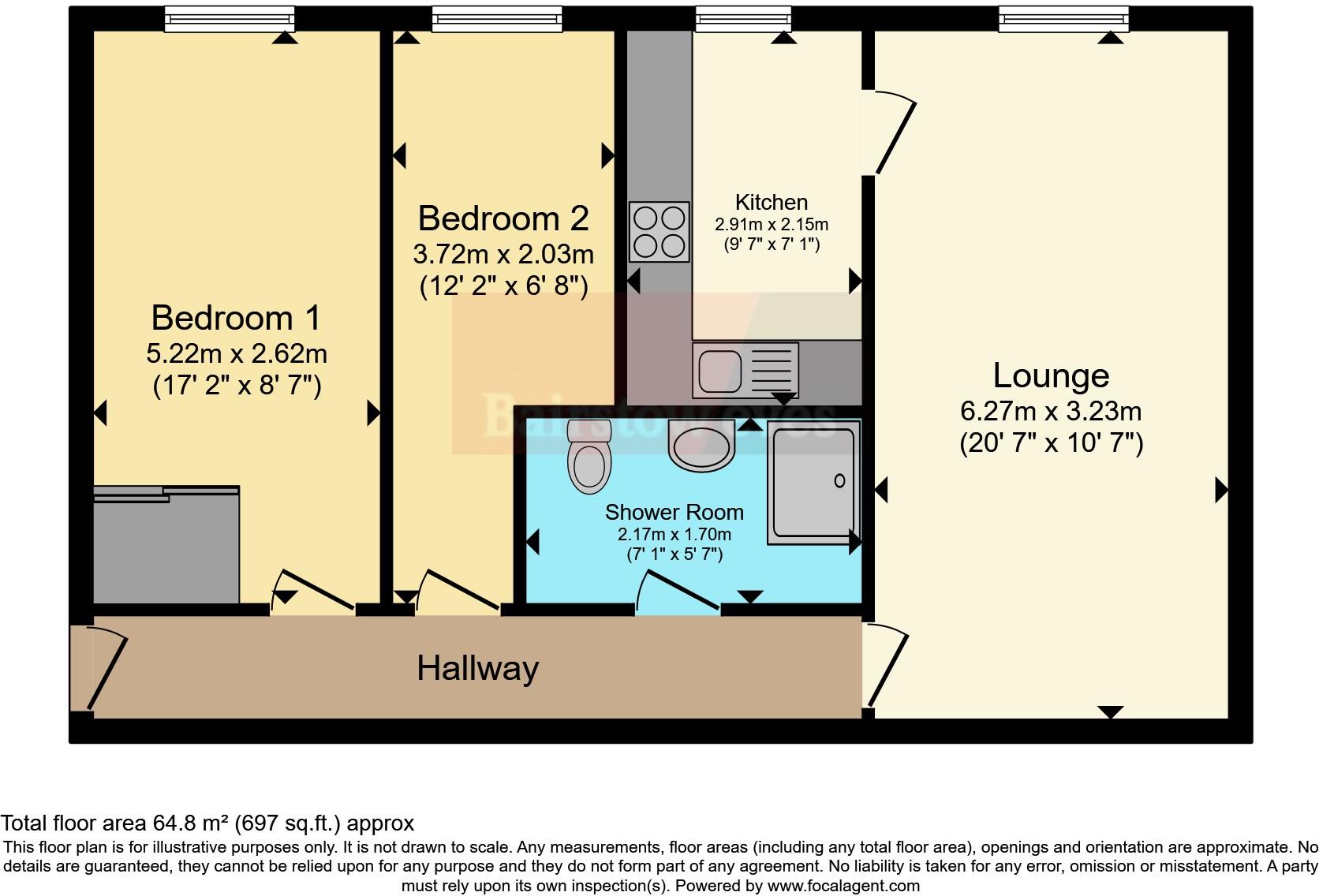
Floorplan
EPC Graphs
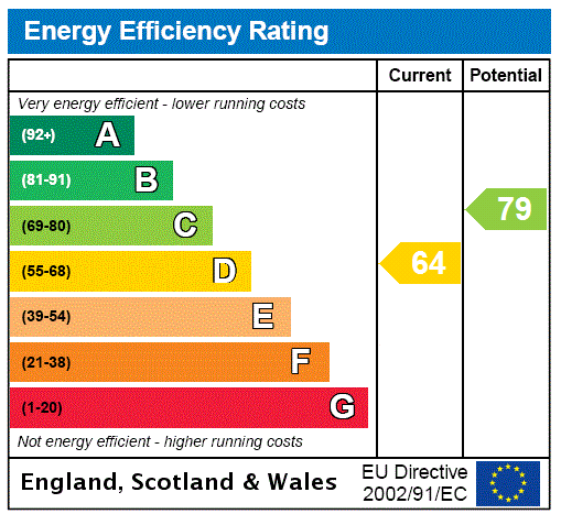
EPC Rating Graph
Price history
| Event | Date | Price | % change |
|---|---|---|---|
| Sold | 06/03/2026 (3 months ago) | £68,000 | — |
Source: HM Land Registry Price Paid Data. Crown copyright.
Sold Comparables
Same street and nearby sales within 0.25 miles (last 5 years). Data from Land Registry Price Paid.
| Address | Price | Date | Type |
|---|---|---|---|
| 1A DOVERIDGE PLACE, WALSALL, WEST MIDLANDS, WS1 3EF | £130,000 | 03/11/2023 | Flat |
| Same street HIGH VIEW, 77 FLAT 10 HIGHGATE ROAD, WALSALL, WEST MIDLANDS, WS1 3JA | £77,500 | 02/10/2023 | Flat |
| Same street HIGH VIEW, 77 FLAT 5 HIGHGATE ROAD, WALSALL, WEST MIDLANDS, WS1 3JA | £65,000 | 10/02/2023 | Flat |
| Same street 75A HIGHGATE ROAD, WALSALL, WEST MIDLANDS, WS1 3JA | £520,000 | 07/07/2022 | Detached |
| Same street 75 HIGHGATE ROAD, WALSALL, WEST MIDLANDS, WS1 3JA | £235,000 | 12/05/2022 | Other |
| 1A DOVERIDGE PLACE, WALSALL, WEST MIDLANDS, WS1 3EF | £75,000 | 22/04/2022 | Flat |
| Same street HIGH VIEW, 77 FLAT 38 HIGHGATE ROAD, WALSALL, WEST MIDLANDS, WS1 3JA | £72,000 | 21/03/2022 | Flat |
| Same street HIGH VIEW, 77 FLAT 35 HIGHGATE ROAD, WALSALL, WEST MIDLANDS, WS1 3JA | £64,000 | 18/02/2022 | Flat |
| Same street HIGH VIEW, 77 FLAT 12 HIGHGATE ROAD, WALSALL, WEST MIDLANDS, WS1 3JA | £80,000 | 10/01/2022 | Flat |
| Same street HIGH VIEW, 77 FLAT 10 HIGHGATE ROAD, WALSALL, WEST MIDLANDS, WS1 3JA | £70,000 | 12/11/2021 | Flat |
| Same street 81 HIGHGATE ROAD, WALSALL, WEST MIDLANDS, WS1 3JA | £290,000 | 30/09/2021 | Semi-detached |
Street average: £163,722 (9 sales)
Area average: £102,500 (2 sales)
Capital growth trend
Land Registry outcode average: last 12 months vs 5y and 10y ago (from sold prices).
House Price Index (HM Land Registry — official index, not sold-price averages): Walsall. Series: Flats and maisonettes. As of March 2026.
Rental Range
Estimated market rent for Walsall. Low = conservative, Realistic = average, Optimistic = best case.
Based on Local Authority from postcode lookup → Walsall.
LHA (30th percentile) floor for Black Country: £623/mo (Apr 2025 – Mar 2026)
Location
Address
Green Hill Walk
Nearby
Nearest stations, universities and amenities (distance from property).
| Type | Name | Distance |
|---|---|---|
| Bus stop | West Bromwich St / Little London | 0.2 miles |
| Shop | Palm Medical | 0.2 miles |
| Shop | JB Garage | 0.3 miles |
| Train station | Walsall | 0.7 miles |
| Train station | Bescot Stadium | 1.1 miles |
| University | Maryvale Institute | 4.0 miles |
| University | University of Wolverhampton Wulfruna Campus | 6.4 miles |
| Hospital | Bilston Street Surgery | 6.5 miles |
| Hospital | krishna pemmaraju | 8.3 miles |
Street-level crime
| Category | Count |
|---|---|
| Violence and sexual offences | 206 |
| Shoplifting | 108 |
| Vehicle crime | 38 |
| Drugs | 34 |
| Criminal damage and arson | 33 |
| Public order | 32 |
| Burglary | 27 |
| Other theft | 24 |
| Anti-social behaviour | 20 |
| Other crime | 14 |
| Robbery | 12 |
| Possession of weapons | 10 |
| Theft from the person | 9 |
| Bicycle theft | 2 |
| Total incidents | 569 |
Within 1 mile during Apr 2026. Source: data.police.uk (England & Wales).
Schools nearby
Nearest open schools with Ofsted ratings (England). Closed schools are not shown. Data from Get Information about Schools and Ofsted.
| Name | Type | Distance | Ofsted |
|---|---|---|---|
| Caldmore Primary Academy | Primary | 0.2 miles | Good — 17 Nov 2019 |
| St Mary's The Mount Catholic Primary School | Primary | 0.3 miles | Outstanding — 11 Nov 2013 |
| Blue Coat Church of England Aided Infant School | Primary | 0.3 miles | Good — 11 Sep 2017 |
| Whitehall Nursery and Infant School | Primary | 0.3 miles | Outstanding — 13 Jan 2015 |
| Blue Coat Church of England Academy | Secondary | 0.4 miles | Good — 18 Oct 2014 |
Rental Comparables
Residential lets from OpenRent and Rightmove for the area (same bedroom count). Use to validate rent estimates. Student lets are excluded.
| Title | Rent | Beds | Distance | As seen on |
|---|---|---|---|---|
| 2 Bed Flat, Pommel Close, WS5 | £900/mo | 2 | 1.16 miles | OpenRent |
Average rent: £900/mo (1 listing)
Rent-driven metrics
Based on OpenRent comparables.
- Rent ratio — Monthly rent ÷ purchase price (1% rule). 1%+ = strong, 0.8–1% = okay, <0.8% = weak for cashflow.
- Max investor price — Rent ÷ 0.8%; the price at which rent would be 0.8% of price (Stoke-style target).
- Target investor price — Rent ÷ 1%; the price at which rent would be 1% of price (strong cashflow band).
- Gross yield — Annual rent as % of purchase price (no costs).
- Cost-to-rent — Price ÷ annual rent (from OpenRent comparables). Under 14× = strong, 14–16× = acceptable, 17×+ = compressed.
- Cashflow — Rent minus mortgage, 10% maintenance, £25/mo compliance. Assumes 75% LTV, 3.95% APR (5yr fixed), 25yr term.
- ROI — Annual profit ÷ cash in (deposit + 4% purchase costs).
Enter House Number
Enter the house number to help us retrieve more accurate pricing history and property data.
Please log in to submit or correct the house number for this listing.
Log in to continue