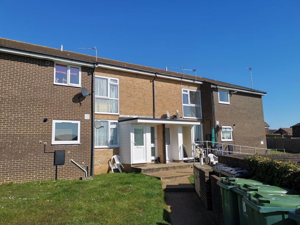
Flat 7
WINFORD COURT, FOREST WAY, SANDOWN, WINFORD, ISLE OF WIGHT PO36 0JJ
£595 pcm
Property details
Floor area
45 m²
Deprivation
Decile 5 (13,795 of 33,755)
Street crime
8 incidents within 1 mile (Apr 2026)
Key features
- Good Size First Floor Flat
- 2 Bedrooms
- Situated In A Residential Area Of Winford
- Allocated Parking Space
Additional details
- Heating
- Double glazing, Gas central
- Parking
- Off street, Allocated
Description
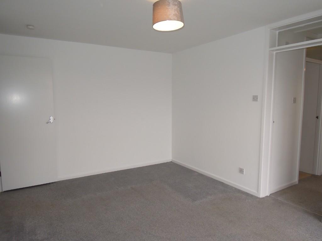
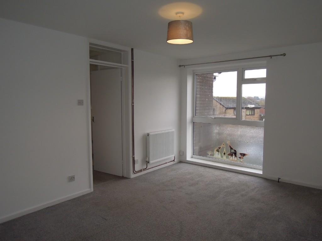
A good size, two bedroom first floor flat. Own private entrance. Situated in a quiet residential area
of Winford. Allocated parking space.
ACCOMMODATION:
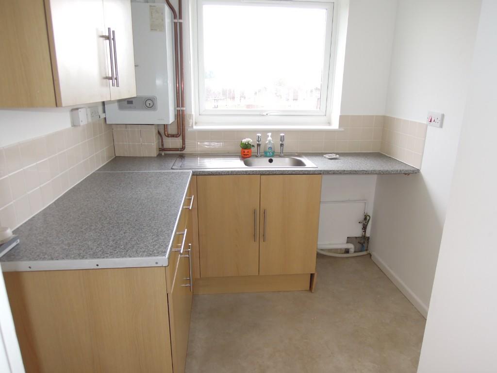
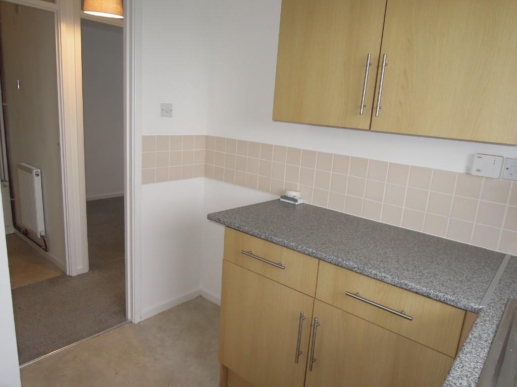
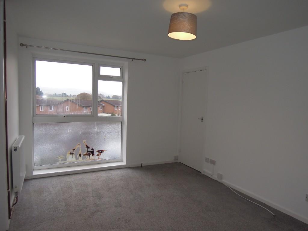
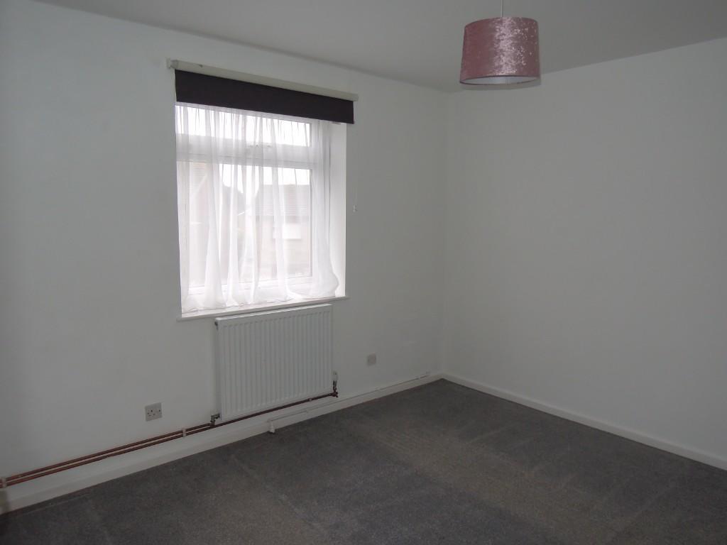
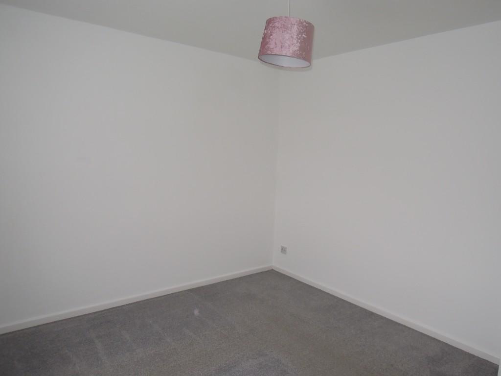
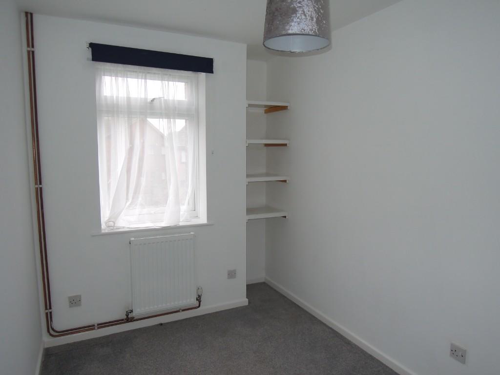
ENTRANCE stairs to first floor * LOUNGE 14'11 x 10'1 window to front and large built in storage cupboard *HALLWAY with built in storage cupboard *KITCHEN 8'0 x 6'3 space and plumbing for washing machine, space and point for cooker, space for fridge/freezer
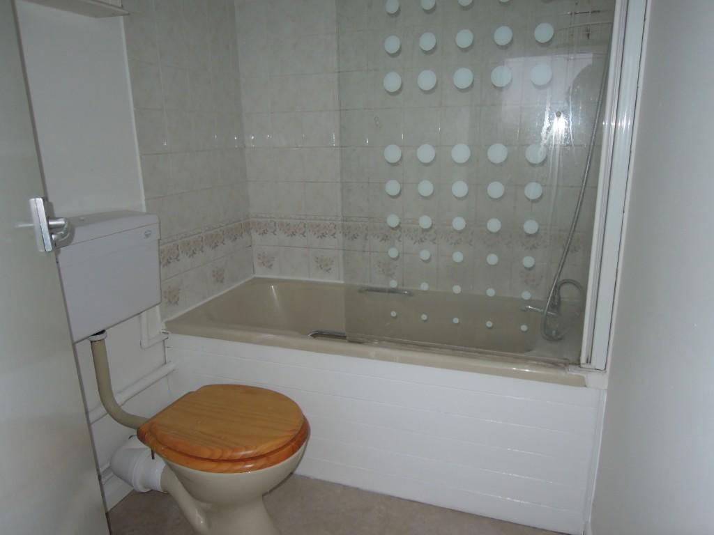
* BATHROOM 6'4 x 4'11 panel bath with fitted shower over, pedestal wash hand basin & low flush wc *BEDROOM ONE 11'1 x 10'1 window to side * BEDROOM TWO 10'6 x 6'10 window to side *
HEATING: Gas fired central heating and double glazing
OUTSIDE: Allocated Parking Space
TENANCY
LIMITATIONS: Sorry no Pets or Smokers
PROPERTY
AVAILABLE: Immediately
HOLDING FEE: Equal to one weeks rent
TO VIEW: By Appointment only please with
Whitehouse Porter Estate Agents
UNFURNISHED
RENTAL: £595 PCM
DEPOSIT: £595
COUNCIL TAX BAND 'A'
Listed by
Sandown
Whitehouse & Porter
Reference: 129787658
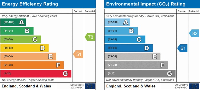
EPC ratings on this postcode
We don't have a matched EPC for this property yet. Below are efficiency scores and details for other addresses on this postcode.
| Address | Current | Potential | Floor area | Age band | Type |
|---|---|---|---|---|---|
| Flat 1 Winford Court, Forest Way, Winford, SANDOWN | 59 | 80 | 38 m² | England and Wales: 1976-1982 | Flat |
| Flat 10, Winford Court, Forest Way, SANDOWN | 72 | 77 | 39 m² | England and Wales: 1967-1975 | Flat |
| Flat 11 Winford Court, Forest Way, Winford, SANDOWN | 74 | 78 | 42 m² | England and Wales: 1983-1990 | Flat |
| Flat 11, Winford Court, Forest Way, SANDOWN | 70 | 77 | 44 m² | England and Wales: 1976-1982 | Flat |
| FLAT 12, WINFORD COURT, FOREST WAY, SANDOWN | 75 | 76 | 39 m² | England and Wales: 1983-1990 | Flat |
| Flat 13 Winford Court, Forest Way, Winford, SANDOWN | 53 | 79 | 49 m² | England and Wales: 1976-1982 | Flat |
| Flat 16 Winford Court, Forest Way, Winford, SANDOWN | 60 | 78 | 49 m² | England and Wales: 1983-1990 | Flat |
| Flat 16 Winford Court, Forest Way, Winford, SANDOWN | 70 | 79 | 48 m² | England and Wales: 1983-1990 | Flat |
| Flat 2 Winford Court, Forest Way, Winford, SANDOWN | 75 | 78 | 45 m² | England and Wales: 1983-1990 | Flat |
| Flat 2, Winford Court, Forest Way, SANDOWN | 73 | 77 | 47 m² | England and Wales: 1967-1975 | Flat |
| Flat 3, Winford Court, Forest Way, SANDOWN | 73 | 78 | 43 m² | England and Wales: 1976-1982 | Flat |
| Flat 4 Winford Court, Forest Way, Winford, SANDOWN | 73 | 77 | 42 m² | England and Wales: 1976-1982 | Flat |
| Flat 6 Winford Court, Forest Way, Winford, SANDOWN | 66 | 77 | 49 m² | England and Wales: 1983-1990 | Flat |
| FLAT 6, WINFORD COURT, FOREST WAY, NEWCHURCH | 60 | 78 | 45 m² | England and Wales: 1967-1975 | Flat |
| Flat 7 Winford Court, Forest Way, Winford, SANDOWN | 51 | 78 | 45 m² | England and Wales: 1976-1982 | Flat |
Flood risk
Zone: 1
Risk: Low
Job (default Low)
EPC Graphs
EPC 1
Rental Range
Estimated market rent for Isle of Wight. Low = conservative, Realistic = average, Optimistic = best case.
Based on Local Authority from postcode lookup → Isle of Wight.
Location
Address
Forest Way
Nearby
Nearest stations, universities and amenities (distance from property).
| Type | Name | Distance |
|---|---|---|
| Bus stop | Forest Road East | 0.1 miles |
| Bus stop | Winford, Parkway | 0.1 miles |
| Shop | William Hall Independent Funeral Directors | 0.3 miles |
| Shop | Isle of Wight Cheese Co | 0.4 miles |
| Train station | Shanklin | 1.6 miles |
| Train station | Lake | 1.7 miles |
| Hospital | Earl Mountbatten Hospice | 5.1 miles |
| Hospital | Orchard Private Hospital | 5.4 miles |
| University | University of Portsmouth Area | 10.9 miles |
| University | 36-40 Middle Street | 10.9 miles |
Street-level crime
| Category | Count |
|---|---|
| Violence and sexual offences | 7 |
| Criminal damage and arson | 1 |
| Total incidents | 8 |
Within 1 mile during Apr 2026. Source: data.police.uk (England & Wales).
Schools nearby
Nearest open schools with Ofsted ratings (England). Closed schools are not shown. Data from Get Information about Schools and Ofsted.
| Name | Type | Distance | Ofsted |
|---|---|---|---|
| Newchurch Primary School | Primary | 0.9 miles | Good — 8 Sep 2024 |
| Broadlea Primary School | Primary | 1.3 miles | Good — 15 Nov 2021 |
| Gatten and Lake Primary School | Primary | 1.6 miles | Good — 12 Jan 2023 |
| St Blasius Shanklin CofE Primary Academy | Primary | 1.8 miles | Good — 20 Jul 2017 |
| The Bay Church of England School | Other | 1.9 miles | Good — 26 Apr 2023 |
Rental Comparables
Rental listings exist nearby, but none matched the 2-bedroom count for this property.
Enter House Number
Enter the house number to help us retrieve more accurate pricing history and property data.
Please log in to submit or correct the house number for this listing.
Log in to continue