183 PONTEFRACT ROAD
BARNSLEY, CUDWORTH, SOUTH YORKSHIRE S72 8AE
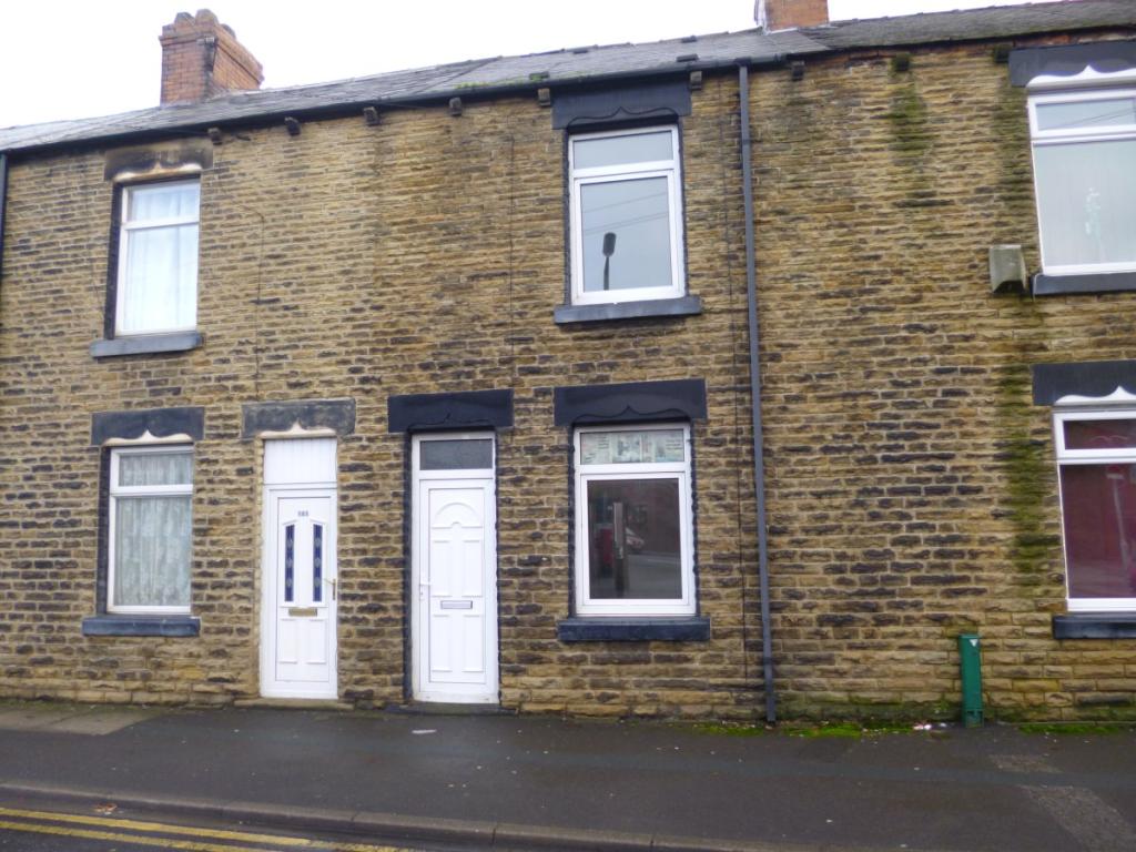
Photo 1
/ 1
Property details
Floor area
81 m²
EPC rating
D
Year built
England and Wales: 1900-1929
Deprivation
Decile 4 (10,816 of 33,755)
Street crime
96 incidents within 1 mile (Apr 2026)
Key features
- 3 Beds
- 2 Receptions
- 1 Bathroom
- Part Furnished
- D/G
- Gas Central Heating
- Terrace
- Recently refurbished
- Viewing Advised
Description
Served by local amenities in Cudworth and ideally suited to the younger family, this three bedroom mid terrace house has recently been decorated including new carpets throughout.
With double glazing and central heating, the property comprises:
Lounge, dining room, fitted kitchen, three bedrooms and a family bathroom.
Bond £350, DSS and pets considered, no smokers.
Listed by
Barnsley
Beecroft Estates
Reference: 41705260
EPC Rating & Upgrade Cost
Current rating: D
Potential rating: B
Inspection date: 09/09/2023
Expiry date: 08/09/2033
Current heating cost: £1,781/year
Potential heating cost: £1,139/year
Est. upgrade cost to C: £13,000
Recommendations
- Room-in-roof insulation (£1,500 - £2,700)
- Cavity wall insulation (£500 - £1,500)
- Upgrade heating controls (£350 - £450)
- Solar water heating (£4,000 - £6,000)
- Solar photovoltaic panels, 2.5 kWp (£3,500 - £5,500)
Flood risk
Zone: 1
Risk: Low
Job (default Low)
Rental Range
Estimated market rent for Yorkshire and The Humber. Low = conservative, Realistic = average, Optimistic = best case.
Based on Region from postcode lookup → Yorkshire and The Humber.
LHA (30th percentile) floor for Barnsley: £549/mo (Apr 2025 – Mar 2026)
Location
Nearby
Nearest stations, universities and amenities (distance from property).
| Type | Name | Distance |
|---|---|---|
| Bus stop | Pontefract Road/Albert Street | 0.0 miles |
| Bus stop | Pontefract Road/Montague Street | 0.1 miles |
| Shop | Fulton's Foods | 0.5 miles |
| Shop | Aldi | 0.5 miles |
| Hospital | Holgate Hospital | 2.0 miles |
| Hospital | Kendray Hospital | 3.3 miles |
| Train station | Barnsley Interchange | 3.4 miles |
| Train station | Fitzwilliam | 3.6 miles |
Street-level crime
| Category | Count |
|---|---|
| Violence and sexual offences | 28 |
| Anti-social behaviour | 22 |
| Vehicle crime | 9 |
| Criminal damage and arson | 8 |
| Other theft | 7 |
| Burglary | 6 |
| Public order | 6 |
| Other crime | 3 |
| Shoplifting | 3 |
| Drugs | 1 |
| Possession of weapons | 1 |
| Robbery | 1 |
| Theft from the person | 1 |
| Total incidents | 96 |
Within 1 mile during Apr 2026. Source: data.police.uk (England & Wales).
Schools nearby
Nearest open schools with Ofsted ratings (England). Closed schools are not shown. Data from Get Information about Schools and Ofsted.
| Name | Type | Distance | Ofsted |
|---|---|---|---|
| Cherry Dale Primary School | Primary | 0.1 miles | Outstanding — 4 Dec 2014 |
| Outwood Academy Shafton | Secondary | 0.3 miles | Good — 16 Feb 2018 |
| Shafton Primary Academy | Primary | 0.5 miles | Good — 10 Dec 2015 |
| Churchfield Primary School | Primary | 0.6 miles | Good — 16 Jul 2024 |
| Milefield Primary School | Primary | 1.1 miles | Good — 2 May 2024 |
Rental Comparables
Residential lets from OpenRent and Rightmove for the area (same bedroom count). Use to validate rent estimates. Student lets are excluded.
| Title | Rent | Beds | Distance | As seen on |
|---|---|---|---|---|
| 3 Bed Terraced House, Scholars Gate, S72 | £1,000/mo | 3 | 0.1 miles | OpenRent |
| 3 Bed Semi-Detached House, Kings Road, S72 | £850/mo | 3 | 0.14 miles | OpenRent |
| 3 Bed Semi-Detached House, Intake Lane, S72 | £895/mo | 3 | 0.26 miles | OpenRent |
| 3 Bed Terraced House, Church Street, S72 | £850/mo | 3 | 0.65 miles | OpenRent |
| 3 Bed Terraced House, St. Johns Road, S72 | £825/mo | 3 | 0.69 miles | OpenRent |
| 3 Bed Detached House, Bellcross Way, S71 | £1,175/mo | 3 | 1.22 miles | OpenRent |
Average rent: £933/mo (6 listings)