19 SPENCER STREET
MANSFIELD, MANSFIELD, NOTTINGHAMSHIRE NG18 5LR
£415 pcm
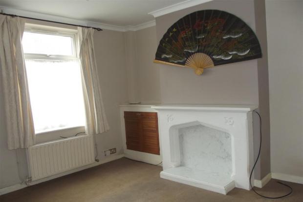
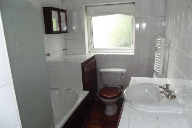
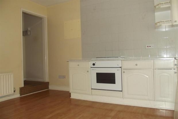
Photo 1 Photo 2 Photo 3
/ 3
Property details
Floor area
84 m²
EPC rating
D
Year built
England and Wales: 1930-1949
Deprivation
Decile 1 (1,958 of 33,755)
Street crime
562 incidents within 1 mile (Apr 2026)
Key features
- TERRACED HOUSE
- Two Bedrooms
- One Reception Room
- Unfurnished
- Heating: Gas Central Heating
- Parking: On Road Parking
- Available: NOW
- Deposit: £475
Additional details
- Parking
- Yes
- Garden
- Yes
Description
The property itself comprises of:
Ground Floor:
Lounge with feature fire place, modern fitted kitchen with wall and base units, integral oven and hob, sink and drainer and tiled splash backs. Further to the kitchen is a small dining area with further storage cupboards.
First Floor:
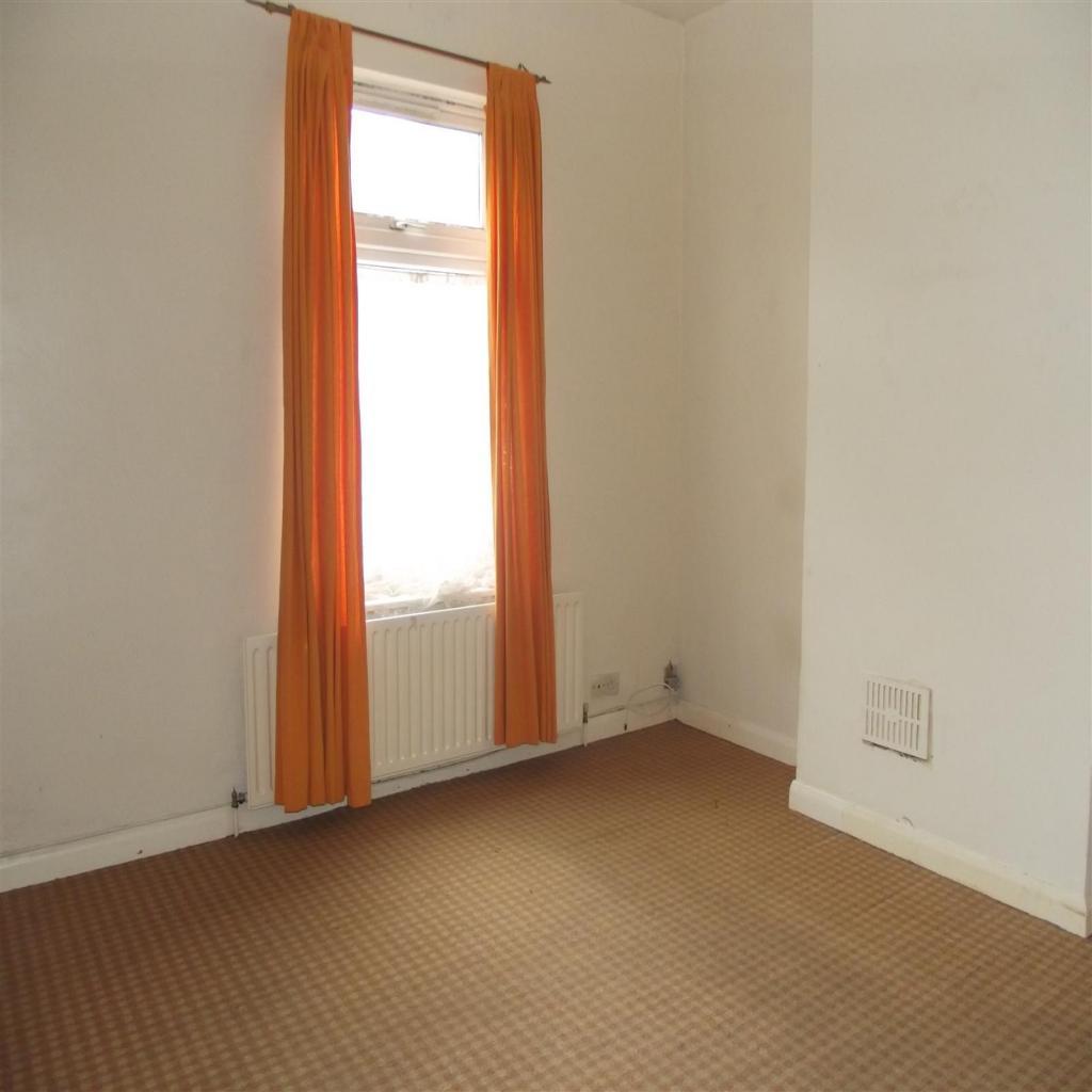
Two spacious bedrooms, and family bathroom .
Outside:
To the front is on street parking, to the rear is an enclosed garden.
Listed by
Mansfield
Countrywide UK Lettings - Connells
Reference: 41368777
EPC Rating & Upgrade Cost
Current rating: D
Potential rating: C
Inspection date: 18/02/2017
Expiry date: 17/02/2027
Current heating cost: £749/year
Potential heating cost: £673/year
Recommendations
- 50 mm internal or external wall insulation (14,000)
- Solar water heating (6,000)
- Solar photovoltaic panels, 2.5 kWp (8,000)
Flood risk
Zone: 1
Risk: Low
Job (default Low)
Floorplans
Floorplan 1
Rental Range
Estimated market rent for Mansfield. Low = conservative, Realistic = average, Optimistic = best case.
Based on Local Authority from postcode lookup → Mansfield.
LHA (30th percentile) floor for North Nottingham: £549/mo (Apr 2025 – Mar 2026)
Location
Nearby
Nearest stations, universities and amenities (distance from property).
| Type | Name | Distance |
|---|---|---|
| Bus stop | Community Hospital | 0.1 miles |
| Shop | Unknown | 0.1 miles |
| Shop | NOT Motors | 0.1 miles |
| Hospital | Mansfield Community Hospital | 0.1 miles |
| Train station | Mansfield | 0.4 miles |
| Hospital | Kings Mill Hospital | 1.2 miles |
| Train station | Mansfield Woodhouse | 1.5 miles |
| University | Nottingham Trent University Vision University Centre | 1.7 miles |
| University | Clinical Sciences | 10.6 miles |
Street-level crime
| Category | Count |
|---|---|
| Violence and sexual offences | 188 |
| Shoplifting | 87 |
| Anti-social behaviour | 80 |
| Criminal damage and arson | 39 |
| Public order | 38 |
| Vehicle crime | 36 |
| Other theft | 30 |
| Drugs | 21 |
| Burglary | 12 |
| Possession of weapons | 11 |
| Robbery | 11 |
| Other crime | 7 |
| Theft from the person | 2 |
| Total incidents | 562 |
Within 1 mile during Apr 2026. Source: data.police.uk (England & Wales).
Schools nearby
Nearest open schools with Ofsted ratings (England). Closed schools are not shown. Data from Get Information about Schools and Ofsted.
| Name | Type | Distance | Ofsted |
|---|---|---|---|
| Sutton Road Primary School | Primary | 0.2 miles | Good — 14 Jun 2012 |
| St Philip Neri With St Bede Catholic Voluntary Academy | Primary | 0.5 miles | Good — 31 Oct 2012 |
| Wainwright Primary Academy | Primary | 0.6 miles | Good — 19 Sep 2023 |
| Intake Farm Primary School | Primary | 0.6 miles | Good — 16 Feb 2018 |
| R.E.A.L. Independent Schools Mansfield | Other | 0.7 miles | Good — 2 May 2024 |
Rental Comparables
Rental listings exist nearby, but none matched the 2-bedroom count for this property.