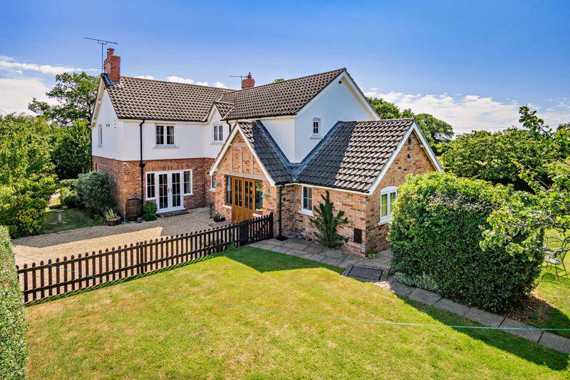
Ridley
Nr. Tarporley, CW6 9RY
Property details
Tenure
FREEHOLD
Council tax band
F
Local average
£747,172 (+0.4%)
Deprivation
Decile 5 (14,793 of 33,755)
Street crime
0 incidents within 1 mile (Apr 2026)
Key features
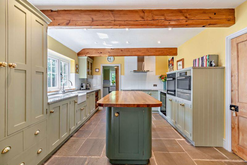
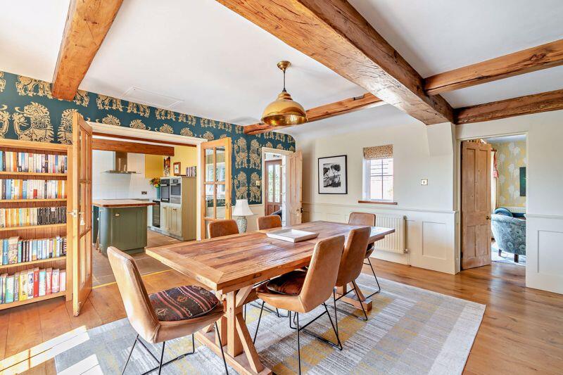
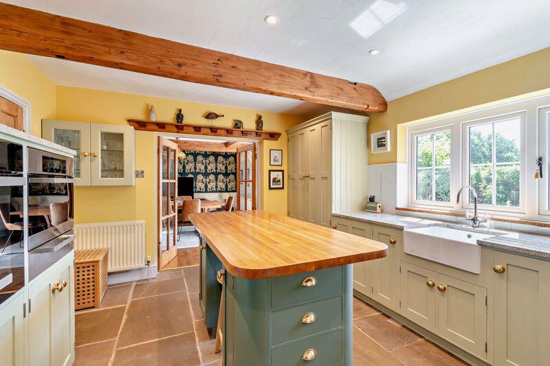
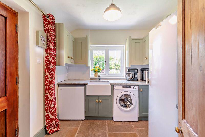
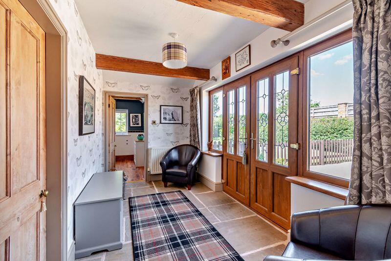
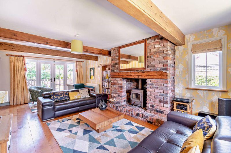
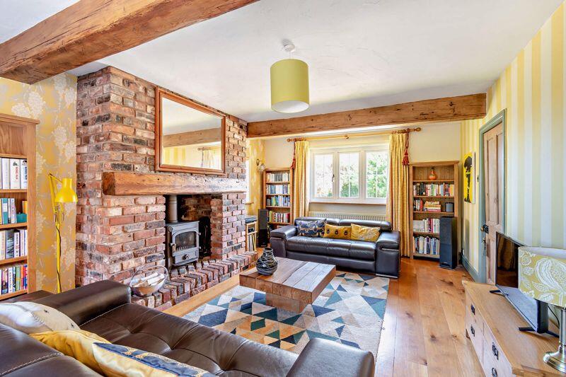
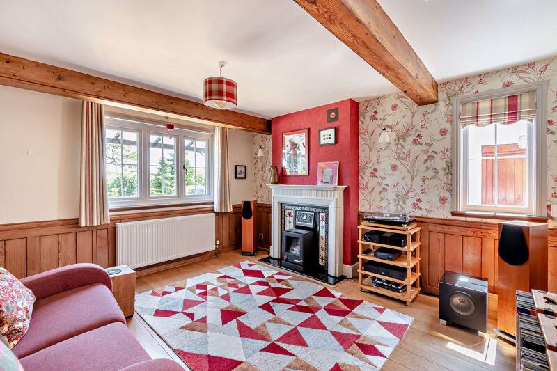
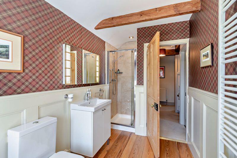
- Reception Hall, Dining/family room, well proportioned living room, sitting room/snug, kitchen breakfast room, utility, ground floor shower room.
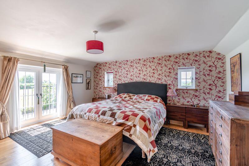
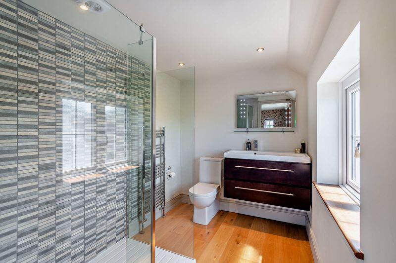
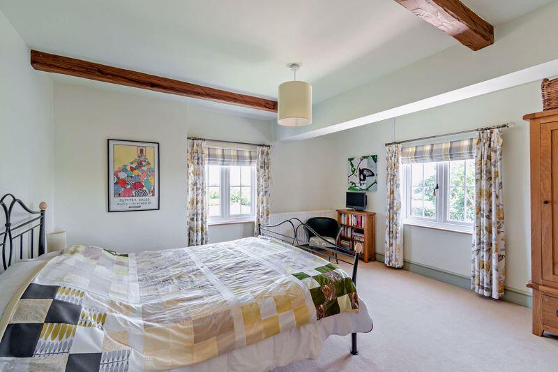
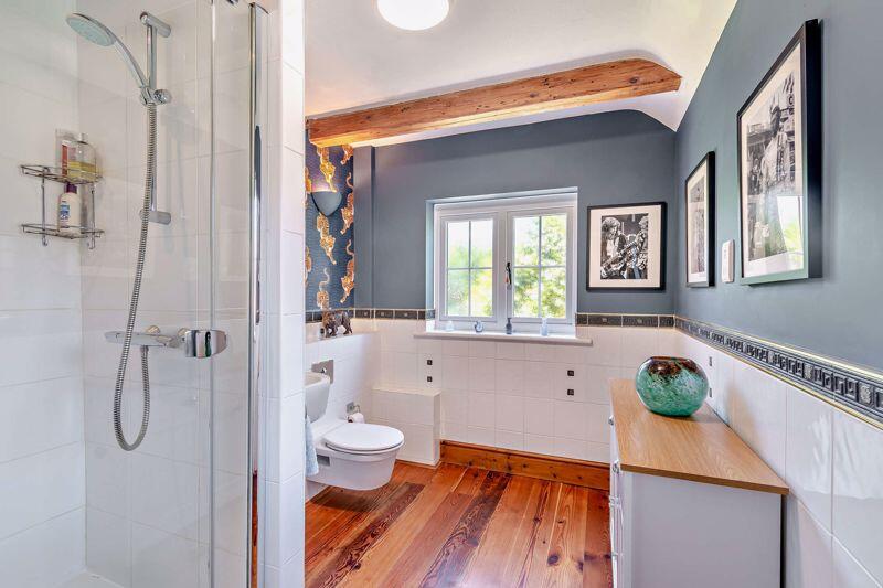
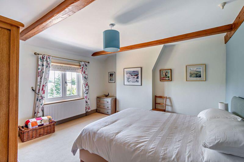
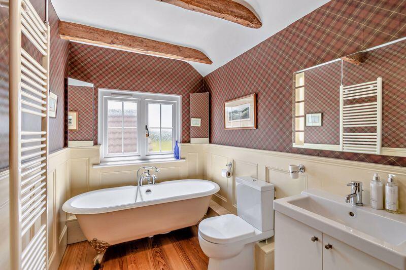
- Master bedroom Suite with walk-in wardrobe and ensuite shower room, three further bedrooms, family bathroom.
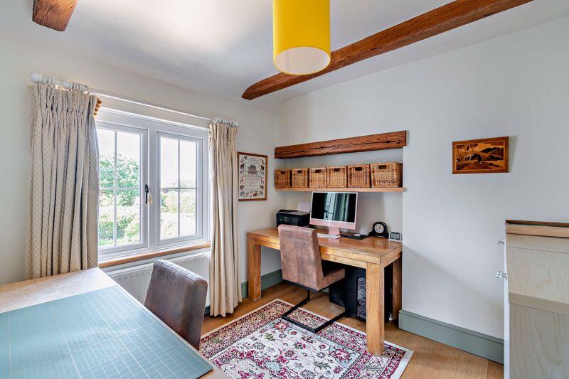
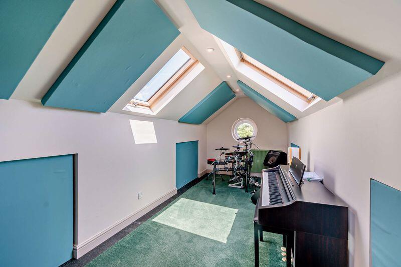
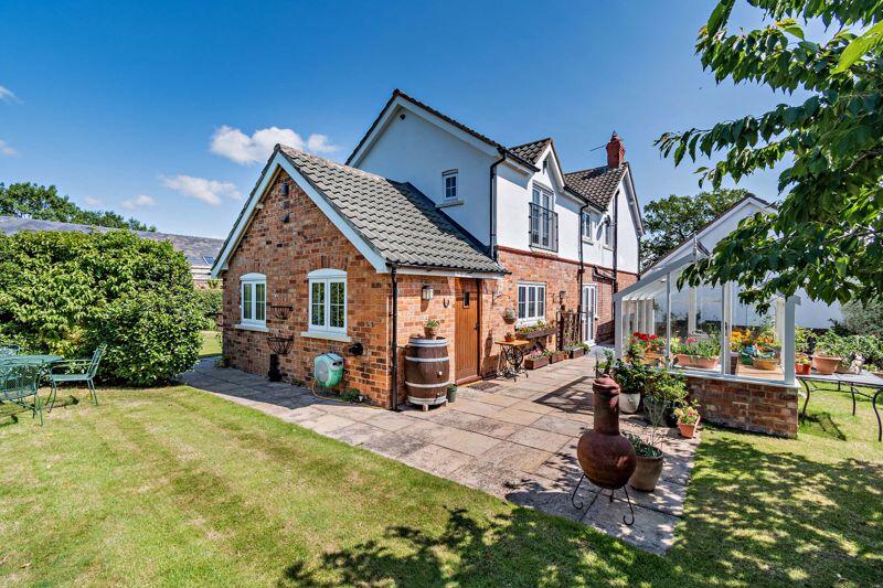
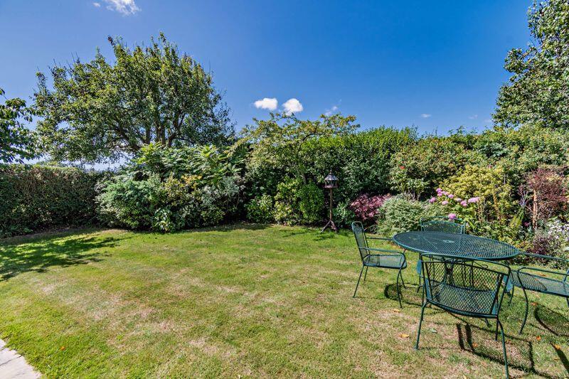
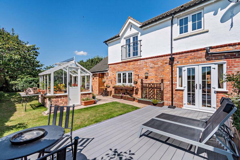
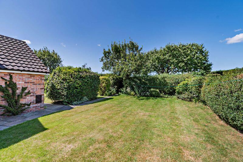
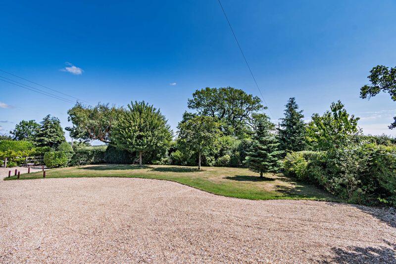
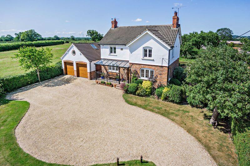
- Attractive well maintained gardens extending to just under half an acre, double garage with versatile Home Office/Soundproofed Music Room above.
- EPC Rating : D
Additional details
- Parking
- Yes
- Garden
- Yes
Description
Listed by
Tarporley
Cheshire Lamont
Reference: 164367233
EPC ratings on this postcode
We don't have a matched EPC for this property yet. Below are efficiency scores and details for other addresses on this postcode.
| Address | Current | Potential | Floor area | Age band | Type |
|---|---|---|---|---|---|
| Chesterton Barn, Ridley | 73 | 76 | 286 m² | — | House |
| Chesterton Croft, Ridley | 54 | 64 | 195 m² | England and Wales: 1900-1929 | House |
| CHESTERTON CROFTS, WHITCHURCH ROAD, RIDLEY | 60 | 83 | 196 m² | England and Wales: 1900-1929 | House |
| CHESTERTON CROFTS, WHITCHURCH ROAD, RIDLEY, RIDLEY | 60 | 83 | 196 m² | England and Wales: 1900-1929 | Detached |
| Meadow Farm, Ridley | 18 | 83 | 130 m² | England and Wales: 1900-1929 | House |
| Meadow Farm, Ridley, TARPORLEY | 18 | 83 | 130 m² | England and Wales: 1900-1929 | Detached |
| Mount Pleasant Farm, Ridley | 10 | 95 | 84 m² | England and Wales: 1900-1929 | House |
| Mount Pleasant Farm, Ridley, TARPORLEY | 10 | 95 | 84 m² | England and Wales: 1900-1929 | Detached |
| Newholme, Ridley | 44 | 94 | 93 m² | England and Wales: 1950-1966 | House |
| Newholme, Ridley | 21 | 70 | 83 m² | England and Wales: 1950-1966 | House |
| Newholme, Ridley, TARPORLEY | 44 | 94 | 93 m² | England and Wales: 1950-1966 | Detached |
| Newholme, Ridley, TARPORLEY | 21 | 70 | 83 m² | England and Wales: 1950-1966 | Detached |
| Oak Farm, Ridley | 17 | 74 | 145 m² | England and Wales: 1900-1929 | House |
| Oak Farm, Ridley, TARPORLEY | 17 | 74 | 145 m² | England and Wales: 1900-1929 | Detached |
| Ridley Cottage, Ridley | 34 | 93 | 95 m² | England and Wales: before 1900 | House |
Flood risk
Zone: 1
Risk: Low
Job (default Low)
Floorplans
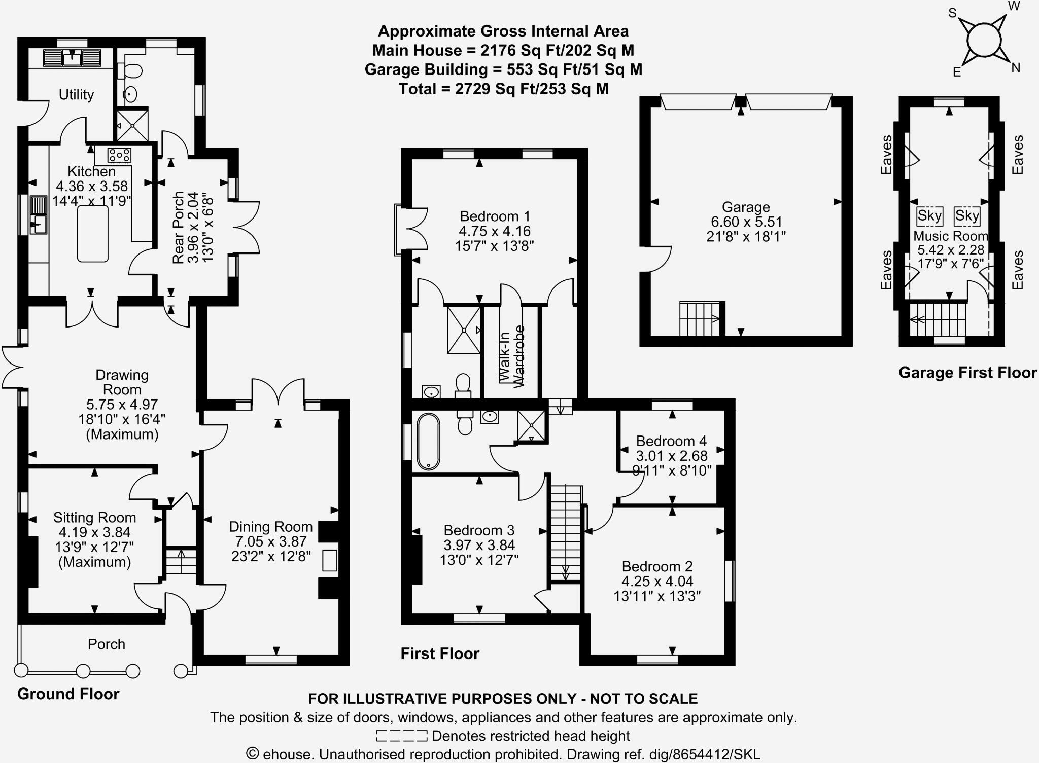
Floor Plan
EPC Graphs

EPC
Price history
No sales history found for this property in Land Registry Price Paid data.
Sold Comparables
Sold comparables data is not available for this property.
Capital growth trend
Land Registry outcode average: last 12 months vs 5y and 10y ago (from sold prices).
House Price Index (HM Land Registry — official index, not sold-price averages): Cheshire East. Series: Detached. As of March 2026.
Rental Range
Estimated market rent for Cheshire East. Low = conservative, Realistic = average, Optimistic = best case.
Based on Local Authority from postcode lookup → Cheshire East.
LHA (30th percentile) floor for Lancaster: £723/mo (Apr 2025 – Mar 2026)
Location
Address
Tarporley Road
Nearby
Nearest stations, universities and amenities (distance from property).
| Type | Name | Distance |
|---|---|---|
| Bus stop | Ridley, Whitchurch Road / Skip Brown Cars | 0.2 miles |
| Shop | Cholmondeley Castle Farm Shop | 2.3 miles |
| Shop | The Co-operative Food | 2.4 miles |
| Train station | Wrenbury | 5.1 miles |
| Hospital | Tarporley War Memorial Hospital | 5.4 miles |
| Train station | Nantwich | 6.1 miles |
| Hospital | Whitchurch Community Hospital | 7.5 miles |
| University | University of Buckingham Crewe Campus | 10.1 miles |
| University | University of Chester - Queen's Park Campus | 11.7 miles |
Street-level crime
| Category | Count |
|---|---|
| Total incidents | 0 |
Within 1 mile during Apr 2026. Source: data.police.uk (England & Wales).
Schools nearby
Nearest open schools with Ofsted ratings (England). Closed schools are not shown. Data from Get Information about Schools and Ofsted.
| Name | Type | Distance | Ofsted |
|---|---|---|---|
| Bunbury Aldersey CofE Primary School | Primary | 2.5 miles | Good — 28 Jan 2020 |
| Bickerton Holy Trinity CofE Primary School | Primary | 2.7 miles | Good — 26 Jun 2024 |
| Wrenbury Primary School | Primary | 4.7 miles | Good — 6 Mar 2018 |
Rental Comparables
Loading rental comparables for this postcode. Refresh in a few minutes.
Rent-driven metrics
Based on Area rent estimate.
- Rent ratio — Monthly rent ÷ purchase price (1% rule). 1%+ = strong, 0.8–1% = okay, <0.8% = weak for cashflow.
- Max investor price — Rent ÷ 0.8%; the price at which rent would be 0.8% of price (Stoke-style target).
- Target investor price — Rent ÷ 1%; the price at which rent would be 1% of price (strong cashflow band).
- Gross yield — Annual rent as % of purchase price (no costs).
Enter House Number
Enter the house number to help us retrieve more accurate pricing history and property data.
Please log in to submit or correct the house number for this listing.
Log in to continue