9 ROXLEY ROAD
LONDON, GREATER LONDON SE13 6HG
£2,300 pcm
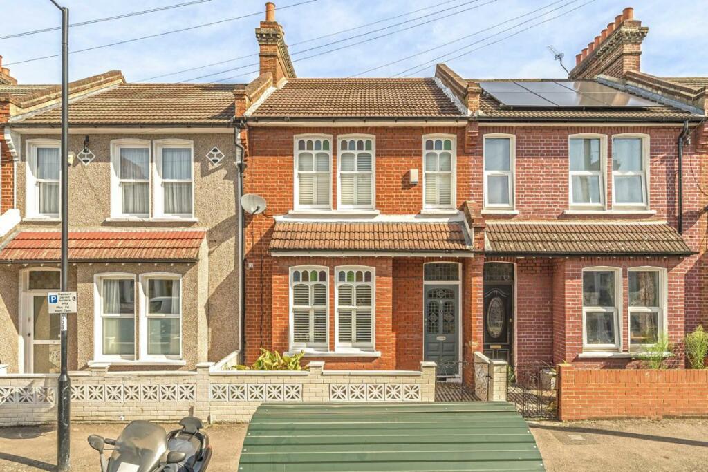
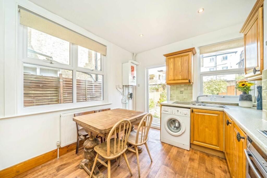
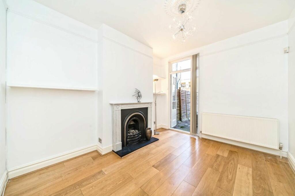
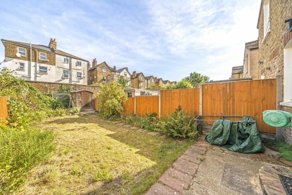
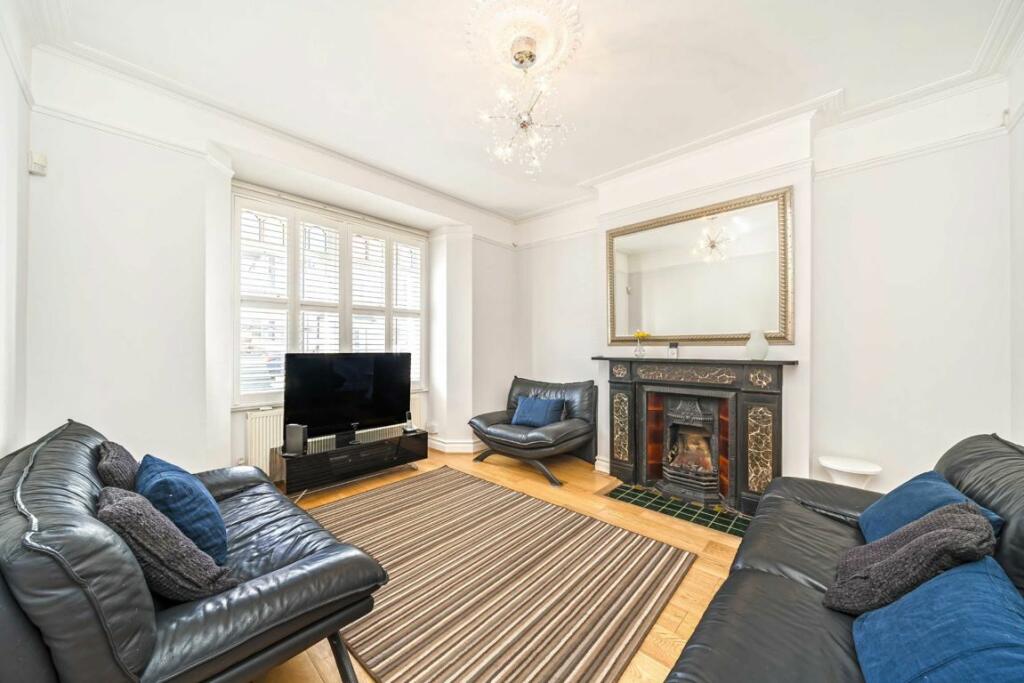
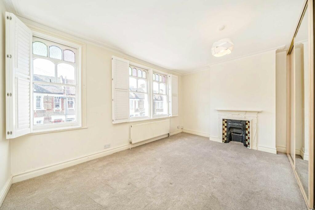
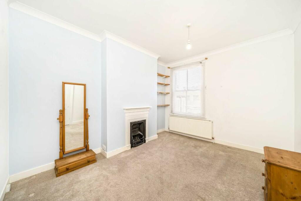
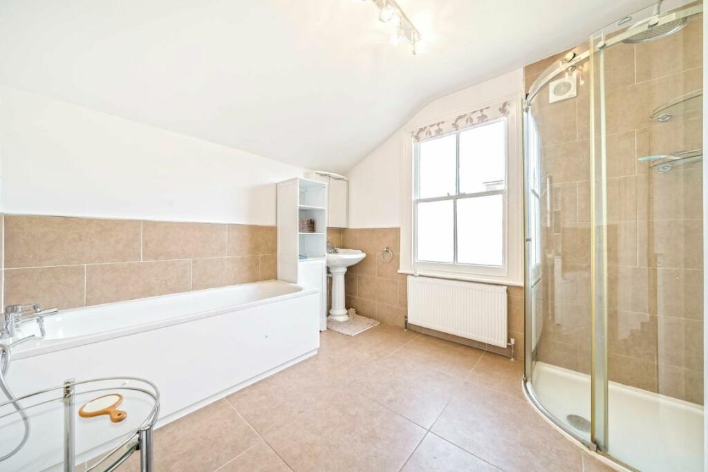
Photo 1 Photo 2 Photo 3 Photo 4 Photo 5 Photo 6 Photo 7 Photo 8
/ 8
Property details
Tenure
FREEHOLD
Floor area
100 m²
Deprivation
Decile 3 (9,713 of 33,755)
Street crime
969 incidents within 1 mile (Apr 2026)
Key features
- Family Home
- Terraced House
- Two Double Bedrooms
- Seperate Lounge & Diner
- South Facing Garden
- Close To Lewisham Stations
Additional details
- Parking
- Yes
- Garden
- Yes
Description
Lewisham DLR and mainline stations provide quick and easy access into Canary Wharf and central London respectively. For motorists there is on street permit parking.
Listed by
Lewisham
Dexters
Reference: 151520744
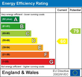
EPC Rating & Upgrade Cost
Fetching EPC data… Refresh this page in a moment.
Flood risk
Zone: 1
Risk: Low
Job (default Low)
Floorplans
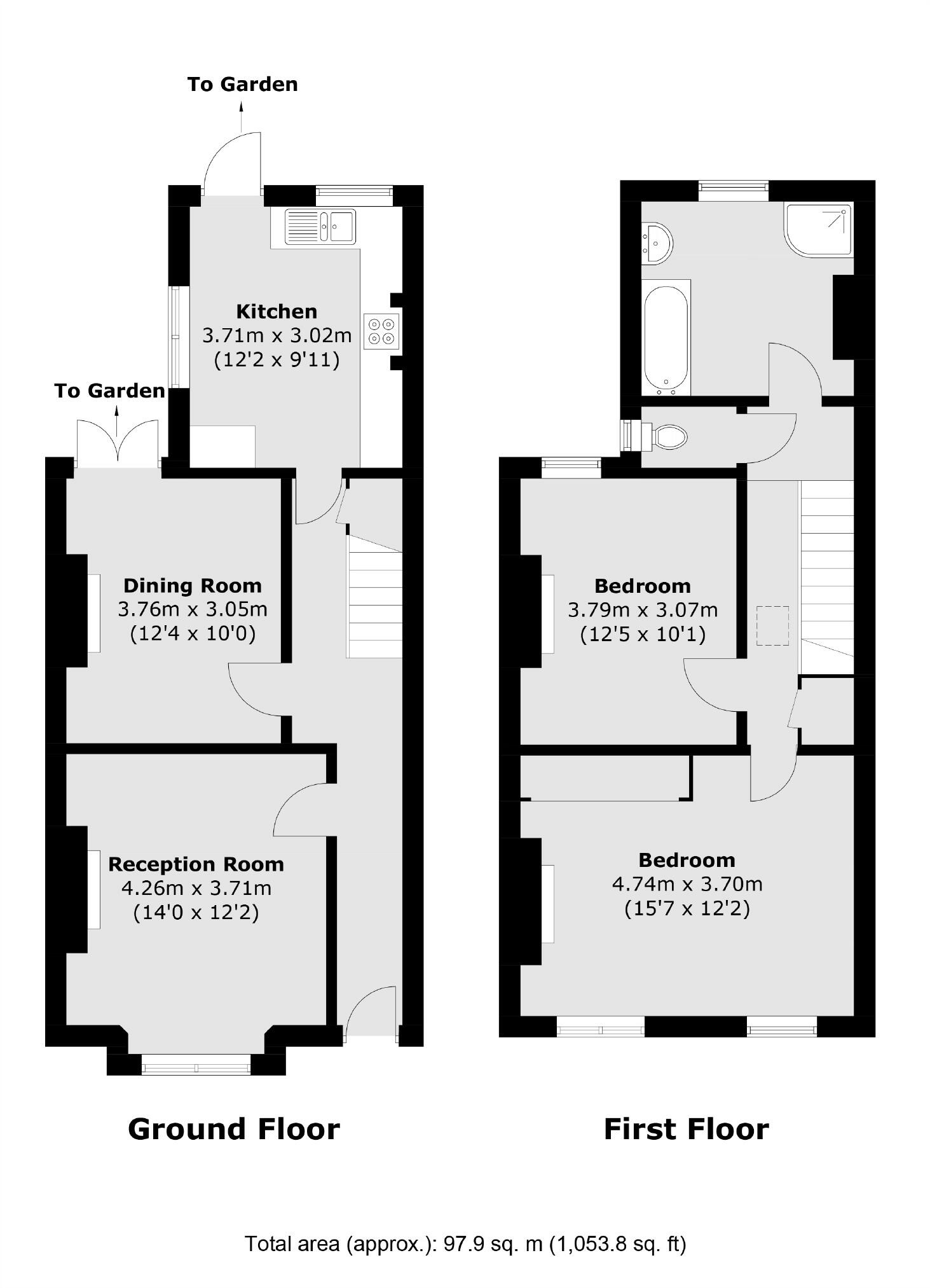
Floorplan 1
EPC Graphs
EPC 1
FENSA Certificates
This property has 1 FENSA certificate(s) on record, indicating window/door installations by FENSA-approved installers.
FENSA Certificate #9303136
Property Details
Street: 9 Roxley Road
Town: Lewisham
Postcode: SE13 6HG
Installation Details
Items: 3 windows and 1 door
Certificate Issued: 21/01/2013
Work Completed: 20/12/2012
This certificate data was retrieved from FENSA's database
What is FENSA? FENSA (Fenestration Self-Assessment Scheme) is a government-authorised scheme that monitors building regulation compliance for replacement windows and doors. Certificates indicate that work was completed by FENSA-approved installers.
Rental Range
Estimated market rent for Lewisham. Low = conservative, Realistic = average, Optimistic = best case.
Based on Local Authority from postcode lookup → Lewisham.
LHA (30th percentile) floor for Cambridge: £947/mo (Apr 2025 – Mar 2026)
Location
Nearby
Nearest stations, universities and amenities (distance from property).
| Type | Name | Distance |
|---|---|---|
| Shop | M and J Tyres | 0.0 miles |
| Shop | Damascus Halal Market | 0.0 miles |
| Bus stop | Mount Pleasant Road | 0.0 miles |
| Train station | Ladywell | 0.4 miles |
| Train station | Catford Bridge | 0.6 miles |
| University | University of Greenwich | 2.2 miles |
| Hospital | Sloane Hospital | 3.0 miles |
| Hospital | King's College Hospital Emergency Department | 3.5 miles |
| University | University of Wales Trinity Saint David London Campus | 4.5 miles |
Street-level crime
| Category | Count |
|---|---|
| Violence and sexual offences | 329 |
| Anti-social behaviour | 169 |
| Shoplifting | 80 |
| Public order | 79 |
| Other theft | 62 |
| Criminal damage and arson | 47 |
| Vehicle crime | 46 |
| Robbery | 37 |
| Burglary | 35 |
| Drugs | 34 |
| Theft from the person | 27 |
| Possession of weapons | 11 |
| Other crime | 7 |
| Bicycle theft | 6 |
| Total incidents | 969 |
Within 1 mile during Apr 2026. Source: data.police.uk (England & Wales).
Schools nearby
Nearest open schools with Ofsted ratings (England). Closed schools are not shown. Data from Get Information about Schools and Ofsted.
| Name | Type | Distance | Ofsted |
|---|---|---|---|
| Education-My Life Matters | Other | 0.2 miles | Good — 9 Jun 2024 |
| St Mary's Lewisham Church of England Primary School | Primary | 0.3 miles | Good — 25 Jan 2022 |
| Holbeach Primary School | Primary | 0.4 miles | Good — 12 Dec 2017 |
| Brindishe Green School | Primary | 0.5 miles | Good — 26 Nov 2023 |
| Prendergast Ladywell School | Other | 0.5 miles | Good — 24 Mar 2019 |
Rental Comparables
Residential lets from OpenRent and Rightmove for the area (same bedroom count). Use to validate rent estimates. Student lets are excluded.
| Title | Rent | Beds | Distance | As seen on |
|---|---|---|---|---|
| 2 Bed Flat, Catford, SE6 | £1,900/mo | 2 | 0.14 miles | OpenRent |
| 2 Bed Maisonette, Honley Road, SE6 | £1,800/mo | 2 | 0.27 miles | OpenRent |
Average rent: £1,850/mo (2 listings)