Harworth House
Blyth Road, Harworth, Doncaster, South Yorkshire, DN11, DN11 8FS
£600 pcm
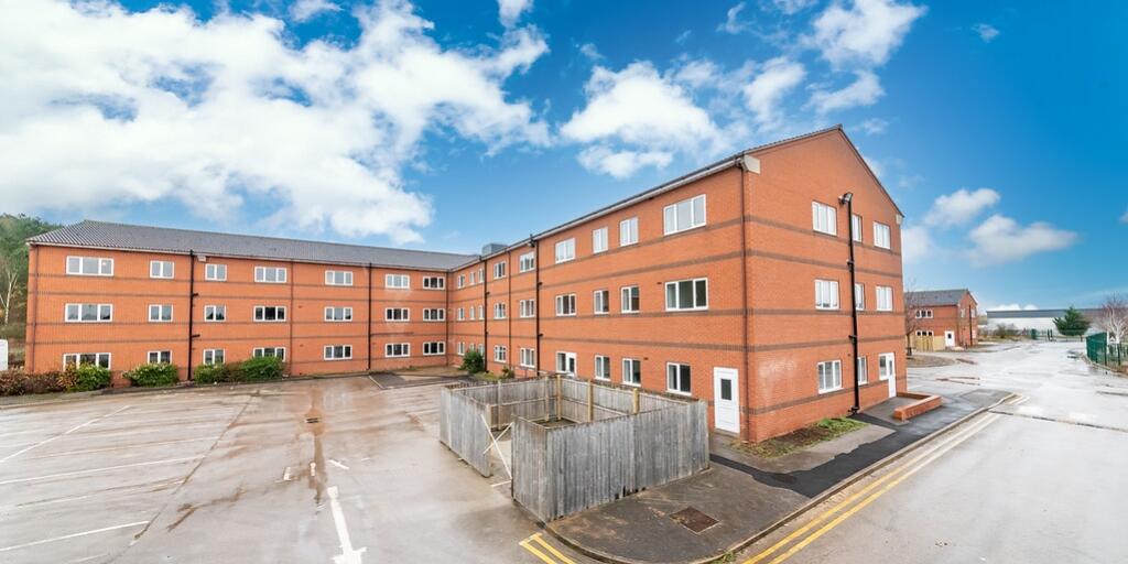
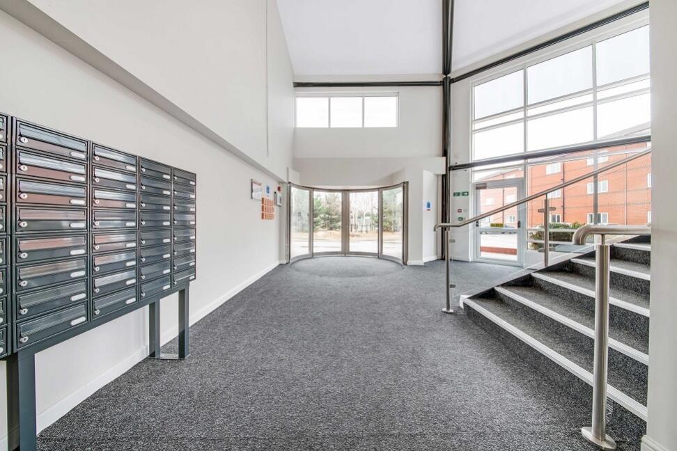
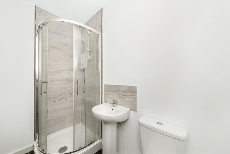
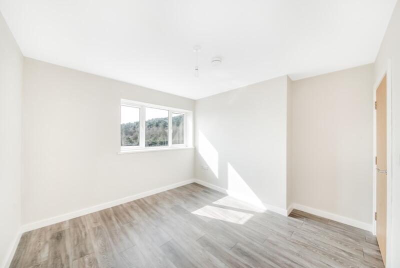
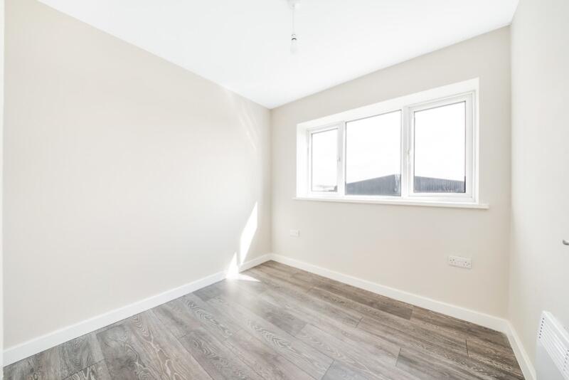
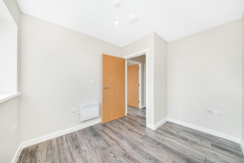
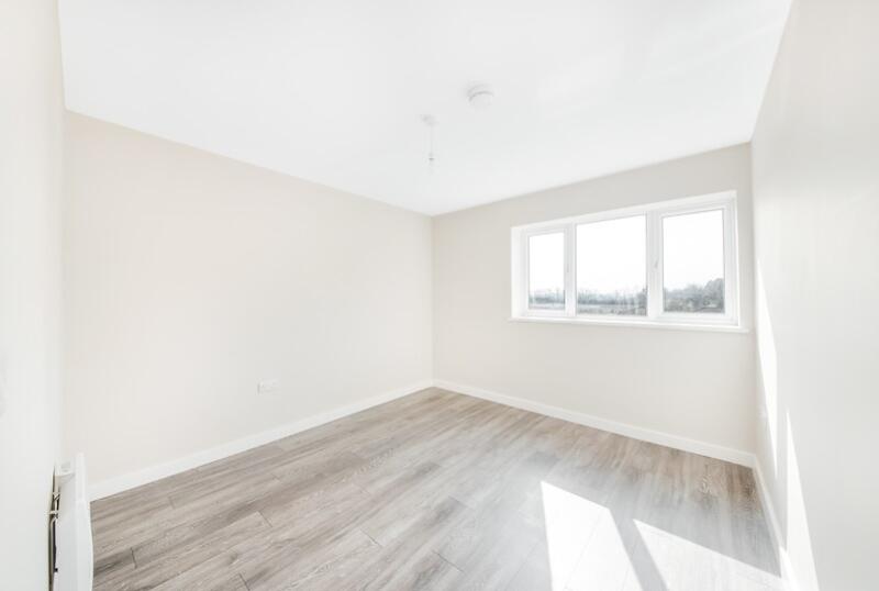
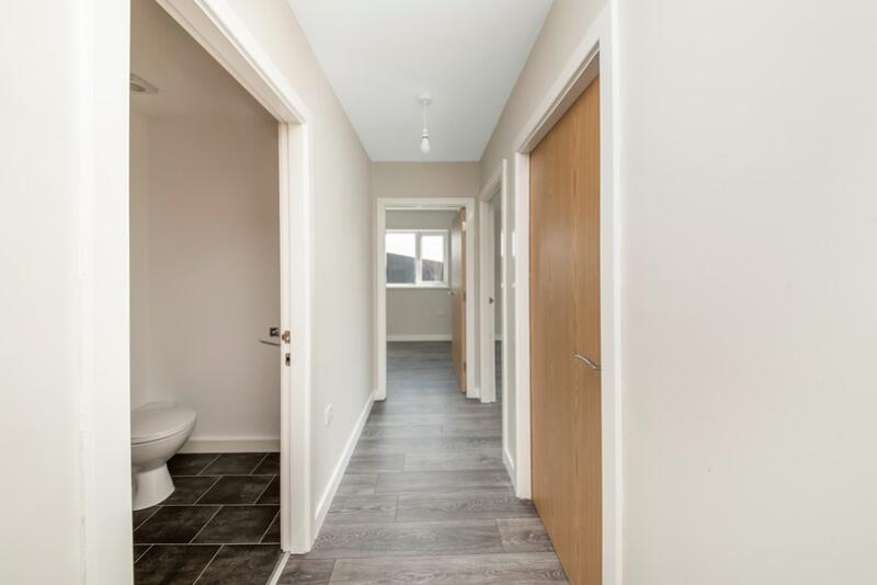
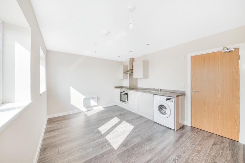
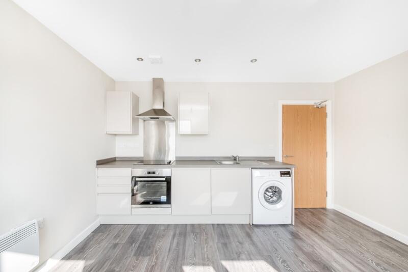
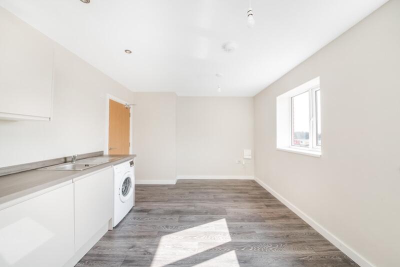
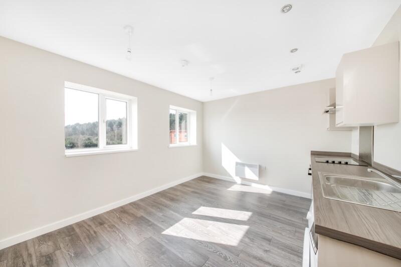
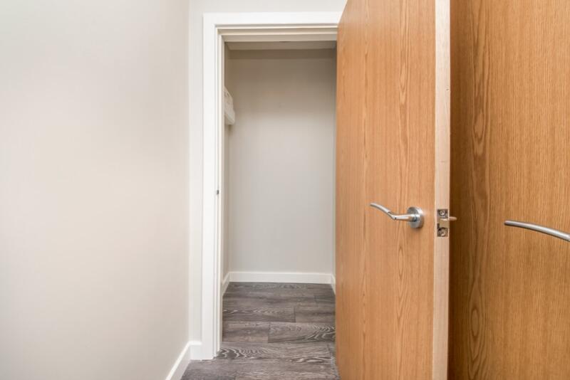
Photo 1 Communal Area bathroom Bedroom 2.2 Bedroom 2 Bedroom.2 Bedroom Hall Kitchen.3 Kitchen.4 Kitchen.5 Kitchen Store
/ 13
Property details
Council tax band
TBC
Deprivation
Decile 7 (23,284 of 33,755)
Street crime
62 incidents within 1 mile (Apr 2026)
Key features
- Excellent Location
- White Goods Included
- 2 Bedrooms
- Open Plan Living Area
Description
Listed by
Bradford
TIR Lettings Ltd
Reference: 151436891
EPC ratings on this postcode
We don't have a matched EPC for this property yet. Below are efficiency scores and details for other addresses on this postcode.
| Address | Current | Potential | Floor area | Age band | Type |
|---|---|---|---|---|---|
| 1 Harworth House, Blyth Road, Harworth, DONCASTER | 63 | 63 | 39 m² | — | Flat |
| 10 Harworth House, Blyth Road, Harworth, DONCASTER | 62 | 62 | 46 m² | — | Flat |
| 11 Harworth House, Blyth Road, Harworth, DONCASTER | 61 | 61 | 37 m² | — | Flat |
| 12 Harworth House, Blyth Road, Harworth, DONCASTER | 68 | 68 | 29 m² | — | Flat |
| 13 Harworth House, Blyth Road, Harworth, DONCASTER | 67 | 67 | 29 m² | — | Flat |
| 14 Harworth House, Blyth Road, Harworth, DONCASTER | 65 | 65 | 37 m² | — | Flat |
| 15 Harworth House, Blyth Road, Harworth, DONCASTER | 66 | 66 | 41 m² | — | Flat |
| 16 Harworth House, Blyth Road, Harworth, DONCASTER | 69 | 69 | 34 m² | — | Flat |
| 17 Harworth House, Blyth Road, Harworth, DONCASTER | 69 | 69 | 29 m² | — | Flat |
| 18 Harworth House, Blyth Road, Harworth, DONCASTER | 68 | 68 | 34 m² | — | Flat |
| 19 Harworth House, Blyth Road, Harworth, DONCASTER | 68 | 68 | 31 m² | — | Flat |
| 2 Harworth House, Blyth Road, Harworth, DONCASTER | 68 | 68 | 30 m² | — | Flat |
| 20 Harworth House, Blyth Road, Harworth, DONCASTER | 67 | 67 | 41 m² | — | Flat |
| 21 Harworth House, Blyth Road, Harworth, DONCASTER | 68 | 68 | 37 m² | — | Flat |
| 22 Harworth House, Blyth Road, Harworth, DONCASTER | 72 | 72 | 38 m² | — | Flat |
Flood risk
Zone: 1
Risk: Low
Job (default Low)
Floorplans
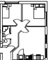
Floorplan 1
EPC Graphs
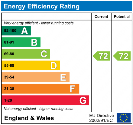
EPC 1
Rental Range
Estimated market rent for Bassetlaw. Low = conservative, Realistic = average, Optimistic = best case.
Based on Local Authority from postcode lookup → Bassetlaw.
LHA (30th percentile) floor for Doncaster: £499/mo (Apr 2025 – Mar 2026)
Location
Address
Serlby Road
Nearby
Nearest stations, universities and amenities (distance from property).
| Type | Name | Distance |
|---|---|---|
| Bus stop | Serlby Road | 0.1 miles |
| Bus stop | Certex | 0.1 miles |
| Shop | Asda Express | 1.4 miles |
| Shop | WHSmith | 1.5 miles |
| Hospital | Tickhill Road | 6.8 miles |
| Train station | Worksop | 7.0 miles |
| Train station | Shireoaks | 7.1 miles |
| Hospital | Unknown | 7.3 miles |
Street-level crime
| Category | Count |
|---|---|
| Burglary | 18 |
| Criminal damage and arson | 8 |
| Anti-social behaviour | 7 |
| Violence and sexual offences | 7 |
| Other theft | 5 |
| Public order | 5 |
| Vehicle crime | 5 |
| Shoplifting | 3 |
| Other crime | 2 |
| Bicycle theft | 1 |
| Possession of weapons | 1 |
| Total incidents | 62 |
Within 1 mile during Apr 2026. Source: data.police.uk (England & Wales).
Schools nearby
Nearest open schools with Ofsted ratings (England). Closed schools are not shown. Data from Get Information about Schools and Ofsted.
| Name | Type | Distance | Ofsted |
|---|---|---|---|
| Harworth CofE Academy | Primary | 0.7 miles | Good — 23 Nov 2017 |
| St Patrick's Catholic Primary School | Primary | 1.1 miles | Good — 25 May 2023 |
| Serlby Park Academy | Other | 1.2 miles | Good — 29 Nov 2023 |
| The Primary School of St Mary and St Martin | Primary | 2.3 miles | Good — 19 Nov 2010 |
| Tickhill St Mary's Church of England Primary and Nursery School | Primary | 2.5 miles | Good — 1 Dec 2016 |
Rental Comparables
Loading rental comparables for this postcode. Refresh in a few minutes.
Enter House Number
Enter the house number to help us retrieve more accurate pricing history and property data.
Please log in to submit or correct the house number for this listing.
Log in to continue