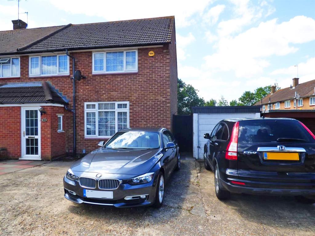
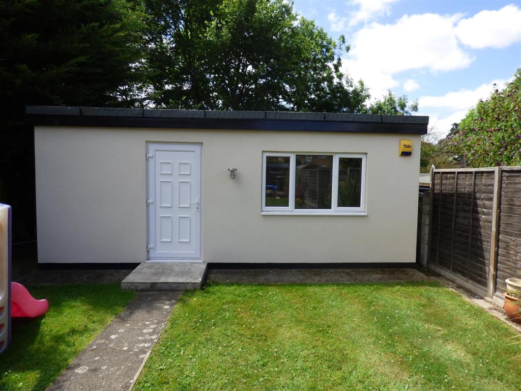
39 LINTON AVENUE
BOREHAMWOOD, HERTFORDSHIRE WD6 4RB
£550,000


Property details
Floor area
99 m²
Last sold
£510,000 Dec 2017
Local average
£1,727,500 (-68.2%)
Deprivation
Decile 5 (15,709 of 33,755)
Street crime
286 incidents within 1 mile (Apr 2026)
Key features
- Extended
- Three bedrooms
- Large driveway
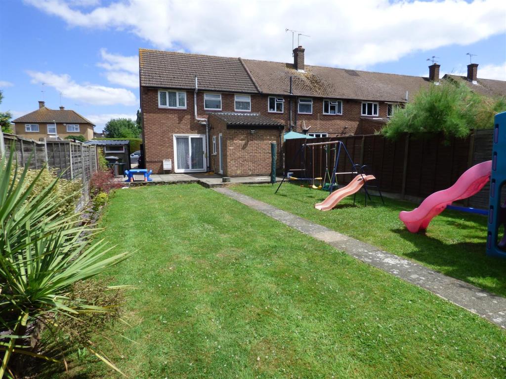
- South west facing garden
- Detached garage
- Modern kitchen
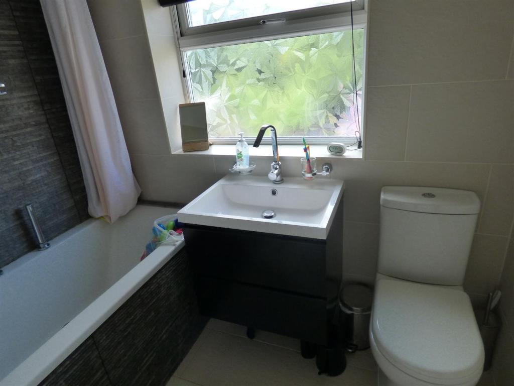
- Modern bathroom
- Close to town
- Potential to extend
- Downstairs cloakroom
Additional details
- Parking
- Yes
- Garden
- Yes
Description
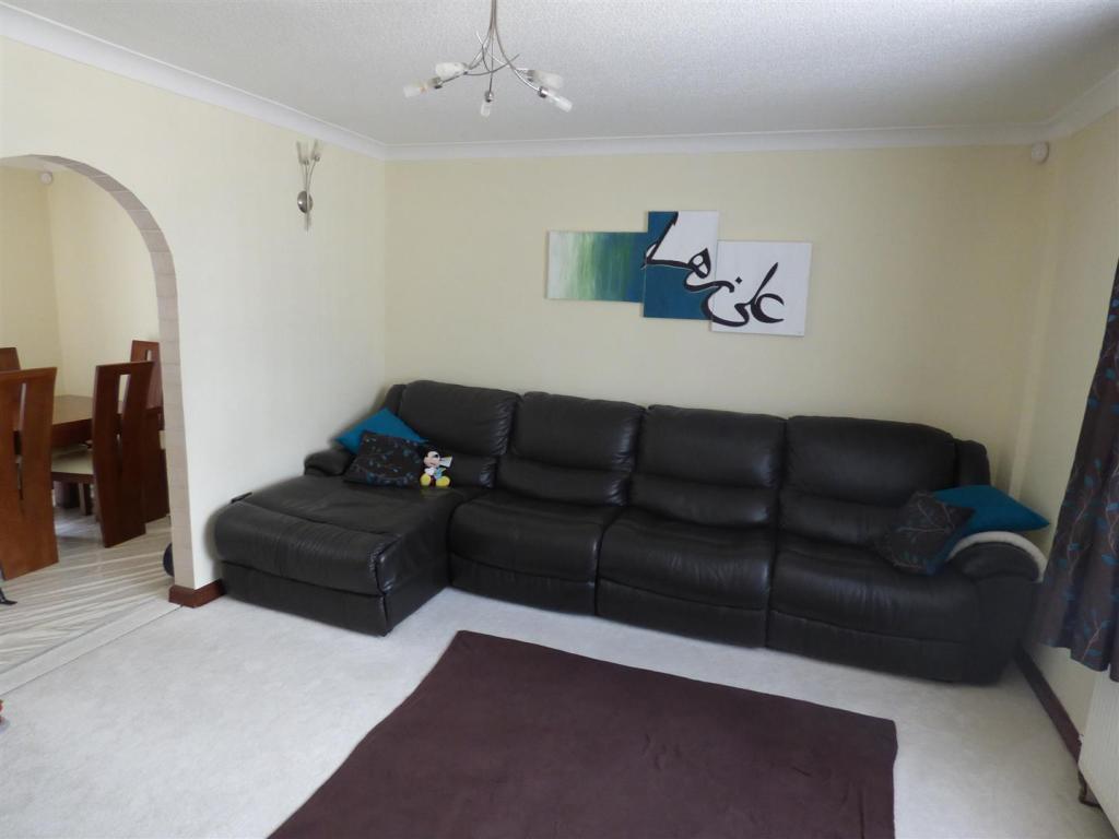
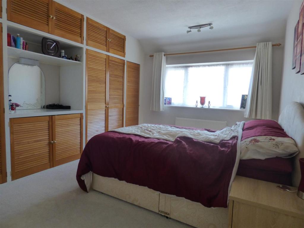
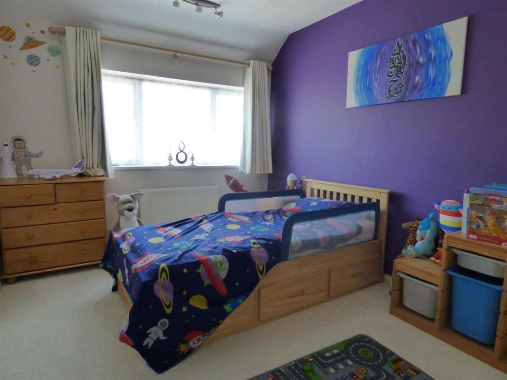
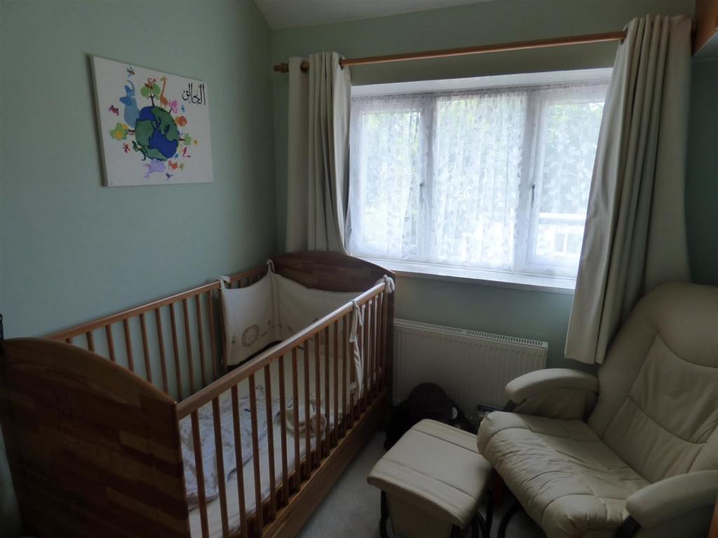
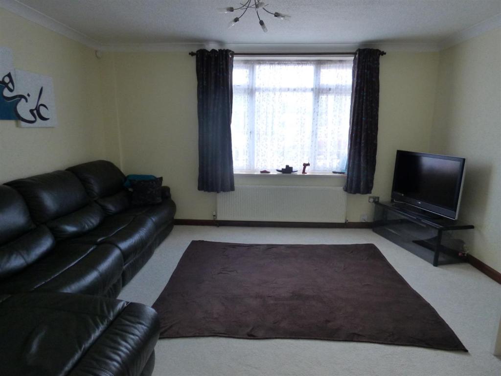
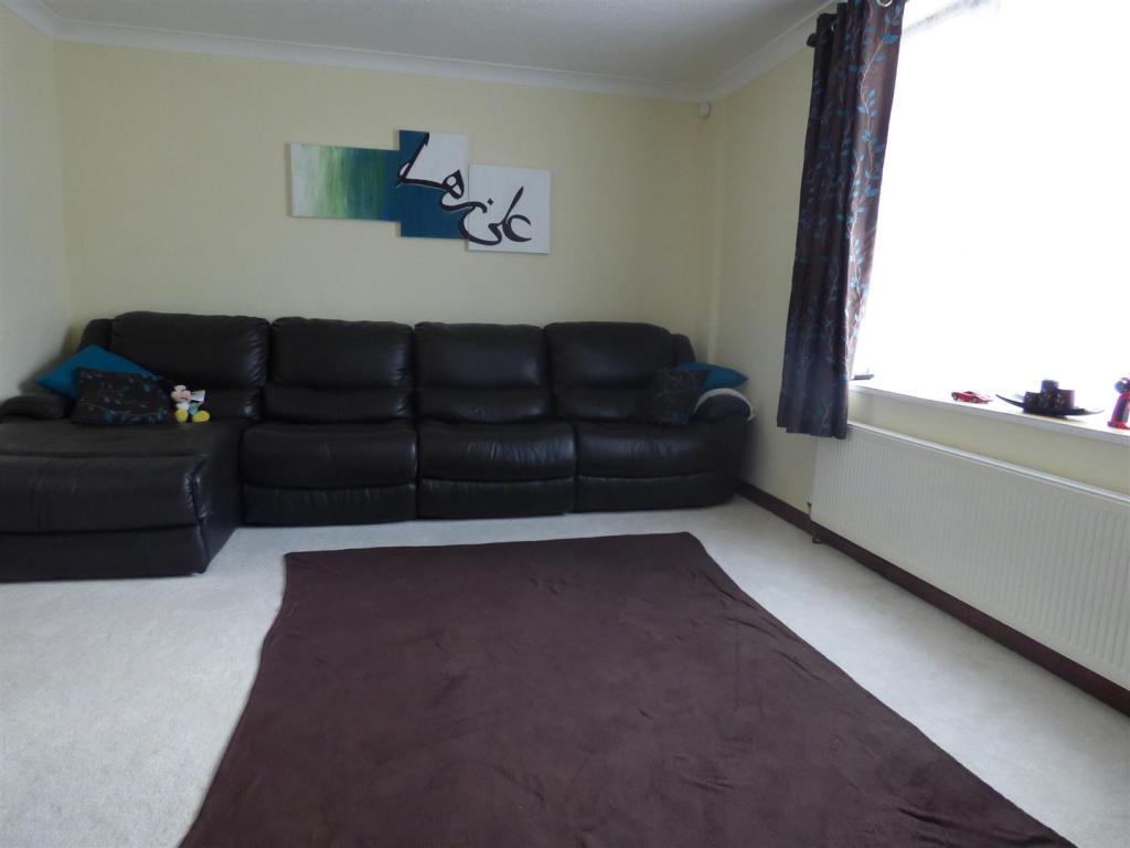
Lounge - 4.44 x 3.95 (14'6" x 12'11") -
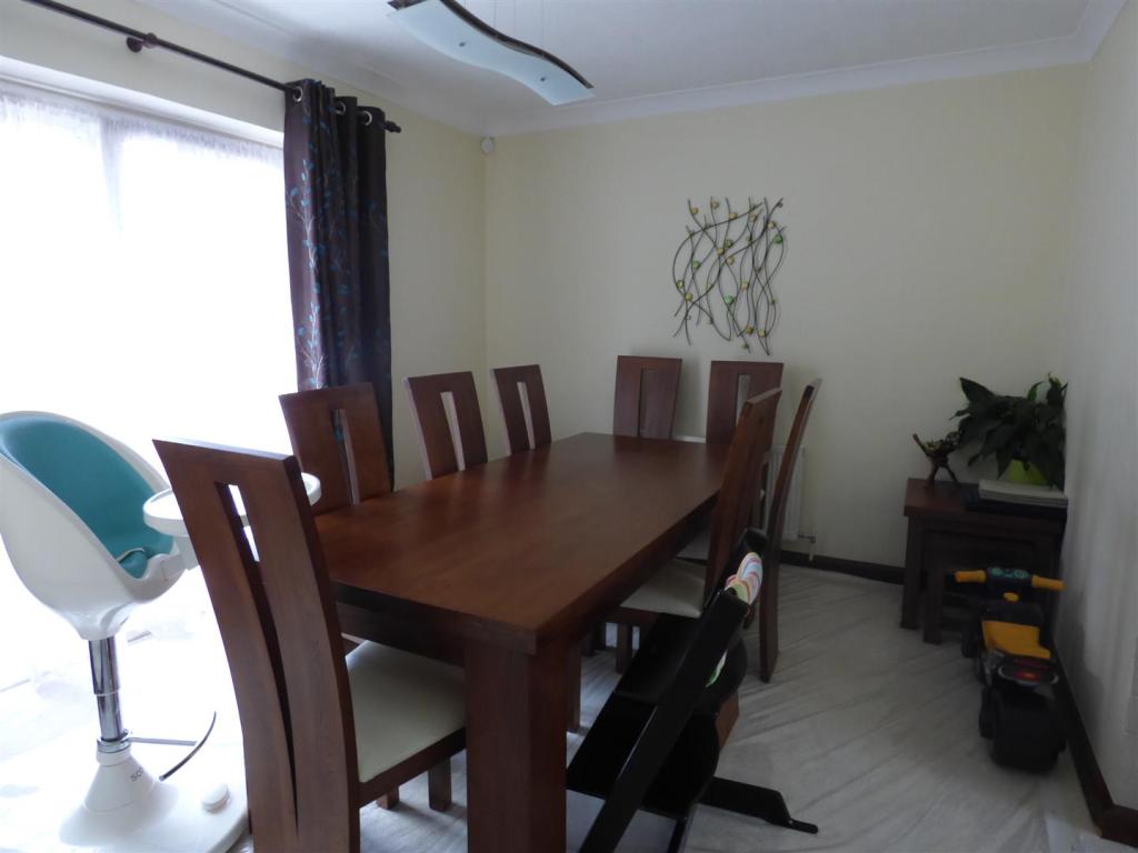
Dining Room - 3.54 x 3.06 (11'7" x 10'0") -
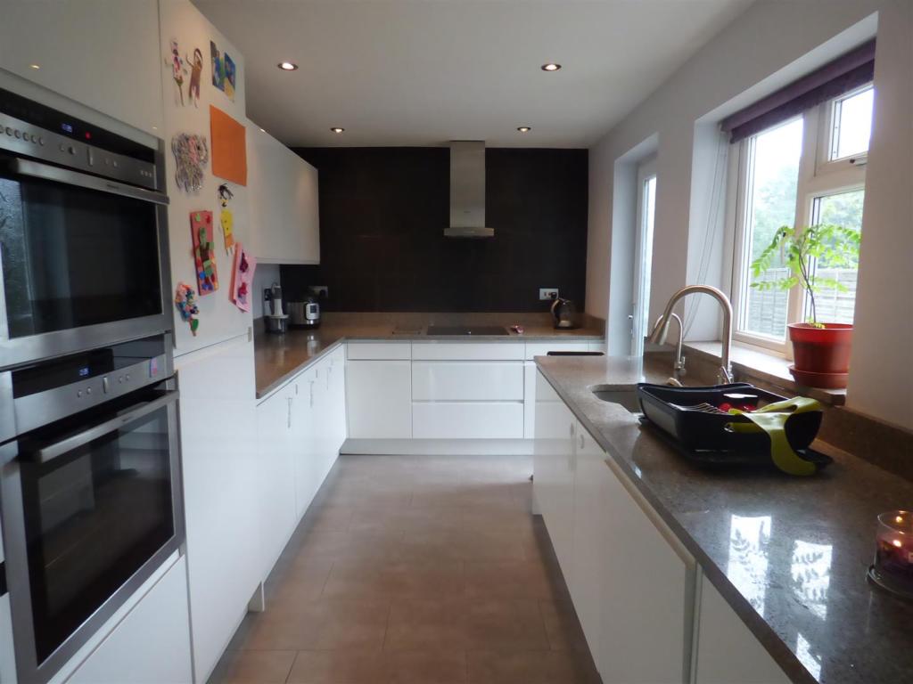
Kitchen - 4.21 x 2.63 (13'9" x 8'7") -
Bedroom 1 - 4.19 x 3.50 (13'8" x 11'5") -
Bedroom 2 - 4.19 x 2.82 (13'8" x 9'3") -
Bedroom 3 - 2.88 x 2.40 (9'5" x 7'10") -
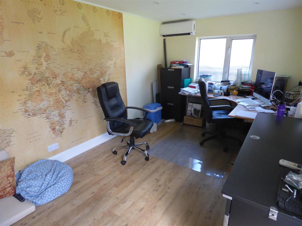
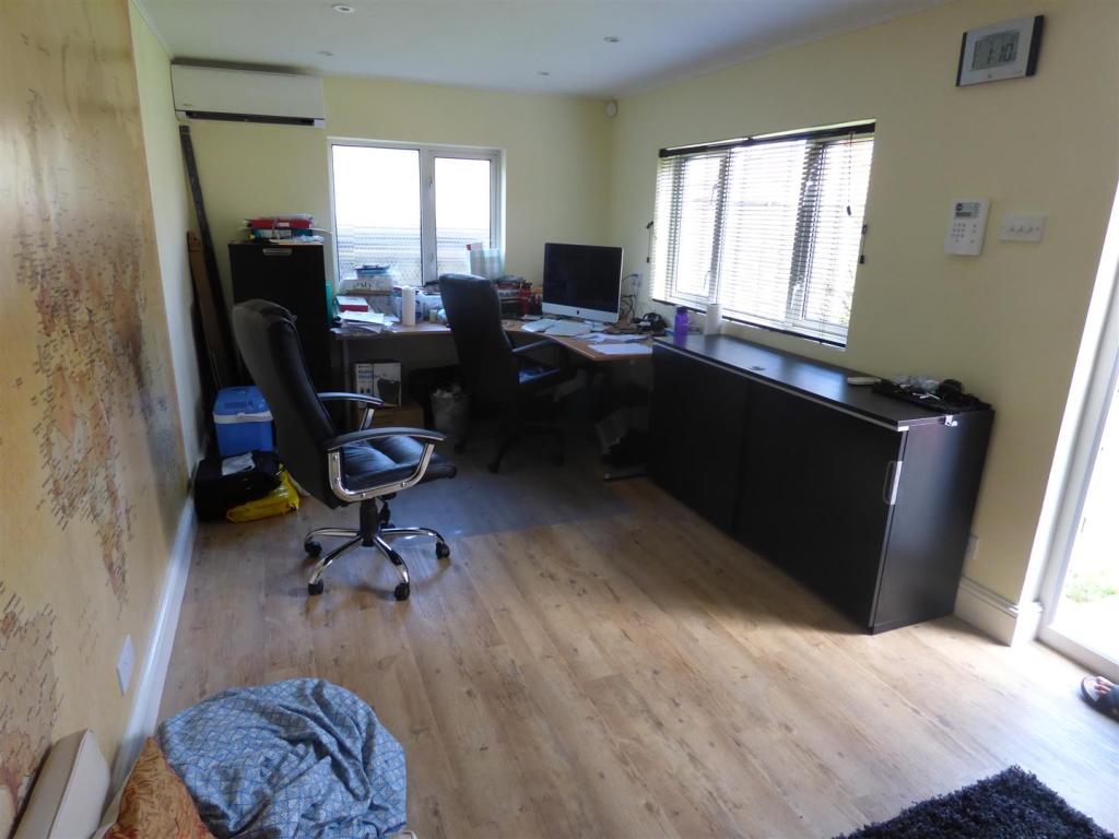
Outbuilding - 5.08 x 2.75 (16'7" x 9'0") -
Rear Garden -
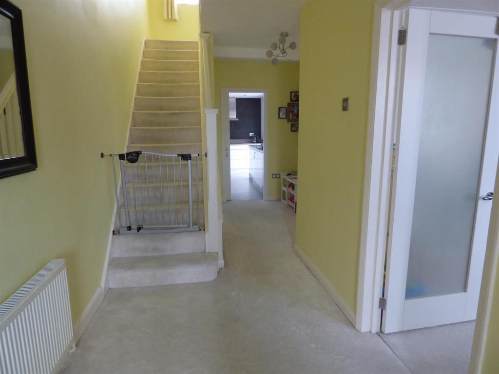
Hallway -
Listed by
Borehamwood
Barons Estates
Reference: 60858601
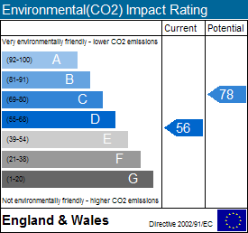
EPC Rating & Upgrade Cost
Fetching EPC data… Refresh this page in a moment.
Flood risk
Zone: 1
Risk: Low
Job (default Low)
Floorplans
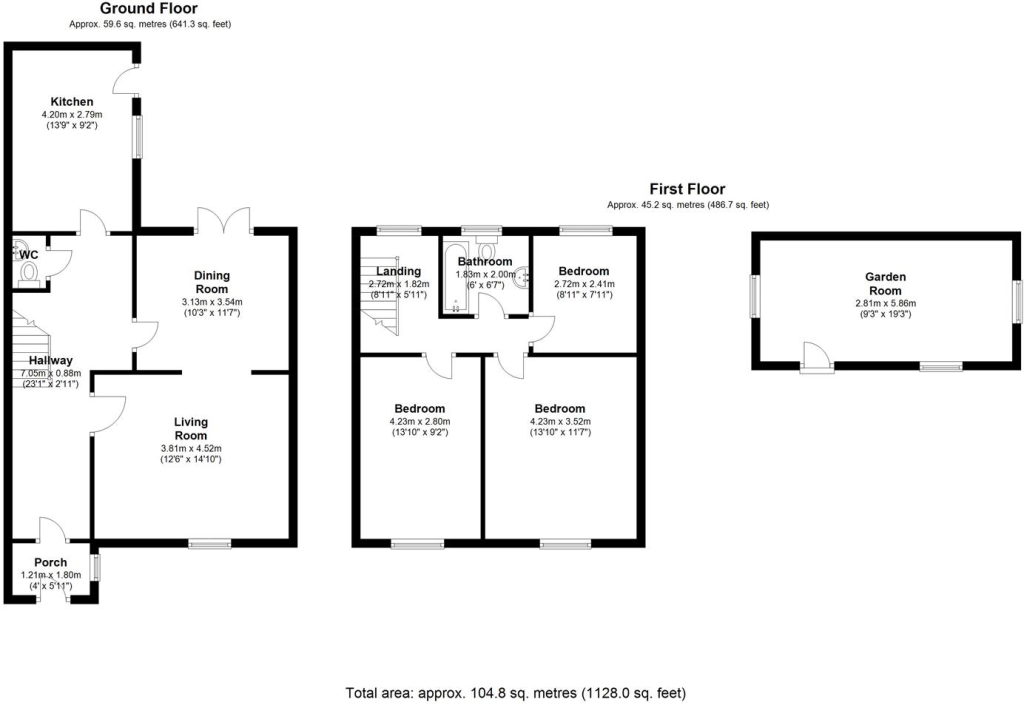
3939393.png
EPC Graphs

EE Rating
EI Rating
FENSA Certificates
This property has 1 FENSA certificate(s) on record, indicating window/door installations by FENSA-approved installers.
FENSA Certificate #1974470
Property Details
Street: 39 Linton Avenue
Town: BOREHAMWOOD
Postcode: WD6 4RB
Installation Details
Items: 10 windows and 2 doors
Certificate Issued: 23/08/2004
Work Completed: 26/07/2004
This certificate data was retrieved from FENSA's database
What is FENSA? FENSA (Fenestration Self-Assessment Scheme) is a government-authorised scheme that monitors building regulation compliance for replacement windows and doors. Certificates indicate that work was completed by FENSA-approved installers.
Price history
82% since 2009
| Event | Date | Price | % change |
|---|---|---|---|
| Sold | 01/12/2017 (8 years ago) | £510,000 | +82.1% |
| Sold | 21/12/2009 (16 years ago) | £280,000 | — |
Source: HM Land Registry Price Paid Data. Crown copyright.
Sold Comparables
Same street and nearby sales within 0.25 miles (last 5 years). Data from Land Registry Price Paid.
| Address | Price | Date | Type |
|---|---|---|---|
| Same street 63 LINTON AVENUE, BOREHAMWOOD, HERTSMERE, HERTFORDSHIRE, WD6 4RB | £415,000 | 02/10/2024 | Terraced |
| Same street 11 LINTON AVENUE, BOREHAMWOOD, HERTSMERE, HERTFORDSHIRE, WD6 4RB | £436,000 | 16/06/2023 | Terraced |
| Same street 55 LINTON AVENUE, BOREHAMWOOD, HERTSMERE, HERTFORDSHIRE, WD6 4RB | £415,000 | 28/01/2022 | Terraced |
| Same street 35 LINTON AVENUE, BOREHAMWOOD, HERTSMERE, HERTFORDSHIRE, WD6 4RB | £500,000 | 23/11/2021 | Terraced |
| Same street 49 LINTON AVENUE, BOREHAMWOOD, HERTSMERE, HERTFORDSHIRE, WD6 4RB | £350,000 | 30/06/2021 | Terraced |
Street average: £423,200 (5 sales)
Capital growth trend
House Price Index (HM Land Registry — official index, not sold-price averages): Hertsmere. Series: All dwelling types. As of March 2026.
Rental Range
Estimated market rent for Hertsmere. Low = conservative, Realistic = average, Optimistic = best case.
Based on Local Authority from postcode lookup → Hertsmere.
LHA (30th percentile) floor for Bedford: £997/mo (Apr 2025 – Mar 2026)
Location
Nearby
Nearest stations, universities and amenities (distance from property).
| Type | Name | Distance |
|---|---|---|
| Shop | Just Kosher | 0.1 miles |
| Bus stop | Croxdale Road | 0.2 miles |
| Shop | Co-op Food | 0.4 miles |
| Train station | Elstree & Borehamwood | 0.7 miles |
| University | The Elstree UTC | 0.9 miles |
| Train station | Radlett | 2.2 miles |
| Hospital | Royal National Orthopaedic Hospital | 2.5 miles |
| University | John Scales Centre for Biomedical Engineering | 2.6 miles |
| Hospital | Spire Bushey Hospital | 2.8 miles |
Street-level crime
| Category | Count |
|---|---|
| Anti-social behaviour | 88 |
| Violence and sexual offences | 75 |
| Shoplifting | 24 |
| Public order | 18 |
| Criminal damage and arson | 15 |
| Other theft | 14 |
| Vehicle crime | 14 |
| Drugs | 13 |
| Other crime | 6 |
| Robbery | 6 |
| Burglary | 4 |
| Possession of weapons | 4 |
| Theft from the person | 4 |
| Bicycle theft | 1 |
| Total incidents | 286 |
Within 1 mile during Apr 2026. Source: data.police.uk (England & Wales).
Schools nearby
Nearest open schools with Ofsted ratings (England). Closed schools are not shown. Data from Get Information about Schools and Ofsted.
| Name | Type | Distance | Ofsted |
|---|---|---|---|
| Meryfield Primary School | Primary | 0.3 miles | Good — 15 Dec 2011 |
| Cowley Hill School | Primary | 0.4 miles | Good — 11 Jan 2012 |
| St Teresa Catholic Primary School | Primary | 0.5 miles | Good — 4 Jul 2016 |
| Woodlands Primary School | Primary | 0.5 miles | Good — 28 Sep 2022 |
| Parkside Community Primary School | Primary | 0.5 miles | Good — 3 Feb 2020 |
Rental Comparables
Residential lets from OpenRent and Rightmove for the area (same bedroom count). Use to validate rent estimates. Student lets are excluded.
| Title | Rent | Beds | Distance | As seen on |
|---|---|---|---|---|
| 3 Bed Semi-Detached House, Lexington Close, WD6 | £2,100/mo | 3 | 0.24 miles | OpenRent |
Average rent: £2,100/mo (1 listing)
Rent-driven metrics
Based on OpenRent comparables.
- Rent ratio — Monthly rent ÷ purchase price (1% rule). 1%+ = strong, 0.8–1% = okay, <0.8% = weak for cashflow.
- Max investor price — Rent ÷ 0.8%; the price at which rent would be 0.8% of price (Stoke-style target).
- Target investor price — Rent ÷ 1%; the price at which rent would be 1% of price (strong cashflow band).
- Gross yield — Annual rent as % of purchase price (no costs).
- Cost-to-rent — Price ÷ annual rent (from OpenRent comparables). Under 14× = strong, 14–16× = acceptable, 17×+ = compressed.
- Cashflow — Rent minus mortgage, 10% maintenance, £25/mo compliance. Assumes 75% LTV, 3.95% APR (5yr fixed), 25yr term.
- ROI — Annual profit ÷ cash in (deposit + 4% purchase costs).