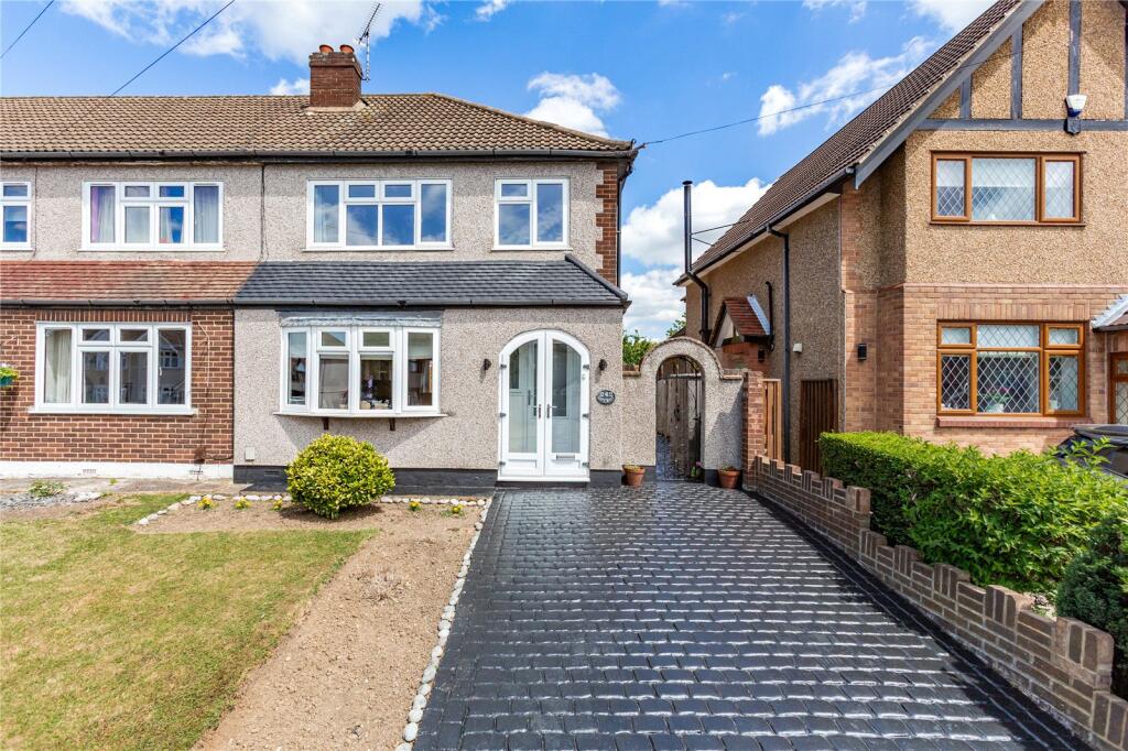
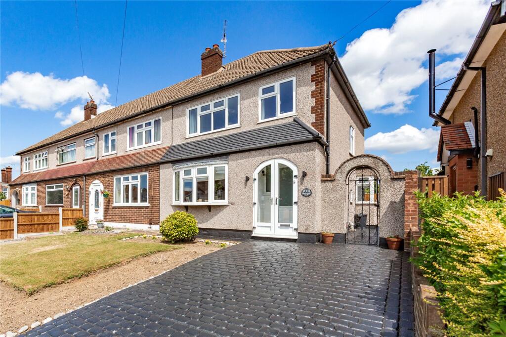
242 COLLIER ROW LANE
ROMFORD, GREATER LONDON RM5 3JB
£475,000
Property details
Tenure
FREEHOLD
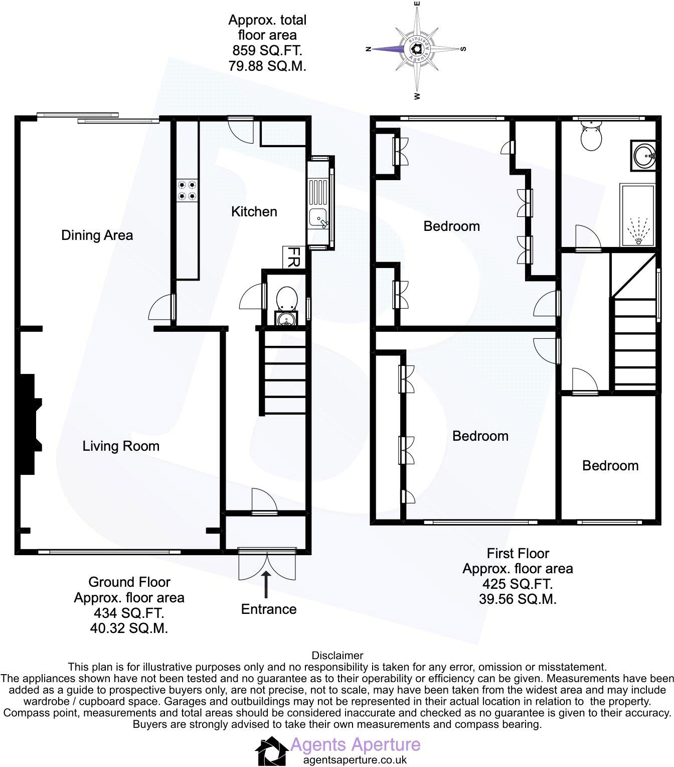
Floor area
80 m²
Council tax band
D
Last sold
£470,000 Oct 2025
Local average
£397,105 (+19.6%)
Deprivation
Decile 7 (21,405 of 33,755)
Street crime
203 incidents within 1 mile (Apr 2026)
Additional details
- Electricity
- Mains supply
- Water
- Mains supply
- Sewerage
- Mains supply
- Heating
- Gas
- Parking
- Yes
- Garden
- Yes
Description
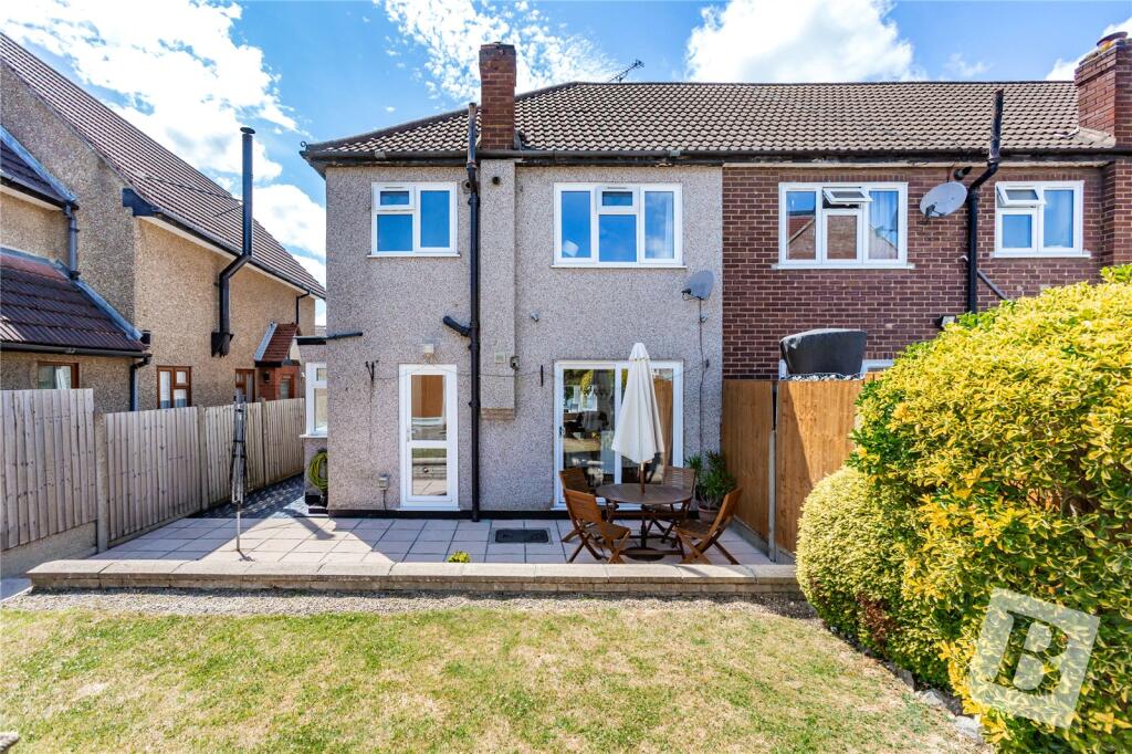
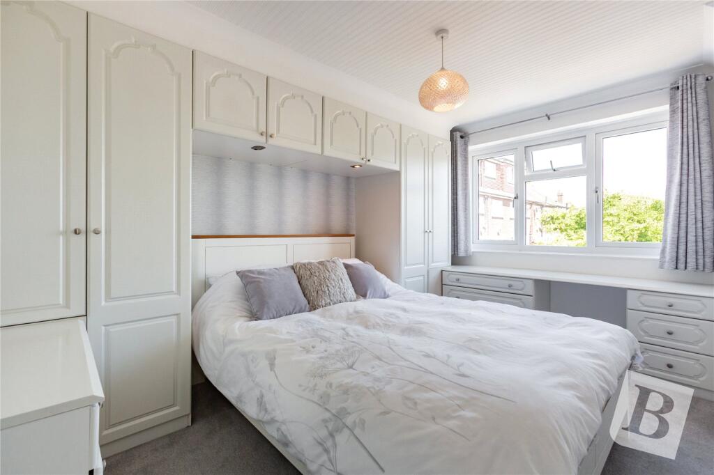
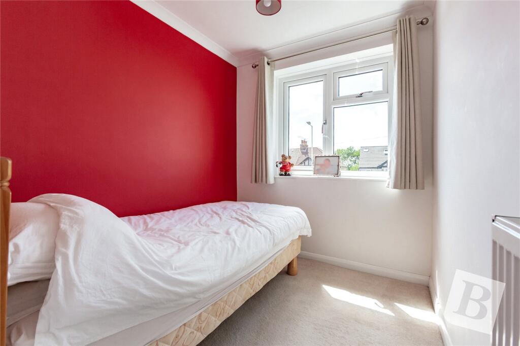
•STUNNING THREE BEDROOM END OF TERRACE FAMILY HOME
•POTENTIAL FOR FURTHER EXPANSION SUBJECT TO NECESSARY PLANNING CONSENTS
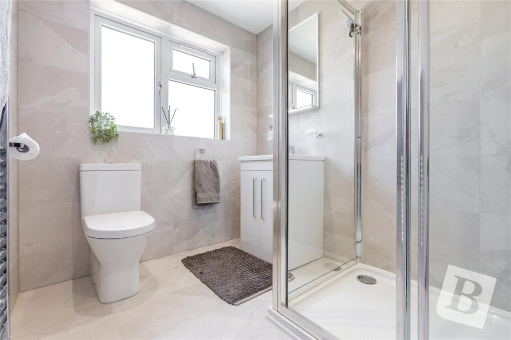
•IMMACULATE SHOWER ROOM WHICH HAS BEEN METICULOUSLY DESIGNED BY THE CURRENT OWNERS
•OFF STREET PARKING
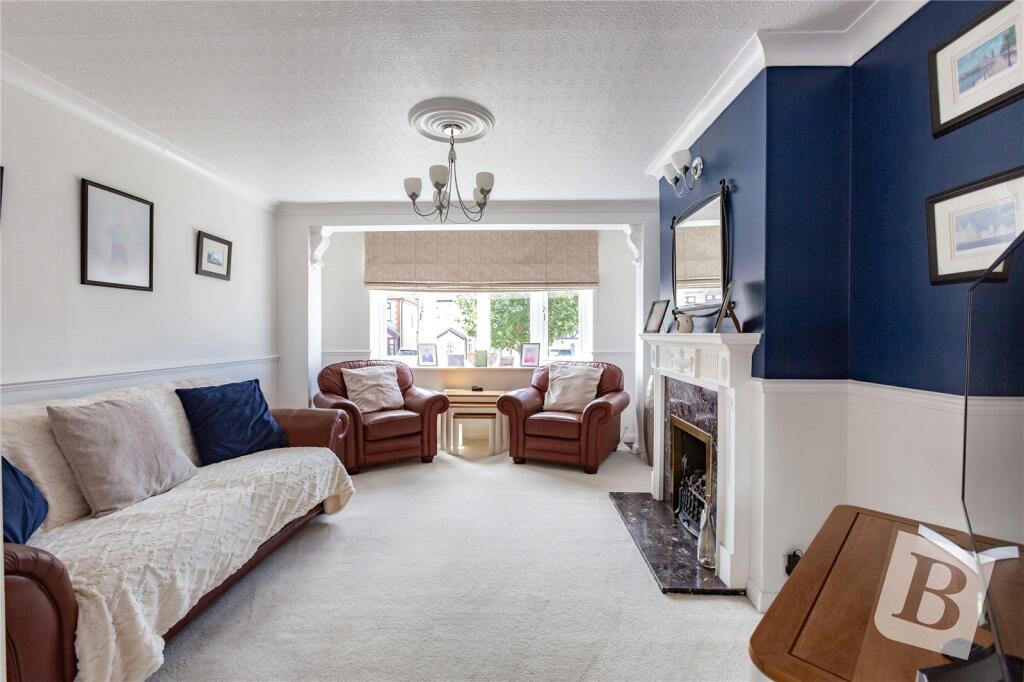
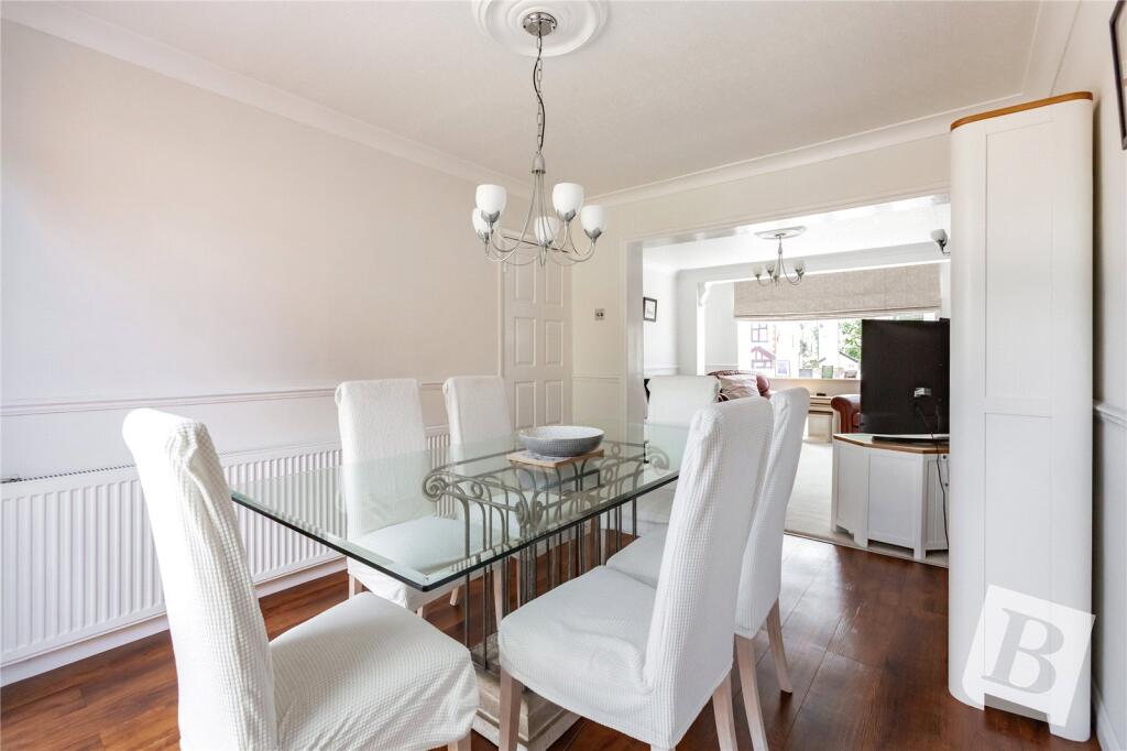
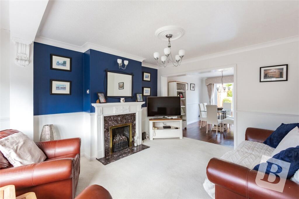
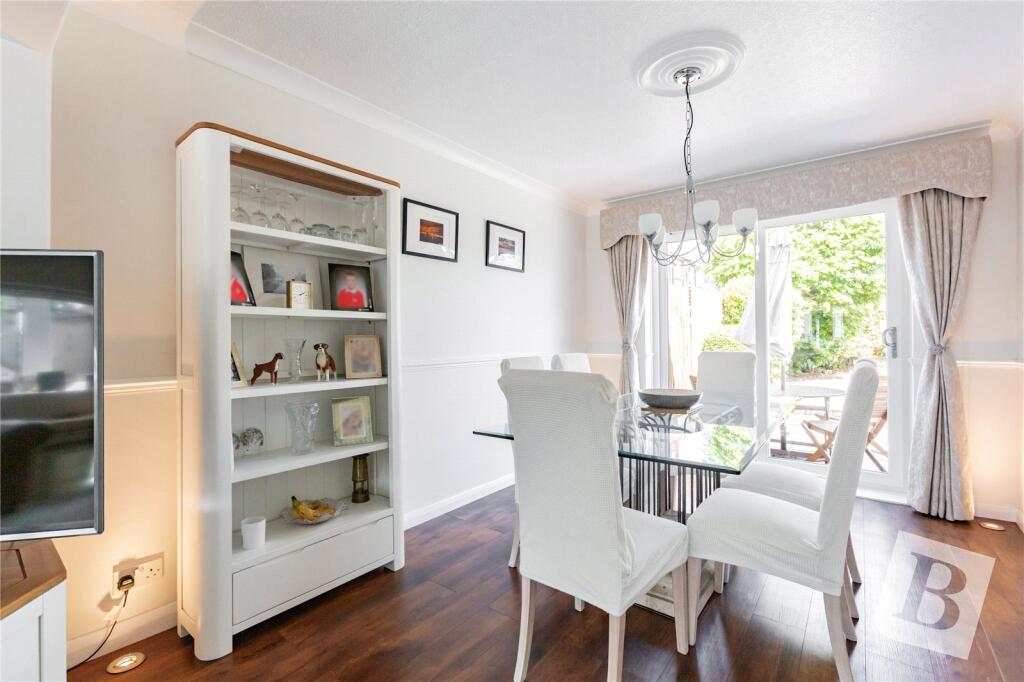
•TWO RECEPTION ROOMS
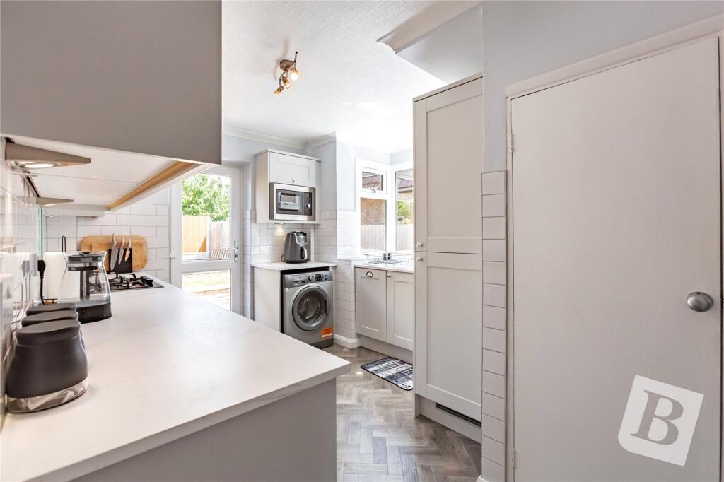
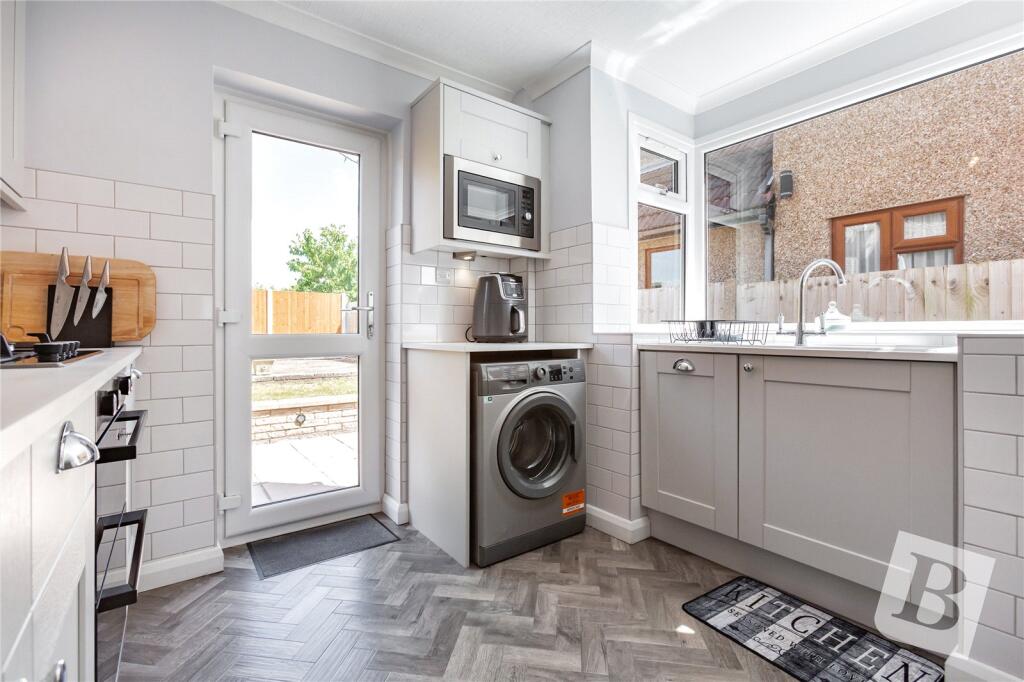
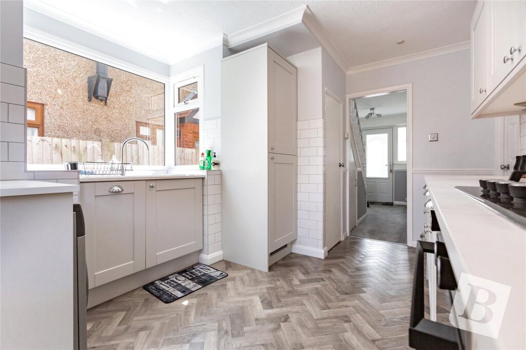
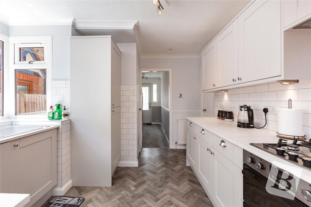
•12' KITCHEN WITH A RANGE OF INTEGRATED APPLIANCES
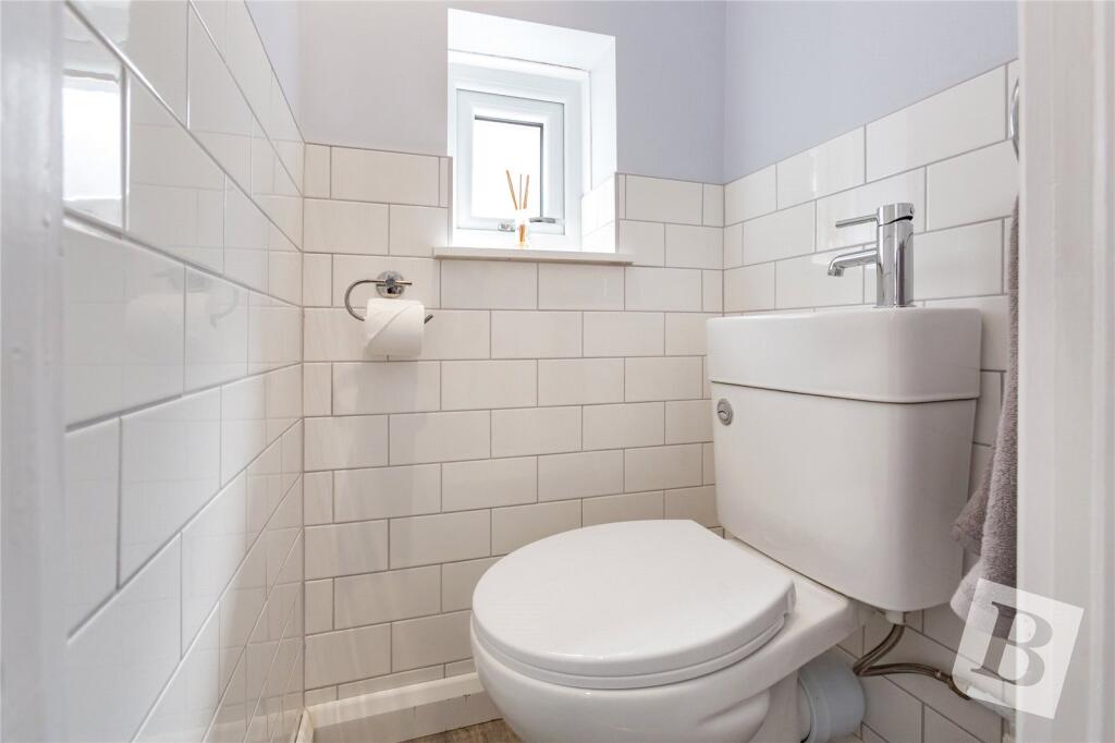
•GROUND FLOOR WC
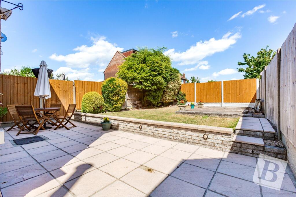
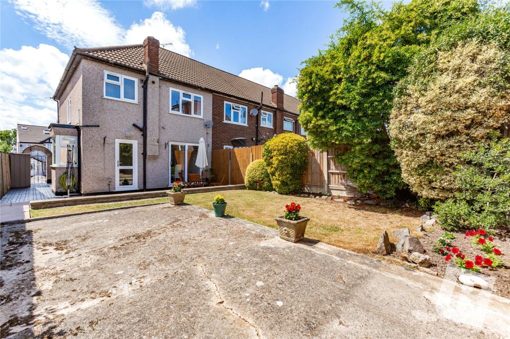
•WELL MAINTAINED REAR GARDEN
•COUNCIL BAND TAX: D
Listed by
Romford
Balgores
Reference: 164129303
EPC Rating & Upgrade Cost
Fetching EPC data… Refresh this page in a moment.
Flood risk
Zone: 1
Risk: Low
Job (default Low)
Floorplans
Picture No. 22
EPC Graphs
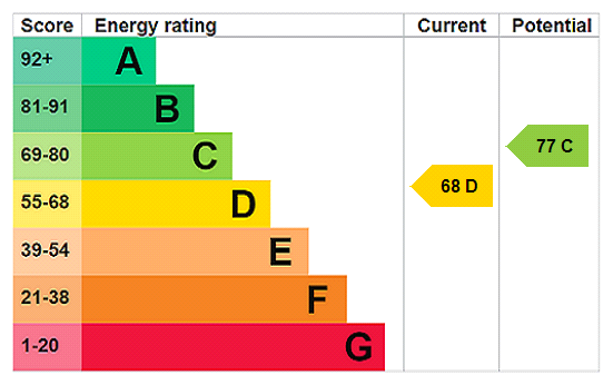
EPC Rating Graph
FENSA Certificates
This property has 1 FENSA certificate(s) on record, indicating window/door installations by FENSA-approved installers.
FENSA Certificate #14402313
Property Details
Street: 242 Collier Row Lane
Town: ROMFORD
Postcode: RM5 3JB
Installation Details
Items: 15 windows and 6 doors
Certificate Issued: 17/01/2021
Work Completed: 11/01/2021
This certificate data was retrieved from FENSA's database
What is FENSA? FENSA (Fenestration Self-Assessment Scheme) is a government-authorised scheme that monitors building regulation compliance for replacement windows and doors. Certificates indicate that work was completed by FENSA-approved installers.
Price history
| Event | Date | Price | % change |
|---|---|---|---|
| Sold | 16/10/2025 (7 months ago) | £470,000 | — |
Source: HM Land Registry Price Paid Data. Crown copyright.
Sold Comparables
Same street and nearby sales within 0.25 miles (last 5 years). Data from Land Registry Price Paid.
| Address | Price | Date | Type |
|---|---|---|---|
| Same street 246 COLLIER ROW LANE, ROMFORD, HAVERING, GREATER LONDON, RM5 3JB | £381,000 | 11/12/2023 | Terraced |
| 19 KENWAY, ROMFORD, HAVERING, GREATER LONDON, RM5 3EH | £450,000 | 08/12/2023 | Terraced |
| 13 HULSE AVENUE, ROMFORD, HAVERING, GREATER LONDON, RM7 8NT | £425,000 | 11/08/2023 | Terraced |
| 1 HULSE AVENUE, ROMFORD, HAVERING, GREATER LONDON, RM7 8NT | £560,000 | 12/07/2023 | Terraced |
| 15 CLOVELLY GARDENS, ROMFORD, HAVERING, GREATER LONDON, RM7 8NP | £440,000 | 24/03/2023 | Terraced |
| 3 HULSE AVENUE, ROMFORD, HAVERING, GREATER LONDON, RM7 8NT | £465,000 | 17/11/2022 | Terraced |
| 6 ELM ROAD, ROMFORD, HAVERING, GREATER LONDON, RM7 8HH | £420,000 | 14/11/2022 | Terraced |
| 1 MOWBRAYS CLOSE, ROMFORD, HAVERING, GREATER LONDON, RM5 3HJ | £390,000 | 09/11/2022 | Terraced |
| 8 ARGUS CLOSE, ROMFORD, HAVERING, GREATER LONDON, RM7 8NJ | £550,000 | 07/11/2022 | Terraced |
| Same street 192 COLLIER ROW LANE, ROMFORD, HAVERING, GREATER LONDON, RM5 3JB | £452,000 | 28/10/2022 | Terraced |
| 8 HOOD WALK, ROMFORD, HAVERING, GREATER LONDON, RM7 8NU | £423,000 | 26/10/2022 | Terraced |
| 1 KENWAY, ROMFORD, HAVERING, GREATER LONDON, RM5 3EH | £670,000 | 21/10/2022 | Terraced |
| 241 COLLIER ROW LANE, ROMFORD, HAVERING, GREATER LONDON, RM5 3JA | £460,000 | 09/09/2022 | Terraced |
| 101 MOWBRAYS ROAD, ROMFORD, HAVERING, GREATER LONDON, RM5 3EL | £430,000 | 06/09/2022 | Terraced |
| 56 LYNTON AVENUE, ROMFORD, HAVERING, GREATER LONDON, RM7 8NL | £450,000 | 26/08/2022 | Terraced |
| 9 HILLFOOT AVENUE, ROMFORD, HAVERING, GREATER LONDON, RM5 3LJ | £520,000 | 10/08/2022 | Terraced |
| 70 LYNTON AVENUE, ROMFORD, HAVERING, GREATER LONDON, RM7 8NL | £425,000 | 29/07/2022 | Terraced |
| Same street 220 COLLIER ROW LANE, ROMFORD, HAVERING, GREATER LONDON, RM5 3JB | £474,256 | 28/07/2022 | Terraced |
| 80 MOWBRAYS ROAD, ROMFORD, HAVERING, GREATER LONDON, RM5 3EL | £370,000 | 25/07/2022 | Terraced |
| 54 HILLFOOT ROAD, COLLIER ROW, ROMFORD, HAVERING, GREATER LONDON, RM5 3LL | £425,000 | 15/07/2022 | Terraced |
| 129 LYNTON AVENUE, ROMFORD, HAVERING, GREATER LONDON, RM7 8NH | £286,000 | 08/07/2022 | Terraced |
| 4 ELM ROAD, ROMFORD, HAVERING, GREATER LONDON, RM7 8HH | £460,000 | 17/06/2022 | Terraced |
| 25 HILLFOOT AVENUE, ROMFORD, HAVERING, GREATER LONDON, RM5 3LJ | £425,000 | 26/05/2022 | Terraced |
| Same street 238 COLLIER ROW LANE, ROMFORD, HAVERING, GREATER LONDON, RM5 3JB | £710,000 | 10/05/2022 | Semi-detached |
Street average: £504,314 (4 sales)
Area average: £452,200 (20 sales)
Capital growth trend
Land Registry outcode average: last 12 months vs 5y and 10y ago (from sold prices).
House Price Index (HM Land Registry — official index, not sold-price averages): Havering. Series: Terraced. As of March 2026.
Rental Range
Estimated market rent for Havering. Low = conservative, Realistic = average, Optimistic = best case.
Based on Local Authority from postcode lookup → Havering.
LHA (30th percentile) floor for Outer North East London: £1,496/mo (Apr 2025 – Mar 2026)
Location
Nearby
Nearest stations, universities and amenities (distance from property).
| Type | Name | Distance |
|---|---|---|
| Bus stop | Hulse Avenue | 0.1 miles |
| Bus stop | Hillfoot Road | 0.1 miles |
| Shop | Tesco | 0.3 miles |
| Shop | Debneys Opticians | 0.3 miles |
| Hospital | Victoria Hospital | 1.2 miles |
| Train station | Romford | 1.6 miles |
| Hospital | Queens Hospital | 1.9 miles |
| Train station | Gidea Park | 2.0 miles |
| University | University of East London | 7.3 miles |
Street-level crime
| Category | Count |
|---|---|
| Violence and sexual offences | 67 |
| Anti-social behaviour | 38 |
| Vehicle crime | 23 |
| Shoplifting | 20 |
| Other theft | 16 |
| Public order | 12 |
| Criminal damage and arson | 9 |
| Drugs | 5 |
| Robbery | 5 |
| Burglary | 4 |
| Other crime | 2 |
| Possession of weapons | 1 |
| Theft from the person | 1 |
| Total incidents | 203 |
Within 1 mile during Apr 2026. Source: data.police.uk (England & Wales).
Schools nearby
Nearest open schools with Ofsted ratings (England). Closed schools are not shown. Data from Get Information about Schools and Ofsted.
| Name | Type | Distance | Ofsted |
|---|---|---|---|
| St Patrick's Catholic Primary School | Primary | 0.3 miles | Good — 15 Jun 2012 |
| Crownfield Junior School | Primary | 0.4 miles | Good — 11 Jun 2014 |
| Crownfield Infant School | Primary | 0.4 miles | Good — 15 Oct 2014 |
| Clockhouse Primary School | Primary | 0.5 miles | Outstanding — 16 Jul 2023 |
| Parklands Primary School | Primary | 0.6 miles | Good — 9 Jun 2024 |
Rental Comparables
Residential lets from OpenRent and Rightmove for the area (same bedroom count). Use to validate rent estimates. Student lets are excluded.
| Title | Rent | Beds | Distance | As seen on |
|---|---|---|---|---|
| 3 Bed Flat, Collier Row Road, RM5 | £1,950/mo | 3 | 0.34 miles | OpenRent |
Average rent: £1,950/mo (1 listing)
Rent-driven metrics
Based on OpenRent comparables.
- Rent ratio — Monthly rent ÷ purchase price (1% rule). 1%+ = strong, 0.8–1% = okay, <0.8% = weak for cashflow.
- Max investor price — Rent ÷ 0.8%; the price at which rent would be 0.8% of price (Stoke-style target).
- Target investor price — Rent ÷ 1%; the price at which rent would be 1% of price (strong cashflow band).
- Gross yield — Annual rent as % of purchase price (no costs).
- Cost-to-rent — Price ÷ annual rent (from OpenRent comparables). Under 14× = strong, 14–16× = acceptable, 17×+ = compressed.
- Cashflow — Rent minus mortgage, 10% maintenance, £25/mo compliance. Assumes 75% LTV, 3.95% APR (5yr fixed), 25yr term.
- ROI — Annual profit ÷ cash in (deposit + 4% purchase costs).