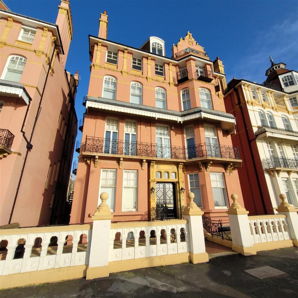
FLAT 4
2 KINGS GARDENS, HOVE, BRIGHTON AND HOVE BN3 2PE
£4,000 pcm
Property details
Floor area
178 m²
Council tax band
F
Deprivation
Decile 7 (20,533 of 33,755)
Street crime
490 incidents within 1 mile (Mar 2026)
Key features
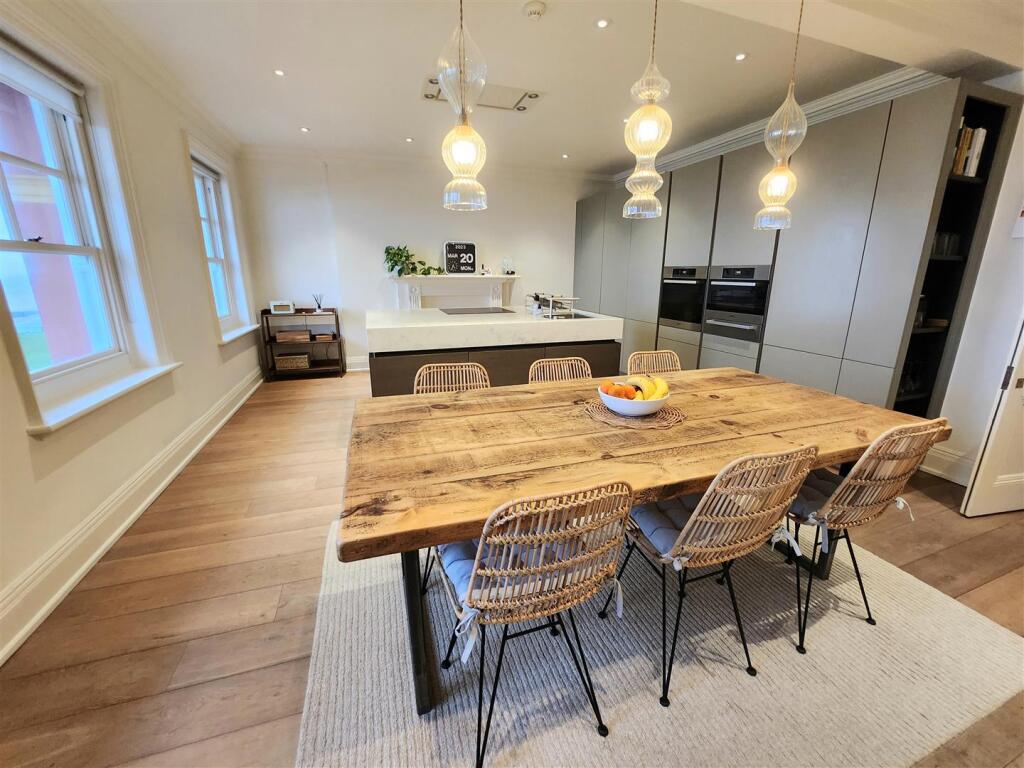
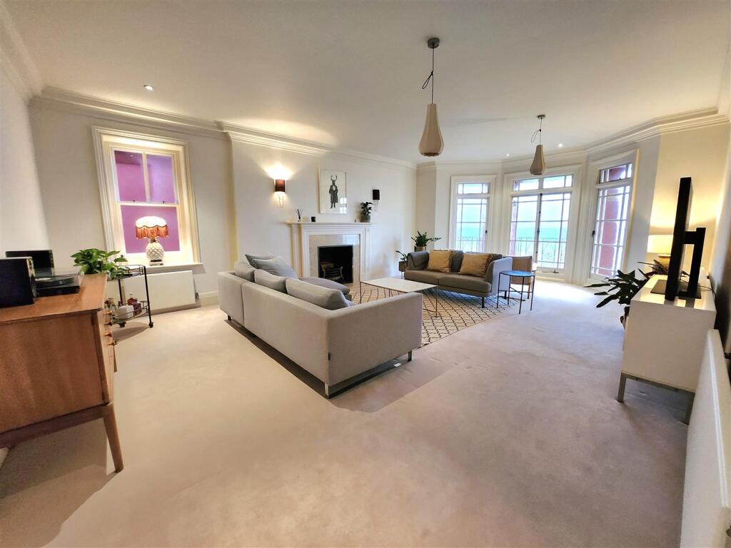
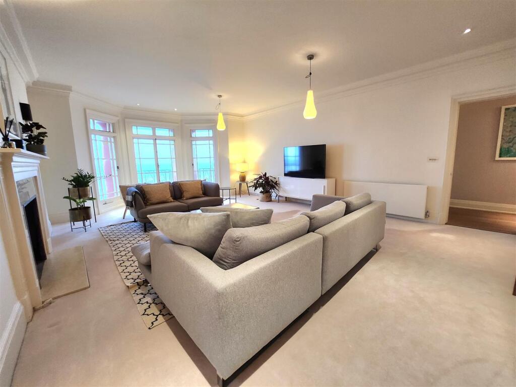
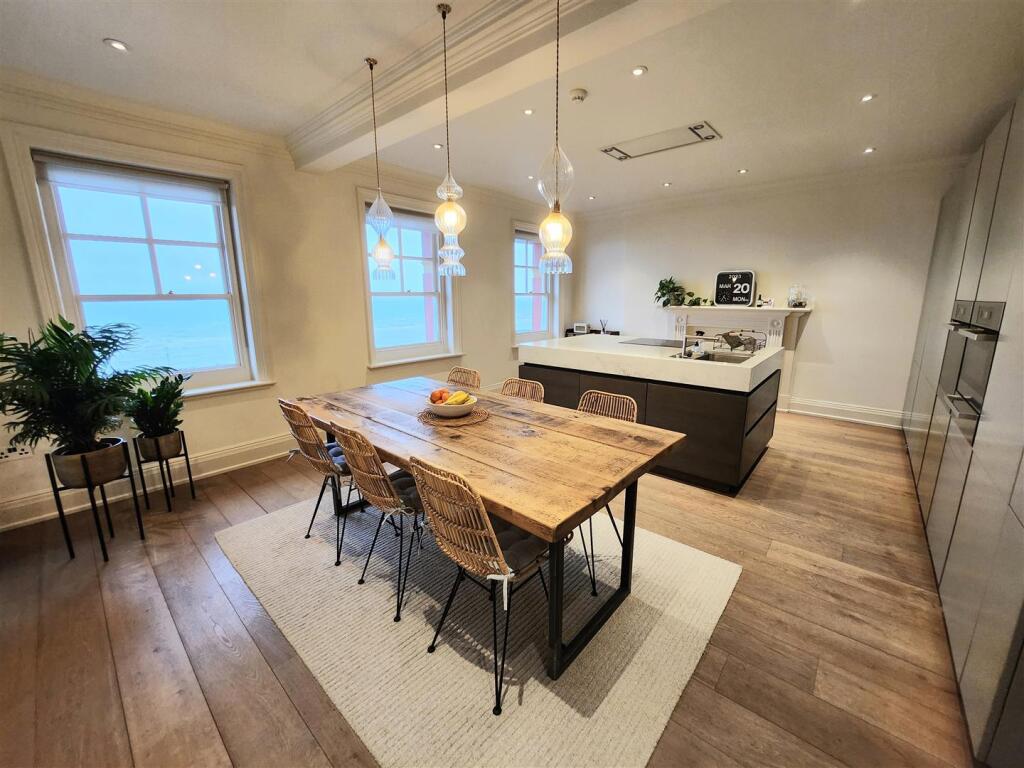
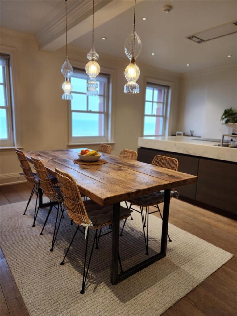
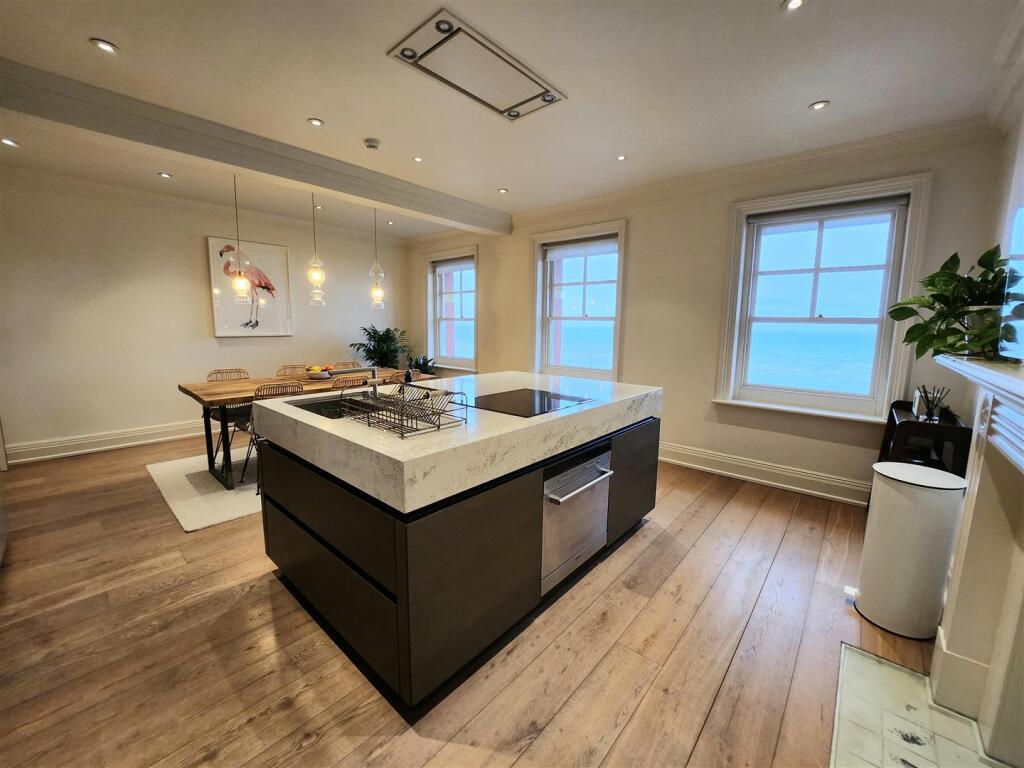
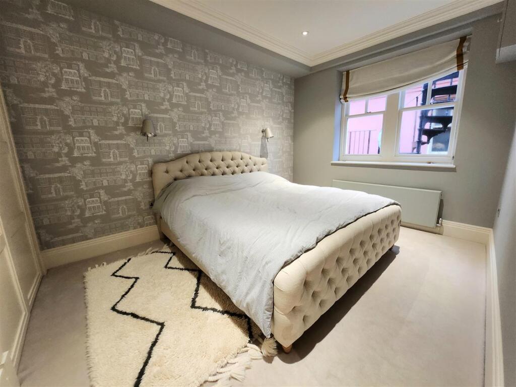
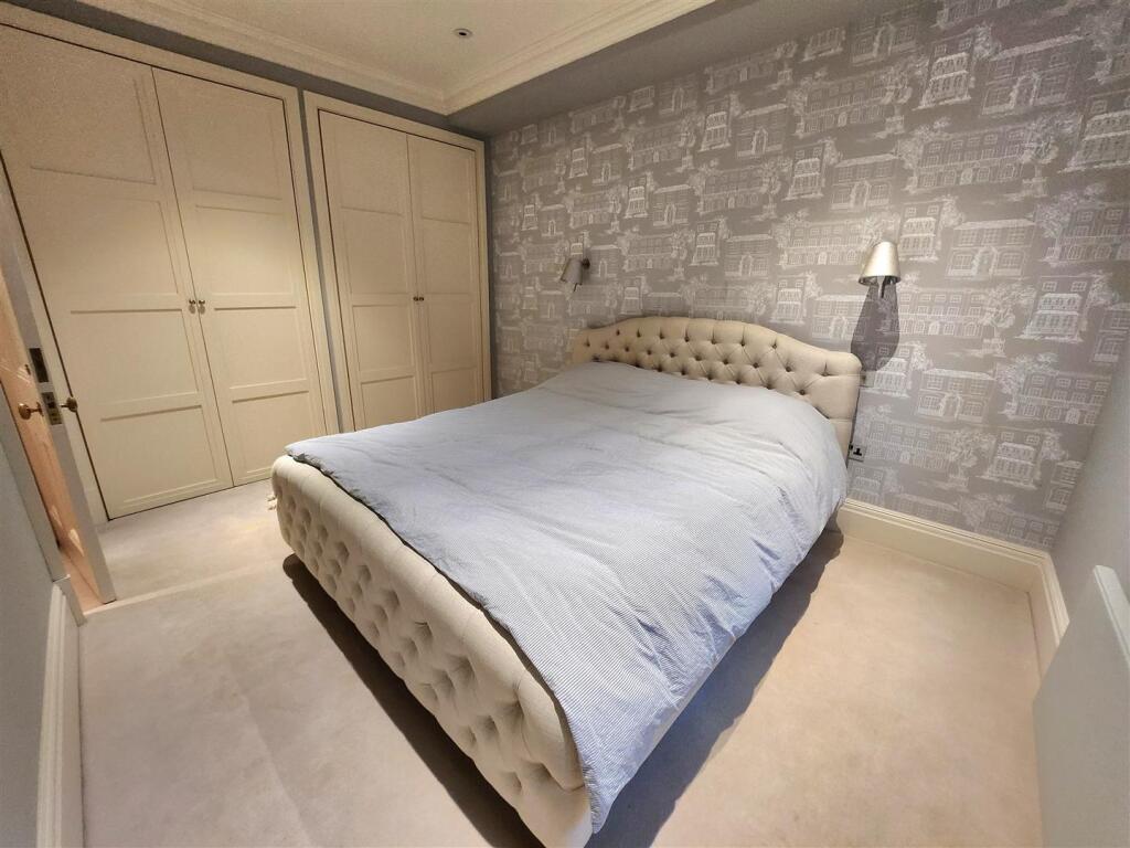
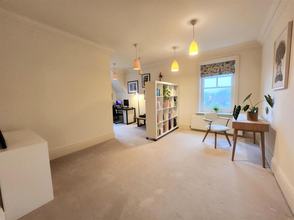
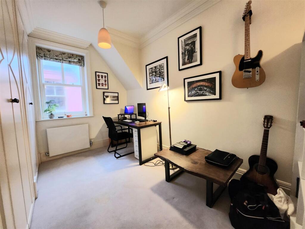
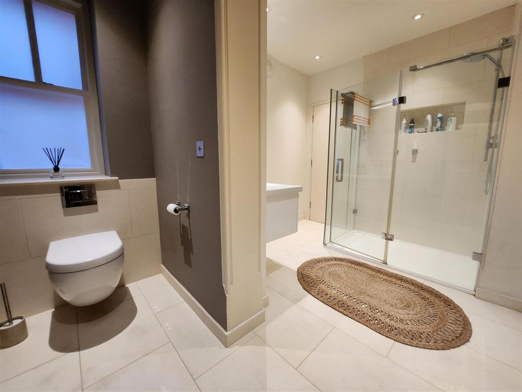
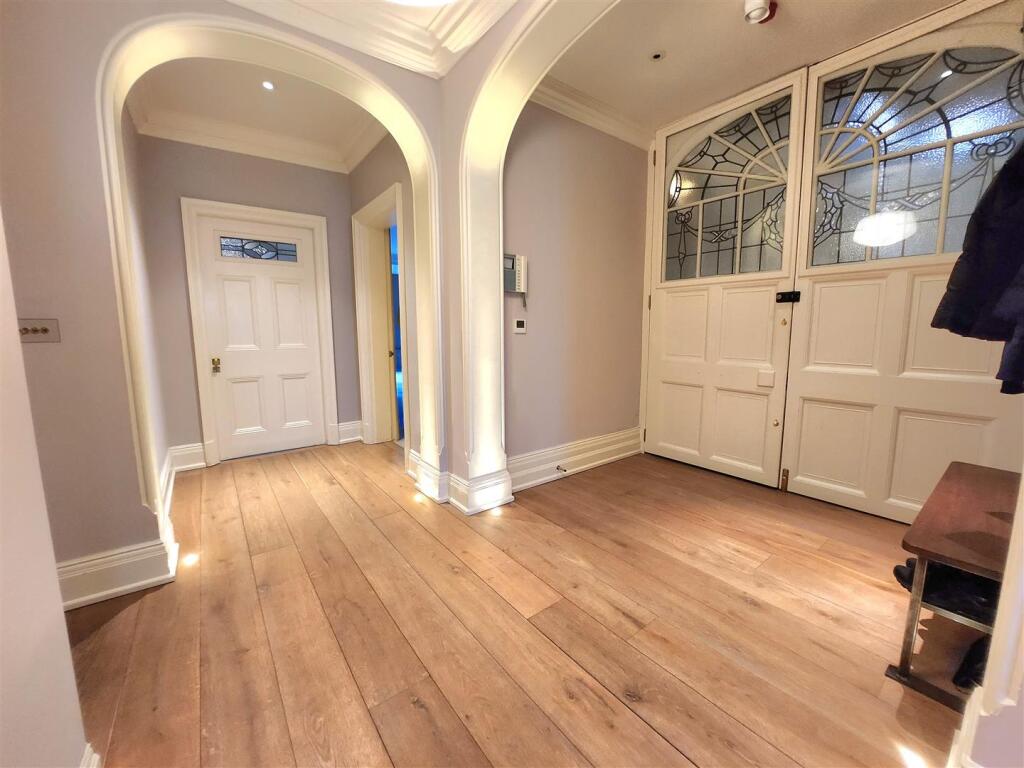
- Modern décor throughout combined with Victorian features
- The property can be accessed by a lift leading directly into the apartment
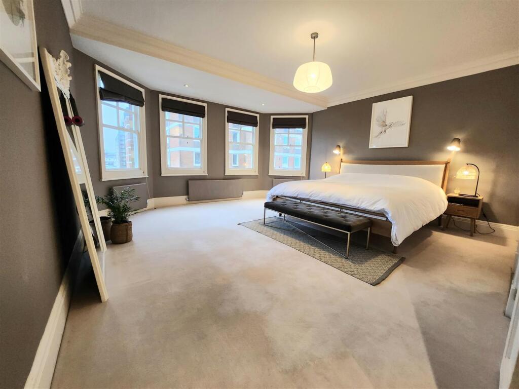
- Three bedroom property, all with built in storage cupboards
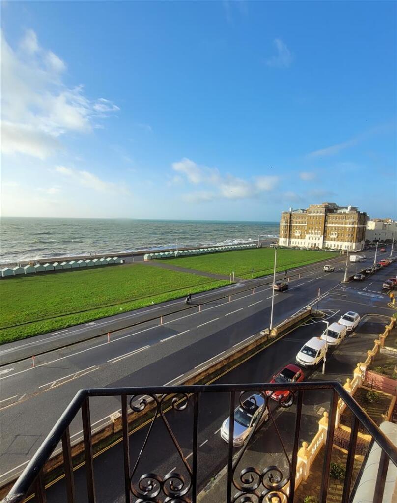
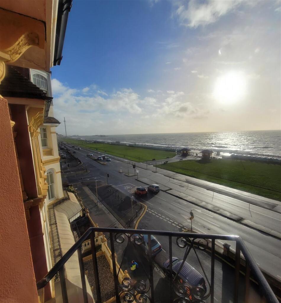
- Third floor, direct sea views
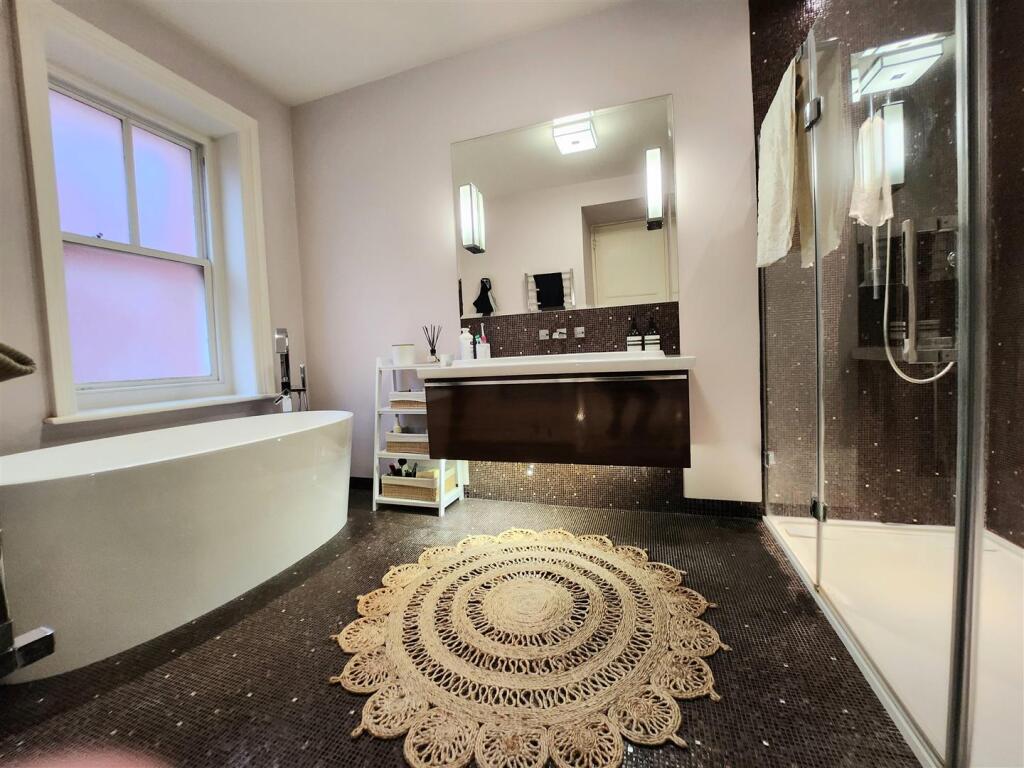
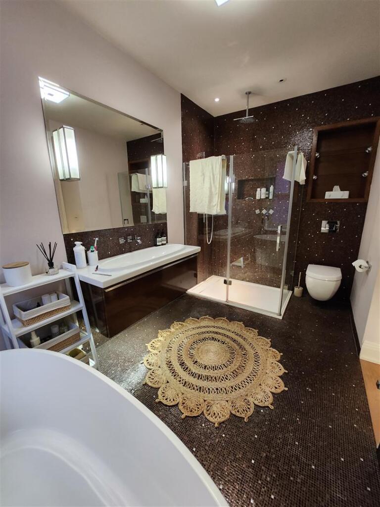
- The property has been refurbished to a very high standard throughout
- Available to move in towards the middle of January 2026
- Two bathrooms
- Must be seen
- Please contact us to arrange a viewing
- Unfurnished
Description
Listed by
Hove
PIER ASSOCIATES LIMITED
Reference: 166532843
EPC Rating & Upgrade Cost
Fetching EPC data… Refresh this page in a moment.
Flood risk
Zone: 1
Risk: Low
Job (default Low)
EPC Graphs
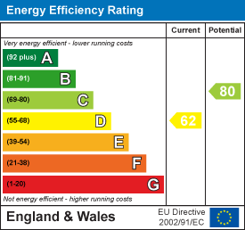
EE Rating
Company ownership
Registered legal owner is a company.
Company: THE 2 KING'S GARDENS MANAGEMENT COMPANY LIMITED
Rental Range
Estimated market rent for Brighton and Hove. Low = conservative, Realistic = average, Optimistic = best case.
Based on Local Authority from postcode lookup → Brighton and Hove.
LHA (30th percentile) floor for Brighton and Hove: £1,446/mo (Apr 2025 – Mar 2026)
Location
Nearby
Nearest stations, universities and amenities (distance from property).
| Type | Name | Distance |
|---|---|---|
| Bus stop | Fourth Avenue | 0.1 miles |
| Bus stop | Unknown | 0.1 miles |
| Shop | Velvet | 0.2 miles |
| Shop | Nick Rivett Sport | 0.2 miles |
| Hospital | Aldrington House | 0.7 miles |
| Train station | Hove | 0.7 miles |
| Hospital | The Montefiore Hospital | 0.8 miles |
| Train station | Aldrington | 0.9 miles |
| University | University of Brighton Phoenix Halls | 1.7 miles |
| University | Silverstone SB309 Lecture Theatre | 4.6 miles |
Street-level crime
| Category | Count |
|---|---|
| Anti-social behaviour | 123 |
| Violence and sexual offences | 115 |
| Shoplifting | 57 |
| Other theft | 45 |
| Public order | 42 |
| Drugs | 29 |
| Criminal damage and arson | 27 |
| Vehicle crime | 14 |
| Burglary | 13 |
| Other crime | 11 |
| Bicycle theft | 7 |
| Possession of weapons | 4 |
| Theft from the person | 2 |
| Robbery | 1 |
| Total incidents | 490 |
Within 1 mile during Mar 2026. Source: data.police.uk (England & Wales).
Schools nearby
Nearest open schools with Ofsted ratings (England). Closed schools are not shown. Data from Get Information about Schools and Ofsted.
| Name | Type | Distance | Ofsted |
|---|---|---|---|
| St Andrew's CofE (Aided) Primary School | Primary | 0.4 miles | Good — 20 Apr 2015 |
| Brighton and Hove Clinic School | Other | 0.5 miles | Outstanding — 18 Jun 2024 |
| Brunswick Primary School | Primary | 0.6 miles | Requires improvement — 11 Jul 2024 |
| The Montessori Place | Other | 0.6 miles | Outstanding — 28 Sep 2022 |
| St Christopher's School | Other | 0.7 miles | — (No rating) |
Rental Comparables
Rental listings exist nearby, but none matched the 3-bedroom estimate from EPC for this property.