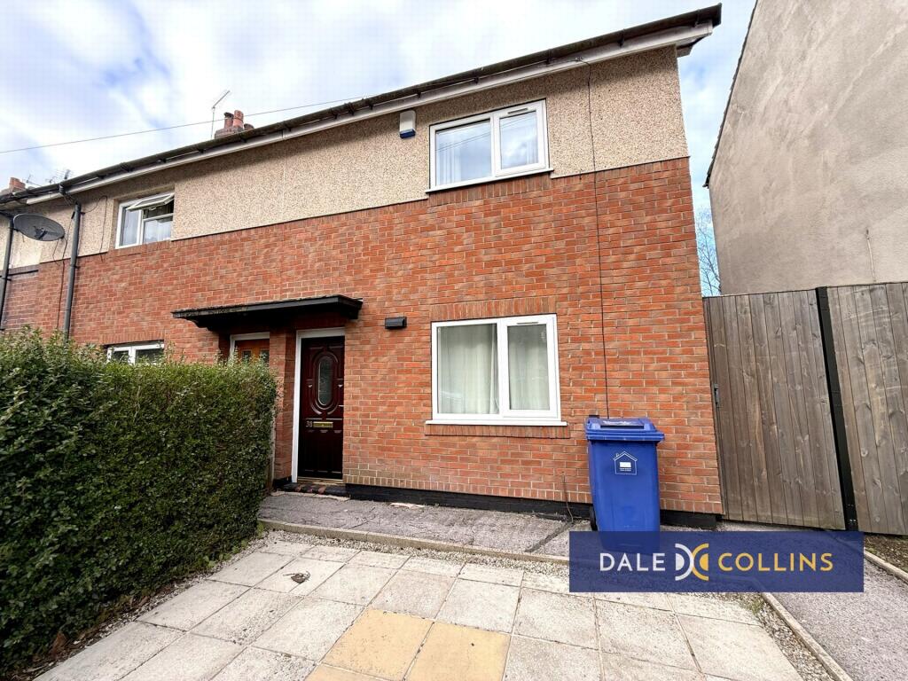
Silverdale Road
Silverdale, ST5, ST5 2TB
£950 pcm
Property details
Floor area
73 m²
Council tax band
A
Deprivation
Decile 4 (11,963 of 33,755)
Street crime
333 incidents within 1 mile (May 2026)
Key features
- BEAUTIFUL END TOWN HOUSE
- TWO DOUBLE BEDROOMS
- SPACIOUS LOUNGE
- OFF ROAD PARKING FOR TWO CARS
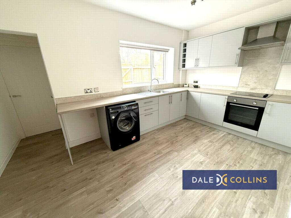
- KITCHEN APPLIANCES INCLUDED
- LUXURY BATHROOM
- GAS CENTRAL HEATING
- UTILITY & GUEST WC
- SUPER LOCATION!!
- CLOSE TO NEWCASTLE CENTRE
Additional details
- Parking
- Yes
- Garden
- Yes
Description
HALLWAY: Laminate flooring.
LOUNGE: 11'8" x 14'1" (3.56m x 4.29m), Laminate flooring, central heating radiator, uPVC double glazing, under stairs store.
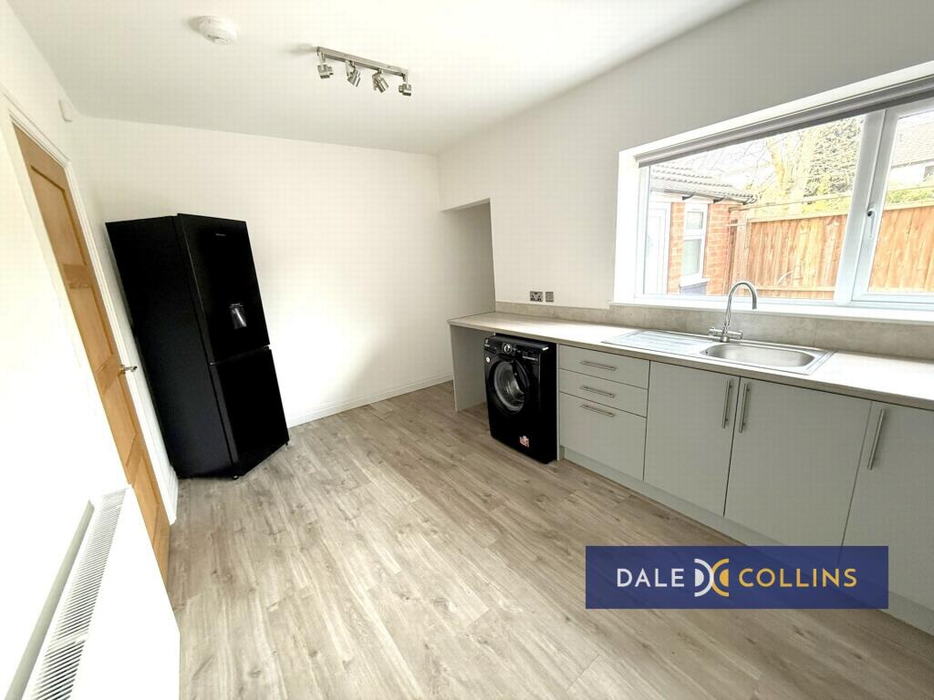
KITCHEN: 14'8" x 9'2" (4.47m x 2.79m), Stainless steel sink unit with cupboards below, base and wall storage units, working surfaces. Integrated electric hob, oven and extractor. Laminate flooring, central heating radiator, washing machine, fridge/freezer, uPVC double glazing.
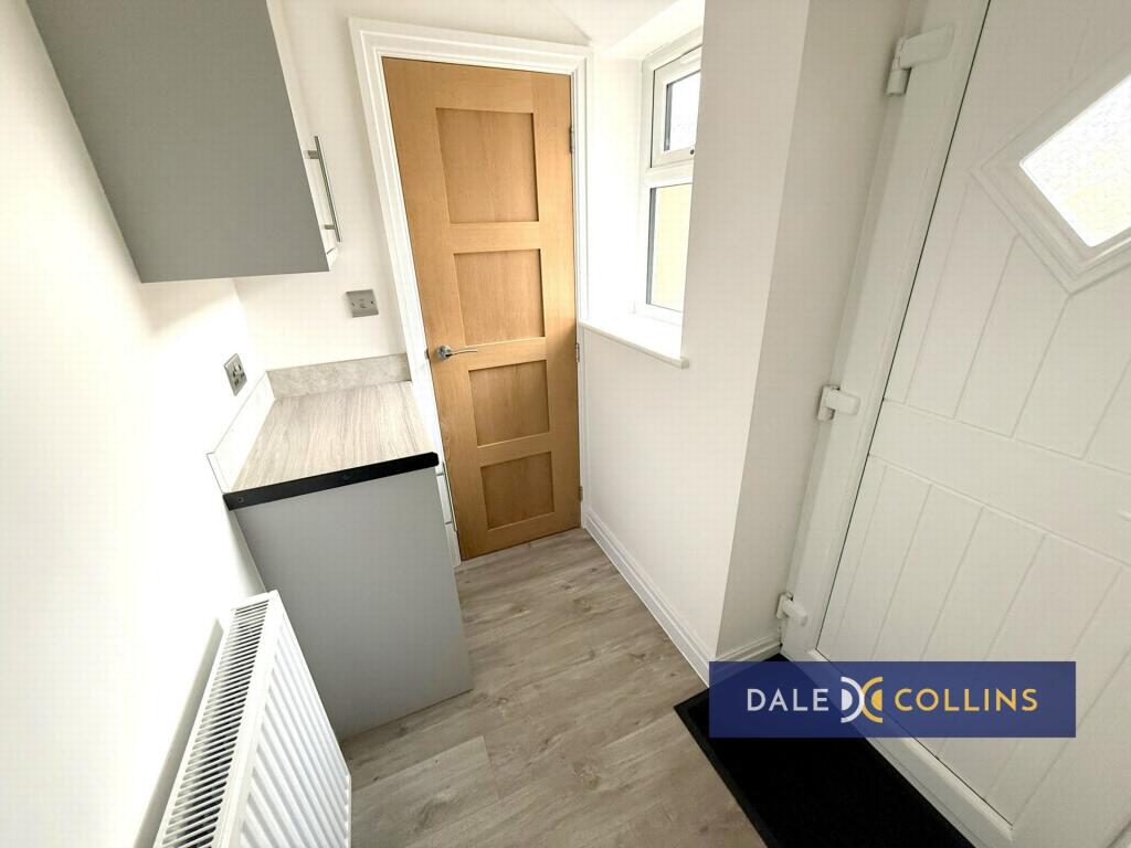
REAR HALLWAY: uPVC double glazing, laminate flooring, central heating radiator.
GROUND FLOOR WC: Low level WC, wash hand basin, laminate flooring, uPVC double glazing.
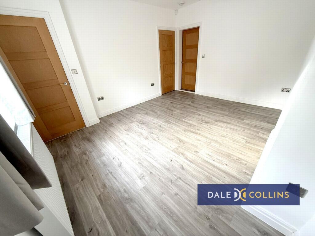
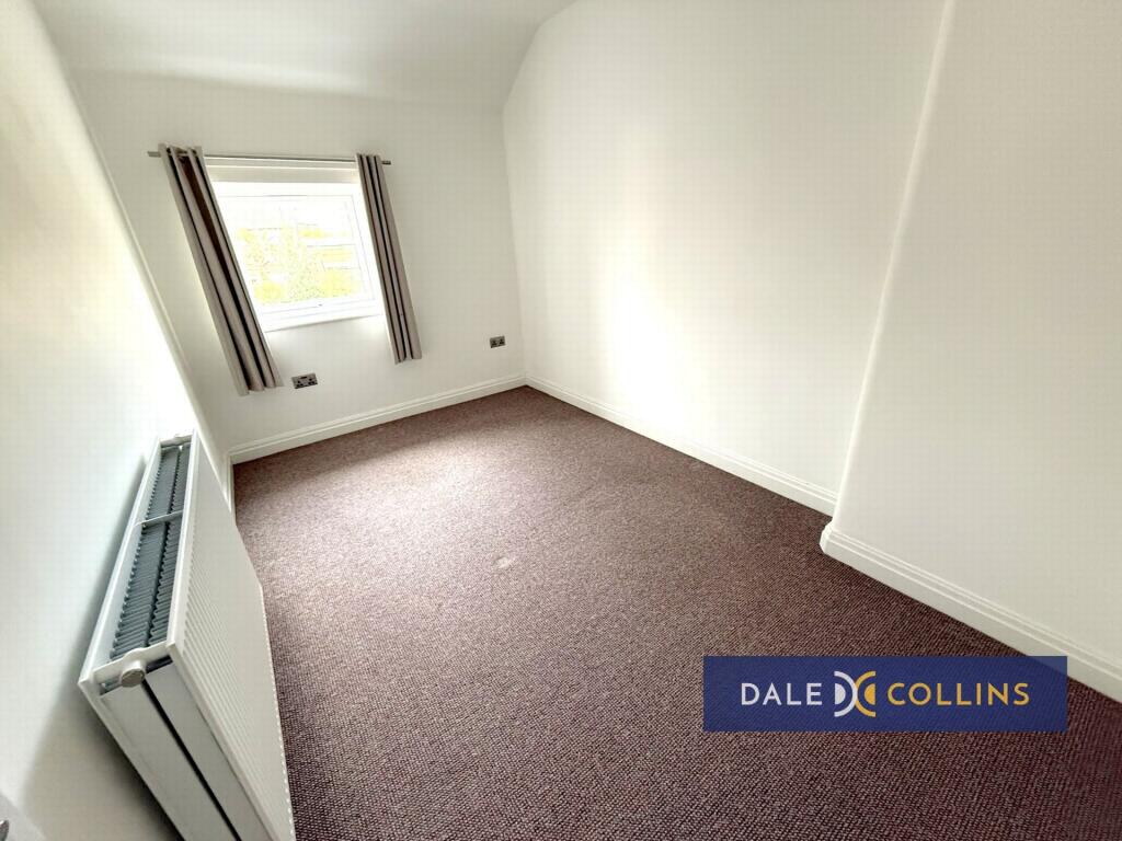
LANDING: Fitted carpet.
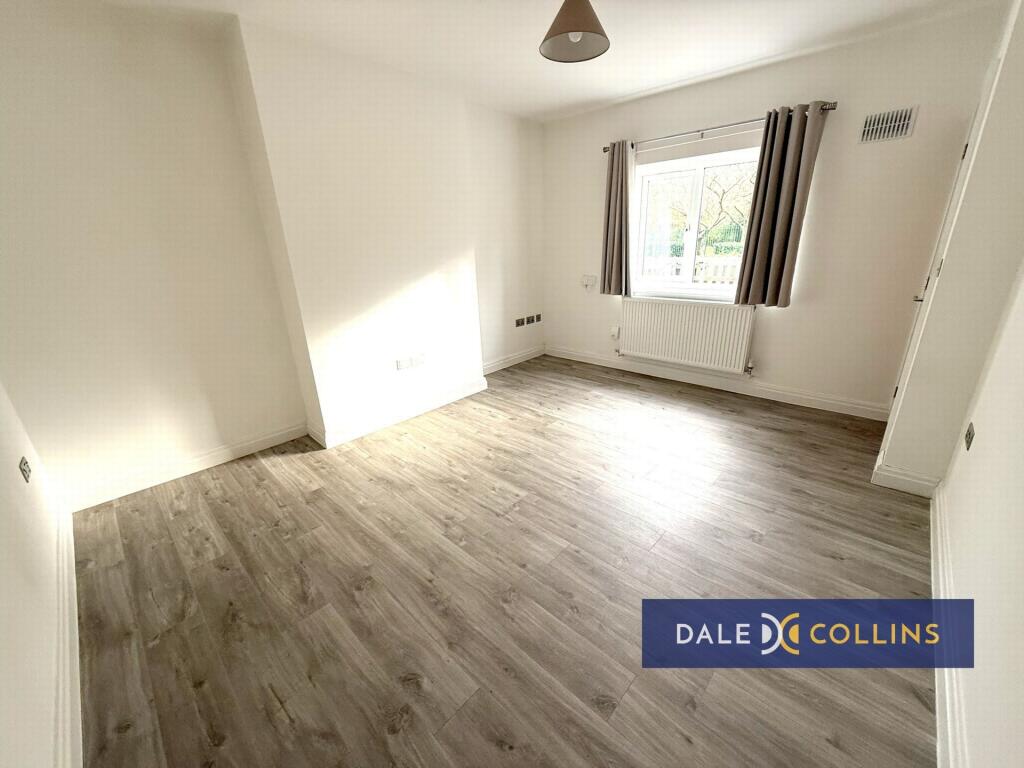
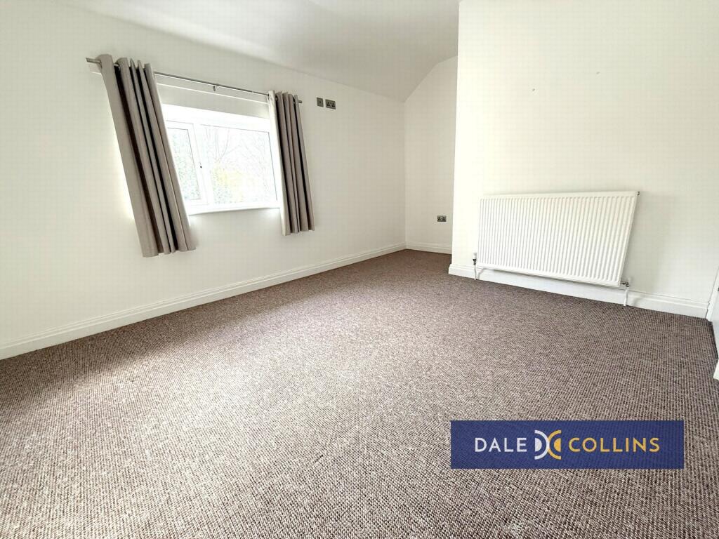
BEDROOM ONE: 14'9" x 10'8" (4.50m x 3.25m), Fitted carpet, uPVC double glazing, central heating radiator, store.
BEDROOM TWO: 12'9" x 8'0" (3.89m x 2.44m), Fitted carpet, uPVC double glazing, central heating radiato.
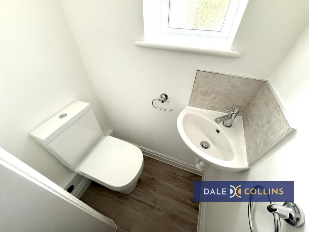
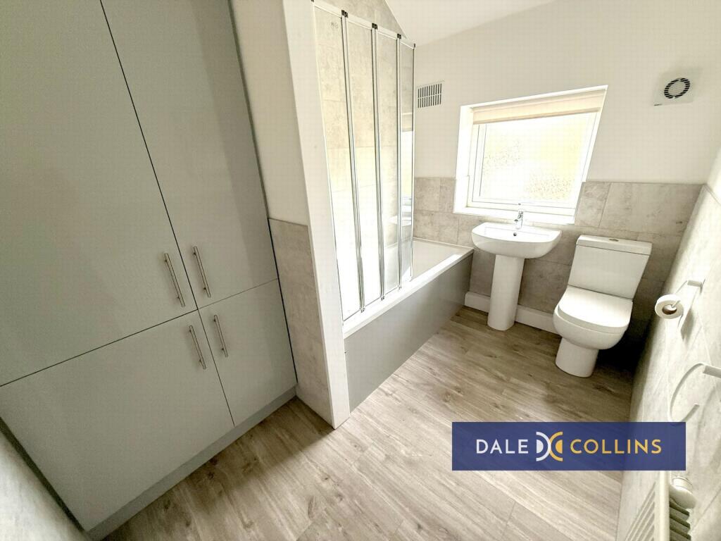
BATHROOM/WC: 9'2" x 6'3" (2.79m x 1.91m), Panelled bath with shower over and screen, low level WC, pedestal wash hand basin, uPVC double glazing, laminate flooring, central heating radiator, storage.
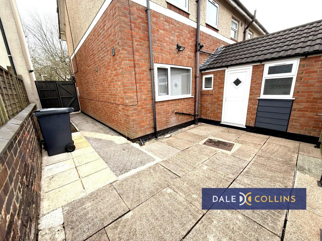
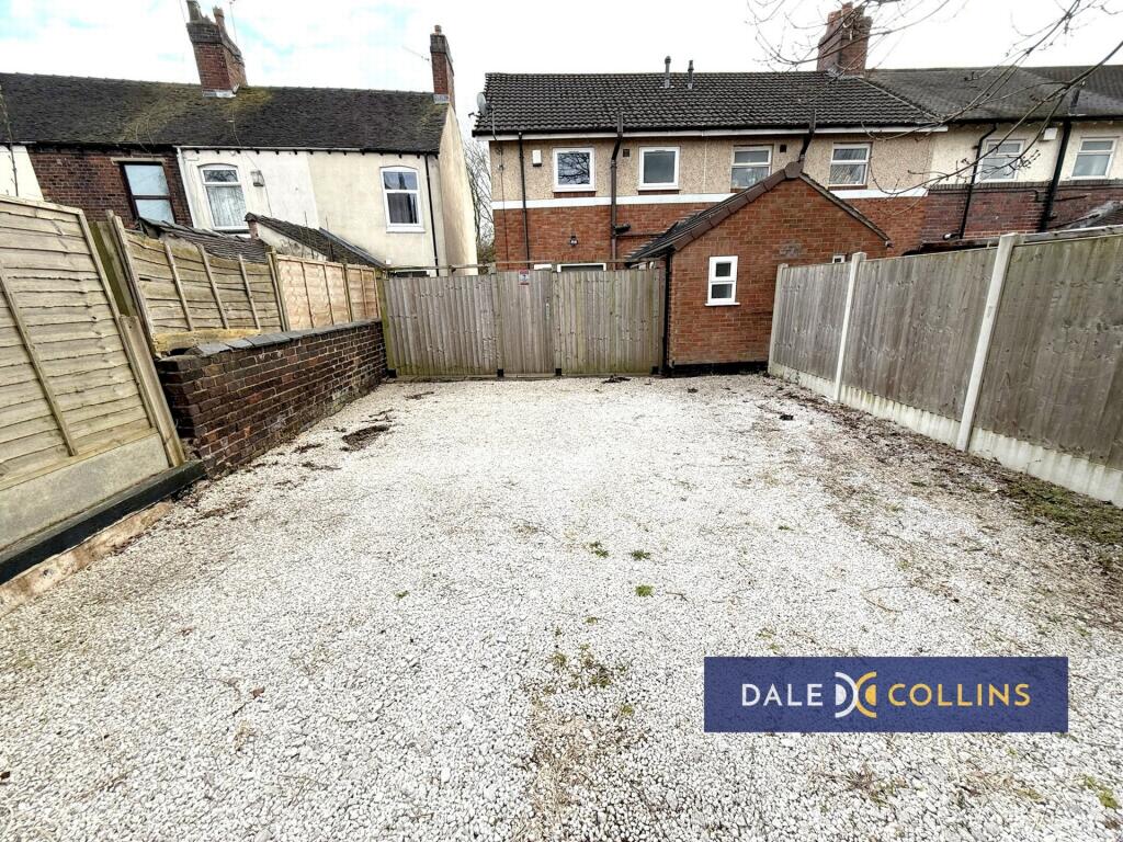
EXTERNALLY: Gardens front and rear. Pull-in to the rear of the property providing off road parking.
Listed by
Trentham
Dale and Collins
Reference: 173942213
EPC Rating & Upgrade Cost
Fetching EPC data… Refresh this page in a moment.
Flood risk
Zone: 1
Risk: Low
Job (default Low)
EPC Graphs
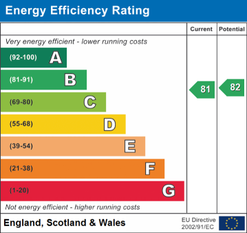
EPC
Company ownership
Registered legal owner is a company.
Company: HOME4RENT LIMITED (10344330)
Rental Range
Estimated market rent for Newcastle-under-Lyme. Low = conservative, Realistic = average, Optimistic = best case.
Based on Local Authority from postcode lookup → Newcastle-under-Lyme.
LHA (30th percentile) floor for Staffordshire North: £479/mo (Apr 2025 – Mar 2026)
Location
Address
38 Silverdale Road
Nearby
Nearest stations, universities and amenities (distance from property).
| Type | Name | Distance |
|---|---|---|
| Bus stop | Queen Elizabeth Park | 0.1 miles |
| Bus stop | Orme Queen Elizabeth Park | 0.1 miles |
| Shop | Unknown | 0.1 miles |
| Shop | ATS Euromaster | 0.1 miles |
| Hospital | Hartshill Medical Centre | 0.9 miles |
| Hospital | Royal Stoke University Hospital | 0.9 miles |
| University | Keele University | 1.7 miles |
| Train station | Silverdale | 2.1 miles |
| University | University of Staffordshire Stoke Campus | 2.1 miles |
| Train station | Stoke-on-Trent | 2.1 miles |
Street-level crime
| Category | Count |
|---|---|
| Violence and sexual offences | 132 |
| Anti-social behaviour | 62 |
| Public order | 32 |
| Shoplifting | 27 |
| Other theft | 19 |
| Drugs | 17 |
| Criminal damage and arson | 15 |
| Burglary | 13 |
| Vehicle crime | 5 |
| Bicycle theft | 4 |
| Robbery | 4 |
| Other crime | 1 |
| Possession of weapons | 1 |
| Theft from the person | 1 |
| Total incidents | 333 |
Within 1 mile during May 2026. Source: data.police.uk (England & Wales).
Schools nearby
Nearest open schools with Ofsted ratings (England). Closed schools are not shown. Data from Get Information about Schools and Ofsted.
| Name | Type | Distance | Ofsted |
|---|---|---|---|
| St Giles' and St George's Church of England Academy | Primary | 0.1 miles | Good — 21 May 2023 |
| Blackfriars Academy | Other | 0.1 miles | Outstanding — 6 Feb 2013 |
| St Mary's Catholic Primary School | Primary | 0.2 miles | Good — 17 Feb 2017 |
| Hassell Primary School | Primary | 0.4 miles | Good — 25 Oct 2023 |
| Newcastle and Stafford Colleges Group | Other | 0.4 miles | — (No rating) |
Rental Comparables
Residential lets from OpenRent and Rightmove for the area (same bedroom count). Use to validate rent estimates. Student lets are excluded.
Average rent: £928/mo (50 listings)