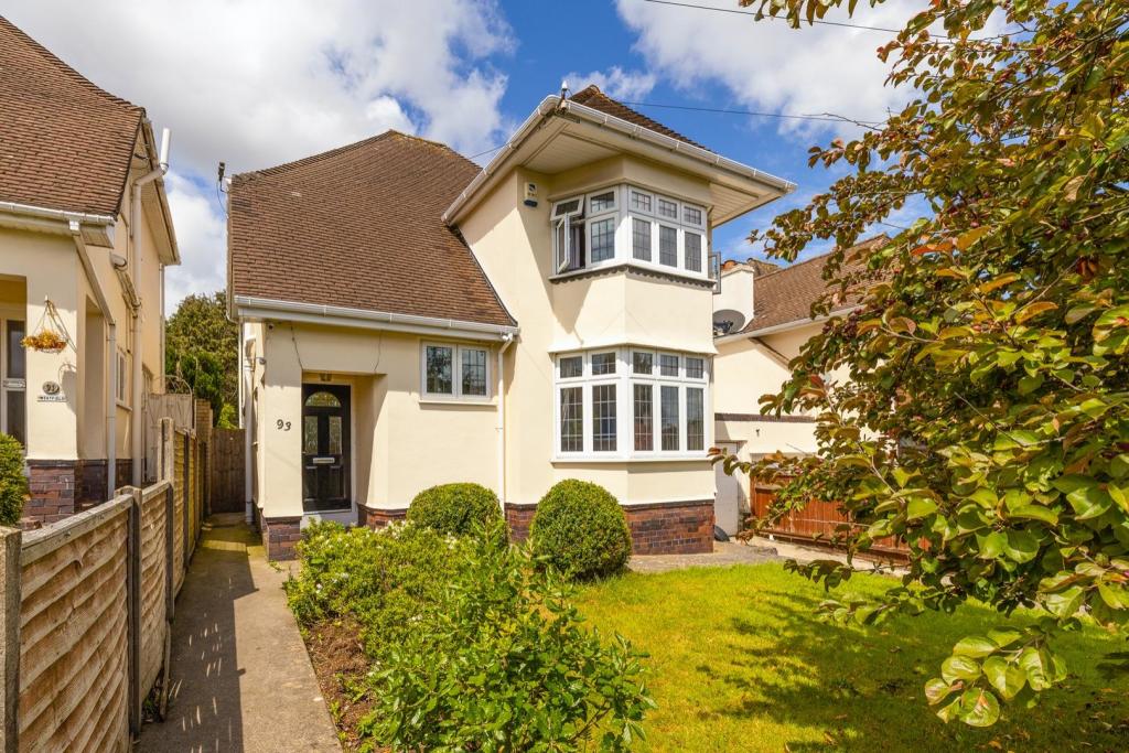
93 BRENTRY LANE
BRISTOL, CITY OF BRISTOL BS10 6RH
£575,000
93 Brentry Lane20.jpg 93 Brentry Lane14.jpg 93 Brentry Lane10.jpg 93 Brentry Lane13.jpg 93 Brentry Lane16.jpg 93 Brentry Lane15.jpg 93 Brentry Lane12.jpg 93 Brentry Lane21.jpg 93 Brentry Lane11.jpg 93 Brentry Lane9.jpg 93 Brentry Lane6.jpg 93 Brentry Lane7.jpg 93 Brentry Lane1.jpg 93 Brentry Lane3.jpg 93 Brentry Lane5.jpg 93 Brentry Lane2.jpg 93 Brentry Lane8.jpg 93 Brentry Lane17.jpg 93 Brentry Lane18.jpg 93 Brentry Lane19.jpg
/ 20
Property details
Tenure
FREEHOLD
Floor area
137 m²
Last sold
£550,000 Jun 2023
Local average
£604,040 (-4.8%)
Deprivation
Decile 4 (11,813 of 33,755)
Street crime
270 incidents within 1 mile (Apr 2026)
Additional details
- Garden
- Yes
Description
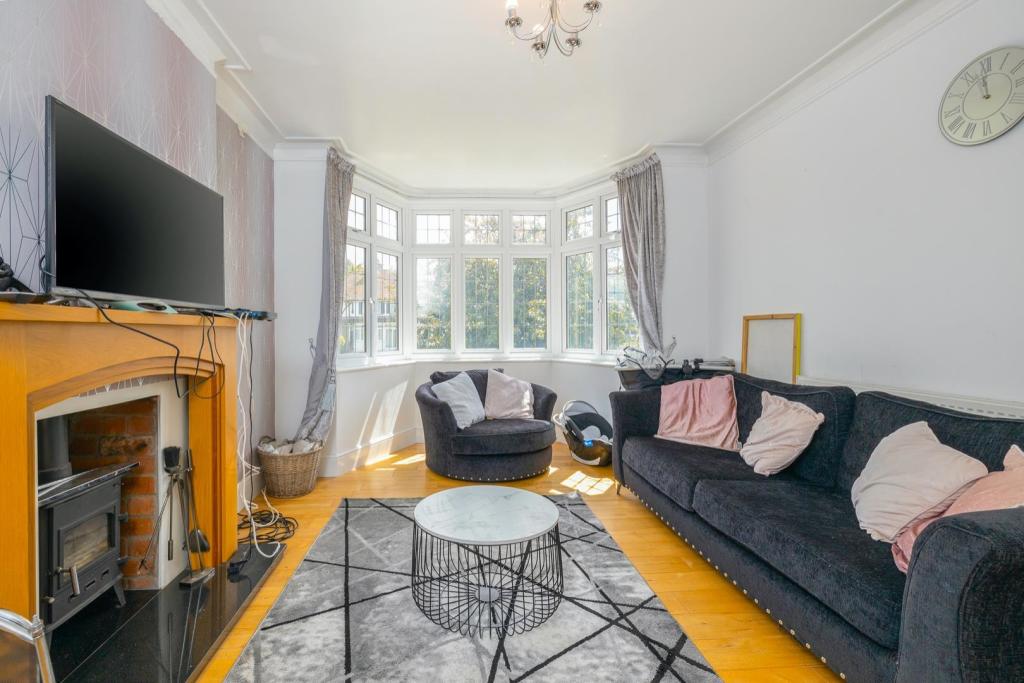
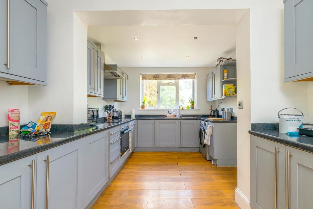
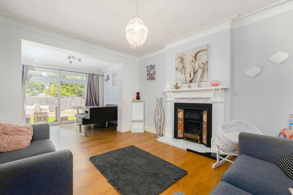
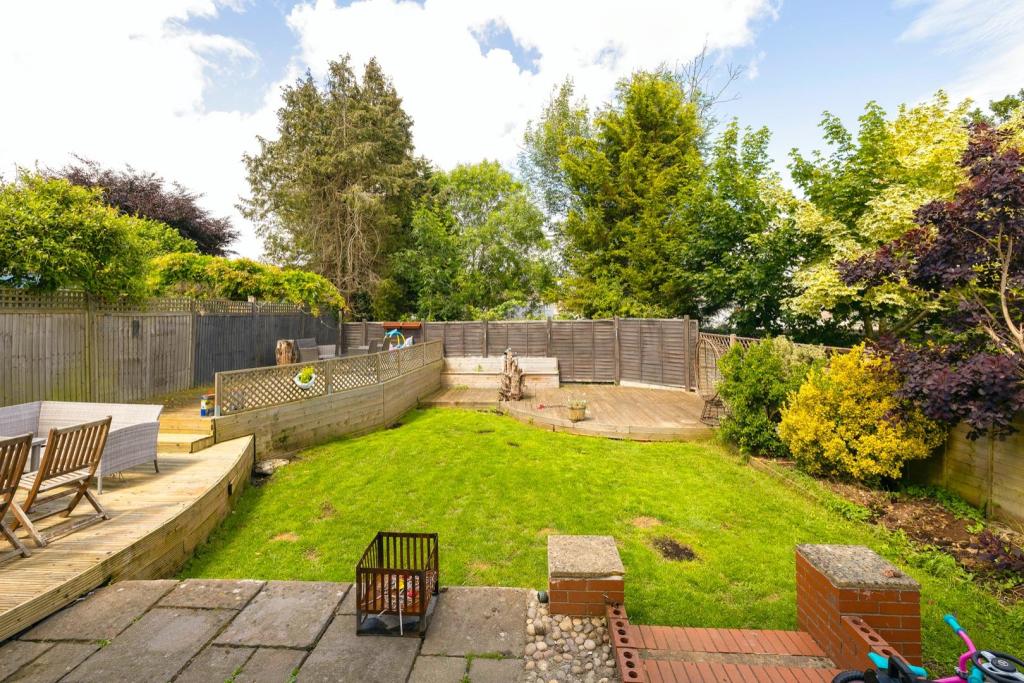
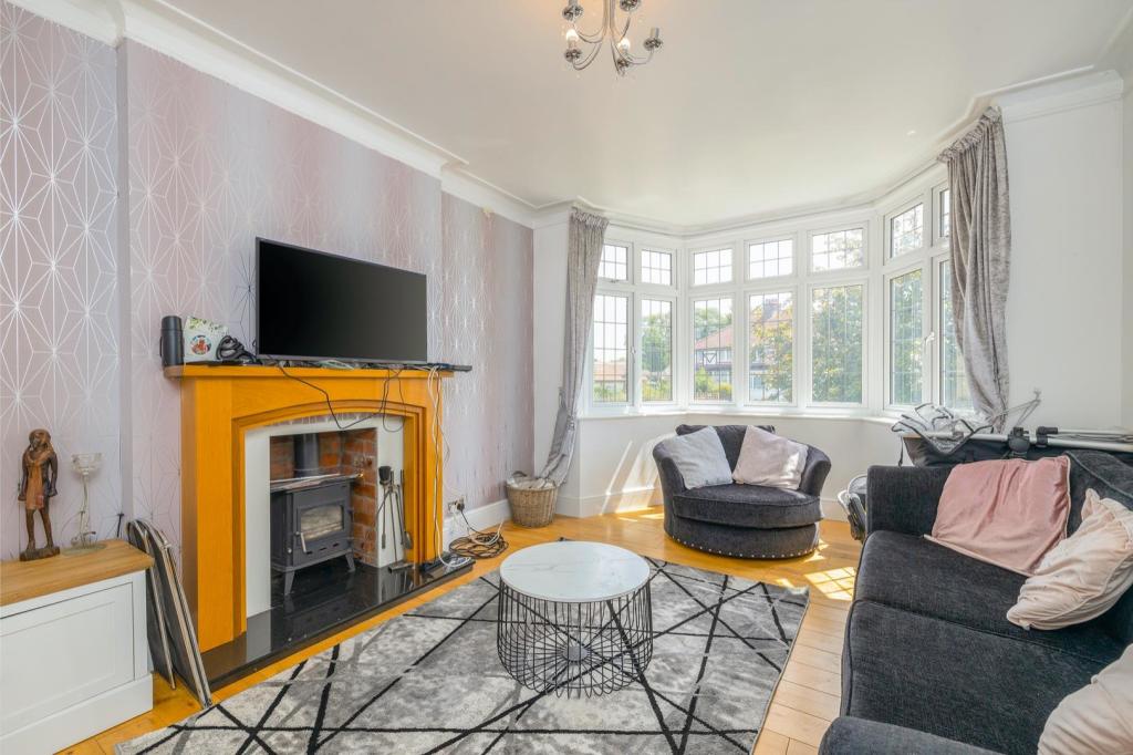
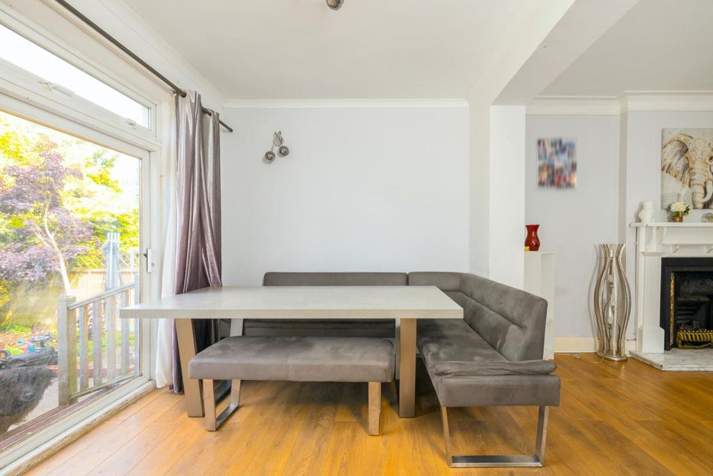
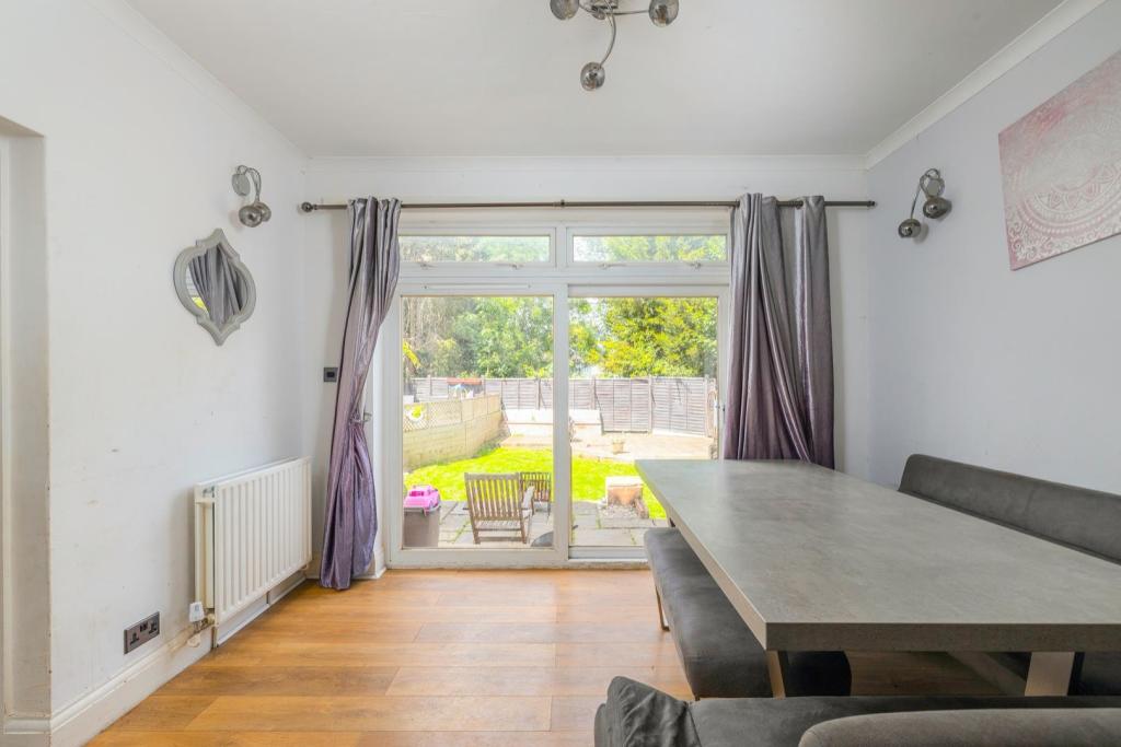
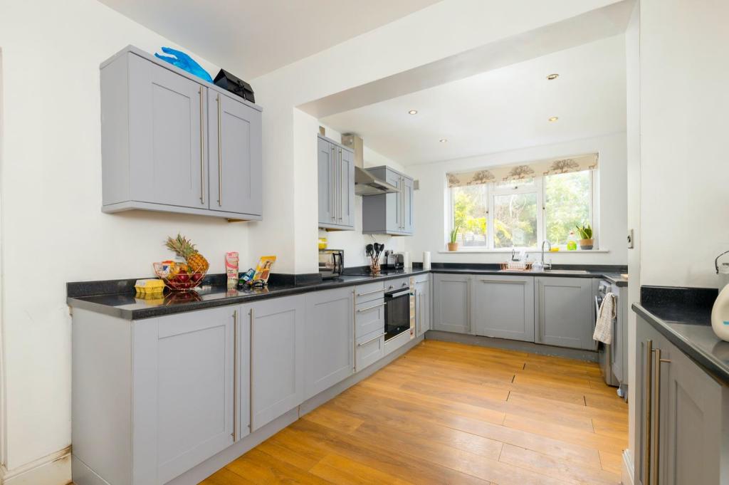
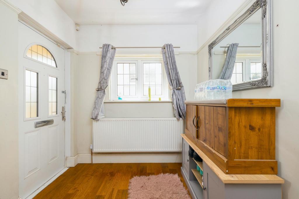
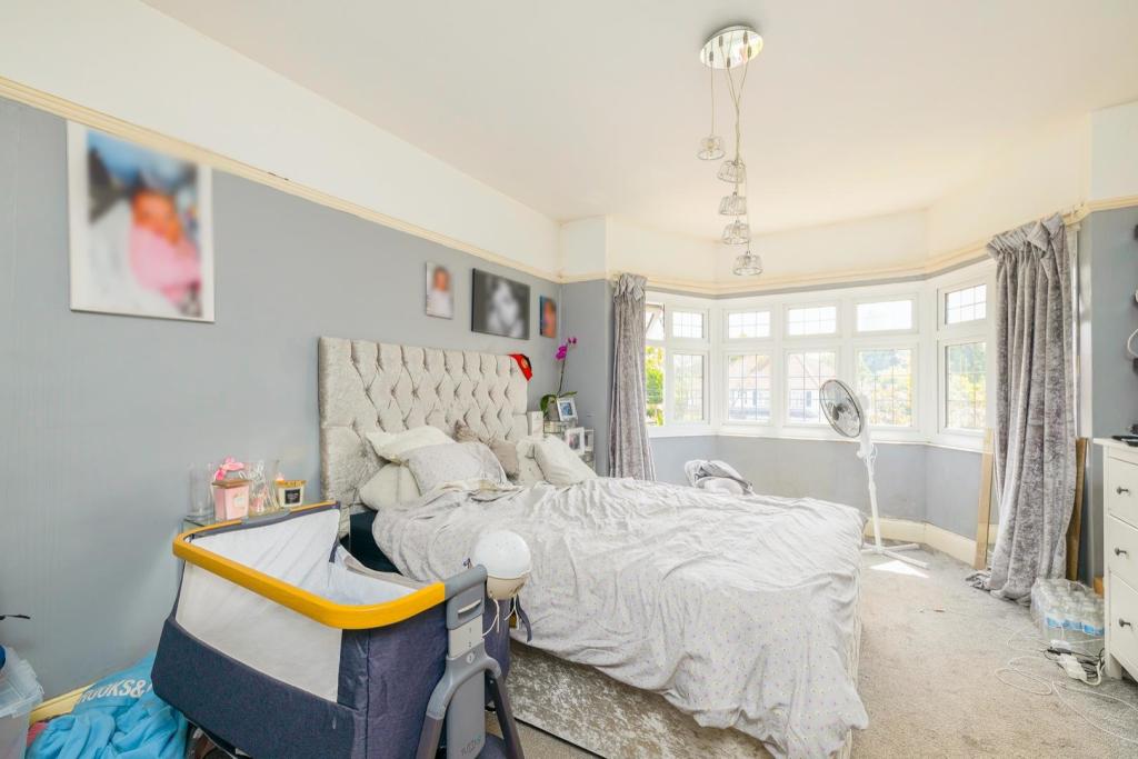
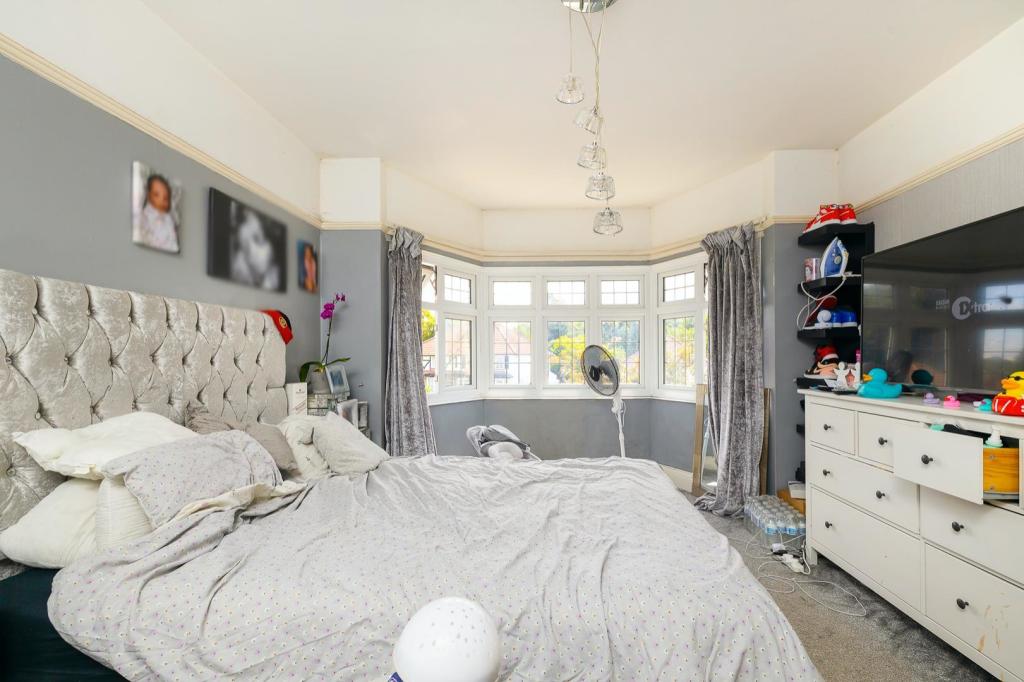
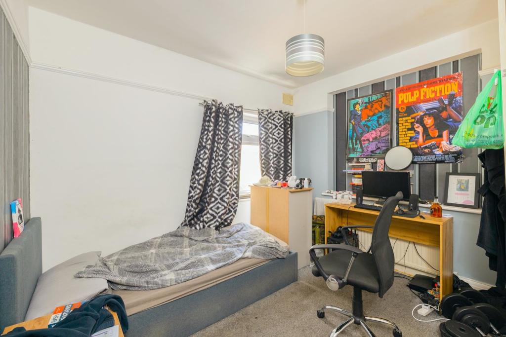
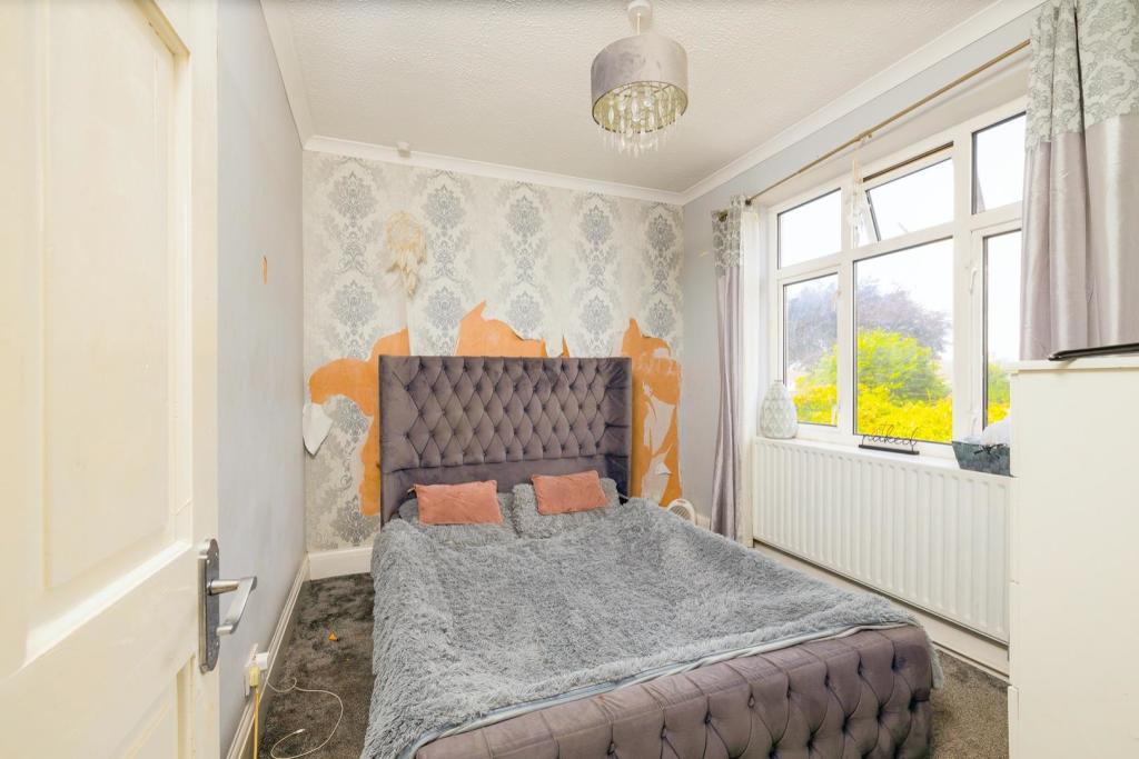
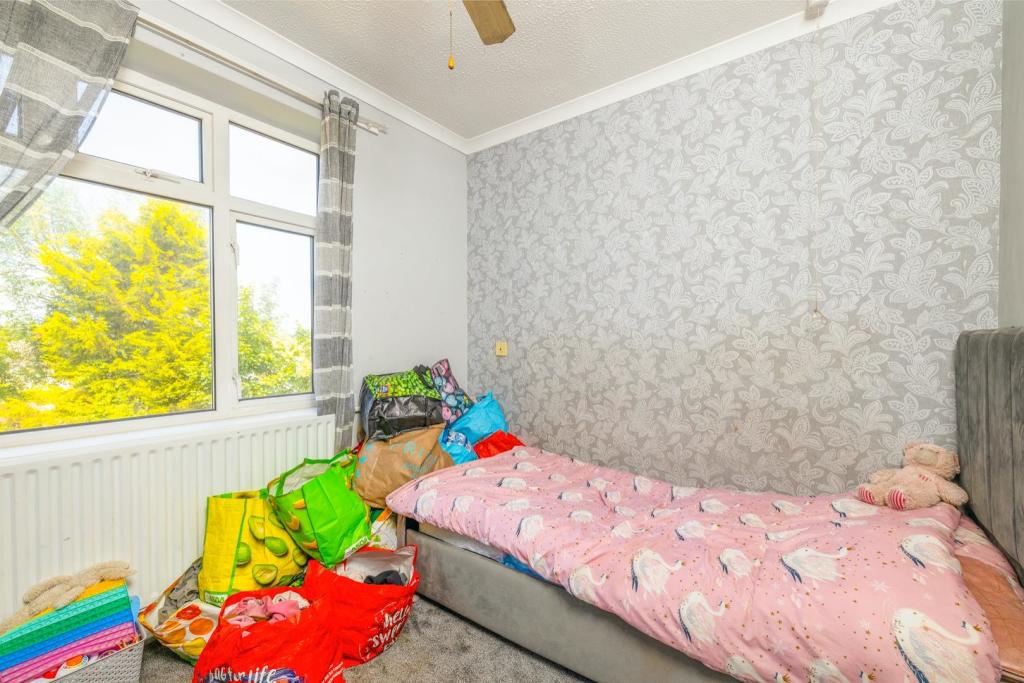
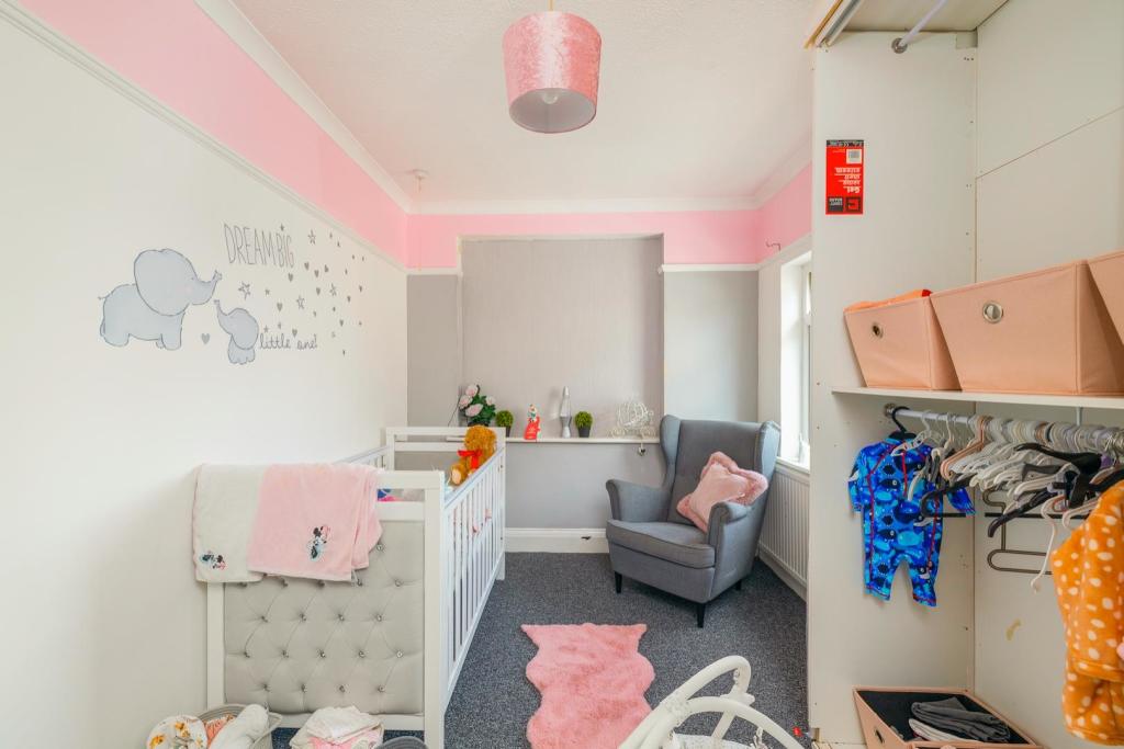
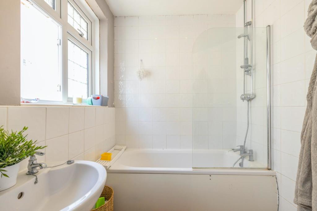
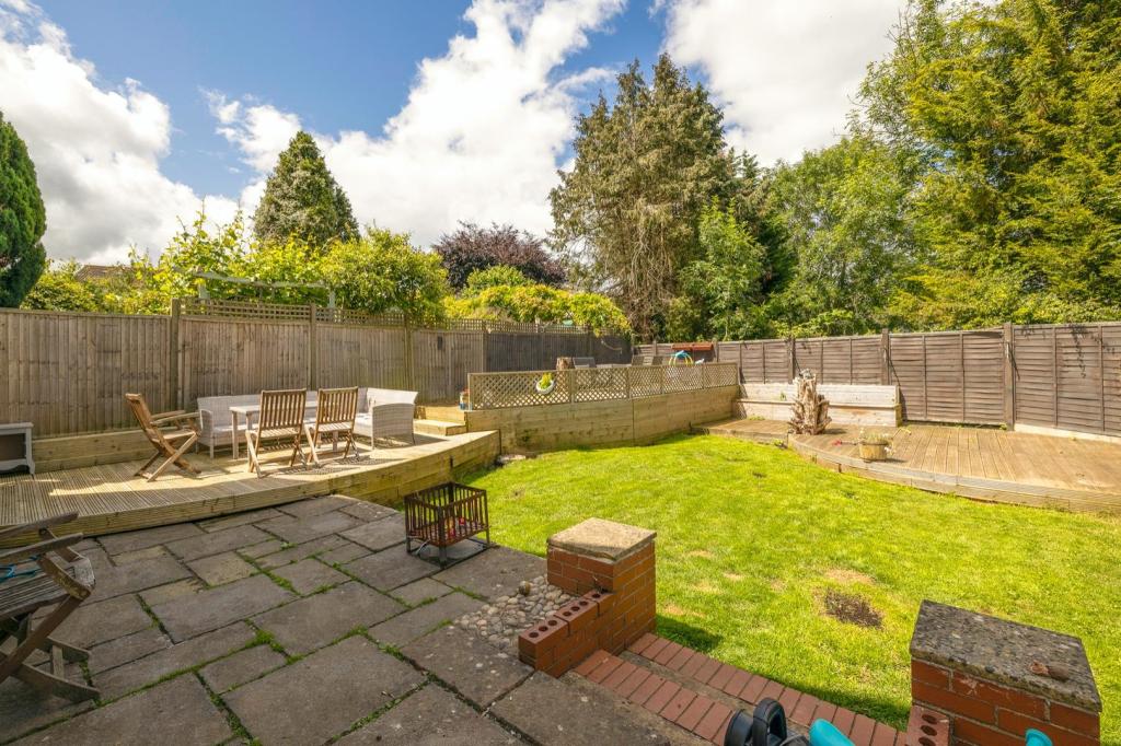
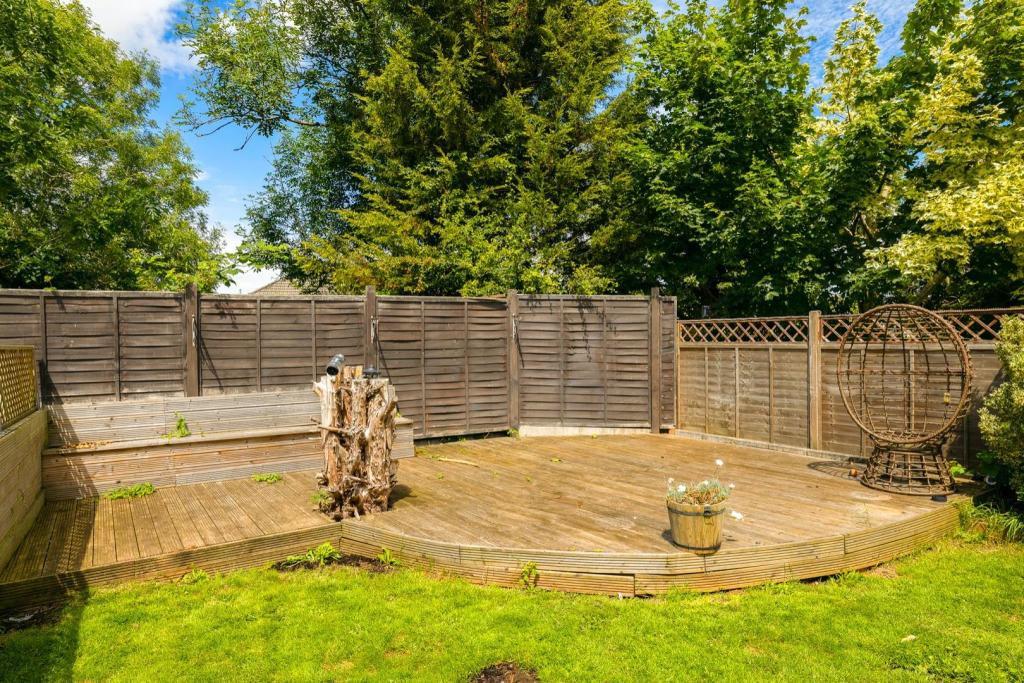
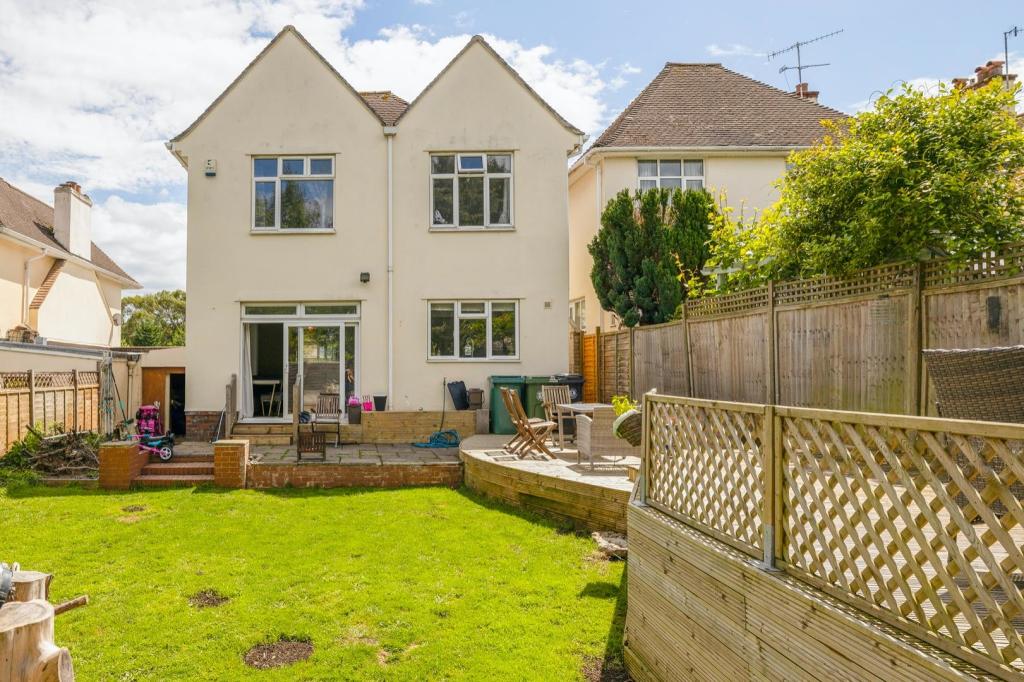
Placed on Brentry Lane amongst the substantial detached homes is this five bedroom family home. Upon entry, you are met by a large entrance hall that leads through to the living room with beautiful wooden flooring, a log burner, and is flooded with natural light. The kitchen has work surfaces that wrap around the entire room, couple with a plentiful supply of cupboard space. There is also a dining room, which has been opened up with the lounge that offers a fantastic space for social occasions. Sliding doors lead out onto a generous west facing garden with decking that wraps around, a lawn in the centre, with lines of trees that surround the plot. The first floor comprises five well-proportioned bedrooms, as well as a family bathroom.
Council tax band E.
Listed by
Bristol
The Letting Game
Reference: 124881248
EPC Rating & Upgrade Cost
Fetching EPC data… Refresh this page in a moment.
Flood risk
Zone: 1
Risk: Low
Job (default Low)
Floorplans
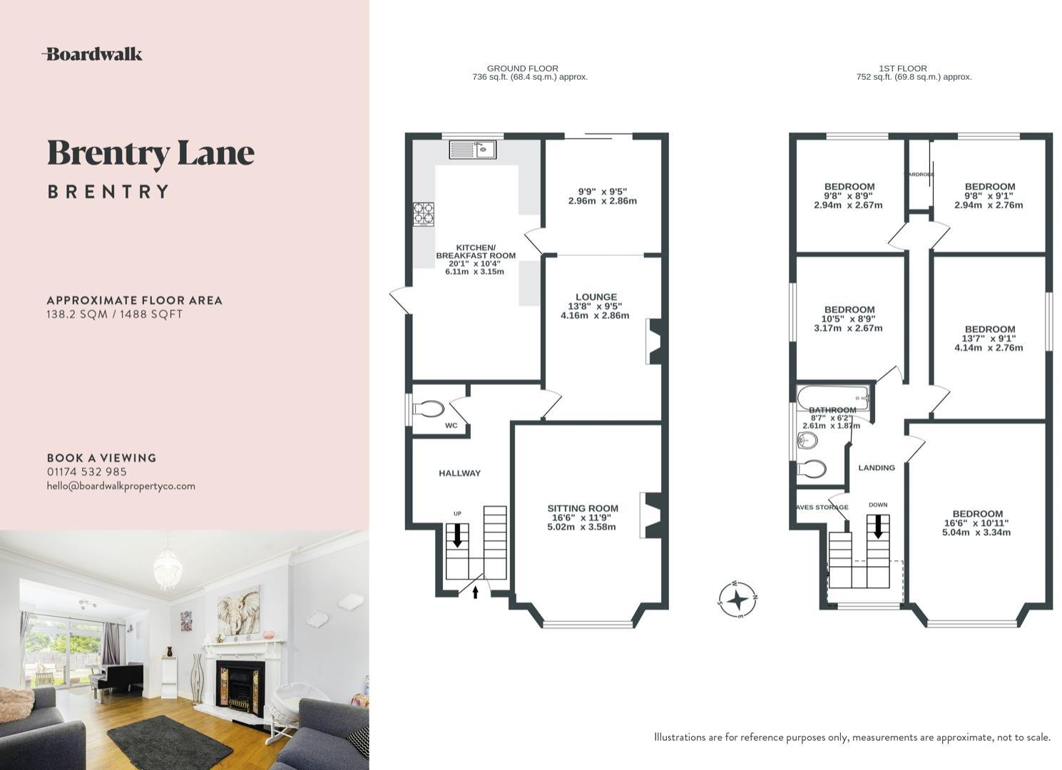
93 Brentry Lane.jpg
EPC Graphs
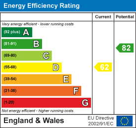
EE Rating
FENSA Certificates
This property has 1 FENSA certificate(s) on record, indicating window/door installations by FENSA-approved installers.
FENSA Certificate #8403513
Property Details
Street: 93 Brentry Lane
Town: BRISTOL
Postcode: BS10 6RH
Installation Details
Items: 11 windows and 1 door
Certificate Issued: 03/10/2011
Work Completed: 29/08/2011
This certificate data was retrieved from FENSA's database
What is FENSA? FENSA (Fenestration Self-Assessment Scheme) is a government-authorised scheme that monitors building regulation compliance for replacement windows and doors. Certificates indicate that work was completed by FENSA-approved installers.
Price history
120% since 2011
| Event | Date | Price | % change |
|---|---|---|---|
| Sold | 30/06/2023 (2 years ago) | £550,000 | +14.2% |
| Sold | 30/01/2019 (7 years ago) | £481,500 | +92.6% |
| Sold | 22/07/2011 (14 years ago) | £250,000 | — |
Source: HM Land Registry Price Paid Data. Crown copyright.
Sold Comparables
Same street and nearby sales within 0.25 miles (last 5 years). Data from Land Registry Price Paid.
| Address | Price | Date | Type |
|---|---|---|---|
| Same street 71A BRENTRY LANE, BRISTOL, CITY OF BRISTOL, BS10 6RH | £310,000 | 27/10/2023 | Semi-detached |
| 98 BRENTRY LANE, BRISTOL, CITY OF BRISTOL, BS10 6RG | £485,000 | 26/05/2023 | Detached |
| 9 TRANMERE GROVE, BRISTOL, CITY OF BRISTOL, BS10 7JW | £340,000 | 23/05/2023 | Detached |
| 34 APPLEGATE, BRISTOL, CITY OF BRISTOL, BS10 6QJ | £525,000 | 30/03/2023 | Detached |
| 36 APPLEGATE, BRISTOL, CITY OF BRISTOL, BS10 6QJ | £552,500 | 02/12/2022 | Detached |
| 35 CHARLTON LANE, BRISTOL, CITY OF BRISTOL, BS10 6SL | £550,000 | 09/05/2022 | Detached |
| 3 CHARLTON LANE, BRISTOL, CITY OF BRISTOL, BS10 6SG | £410,000 | 08/04/2022 | Detached |
| 90 BRENTRY LANE, BRISTOL, CITY OF BRISTOL, BS10 6RQ | £475,000 | 15/03/2022 | Detached |
| 35C CHARLTON LANE, BRISTOL, CITY OF BRISTOL, BS10 6SL | £330,000 | 14/12/2021 | Detached |
| 2 LYPPINCOURT ROAD, BRISTOL, CITY OF BRISTOL, BS10 7JF | £345,000 | 27/08/2021 | Detached |
| Same street 75 BRENTRY LANE, BRISTOL, CITY OF BRISTOL, BS10 6RH | £287,500 | 09/07/2021 | Semi-detached |
Street average: £298,750 (2 sales)
Area average: £445,833 (9 sales)
Capital growth trend
Land Registry outcode average: last 12 months vs 5y and 10y ago (from sold prices).
House Price Index (HM Land Registry — official index, not sold-price averages): City of Bristol. Series: Detached. As of March 2026.
Rental Range
Estimated market rent for Bristol, City of. Low = conservative, Realistic = average, Optimistic = best case.
Based on Local Authority from postcode lookup → Bristol, City of.
LHA (30th percentile) floor for Bristol: £1,845/mo (Apr 2025 – Mar 2026)
Location
Nearby
Nearest stations, universities and amenities (distance from property).
| Type | Name | Distance |
|---|---|---|
| Bus stop | Marlwood Drive | 0.1 miles |
| Shop | Mercedes Servicing | 0.8 miles |
| Shop | Mercedes Benz Dealership and Servicing | 0.8 miles |
| Train station | Filton Abbey Wood | 2.2 miles |
| Train station | Patchway | 2.4 miles |
| Hospital | Spire Bristol | 2.7 miles |
| University | School of Architecture and Environment | 2.9 miles |
| Hospital | South West Regional Laboratories | 3.6 miles |
| University | 5 Priory Road, Life Sciences | 3.6 miles |
Street-level crime
| Category | Count |
|---|---|
| Violence and sexual offences | 101 |
| Anti-social behaviour | 34 |
| Shoplifting | 33 |
| Criminal damage and arson | 27 |
| Public order | 20 |
| Other theft | 14 |
| Vehicle crime | 13 |
| Burglary | 10 |
| Drugs | 9 |
| Other crime | 6 |
| Robbery | 2 |
| Possession of weapons | 1 |
| Total incidents | 270 |
Within 1 mile during Apr 2026. Source: data.police.uk (England & Wales).
Schools nearby
Nearest open schools with Ofsted ratings (England). Closed schools are not shown. Data from Get Information about Schools and Ofsted.
| Name | Type | Distance | Ofsted |
|---|---|---|---|
| Brentry Primary School | Primary | 0.2 miles | Good — 14 Nov 2021 |
| Blaise Primary and Nursery School | Primary | 0.6 miles | Outstanding — 5 Dec 2013 |
| Little Mead Primary Academy | Primary | 0.6 miles | Requires improvement — 18 Jul 2023 |
| Henbury Court Primary Academy | Primary | 0.7 miles | — (Inspected (no overall grade)) |
| Bristol Free School | Secondary | 0.7 miles | Good — 5 May 2022 |
Rental Comparables
Rental listings exist nearby, but none matched the 5-bedroom count for this property.
Rent-driven metrics
Based on Area rent estimate.
- Rent ratio — Monthly rent ÷ purchase price (1% rule). 1%+ = strong, 0.8–1% = okay, <0.8% = weak for cashflow.
- Max investor price — Rent ÷ 0.8%; the price at which rent would be 0.8% of price (Stoke-style target).
- Target investor price — Rent ÷ 1%; the price at which rent would be 1% of price (strong cashflow band).
- Gross yield — Annual rent as % of purchase price (no costs).