12 SALTWOOD AVENUE
WORCESTER, BERKELEY ALFORD, WORCESTERSHIRE WR4 0JP
£925 pcm


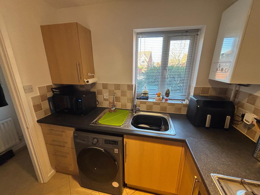


Photo 1 Photo 2 Photo 3 Photo 4 Photo 5 Photo 6 Photo 7 Photo 8 Photo 9 Photo 10 Photo 11 Photo 12 Photo 13
/ 13
Property details
Floor area
50 m²
Council tax band
B
Deprivation
Decile 9 (27,676 of 33,755)
Street crime
154 incidents within 1 mile (Apr 2026)
Key features
- 1 bedroom terraced house
- Located in Warndon Villages
- Available furnished
- Kitchen with appliances
- Living room
- Double bedroom with en-suite shower
- Rear garden
- Allocated off road parking
- Double glazing
- Shower
Additional details
- Heating
- Electric, Double glazing, Central
- Parking
- Off street, Private
- Garden
- Private garden
Description
The property further benefits from gas central heating, double glazing and allocated off road parking.
This is a non-smoking property.
Council Tax band: B
Holding Deposit required - £213.00 EPC rating: C.
Listed by
Worcester
The Property Franchise Group
Reference: 173543858
EPC Rating & Upgrade Cost
Fetching EPC data… Refresh this page in a moment.
Flood risk
Zone: 1
Risk: Low
Job (default Low)
EPC Graphs

EPC Certificate
Rental Range
Estimated market rent for Worcester. Low = conservative, Realistic = average, Optimistic = best case.
Based on Local Authority from postcode lookup → Worcester.
LHA (30th percentile) floor for Worcester South: £567/mo (Apr 2025 – Mar 2026)
Location
Nearby
Nearest stations, universities and amenities (distance from property).
| Type | Name | Distance |
|---|---|---|
| Bus stop | Saltwood Avenue | 0.1 miles |
| Bus stop | Tamworth Avenue | 0.1 miles |
| Shop | Avant Garde | 0.4 miles |
| Shop | Drinks | 0.4 miles |
| Hospital | Worcestershire Royal Hospital | 1.1 miles |
| Train station | Worcester Shrub Hill | 1.7 miles |
| Train station | Worcester Foregate Street | 2.1 miles |
| Hospital | Spire Southbank Hospital | 2.5 miles |
| University | University of Worcester Lakeside Campus | 4.6 miles |
Street-level crime
| Category | Count |
|---|---|
| Violence and sexual offences | 63 |
| Criminal damage and arson | 24 |
| Shoplifting | 20 |
| Public order | 12 |
| Other theft | 10 |
| Burglary | 7 |
| Other crime | 4 |
| Bicycle theft | 3 |
| Drugs | 3 |
| Robbery | 3 |
| Possession of weapons | 2 |
| Vehicle crime | 2 |
| Theft from the person | 1 |
| Total incidents | 154 |
Within 1 mile during Apr 2026. Source: data.police.uk (England & Wales).
Schools nearby
Nearest open schools with Ofsted ratings (England). Closed schools are not shown. Data from Get Information about Schools and Ofsted.
| Name | Type | Distance | Ofsted |
|---|---|---|---|
| St Joseph's Catholic Primary School | Primary | 0.4 miles | Good — 6 Feb 2013 |
| Oasis Academy Warndon | Primary | 0.5 miles | Outstanding — 23 Jan 2023 |
| The Lyppard Grange Primary School | Primary | 0.5 miles | Good — 30 Apr 2014 |
| The Aspire Academy | Other | 0.7 miles | Good — 6 Jun 2017 |
| Carnforth School | Primary | 0.7 miles | Good — 10 Feb 2022 |
Rental Comparables
Residential lets from OpenRent and Rightmove for the area (same bedroom count). Use to validate rent estimates. Student lets are excluded.
| Title | Rent | Beds | Distance | As seen on |
|---|---|---|---|---|
| 1 Bed Flat, Beeston Gardens, WR4 | £815/mo | 1 | 0.02 miles | OpenRent |
| 1 Bed Terraced House, Lydford Terrace, WR4 | £850/mo | 1 | 0.06 miles | OpenRent |
| 1 Bed Flat, Warndon Villages, WR4 | £850/mo | 1 | 0.07 miles | OpenRent |
| 1 Bed Flat, Berkeley Court, WR4 | £725/mo | 1 | 0.41 miles | OpenRent |
| 1 Bed Maisonette, Northleach Close, WR4 | £810/mo | 1 | 0.96 miles | OpenRent |
| 1 Bed Flat, Bridgewater House, WR4 | £800/mo | 1 | 1.07 miles | OpenRent |
| 1 Bed Flat, Avon Rd, WR4 | £650/mo | 1 | 1.07 miles | OpenRent |
Average rent: £786/mo (7 listings)