FLAT 3
HALLAM HOUSE, 11, ELTON ROAD, CLEVEDON, NORTH SOMERSET BS21 7RF
£326,000
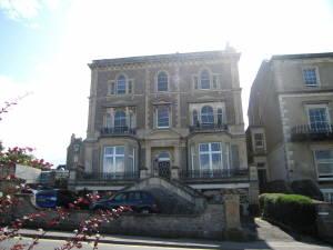

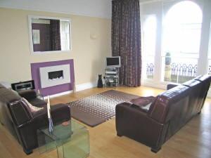
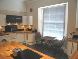
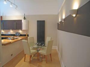
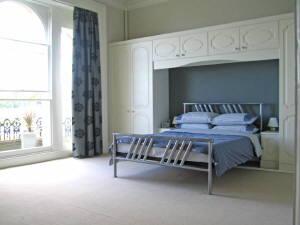
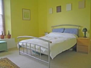
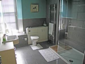

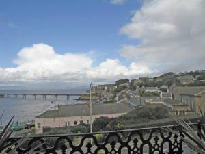
Photo 1 Photo 2 Photo 3 Photo 4 Photo 5 Photo 6 Photo 7 Photo 8 Photo 9 Photo 10
/ 10
Property details
Floor area
153 m²
EPC rating
C
Year built
England and Wales: before 1900
Last sold
£325,000 Nov 2009
Price per m²
£6,520/m²
Local average
£234,579 (+39%)
Deprivation
Decile 9 (27,836 of 33,755)
Key features
- Fantastic Channel Views
- Second Floor Apartment
- Three Bedrooms
- Re - Fitted Kitchen
- Re - Fitted Shower Room
- Period Features
- Two Balconies
- Garage & Parking
Additional details
- Parking
- Yes
Description
Listed by
Clevedon
Heritage Estate Agents
Reference: 13408392
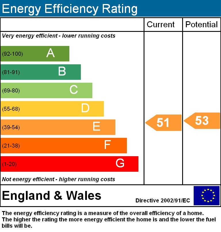
EPC Rating & Upgrade Cost
Current rating: C
Potential rating: C
Inspection date: 12/10/2023
Expiry date: 11/10/2033
Flood risk
Zone: 1
Risk: Low
Not in Flood Risk Area (no data)
Floorplans
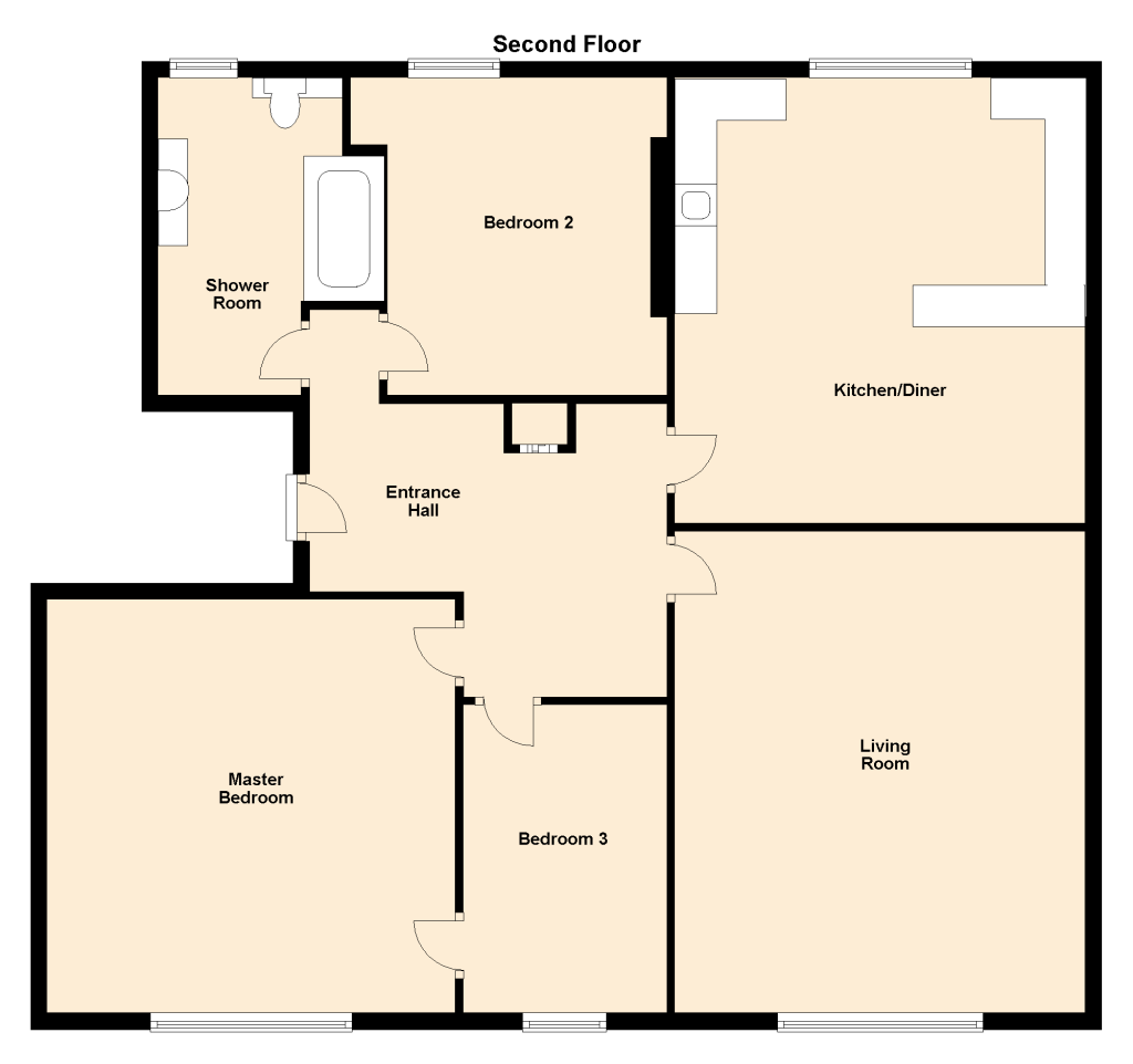
Floorplan 1
EPC Graphs
EPC 1
EPC 2
Price history
| Event | Date | Price | % change |
|---|---|---|---|
| Sold | 19/11/2009 (16 years ago) | £325,000 | — |
Source: HM Land Registry Price Paid Data. Crown copyright.
Sold Comparables
Same street and nearby sales within 0.25 miles (last 5 years). Data from Land Registry Price Paid.
| Address | Price | Date | Type |
|---|---|---|---|
| 7 FLAT 4 ELTON ROAD, CLEVEDON, NORTH SOMERSET, BS21 7RF | £410,000 | 03/07/2024 | Flat |
| 7 FLAT 3 ELTON ROAD, CLEVEDON, NORTH SOMERSET, BS21 7RF | £280,000 | 09/02/2024 | Flat |
| 7 FLAT 5 ELTON ROAD, CLEVEDON, NORTH SOMERSET, BS21 7RF | £465,000 | 13/12/2023 | Flat |
| HALLAM HOUSE, 11 FLAT 2 ELTON ROAD, CLEVEDON, NORTH SOMERSET, BS21 7RF | £535,100 | 30/06/2021 | Flat |
Area average: £422,525 (4 sales)
Capital growth trend
Land Registry outcode average: last 12 months vs 5y and 10y ago (from sold prices).
House Price Index (HM Land Registry — official index, not sold-price averages): North Somerset. Series: Flats and maisonettes. As of March 2026.
Rental Range
Estimated market rent for North Somerset. Low = conservative, Realistic = average, Optimistic = best case.
Based on Local Authority from postcode lookup → North Somerset.
LHA (30th percentile) floor for Bristol: £1,296/mo (Apr 2025 – Mar 2026)
Location
Nearby
Nearest stations, universities and amenities (distance from property).
| Type | Name | Distance |
|---|---|---|
| Shop | Unknown | 0.5 miles |
| Bus stop | Stoneyhead | 0.5 miles |
| Shop | Somerset Motorhome Centre | 0.9 miles |
| Train station | Taunton | 4.7 miles |
| Hospital | Unknown | 5.0 miles |
| Train station | Westonzoyland | 6.8 miles |
Street-level crime
Crime data is not yet available for this property.
Rental Comparables
Residential lets from OpenRent and Rightmove for the area (same bedroom count). Use to validate rent estimates. Student lets are excluded.
| Title | Rent | Beds | As seen on |
|---|---|---|---|
| 3 Bed Terraced House, Strode Road, BS21 | £1,500/mo | 3 | OpenRent |
| 3 Bed Detached House, Hill Road, BS21 | £1,650/mo | 3 | OpenRent |
Average rent: £1,575/mo (2 listings)
Rent-driven metrics
Based on OpenRent comparables.
- Rent ratio — Monthly rent ÷ purchase price (1% rule). 1%+ = strong, 0.8–1% = okay, <0.8% = weak for cashflow.
- Max investor price — Rent ÷ 0.8%; the price at which rent would be 0.8% of price (Stoke-style target).
- Target investor price — Rent ÷ 1%; the price at which rent would be 1% of price (strong cashflow band).
- Gross yield — Annual rent as % of purchase price (no costs).
- Cost-to-rent — Price ÷ annual rent (from OpenRent comparables). Under 14× = strong, 14–16× = acceptable, 17×+ = compressed.
- Cashflow — Rent minus mortgage, 10% maintenance, £25/mo compliance. Assumes 75% LTV, 3.95% APR (5yr fixed), 25yr term.
- ROI — Annual profit ÷ cash in (deposit + 4% purchase costs).