Hollyberries
COKES LANE, CHALFONT ST GILES, BUCKINGHAMSHIRE HP8 4TX
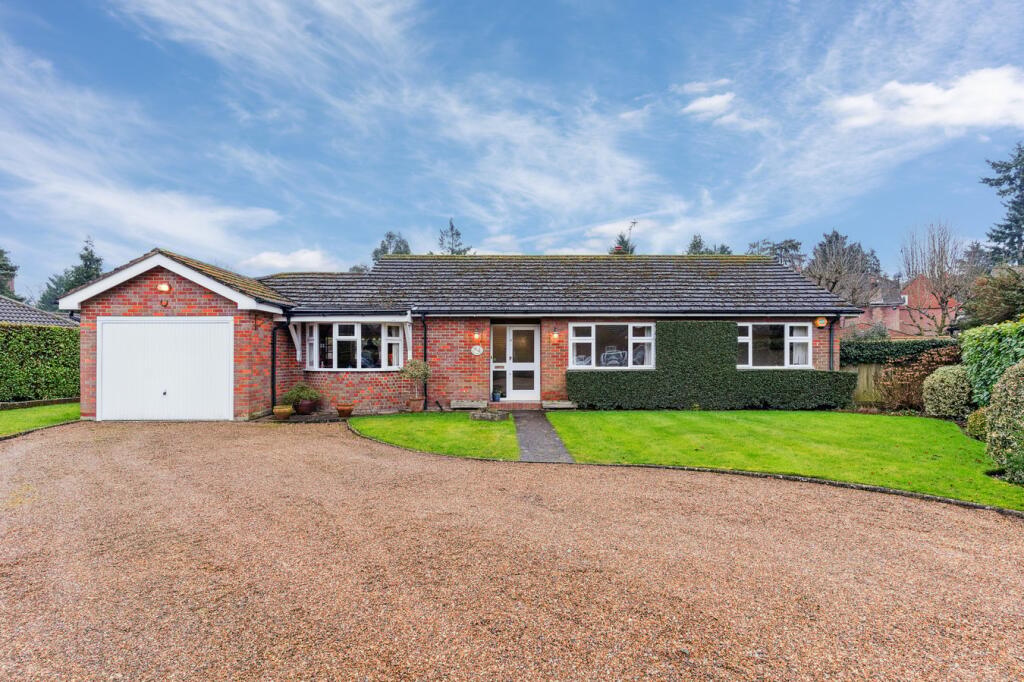
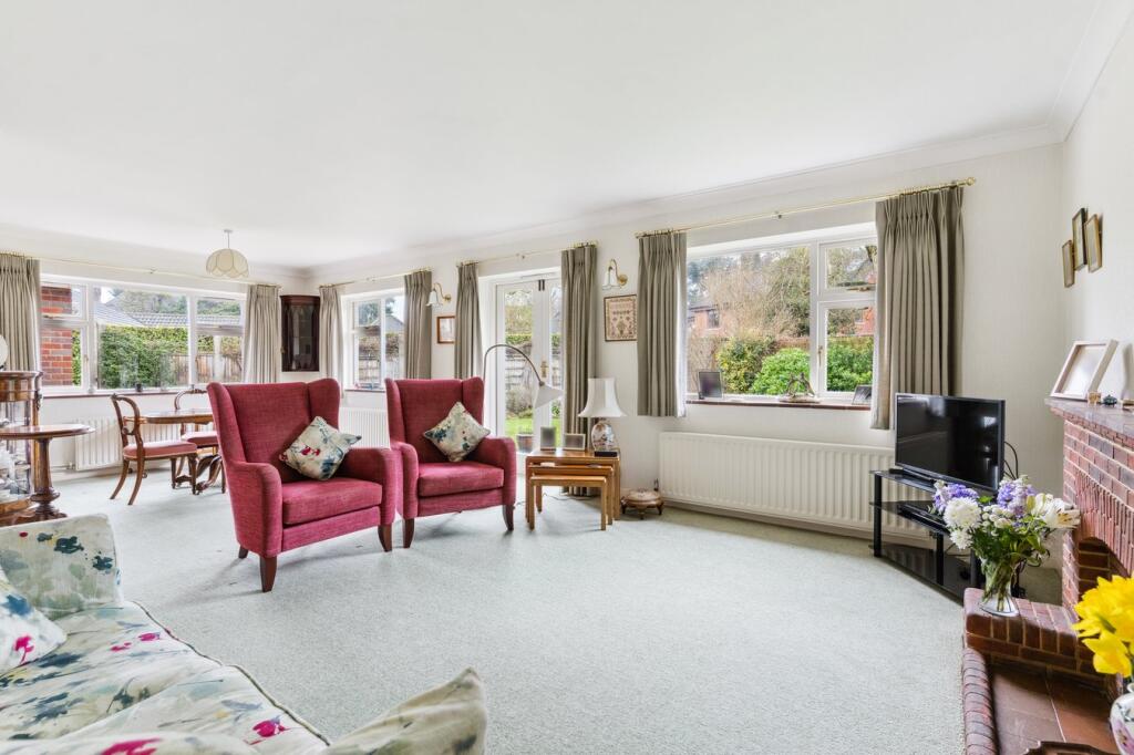
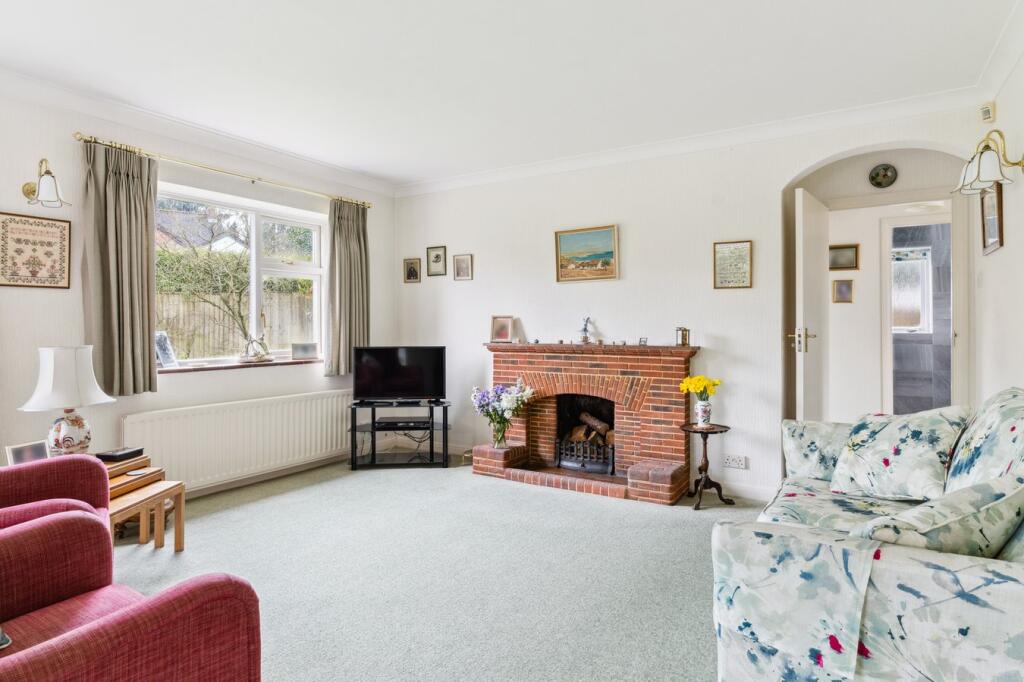
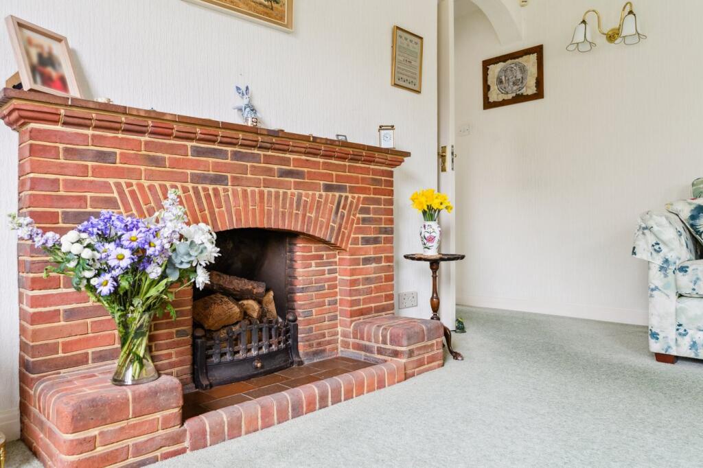
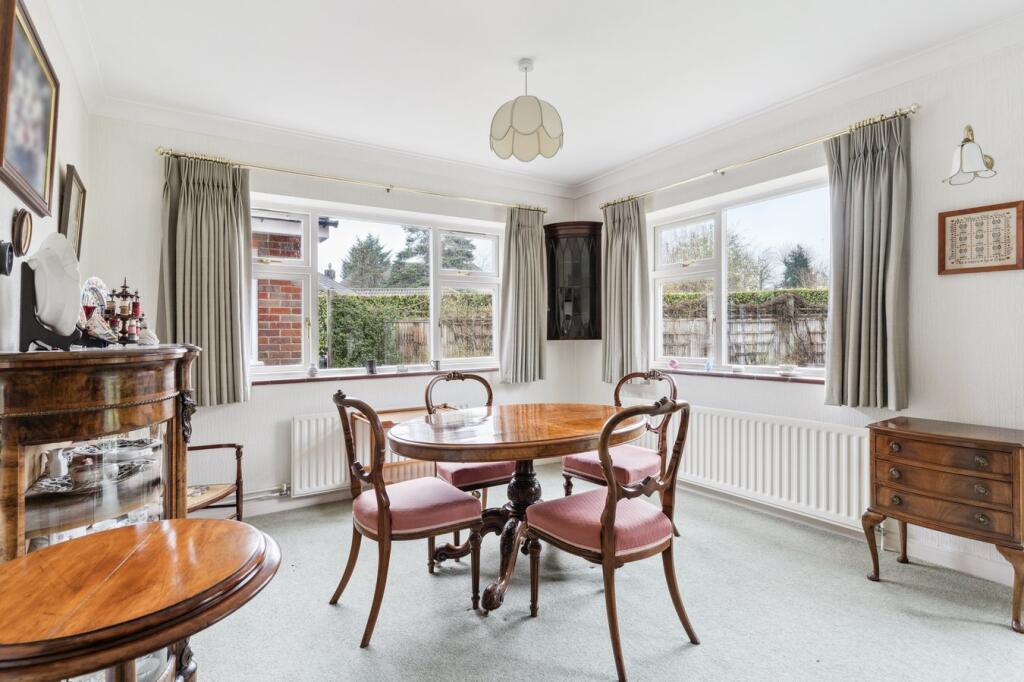
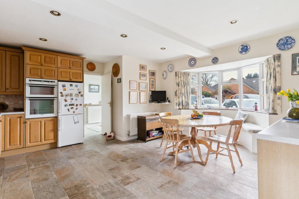
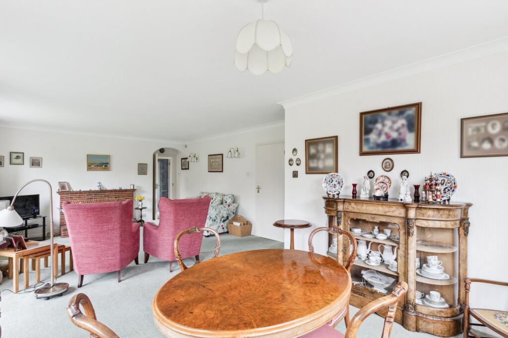
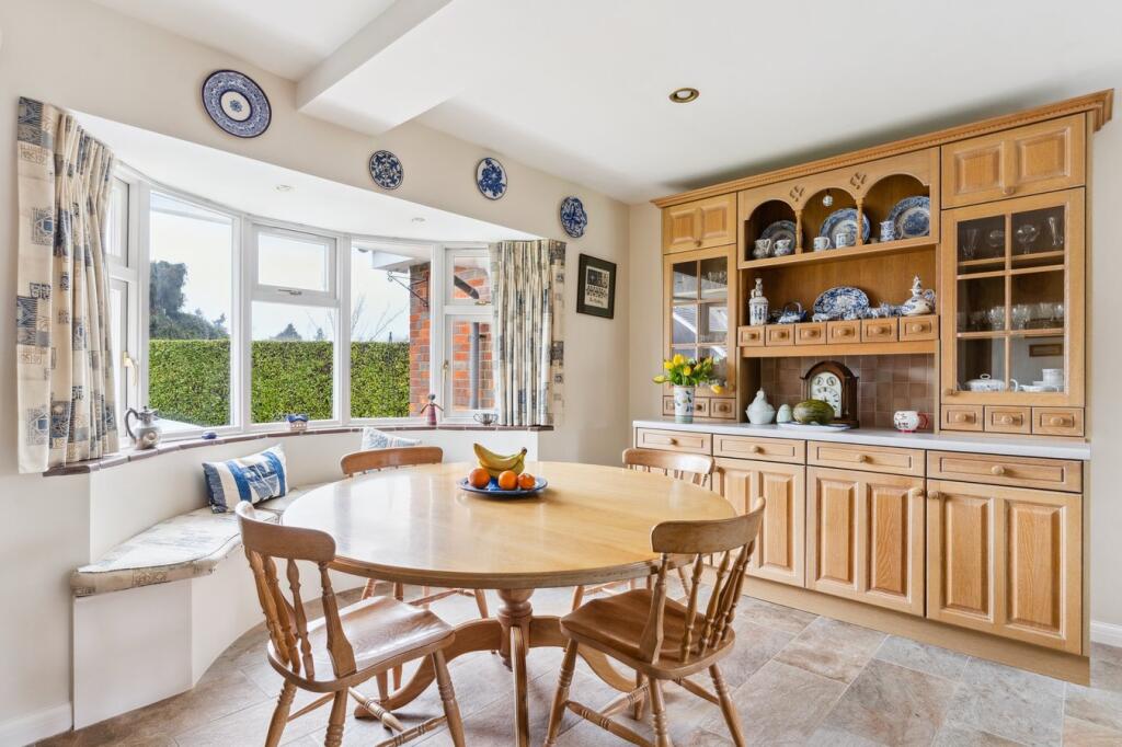
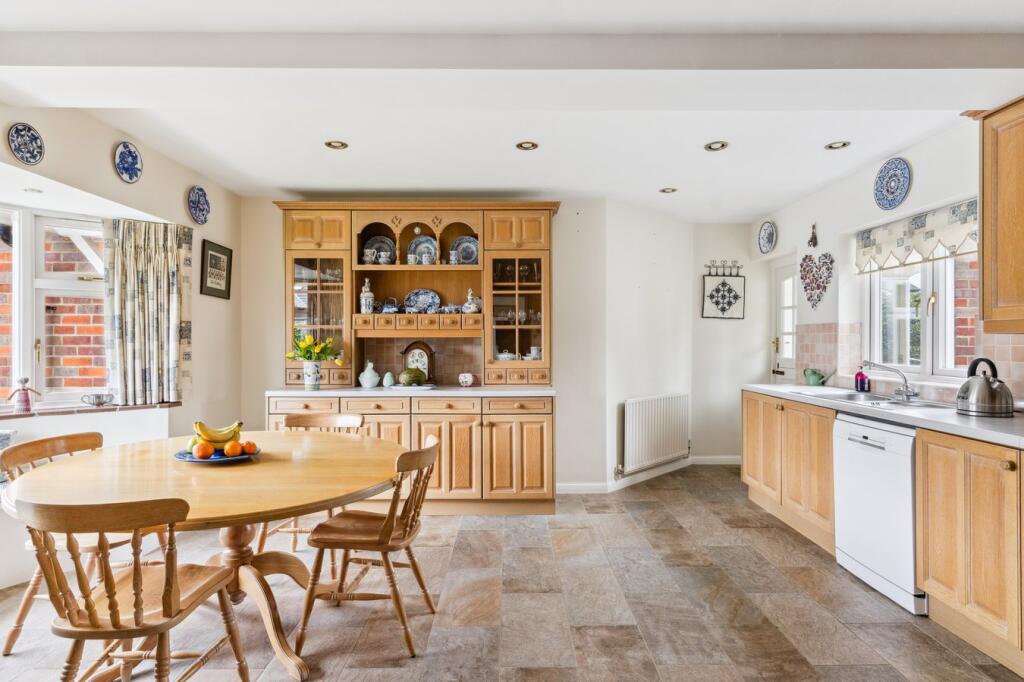
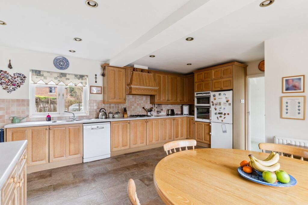
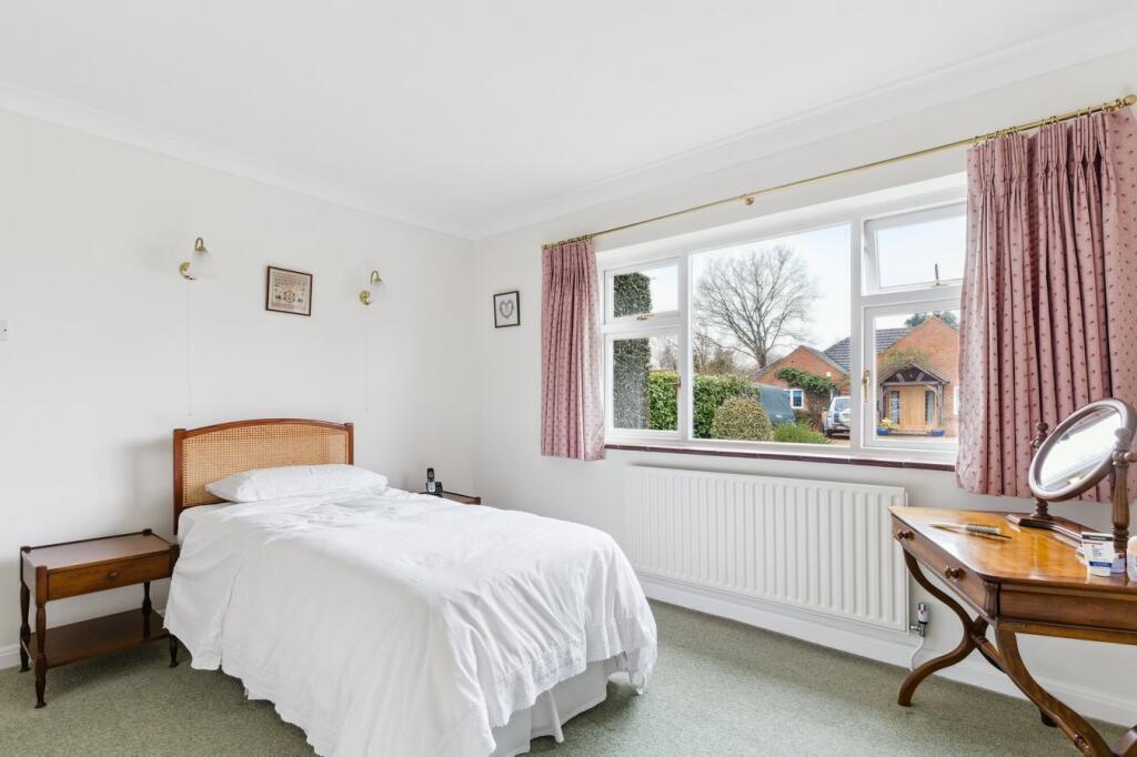
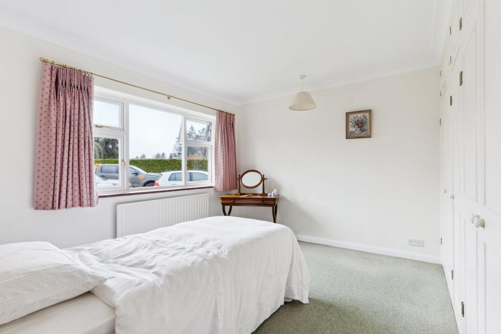
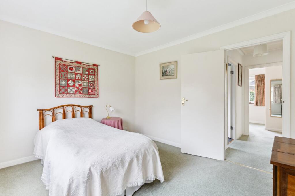
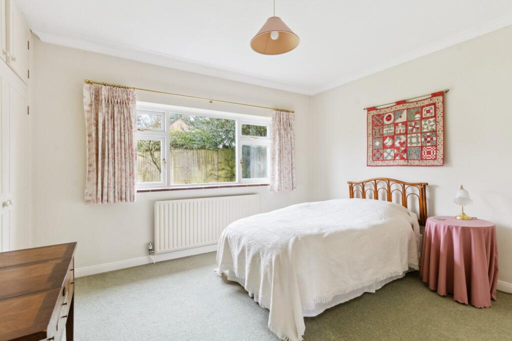
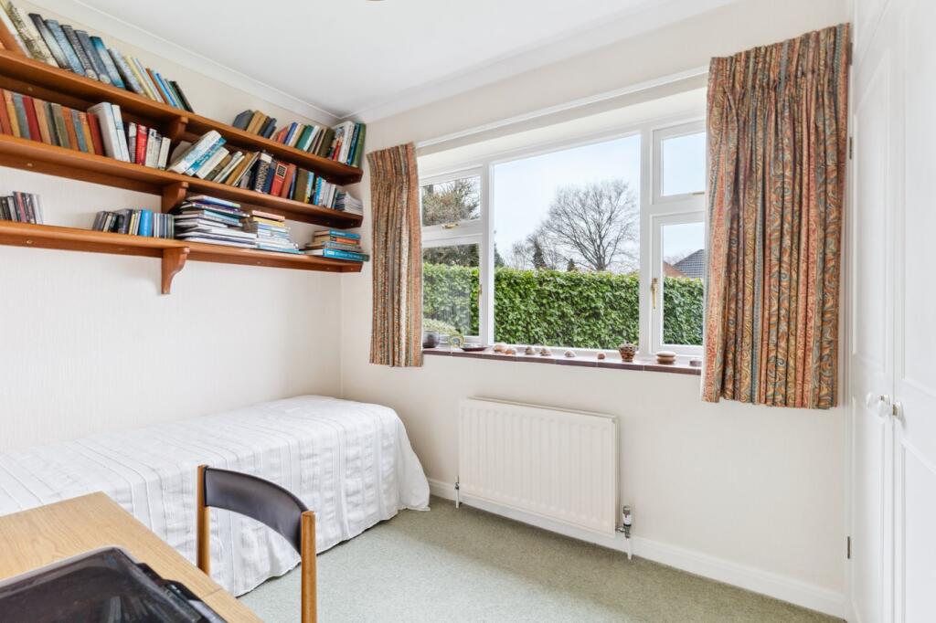
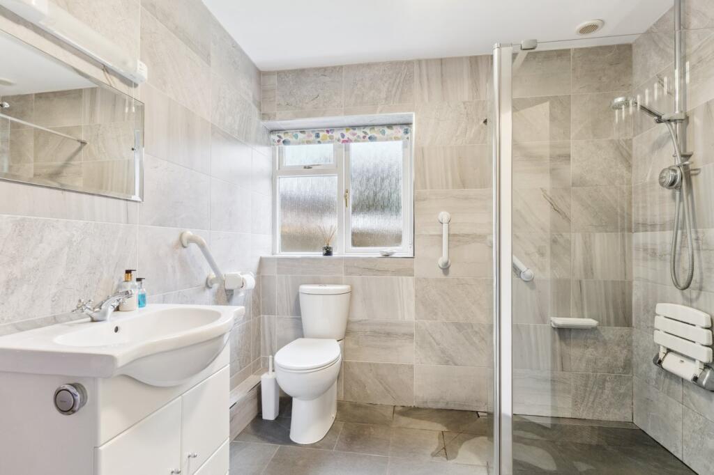
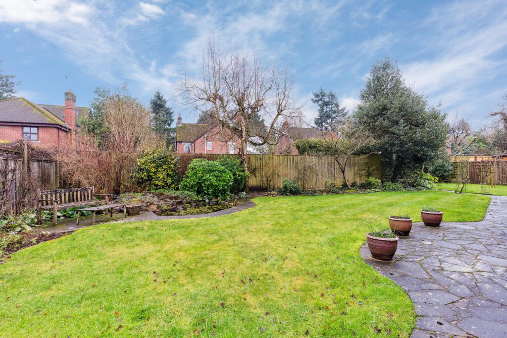
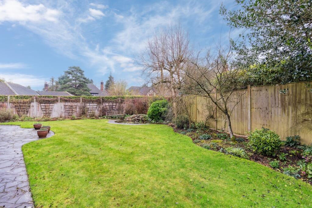
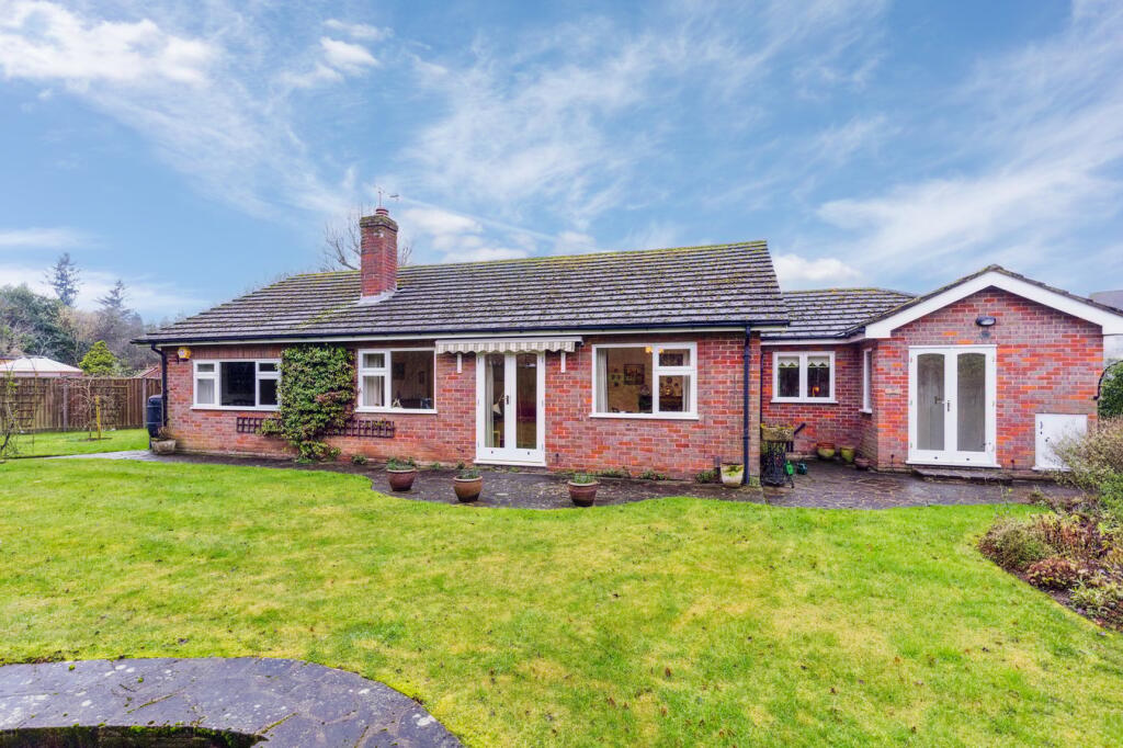

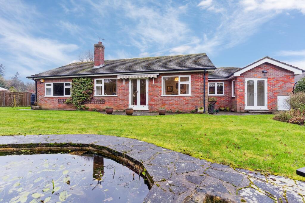
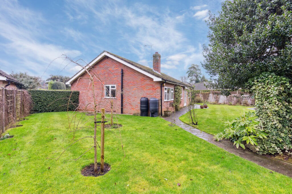
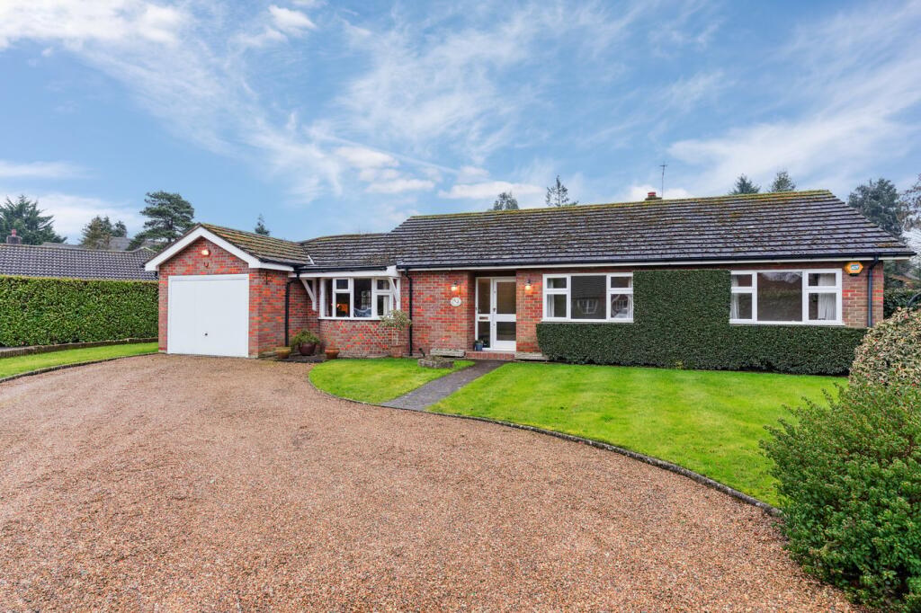
Photo 1 Photo 2 Photo 3 Photo 4 Photo 5 Photo 6 Photo 7 Photo 8 Photo 9 Photo 10 Photo 11 Photo 12 Photo 13 Photo 14 Photo 15 Photo 16 Photo 17 Photo 18 Photo 19 Photo 20 Photo 21 Photo 22 Photo 23
/ 23
Property details
Tenure
FREEHOLD
Floor area
105 m²
Council tax band
G
EPC rating
D
Last sold
£925,000 Oct 2025
Price per m²
£9,000/m²
Local average
£1,019,840 (-7.3%)
Deprivation
Decile 7 (20,702 of 33,755)
Street crime
31 incidents within 1 mile (May 2026)
Key features
- DETACHED BUNGALOW
- THREE BEDROOMS
- LARGE GARAGE
- PICTURESQUE AND ENCLOSED REAR GARDEN
- SHORT LEVEL WALK OF LITTLE CHALFONT TOWN CENTRE AND STATION
- WALKING DISTANCE OF LOCAL SCHOOLS
Additional details
- Parking
- Driveway
- Garden
- Yes
- Listed property
- No
- Restrictions
- No
- Required access
- No
- Rights of way
- No
- Flooded in last 5 years
- No
- Flood defences
- No
Description
Listed by
Amersham
John Nash & Co.
Reference: 160019534
EPC Rating & Upgrade Cost
Current rating: D
Potential rating: B
Inspection date: 11/02/2025
Expiry date: 10/02/2035
Current heating cost: £983/year
Potential heating cost: £853/year
Est. upgrade cost to C: £10,500
Recommendations
- Floor insulation (suspended floor) (£800 - £1,200)
- Solar water heating (£4,000 - £6,000)
- Solar photovoltaic panels, 2.5 kWp (£3,500 - £5,500)
Flood risk
Zone: 1
Risk: Low
Job (default Low)
Floorplans
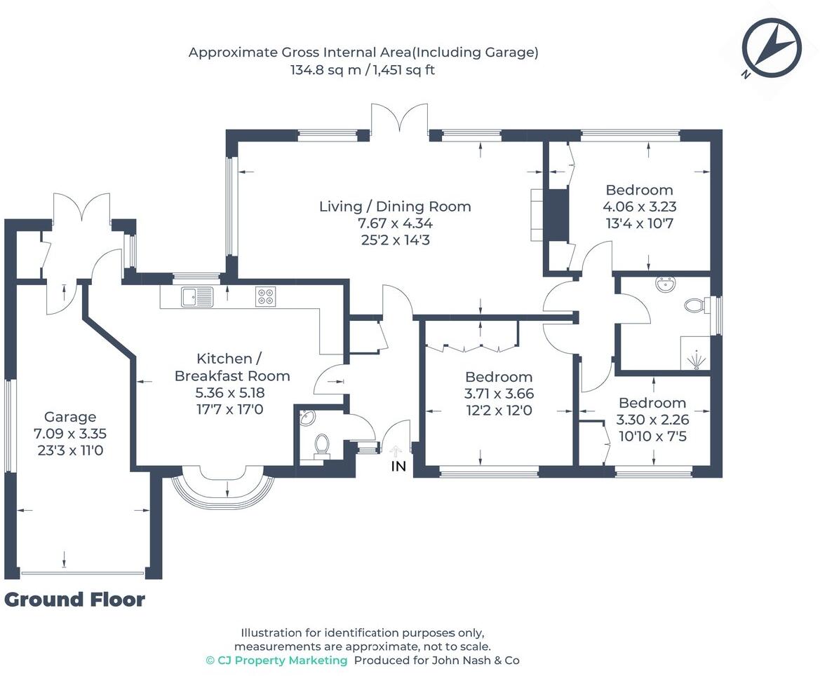
Floorplan 1
EPC Graphs

EPC 1
Price history
| Event | Date | Price | % change |
|---|---|---|---|
| Sold | 16/10/2025 (9 months ago) | £925,000 | — |
Source: HM Land Registry Price Paid Data. Crown copyright.
Sold Comparables
Same street and nearby sales within 0.25 miles (last 5 years). Data from Land Registry Price Paid.
| Address | Price | Date | Type |
|---|---|---|---|
| Same street CHESTER COKES LANE, CHALFONT ST GILES, BUCKINGHAMSHIRE, HP8 4TX | £1,361,000 | 08/06/2023 | Detached |
| Same street ORCHARD CORNER COKES LANE, CHALFONT ST GILES, BUCKINGHAMSHIRE, HP8 4TX | £3,600,000 | 04/04/2023 | Detached |
| THE CROFT DOGGETTS WOOD LANE, CHALFONT ST GILES, BUCKINGHAMSHIRE, HP8 4TH | £1,760,000 | 21/12/2022 | Detached |
| CHESTNUT LODGE HAREWOOD ROAD, CHALFONT ST GILES, BUCKINGHAMSHIRE, HP8 4UA | £2,025,000 | 18/11/2022 | Detached |
| PRIORS DOGGETTS WOOD LANE, CHALFONT ST GILES, BUCKINGHAMSHIRE, HP8 4TH | £2,600,000 | 24/08/2022 | Detached |
| JOMUR HOUSE DOGGETTS WOOD LANE, CHALFONT ST GILES, BUCKINGHAMSHIRE, HP8 4TH | £3,290,000 | 09/08/2022 | Detached |
| WOODSIDE HAREWOOD ROAD, CHALFONT ST GILES, BUCKINGHAMSHIRE, HP8 4UA | £2,150,000 | 29/07/2022 | Detached |
| SILVERDELL DOGGETTS WOOD LANE, CHALFONT ST GILES, BUCKINGHAMSHIRE, HP8 4TH | £2,775,000 | 27/05/2022 | Detached |
| LANNA HAREWOOD ROAD, CHALFONT ST GILES, BUCKINGHAMSHIRE, HP8 4UA | £2,925,000 | 22/03/2022 | Detached |
| CHARNWOOD SNELLS LANE, AMERSHAM, BUCKINGHAMSHIRE, HP7 9QJ | £1,525,000 | 07/03/2022 | Detached |
Street average: £2,480,500 (2 sales)
Area average: £2,381,250 (8 sales)
Capital growth trend
Land Registry outcode average: last 12 months vs 5y and 10y ago (from sold prices).
House Price Index (HM Land Registry — official index, not sold-price averages): Buckinghamshire. Series: Detached. As of April 2026.
Rental Range
Estimated market rent for Buckinghamshire. Low = conservative, Realistic = average, Optimistic = best case.
Based on Local Authority from postcode lookup → Buckinghamshire.
LHA (30th percentile) floor for Chilterns: £1,446/mo (Apr 2025 – Mar 2026)
Location
Address
Coke's Lane
Nearby
Nearest stations, universities and amenities (distance from property).
| Type | Name | Distance |
|---|---|---|
| Shop | Paul and Draga's Hair Studio | 0.4 miles |
| Shop | Echoes | 0.5 miles |
| Bus stop | Unknown | 0.5 miles |
| Train station | Chalfont & Latimer | 0.7 miles |
| Train station | Amersham | 1.8 miles |
| Hospital | Amersham Hospital | 2.2 miles |
| Hospital | Chalfont Centre for Epilepsy | 2.8 miles |
| University | Buckinghamshire New University | 3.5 miles |
| University | National Film and Television School | 4.8 miles |
Street-level crime
| Category | Count |
|---|---|
| Violence and sexual offences | 14 |
| Anti-social behaviour | 6 |
| Other theft | 3 |
| Burglary | 2 |
| Public order | 2 |
| Possession of weapons | 1 |
| Shoplifting | 1 |
| Theft from the person | 1 |
| Vehicle crime | 1 |
| Total incidents | 31 |
Within 1 mile during May 2026. Source: data.police.uk (England & Wales).
Schools nearby
Nearest open schools with Ofsted ratings (England). Closed schools are not shown. Data from Get Information about Schools and Ofsted.
| Name | Type | Distance | Ofsted |
|---|---|---|---|
| Dr Challoner's High School | Secondary | 0.5 miles | Outstanding — 24 Jan 2024 |
| Chalfont Valley E-ACT Primary Academy | Primary | 0.8 miles | Good — 11 Nov 2019 |
| Little Chalfont Primary School | Primary | 0.9 miles | Outstanding — 22 Nov 2011 |
| Stony Dean School | Other | 1.0 miles | Outstanding — 21 Jan 2015 |
| Amersham School | Secondary | 1.1 miles | Good — 21 Apr 2016 |
Rental Comparables
Rental listings exist nearby, but none matched the 3-bedroom count for this property.
Rent-driven metrics
Based on Area rent estimate.
- Rent ratio — Monthly rent ÷ purchase price (1% rule). 1%+ = strong, 0.8–1% = okay, <0.8% = weak for cashflow.
- Max investor price — Rent ÷ 0.8%; the price at which rent would be 0.8% of price (Stoke-style target).
- Target investor price — Rent ÷ 1%; the price at which rent would be 1% of price (strong cashflow band).
- Gross yield — Annual rent as % of purchase price (no costs).
Enter House Number
Enter the house number to help us retrieve more accurate pricing history and property data.
Please log in to submit or correct the house number for this listing.
Log in to continue