66 SOUTHGATE STREET
BURY ST EDMUNDS, SUFFOLK IP33 2BJ
£1,170 pcm
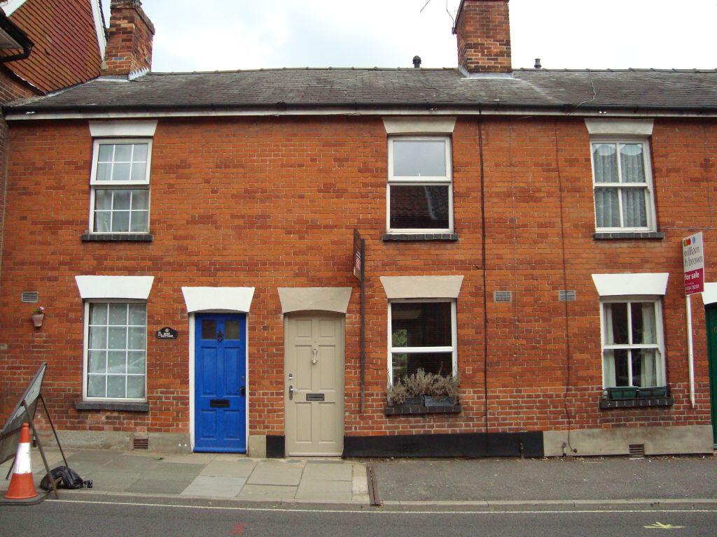
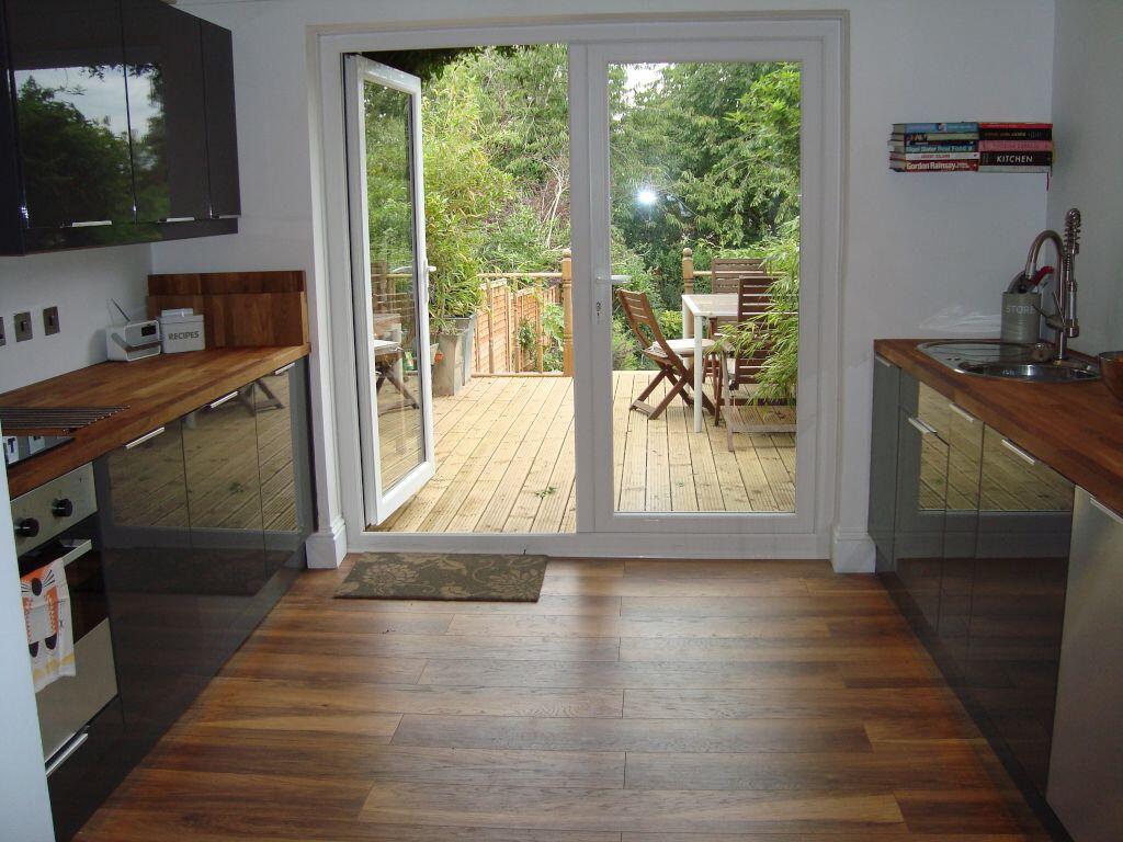
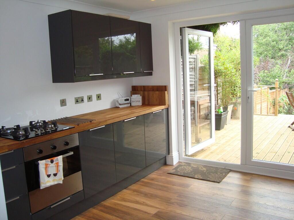
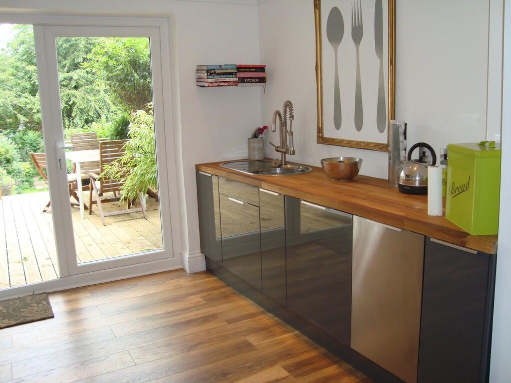
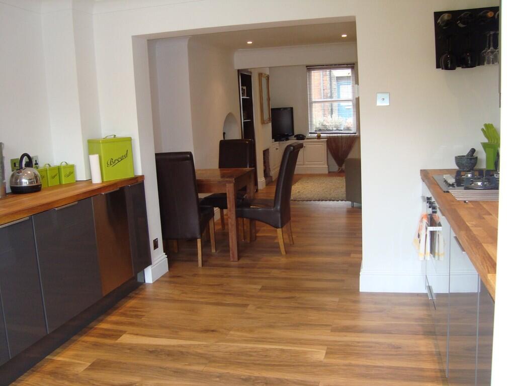
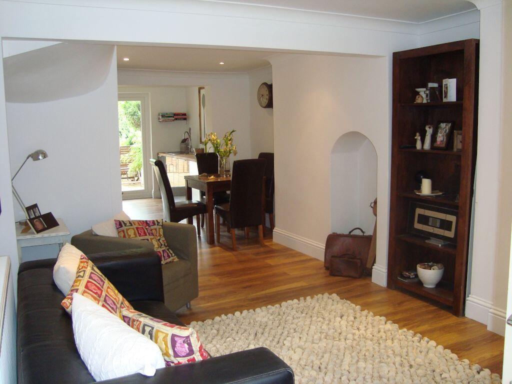
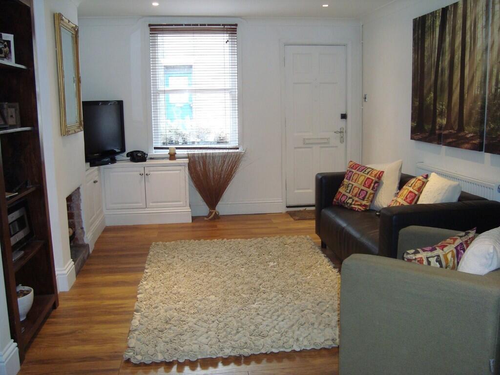
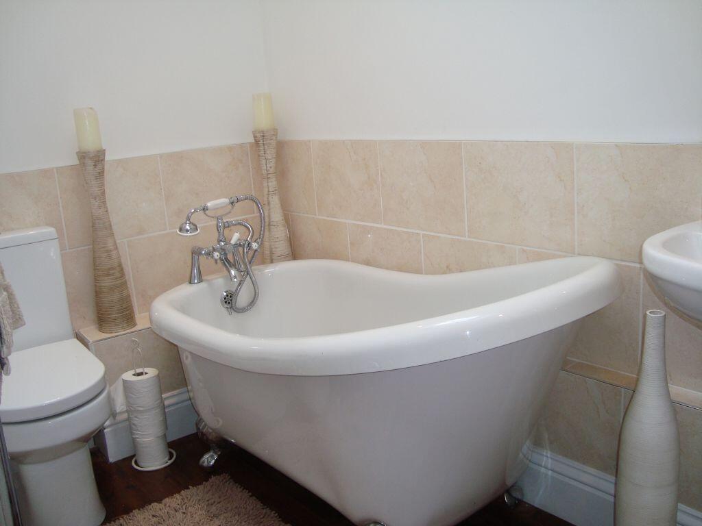
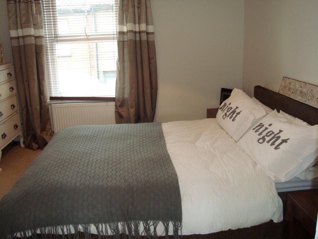
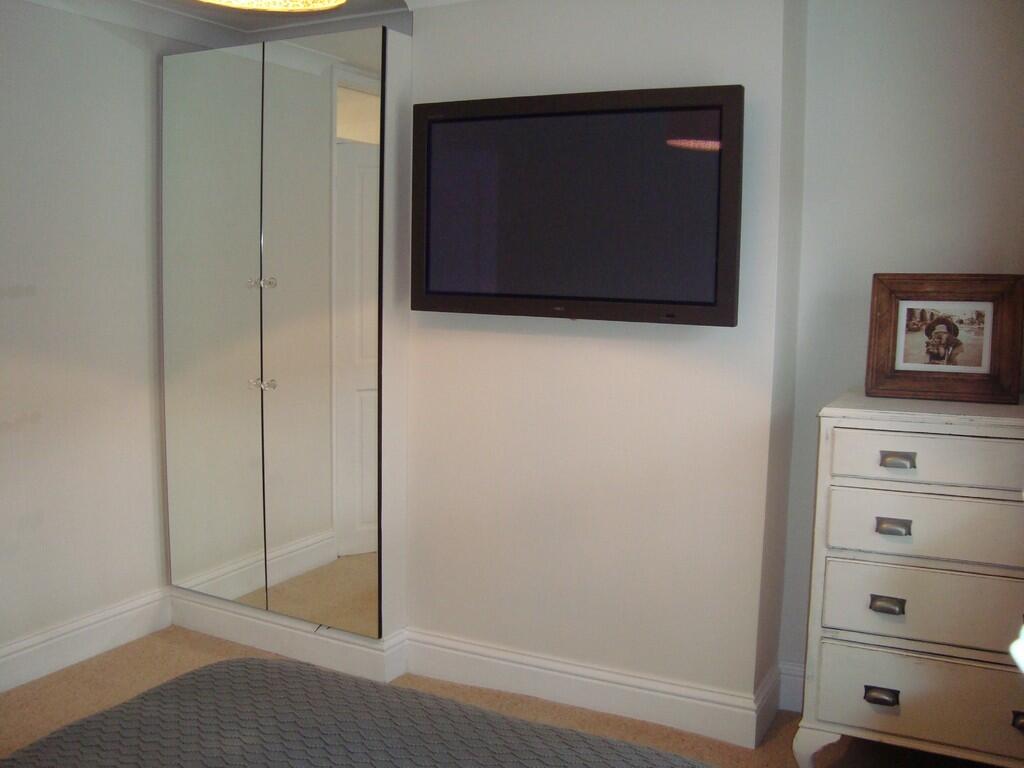
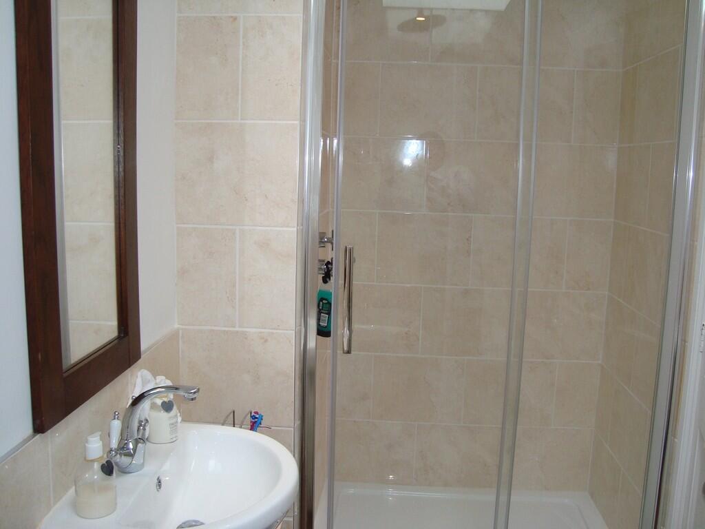
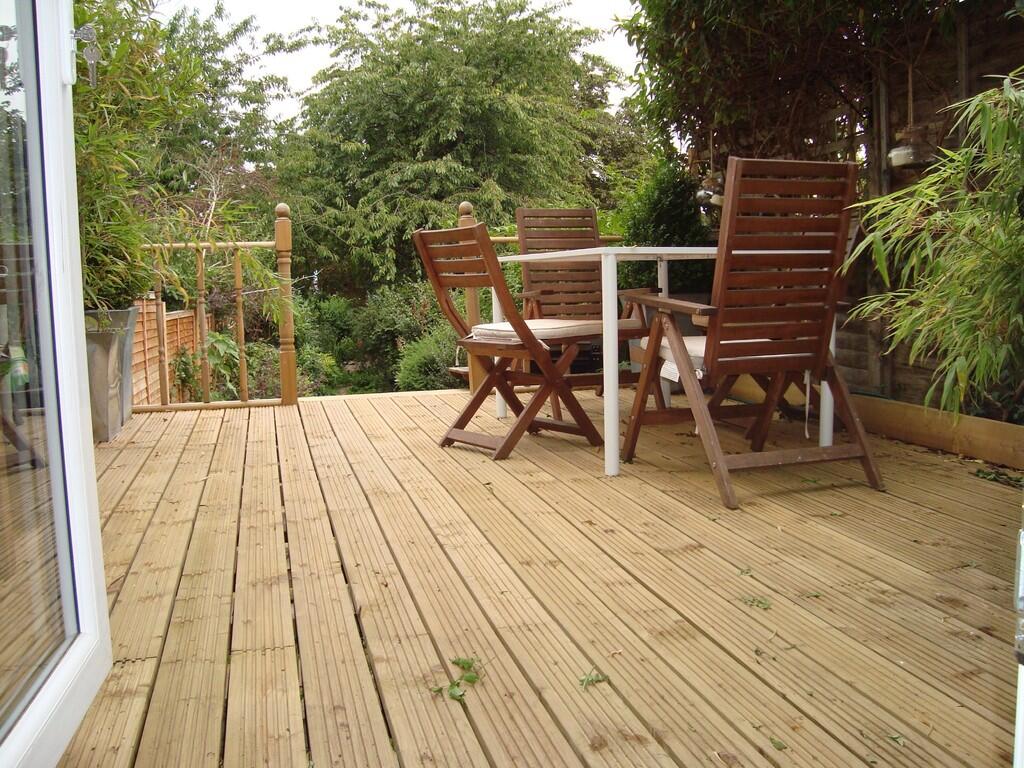
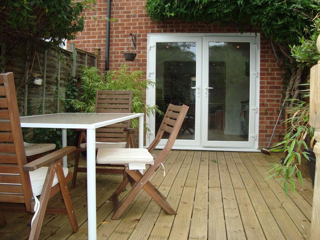
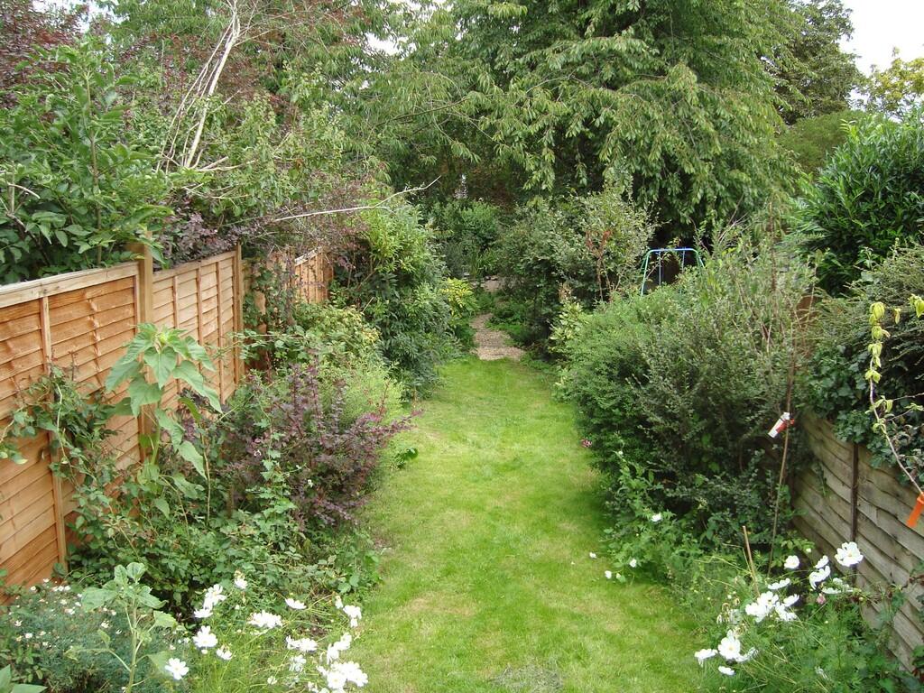
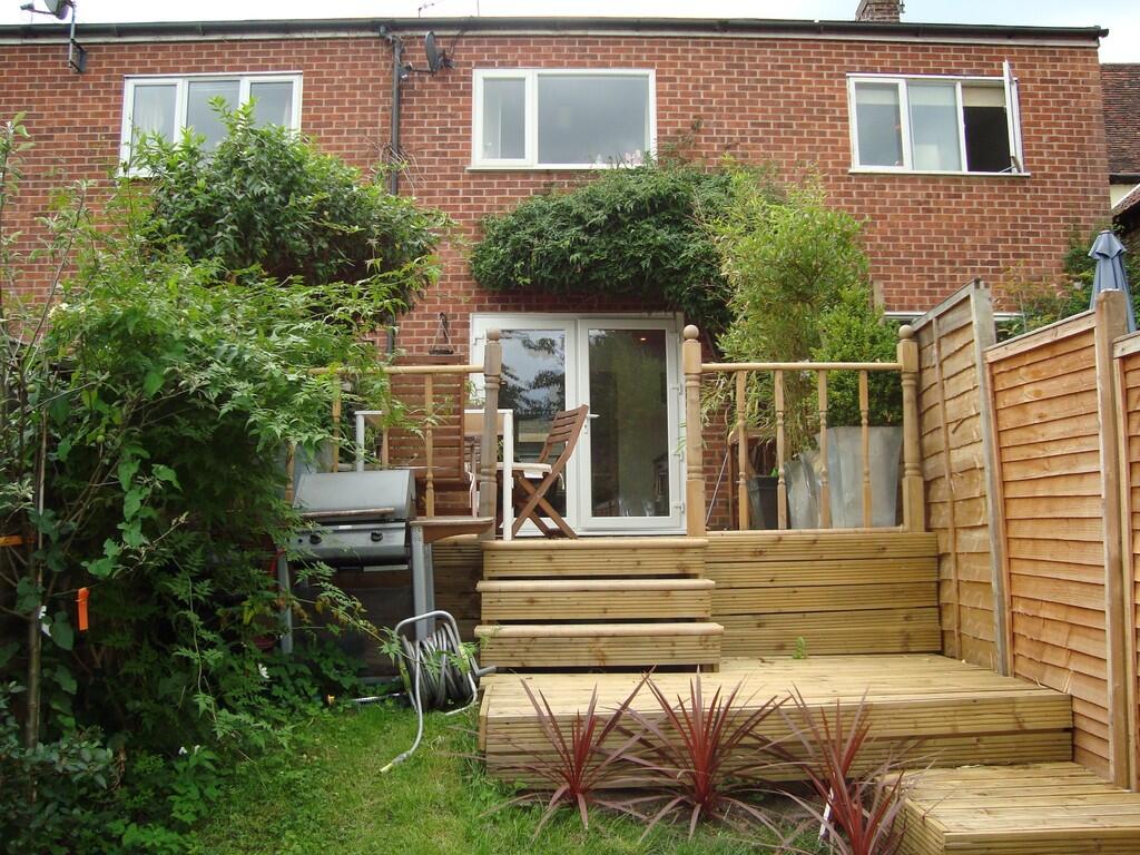
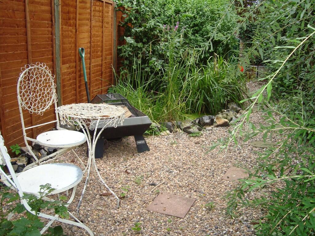
Photo 1 Photo 2 Photo 3 Photo 4 Photo 5 Photo 6 Photo 7 Photo 8 Photo 9 Photo 10 Photo 11 Photo 12 Photo 13 Photo 14 Photo 15 Photo 16 Photo 17
/ 17
Property details
Floor area
63 m²
Council tax band
B
EPC rating
C
Year built
England and Wales: before 1900
Deprivation
Decile 8 (23,923 of 33,755)
Street crime
136 incidents within 1 mile (Apr 2026)
Key features
- 2 BEDROOMS
- RAISED DECKING
- MODERN KITCHEN
- BATHROOM
- LARGE LIVING AREA
Additional details
- Heating
- Gas central
- Parking
- On street, Permit
- Garden
- Yes
Description
EPC Rating: C
Council Tax Band: B
KITCHEN- Modern room with integrated appliances and wood effect laminate flooring. Sink with extendable tap and gas hob. Plenty of cabinet and counter space. Door through to the garden and open to the dining room
DINING ROOM- Nook room off the lounge and kitchen that fits a dining room table. Wood effect laminate flooring.
LOUNGE- Wood effect vinyl flooring, open to dining room, decorative fireplace and corner storage.
BEDROOM 1- Carpeted, window and two mirrored wardrobes.
BEDROOM 2- Carpeted and large window
BATHROOM- Modern bathroom with clawfoot bathtub, sink, w/c, wood effect laminate flooring, and separate shower unit with rainfall shower head
EXTERIOR- ** Enclosed with a raised decking area, hidden firepit area, and large lawn area
Listed by
Bury St. Edmunds
Tennens Properties Ltd
Reference: 166288361
EPC Rating & Upgrade Cost
Current rating: C
Potential rating: B
Inspection date: 18/12/2023
Expiry date: 17/12/2033
Current heating cost: £899/year
Potential heating cost: £741/year
Est. upgrade cost to C: £14,415
Recommendations
- Low energy lighting for all fixed outlets (£15)
- Solar water heating (£4,000 - £6,000)
- Replace single glazed windows with low-E double glazing (£3,300 - £6,500)
- Solar photovoltaic panels, 2.5 kWp (£3,500 - £5,500)
Flood risk
Zone: 1
Risk: Low
Job (default Low)
Floorplans
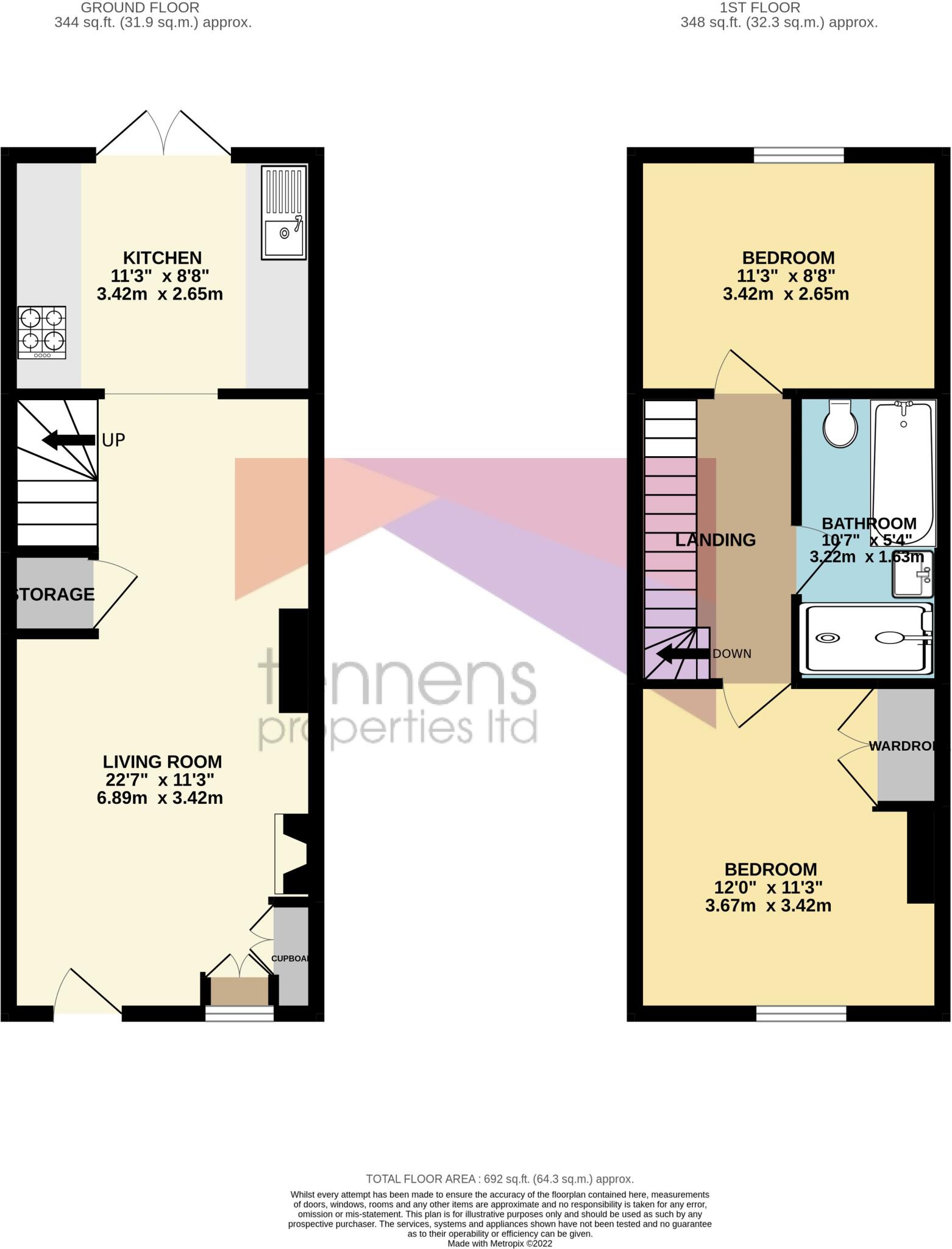
Floor Plan Septem...
EPC Graphs
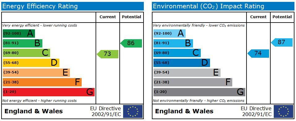
EPC 1
Rental Range
Estimated market rent for West Suffolk. Low = conservative, Realistic = average, Optimistic = best case.
Based on Local Authority from postcode lookup → West Suffolk.
LHA (30th percentile) floor for Bury St Edmunds: £773/mo (Apr 2025 – Mar 2026)
Location
Nearby
Nearest stations, universities and amenities (distance from property).
| Type | Name | Distance |
|---|---|---|
| Bus stop | Government Offices | 0.1 miles |
| Shop | Warne Motors Bury | 0.2 miles |
| Shop | Spoke & Motor | 0.2 miles |
| Hospital | St Edmunds Hospital | 0.3 miles |
| Hospital | West Suffolk Hospital | 0.8 miles |
| Train station | Bury St Edmunds | 1.3 miles |
| Train station | Thurston | 3.7 miles |
Street-level crime
| Category | Count |
|---|---|
| Violence and sexual offences | 46 |
| Criminal damage and arson | 20 |
| Public order | 18 |
| Shoplifting | 18 |
| Anti-social behaviour | 11 |
| Other theft | 9 |
| Drugs | 6 |
| Burglary | 3 |
| Robbery | 2 |
| Other crime | 1 |
| Possession of weapons | 1 |
| Vehicle crime | 1 |
| Total incidents | 136 |
Within 1 mile during Apr 2026. Source: data.police.uk (England & Wales).
Schools nearby
Nearest open schools with Ofsted ratings (England). Closed schools are not shown. Data from Get Information about Schools and Ofsted.
| Name | Type | Distance | Ofsted |
|---|---|---|---|
| Hardwick Primary School | Primary | 0.3 miles | Good — 12 Jul 2013 |
| Learning Support, Western Area Education Office | Other | 0.3 miles | — (No rating) |
| Guildhall Feoffment Community Primary School | Primary | 0.5 miles | Good — 8 Feb 2011 |
| St Edmund's Catholic Primary School | Primary | 0.5 miles | Good — 19 Apr 2012 |
| South Lee School | Other | 0.5 miles | — (No rating) |
Rental Comparables
Residential lets from OpenRent and Rightmove for the area (same bedroom count). Use to validate rent estimates. Student lets are excluded.
| Title | Rent | Beds | Distance | As seen on |
|---|---|---|---|---|
| 2 Bed Flat, Cobb Close, IP32 | £1,150/mo | 2 | 1.23 miles | OpenRent |
Average rent: £1,150/mo (1 listing)