41 - 43
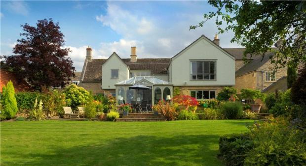
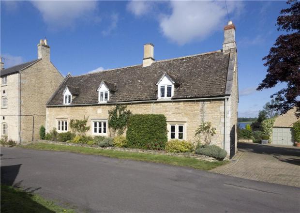
WESTON ROAD, OAKHAM, EDITH WESTON, RUTLAND LE15 8HQ
Property details
Last sold
£1,650,000 Dec 2024
Local average
£575,842 (+117.1%)
Deprivation
Decile 8 (25,678 of 33,755)
Street crime
2 incidents within 1 mile (Apr 2026)
Key features
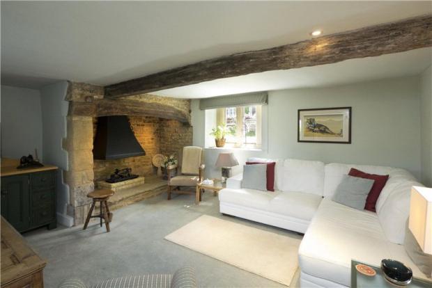
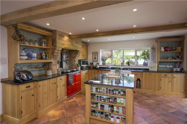
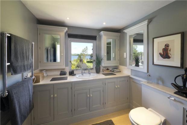
- Reception Hall, Cloakroom
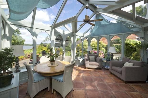
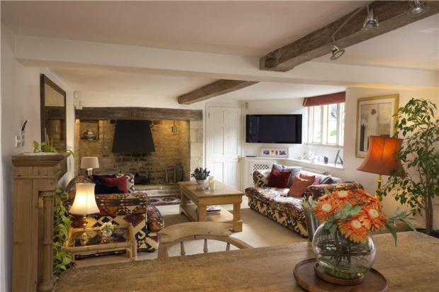
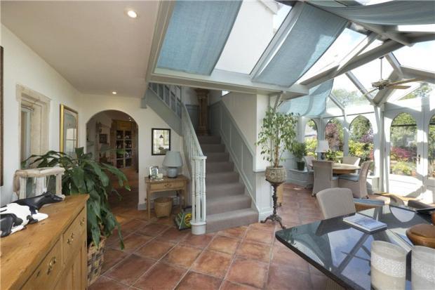
- Drawing Room, Conservatory
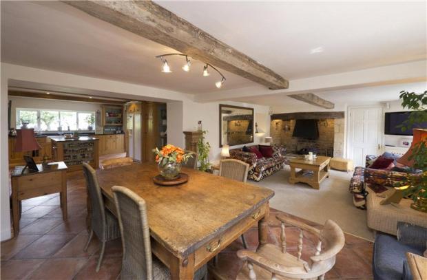
- Sitting/Dining Room, Kitchen
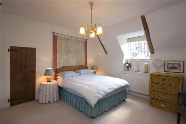
- Principal Bedroom Suite
- 3 further Bedrooms, Bathroom
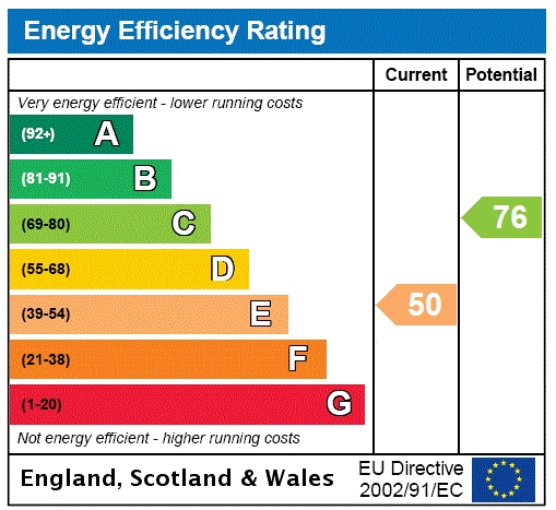
- EPC Rating E
- Garage, Home Office
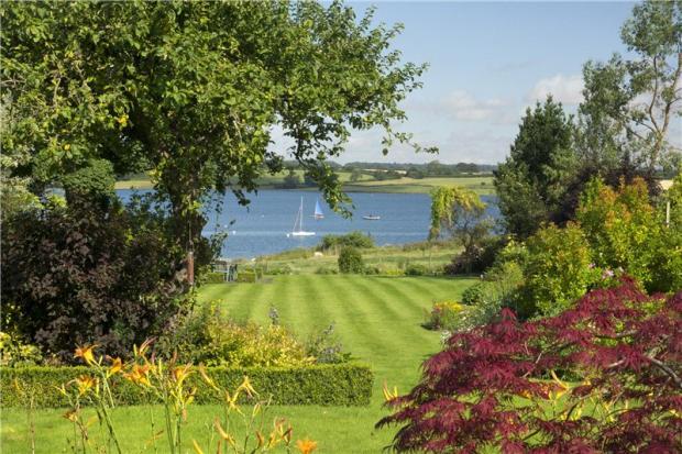
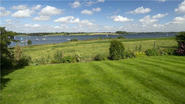
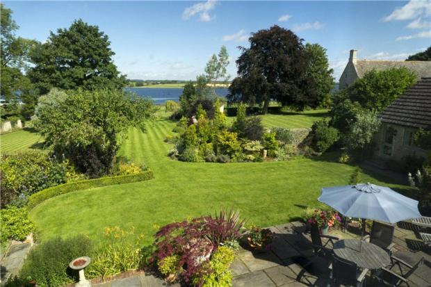
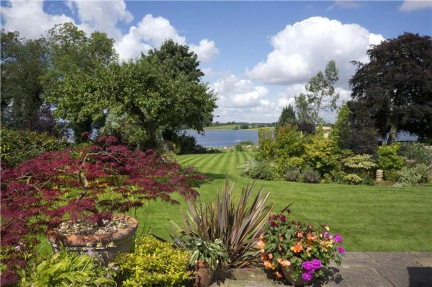
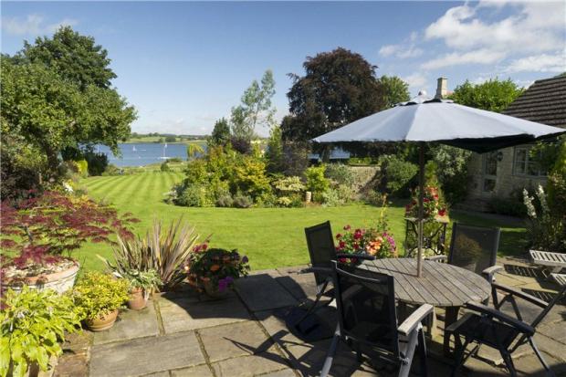
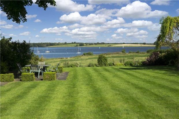
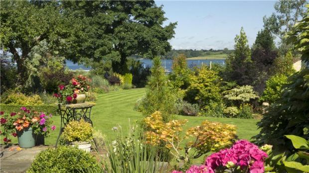
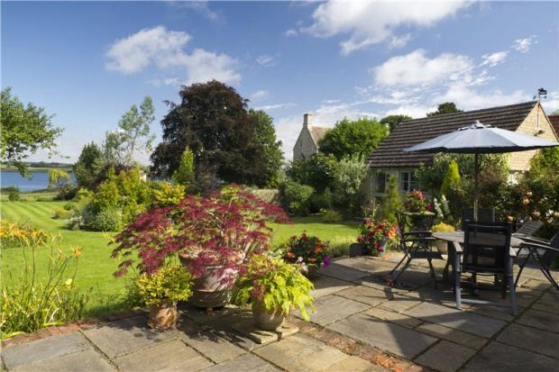
- Superb Landscaped Gardens
Additional details
- Parking
- Yes
- Garden
- Yes
Description
Listed by
Stamford
King West
Reference: 24036252
Flood risk
Zone: 1
Risk: Low
Job (default Low)
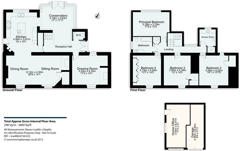
Floorplans
Picture No. 19
Price history
288% since 2001
| Event | Date | Price | % change |
|---|---|---|---|
| Sold | 19/12/2024 (1 year ago) | £1,650,000 | +288.2% |
| Sold | 18/05/2001 (25 years ago) | £425,000 | — |
Source: HM Land Registry Price Paid Data. Crown copyright.
Sold Comparables
Same street and nearby sales within 0.25 miles (last 5 years). Data from Land Registry Price Paid.
| Address | Price | Date | Type |
|---|---|---|---|
| 8 ST MARYS CLOSE, EDITH WESTON, OAKHAM, RUTLAND, LE15 8HF | £780,000 | 06/07/2023 | Detached |
| 5A CHURCH LANE, EDITH WESTON, OAKHAM, RUTLAND, LE15 8EY | £725,000 | 30/09/2022 | Detached |
| Same street STONE COTTAGE, 34 WESTON ROAD, EDITH WESTON, OAKHAM, RUTLAND, LE15 8HQ | £665,000 | 01/07/2022 | Detached |
| 6 KING EDWARDS WAY, EDITH WESTON, OAKHAM, RUTLAND, LE15 8EZ | £385,000 | 29/07/2021 | Detached |
Street average: £665,000 (1 sale)
Area average: £630,000 (3 sales)
Capital growth trend
Land Registry outcode average: last 12 months vs 5y and 10y ago (from sold prices).
House Price Index (HM Land Registry — official index, not sold-price averages): Rutland. Series: Detached. As of March 2026.
Rental Range
Estimated market rent for Rutland. Low = conservative, Realistic = average, Optimistic = best case.
Based on Local Authority from postcode lookup → Rutland.
LHA (30th percentile) floor for Leicester: £1,047/mo (Apr 2025 – Mar 2026)
Location
Nearby
Nearest stations, universities and amenities (distance from property).
| Type | Name | Distance |
|---|---|---|
| Shop | Edith Weston Village Store and Coffee Cabin | 0.2 miles |
| Bus stop | Unknown | 0.4 miles |
| Shop | Wing Hall Farm Shop | 2.7 miles |
| Train station | Oakham | 4.8 miles |
| Hospital | Rutland Memorial Hospital | 4.9 miles |
| Train station | Stamford | 6.5 miles |
Street-level crime
| Category | Count |
|---|---|
| Public order | 1 |
| Violence and sexual offences | 1 |
| Total incidents | 2 |
Within 1 mile during Apr 2026. Source: data.police.uk (England & Wales).
Schools nearby
Nearest open schools with Ofsted ratings (England). Closed schools are not shown. Data from Get Information about Schools and Ofsted.
| Name | Type | Distance | Ofsted |
|---|---|---|---|
| Edith Weston Academy | Primary | 0.2 miles | Good — 19 Dec 2017 |
| St Mary and St John CofE VA Primary School | Primary | 1.4 miles | Good — 7 Dec 2023 |
| Empingham Church of England Primary School | Primary | 2.8 miles | Good — 21 Dec 2010 |
| Wilds Lodge School | Other | 2.8 miles | Outstanding — 4 Dec 2019 |
| Exton and Greetham CofE Primary School | Primary | 3.5 miles | Good — 29 Apr 2014 |
Rental Comparables
Loading rental comparables for this postcode. Refresh in a few minutes.
Rent-driven metrics
Based on Area rent estimate.
- Rent ratio — Monthly rent ÷ purchase price (1% rule). 1%+ = strong, 0.8–1% = okay, <0.8% = weak for cashflow.
- Max investor price — Rent ÷ 0.8%; the price at which rent would be 0.8% of price (Stoke-style target).
- Target investor price — Rent ÷ 1%; the price at which rent would be 1% of price (strong cashflow band).
- Gross yield — Annual rent as % of purchase price (no costs).