Central Village Location
Alderley Edge, SK9 7JS

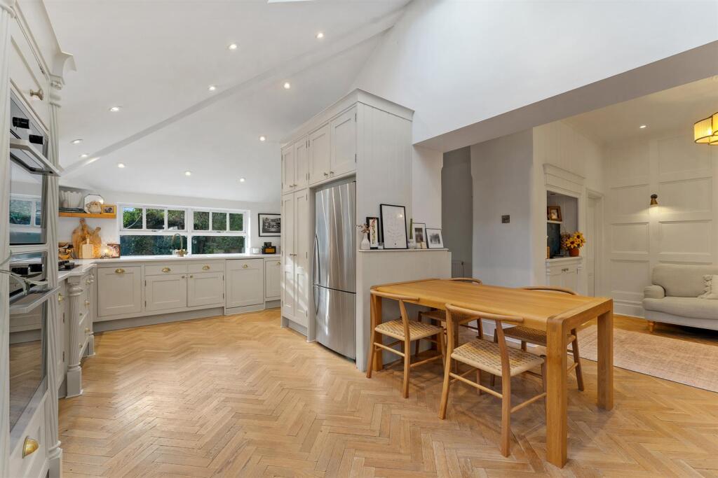
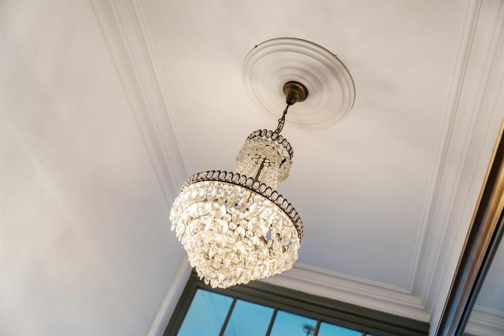
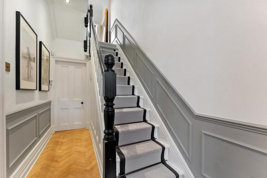
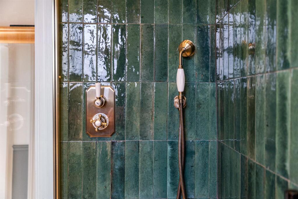
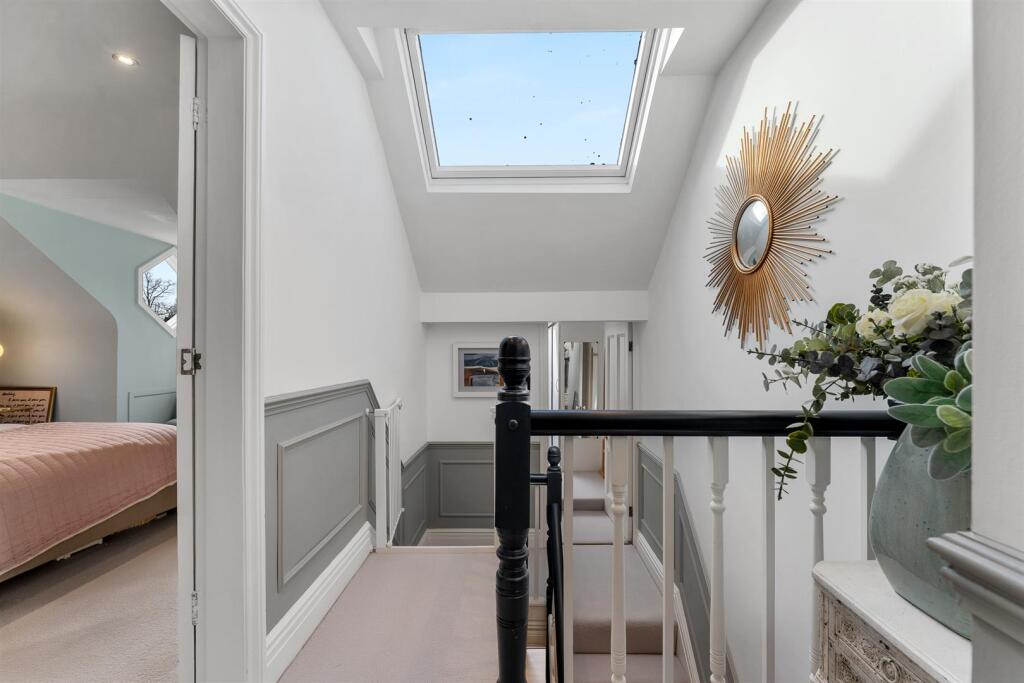
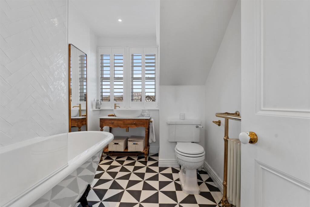

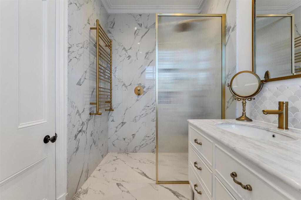

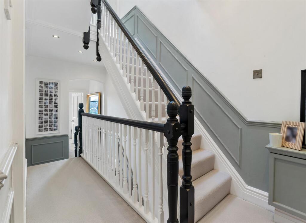
Photo 1 Photo 2 Photo 3 Photo 4 Photo 5 Photo 6 Photo 7 Photo 8 Photo 9 Photo 10 Photo 11
/ 11
Property details
Tenure
LEASEHOLD
Council tax band
G
Local average
£478,220 (+213.7%)
Deprivation
Decile 8 (23,938 of 33,755)
Street crime
24 incidents within 1 mile (Apr 2026)
Key features
- Period Family Home
- Central Village Location
- Immaculately Presented and Updated
- No Onward Chain
- Ample Parking
- South Facing Garden
Additional details
- Parking
- Yes
- Garden
- Yes
Description
Key Features:
- Over 2,600 sq.ft
- Set Across Four Levels
- Original Period Features
- Five Bedrooms
- Three Bathrooms
- Feature Fireplaces
- Central Village Location
- Driveway with Ample Parking
- South Facing Garden
- No Onward Chain
- Conservation Area
Listed by
Alderley Edge
Mosley Jarman
Reference: 172876127
EPC ratings on this postcode
We don't have a matched EPC for this property yet. Below are efficiency scores and details for other addresses on this postcode.
| Address | Current | Potential | Floor area | Age band | Type |
|---|---|---|---|---|---|
| 14B LONDON ROAD, ALDERLEY EDGE | 67 | 84 | 72 m² | England and Wales: 1900-1929 | House |
| 14B LONDON ROAD, ALDERLEY EDGE, ALDERLEY EDGE | 67 | 84 | 72 m² | England and Wales: 1900-1929 | Terraced |
| 14b, London Road | 69 | 70 | 76 m² | England and Wales: before 1900 | Flat |
Flood risk
Zone: 1
Risk: Low
Job (default Low)
Floorplans

Floorplan 1
EPC Graphs

EE Rating
Price history
No sales history found for this property in Land Registry Price Paid data.
Sold Comparables
Same street and nearby sales within 0.25 miles (last 5 years). Data from Land Registry Price Paid.
| Address | Price | Date | Type |
|---|---|---|---|
| 14 TRAFFORD ROAD, ALDERLEY EDGE, CHESHIRE EAST, SK9 7NT | £600,000 | 22/05/2024 | Semi-detached |
| 38 TRAFFORD ROAD, ALDERLEY EDGE, CHESHIRE EAST, SK9 7NN | £997,000 | 07/10/2022 | Semi-detached |
| 18 TRAFFORD ROAD, ALDERLEY EDGE, CHESHIRE EAST, SK9 7NT | £995,000 | 22/07/2022 | Semi-detached |
| 18 TRAFFORD ROAD, ALDERLEY EDGE, CHESHIRE EAST, SK9 7NT | £995,000 | 22/07/2022 | Semi-detached |
| 9 TRAFFORD ROAD, ALDERLEY EDGE, CHESHIRE EAST, SK9 7NN | £1,282,500 | 19/07/2022 | Semi-detached |
| 8 THE AVENUE, ALDERLEY EDGE, CHESHIRE EAST, SK9 7NJ | £917,000 | 22/06/2022 | Semi-detached |
| 5 TRAFFORD ROAD, ALDERLEY EDGE, CHESHIRE EAST, SK9 7NT | £975,000 | 17/12/2021 | Semi-detached |
| 21 CHAPEL ROAD, ALDERLEY EDGE, CHESHIRE EAST, SK9 7DX | £945,500 | 27/09/2021 | Semi-detached |
| 20 CLIFTON STREET, ALDERLEY EDGE, CHESHIRE EAST, SK9 7NW | £800,000 | 24/09/2021 | Semi-detached |
| 15 CLIFTON STREET, ALDERLEY EDGE, CHESHIRE EAST, SK9 7NW | £689,000 | 30/07/2021 | Semi-detached |
| 44 TRAFFORD ROAD, ALDERLEY EDGE, CHESHIRE EAST, SK9 7NN | £798,000 | 29/06/2021 | Semi-detached |
| 1 CHAPEL ROAD, ALDERLEY EDGE, CHESHIRE EAST, SK9 7DX | £482,500 | 22/06/2021 | Semi-detached |
Area average: £873,042 (12 sales)
Capital growth trend
Land Registry outcode average: last 12 months vs 5y and 10y ago (from sold prices).
House Price Index (HM Land Registry — official index, not sold-price averages): Cheshire East. Series: Semi-detached. As of March 2026.
Rental Range
Estimated market rent for Cheshire East. Low = conservative, Realistic = average, Optimistic = best case.
Based on Local Authority from postcode lookup → Cheshire East.
LHA (30th percentile) floor for West Pennine: £760/mo (Apr 2025 – Mar 2026)
Location
Address
London Road
Nearby
Nearest stations, universities and amenities (distance from property).
| Type | Name | Distance |
|---|---|---|
| Shop | SamHead | 0.0 miles |
| Shop | Beauty Works | 0.0 miles |
| Bus stop | Alderley Edge, London Road / Clifton Street | 0.0 miles |
| Train station | Alderley Edge | 0.1 miles |
| Hospital | The Wilmslow Hospital | 1.6 miles |
| Hospital | Soss Moss Hospital | 1.7 miles |
| Train station | Wilmslow | 1.8 miles |
| University | University of Manchester Fallowfield Campus | 9.9 miles |
| University | Fallowfield Reception and Richmond Amenities Building | 9.9 miles |
Street-level crime
| Category | Count |
|---|---|
| Violence and sexual offences | 7 |
| Drugs | 5 |
| Public order | 3 |
| Anti-social behaviour | 2 |
| Burglary | 2 |
| Other theft | 2 |
| Criminal damage and arson | 1 |
| Robbery | 1 |
| Theft from the person | 1 |
| Total incidents | 24 |
Within 1 mile during Apr 2026. Source: data.police.uk (England & Wales).
Schools nearby
Nearest open schools with Ofsted ratings (England). Closed schools are not shown. Data from Get Information about Schools and Ofsted.
| Name | Type | Distance | Ofsted |
|---|---|---|---|
| Alderley Edge Community Primary School | Primary | 0.2 miles | — (Inspected (no overall grade)) |
| Alderley Edge School for Girls | Other | 0.2 miles | — (No rating) |
| The Ryleys School | Other | 0.3 miles | — (No rating) |
| Nether Alderley Primary School | Primary | 1.1 miles | Good — 1 May 2012 |
| Lindow Community Primary School | Primary | 1.1 miles | Good — 11 Mar 2014 |
Rental Comparables
Loading rental comparables for this postcode. Refresh in a few minutes.
Rent-driven metrics
Based on Area rent estimate.
- Rent ratio — Monthly rent ÷ purchase price (1% rule). 1%+ = strong, 0.8–1% = okay, <0.8% = weak for cashflow.
- Max investor price — Rent ÷ 0.8%; the price at which rent would be 0.8% of price (Stoke-style target).
- Target investor price — Rent ÷ 1%; the price at which rent would be 1% of price (strong cashflow band).
- Gross yield — Annual rent as % of purchase price (no costs).
Enter House Number
Enter the house number to help us retrieve more accurate pricing history and property data.
Please log in to submit or correct the house number for this listing.
Log in to continue