18 ST JOHNS
HINCKLEY, LEICESTERSHIRE LE10 1NX
£495 pcm
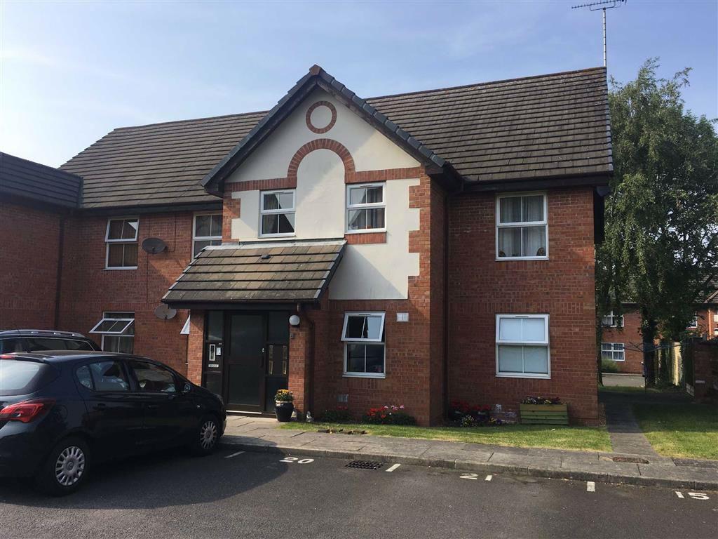
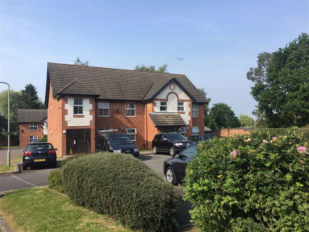
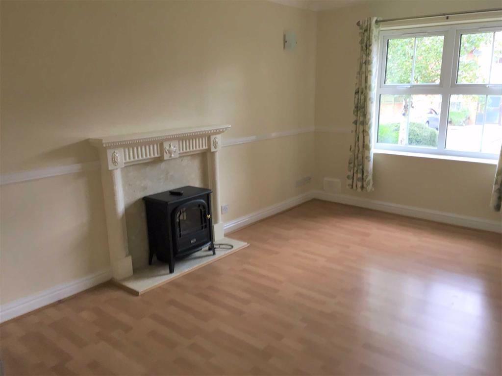
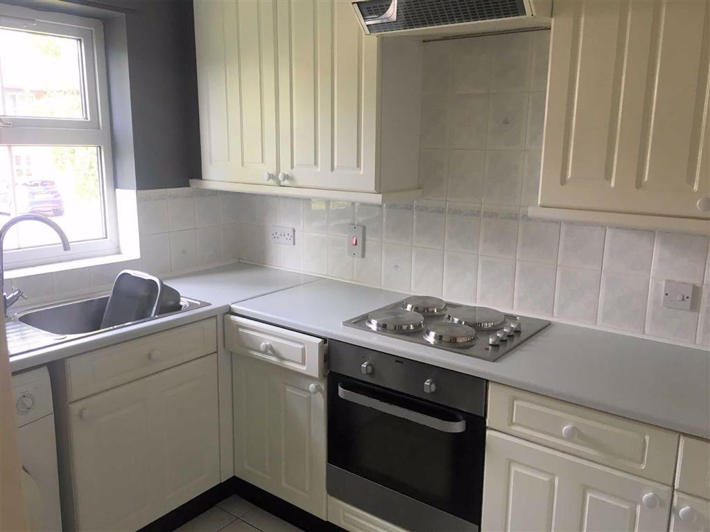
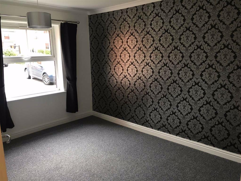
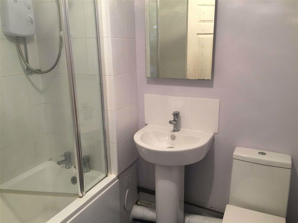
Photo 1 Photo 2 Photo 3 Photo 4 Photo 5 Photo 6
/ 6
Property details
Deprivation
Decile 4 (12,467 of 33,755)
Street crime
195 incidents within 1 mile (Apr 2026)
Additional details
- Parking
- Yes
Description
Unfurnished.
You may download, store and use the material for your own personal use and research. You may not republish, retransmit, redistribute or otherwise make the material available to any party or make the same available on any website, online service or bulletin board of your own or of any other party or make the same available in hard copy or in any other media without the website owner's express prior written consent. The website owner's copyright must remain on all reproductions of material taken from this website.
Listed by
Hinckley
Wards Residential
Reference: 72948510
EPC Rating & Upgrade Cost
Fetching EPC data… Refresh this page in a moment.
Flood risk
Zone: 1
Risk: Low
Job (default Low)
EPC Graphs

EPC 1
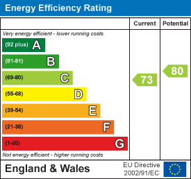
EPC 2
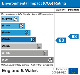
EPC 3
Rental Range
Estimated market rent for Hinckley and Bosworth. Low = conservative, Realistic = average, Optimistic = best case.
Based on Local Authority from postcode lookup → Hinckley and Bosworth.
LHA (30th percentile) floor for Leicester: £539/mo (Apr 2025 – Mar 2026)
Location
Nearby
Nearest stations, universities and amenities (distance from property).
| Type | Name | Distance |
|---|---|---|
| Bus stop | De Montfort Road | 0.1 miles |
| Bus stop | New Street | 0.1 miles |
| Shop | Londis | 0.3 miles |
| Shop | Salon Eden | 0.4 miles |
| Train station | Hinckley | 0.8 miles |
| Train station | Shenton | 4.2 miles |
| Hospital | Stewart House | 7.0 miles |
| Hospital | George Elliot Medical Centre | 10.6 miles |
| University | Unknown | 11.2 miles |
Street-level crime
| Category | Count |
|---|---|
| Violence and sexual offences | 58 |
| Shoplifting | 30 |
| Anti-social behaviour | 28 |
| Burglary | 19 |
| Criminal damage and arson | 16 |
| Other theft | 15 |
| Public order | 11 |
| Vehicle crime | 7 |
| Robbery | 4 |
| Drugs | 3 |
| Bicycle theft | 2 |
| Other crime | 2 |
| Total incidents | 195 |
Within 1 mile during Apr 2026. Source: data.police.uk (England & Wales).
Schools nearby
Nearest open schools with Ofsted ratings (England). Closed schools are not shown. Data from Get Information about Schools and Ofsted.
| Name | Type | Distance | Ofsted |
|---|---|---|---|
| Hinckley Parks Primary School | Primary | 0.2 miles | Good — 4 Sep 2014 |
| Saint Peter's Catholic Primary School, A Voluntary Academy | Primary | 0.3 miles | Good — 11 Jun 2013 |
| St Mary's Church of England Primary School, Hinckley | Primary | 0.5 miles | Good — 3 Oct 2023 |
| The Hinckley School | Secondary | 0.6 miles | Good — 16 Oct 2023 |
| R.E.A.L Independent Schools Hinckley | Other | 0.6 miles | Good — 14 Nov 2021 |
Rental Comparables
Rental listings exist nearby, but none matched the 1-bedroom count for this property.