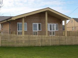
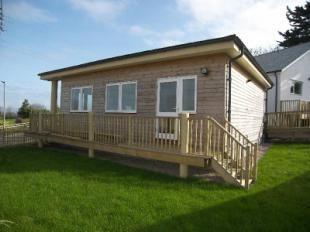
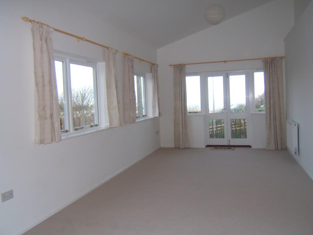
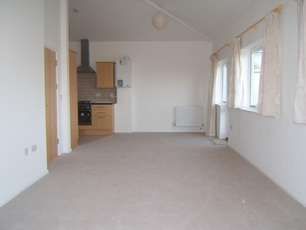
Godrevy View
TRENWITH LANE, ST IVES, CORNWALL TR26 1DA
£695 pcm
Property details
Deprivation
Decile 2 (6,446 of 33,755)
Street crime
45 incidents within 1 mile (Apr 2026)
Key features
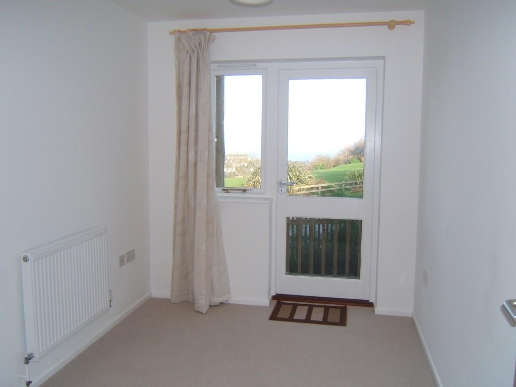
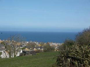
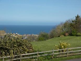
- Sea & Coastal View
- Detached Bungalow
- Two Bedrooms
- Garden & Veranda
- Parking
- Gas Cental Heating
- Double Glazed
- Available Now
- Sorry No Pets, Dss or Smokers
Additional details
- Parking
- Yes
- Garden
- Yes
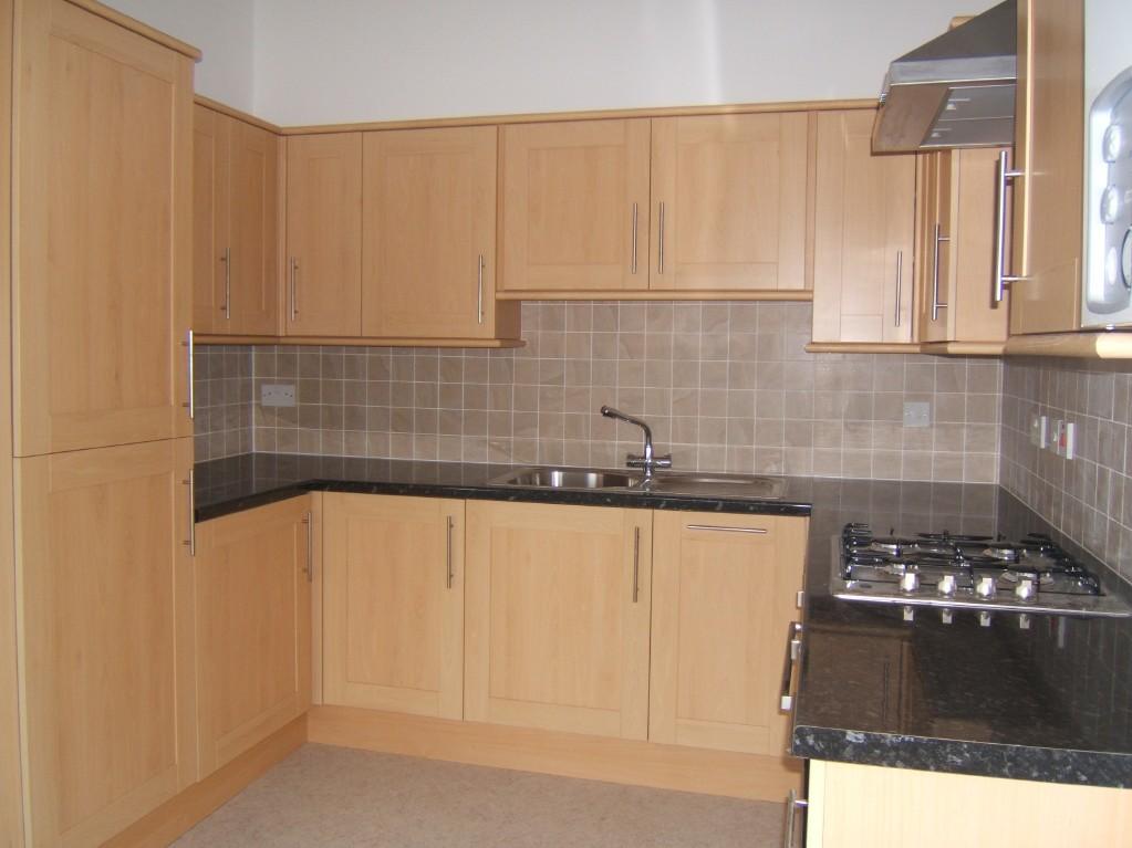
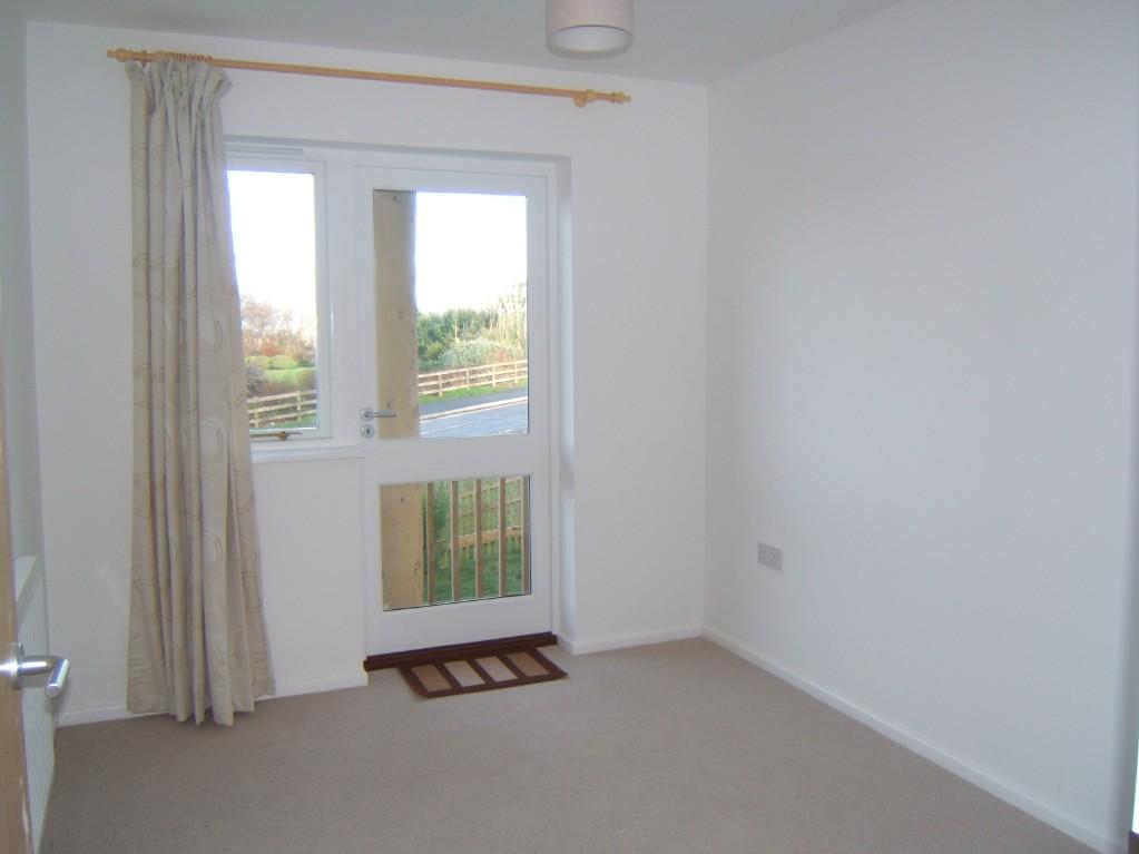
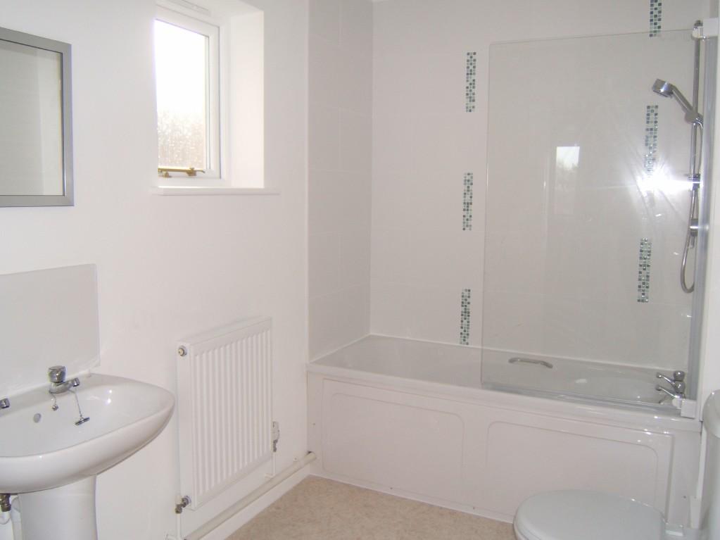
Description
Listed by
Mid & West Cornwall Lettings
Miller & Son
Reference: 27855617
EPC ratings on this postcode
We don't have a matched EPC for this property yet. Below are efficiency scores and details for other addresses on this postcode.
| Address | Current | Potential | Floor area | Age band | Type |
|---|---|---|---|---|---|
| Belgrano, Trenwith Lane, ST. IVES | 53 | 78 | 138 m² | England and Wales: 1930-1949 | Detached |
| Five Winds, Trenwith Lane, ST. IVES | 64 | 80 | 146 m² | England and Wales: 1950-1966 | Detached |
| Five Winds, Trenwith Lane, ST. IVES | 63 | 81 | 133 m² | — | Detached |
| Flat Five Winds, Trenwith Lane, ST. IVES | 54 | 65 | 38 m² | England and Wales: 1967-1975 | Flat |
| Flat Gospel Hall, Trenwith Lane, ST. IVES | 13 | 44 | 44 m² | England and Wales: 1950-1966 | Detached |
| Pendennis, Trenwith Lane, ST. IVES | 44 | 81 | 116 m² | England and Wales: 1950-1966 | Detached |
| The Flat, Trenwith House, Trenwith Lane, ST. IVES | 46 | 78 | 27 m² | England and Wales: 1900-1929 | Flat |
| Trenwith Cottage, Trenwith Lane, ST. IVES | 62 | 85 | 100 m² | England and Wales: before 1900 | Terraced |
| Trenwith House, Trenwith Lane, ST. IVES | 57 | 83 | 135 m² | England and Wales: 1900-1929 | Detached |
Flood risk
Zone: 1
Risk: Low
Job (default Low)
Rental Range
Estimated market rent for Cornwall. Low = conservative, Realistic = average, Optimistic = best case.
Based on Local Authority from postcode lookup → Cornwall.
Location
Address
Trenwith Lane
Nearby
Nearest stations, universities and amenities (distance from property).
| Type | Name | Distance |
|---|---|---|
| Bus stop | Trenwith Bridge | 0.1 miles |
| Bus stop | Nanjivey | 0.1 miles |
| Shop | Spar | 0.2 miles |
| Shop | St Ives Brewery | 0.2 miles |
| Train station | St Ives | 0.5 miles |
| Train station | Carbis Bay | 1.4 miles |
| Hospital | St. Michael's Hospital | 3.5 miles |
| Hospital | West Cornwall Hospital (Penzance) | 6.4 miles |
Street-level crime
| Category | Count |
|---|---|
| Violence and sexual offences | 21 |
| Anti-social behaviour | 8 |
| Criminal damage and arson | 5 |
| Public order | 4 |
| Drugs | 2 |
| Other theft | 2 |
| Shoplifting | 2 |
| Vehicle crime | 1 |
| Total incidents | 45 |
Within 1 mile during Apr 2026. Source: data.police.uk (England & Wales).
Schools nearby
Nearest open schools with Ofsted ratings (England). Closed schools are not shown. Data from Get Information about Schools and Ofsted.
| Name | Type | Distance | Ofsted |
|---|---|---|---|
| St Ives Junior School | Primary | 0.1 miles | Requires improvement — 21 Jan 2024 |
| St Ives Infant School | Primary | 0.1 miles | Good — 4 Mar 2024 |
| St Ives School | Secondary | 0.6 miles | Good — 27 Feb 2017 |
| St Uny CofE Academy | Primary | 1.6 miles | Good — 21 Sep 2022 |
| Nancledra School | Primary | 2.3 miles | Good — 15 Jul 2015 |
Rental Comparables
Rental listings exist nearby, but none matched the 2-bedroom count for this property.
Enter House Number
Enter the house number to help us retrieve more accurate pricing history and property data.
Please log in to submit or correct the house number for this listing.
Log in to continue