11 DOWNESWAY
ALDERLEY EDGE, CHESHIRE EAST SK9 7XB
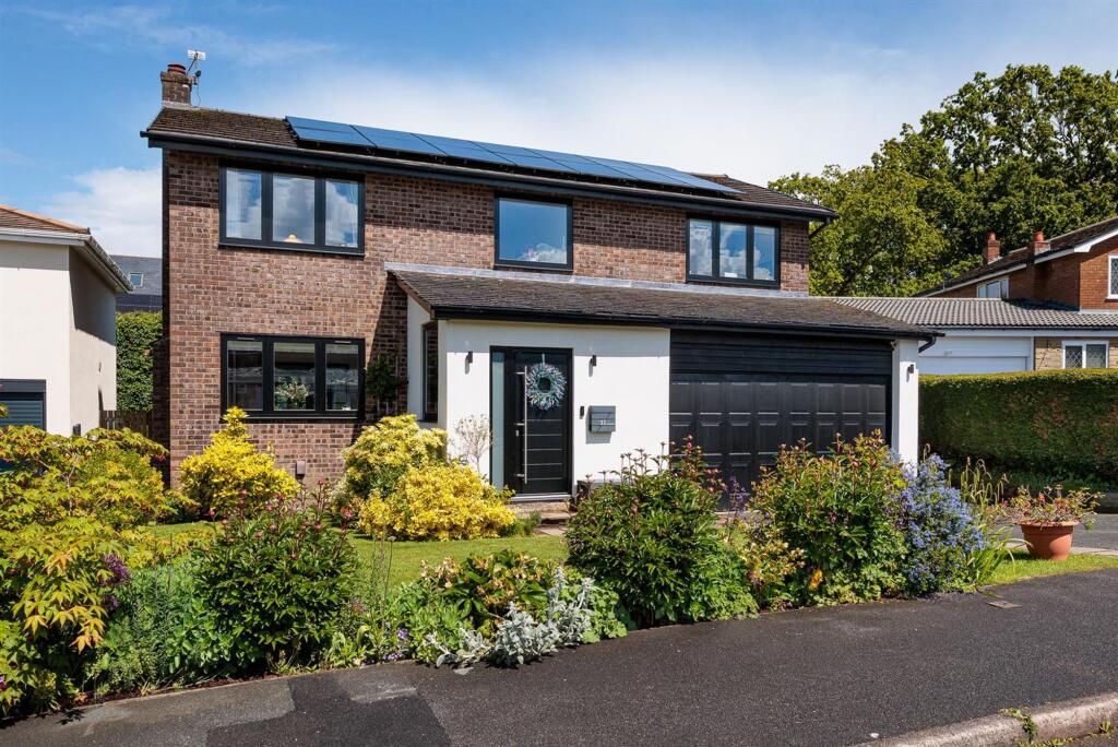
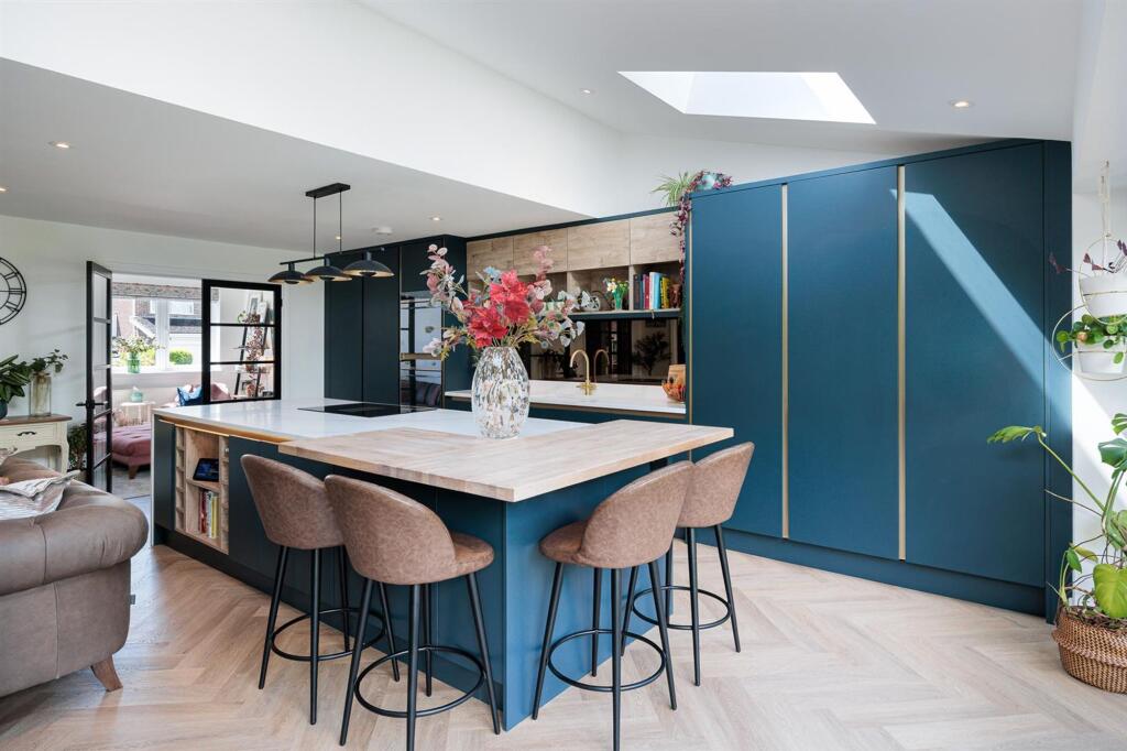
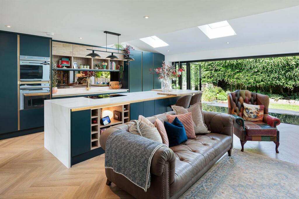
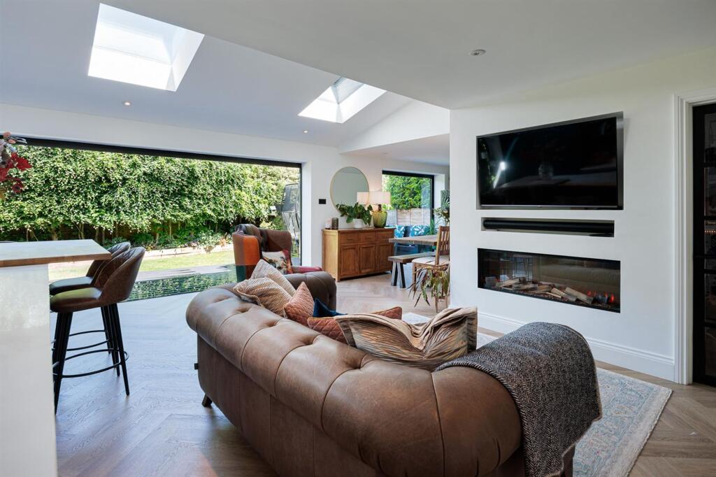
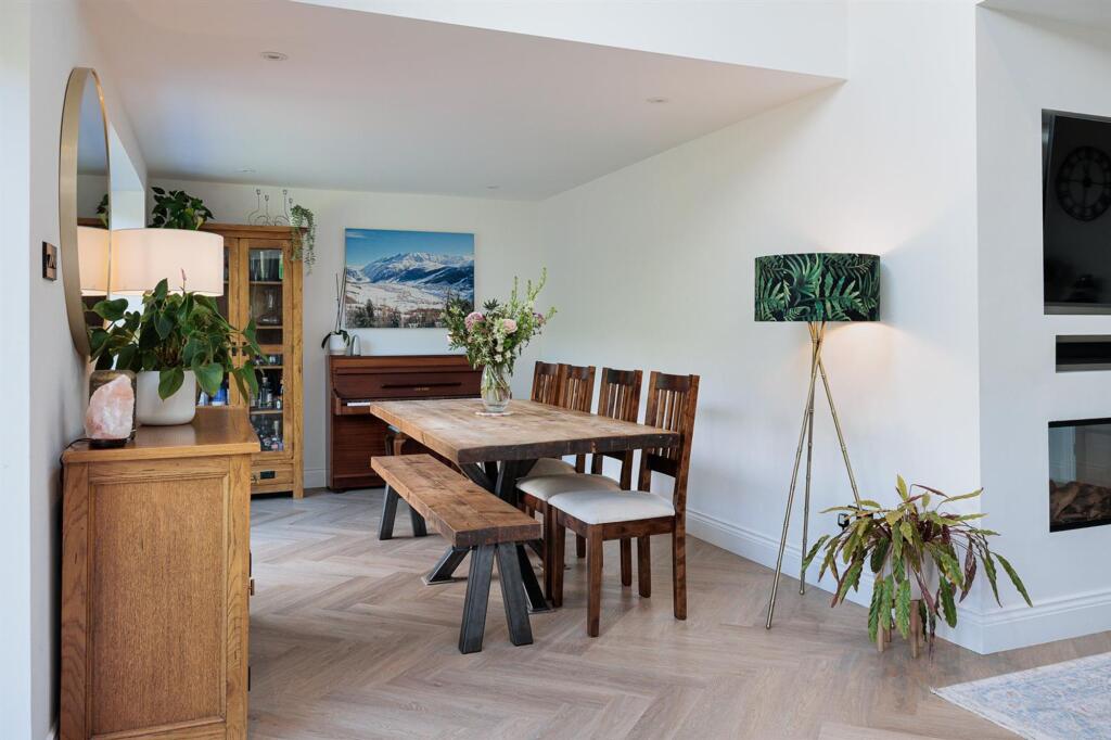
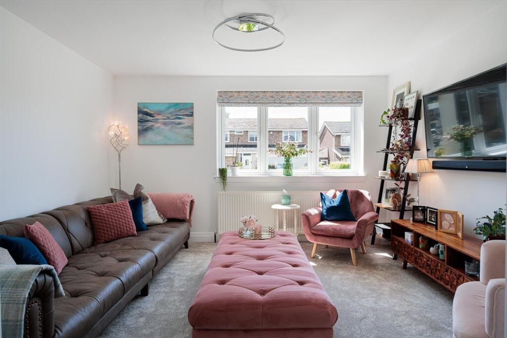
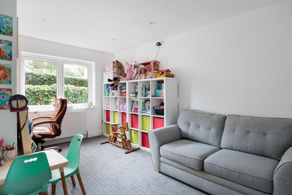
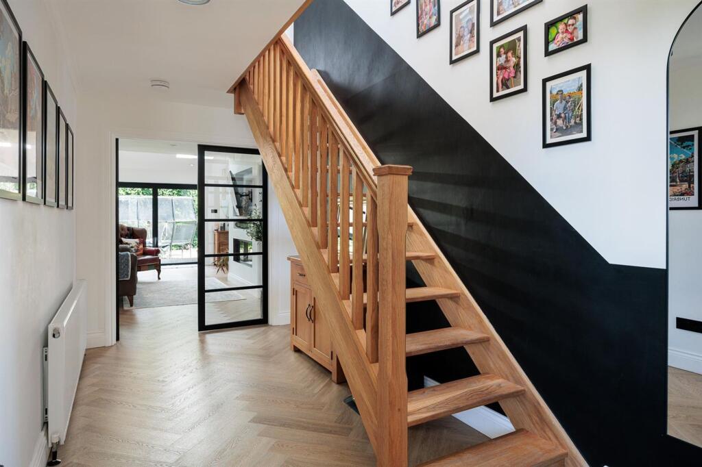

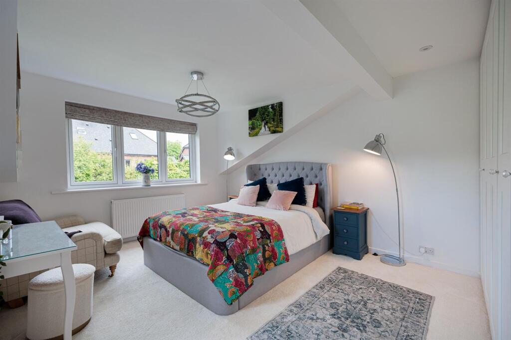
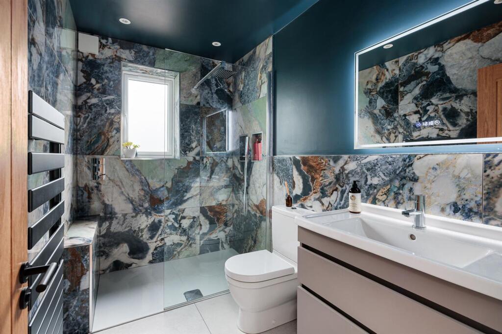
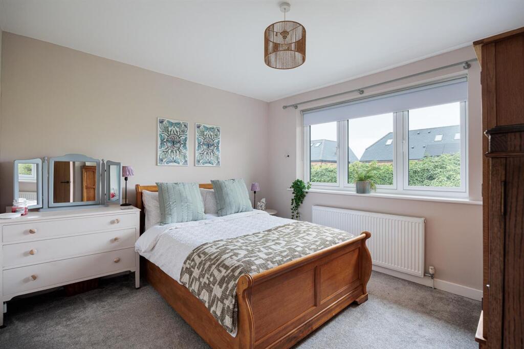

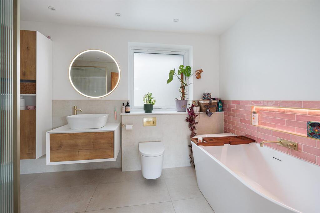
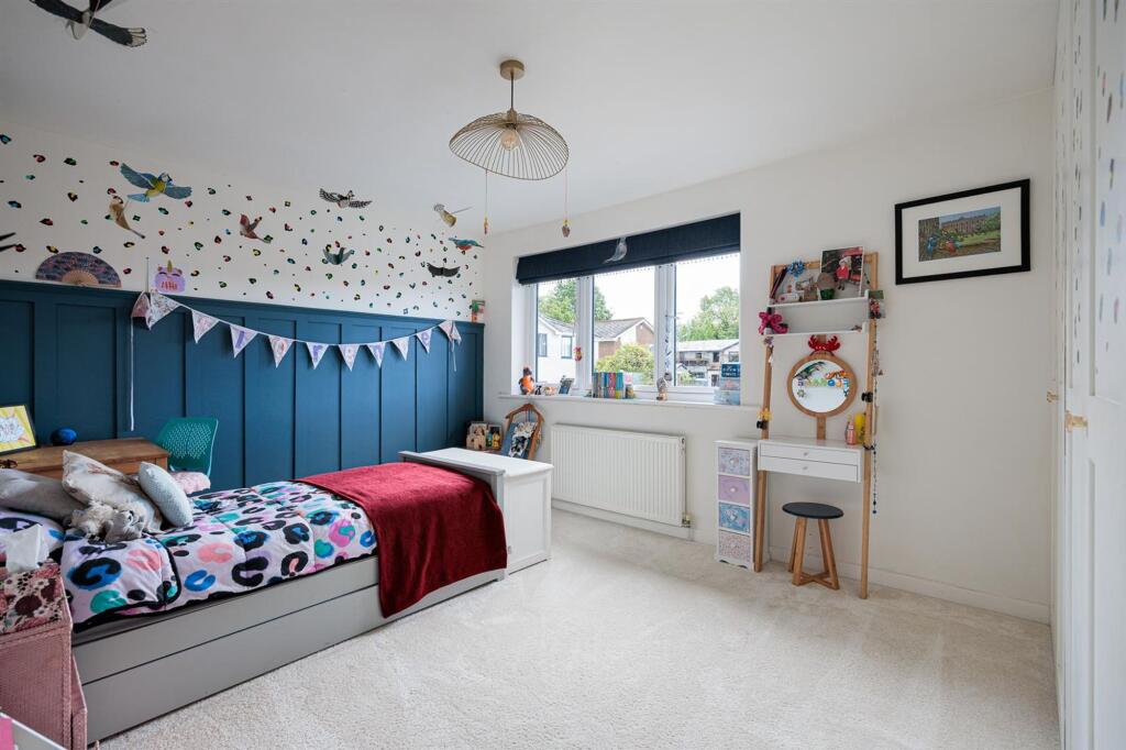
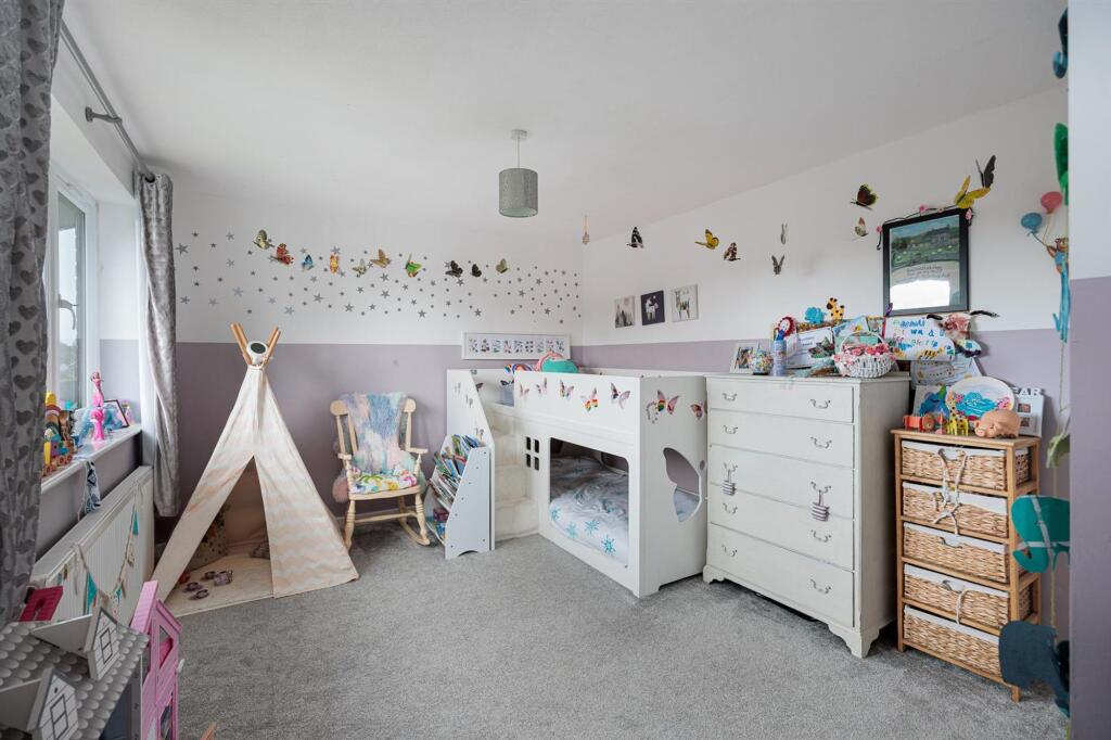
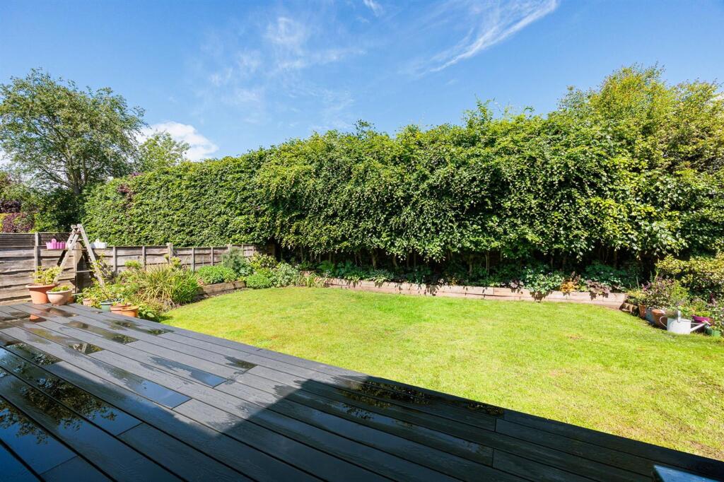
Photo 1 Photo 2 Photo 3 Photo 4 Photo 5 Photo 6 Photo 7 Photo 8 Photo 9 Photo 10 Photo 11 Photo 12 Photo 13 Photo 14 Photo 15 Photo 16 Photo 17
/ 17
Property details
Floor area
179 m²
Last sold
£673,250 Jan 2021
Local average
£837,551 (+13.4%)
Deprivation
Decile 10 (32,229 of 33,755)
Street crime
22 incidents within 1 mile (Apr 2026)
Key features
- Four Double Bedrooms
- Village Location
- Stunning Kitchen
- Recently Extended and Remodelled
- Solar Panels
- Open Plan Living
Additional details
- Parking
- Yes
- Garden
- Yes
- Listed property
- No
- Restrictions
- No
- Required access
- No
- Rights of way
- No
- Flooded in last 5 years
- No
- Flood defences
- No
Description
EPC Rating: D
Listed by
Alderley Edge
Mosley Jarman
Reference: 89815269
EPC Rating & Upgrade Cost
Fetching EPC data… Refresh this page in a moment.
Flood risk
Zone: 1
Risk: Low
Job (default Low)
Floorplans
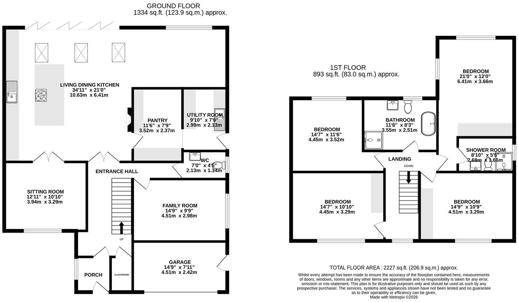
Floorplan 1
EPC Graphs
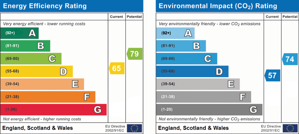
EPC 1
FENSA Certificates
This property has 2 FENSA certificate(s) on record, indicating window/door installations by FENSA-approved installers.
FENSA Certificate #10886406
Property Details
Street: 11 Downesway
Town: ALDERLEY EDGE
Postcode: SK9 7XB
Installation Details
Items: 1 window
Certificate Issued: 23/03/2015
Work Completed: 23/02/2015
This certificate data was retrieved from FENSA's database
FENSA Certificate #16330156 Recent
Property Details
Street: 11 Downesway
Town: ALDERLEY EDGE
Postcode: SK9 7XB
Installation Details
Items: 15 windows and 4 doors
Certificate Issued: 09/06/2024
Work Completed: 24/05/2024
This certificate data was retrieved from FENSA's database
What is FENSA? FENSA (Fenestration Self-Assessment Scheme) is a government-authorised scheme that monitors building regulation compliance for replacement windows and doors. Certificates indicate that work was completed by FENSA-approved installers.
Price history
| Event | Date | Price | % change |
|---|---|---|---|
| Listed for sale | — | £950,000 | +41.1% |
| Sold | 08/01/2021 (5 years ago) | £673,250 | — |
Source: HM Land Registry Price Paid Data. Crown copyright.
Sold Comparables
Same street and nearby sales within 0.25 miles (last 5 years). Data from Land Registry Price Paid.
| Address | Price | Date | Type |
|---|---|---|---|
| Same street 21 DOWNESWAY, ALDERLEY EDGE, CHESHIRE EAST, SK9 7XB | £675,000 | 25/11/2022 | Detached |
| Same street 17 DOWNESWAY, ALDERLEY EDGE, CHESHIRE EAST, SK9 7XB | £717,000 | 29/04/2022 | Detached |
| 10 CONGLETON ROAD, ALDERLEY EDGE, CHESHIRE EAST, SK9 7AA | £41,600 | 29/07/2021 | Other |
Street average: £696,000 (2 sales)
Area average: £41,600 (1 sale)
Capital growth trend
Land Registry outcode average: last 12 months vs 5y and 10y ago (from sold prices).
House Price Index (HM Land Registry — official index, not sold-price averages): Cheshire East. Series: All dwelling types. As of March 2026.
Rental Range
Estimated market rent for Cheshire East. Low = conservative, Realistic = average, Optimistic = best case.
Based on Local Authority from postcode lookup → Cheshire East.
LHA (30th percentile) floor for West Pennine: £760/mo (Apr 2025 – Mar 2026)
Location
Nearby
Nearest stations, universities and amenities (distance from property).
| Type | Name | Distance |
|---|---|---|
| Shop | Murphy's Barber Shop | 0.2 miles |
| Shop | Coggles | 0.2 miles |
| Bus stop | Alderley Edge, London Road / Nat West Bank | 0.2 miles |
| Train station | Alderley Edge | 0.4 miles |
| Train station | Wilmslow | 2.0 miles |
| Hospital | Rosemount Resource Centre | 4.7 miles |
| Hospital | Altrincham Hospital | 7.5 miles |
| University | University of Manchester Fallowfield Campus | 10.1 miles |
| University | Fallowfield Reception and Richmond Amenities Building | 10.1 miles |
Street-level crime
| Category | Count |
|---|---|
| Violence and sexual offences | 7 |
| Drugs | 5 |
| Public order | 3 |
| Anti-social behaviour | 2 |
| Other theft | 2 |
| Burglary | 1 |
| Criminal damage and arson | 1 |
| Robbery | 1 |
| Total incidents | 22 |
Within 1 mile during Apr 2026. Source: data.police.uk (England & Wales).
Schools nearby
Nearest open schools with Ofsted ratings (England). Closed schools are not shown. Data from Get Information about Schools and Ofsted.
| Name | Type | Distance | Ofsted |
|---|---|---|---|
| The Ryleys School | Other | 0.3 miles | — (No rating) |
| Alderley Edge Community Primary School | Primary | 0.4 miles | — (Inspected (no overall grade)) |
| Alderley Edge School for Girls | Other | 0.4 miles | — (No rating) |
| Nether Alderley Primary School | Primary | 0.9 miles | Good — 1 May 2012 |
| Lindow Community Primary School | Primary | 1.2 miles | Good — 11 Mar 2014 |
Rental Comparables
Loading rental comparables for this postcode. Refresh in a few minutes.
Rent-driven metrics
Based on Area rent estimate.
- Rent ratio — Monthly rent ÷ purchase price (1% rule). 1%+ = strong, 0.8–1% = okay, <0.8% = weak for cashflow.
- Max investor price — Rent ÷ 0.8%; the price at which rent would be 0.8% of price (Stoke-style target).
- Target investor price — Rent ÷ 1%; the price at which rent would be 1% of price (strong cashflow band).
- Gross yield — Annual rent as % of purchase price (no costs).