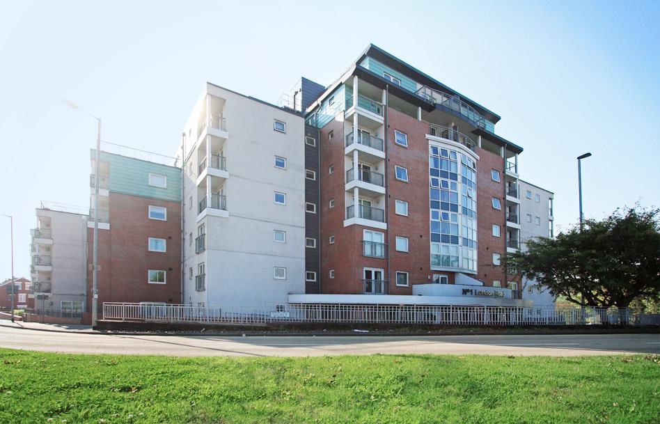
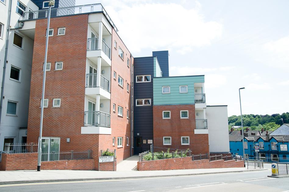
FLAT 18
WINDSOR COURT, LONDON ROAD, NEWCASTLE, STAFFORDSHIRE ST5 1NY
18_windsor_gwi_0489Combi_W.jpg 18_windsor_gwi_0465E_W.jpg IMG_0050bweb.jpg 18_Windsor_gwi_8586E_W.jpg 18_windsor_gwi_0476E_W.jpg 18_windsor_gwi_0458E_W.jpg 18_windsor_gwi_0506E_W.jpg 18_windsor_gwi_0502E_W.jpg 18_windsor_gwi_0505E_W.jpg 18_Windsor_gwi_8626E_W.jpg 18_windsor_gwi_0436E_W.jpg 18_windsor_gwi_0443E_W.jpg 18_windsor_gwi_0431E_W.jpg 18_Windsor_gwi_8638E_W.jpg 18_windsor_gwi_0455E_W.jpg 18_windsor_gwi_0453E_W.jpg 18_windsor_gwi_0439E_W.jpg 18_windsor_gwi_0442E_W.jpg LondonRd_gwi_0750ECombiW.jpg LondonRd_gwi_0691EW.jpg LondonRd_gwi_0713EW.jpg 18_Windsor_gwi_8616E_W.jpg 18_Windsor_gwi_8621E_W.jpg 29 Windsor Court (11).jpg 24 Windsor Court (4).jpg 18_windsor_gwi_0508E_W.jpg
/ 26
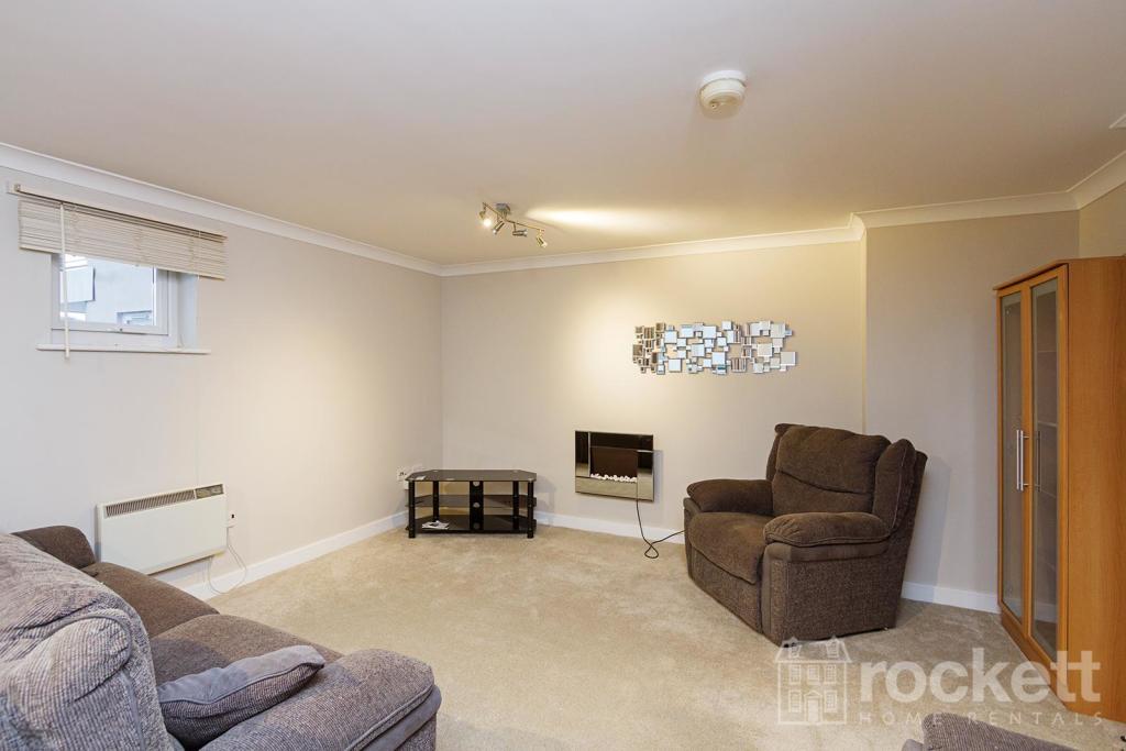
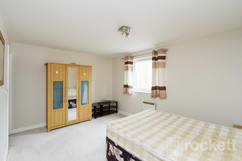
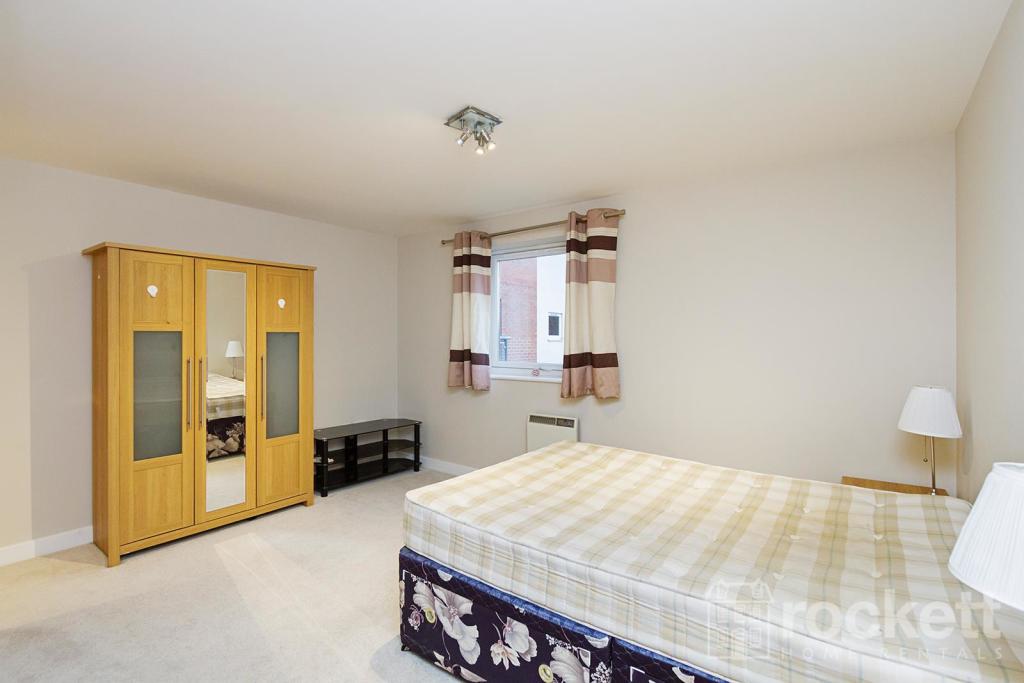
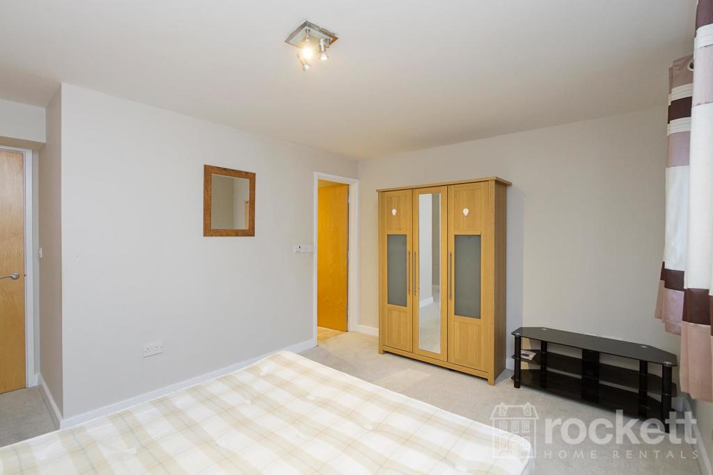
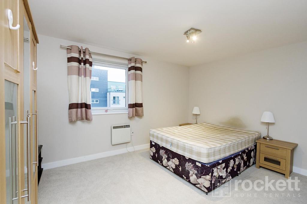
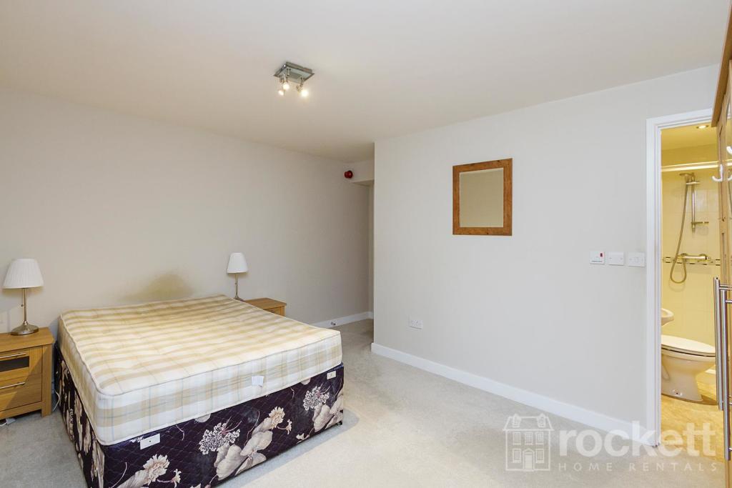
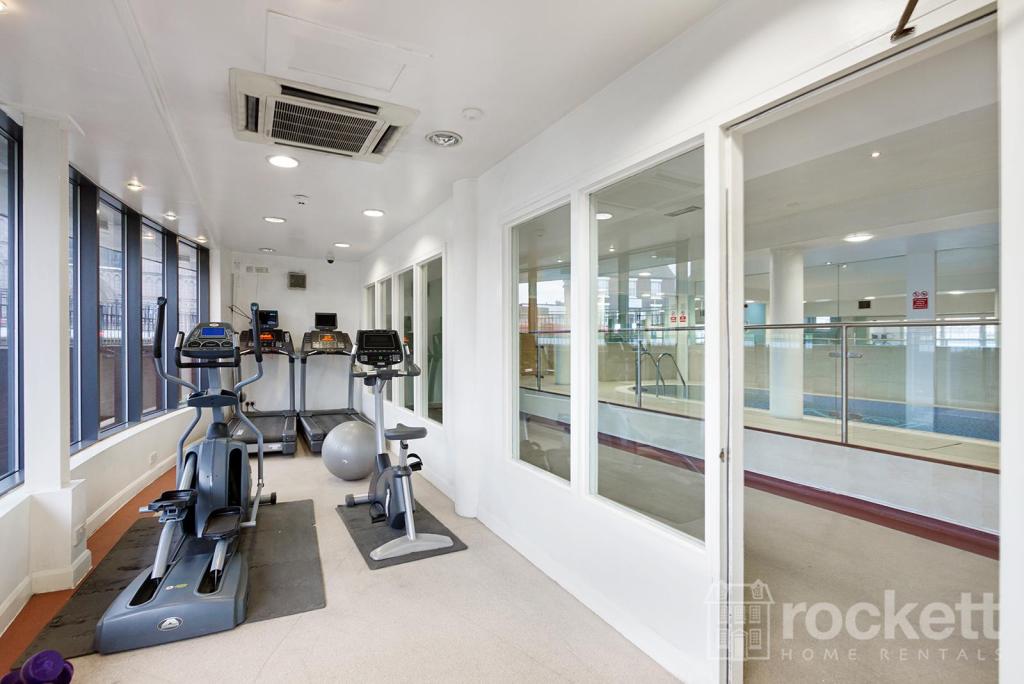
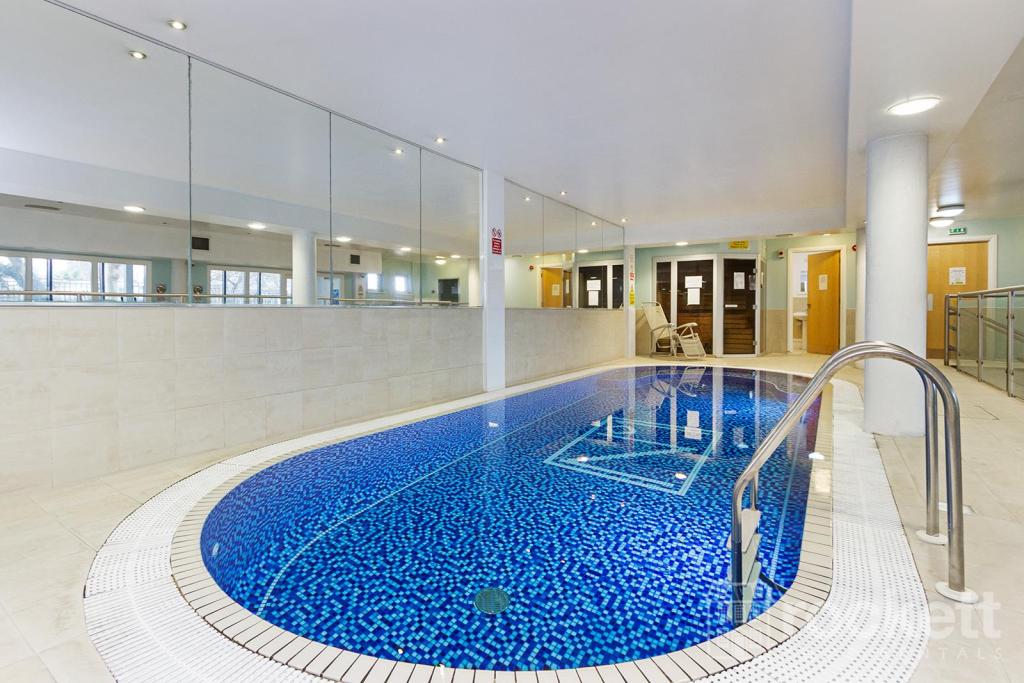
Property details
Deprivation
Decile 4 (10,391 of 33,755)
Street crime
331 incidents within 1 mile (Apr 2026)
Additional details
- Parking
- Yes
Description
Listed by
Wolstanton
Rockett Home Rentals Ltd
Reference: 86919508
EPC Rating & Upgrade Cost
Fetching EPC data… Refresh this page in a moment.
Flood risk
Zone: 1
Risk: Low
Job (default Low)
EPC Graphs
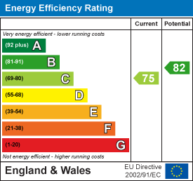
EE Rating
Rental Range
Estimated market rent for Newcastle-under-Lyme. Low = conservative, Realistic = average, Optimistic = best case.
Based on Local Authority from postcode lookup → Newcastle-under-Lyme.
LHA (30th percentile) floor for Staffordshire North: £479/mo (Apr 2025 – Mar 2026)
Location
Address
1 London Road
Nearby
Nearest stations, universities and amenities (distance from property).
| Type | Name | Distance |
|---|---|---|
| Bus stop | Cherry Tree PH | 0.1 miles |
| Bus stop | Lyme Valley Road | 0.1 miles |
| Shop | Timpson | 0.1 miles |
| Shop | Sports Direct | 0.2 miles |
| Hospital | Royal Stoke University Hospital | 0.6 miles |
| Hospital | North Staffordshire Nuffield Hospital | 1.4 miles |
| Train station | Stoke-on-Trent | 1.8 miles |
| University | Keele University | 2.0 miles |
| Train station | Longport | 2.4 miles |
| University | University of Buckingham Crewe Campus | 10.1 miles |
Street-level crime
| Category | Count |
|---|---|
| Violence and sexual offences | 100 |
| Anti-social behaviour | 62 |
| Public order | 35 |
| Criminal damage and arson | 25 |
| Shoplifting | 23 |
| Other theft | 20 |
| Burglary | 16 |
| Drugs | 16 |
| Vehicle crime | 11 |
| Other crime | 8 |
| Robbery | 6 |
| Possession of weapons | 5 |
| Theft from the person | 3 |
| Bicycle theft | 1 |
| Total incidents | 331 |
Within 1 mile during Apr 2026. Source: data.police.uk (England & Wales).
Schools nearby
Nearest open schools with Ofsted ratings (England). Closed schools are not shown. Data from Get Information about Schools and Ofsted.
| Name | Type | Distance | Ofsted |
|---|---|---|---|
| Hassell Primary School | Primary | 0.1 miles | Good — 25 Oct 2023 |
| Blackfriars Academy | Other | 0.3 miles | Outstanding — 6 Feb 2013 |
| Newcastle-under-Lyme School | Other | 0.3 miles | — (No rating) |
| St Giles' and St George's Church of England Academy | Primary | 0.4 miles | Good — 21 May 2023 |
| Co-op Academy Friarswood | Primary | 0.4 miles | Good — 8 Mar 2013 |
Rental Comparables
Residential lets from OpenRent and Rightmove for the area (same bedroom count). Use to validate rent estimates. Student lets are excluded.
Average rent: £846/mo (52 listings)