St17 9Rt
ST17 9RT
Listing type
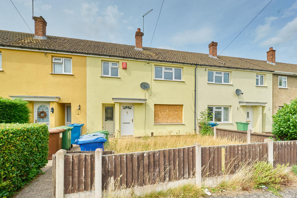

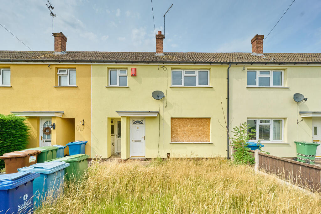
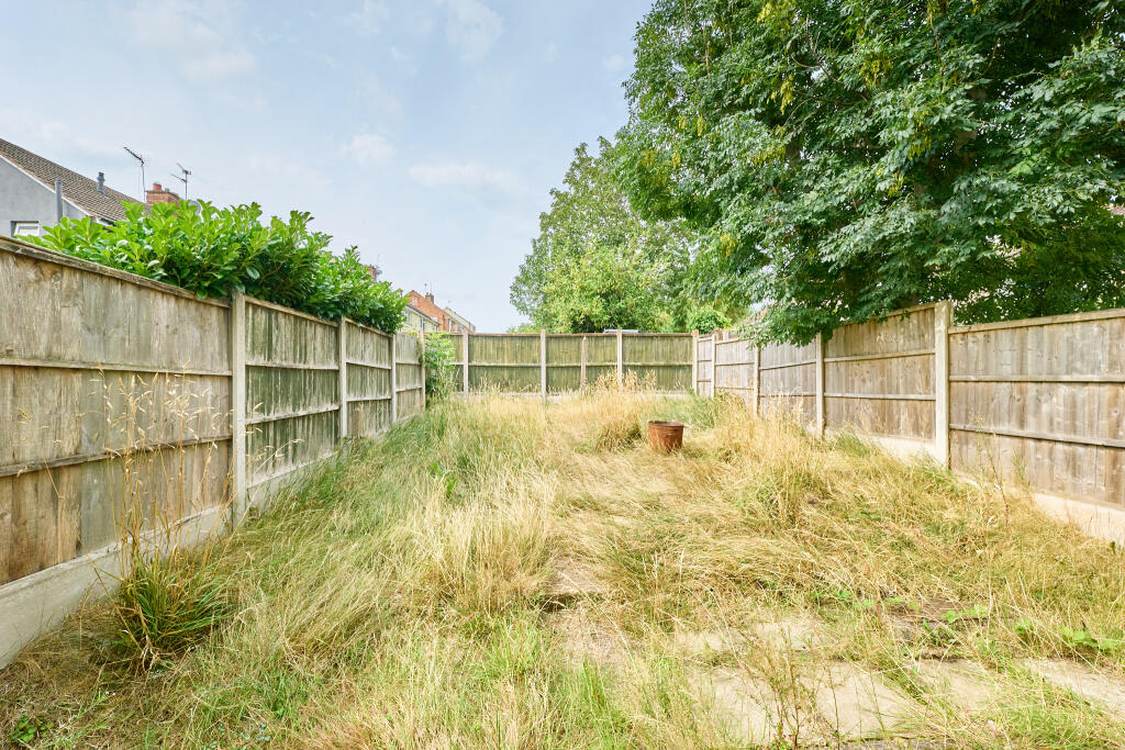
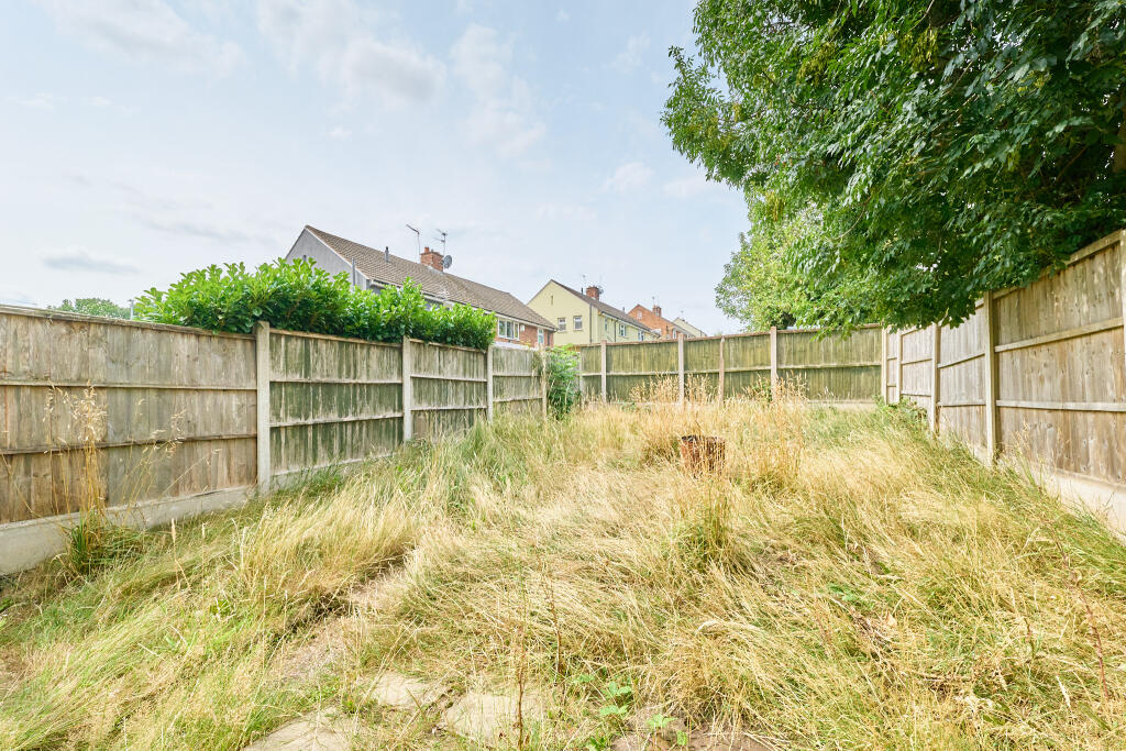
Property details
Listing category
Auction
Tenure
FREEHOLD
Council tax band
A
Deprivation
Decile 2 (3,569 of 33,755)
EPC ratings on this postcode
We don't have a matched EPC for this property yet. Below are efficiency scores and details for other addresses on this postcode.
| Address | Current | Potential | Floor area | Age band | Type |
|---|---|---|---|---|---|
| 29, Attlee Crescent, STAFFORD | 68 | 73 | 64 m² | England and Wales: 1950-1966 | Flat |
| 31 Attlee Crescent, STAFFORD | 74 | 76 | 60 m² | England and Wales: 1950-1966 | Flat |
| 33, Attlee Crescent, STAFFORD | 76 | 79 | 67 m² | England and Wales: 1950-1966 | Flat |
| 35 Attlee Crescent, STAFFORD | 81 | 82 | 71 m² | England and Wales: 1950-1966 | Flat |
| 35, Attlee Crescent, STAFFORD | 82 | 83 | 67 m² | England and Wales: 1950-1966 | Flat |
| 37, Attlee Crescent, STAFFORD | 74 | 76 | 67 m² | England and Wales: 1950-1966 | Flat |
| 38 ATTLEE CRESCENT, STAFFORD | 57 | 71 | 80 m² | England and Wales: 1950-1966 | Terraced |
| 42 Attlee Crescent, STAFFORD | 72 | 79 | 77 m² | England and Wales: 1950-1966 | Terraced |
| 44, Attlee Crescent, STAFFORD | 71 | 88 | 78 m² | England and Wales: 1950-1966 | Terraced |
| 47 Attlee Crescent, STAFFORD | 80 | 80 | 68 m² | England and Wales: 1950-1966 | Flat |
| 49, Attlee Crescent, STAFFORD | 75 | 76 | 68 m² | England and Wales: 1950-1966 | Flat |
| 55 Attlee Crescent, STAFFORD | 71 | 75 | 62 m² | England and Wales: 1950-1966 | Flat |
| 55, Attlee Crescent, STAFFORD | 72 | 79 | 63 m² | England and Wales: 1950-1966 | Flat |
| 59 Attlee Crescent, STAFFORD | 80 | 80 | 67 m² | England and Wales: 1950-1966 | Flat |
| 59, Attlee Crescent, STAFFORD | 76 | 78 | 68 m² | England and Wales: 1950-1966 | Flat |
Flood risk
Zone: 1
Risk: Low
Not in Flood Risk Area (no data)
Floorplans
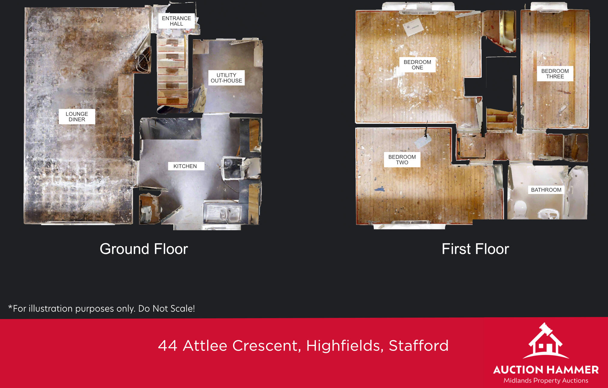
Floor Plan AH 44 Attlee Crescent Highfields Stafford T202508102203.jpg
Price history
No sales history found for this property in Land Registry Price Paid data.
Sold Comparables
Same street and nearby sales within 0.25 miles (last 5 years). Data from Land Registry Price Paid.
| Address | Price | Date | Type |
|---|---|---|---|
| 38 ATTLEE CRESCENT, STAFFORD, STAFFORDSHIRE, ST17 9RT | £165,000 | 16/12/2021 | Terraced |
Area average: £165,000 (1 sale)
Capital growth trend
Land Registry outcode average: last 12 months vs 5y and 10y ago (from sold prices).
House Price Index (HM Land Registry — official index, not sold-price averages): Stafford. Series: All dwelling types. As of March 2026.
Rental Range
Estimated market rent for Stafford. Low = conservative, Realistic = average, Optimistic = best case.
Based on Local Authority from postcode lookup → Stafford.
LHA (30th percentile) floor for Mid Staffs: £738/mo (Apr 2025 – Mar 2026)
Location
Nearby
Nearest stations, universities and amenities (distance from property).
| Type | Name | Distance |
|---|---|---|
| Bus stop | Attlee Crescent | 0.0 miles |
| Bus stop | Norfolk Way | 0.1 miles |
| Hospital | Rowley Hall Hospital | 0.4 miles |
| Shop | Morrisons Daily | 0.4 miles |
| Shop | Spar | 0.4 miles |
| Train station | Stafford | 1.0 miles |
| Hospital | St George's Hospital | 1.7 miles |
| University | Staffordshire University Blackheath Lane Site | 2.9 miles |
| Train station | Penkridge | 4.5 miles |
Street-level crime
Crime data is not yet available for this property.
Rental Comparables
Loading rental comparables for this postcode. Refresh in a few minutes.
Enter House Number
Enter the house number to help us retrieve more accurate pricing history and property data.
Please log in to submit or correct the house number for this listing.
Log in to continue