13 RADSTOCK ROAD
SOUTHAMPTON, SOUTHAMPTON SO19 2HN


Property details
Tenure
FREEHOLD
Floor area
127 m²
Council tax band
C
EPC rating
D
Year built
England and Wales: 1930-1949
Last sold
£250,000 Jul 2016
Price per m²
£2,756/m²
Local average
£304,781 (+14.8%)
Deprivation
Decile 2 (5,059 of 33,755)
Street crime
387 incidents within 1 mile (Apr 2026)
Key features
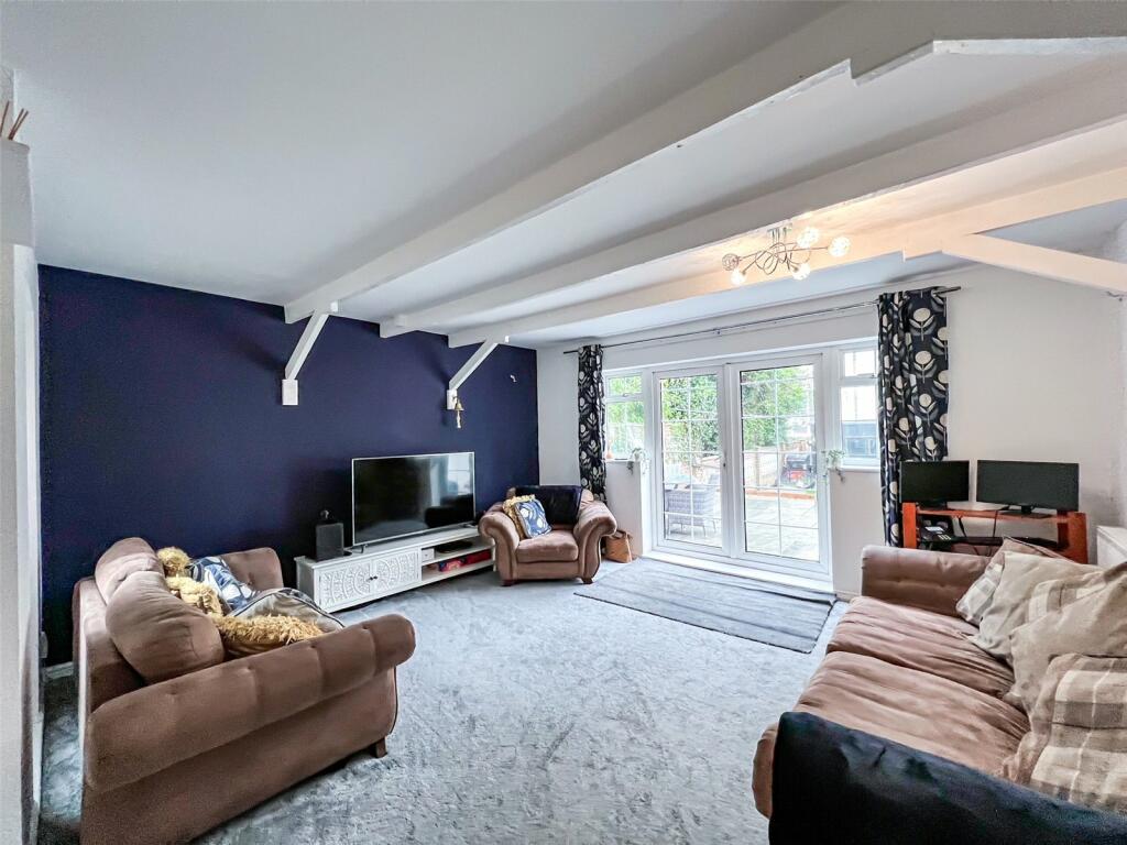
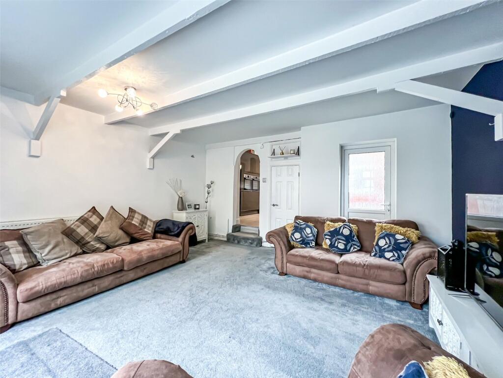
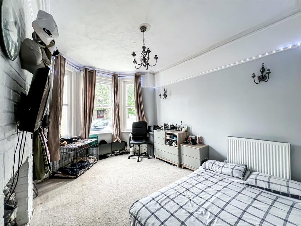
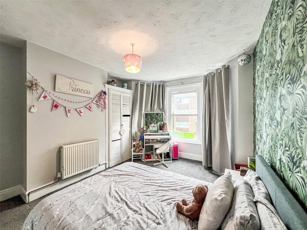
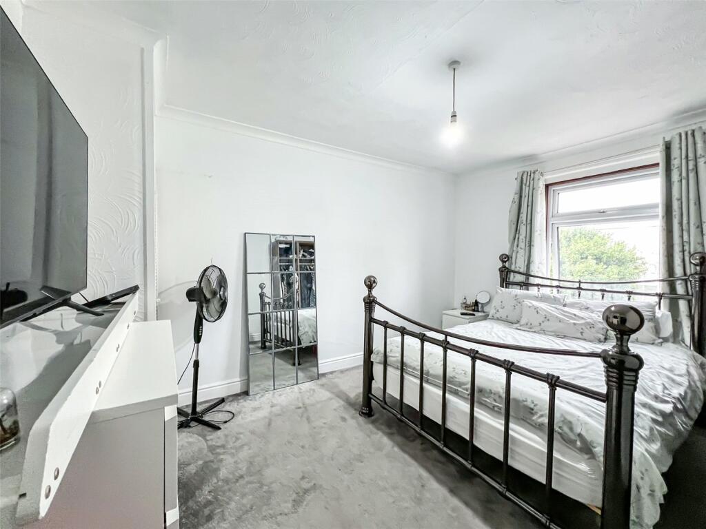
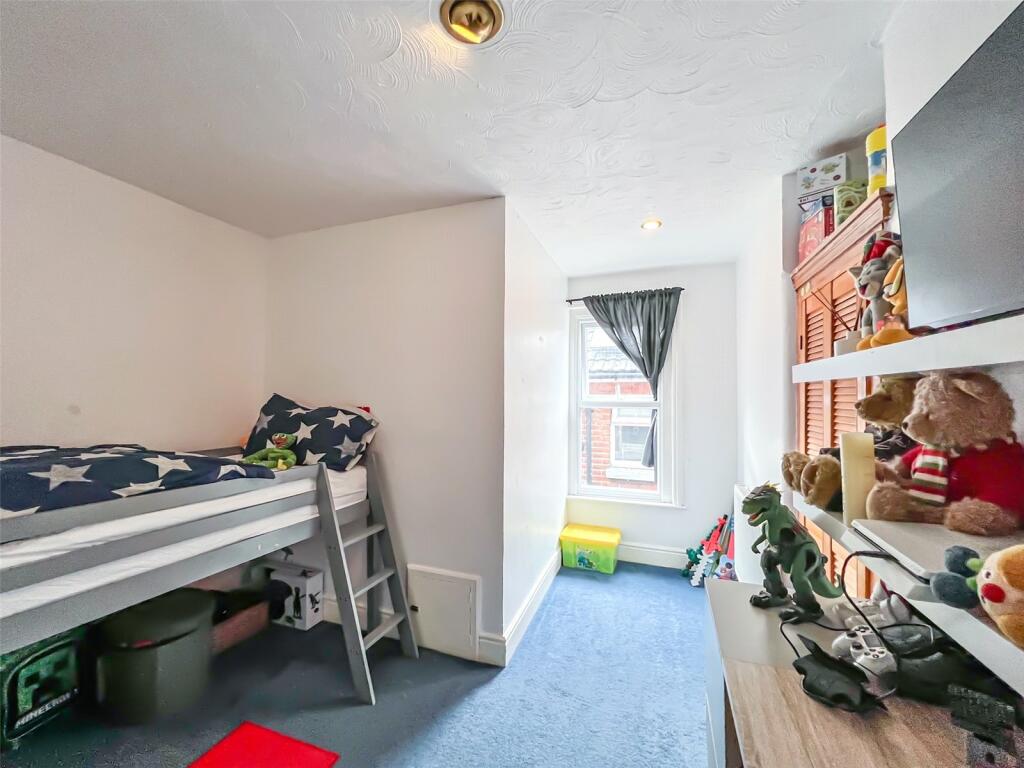
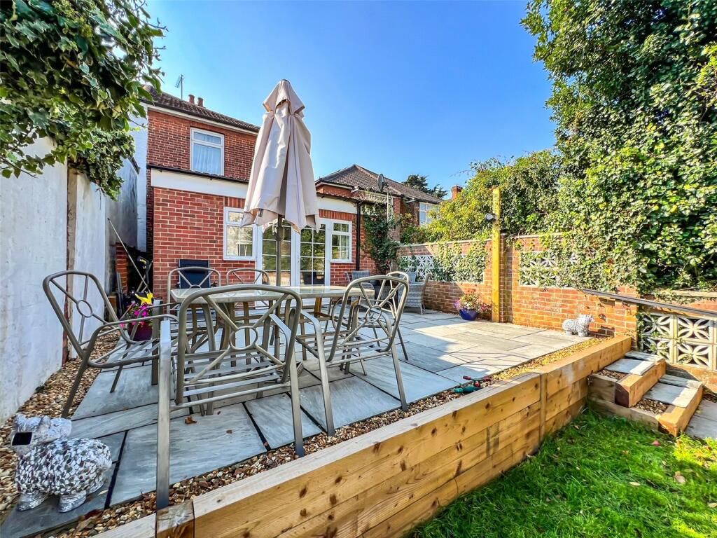
- Extended Semi Detached Family Home
- Three/Four Bedrooms Double Bedrooms
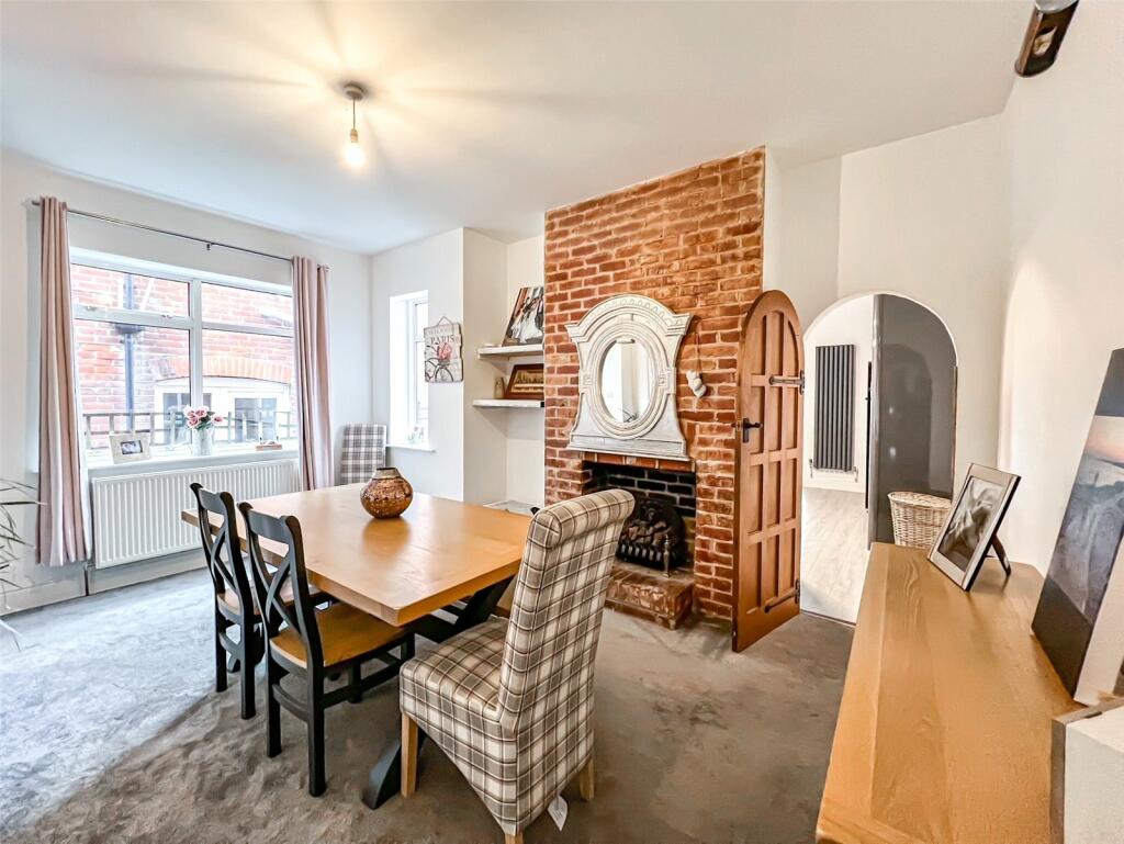
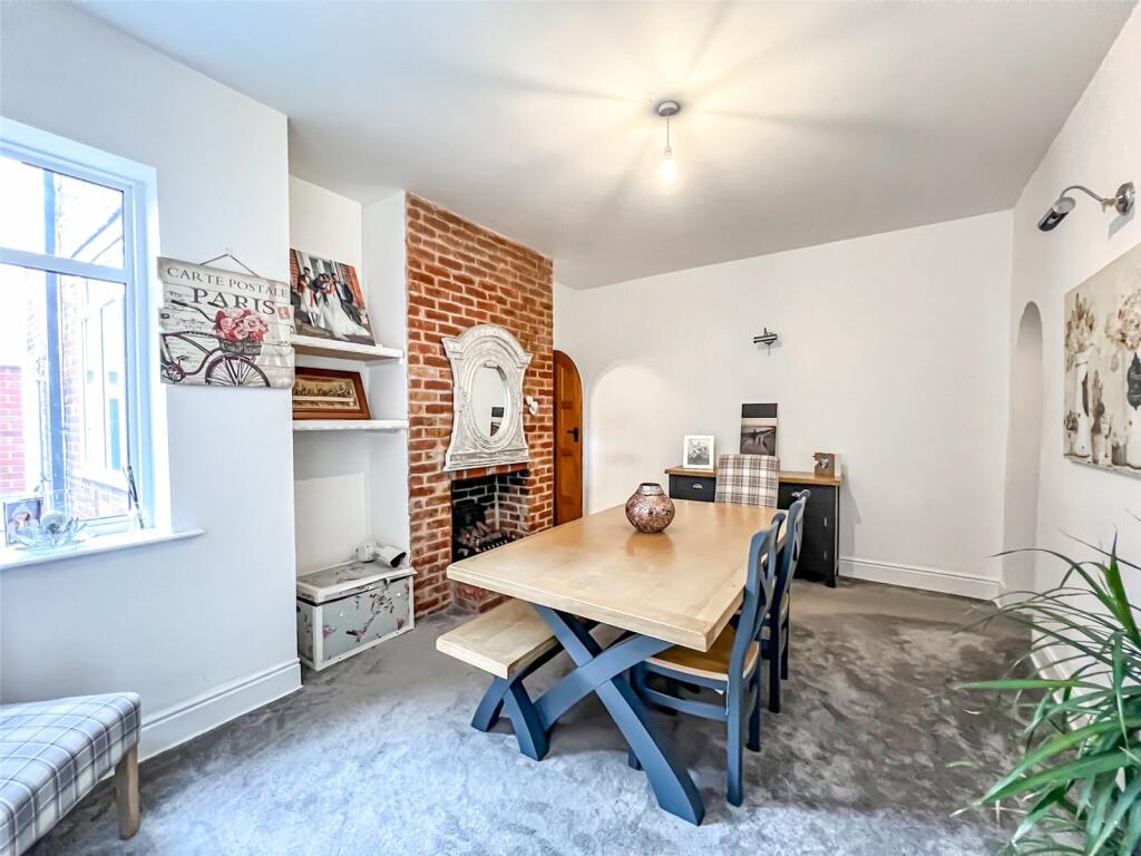
- Two/Three Reception Rooms
- 15ft Lounge & Dining Room
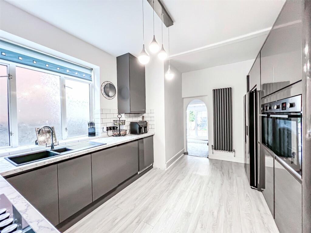
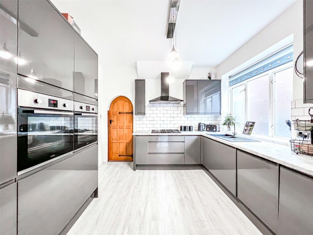
- Recently Refitted Kitchen and Bathroom
- Recently Fitted Boiler
- 13ft Master Bedroom
- Downstairs Cloakroom
- Double Glazing
- Off Road Parking
Additional details
- Parking
- Yes
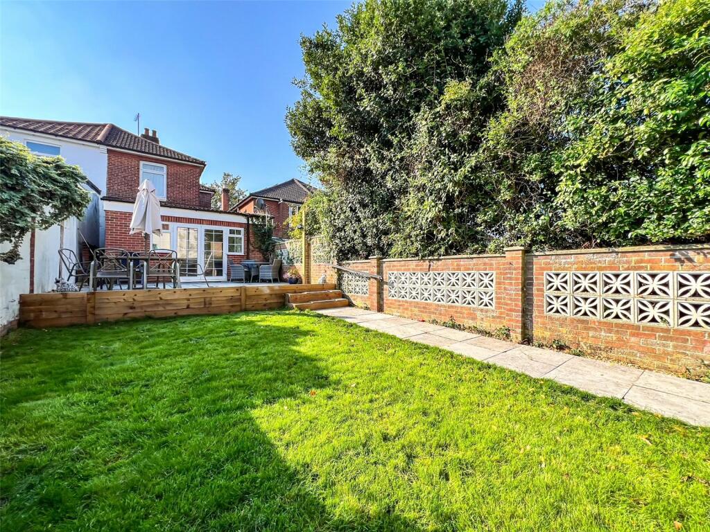
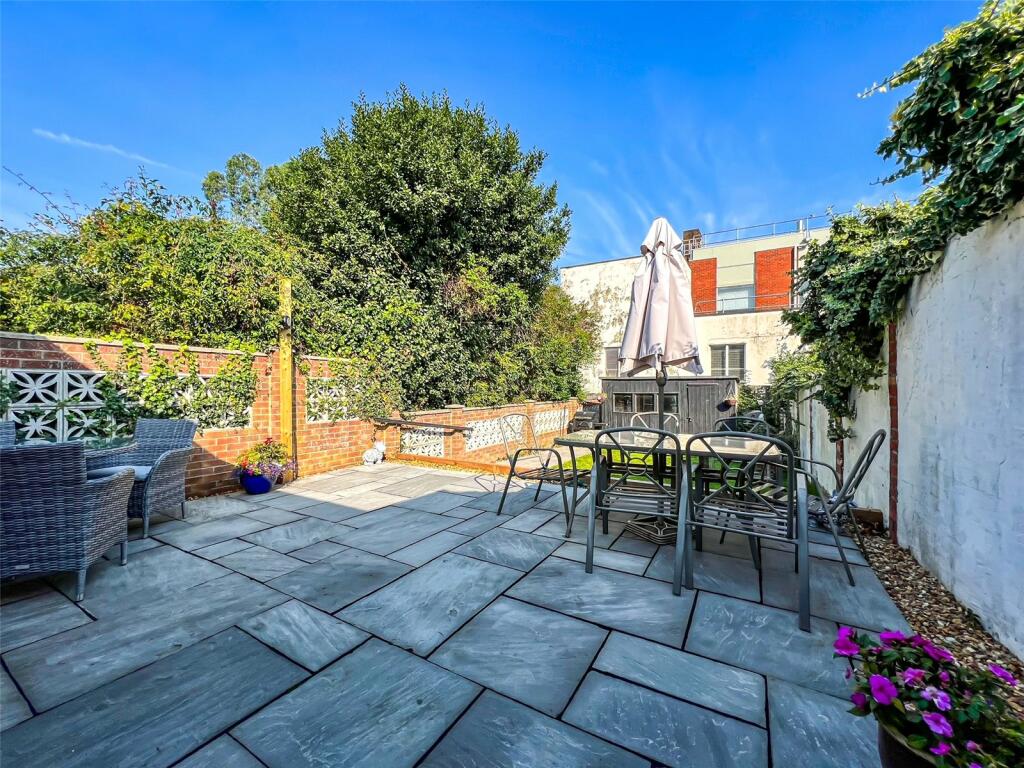
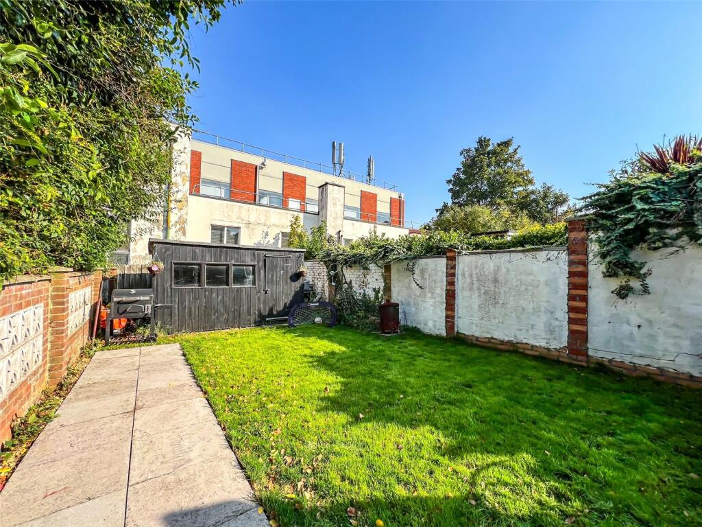
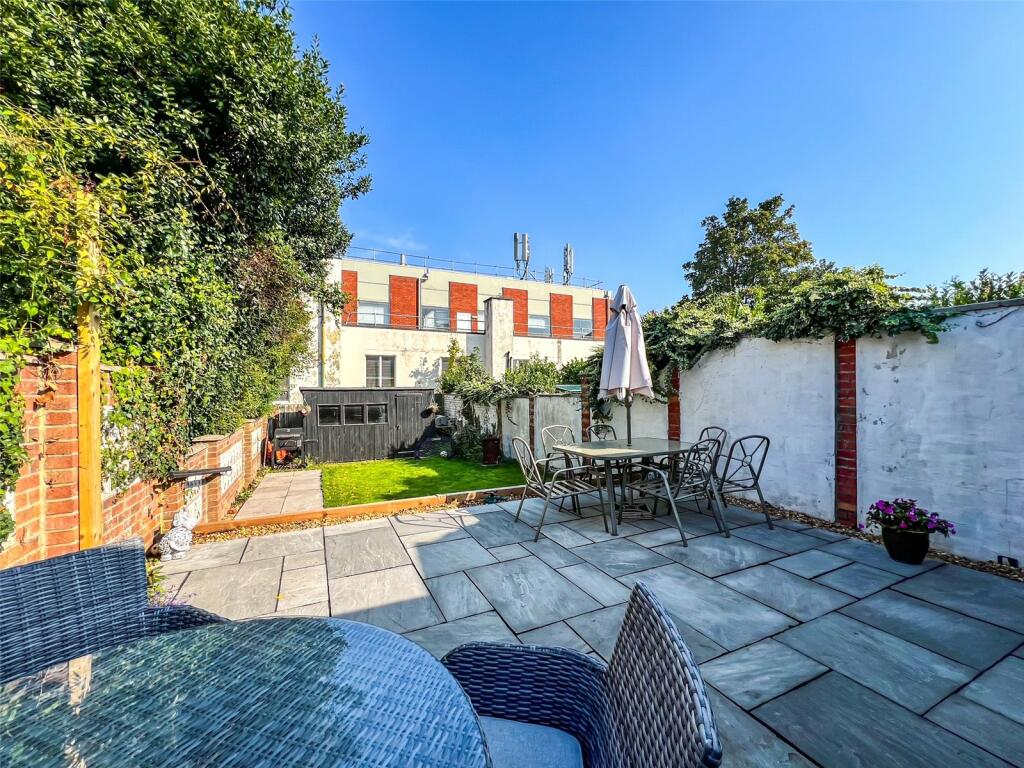
- Garden
- Yes
Description
Located in the highly requested area of Woolston, just around the corner from a small parade of shops including a local newsagent. You are also just a short walk from the local park with woodland walks and nature trails. You are also close to Weston Shore where you can see some of the world’s largest cruise ships coming into dock or setting sail. Woolston shopping precinct is close by with a wide range of shops and amenities. Newly built Centenary Quay offers a range of bars, restaurants and leisure facilities. Access to Southampton City centre is just a ten-minute drive away. Bus routes and Woolston train station are both within walking distance.
Listed by
Bitterne
Countrywide UK Sales - Connells
Reference: 153085937
EPC Rating & Upgrade Cost
Current rating: D
Potential rating: C
Inspection date: 06/01/2015
Expiry date: 05/01/2025 (expired)
Current heating cost: £881/year
Potential heating cost: £819/year
Recommendations
- Increase loft insulation to 270 mm (350)
- Floor insulation (suspended floor) (1,200)
- Low energy lighting for all fixed outlets (75)
- Solar water heating (6,000)
- Solar photovoltaic panels, 2.5 kWp (8,000)
Flood risk
Zone: 1
Risk: Low
Job (default Low)
Floorplans
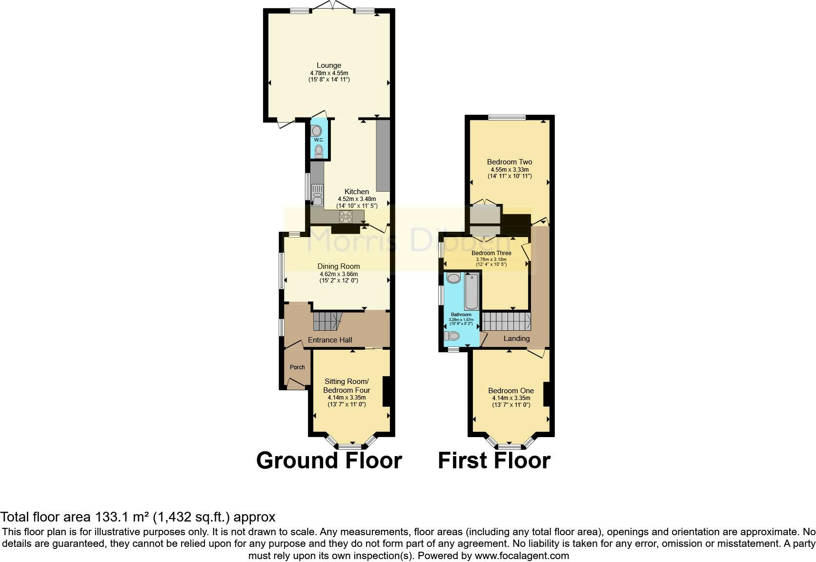
Floorplan
EPC Graphs
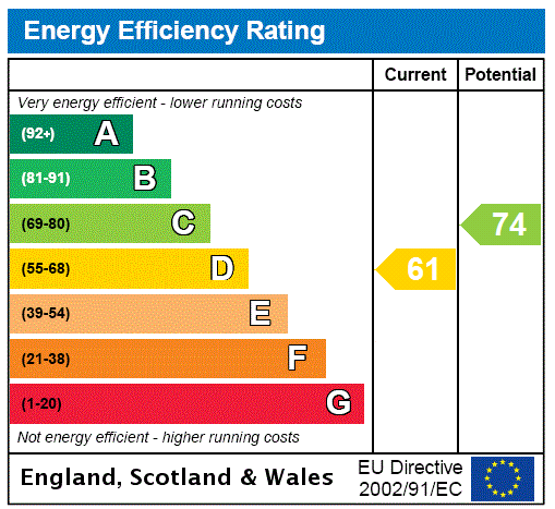
EPC Rating Graph
FENSA Certificates
This property has 2 FENSA certificate(s) on record, indicating window/door installations by FENSA-approved installers.
FENSA Certificate #11884059
Property Details
Street: 13 Radstock Road
Town: SOUTHAMPTON
Postcode: SO19 2HN
Installation Details
Items: 1 window
Certificate Issued: 11/10/2016
Work Completed: 31/08/2016
This certificate data was retrieved from FENSA's database
FENSA Certificate #14715090 Recent
Property Details
Street: 13 Radstock Road
Town: SOUTHAMPTON
Postcode: SO19 2HN
Installation Details
Items: 5 windows
Certificate Issued: 01/08/2021
Work Completed: 23/07/2021
This certificate data was retrieved from FENSA's database
What is FENSA? FENSA (Fenestration Self-Assessment Scheme) is a government-authorised scheme that monitors building regulation compliance for replacement windows and doors. Certificates indicate that work was completed by FENSA-approved installers.
Price history
| Event | Date | Price | % change |
|---|---|---|---|
| Sold | 01/07/2016 (9 years ago) | £250,000 | — |
Source: HM Land Registry Price Paid Data. Crown copyright.
Sold Comparables
Same street and nearby sales within 0.25 miles (last 5 years). Data from Land Registry Price Paid.
| Address | Price | Date | Type |
|---|---|---|---|
| Same street 3 RADSTOCK ROAD, SOUTHAMPTON, SO19 2HN | £175,000 | 23/06/2023 | Flat |
| Same street 7 RADSTOCK ROAD, SOUTHAMPTON, SO19 2HN | £350,000 | 09/06/2023 | Semi-detached |
| 44 BRIDGE ROAD, SOUTHAMPTON, SO19 7GQ | £290,000 | 30/11/2022 | Semi-detached |
| 8 AILSA LANE, SOUTHAMPTON, SO19 7GT | £250,000 | 18/11/2022 | Semi-detached |
| Same street 29B RADSTOCK ROAD, SOUTHAMPTON, SO19 2HN | £242,500 | 27/10/2022 | Terraced |
| 21 MANOR ROAD SOUTH, SOUTHAMPTON, SO19 2DP | £295,000 | 10/10/2022 | Semi-detached |
| 64 BRIDGE ROAD, SOUTHAMPTON, SO19 7GQ | £340,000 | 30/09/2022 | Semi-detached |
| 13 MANOR ROAD SOUTH, SOUTHAMPTON, SO19 2DP | £250,000 | 05/09/2022 | Semi-detached |
| 67 BRIDGE ROAD, SOUTHAMPTON, SO19 7GR | £260,000 | 06/05/2022 | Semi-detached |
| 16 SWANAGE CLOSE, SOUTHAMPTON, SO19 2EW | £204,000 | 15/10/2021 | Semi-detached |
| 60 BRIDGE ROAD, SOUTHAMPTON, SO19 7GQ | £315,000 | 16/08/2021 | Semi-detached |
Street average: £255,833 (3 sales)
Area average: £275,500 (8 sales)
Capital growth trend
Land Registry outcode average: last 12 months vs 5y and 10y ago (from sold prices).
House Price Index (HM Land Registry — official index, not sold-price averages): Southampton. Series: Semi-detached. As of March 2026.
Rental Range
Estimated market rent for Southampton. Low = conservative, Realistic = average, Optimistic = best case.
Based on Local Authority from postcode lookup → Southampton.
LHA (30th percentile) floor for Southampton: £1,446/mo (Apr 2025 – Mar 2026)
Location
Nearby
Nearest stations, universities and amenities (distance from property).
| Type | Name | Distance |
|---|---|---|
| Bus stop | The Drummond | 0.0 miles |
| Shop | Intruder Alert Systems Ltd | 0.1 miles |
| Shop | Bill's Bait & Tackle | 0.1 miles |
| Bus stop | Norton Close | 0.1 miles |
| Train station | Woolston | 0.1 miles |
| Train station | Sholing | 0.6 miles |
| University | Warsash Maritime Acadmeny | 0.8 miles |
| University | Waterfront Campus | 1.0 miles |
| Hospital | Royal South Hants Urgent Treatment Centre | 1.3 miles |
| Hospital | Royal South Hants Hospital | 1.3 miles |
Street-level crime
| Category | Count |
|---|---|
| Violence and sexual offences | 150 |
| Shoplifting | 69 |
| Criminal damage and arson | 35 |
| Anti-social behaviour | 29 |
| Other theft | 26 |
| Public order | 20 |
| Vehicle crime | 13 |
| Drugs | 12 |
| Other crime | 11 |
| Burglary | 10 |
| Possession of weapons | 5 |
| Bicycle theft | 4 |
| Robbery | 2 |
| Theft from the person | 1 |
| Total incidents | 387 |
Within 1 mile during Apr 2026. Source: data.police.uk (England & Wales).
Schools nearby
Nearest open schools with Ofsted ratings (England). Closed schools are not shown. Data from Get Information about Schools and Ofsted.
| Name | Type | Distance | Ofsted |
|---|---|---|---|
| St Patrick's Catholic Primary School | Primary | 0.2 miles | Good — 20 Jul 2015 |
| Ludlow Infant Academy | Primary | 0.2 miles | Good — 7 Nov 2018 |
| Ludlow Junior School | Primary | 0.3 miles | Good — 1 Feb 2012 |
| Woolston Infant School | Primary | 0.3 miles | Good — 18 Dec 2014 |
| Oasis Academy Sholing | Secondary | 0.8 miles | Requires improvement — 1 Dec 2022 |
Rental Comparables
Rental listings exist nearby, but none matched the 4-bedroom count for this property.
Rent-driven metrics
Based on Area rent estimate.
- Rent ratio — Monthly rent ÷ purchase price (1% rule). 1%+ = strong, 0.8–1% = okay, <0.8% = weak for cashflow.
- Max investor price — Rent ÷ 0.8%; the price at which rent would be 0.8% of price (Stoke-style target).
- Target investor price — Rent ÷ 1%; the price at which rent would be 1% of price (strong cashflow band).
- Gross yield — Annual rent as % of purchase price (no costs).