High Road Leytonstone
Lyeton, London, E11, E11 3HS
£1,750 pcm
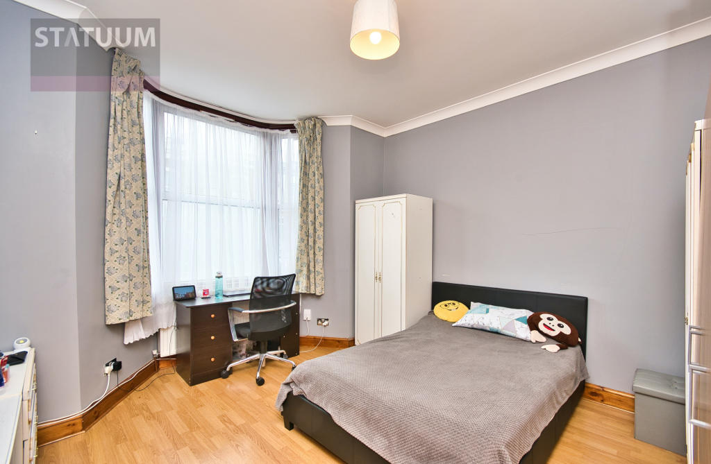
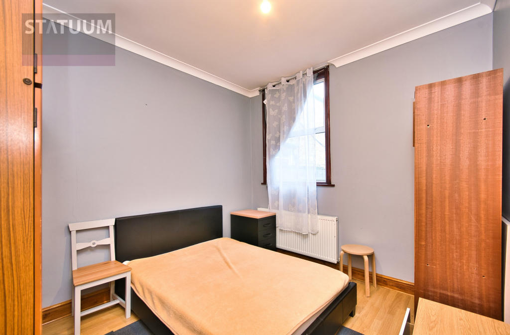
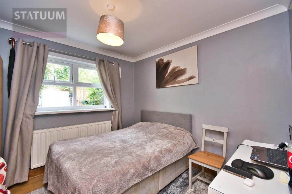
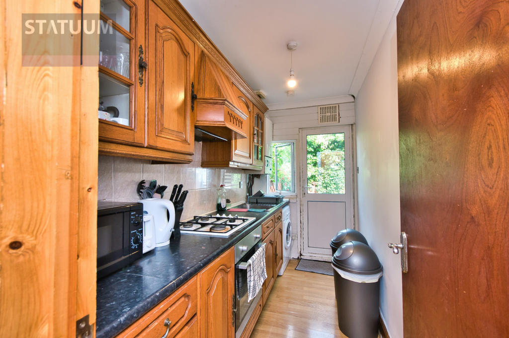
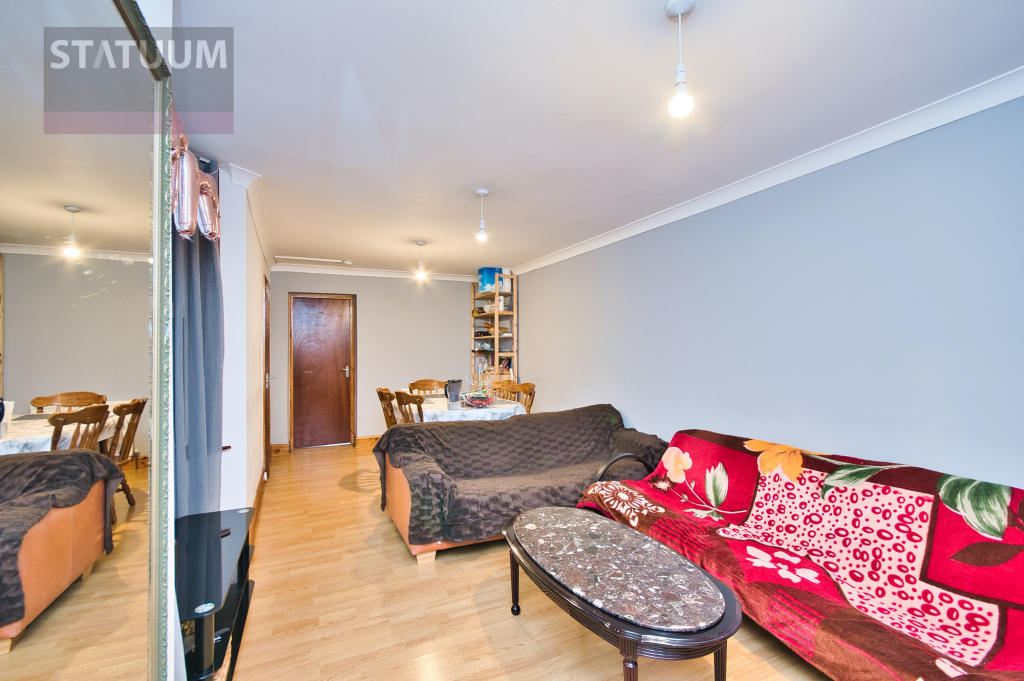
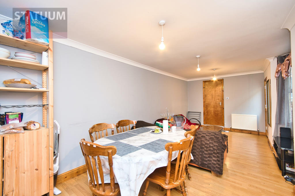
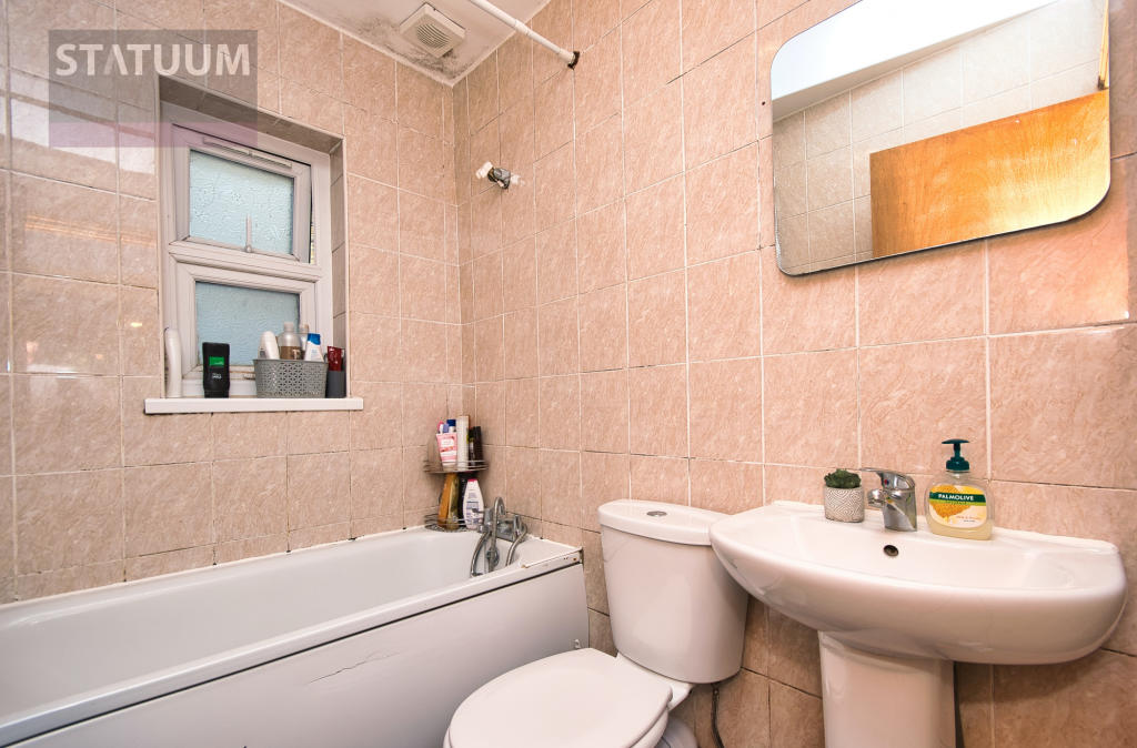
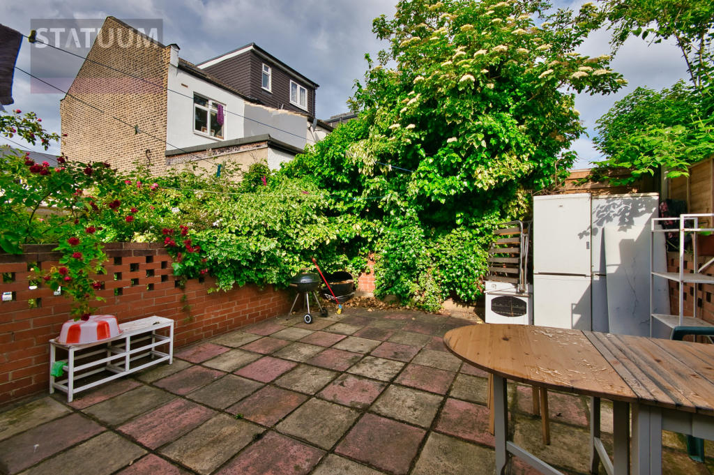
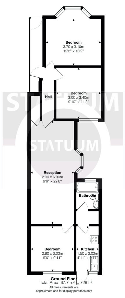
Photo 1 Photo 2 Photo 3 Photo 4 Photo 5 Photo 6 Photo 7 Photo 8 Photo 9
/ 9
Property details
Deprivation
Decile 4 (10,531 of 33,755)
Street crime
1245 incidents within 1 mile (Apr 2026)
Key features
- Shops and amenities nearby
- Fitted Kitchen
- Double glazing
- Close to public transport
- Modern Decor
- Viewing Advised
- Prviate Garden
- Period Features
- Bright and Airy
Additional details
- Garden
- Yes
Description
This light bright and airy ground floor flat has been modernised to a very high standard and consisting of all three double bedrooms, bathroom suite, large separate lounge and dining area, fully fitted galley kitchen, beautiful private rear garden, throughout neutrally painted and decorated, laminated flooring, double glazing and available from 22nd of June 2022, as part-furnished. Suitable for families.
Rent £ 1,850.00 PCM excluding bills.
Deposit £ 1,850.00
Nearest Stations are Leyton/Leytonstone Underground Station. Also short journey away from Stratford Olympic and Leyton Mill Shopping area.
Listed by
London
Statuum Ltd
Reference: 123610172
EPC Rating & Upgrade Cost
Fetching EPC data… Refresh this page in a moment.
Flood risk
Zone: 1
Risk: Low
Job (default Low)
Floorplans
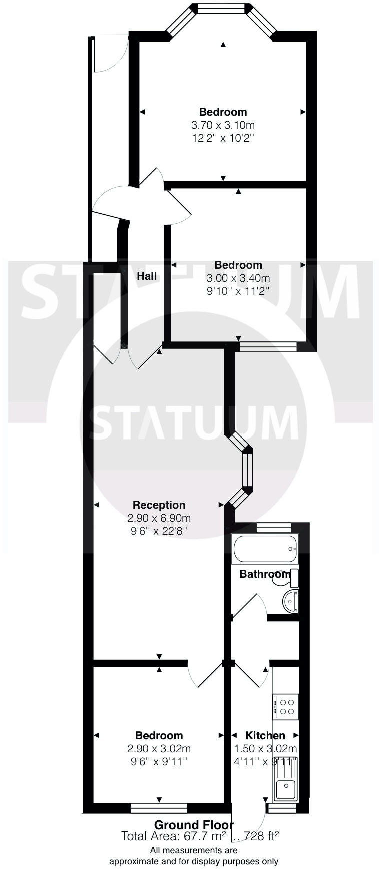
Floorplan 1
EPC Graphs
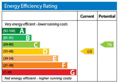
EPC Graph
Rental Range
Estimated market rent for Waltham Forest. Low = conservative, Realistic = average, Optimistic = best case.
Based on Local Authority from postcode lookup → Waltham Forest.
LHA (30th percentile) floor for Outer East London: £1,670/mo (Apr 2025 – Mar 2026)
Location
Address
88 Birch Grove
Nearby
Nearest stations, universities and amenities (distance from property).
| Type | Name | Distance |
|---|---|---|
| Shop | Gospodina Magazin Românesc | 0.0 miles |
| Shop | Barber Shop | 0.0 miles |
| Bus stop | Ranelagh Road | 0.0 miles |
| Train station | Leyton | 0.4 miles |
| Train station | Leytonstone High Road | 0.6 miles |
| University | University of East London | 0.9 miles |
| University | Arden University Stratford Campus | 1.1 miles |
| Hospital | Rainbow Ward | 2.6 miles |
| Hospital | A&E Department | 2.6 miles |
Street-level crime
| Category | Count |
|---|---|
| Anti-social behaviour | 302 |
| Violence and sexual offences | 243 |
| Shoplifting | 168 |
| Other theft | 111 |
| Vehicle crime | 77 |
| Theft from the person | 71 |
| Public order | 65 |
| Burglary | 52 |
| Drugs | 50 |
| Criminal damage and arson | 47 |
| Robbery | 24 |
| Possession of weapons | 18 |
| Other crime | 10 |
| Bicycle theft | 7 |
| Total incidents | 1245 |
Within 1 mile during Apr 2026. Source: data.police.uk (England & Wales).
Schools nearby
Nearest open schools with Ofsted ratings (England). Closed schools are not shown. Data from Get Information about Schools and Ofsted.
| Name | Type | Distance | Ofsted |
|---|---|---|---|
| The Jenny Hammond Primary School | Primary | 0.1 miles | Good — 23 Apr 2012 |
| Downsell Primary School | Primary | 0.2 miles | Good — 29 Jan 2024 |
| Mayville Primary School | Primary | 0.3 miles | Good — 12 Jun 2024 |
| Education Links | Other | 0.4 miles | Good — 11 Sep 2017 |
| Acacia Nursery | Nursery | 0.4 miles | Outstanding — 24 Jul 2023 |
Rental Comparables
Rental comparables are temporarily unavailable while listing-site fetches are paused. Try again later.