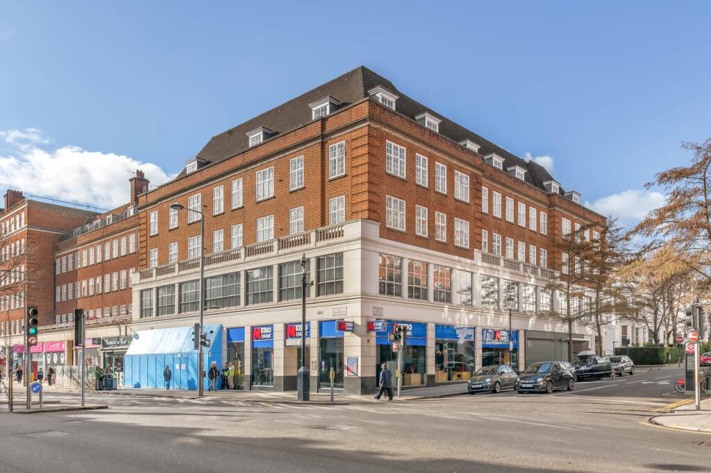
FLAT G
DAVIS COURT, ARGYLL ROAD, LONDON, GREATER LONDON W8 7BQ
£1,750,000
Property details
Tenure
LEASEHOLD (120 years remaining on lease)
Floor area
127 m²
Council tax band
G
Year built
England and Wales: 1930-1949
Last sold
£1,670,000 Jul 2025
Price per m²
£13,780/m²
Local average
£1,975,089 (-11.4%)
Deprivation
Decile 9 (27,934 of 33,755)
Street crime
1010 incidents within 1 mile (Apr 2026)
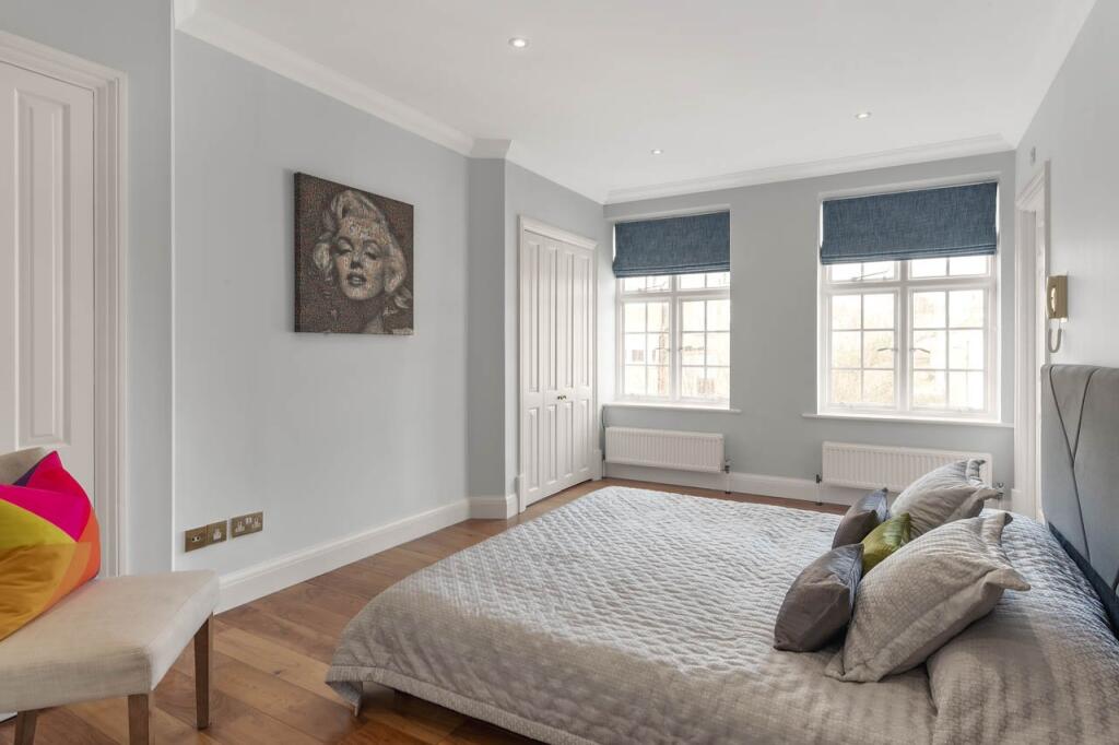
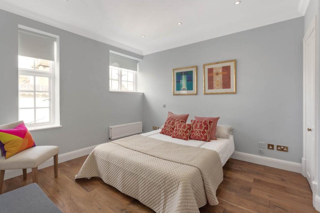
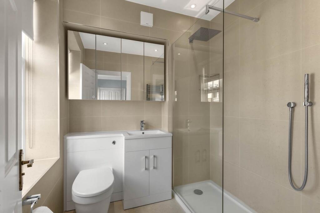
Key features
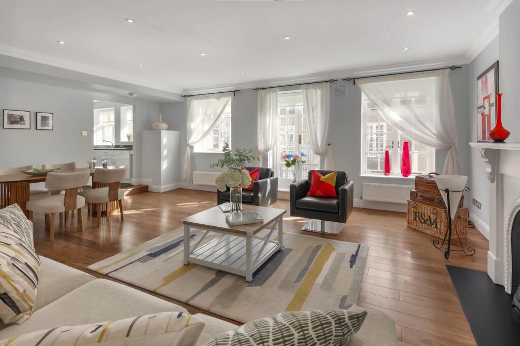
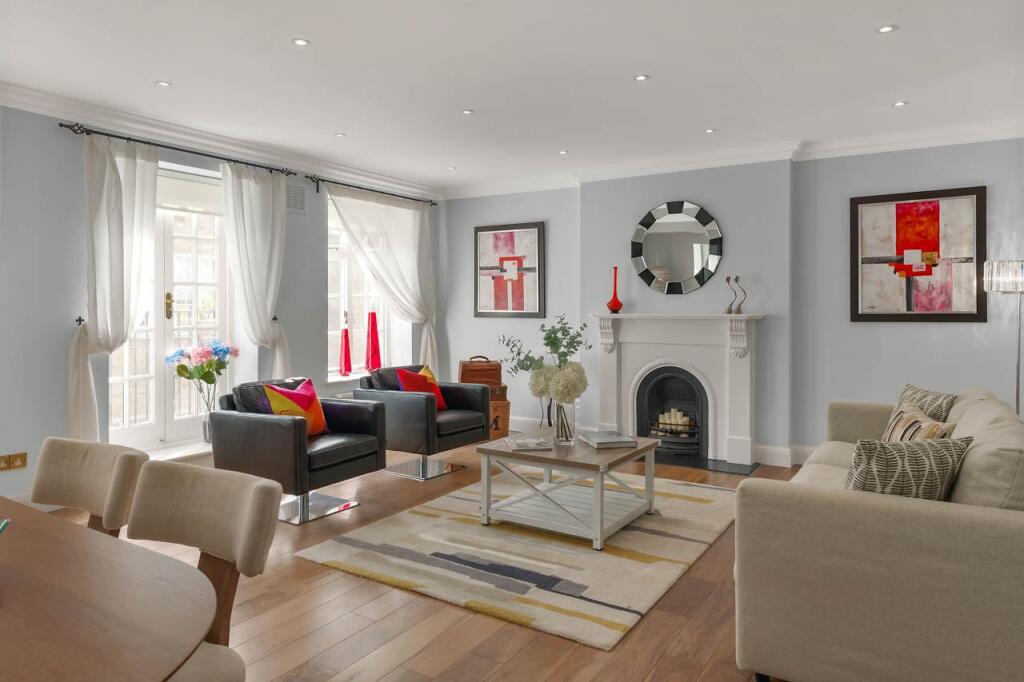
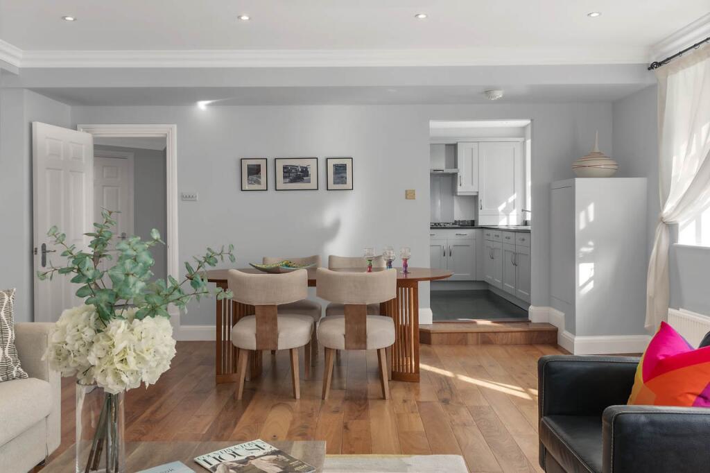
- Entrance hall
- Reception room
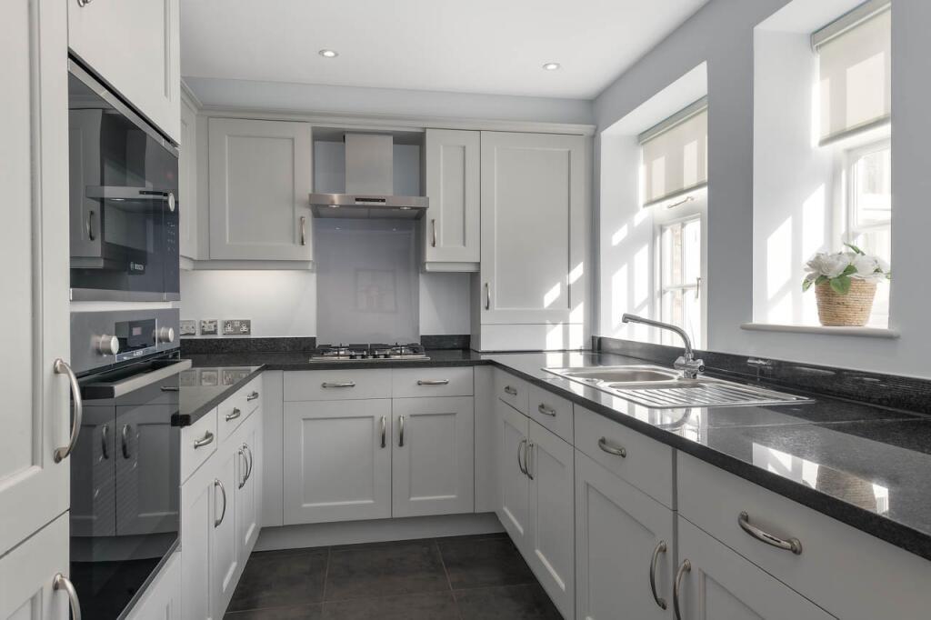
- Kitchen
- Three bedrooms
- Three bathrooms
- Balcony
- Lift
Description
The reception room has French doors opening on to a balcony terrace. The bedroom accommodation offers two double bedrooms with en suite bathrooms, a further bedroom and bathroom.
Davis Court is in an extremely convenient location, just moments from all the shops, restaurants and transport amenities along Kensington High Street. The beautiful open spaces of Holland Park and Hyde Park are a short distance away.
Listed by
Kensington
BNP Paribas - Strutt & Parker
Reference: 164695481
EPC Rating & Upgrade Cost
Fetching EPC data… Refresh this page in a moment.
Flood risk
Zone: 1
Risk: Low
Job (default Low)
Floorplans
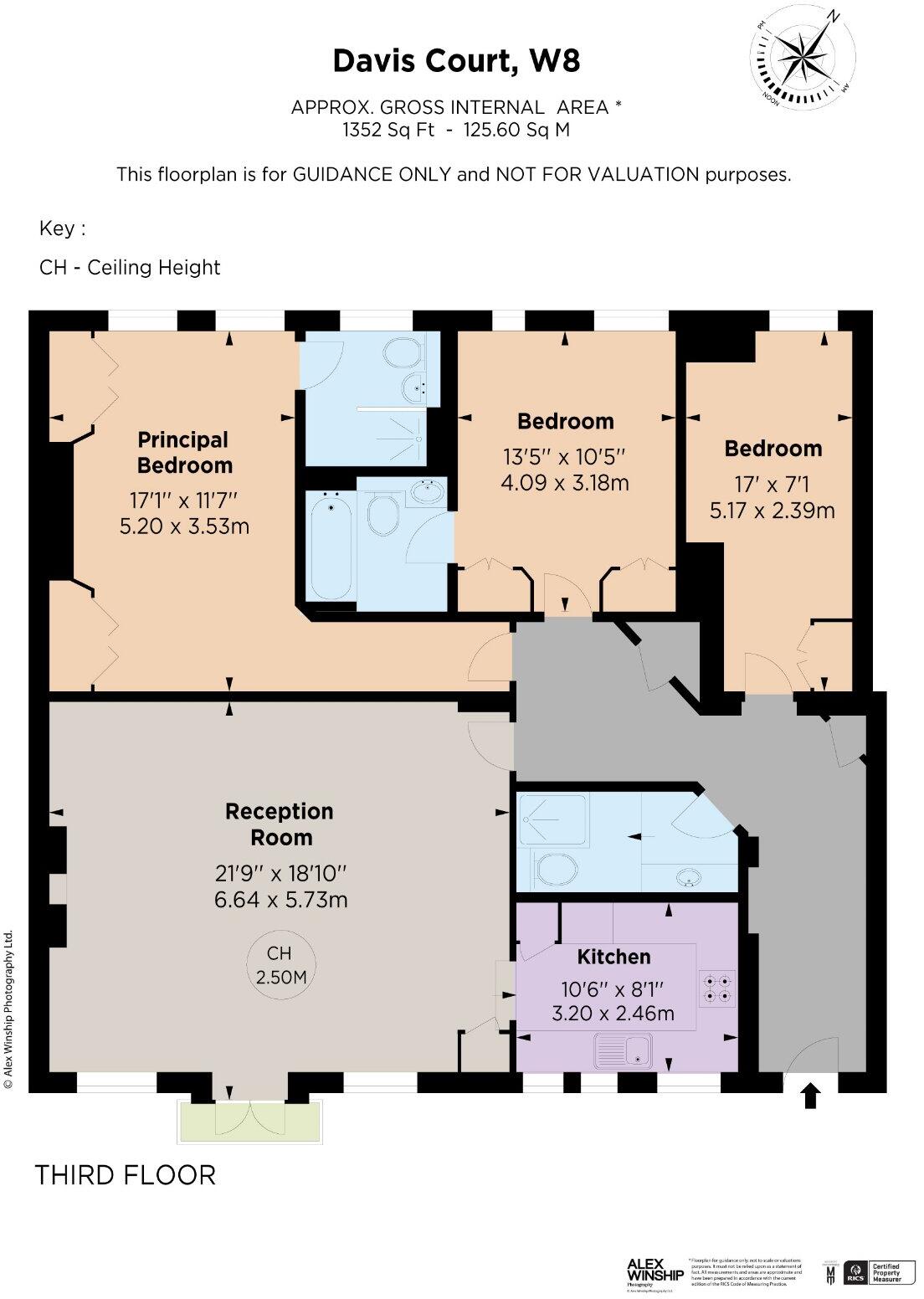
Picture No. 02
EPC Graphs
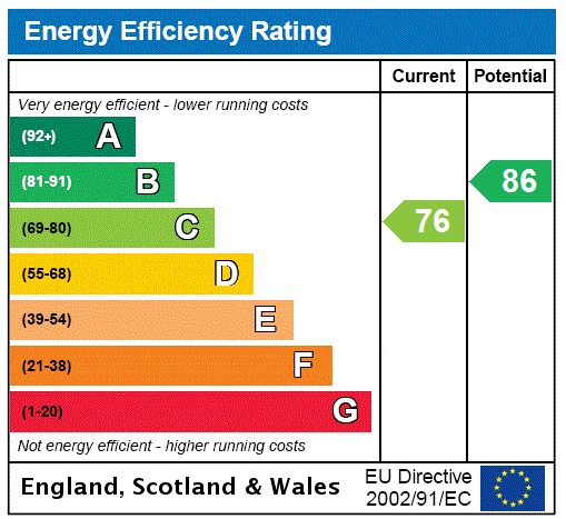
EPC Rating Graph
Price history
255% since 1999
| Event | Date | Price | % change |
|---|---|---|---|
| Sold | 11/07/2025 (11 months ago) | £1,670,000 | +255.3% |
| Sold | 15/04/1999 (27 years ago) | £470,000 | — |
Source: HM Land Registry Price Paid Data. Crown copyright.
Sold Comparables
Same street and nearby sales within 0.25 miles (last 5 years). Data from Land Registry Price Paid.
| Address | Price | Date | Type |
|---|---|---|---|
| STAFFORD COURT FLAT 22A KENSINGTON HIGH STREET, LONDON, KENSINGTON AND CHELSEA, GREATER LONDON, W8 7DJ | £475,000 | 28/09/2023 | Flat |
| PHILLIMORE COURT 2 KENSINGTON HIGH STREET, LONDON, KENSINGTON AND CHELSEA, GREATER LONDON, W8 7DS | £2,000,000 | 05/05/2023 | Flat |
| Same street DAVIS COURT FLAT E ARGYLL ROAD, LONDON, KENSINGTON AND CHELSEA, GREATER LONDON, W8 7BQ | £900,000 | 03/02/2023 | Flat |
| Same street DAVIS COURT FLAT P ARGYLL ROAD, LONDON, KENSINGTON AND CHELSEA, GREATER LONDON, W8 7BQ | £1,150,000 | 24/06/2022 | Flat |
| 5 FLAT 2 STAFFORD TERRACE, LONDON, KENSINGTON AND CHELSEA, GREATER LONDON, W8 7BJ | £410,000 | 12/04/2022 | Flat |
| 10 FLAT 1 STAFFORD TERRACE, LONDON, KENSINGTON AND CHELSEA, GREATER LONDON, W8 7BH | £1,625,251 | 25/02/2022 | Flat |
| STAFFORD COURT FLAT 12 KENSINGTON HIGH STREET, LONDON, KENSINGTON AND CHELSEA, GREATER LONDON, W8 7DJ | £1,650,000 | 30/06/2021 | Flat |
Street average: £1,025,000 (2 sales)
Area average: £1,232,050 (5 sales)
Capital growth trend
Land Registry outcode average: last 12 months vs 5y and 10y ago (from sold prices).
House Price Index (HM Land Registry — official index, not sold-price averages): Kensington and Chelsea. Series: Flats and maisonettes. As of March 2026.
Rental Range
Estimated market rent for Kensington and Chelsea. Low = conservative, Realistic = average, Optimistic = best case.
Based on Local Authority from postcode lookup → Kensington and Chelsea.
LHA (30th percentile) floor for Central London: £2,154/mo (Apr 2025 – Mar 2026)
Location
Address
1b Argyll Road
Nearby
Nearest stations, universities and amenities (distance from property).
| Type | Name | Distance |
|---|---|---|
| Shop | Luna Mart | 0.0 miles |
| Shop | Robert Dyas | 0.0 miles |
| Bus stop | Phillimore Gardens | 0.1 miles |
| Train station | High Street Kensington | 0.2 miles |
| University | Richmond University (Kensington Campus) | 0.4 miles |
| University | University of Westminster | 0.4 miles |
| Hospital | Cromwell Hospital | 0.4 miles |
| Train station | Notting Hill Gate | 0.6 miles |
| Hospital | Royal Brompton Hospital | 1.2 miles |
Street-level crime
| Category | Count |
|---|---|
| Anti-social behaviour | 227 |
| Violence and sexual offences | 217 |
| Other theft | 128 |
| Vehicle crime | 75 |
| Theft from the person | 64 |
| Shoplifting | 63 |
| Public order | 61 |
| Burglary | 52 |
| Drugs | 34 |
| Criminal damage and arson | 31 |
| Bicycle theft | 26 |
| Robbery | 13 |
| Possession of weapons | 10 |
| Other crime | 9 |
| Total incidents | 1010 |
Within 1 mile during Apr 2026. Source: data.police.uk (England & Wales).
Schools nearby
Nearest open schools with Ofsted ratings (England). Closed schools are not shown. Data from Get Information about Schools and Ofsted.
| Name | Type | Distance | Ofsted |
|---|---|---|---|
| St Mary Abbots CofE Primary School | Primary | 0.2 miles | Good — 8 Dec 2014 |
| St Barnabas and St Philip's CofE Primary School | Primary | 0.2 miles | Good — 11 Jun 2024 |
| Ashbourne College | Other | 0.3 miles | Outstanding — 31 Jan 2022 |
| Thomas's Kensington | Other | 0.4 miles | — (No rating) |
| Holland Park School | Secondary | 0.4 miles | Inadequate — 16 Jun 2022 |
Rental Comparables
Rental listings exist nearby, but none matched the 3-bedroom count for this property.
Rent-driven metrics
Based on Area rent estimate.
- Rent ratio — Monthly rent ÷ purchase price (1% rule). 1%+ = strong, 0.8–1% = okay, <0.8% = weak for cashflow.
- Max investor price — Rent ÷ 0.8%; the price at which rent would be 0.8% of price (Stoke-style target).
- Target investor price — Rent ÷ 1%; the price at which rent would be 1% of price (strong cashflow band).
- Gross yield — Annual rent as % of purchase price (no costs).