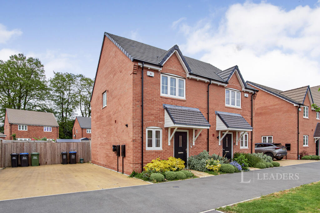
5 THOMAS BATES ROAD
KENILWORTH, WARWICKSHIRE CV8 2BT
£1,475 pcm
Property details
Floor area
66 m²
Council tax band
C
Deprivation
Decile 9 (29,995 of 33,755)
Street crime
67 incidents within 1 mile (Mar 2026)
Key features
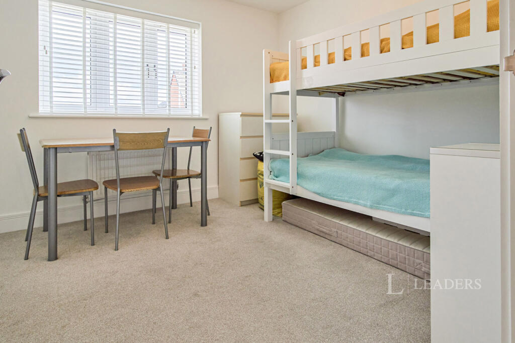
- Two Bedrooms
- Available 27th May
- Unfurnished
- New Build
- EV Charger
- Driveway
Additional details
- Parking
- Yes
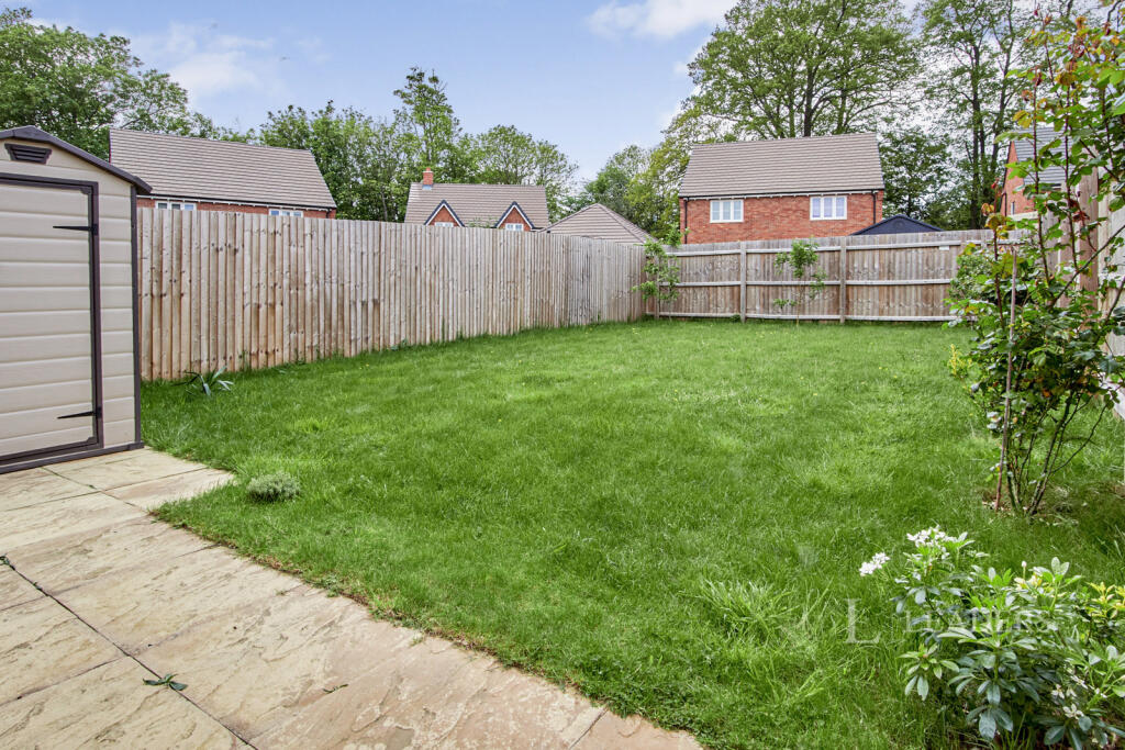
- Garden
- Yes
Description
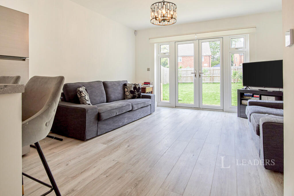
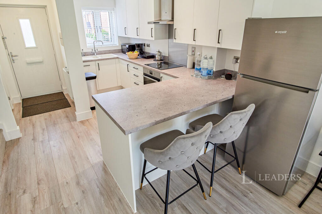
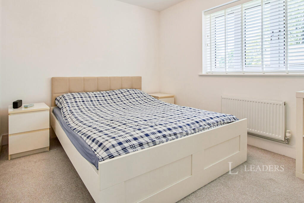
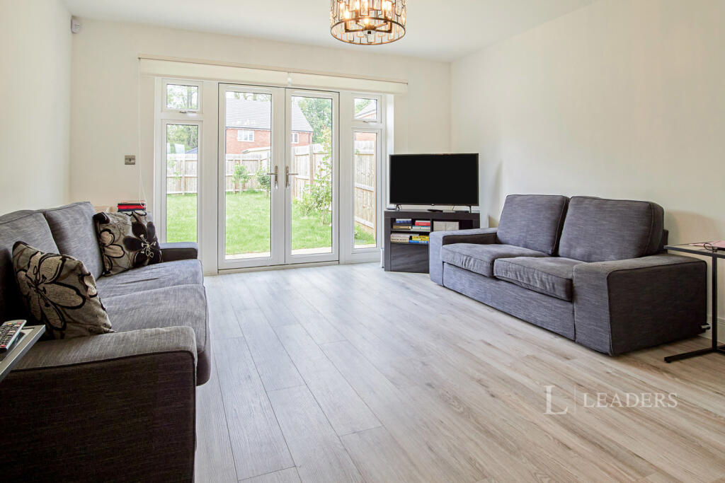
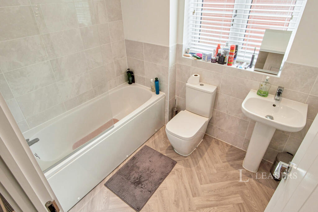
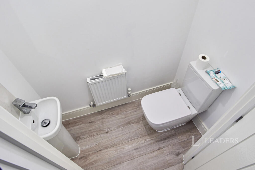
The property briefly comprises of an entrance hall with downstairs w/c, an open plan lounge connecting to the kitchen with a breakfast bar, and large double doors opening to the rear garden allowing plenty of natural light. Upstairs includes a family bathroom and two double bedrooms with built in storage.
EPC Rating: B
Council Tax Band: C
Flood Risk: Very Low
Broadband: Three
The rent excludes the tenancy deposit and any further permitted charges. A holding deposit of £340.38 based on the advertised rent is required to secure the property. Deposit payable is £1,701.92. This property is available unfurnished throughout. Available 27th of May
Listed by
Kenilworth
Leaders and Romans Group
Reference: 88171776
EPC Rating & Upgrade Cost
Fetching EPC data… Refresh this page in a moment.
Flood risk
Zone: 1
Risk: Low
Job (default Low)
Floorplans
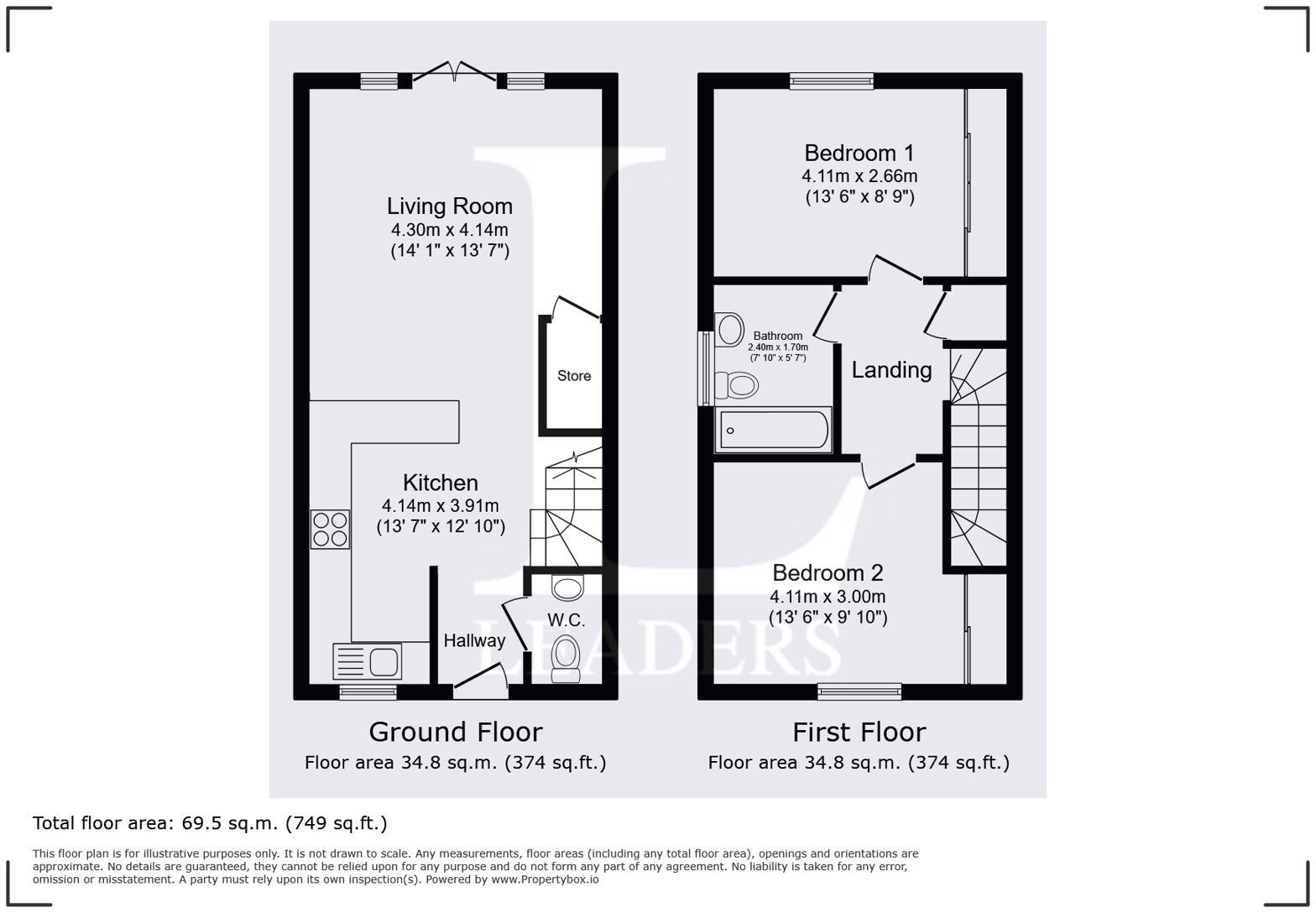
Floorplan
EPC Graphs
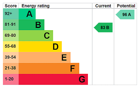
EPC Rating Graph
Rental Range
Estimated market rent for Warwick. Low = conservative, Realistic = average, Optimistic = best case.
Based on Local Authority from postcode lookup → Warwick.
LHA (30th percentile) floor for Coventry: £673/mo (Apr 2025 – Mar 2026)
Location
Nearby
Nearest stations, universities and amenities (distance from property).
| Type | Name | Distance |
|---|---|---|
| Bus stop | Thickthorn Island | 0.2 miles |
| Bus stop | Ferndale Drive | 0.2 miles |
| Shop | Londis | 0.4 miles |
| Train station | Kenilworth | 0.6 miles |
| Shop | Ryman | 0.7 miles |
| University | Centre for Interdisciplinary Methodologies | 3.2 miles |
| Train station | Warwick | 3.4 miles |
| University | Unknown | 5.7 miles |
| Hospital | George Elliot Medical Centre | 6.4 miles |
Street-level crime
| Category | Count |
|---|---|
| Violence and sexual offences | 26 |
| Anti-social behaviour | 9 |
| Shoplifting | 8 |
| Burglary | 7 |
| Other theft | 7 |
| Public order | 4 |
| Criminal damage and arson | 3 |
| Bicycle theft | 1 |
| Drugs | 1 |
| Vehicle crime | 1 |
| Total incidents | 67 |
Within 1 mile during Mar 2026. Source: data.police.uk (England & Wales).
Schools nearby
Nearest open schools with Ofsted ratings (England). Closed schools are not shown. Data from Get Information about Schools and Ofsted.
| Name | Type | Distance | Ofsted |
|---|---|---|---|
| Thorns Community Infant School | Primary | 0.5 miles | Good — 20 Mar 2013 |
| St John's Primary School | Primary | 0.6 miles | Good — 7 Mar 2014 |
| Kenilworth Nursery School & Early Years Training Centre | Nursery | 0.7 miles | Outstanding — 27 Feb 2013 |
| Kenilworth School and Sixth Form | Secondary | 0.9 miles | Outstanding — 10 Dec 2023 |
| Clinton Primary School | Primary | 0.9 miles | Outstanding — 12 Jun 2019 |
Rental Comparables
Residential lets from OpenRent and Rightmove for the area (same bedroom count). Use to validate rent estimates. Student lets are excluded.
| Title | Rent | Beds | Distance | As seen on |
|---|---|---|---|---|
| 2 Bed Flat, Neville Court, CV8 | £1,200/mo | 2 | 0.47 miles | OpenRent |
| 2 Bed Flat, Mark's Court, CV8 | £1,600/mo | 2 | 0.56 miles | OpenRent |
| 2 Bed Flat, Mark's Court, CV8 | £1,600/mo | 2 | 0.57 miles | OpenRent |
| 2 Bed Flat, Queens Road, CV8 | £1,600/mo | 2 | 0.58 miles | OpenRent |
| 2 Bed Flat, Abbey End, CV8 | £1,350/mo | 2 | 0.81 miles | OpenRent |
Average rent: £1,470/mo (5 listings)