29 HIGH STREET
NEWCASTLE, KNUTTON, STAFFORDSHIRE ST5 6DB
£520 pcm
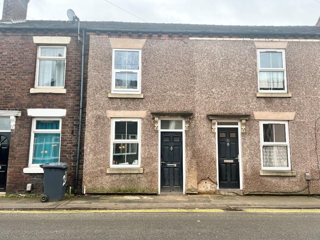
Photo 1
/ 1
Property details
Floor area
68 m²
Last sold
£15,000 Dec 2002
Local average
£144,587 (-99.6%)
Deprivation
Decile 2 (6,567 of 33,755)
Street crime
174 incidents within 1 mile (Apr 2026)
Key features
- Three Bedroom Property
- Available July 2025 for Students
- Three Double Bedrooms
- One Bedroom with Ensuite Shower Room
- Close to Keele Uni
Additional details
- Garden
- Private garden
- Listed property
- No
Description
Listed by
Stoke-on-Trent
The Property Franchise Group
Reference: 168044813
EPC Rating & Upgrade Cost
Fetching EPC data… Refresh this page in a moment.
Flood risk
Zone: 1
Risk: Low
Job (default Low)
FENSA Certificates
This property has 4 FENSA certificate(s) on record, indicating window/door installations by FENSA-approved installers.
FENSA Certificate #13489053
Property Details
Street: 29 High Street
Town: Knutton
Postcode: ST5 6DB
Installation Details
Items: 2 windows
Certificate Issued: 09/04/2019
Work Completed: 15/03/2019
This certificate data was retrieved from FENSA's database
FENSA Certificate #8873570
Property Details
Street: 29 High Street
Town: Knutton
Postcode: ST5 6DB
Installation Details
Items: 1 window and 1 door
Certificate Issued: 22/05/2012
Work Completed: 29/03/2012
This certificate data was retrieved from FENSA's database
FENSA Certificate #16024535 Recent
Property Details
Street: 29 High Street
Town: Knutton
Postcode: ST5 6DB
Installation Details
Items: 5 windows and 1 door
Certificate Issued: 29/10/2023
Work Completed: 16/10/2023
This certificate data was retrieved from FENSA's database
FENSA Certificate #5089724
Property Details
Street: 29 High Street
Town: Knutton
Postcode: ST5 6DB
Installation Details
Items: 3 windows
Certificate Issued: 15/10/2007
Work Completed: 20/06/2007
This certificate data was retrieved from FENSA's database
What is FENSA? FENSA (Fenestration Self-Assessment Scheme) is a government-authorised scheme that monitors building regulation compliance for replacement windows and doors. Certificates indicate that work was completed by FENSA-approved installers.
Price history
| Event | Date | Price | % change |
|---|---|---|---|
| Listed for sale | — | £520 | -96.5% |
| Sold | 17/12/2002 (23 years ago) | £15,000 | — |
Source: HM Land Registry Price Paid Data. Crown copyright.
Sold Comparables
Same street and nearby sales within 0.25 miles (last 5 years). Data from Land Registry Price Paid.
| Address | Price | Date | Type |
|---|---|---|---|
| INGLESIDE17 HIGH STREET, KNUTTON, NEWCASTLE, NEWCASTLE-UNDER-LYME, STAFFORDSHIRE, ST5 6BX | £65,000 | 12/08/2025 | Terraced |
| 12 CHAPEL STREET, KNUTTON, NEWCASTLE, NEWCASTLE-UNDER-LYME, STAFFORDSHIRE, ST5 6DW | £78,000 | 11/06/2025 | Terraced |
| 6 AUDLEY STREET, NEWCASTLE, NEWCASTLE-UNDER-LYME, STAFFORDSHIRE, ST5 6BZ | £125,000 | 06/10/2023 | Terraced |
| 2 PEAKE STREET, NEWCASTLE, NEWCASTLE-UNDER-LYME, STAFFORDSHIRE, ST5 6DP | £70,000 | 20/09/2023 | Terraced |
| 8 GROVE STREET, NEWCASTLE, NEWCASTLE-UNDER-LYME, STAFFORDSHIRE, ST5 6DA | £95,000 | 08/09/2023 | Terraced |
| 21 SILVERDALE STREET, NEWCASTLE, NEWCASTLE-UNDER-LYME, STAFFORDSHIRE, ST5 6BY | £125,000 | 31/08/2023 | Terraced |
| 21 JOHN STREET, KNUTTON, NEWCASTLE, NEWCASTLE-UNDER-LYME, STAFFORDSHIRE, ST5 6DT | £66,000 | 25/08/2023 | Terraced |
| 19 JOHN STREET, KNUTTON, NEWCASTLE, NEWCASTLE-UNDER-LYME, STAFFORDSHIRE, ST5 6DT | £98,000 | 10/07/2023 | Terraced |
| 9 LAWSON TERRACE, KNUTTON, NEWCASTLE, NEWCASTLE-UNDER-LYME, STAFFORDSHIRE, ST5 6DS | £112,000 | 16/06/2023 | Terraced |
| 9 NASH STREET, NEWCASTLE, NEWCASTLE-UNDER-LYME, STAFFORDSHIRE, ST5 6DR | £112,000 | 28/04/2023 | Terraced |
| 9 AUDLEY STREET, NEWCASTLE, NEWCASTLE-UNDER-LYME, STAFFORDSHIRE, ST5 6BZ | £80,000 | 27/03/2023 | Terraced |
| 15 GROVE STREET, NEWCASTLE, NEWCASTLE-UNDER-LYME, STAFFORDSHIRE, ST5 6DA | £65,000 | 23/01/2023 | Terraced |
| 18 MENDIP PLACE, NEWCASTLE, NEWCASTLE-UNDER-LYME, STAFFORDSHIRE, ST5 6JB | £167,000 | 19/12/2022 | Terraced |
| 11 LAWSON TERRACE, KNUTTON, NEWCASTLE, NEWCASTLE-UNDER-LYME, STAFFORDSHIRE, ST5 6DS | £100,000 | 16/12/2022 | Terraced |
| 4 SILVERDALE STREET, NEWCASTLE, NEWCASTLE-UNDER-LYME, STAFFORDSHIRE, ST5 6BY | £98,000 | 03/08/2022 | Terraced |
| 5 NASH STREET, NEWCASTLE, NEWCASTLE-UNDER-LYME, STAFFORDSHIRE, ST5 6DR | £97,500 | 01/06/2022 | Terraced |
| 17 AUDLEY STREET, NEWCASTLE, NEWCASTLE-UNDER-LYME, STAFFORDSHIRE, ST5 6BZ | £145,000 | 30/05/2022 | Terraced |
| 20 CHAPEL STREET, KNUTTON, NEWCASTLE, NEWCASTLE-UNDER-LYME, STAFFORDSHIRE, ST5 6DW | £92,500 | 19/04/2022 | Terraced |
| 3 LAWSON TERRACE, KNUTTON, NEWCASTLE, NEWCASTLE-UNDER-LYME, STAFFORDSHIRE, ST5 6DS | £100,000 | 22/02/2022 | Terraced |
| 22 CHAPEL STREET, KNUTTON, NEWCASTLE, NEWCASTLE-UNDER-LYME, STAFFORDSHIRE, ST5 6DW | £94,252 | 20/12/2021 | Terraced |
Area average: £99,263 (20 sales)
Capital growth trend
Land Registry outcode average: last 12 months vs 5y and 10y ago (from sold prices).
House Price Index (HM Land Registry — official index, not sold-price averages): Newcastle-under-Lyme. Series: Terraced. As of March 2026.
Rental Range
Estimated market rent for Newcastle-under-Lyme. Low = conservative, Realistic = average, Optimistic = best case.
Based on Local Authority from postcode lookup → Newcastle-under-Lyme.
LHA (30th percentile) floor for Staffordshire North: £593/mo (Apr 2025 – Mar 2026)
Location
Nearby
Nearest stations, universities and amenities (distance from property).
| Type | Name | Distance |
|---|---|---|
| Bus stop | Gordon Court | 0.1 miles |
| Shop | Meelie Mobile | 0.9 miles |
| Shop | Argos | 0.9 miles |
| Train station | Silverdale | 1.0 miles |
| Train station | Apedale Road | 1.2 miles |
| Hospital | Bradwell Hospital | 1.4 miles |
| University | Keele University | 1.6 miles |
| Hospital | Hartshill Medical Centre | 1.8 miles |
| University | University of Staffordshire Stoke Campus | 3.0 miles |
Street-level crime
| Category | Count |
|---|---|
| Violence and sexual offences | 56 |
| Anti-social behaviour | 39 |
| Public order | 18 |
| Shoplifting | 14 |
| Criminal damage and arson | 12 |
| Other theft | 10 |
| Vehicle crime | 6 |
| Burglary | 5 |
| Other crime | 5 |
| Drugs | 3 |
| Bicycle theft | 2 |
| Possession of weapons | 2 |
| Robbery | 2 |
| Total incidents | 174 |
Within 1 mile during Apr 2026. Source: data.police.uk (England & Wales).
Schools nearby
Nearest open schools with Ofsted ratings (England). Closed schools are not shown. Data from Get Information about Schools and Ofsted.
| Name | Type | Distance | Ofsted |
|---|---|---|---|
| Knutton St Marys CofE Academy | Primary | 0.3 miles | Good — 4 Jun 2019 |
| Silverdale Primary Academy | Primary | 0.7 miles | Good — 29 Nov 2023 |
| Newcastle and Stafford Colleges Group | Other | 0.7 miles | — (No rating) |
| St John Fisher Catholic College | Secondary | 0.8 miles | Requires improvement — 5 Mar 2024 |
| St Mary's Catholic Primary School | Primary | 1.0 miles | Good — 17 Feb 2017 |
Rental Comparables
Residential lets from OpenRent and Rightmove for the area (same bedroom count). Use to validate rent estimates. Student lets are excluded.
Average rent: £947/mo (36 listings)
Rent-driven metrics
Based on OpenRent comparables.
- Rent ratio — Monthly rent ÷ purchase price (1% rule). 1%+ = strong, 0.8–1% = okay, <0.8% = weak for cashflow.
- Max investor price — Rent ÷ 0.8%; the price at which rent would be 0.8% of price (Stoke-style target).
- Target investor price — Rent ÷ 1%; the price at which rent would be 1% of price (strong cashflow band).
- Gross yield — Annual rent as % of purchase price (no costs).
- Cashflow — Rent minus mortgage, 10% maintenance, £25/mo compliance. Assumes 75% LTV, 3.95% APR (5yr fixed), 25yr term.
- ROI — Annual profit ÷ cash in (deposit + 4% purchase costs).