Seacross
PILGRIMS LANE, WHITSTABLE, SEASALTER, KENT CT5 3AP
£3,500 pcm


Property details
Deprivation
Decile 7 (20,707 of 33,755)
Street crime
35 incidents within 1 mile (Apr 2026)
Key features
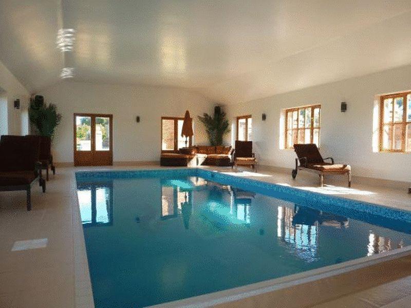
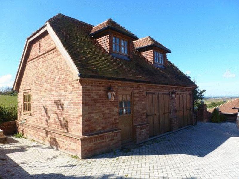
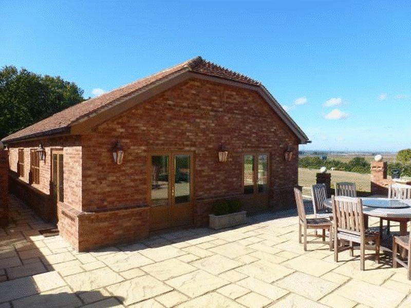
- DETACHED HOUSE
- SWIMMING POOL
- SAUNA
- STEAM ROOM
- SELF CONTAINED ONE BEDROOM ANNEX
- CINEMA ROOM
- DOUBLE GARAGE
- GATED ENTRANCE
Additional details
- Parking
- Yes
Description
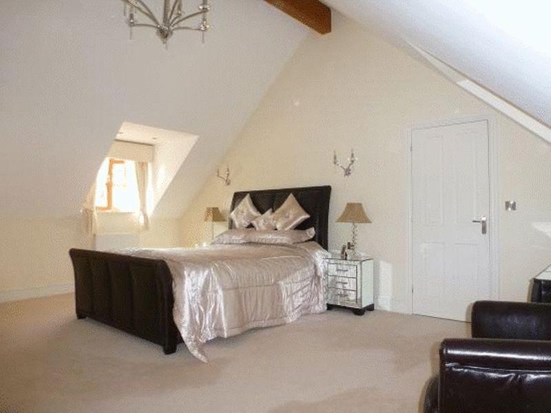
Main House - First Floor: master bedroom with en-suite bathroom with TV and dressing room, Second bedroom with en-suite bathroom with TV, family bathroom with shower and TV. A further 3 bedrooms.
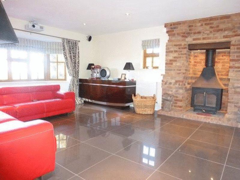
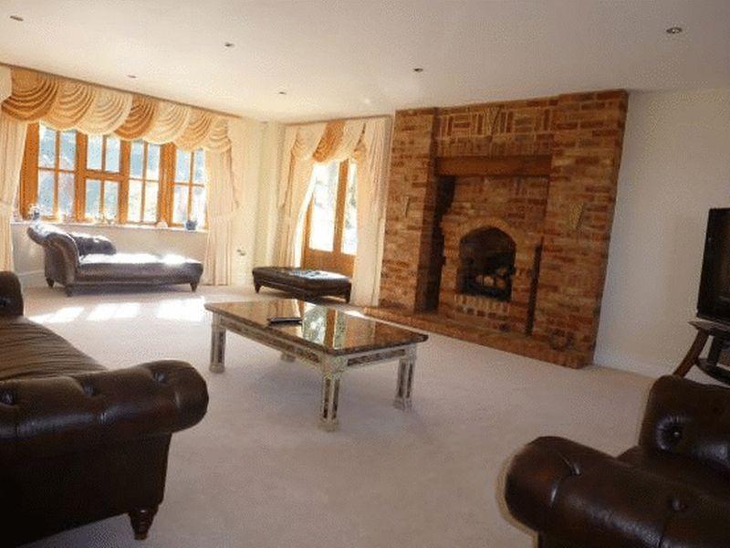
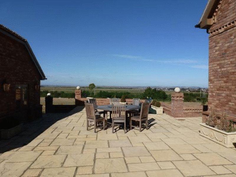
This property is presented to a extremely high standard, Must be viewed.
Listed by
Maxwell Redhill
Maxwell Valentine Limited
Reference: 79650791
EPC ratings on this postcode
We don't have a matched EPC for this property yet. Below are efficiency scores and details for other addresses on this postcode.
| Address | Current | Potential | Floor area | Age band | Type |
|---|---|---|---|---|---|
| Angel House, Pilgrims Lane, Seasalter, WHITSTABLE | 84 | 93 | 120 m² | — | Detached |
| Pilgrims End, Pilgrims Lane, Seasalter, WHITSTABLE | 63 | 81 | 107 m² | England and Wales: 1950-1966 | Detached |
| Pilgrims Lane Kennels, Pilgrims Lane, Seasalter, WHITSTABLE | 60 | 79 | 104 m² | England and Wales: 1950-1966 | Detached |
| Waverley, Pilgrims Lane, Seasalter, WHITSTABLE | 84 | 93 | 120 m² | — | Detached |
| Wayside, Pilgrims Lane, Seasalter, WHITSTABLE | 84 | 93 | 108 m² | — | Detached |
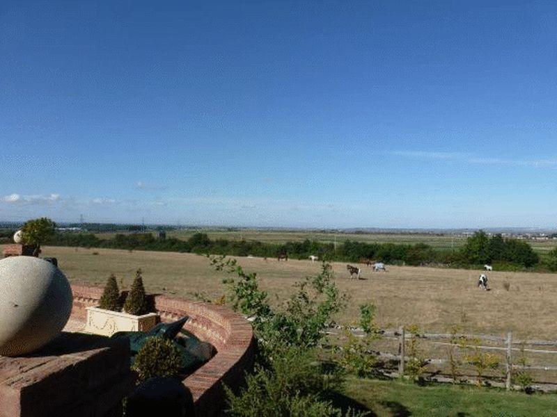
Flood risk
Zone: 1
Risk: Low
Job (default Low)
Rental Range
Estimated market rent for Canterbury. Low = conservative, Realistic = average, Optimistic = best case.
Based on Local Authority from postcode lookup → Canterbury.
LHA (30th percentile) floor for Colchester: £1,247/mo (Apr 2025 – Mar 2026)
Location
Address
Pilgrims Lane
Nearby
Nearest stations, universities and amenities (distance from property).
| Type | Name | Distance |
|---|---|---|
| Hospital | Estuary View Medical Centre | 0.4 miles |
| Shop | Home Bargains | 0.4 miles |
| Shop | M&S Foodhall | 0.4 miles |
| Bus stop | Estuary View Medical Centre | 0.4 miles |
| Bus stop | Seasalter Cross | 0.5 miles |
| Train station | Whitstable | 1.8 miles |
| Hospital | Whitstable and Tankerton Hospital | 2.5 miles |
| Train station | Chestfield & Swalecliffe | 3.0 miles |
| University | University of Kent | 3.8 miles |
| University | Nexus (Templeman) | 3.8 miles |
Street-level crime
| Category | Count |
|---|---|
| Violence and sexual offences | 14 |
| Burglary | 6 |
| Shoplifting | 6 |
| Anti-social behaviour | 4 |
| Other theft | 2 |
| Public order | 2 |
| Drugs | 1 |
| Total incidents | 35 |
Within 1 mile during Apr 2026. Source: data.police.uk (England & Wales).
Schools nearby
Nearest open schools with Ofsted ratings (England). Closed schools are not shown. Data from Get Information about Schools and Ofsted.
| Name | Type | Distance | Ofsted |
|---|---|---|---|
| Joy Lane Primary Foundation School | Primary | 0.9 miles | Good — 3 Mar 2014 |
| Whitstable Junior School | Primary | 1.5 miles | Good — 18 May 2015 |
| St Alphege Church of England Infant School | Primary | 1.5 miles | Good — 3 Jul 2024 |
| The Whitstable School | Secondary | 1.6 miles | Good — 24 Apr 2024 |
| Whitstable and Seasalter Endowed Church of England Junior School | Primary | 1.7 miles | Outstanding — 24 Feb 2017 |
Rental Comparables
Rental listings exist nearby, but none matched the 5-bedroom count for this property.
Enter House Number
Enter the house number to help us retrieve more accurate pricing history and property data.
Please log in to submit or correct the house number for this listing.
Log in to continue