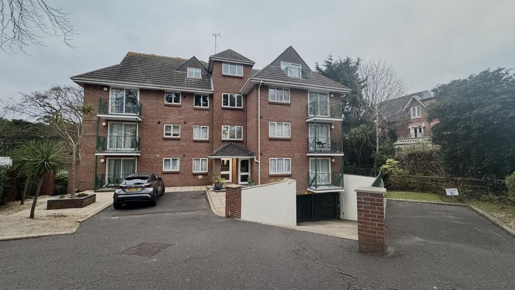
FLAT 6
CAPELLA COURT, 6, EXETER PARK ROAD, BOURNEMOUTH, BOURNEMOUTH BH2 5BD
£1,300 pcm
Property details
Floor area
59 m²
Council tax band
TBC
Street crime
548 incidents within 1 mile (Apr 2026)
Key features
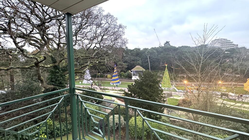
- Views and private access to Bournemouth Gardens
- Central Location to Bournemouth Centre
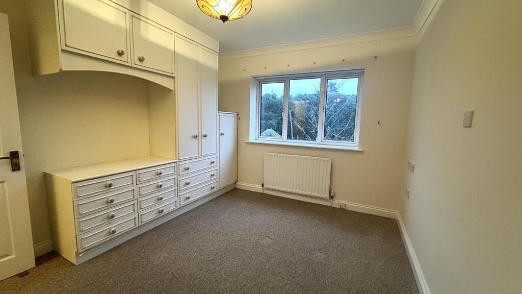
- 2 Bedrooms
- Walking Distance to Bournemouth BeachWalking Distance to Bournemouth Beach
Additional details
- Parking
- Yes
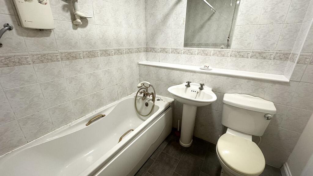
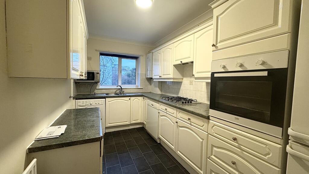
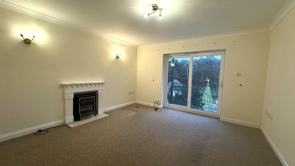
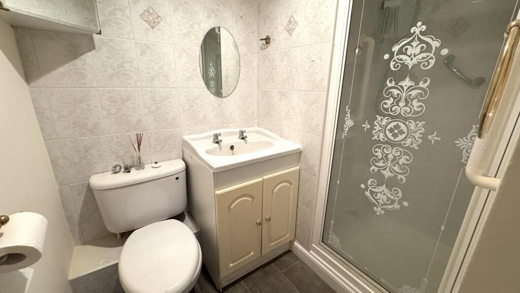
Description
Listed by
Poole
Move on Rentals
Reference: 156077738
EPC Rating & Upgrade Cost
Fetching EPC data… Refresh this page in a moment.
Flood risk
Zone: 1
Risk: Low
Job (default Low)
EPC Graphs
EPC 1
Rental Range
Estimated market rent for Bournemouth, Christchurch and Poole. Low = conservative, Realistic = average, Optimistic = best case.
Based on Local Authority from postcode lookup → Bournemouth, Christchurch and Poole.
Location
Address
6 Exeter Park Road
Nearby
Nearest stations, universities and amenities (distance from property).
| Type | Name | Distance |
|---|---|---|
| Shop | The Central | 0.1 miles |
| Bus stop | Bournemouth Pier | 0.1 miles |
| Shop | Haus Male Grooming | 0.1 miles |
| Train station | Bournemouth | 0.9 miles |
| Hospital | Nuffield Health Bournemouth Hospital | 0.9 miles |
| Hospital | Dorset HealthCare | 1.1 miles |
| University | Bournemouth University (Talbot Campus) | 1.8 miles |
| University | Bournemouth University | 1.8 miles |
| Train station | Branksome | 1.9 miles |
Street-level crime
| Category | Count |
|---|---|
| Anti-social behaviour | 184 |
| Violence and sexual offences | 162 |
| Other theft | 35 |
| Shoplifting | 34 |
| Criminal damage and arson | 30 |
| Public order | 26 |
| Drugs | 23 |
| Vehicle crime | 23 |
| Burglary | 10 |
| Robbery | 10 |
| Bicycle theft | 4 |
| Other crime | 3 |
| Theft from the person | 3 |
| Possession of weapons | 1 |
| Total incidents | 548 |
Within 1 mile during Apr 2026. Source: data.police.uk (England & Wales).
Schools nearby
Nearest open schools with Ofsted ratings (England). Closed schools are not shown. Data from Get Information about Schools and Ofsted.
| Name | Type | Distance | Ofsted |
|---|---|---|---|
| St Michael's Church of England Primary School | Primary | 0.5 miles | — (Inspected (no overall grade)) |
| Livingstone Academy Bournemouth | Other | 0.6 miles | Good — 20 May 2024 |
| Kings Bournemouth | Other | 0.7 miles | Good — 6 Mar 2023 |
| Malmesbury Park Primary School | Primary | 1.2 miles | Good — 11 May 2022 |
| St Martin's School | Other | 1.2 miles | — (No rating) |
Rental Comparables
Residential lets from OpenRent and Rightmove for the area (same bedroom count). Use to validate rent estimates. Student lets are excluded.
| Title | Rent | Beds | Distance | As seen on |
|---|---|---|---|---|
| 2 Bed Flat, Post Office Road, BH1 | £1,280/mo | 2 | 0.17 miles | OpenRent |
| 2 Bed Flat, Richmond Chambers, BH2 | £1,500/mo | 2 | 0.21 miles | OpenRent |
| 2 Bed Flat, Old Christchurch Road, BH1 | £1,400/mo | 2 | 0.23 miles | OpenRent |
| 2 Bed Flat, St. Michaels Road, BH2 | £1,995/mo | 2 | 0.25 miles | OpenRent |
Average rent: £1,544/mo (4 listings)