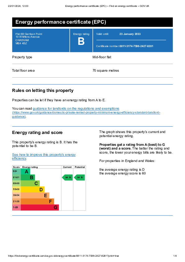
FLAT 68
GARRISON POINT, 10, WHIFFENS AVENUE, CHATHAM, MEDWAY ME4 4SZ
£1,450 pcm

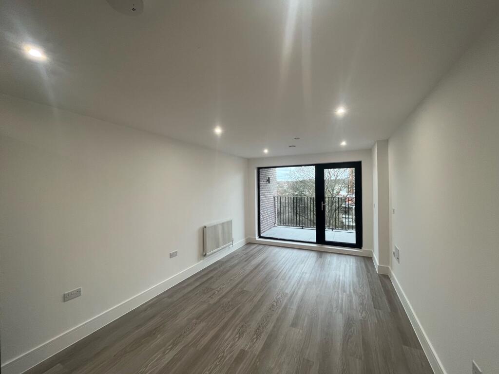
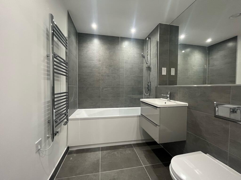
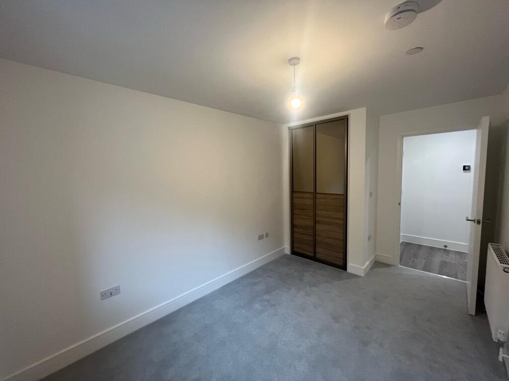
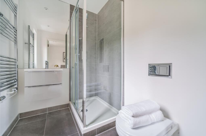
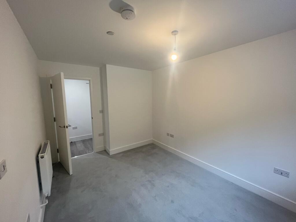
Photo 1 Photo 2 Photo 3 Photo 4 Photo 5 Photo 6
/ 6
Property details
Floor area
70 m²
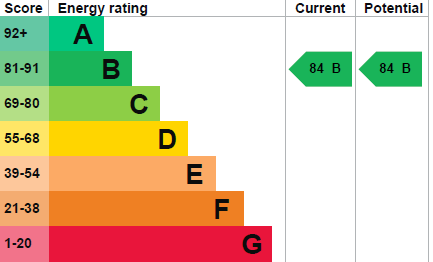
EPC rating
B
Street crime
822 incidents within 1 mile (Apr 2026)
Key features
- Contemporary apartment
- New Build
- Two bedrooms
- Modern kitchen & bathroom
- Fantastic location
- Close to high street & train station
- Free parking for one car
- Property is unfurnished
- Council tax band C
- Available now
Additional details
- Parking
- Yes
Description
The property comprises of two double bedrooms, one with fitted wardrobes and an en-suite, a modern family bathroom with shower over bath and an open plan lounge/kitchen with appliances leading through to the balcony with beautiful views.
This fantastic property is offered to the market unfurnished and has an allocated parking space as well as secure entry systems and lift access. Council Tax Band: Holding Deposit: £334.00
Listed by
Chatham
Countrywide UK Lettings - Connells
Reference: 161656610
EPC Rating & Upgrade Cost
Current rating: B
Potential rating: B
Inspection date: 24/01/2023
Expiry date: 23/01/2033
Current heating cost: £62/year
Potential heating cost: £62/year
Flood risk
Zone: 1
Risk: Low
Job (default Low)
EPC Graphs
EPC 1
EPC Image
Rental Range
Estimated market rent for Medway. Low = conservative, Realistic = average, Optimistic = best case.
Based on Local Authority from postcode lookup → Medway.
LHA (30th percentile) floor for Bury St Edmunds: £773/mo (Apr 2025 – Mar 2026)
Location
Address
Whiffen's Avenue
Nearby
Nearest stations, universities and amenities (distance from property).
| Type | Name | Distance |
|---|---|---|
| Shop | Unknown | 0.1 miles |
| Shop | Sainsbury's | 0.1 miles |
| Bus stop | Chatham Waterfront Bus Station | 0.1 miles |
| Train station | Chatham | 0.4 miles |
| University | Unknown | 0.6 miles |
| Hospital | Medway Maritime Hospital | 0.7 miles |
| University | University of Kent - Medway Campus | 0.8 miles |
| Train station | Rochester | 0.9 miles |
| Hospital | Unknown | 1.8 miles |
Street-level crime
| Category | Count |
|---|---|
| Violence and sexual offences | 266 |
| Anti-social behaviour | 166 |
| Shoplifting | 92 |
| Criminal damage and arson | 67 |
| Other theft | 58 |
| Vehicle crime | 37 |
| Public order | 36 |
| Drugs | 29 |
| Burglary | 19 |
| Possession of weapons | 15 |
| Robbery | 13 |
| Other crime | 12 |
| Theft from the person | 7 |
| Bicycle theft | 5 |
| Total incidents | 822 |
Within 1 mile during Apr 2026. Source: data.police.uk (England & Wales).
Schools nearby
Nearest open schools with Ofsted ratings (England). Closed schools are not shown. Data from Get Information about Schools and Ofsted.
| Name | Type | Distance | Ofsted |
|---|---|---|---|
| Brompton-Westbrook Primary School | Primary | 0.3 miles | Good — 11 Mar 2015 |
| New Road Primary School | Primary | 0.5 miles | Good — 20 Jul 2017 |
| Brompton Academy | Secondary | 0.5 miles | — (Inspected (no overall grade)) |
| St Michael's RC Primary School | Primary | 0.6 miles | Good — 4 Mar 2016 |
| St John's Church of England Infant School | Primary | 0.6 miles | Good — 30 Apr 2024 |
Rental Comparables
Residential lets from OpenRent and Rightmove for the area (same bedroom count). Use to validate rent estimates. Student lets are excluded.
| Title | Rent | Beds | Distance | As seen on |
|---|---|---|---|---|
| 2 Bed Terraced House, Mount Road, ME4 | £1,300/mo | 2 | 0.52 miles | OpenRent |
Average rent: £1,300/mo (1 listing)