36 BRENTWOOD ROAD
ROMFORD, GREATER LONDON RM1 2EX
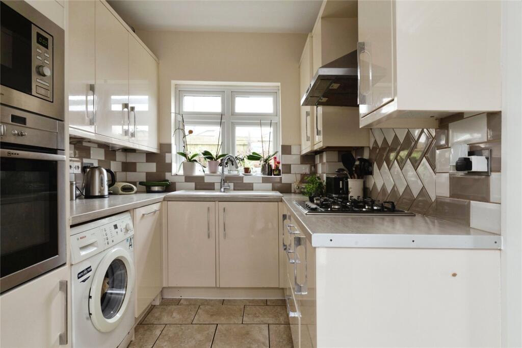
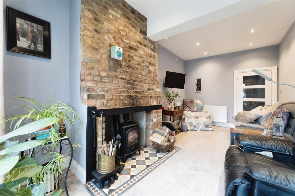
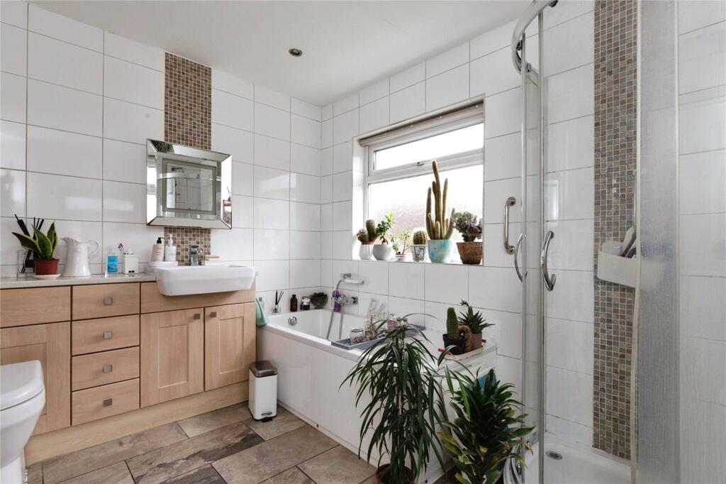
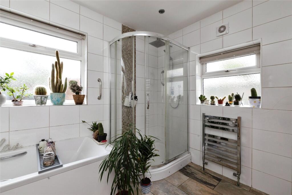
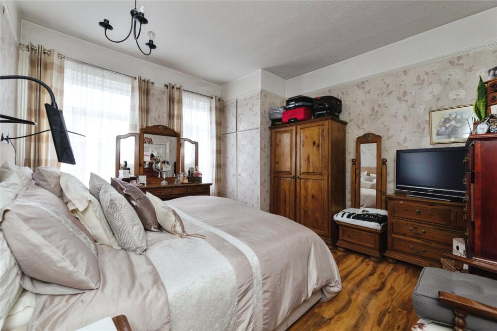
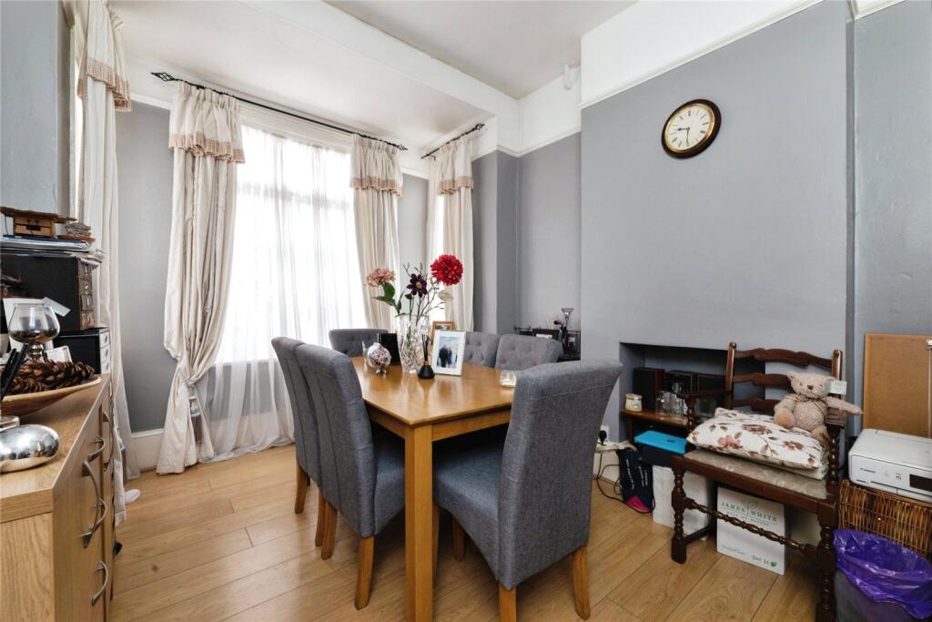
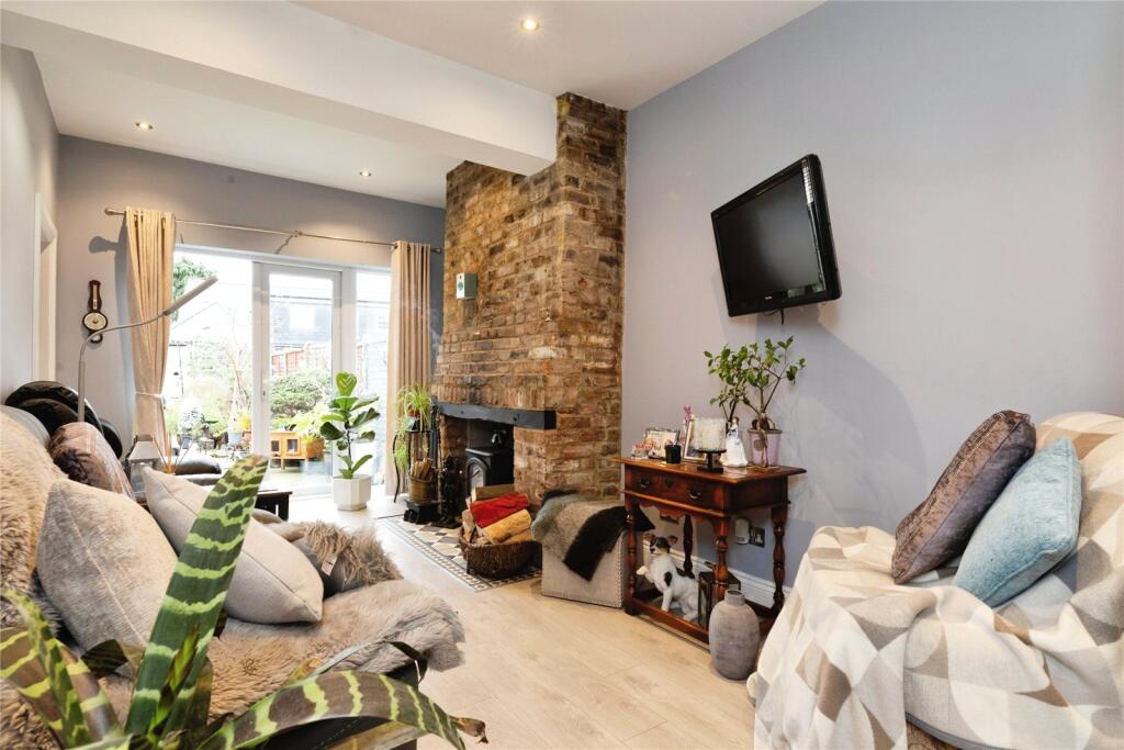
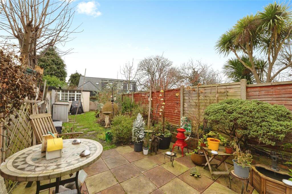
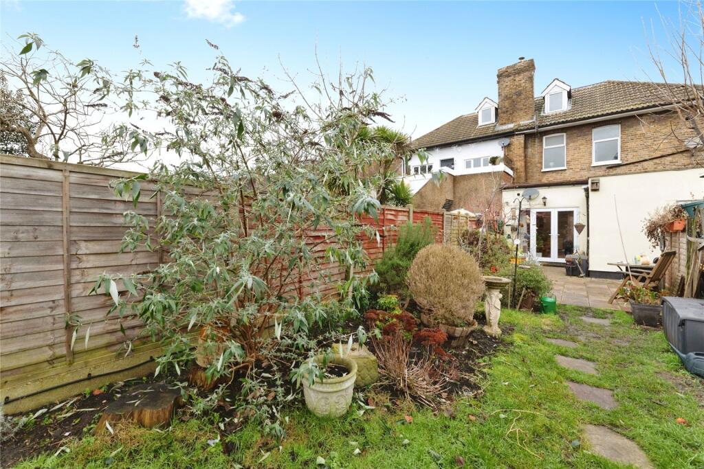
Photo 1 Photo 2 Photo 3 Photo 4 Photo 5 Photo 6 Photo 7 Photo 8 Photo 9
/ 9
Property details
Floor area
83 m²
EPC rating
D
Deprivation
Decile 3 (8,790 of 33,755)
Street crime
601 incidents within 1 mile (Apr 2026)
Key features
- THREE BEDROOM
- BEAUTIFUL GROUND FLOOR
- DRIVEWAY
- STUNNING FLAT
- PERFECT GARDEN AREA
- AVAILABLE FEBRUARY
Additional details
- Parking
- Yes
- Garden
- Yes
Description
Zero Deposit Guarantee Available
A well-presented three-bedroom ground-floor flat offering spacious accommodation, gas central heating and part double glazing. Accessed via a shared communal porch, the property features an L?shaped hallway leading to three bedrooms (one currently used as a dining room) and a bright living room with a feature brick fireplace and patio doors to the rear garden.
The fitted kitchen includes modern cream?gloss units and leads to a large four-piece bathroom with bath and separate shower cubicle.
Externally, the property boasts a private rear garden with patio, lawn and storage shed. To the front, there is off-street parking for 3–4 cars.
Call today to arrange a viewing. Council Tax Band: Holding Deposit: £0.00
Listed by
Romford
Countrywide UK Lettings - Connells
Reference: 87617892
EPC Rating & Upgrade Cost
Current rating: D
Potential rating: C
Inspection date: 20/02/2026
Expiry date: 19/02/2036
Current heating cost: £985/year
Potential heating cost: £486/year
Est. upgrade cost to C: £22,200
Recommendations
- 50 mm internal or external wall insulation (£7,500 - £11,000)
- Floor insulation (solid floor) (£5,000 - £10,000)
- Draughtproof single-glazed windows (£150 - £250)
- Replace single glazed windows with low-E double glazing (£4,500 - £6,000)
Flood risk
Zone: 1
Risk: Low
Job (default Low)
Floorplans
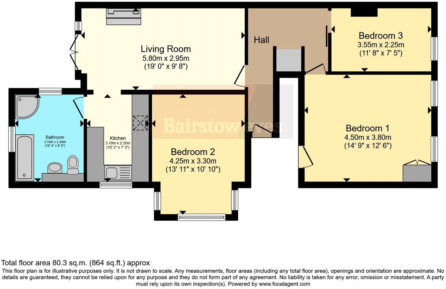
Floorplan 1
Rental Range
Estimated market rent for Havering. Low = conservative, Realistic = average, Optimistic = best case.
Based on Local Authority from postcode lookup → Havering.
LHA (30th percentile) floor for Outer North East London: £1,496/mo (Apr 2025 – Mar 2026)
Location
Nearby
Nearest stations, universities and amenities (distance from property).
| Type | Name | Distance |
|---|---|---|
| Bus stop | South Street | 0.0 miles |
| Shop | ALDI | 0.2 miles |
| Shop | Pets at Home | 0.2 miles |
| Train station | Romford | 0.3 miles |
| Train station | Gidea Park | 1.1 miles |
| Hospital | Suttons Manor Hospital | 6.2 miles |
| Hospital | Neonatal Unit, L1 Z2 | 7.3 miles |
| University | Arden University Stratford Campus | 8.7 miles |
| University | University of Portsmouth Walthamstow Campus | 8.9 miles |
Street-level crime
| Category | Count |
|---|---|
| Violence and sexual offences | 155 |
| Anti-social behaviour | 118 |
| Shoplifting | 82 |
| Drugs | 42 |
| Public order | 42 |
| Other theft | 35 |
| Criminal damage and arson | 32 |
| Vehicle crime | 31 |
| Burglary | 19 |
| Theft from the person | 16 |
| Robbery | 15 |
| Possession of weapons | 6 |
| Other crime | 5 |
| Bicycle theft | 3 |
| Total incidents | 601 |
Within 1 mile during Apr 2026. Source: data.police.uk (England & Wales).
Schools nearby
Nearest open schools with Ofsted ratings (England). Closed schools are not shown. Data from Get Information about Schools and Ofsted.
| Name | Type | Distance | Ofsted |
|---|---|---|---|
| Hylands Primary School | Primary | 0.4 miles | Good — 15 Sep 2016 |
| Concordia Academy | Primary | 0.5 miles | Outstanding — 4 Jul 2019 |
| The Frances Bardsley Academy for Girls | Secondary | 0.5 miles | — (Inspected (no overall grade)) |
| The Bridge | Other | 0.5 miles | Good — 24 Jan 2024 |
| Bep Academy | Other | 0.5 miles | Good — 26 Apr 2023 |
Rental Comparables
Rental listings exist nearby, but none matched the 3-bedroom count for this property.