132A
NEWPORT ROAD, NEWPORT, CWMCARN, CAERPHILLY NP11 7LZ
£550 pcm
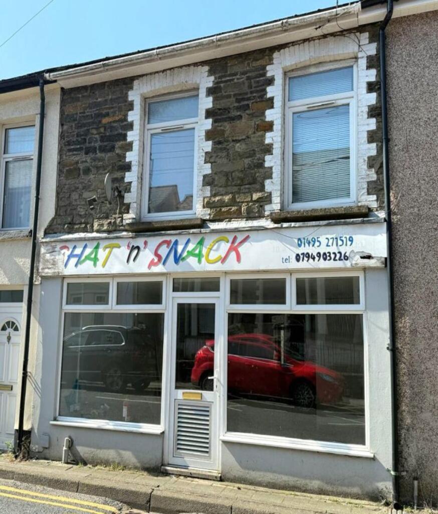

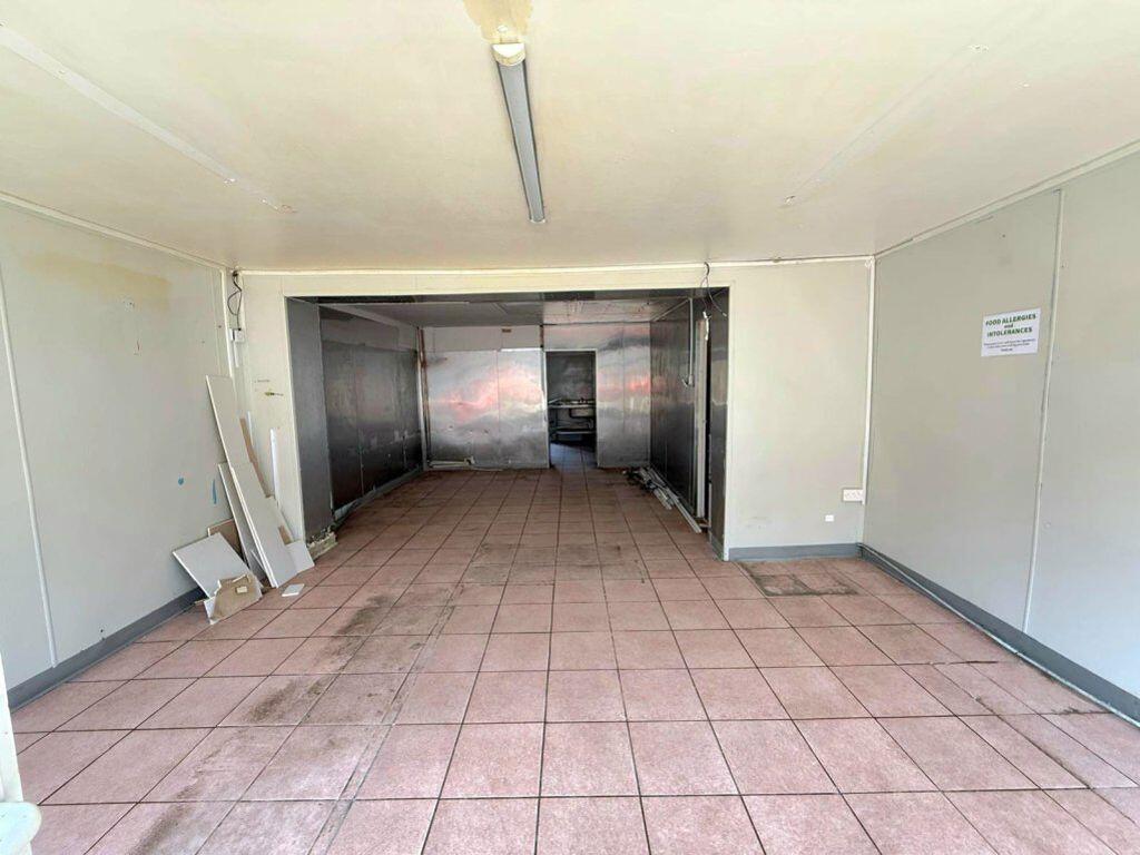
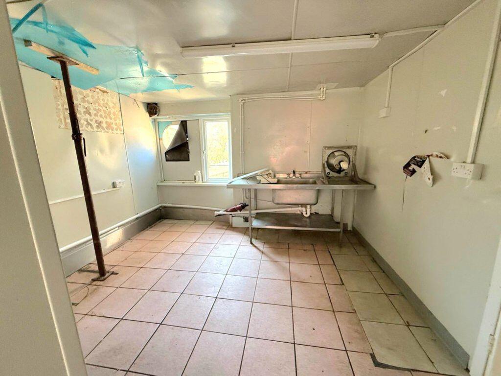
Photo 1 Photo 2 Photo 3 Photo 4
/ 4
Property details
Last sold
£69,000 Apr 2005
Local average
£466,722 (-99.9%)
Street crime
0 incidents within 1 mile (Apr 2026)
Key features
- Cwmcarn
- Commercial
- Furnished Property
Description
Parkmans are pleased to offer this well located rental unit, placed within in the high street of Cwmcarn, offering floor shop space and separate kitchen area, Energy rating TBC **Viewing HIGHLY recommended**
Listed by
Risca
William Parkman and Daughters Ltd
Reference: 161619902
EPC Rating & Upgrade Cost
Fetching EPC data… Refresh this page in a moment.
Flood risk
Zone: 1
Risk: Low
Job (default Low)
EPC Graphs

EPC 1

EPC 2
Price history
59% since 2005
| Event | Date | Price | % change |
|---|---|---|---|
| Listed for sale | — | £550 | -99.5% |
| Sold | 19/12/2024 (1 year ago) | £110,000 | +59.4% |
| Sold | 13/04/2005 (21 years ago) | £69,000 | — |
Source: HM Land Registry Price Paid Data. Crown copyright.
Sold Comparables
Same street and nearby sales within 0.25 miles (last 5 years). Data from Land Registry Price Paid.
| Address | Price | Date | Type |
|---|---|---|---|
| 132 NEWPORT ROAD, CWMCARN, NEWPORT, CAERPHILLY, NP11 7LZ | £110,000 | 19/12/2024 | Other |
Area average: £110,000 (1 sale)
Capital growth trend
Land Registry outcode average: last 12 months vs 5y and 10y ago (from sold prices).
House Price Index (HM Land Registry — official index, not sold-price averages): Caerphilly. Series: All dwelling types. As of March 2026.
Rental Range
Estimated market rent for Caerphilly. Low = conservative, Realistic = average, Optimistic = best case.
Based on Local Authority from postcode lookup → Caerphilly.
Location
Nearby
Nearest stations, universities and amenities (distance from property).
| Type | Name | Distance |
|---|---|---|
| Bus stop | Unknown | 0.2 miles |
| Shop | Cwmcarn Institute & Village Hall | 0.2 miles |
| Shop | Unknown | 0.7 miles |
| Train station | Crosskeys | 0.8 miles |
| Train station | Newbridge | 2.3 miles |
| Hospital | St Anne's Hospice | 5.4 miles |
| University | University of South Wales | 6.7 miles |
| Hospital | Minor Injuries Unit | 6.7 miles |
Street-level crime
| Category | Count |
|---|---|
| Total incidents | 0 |
Within 1 mile during Apr 2026. Source: data.police.uk (England & Wales).
Schools nearby
Nearest open schools with Ofsted ratings (England). Closed schools are not shown. Data from Get Information about Schools and Ofsted.
| Name | Type | Distance | Ofsted |
|---|---|---|---|
| Cwmcarn Primary School | Other | 0.1 miles | — (No rating) |
| Emmanuel Christian School | Other | 0.8 miles | — (No rating) |
| Waunfawr Primary School | Other | 0.9 miles | — (No rating) |
| Y.G. Cwm Gwyddon | Other | 1.1 miles | — (No rating) |
| Abercarn Primary School | Other | 1.6 miles | — (No rating) |
Rental Comparables
Residential lets from OpenRent and Rightmove for the area. Bedroom counts vary — use the Beds column to compare like-for-like lets. Student lets are excluded.
| Title | Rent | Beds | Distance | As seen on |
|---|---|---|---|---|
| 3 Bed Terraced House, Nantcarn Road, NP11 | £875/mo | 3 | 0.39 miles | OpenRent |
| 3 Bed Semi-Detached House, Brett Road, NP11 | £850/mo | 3 | 1.27 miles | OpenRent |
Average rent: £863/mo (2 listings)
Rent-driven metrics
Based on OpenRent comparables.
- Rent ratio — Monthly rent ÷ purchase price (1% rule). 1%+ = strong, 0.8–1% = okay, <0.8% = weak for cashflow.
- Max investor price — Rent ÷ 0.8%; the price at which rent would be 0.8% of price (Stoke-style target).
- Target investor price — Rent ÷ 1%; the price at which rent would be 1% of price (strong cashflow band).
- Gross yield — Annual rent as % of purchase price (no costs).
- Cost-to-rent — Price ÷ annual rent (from OpenRent comparables). Under 14× = strong, 14–16× = acceptable, 17×+ = compressed.
- Cashflow — Rent minus mortgage, 10% maintenance, £25/mo compliance. Assumes 75% LTV, 3.95% APR (5yr fixed), 25yr term.
- ROI — Annual profit ÷ cash in (deposit + 4% purchase costs).