183 MEIR ROAD
STOKE-ON-TRENT, STOKE-ON-TRENT ST3 7JF
£120,000
Property details
Tenure
FREEHOLD
Floor area
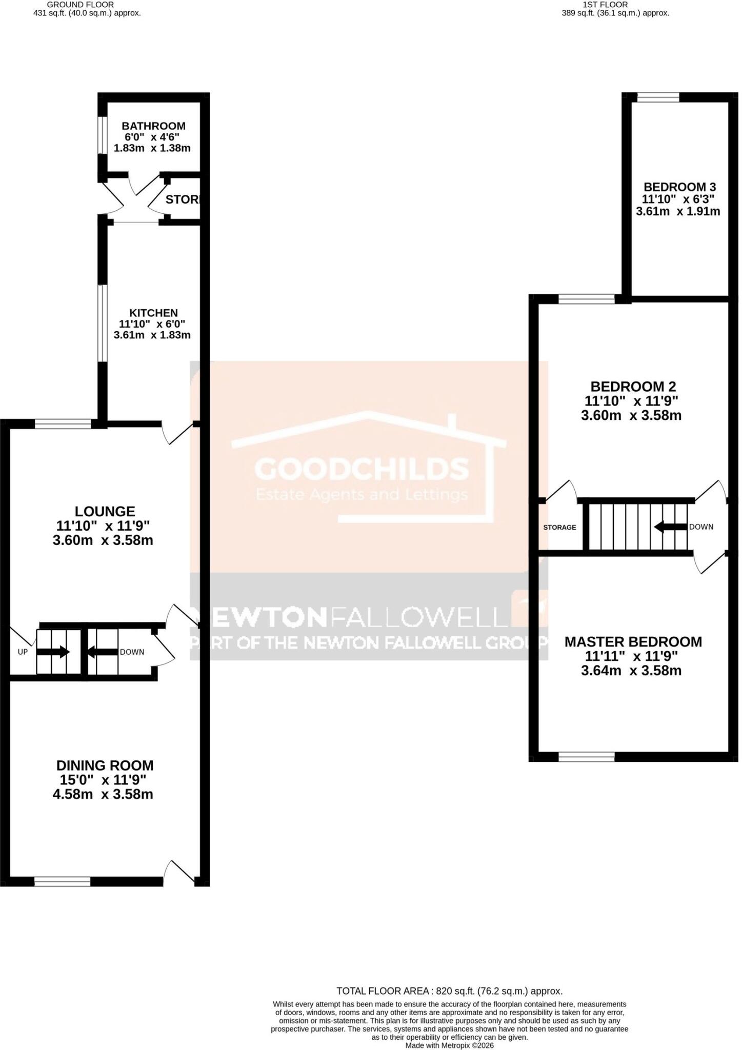
88 m²
Council tax band
A
Last sold
£100,000 Jul 2026
Local average
£133,081 (-9.8%)
Deprivation
Decile 1 (1,130 of 33,755)
Street crime
287 incidents within 1 mile (Aug 2026)
Key features
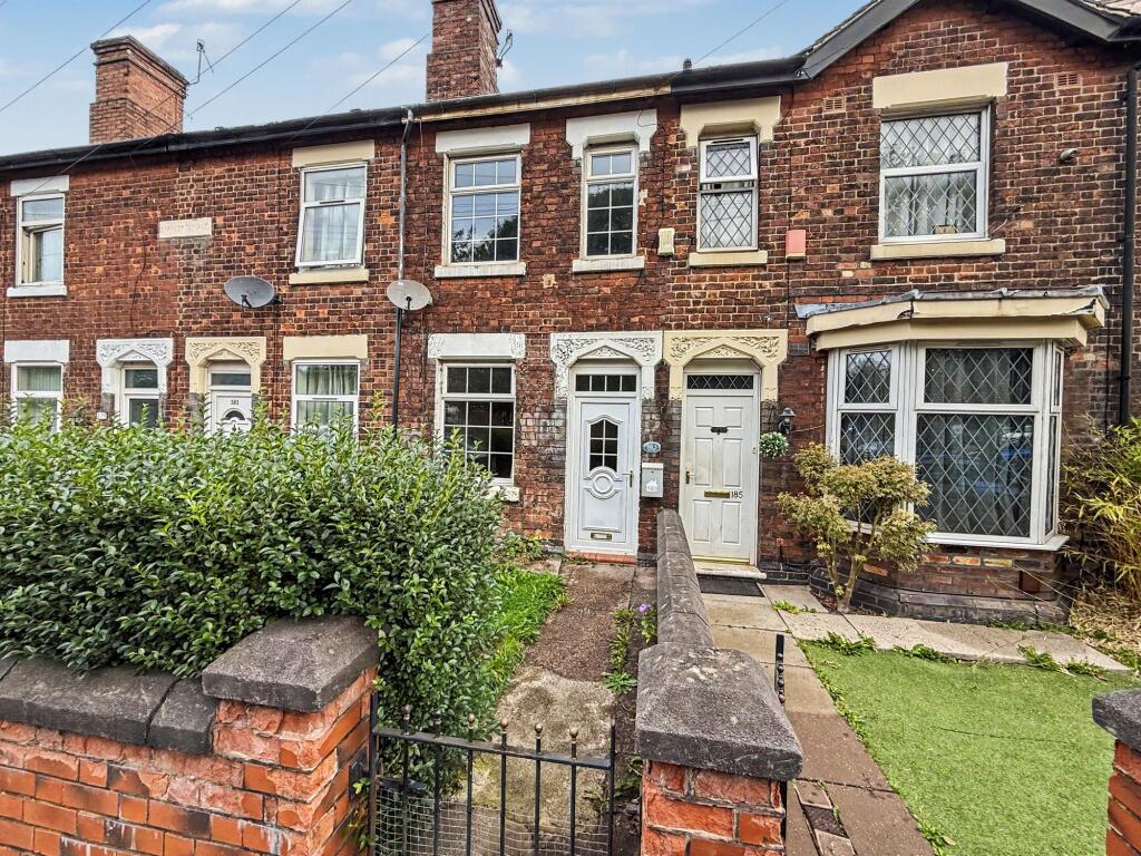
- NO UPWARD CHAIN
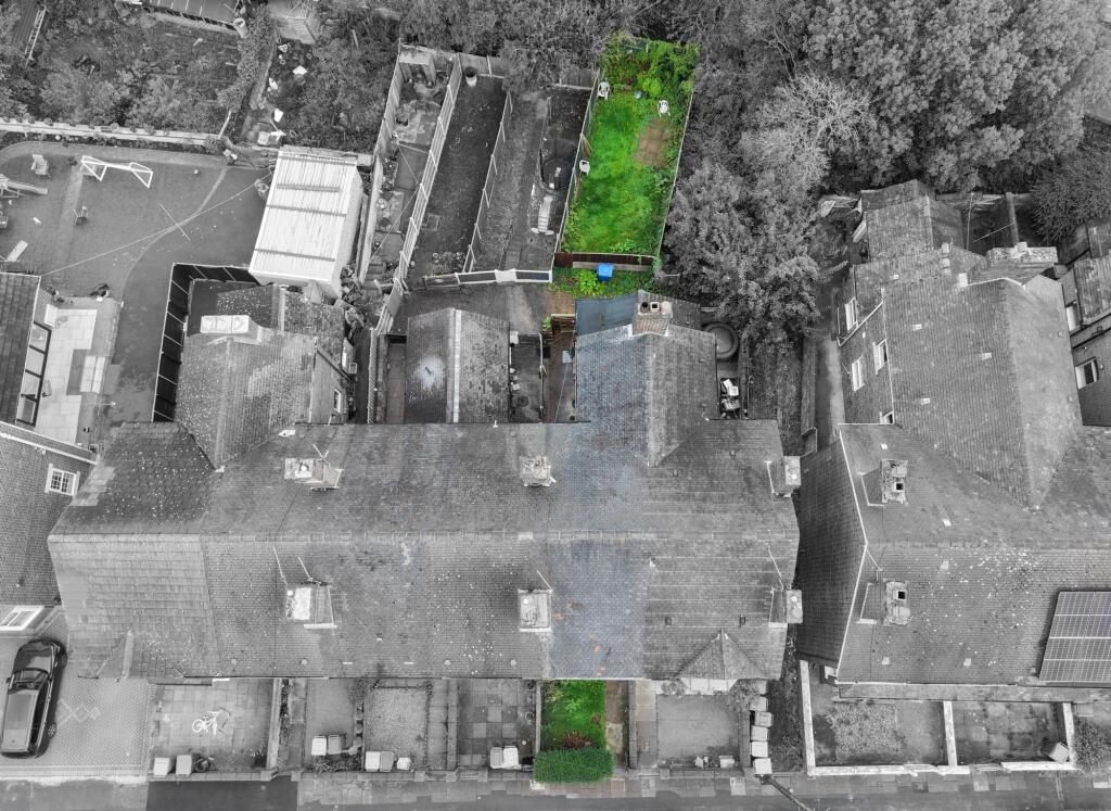
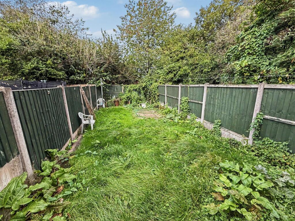
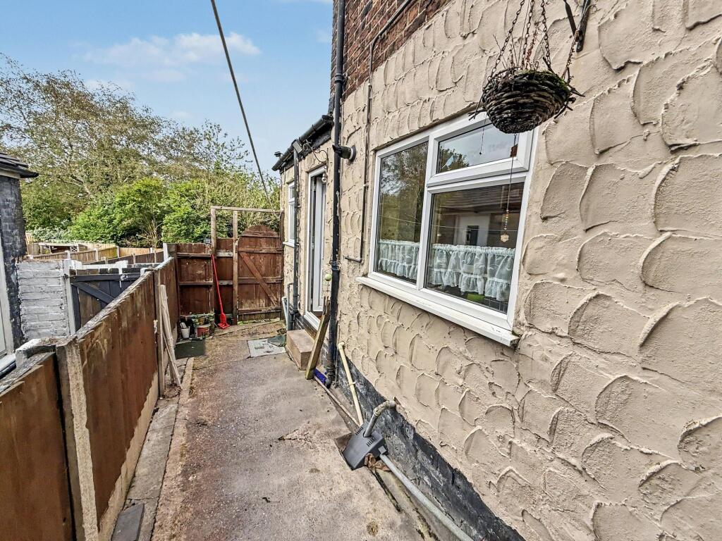
- Enclosed rear garden laid to lawn
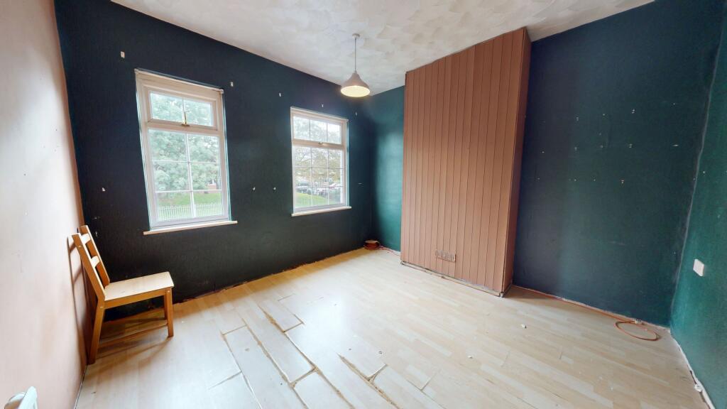
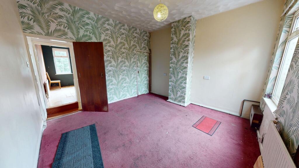
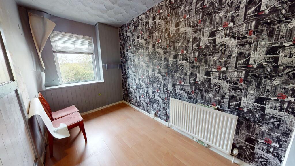
- Three good size bedrooms
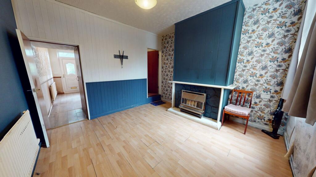
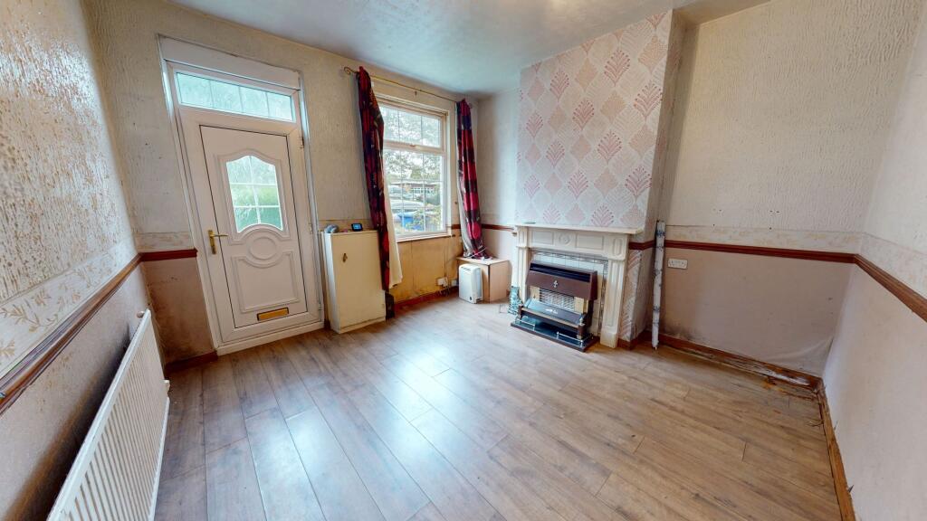
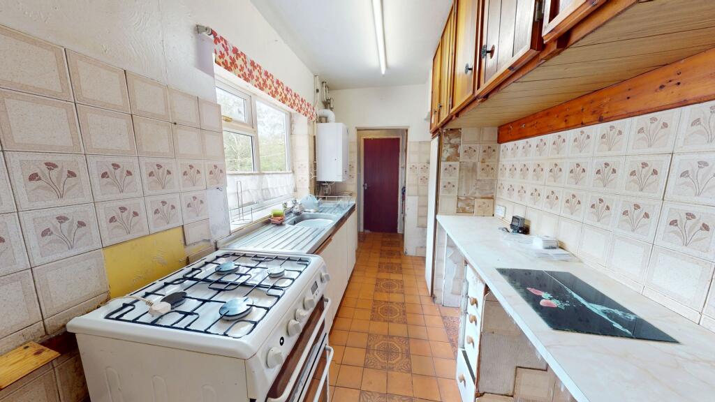
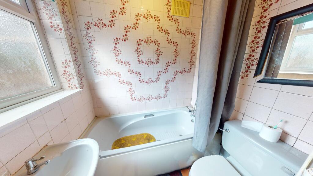
- In need of full renovation
- Two reception rooms
- Combi boiler
- Full double glazing
- Great local amenities and bus routes
Additional details
- Electricity
- Mains supply
- Water
- Mains supply
- Sewerage
- Mains supply
- Heating
- Gas central
- Garden
- Yes
- Listed property
- No
- Restrictions
- No
- Required access
- No
- Rights of way
- No
- Flooded in last 5 years
- No
- Flood defences
- No
Description
Upstairs, the property features three good size bedrooms, each offering plenty of natural light and scope for refurbishment. The house benefits from full double glazing and a modern combi boiler, ensuring energy efficiency and comfort. While the property is in need of full renovation throughout, it offers an ideal blank canvas for those wishing to create a bespoke family home or investment property. Located in a popular residential area, the house is conveniently positioned for a range of local amenities, including shops, supermarkets, and excellent bus routes.
Listed by
Stoke-On-Trent
The Property Franchise Group
Reference: 93964851
Flood risk
Zone: 1
Risk: Low
Job (default Low)
Registered land (INSPIRE)
This location falls inside an HM Land Registry INSPIRE registered freehold polygon.
Plot: ~99 m² (0.02 acres)
Source: HM Land Registry INSPIRE Index Polygons.
Floorplans
All
Price history
| Event | Date | Price | % change |
|---|---|---|---|
| Listed for sale | — | £120,000 | +20% |
| Sold | 13/07/2026 (3 months ago) | £100,000 | — |
Source: HM Land Registry Price Paid Data. Crown copyright.
Sold Comparables
Same street and nearby sales within 0.25 miles (last 5 years). Data from Land Registry Price Paid.
| Address | Price | Date | Type |
|---|---|---|---|
| 587 UTTOXETER ROAD, STOKE-ON-TRENT, ST3 5LT | £100,000 | 01/12/2023 | Terraced |
| 101 MEIR ROAD, STOKE-ON-TRENT, ST3 7JE | £76,000 | 19/09/2023 | Terraced |
| 63 ALEXANDRA ROAD, STOKE-ON-TRENT, ST3 4PS | £87,500 | 05/07/2023 | Terraced |
| 62 ALEXANDRA ROAD, STOKE-ON-TRENT, ST3 4PS | £130,000 | 21/12/2022 | Terraced |
| 529 UTTOXETER ROAD, STOKE-ON-TRENT, ST3 5LT | £85,000 | 12/12/2022 | Terraced |
| 527 UTTOXETER ROAD, STOKE-ON-TRENT, ST3 5LT | £81,000 | 05/10/2022 | Terraced |
| 609 UTTOXETER ROAD, STOKE-ON-TRENT, ST3 5LT | £95,000 | 10/05/2022 | Terraced |
| 51 ALEXANDRA ROAD, STOKE-ON-TRENT, ST3 4PS | £185,000 | 28/03/2022 | Terraced |
| Same street 179 MEIR ROAD, STOKE-ON-TRENT, ST3 7JF | £80,000 | 31/01/2022 | Terraced |
| 119 MEIR ROAD, STOKE-ON-TRENT, ST3 7JE | £85,000 | 29/10/2021 | Terraced |
Street average: £80,000 (1 sale)
Area average: £102,722 (9 sales)
Capital growth trend
Land Registry outcode average: last 12 months vs 5y and 10y ago (from sold prices).
House Price Index (HM Land Registry — official index, not sold-price averages): Stoke-on-Trent. Series: Terraced. As of July 2026.
Rental Range
Estimated market rent for Stoke-on-Trent. Low = conservative, Realistic = average, Optimistic = best case.
Based on Local Authority from postcode lookup → Stoke-on-Trent.
LHA (30th percentile) floor for Staffordshire North: £593/mo (Apr 2025 – Mar 2026)
Location
Nearby
Nearest stations, universities and amenities (distance from property).
| Type | Name | Distance |
|---|---|---|
| Bus stop | Unknown | 0.0 miles |
| Shop | Summer Shades Salon | 0.3 miles |
| Shop | Woolridge News | 0.4 miles |
| Train station | Longton | 1.2 miles |
| Train station | Caverswall Road | 2.0 miles |
| Hospital | Royal Stoke University Hospital | 4.5 miles |
| Hospital | North Staffordshire Hospital | 4.6 miles |
| University | Keele University | 6.7 miles |
| University | Buxton & Leek College | 9.6 miles |
Street-level crime
| Category | Count |
|---|---|
| Violence and sexual offences | 118 |
| Anti-social behaviour | 55 |
| Public order | 29 |
| Criminal damage and arson | 21 |
| Burglary | 19 |
| Shoplifting | 12 |
| Other theft | 10 |
| Vehicle crime | 10 |
| Drugs | 5 |
| Other crime | 4 |
| Bicycle theft | 2 |
| Possession of weapons | 1 |
| Robbery | 1 |
| Total incidents | 287 |
Within 1 mile during Aug 2026. Source: data.police.uk (England & Wales).
Schools nearby
Nearest open schools with Ofsted ratings (England). Closed schools are not shown. Data from Get Information about Schools and Ofsted.
| Name | Type | Distance | Ofsted |
|---|---|---|---|
| Alexandra Junior School | Primary | 0.1 miles | Good — 15 Jan 2023 |
| Abbey Hill Academy & College | Other | 0.2 miles | Good — 3 Mar 2014 |
| Alexandra Infants' School | Primary | 0.3 miles | Requires improvement — 22 Jan 2023 |
| Kinetic Academy | Other | 0.4 miles | Good — 12 May 2022 |
| Rowan House School | Other | 0.6 miles | Good — 21 Apr 2024 |
Rental Comparables
Residential lets from OpenRent and Rightmove for the area (same bedroom count). Use to validate rent estimates. Student lets are excluded.
| Title | Rent | Beds | Distance | As seen on |
|---|---|---|---|---|
| 3 Bed Semi-Detached House, East Grove, ST3 | £850/mo | 3 | 0.33 miles | OpenRent |
| Albert Avenue, Stoke-On-Trent, ST3 | £1,200/mo | 3 | 0.44 miles | Rightmove |
| Friar St, Stoke-On-Trent, ST3 | £1,025/mo | 3 | 1.19 miles | Rightmove |
| 269 Anchor Road, Stoke-On-Trent | £1,200/mo | — | 1.27 miles | Rightmove |
| Oldway Place,Longton, Stoke-on-Trent | £895/mo | 3 | 1.32 miles | Rightmove |
| Grosvenor Street, Stoke-on-Trent, Staffordshire, ST3 | £935/mo | 3 | 1.36 miles | Rightmove |
| Coleridge Road, Blurton, Stoke-on-Trent | £1,195/mo | 3 | 1.66 miles | Rightmove |
| Soames Crescent, Longton | £1,100/mo | 3 | 1.72 miles | Rightmove |
| Wyndham Road, Stoke-On-Trent, ST3 | £950/mo | 3 | 1.91 miles | Rightmove |
| Emsworth Road, Stoke-on-Trent, Staffordshire, ST3 | £775/mo | 3 | 2.04 miles | Rightmove |
| Finstock Avenue, Blurton, Stoke-On-Trent, Staffordshire, ST3 3LA | £875/mo | 3 | 2.1 miles | Rightmove |
| Roundway, Blurton | £1,135/mo | 3 | 2.21 miles | Rightmove |
Average rent: £1,011/mo (12 listings)
Rent-driven metrics
Based on OpenRent comparables.
- This street — Gross yield for this street only (Land Registry sales + rental comparables, same postcode + street).
- Rent ratio — Monthly rent ÷ purchase price (1% rule). 1%+ = strong, 0.8–1% = okay, <0.8% = weak for cashflow.
- Max investor price — Rent ÷ 0.8%; the price at which rent would be 0.8% of price (Stoke-style target).
- Target investor price — Rent ÷ 1%; the price at which rent would be 1% of price (strong cashflow band).
- Gross yield — Annual rent as % of purchase price (no costs).
- Cost-to-rent — Price ÷ annual rent (from OpenRent comparables). Under 14× = strong, 14–16× = acceptable, 17×+ = compressed.
- Cashflow — Rent minus mortgage, 10% maintenance, £25/mo compliance. Assumes 75% LTV, 3.95% APR (5yr fixed), 25yr term.
- ROI — Annual profit ÷ cash in (deposit + 4% purchase costs).