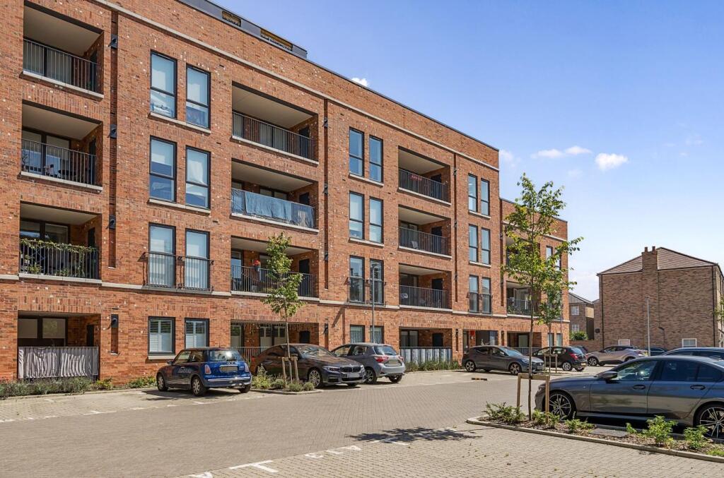
FLAT 17
9 THORNEYCROFT ROAD, LONDON, GREATER LONDON N20 0FW
£1,900 pcm


Property details
Floor area
51 m²
Council tax band
D
EPC rating
B
Deprivation
Decile 7 (22,630 of 33,755)
Street crime
205 incidents within 1 mile (Apr 2026)
Additional details
- Parking
- Yes
Description
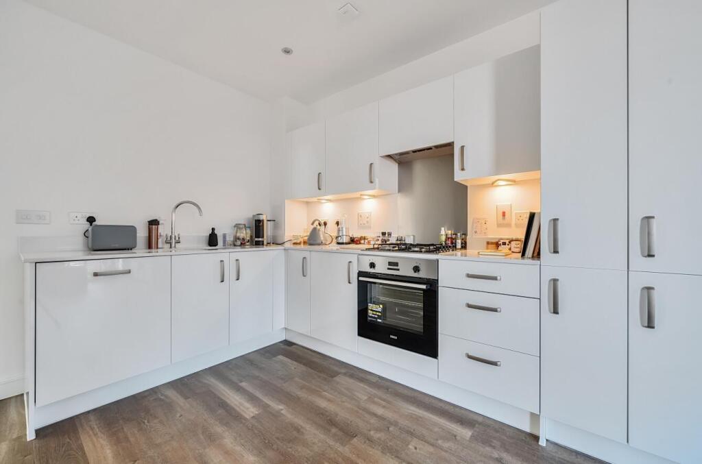
This third (top) floor apartment comprises of an entrance hallway with a storage cupboard and a utility cupboard, an open plan kitchen/lounge, a good sized bathroom, a large bedroom with fitted wardrobes and a balcony.
The property also comes with one parking space, lift access and is close to the High Road as well as Totteridge and Whetstone underground station on the Northern line.
Listed by
Woodside Park
Real Estates
Reference: 166593311
EPC Rating & Upgrade Cost
Current rating: B
Potential rating: B
Inspection date: 12/01/2023
Expiry date: 11/01/2033
Current heating cost: £184/year
Potential heating cost: £184/year
Flood risk
Zone: 1
Risk: Low
Job (default Low)
Floorplans

66a903dd81e53-1165952.jpg
EPC Graphs

EE Rating
Rental Range
Estimated market rent for Barnet. Low = conservative, Realistic = average, Optimistic = best case.
Based on Local Authority from postcode lookup → Barnet.
LHA (30th percentile) floor for Peterborough: £573/mo (Apr 2025 – Mar 2026)
Location
Nearby
Nearest stations, universities and amenities (distance from property).
| Type | Name | Distance |
|---|---|---|
| Bus stop | Oakleigh Park North | 0.1 miles |
| Bus stop | Whetstone / The Griffin | 0.1 miles |
| Shop | Asda Express | 0.1 miles |
| Shop | Charlies | 0.1 miles |
| Train station | Totteridge & Whetstone | 0.3 miles |
| Train station | Oakleigh Park | 0.6 miles |
| Hospital | Priory Hospital | 2.3 miles |
| Hospital | North London Hospice Winchmore Hill | 3.4 miles |
| University | Flood Hazard Research Centre | 3.8 miles |
| University | Middlesex University | 3.8 miles |
Street-level crime
| Category | Count |
|---|---|
| Violence and sexual offences | 57 |
| Anti-social behaviour | 45 |
| Vehicle crime | 23 |
| Burglary | 19 |
| Criminal damage and arson | 10 |
| Other theft | 10 |
| Shoplifting | 10 |
| Public order | 8 |
| Robbery | 7 |
| Drugs | 6 |
| Theft from the person | 5 |
| Other crime | 2 |
| Possession of weapons | 2 |
| Bicycle theft | 1 |
| Total incidents | 205 |
Within 1 mile during Apr 2026. Source: data.police.uk (England & Wales).
Schools nearby
Nearest open schools with Ofsted ratings (England). Closed schools are not shown. Data from Get Information about Schools and Ofsted.
| Name | Type | Distance | Ofsted |
|---|---|---|---|
| All Saints' CofE Nursery and Primary School N20 | Primary | 0.2 miles | Good — 17 Oct 2014 |
| Alma Primary | Primary | 0.2 miles | Good — 5 Oct 2023 |
| Queenswell Infant & Nursery School | Primary | 0.2 miles | Good — 27 Jul 2023 |
| Queenswell Junior School | Primary | 0.2 miles | Good — 26 Feb 2014 |
| Pavilion Study Centre | Other | 0.3 miles | Good — 9 Oct 2017 |
Rental Comparables
Residential lets from OpenRent and Rightmove for the area (same bedroom count). Use to validate rent estimates. Student lets are excluded.
| Title | Rent | Beds | Distance | As seen on |
|---|---|---|---|---|
| Studio Flat, High Road, N20 | £1,400/mo | 1 | 0.3 miles | OpenRent |
| Studio Flat, Church Hill Road, EN4 | £1,000/mo | 1 | 0.75 miles | OpenRent |
| 1 Bed Flat, Damon House, N12 | £1,400/mo | 1 | 0.91 miles | OpenRent |
Average rent: £1,267/mo (3 listings)