FLAT A
48 GOWERS WALK, LONDON, GREATER LONDON E1 8BS
£280 pcm
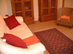

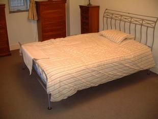

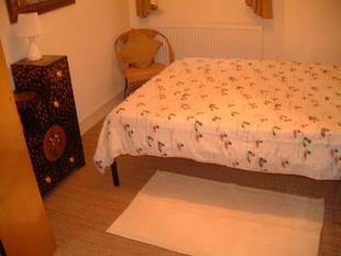
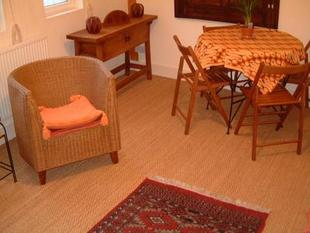
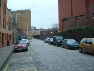
Photo 1 Photo 2 Photo 3 Photo 4 Photo 5 Photo 6 Photo 7
/ 7
Property details
Street crime
2024 incidents within 1 mile (Apr 2026)
Key features
- 2 Large Doubles
- Beautiful Kitchen
- Fantastic Location
- Affordable Rent!
Description
location with separate, fully fitted kitchen, spacious
living/diningroom and 2 large bedrooms. This
property is ideal for professional sharers as it is
close to the city, tube and shops. Bargain rent!
Listed by
City - Lettings
Atkinson McLeod
Reference: 3726719
EPC Rating & Upgrade Cost
Fetching EPC data… Refresh this page in a moment.
Flood risk
Zone: 1
Risk: Low
Job (default Low)
FENSA Certificates
This property has 1 FENSA certificate(s) on record, indicating window/door installations by FENSA-approved installers.
FENSA Certificate #16724144 Recent
Property Details
Street: 48 Gowers Walk
Town: LONDON
Postcode: E1 8BS
Installation Details
Items: 4 windows
Certificate Issued: 16/03/2025
Work Completed: 10/03/2025
This certificate data was retrieved from FENSA's database
What is FENSA? FENSA (Fenestration Self-Assessment Scheme) is a government-authorised scheme that monitors building regulation compliance for replacement windows and doors. Certificates indicate that work was completed by FENSA-approved installers.
Company ownership
Registered legal owner is a company.
Rental Range
Estimated market rent for Tower Hamlets. Low = conservative, Realistic = average, Optimistic = best case.
Based on Local Authority from postcode lookup → Tower Hamlets.
LHA (30th percentile) floor for Inner East London: £1,745/mo (Apr 2025 – Mar 2026)
Location
Nearby
Nearest stations, universities and amenities (distance from property).
| Type | Name | Distance |
|---|---|---|
| Shop | Kova | 0.0 miles |
| Shop | Tian Tian Market | 0.0 miles |
| Bus stop | Henriques Street | 0.1 miles |
| University | NTU London | 0.1 miles |
| Train station | Aldgate East | 0.2 miles |
| Train station | Aldgate | 0.3 miles |
| University | Coventry University London Campus | 0.5 miles |
| Hospital | Moorfields at Hoxton | 1.7 miles |
| Hospital | Medlabs Diagnostics | 2.0 miles |
Street-level crime
| Category | Count |
|---|---|
| Violence and sexual offences | 404 |
| Anti-social behaviour | 376 |
| Other theft | 308 |
| Theft from the person | 228 |
| Shoplifting | 154 |
| Public order | 105 |
| Burglary | 96 |
| Drugs | 84 |
| Criminal damage and arson | 74 |
| Vehicle crime | 66 |
| Robbery | 54 |
| Bicycle theft | 43 |
| Other crime | 21 |
| Possession of weapons | 11 |
| Total incidents | 2024 |
Within 1 mile during Apr 2026. Source: data.police.uk (England & Wales).
Schools nearby
Nearest open schools with Ofsted ratings (England). Closed schools are not shown. Data from Get Information about Schools and Ofsted.
| Name | Type | Distance | Ofsted |
|---|---|---|---|
| Harry Gosling Primary School | Primary | 0.1 miles | Good — 1 Mar 2013 |
| London Enterprise Academy | Secondary | 0.2 miles | — (Inspected (no overall grade)) |
| Kobi Nazrul Primary School | Primary | 0.2 miles | Good — 29 Feb 2016 |
| English Martyrs Roman Catholic Primary School | Primary | 0.2 miles | Good — 23 May 2013 |
| Date Palm Primary | Other | 0.2 miles | Good — 19 May 2022 |
Rental Comparables
Rental comparables are temporarily unavailable while listing-site fetches are paused. Try again later.