18A
COLLEGE ROAD, HARROW, GREATER LONDON HA1 1BE
£1,200 pcm
Property details
Floor area
51 m²
Council tax band
C
Deprivation
Decile 4 (11,714 of 33,755)
Street crime
643 incidents within 1 mile (Apr 2026)
Key features
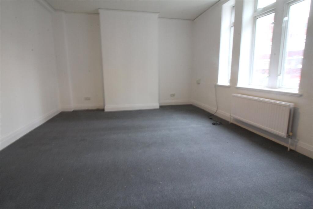
- ONE BEDROOM FLAT
- SPACIOUS LIVING ROOM
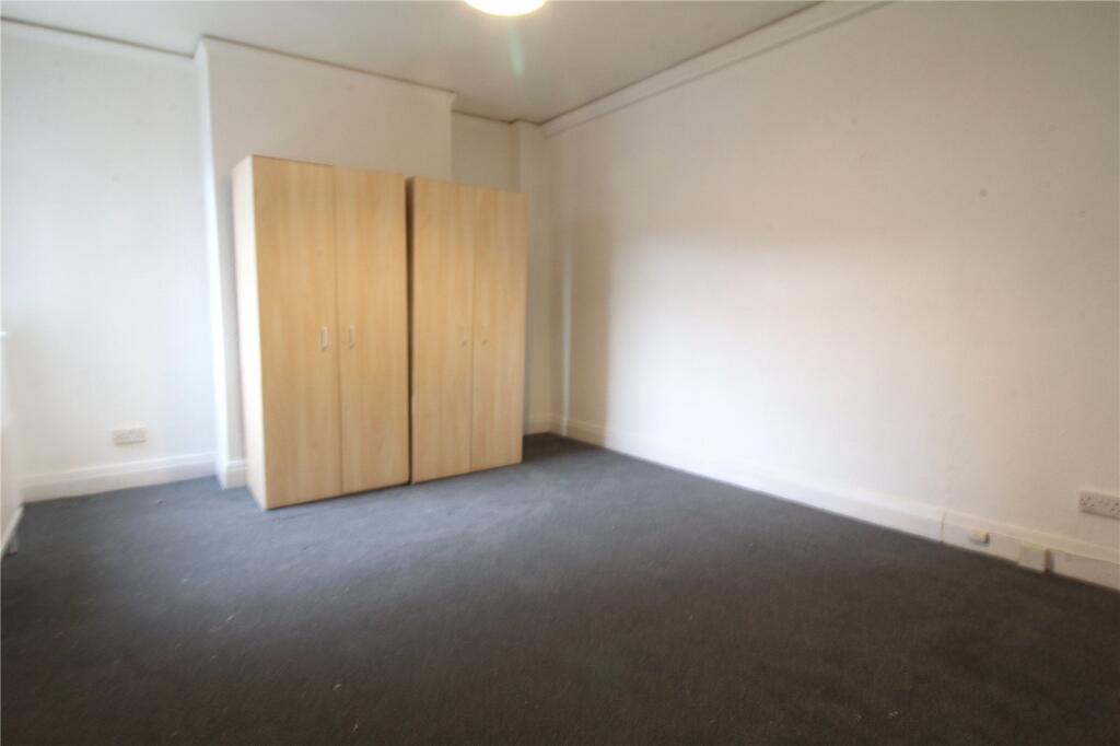
- DOUBLE BEDROOM
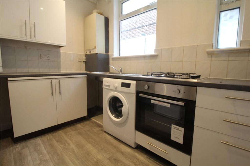
- MODERN KITCHEN UNITS
- CARPETS THROUGHOUT
- RECENTLY PAINTED THROUGHOUT
- OPPOSITE TUBE
- CLOSE TO AMENITIES
- PART FURNISHED
- CENTRAL HARROW
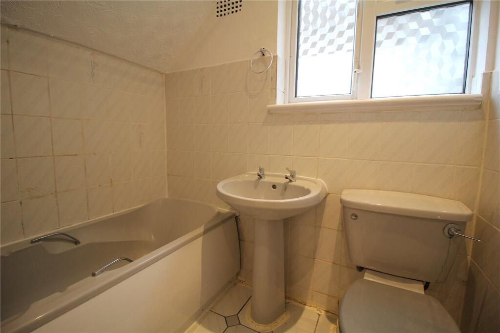
Description
DEPOSIT:£1384.00
Listed by
Stanmore
The Property Franchise Group
Reference: 162455534
EPC Rating & Upgrade Cost
Fetching EPC data… Refresh this page in a moment.
Flood risk
Zone: 1
Risk: Low
Job (default Low)
EPC Graphs
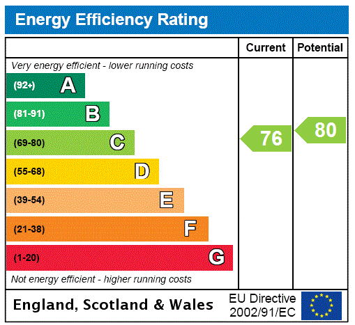
EPC Rating Graph
Rental Range
Estimated market rent for Harrow. Low = conservative, Realistic = average, Optimistic = best case.
Based on Local Authority from postcode lookup → Harrow.
LHA (30th percentile) floor for North West London: £1,097/mo (Apr 2025 – Mar 2026)
Location
Nearby
Nearest stations, universities and amenities (distance from property).
| Type | Name | Distance |
|---|---|---|
| Shop | Toni & Guy | 0.0 miles |
| Shop | Prahova | 0.0 miles |
| Bus stop | Harrow Bus Station | 0.1 miles |
| Train station | Harrow-on-the-Hill | 0.1 miles |
| University | Westminster University, Harrow Campus | 0.6 miles |
| Hospital | Northwick Park Hospital | 0.7 miles |
| Hospital | St Mark's | 0.7 miles |
| Train station | West Harrow | 0.7 miles |
| University | John Scales Centre for Biomedical Engineering | 3.7 miles |
Street-level crime
| Category | Count |
|---|---|
| Violence and sexual offences | 175 |
| Anti-social behaviour | 144 |
| Shoplifting | 70 |
| Theft from the person | 55 |
| Vehicle crime | 40 |
| Public order | 32 |
| Other theft | 30 |
| Criminal damage and arson | 26 |
| Drugs | 25 |
| Robbery | 21 |
| Burglary | 16 |
| Other crime | 4 |
| Bicycle theft | 3 |
| Possession of weapons | 2 |
| Total incidents | 643 |
Within 1 mile during Apr 2026. Source: data.police.uk (England & Wales).
Schools nearby
Nearest open schools with Ofsted ratings (England). Closed schools are not shown. Data from Get Information about Schools and Ofsted.
| Name | Type | Distance | Ofsted |
|---|---|---|---|
| The Jubilee Academy | Other | 0.1 miles | Outstanding — 18 Jun 2023 |
| Red Balloon Learner Centre - Northwest London | Other | 0.3 miles | — (No rating) |
| Norbury School | Primary | 0.3 miles | Good — 12 Nov 2012 |
| Alpha Preparatory School | Other | 0.4 miles | — (No rating) |
| Harrow High School | Secondary | 0.4 miles | Good — 4 Apr 2014 |
Rental Comparables
Residential lets from OpenRent and Rightmove for the area (same bedroom count). Use to validate rent estimates. Student lets are excluded.
| Title | Rent | Beds | Distance | As seen on |
|---|---|---|---|---|
| 1 Bed Flat, Roxborough Heights, HA1 | £1,600/mo | 1 | 0.21 miles | OpenRent |
| 1 Bed Flat, Chesterton House, HA1 | £1,950/mo | 1 | 0.21 miles | OpenRent |
Average rent: £1,775/mo (2 listings)