Pystill Farm
FACHALLT ROAD, HOLYWELL, WHITFORD, FLINTSHIRE CH8 9AL
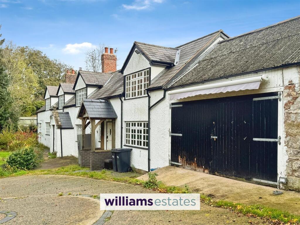
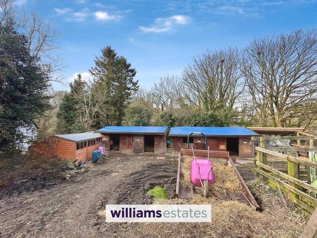
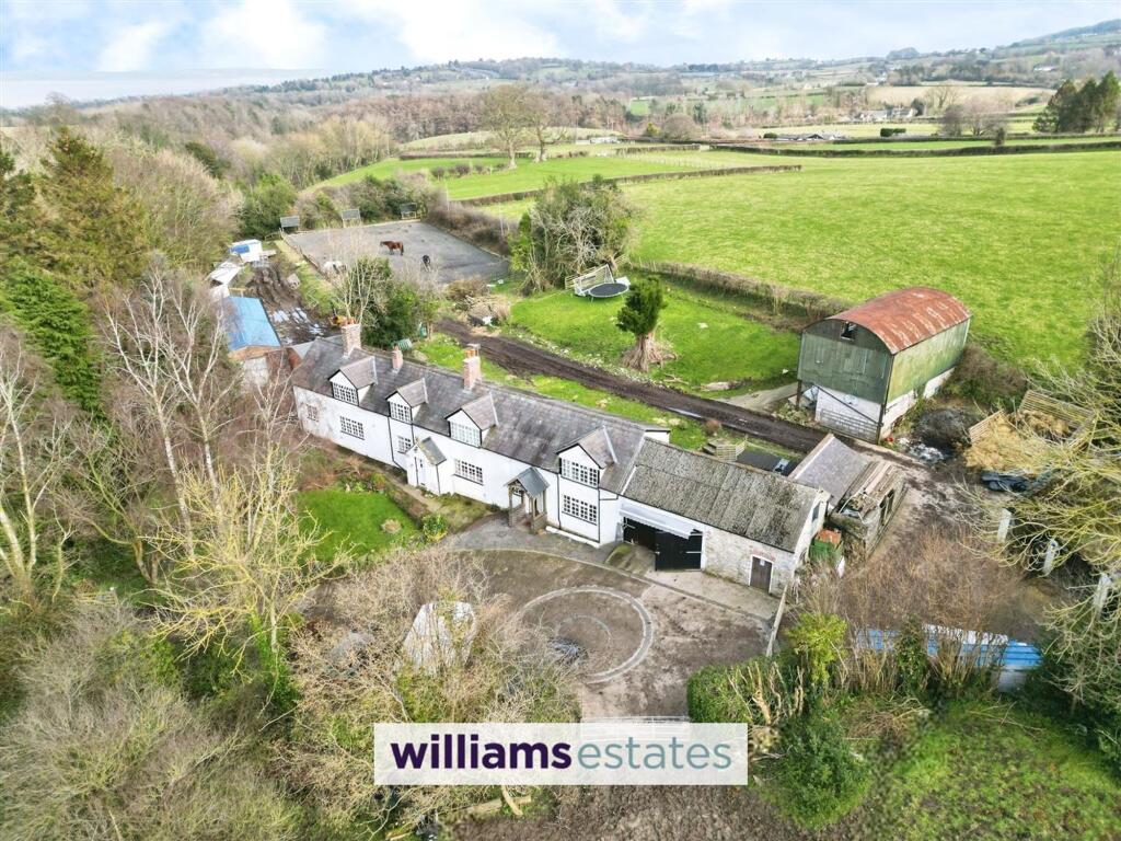
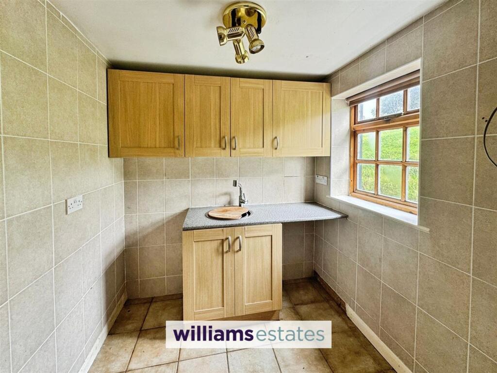
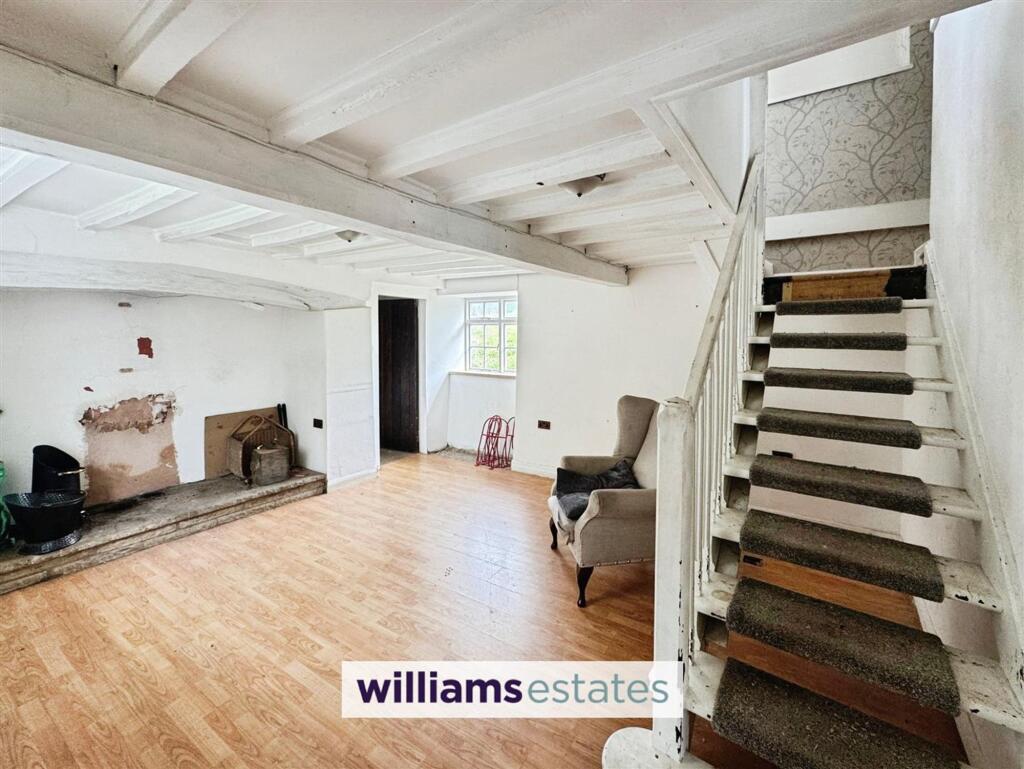
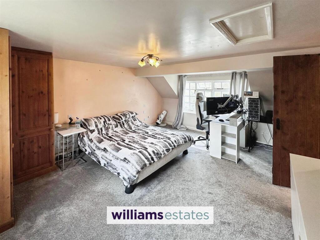
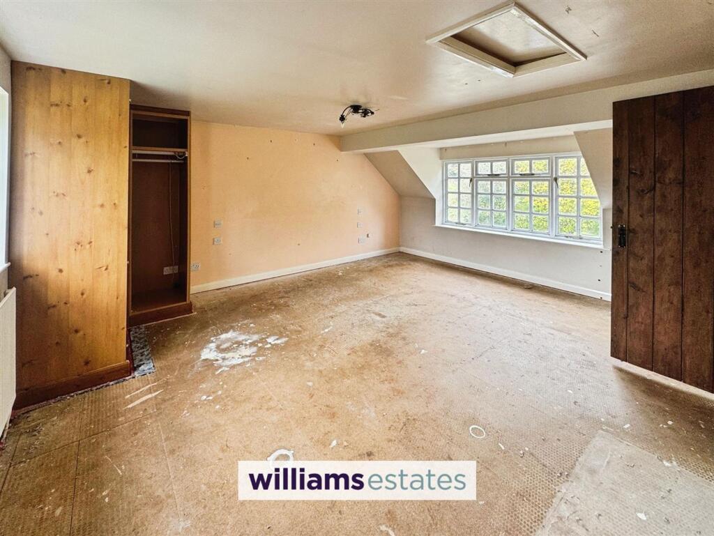
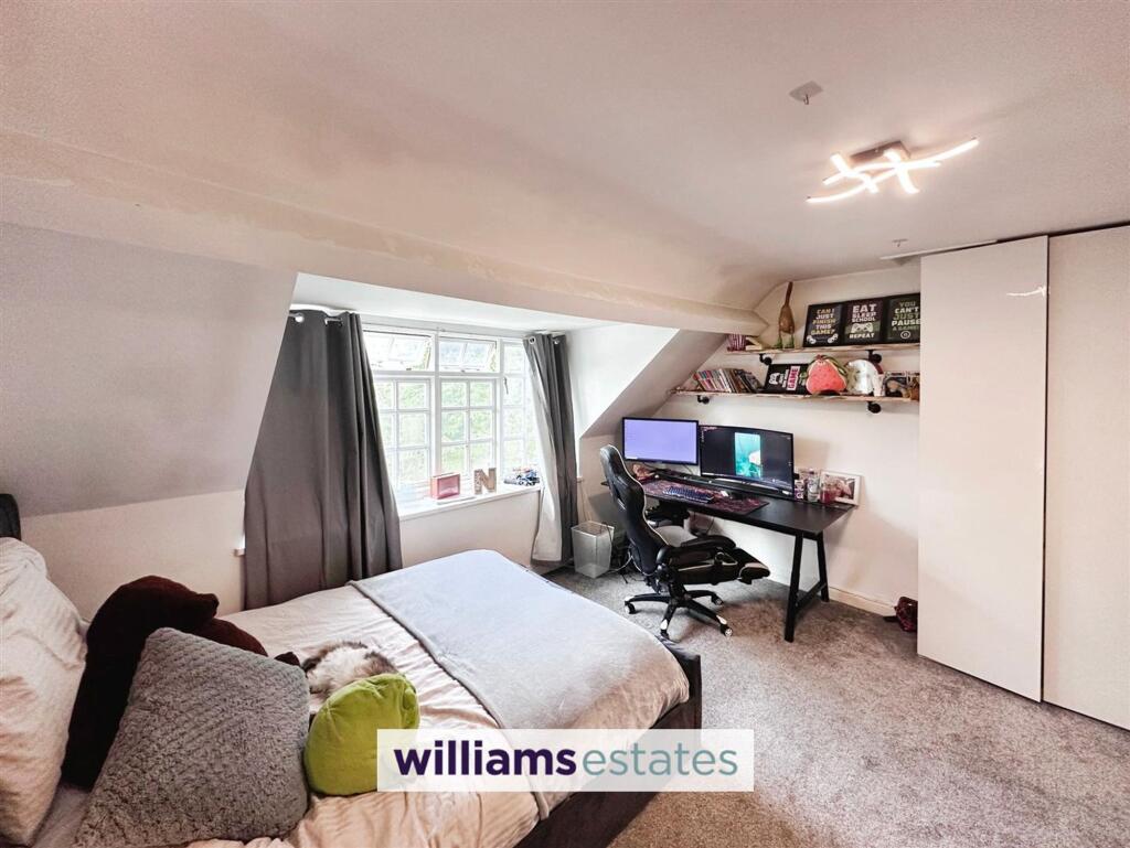
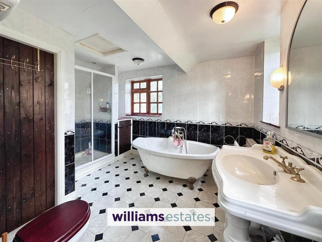
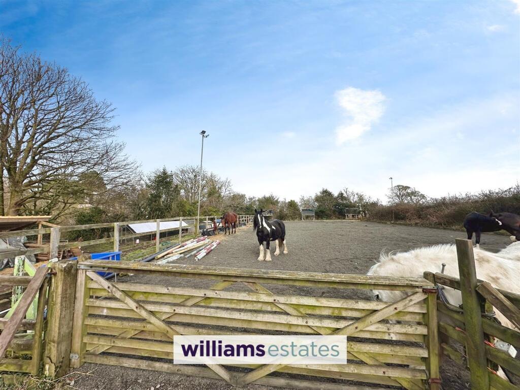
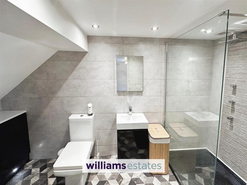
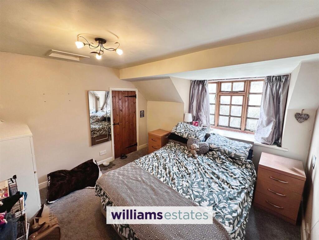
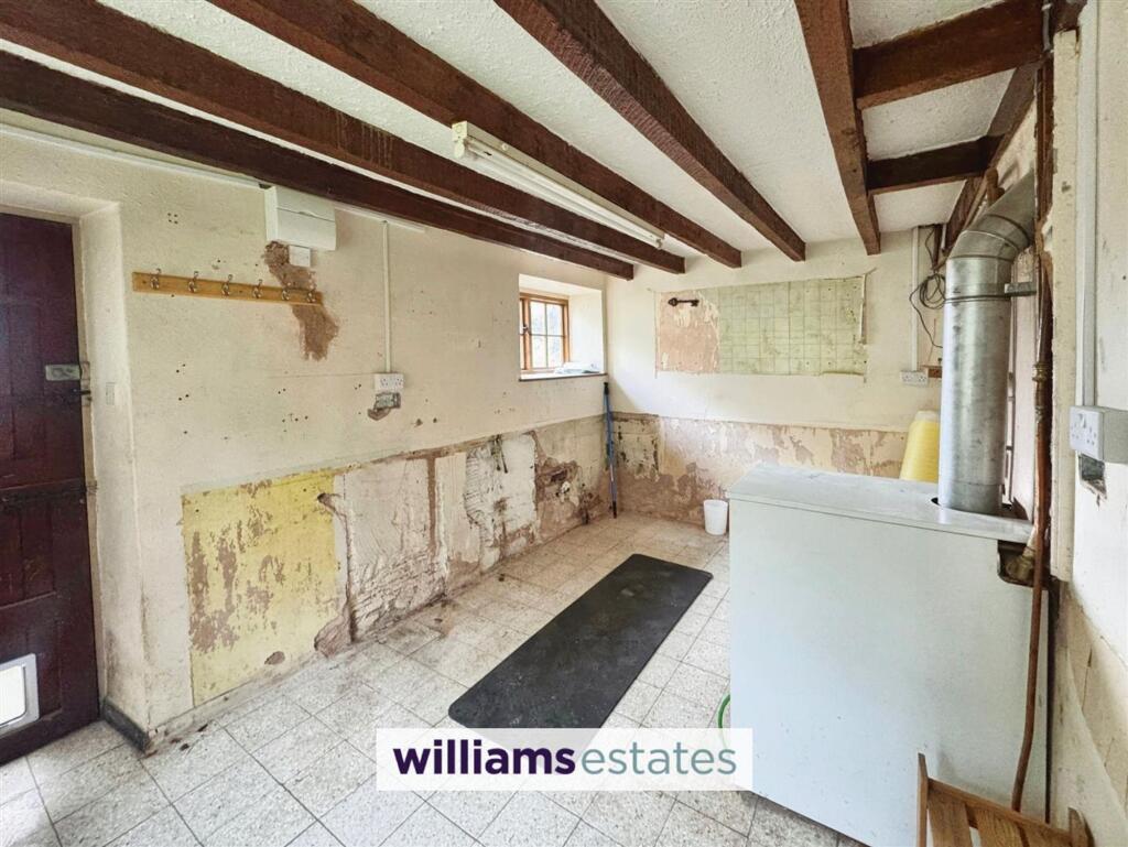
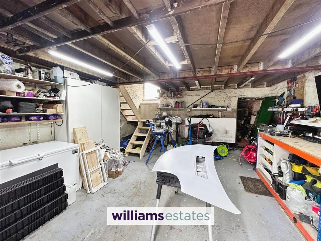
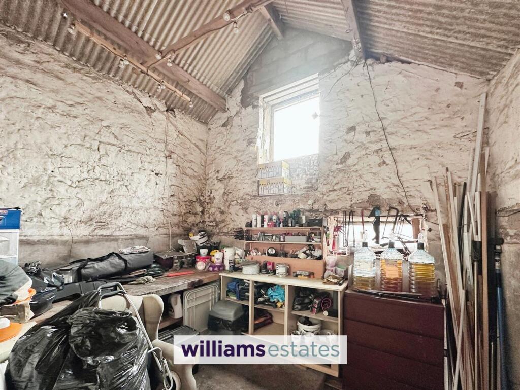
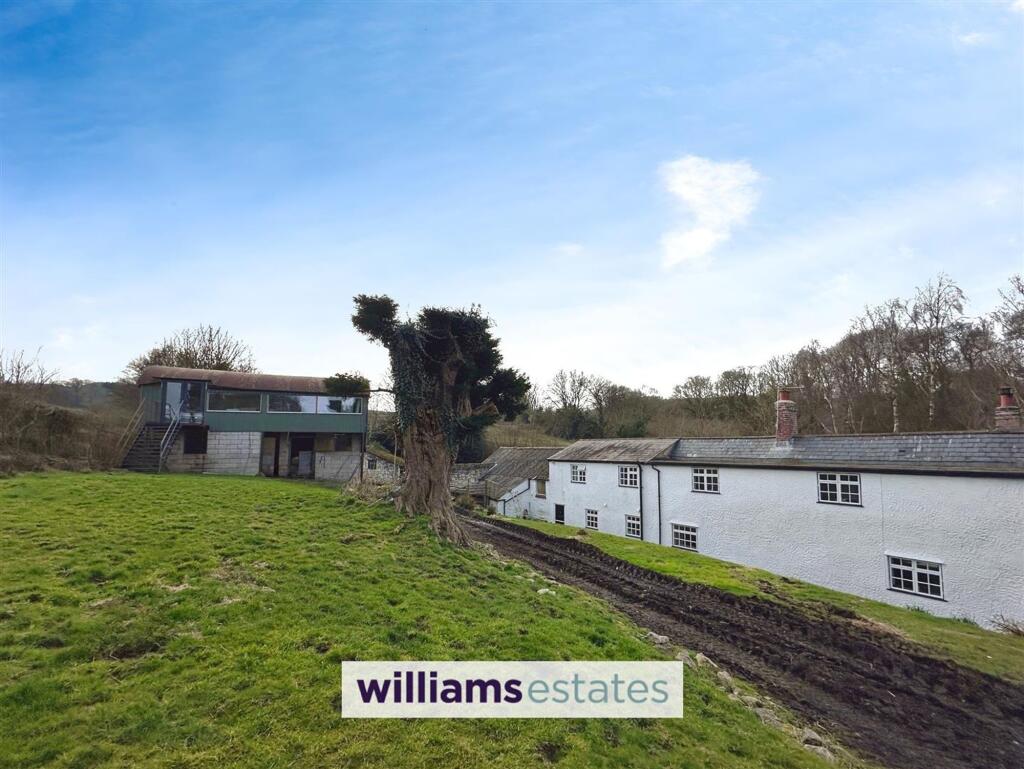
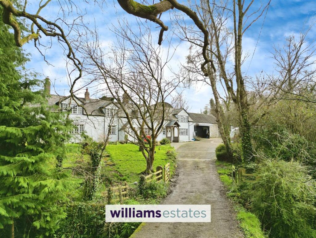
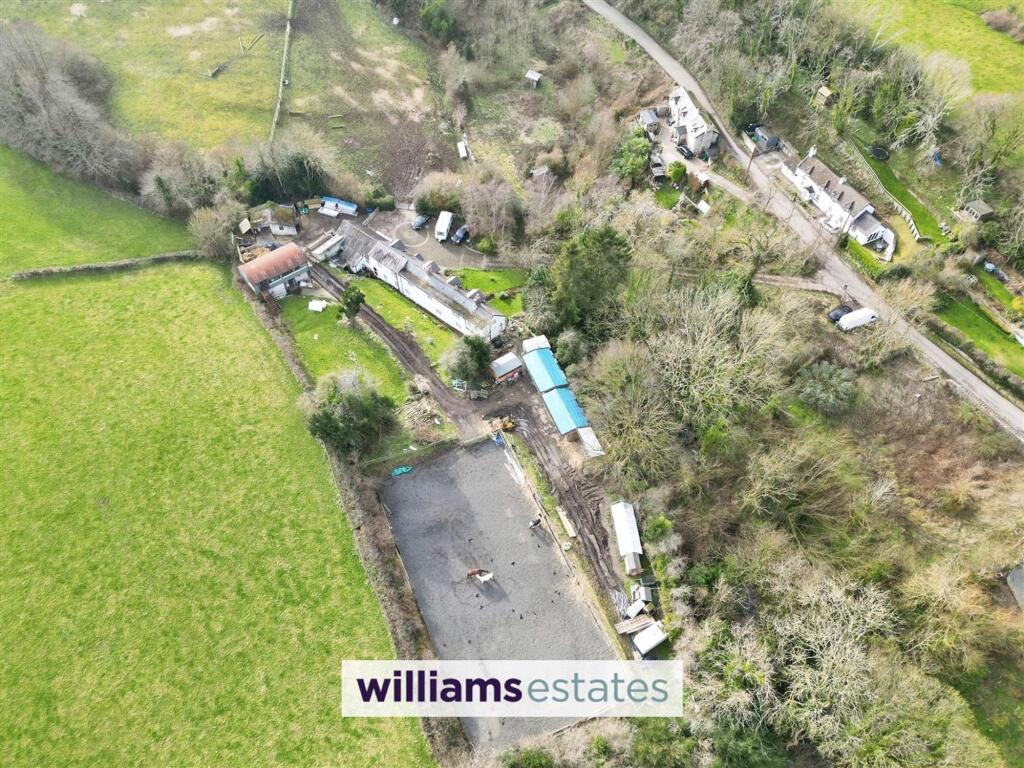
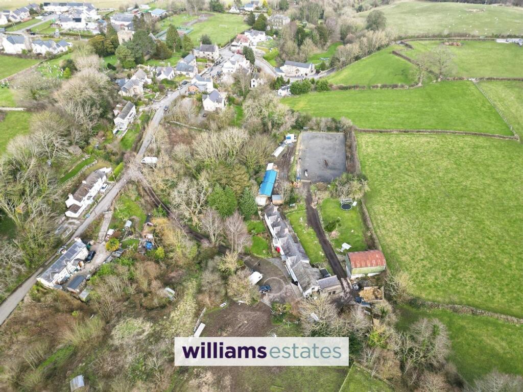
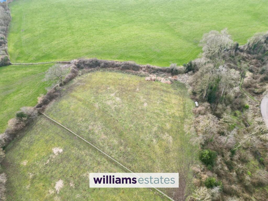
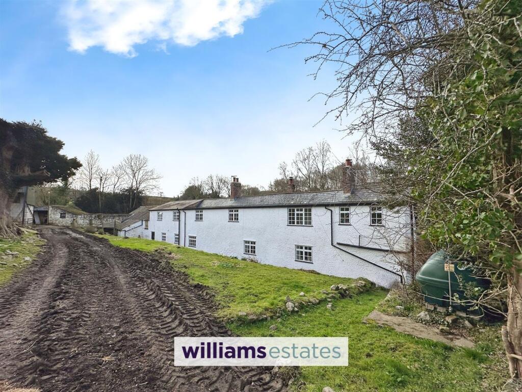
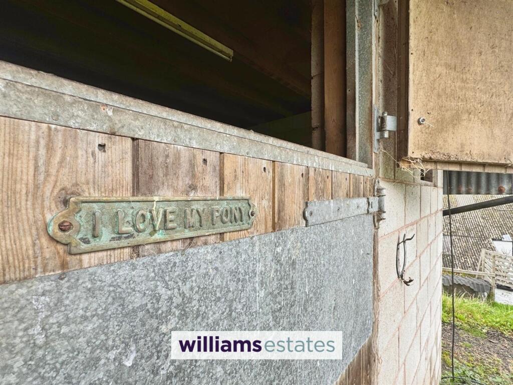
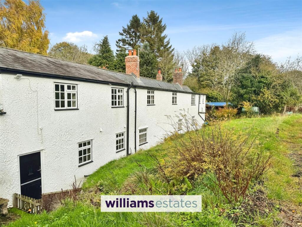
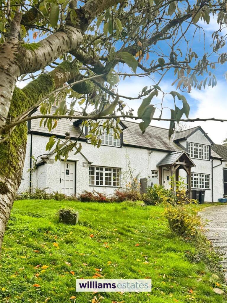
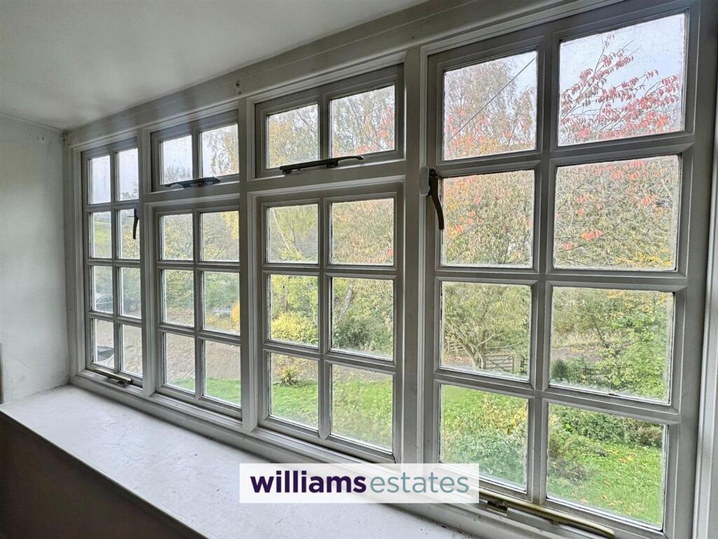
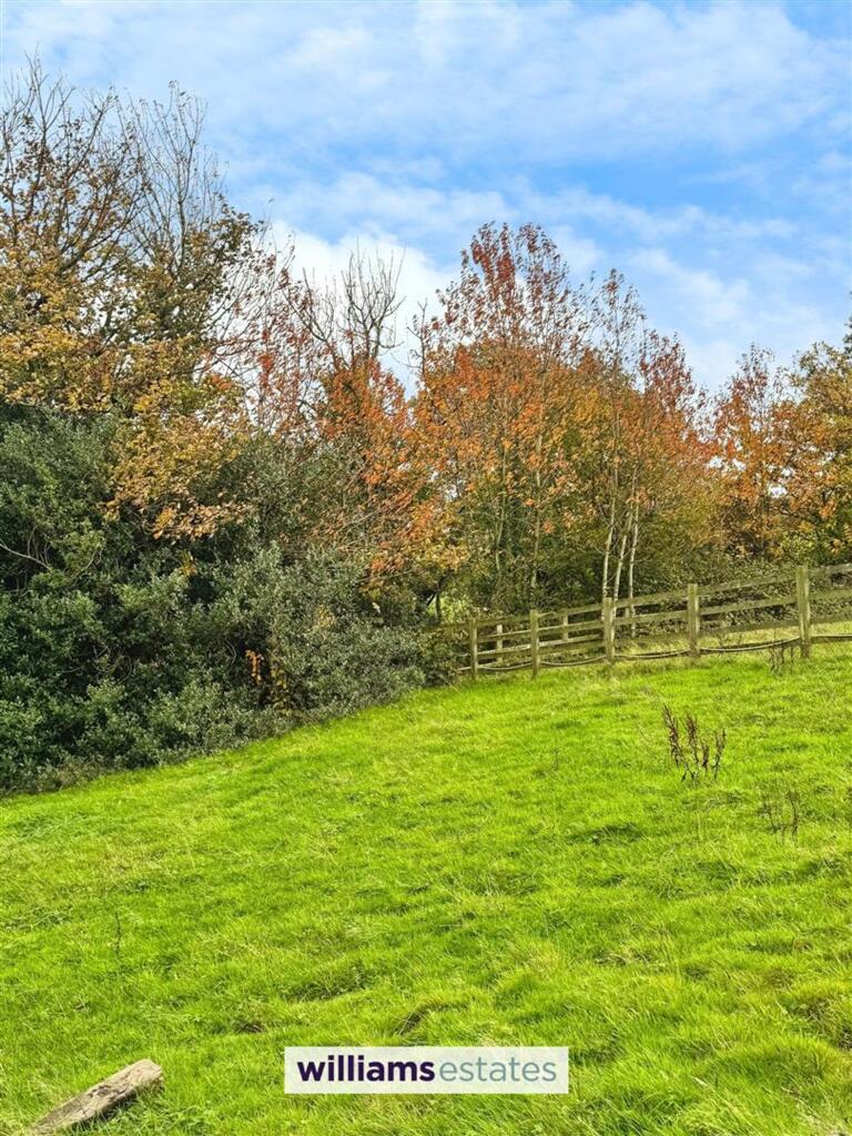
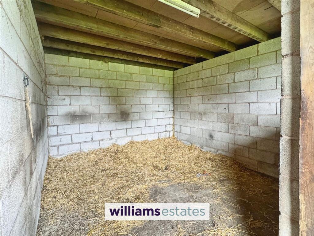
Front Stables Aerial View Lounge Kitchen Reception Room Dining Room Kitchen Utility Room Living Room Bedroom One Bedroom Bedroom Family Bathroom Ménage En-suite off Bedroom One Bedroom Four Store Room Garage Garage Rear of the Property Driveway to the Front Aerial Shot Aerial View Land Rear of the Property Stable Rear Elevation Rear Elevation Views Gardens Stable
/ 32
Property details
Council tax band
G
Last sold
£620,000 Apr 2023
Local average
£410,595 (+58.2%)
Street crime
0 incidents within 1 mile (Apr 2026)
Key features
- Double garage and Workshop
- Timber Stables
- EPC Rating - E
- Council Tax Band - G
- Tenure - Freehold
- Outbuildings
- Four Double Bedrooms with Two En-Suites
- Sat in the Village of Whitford
- 5.18 Acres of Land Small Holding
- 40m x 20m Ménage Arena
Additional details
- Parking
- Yes
- Garden
- Yes
- Restrictions
- No
- Rights of way
- No
- Flooded in last 5 years
- No
- Flood defences
- No
Description
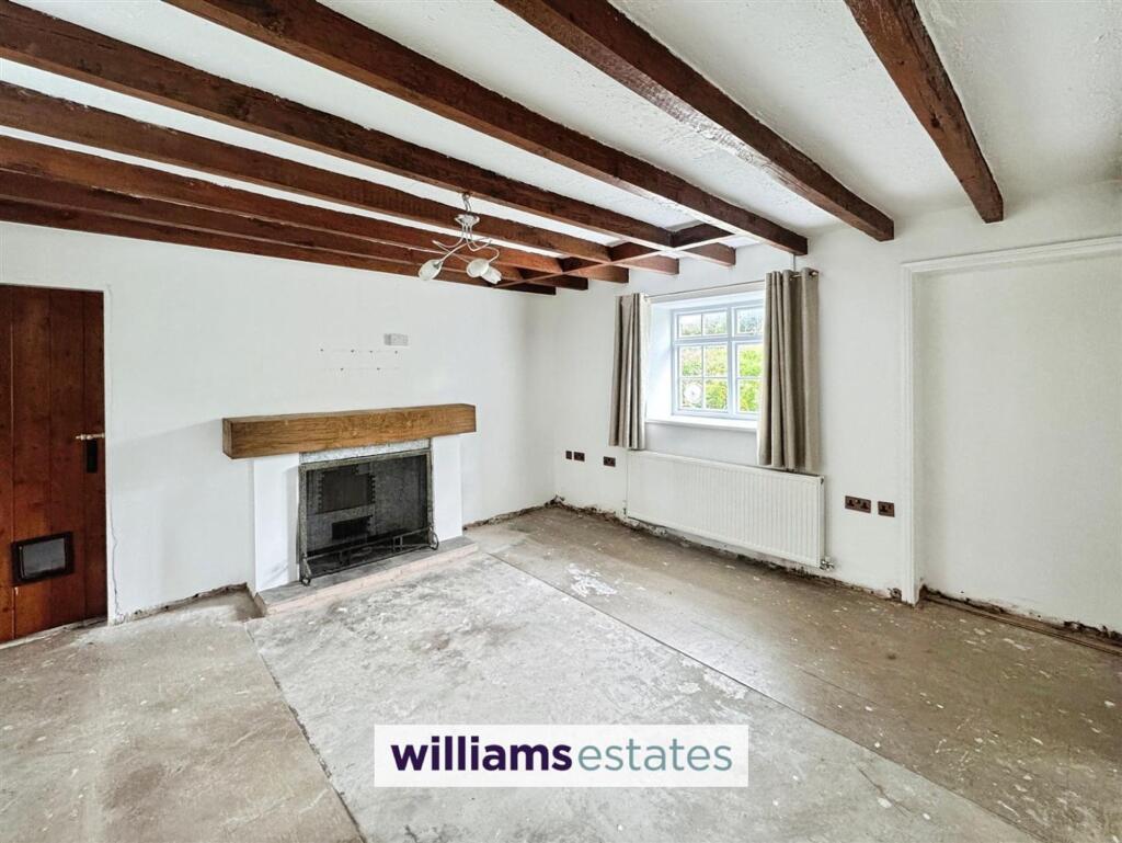
Surrounded by extensive gardens and a large driveway, this home provides fantastic views and a tranquil setting, ideal for those seeking peace in a beautiful village location. The included ménage arena adds versatility for equestrian enthusiasts as well as stables. This property truly offers a unique opportunity for a serene lifestyle amidst stunning countryside as well as an excellent potential for personalisation.
EPC Rating: E
Listed by
Prestatyn
Williams Estates
Reference: 171579446
EPC ratings on this postcode
We don't have a matched EPC for this property yet. Below are efficiency scores and details for other addresses on this postcode.
| Address | Current | Potential | Floor area | Age band | Type |
|---|---|---|---|---|---|
| 1 Fachallt farm, Fachallt farm, Whitford, HOLYWELL | 44 | 85 | 274 m² | England and Wales: before 1900 | Detached |
| 1 Fachallt Farm, Fachallt Road, Whitford, HOLYWELL | 49 | 79 | 256 m² | England and Wales: before 1900 | Detached |
| Garreg Farm, Fachallt Road, Whitford, HOLYWELL | 56 | 88 | 183 m² | England and Wales: before 1900 | Detached |
| Hollow Farm, Fachallt Road, Whitford, HOLYWELL | 72 | 116 | 92 m² | England and Wales: before 1900 | Detached |
| Hollow Farm, Fachallt Road, Whitford, HOLYWELL | 14 | 77 | 92 m² | England and Wales: before 1900 | Detached |
| Hollow Farm, Fachallt Road, Whitford, HOLYWELL | 16 | 64 | 82 m² | England and Wales: 1900-1929 | Detached |
| Orchard Cottage, Fachallt Road, Whitford, HOLYWELL | 57 | 84 | 92 m² | England and Wales: before 1900 | Detached |
| Pistyll Farm, Fachallt Road, Whitford, HOLYWELL | 43 | 91 | 231 m² | England and Wales: before 1900 | Detached |
| The Barn, Fachallt Road, Whitford, HOLYWELL | 68 | 85 | 119 m² | England and Wales: before 1900 | Detached |
Flood risk
Zone: 1
Risk: Low
Job (default Low)
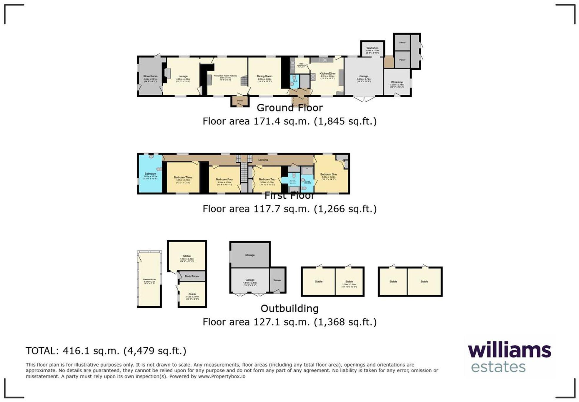
Floorplans
All
Price history
| Event | Date | Price | % change |
|---|---|---|---|
| Listed for sale | — | £649,500 | +4.8% |
| Sold | 04/04/2023 (3 years ago) | £620,000 | — |
Source: HM Land Registry Price Paid Data. Crown copyright.
Sold Comparables
Sold comparables data is not available for this property.
Capital growth trend
Land Registry outcode average: last 12 months vs 5y and 10y ago (from sold prices).
House Price Index (HM Land Registry — official index, not sold-price averages): Flintshire. Series: Detached. As of March 2026.
Rental Range
Estimated market rent for Flintshire. Low = conservative, Realistic = average, Optimistic = best case.
Based on Local Authority from postcode lookup → Flintshire.
Location
Address
Whitford Road
Nearby
Nearest stations, universities and amenities (distance from property).
| Type | Name | Distance |
|---|---|---|
| Shop | Modern Vehicle Services | 1.2 miles |
| Bus stop | Glan-y-don, Ffordd Pennant / Bryn Pennant School | 1.4 miles |
| Shop | Pennant Stores | 1.5 miles |
| Train station | Prestatyn | 5.9 miles |
| Train station | Flint | 6.9 miles |
| Hospital | Denbigh Infirmary | 9.0 miles |
| University | Wrexham University | 9.8 miles |
| University | University of Liverpool Leahurst Veterinary School | 10.6 miles |
| Hospital | Clatterbridge Cancer Centre - Wirral | 10.9 miles |
Street-level crime
| Category | Count |
|---|---|
| Total incidents | 0 |
Within 1 mile during Apr 2026. Source: data.police.uk (England & Wales).
Schools nearby
Nearest open schools with Ofsted ratings (England). Closed schools are not shown. Data from Get Information about Schools and Ofsted.
| Name | Type | Distance | Ofsted |
|---|---|---|---|
| Ysgol Y Llan, Whitford V.P. | Other | 0.2 miles | — (No rating) |
| Ysgol Bro Carmel | Other | 1.4 miles | — (No rating) |
| Ysgol Bryn Pennant C.P. | Other | 1.4 miles | — (No rating) |
| The Clocktower School | Other | 1.7 miles | — (No rating) |
| Ysgol Gynradd Trelogan | Other | 2.1 miles | — (No rating) |
Rental Comparables
Loading rental comparables for this postcode. Refresh in a few minutes.
Rent-driven metrics
Based on Area rent estimate.
- Rent ratio — Monthly rent ÷ purchase price (1% rule). 1%+ = strong, 0.8–1% = okay, <0.8% = weak for cashflow.
- Max investor price — Rent ÷ 0.8%; the price at which rent would be 0.8% of price (Stoke-style target).
- Target investor price — Rent ÷ 1%; the price at which rent would be 1% of price (strong cashflow band).
- Gross yield — Annual rent as % of purchase price (no costs).
Enter House Number
Enter the house number to help us retrieve more accurate pricing history and property data.
Please log in to submit or correct the house number for this listing.
Log in to continue