APARTMENT 3105
10 PARK DRIVE, LONDON, GREATER LONDON E14 9QY
£2,925 pcm
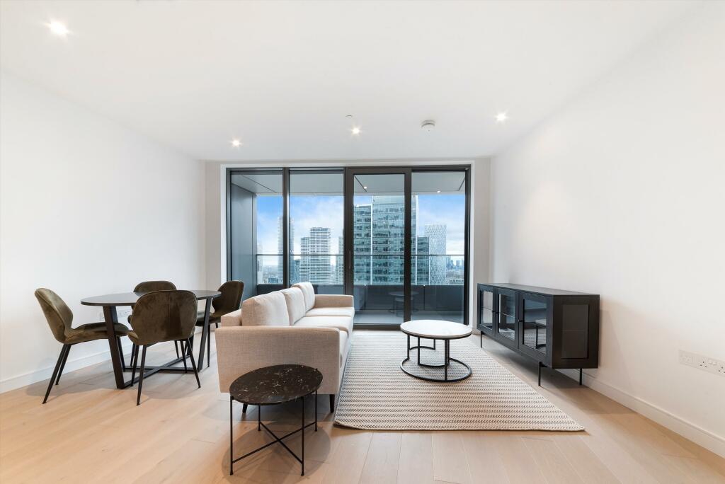
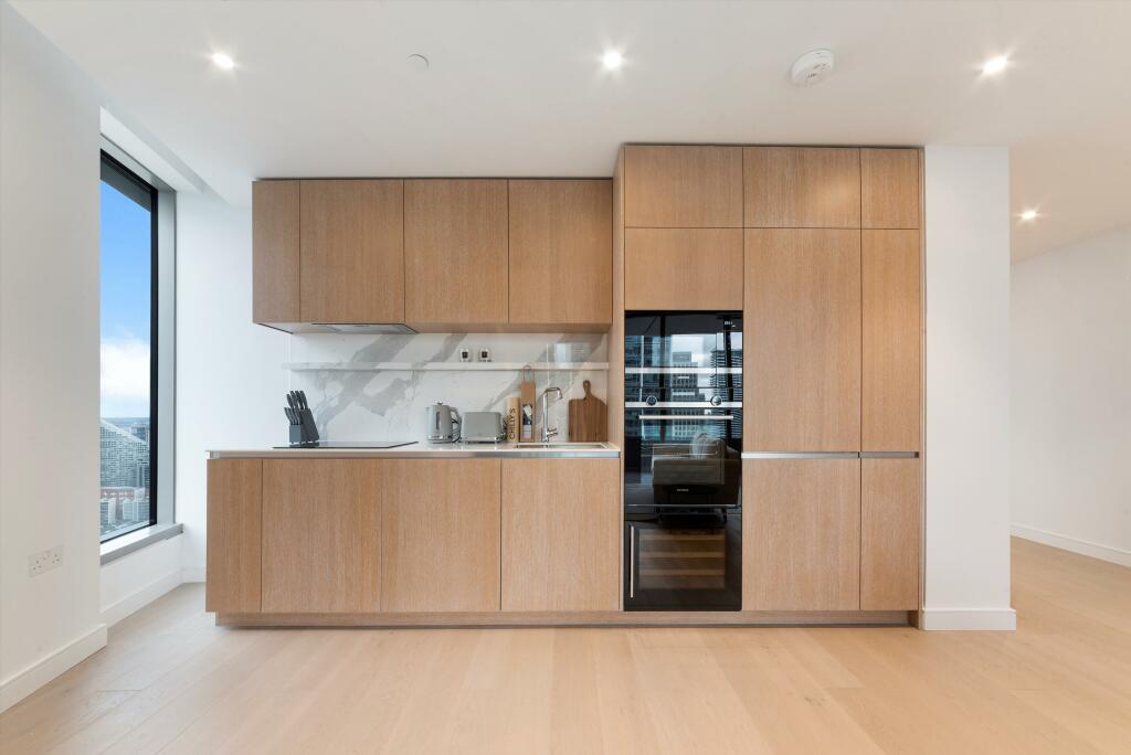
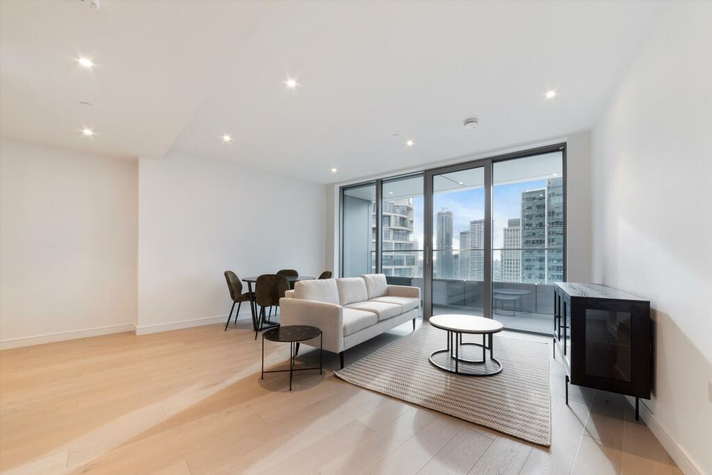
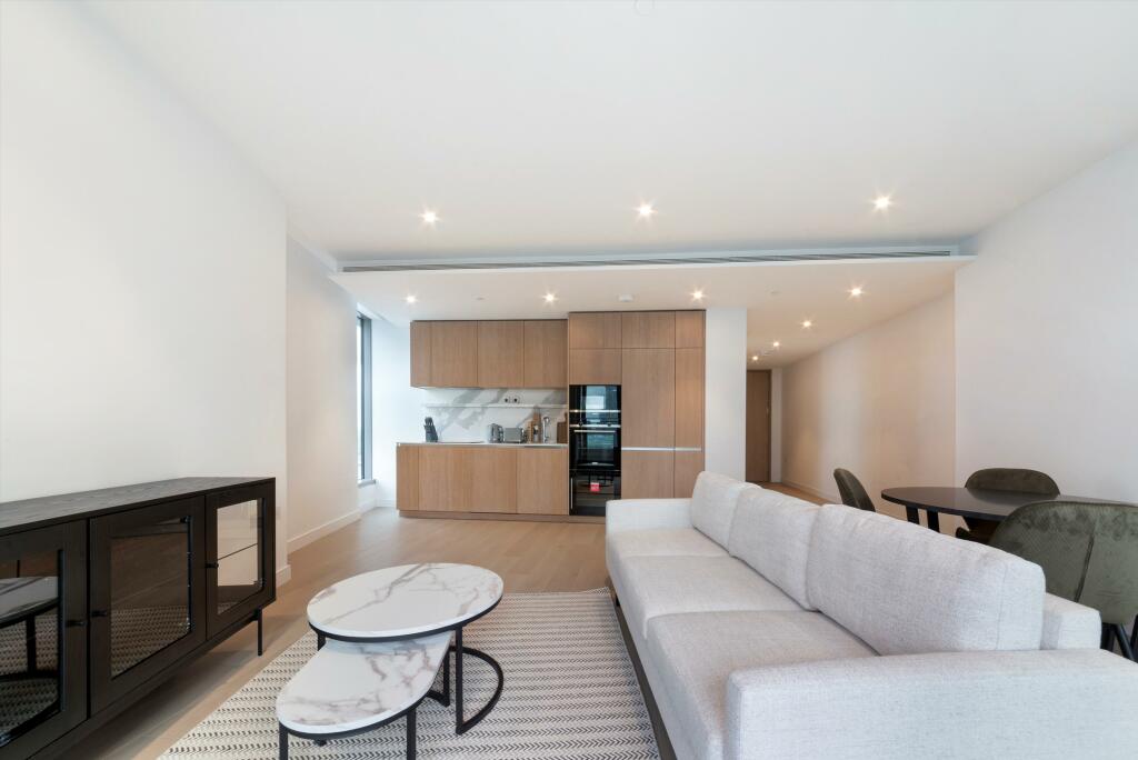
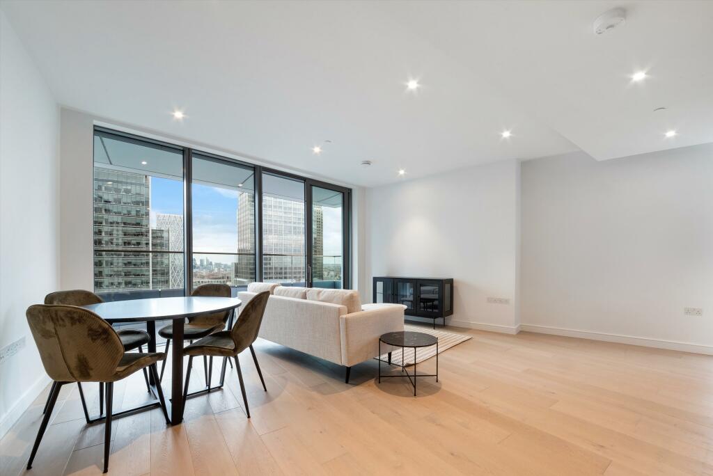

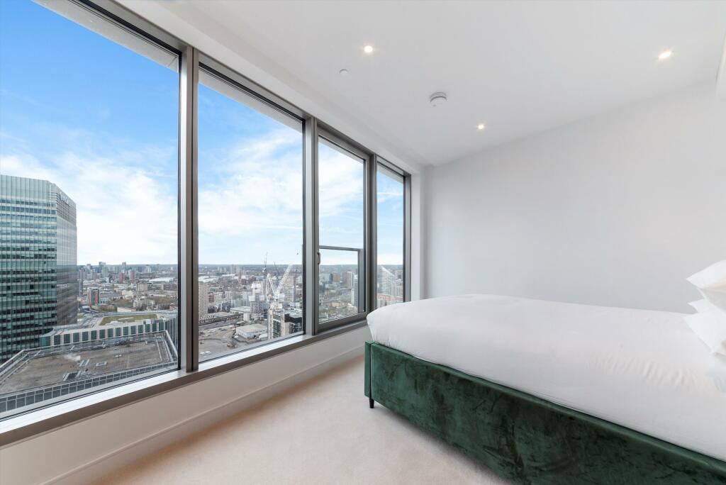
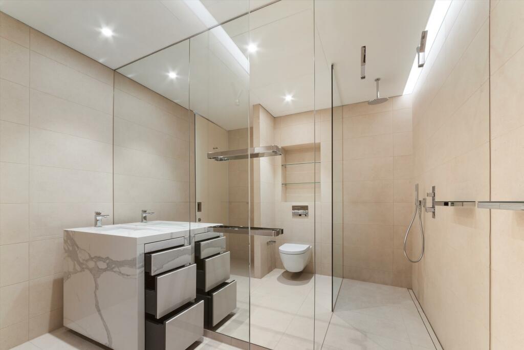
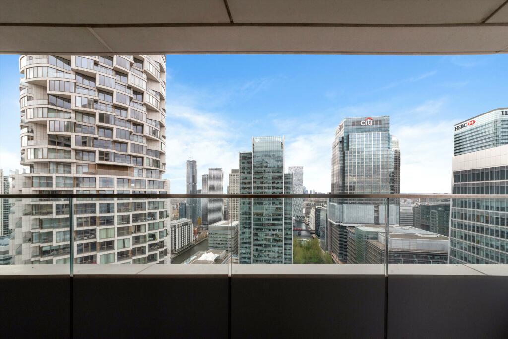
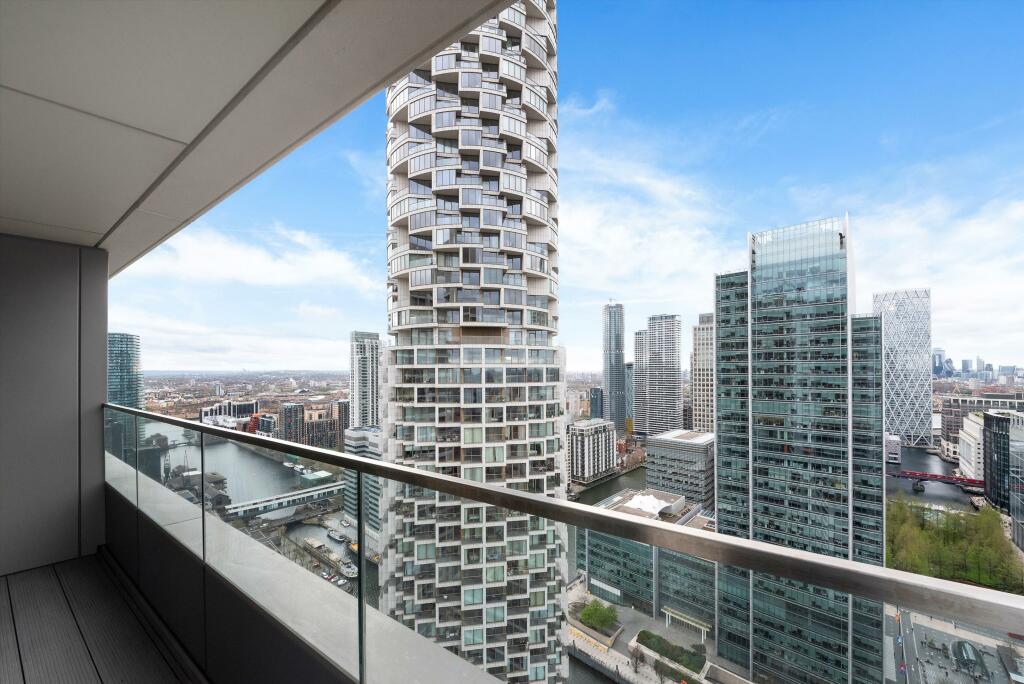
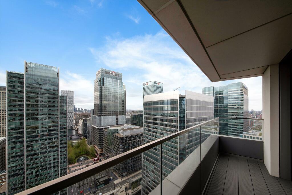
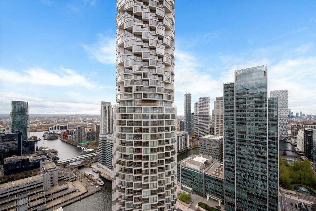
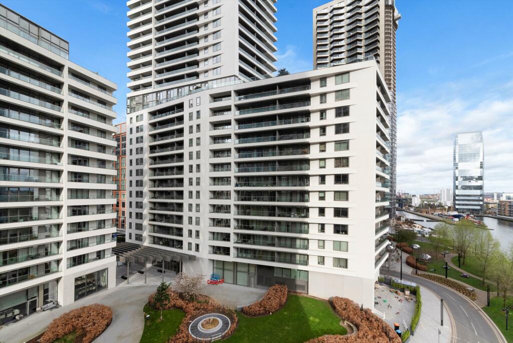
Photo 1 Photo 2 Photo 3 Photo 4 Photo 5 Photo 6 Photo 7 Photo 8 Photo 9 Photo 10 Photo 11 Photo 12 Photo 13
/ 13
Property details
Council tax band
E
Deprivation
Decile 5 (15,484 of 33,755)
Street crime
1144 incidents within 1 mile (Apr 2026)
Key features
- 1 bedroom
- 1 reception room
- 1 bathroom
- Leisure Facilities
- Modern
- Concierge
- Gym
- Town/City
- Upper Floor
- Lateral
Additional details
- Parking
- Yes
Description
The development offers 24 concierge/security, residents terrace and lounge and access to Third Space Gymnasium.10 Park Drive is located within the new Wood Wharf development situated in Canary Wharf, London E14. Close to transport links including Canary Wharf DLR station (0.3 miles) and Jubilee line underground station (0.2 miles). All times and distances are approximate.
Listed by
Canary Wharf
Knight Frank
Reference: 145879613
EPC Rating & Upgrade Cost
Fetching EPC data… Refresh this page in a moment.
Flood risk
Zone: 1
Risk: Low
Job (default Low)
Floorplans
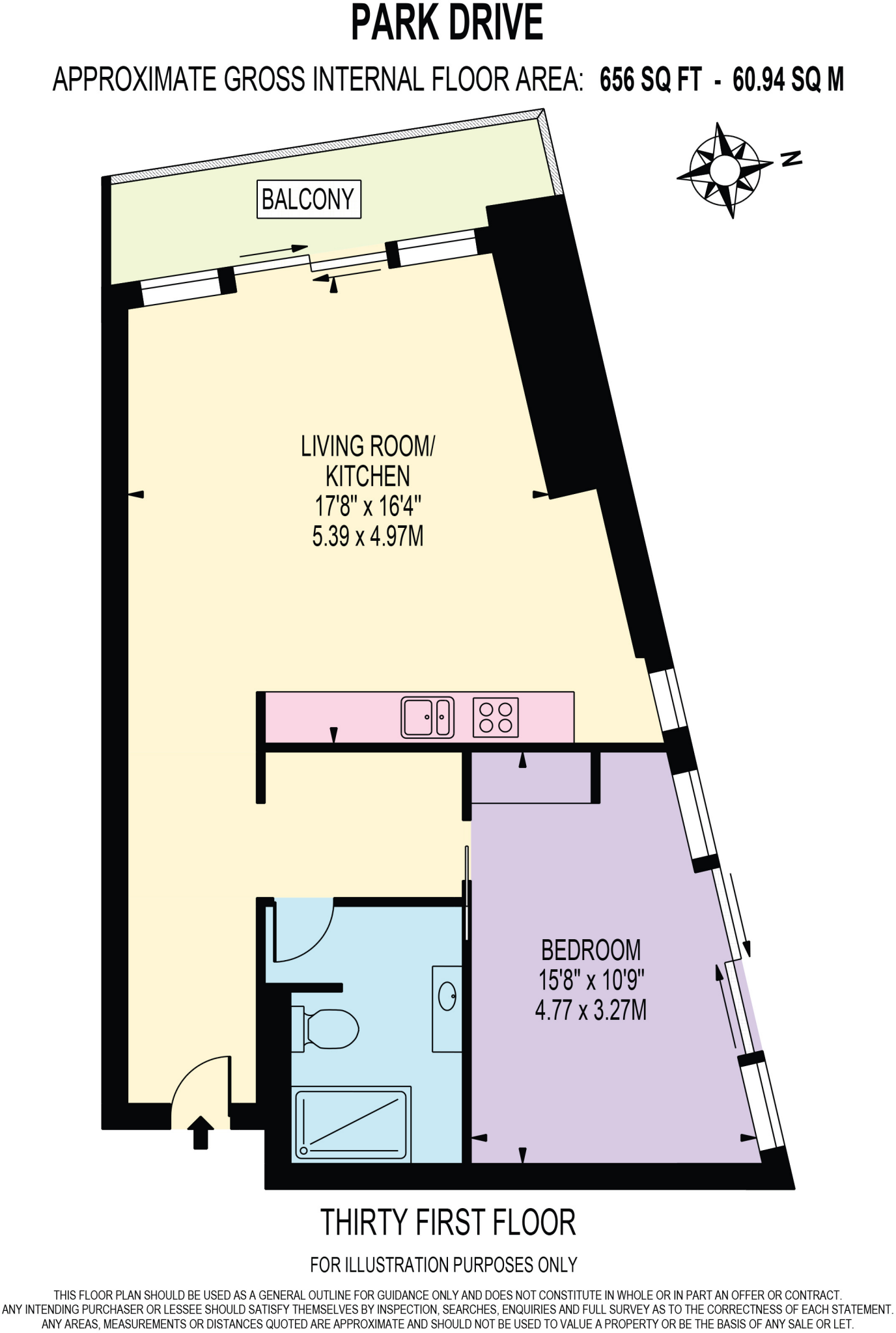
10 Park Drive - hi.j
EPC Graphs
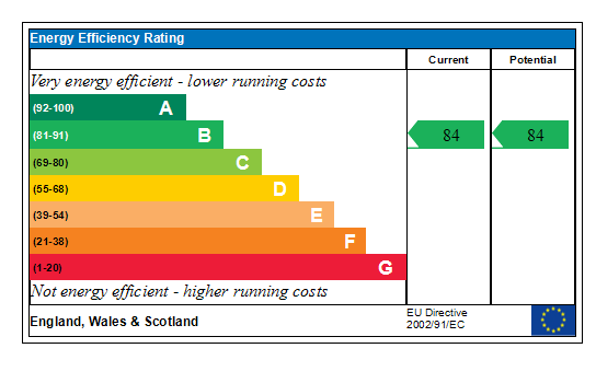
Generated EPC Graph.
Company ownership
Registered legal owner is a company.
Rental Range
Estimated market rent for Tower Hamlets. Low = conservative, Realistic = average, Optimistic = best case.
Based on Local Authority from postcode lookup → Tower Hamlets.
LHA (30th percentile) floor for Inner East London: £1,436/mo (Apr 2025 – Mar 2026)
Location
Nearby
Nearest stations, universities and amenities (distance from property).
| Type | Name | Distance |
|---|---|---|
| Shop | Porsche Store | 0.1 miles |
| Bus stop | Churchill Place | 0.1 miles |
| Shop | Signorelli | 0.1 miles |
| Train station | South Quay | 0.2 miles |
| Train station | Canary Wharf | 0.2 miles |
| University | University of Greenwich | 1.4 miles |
| University | NTU London | 2.4 miles |
| Hospital | A&E Department | 2.5 miles |
| Hospital | Rainbow Ward | 2.6 miles |
Street-level crime
| Category | Count |
|---|---|
| Anti-social behaviour | 277 |
| Violence and sexual offences | 262 |
| Vehicle crime | 94 |
| Drugs | 87 |
| Other theft | 76 |
| Shoplifting | 72 |
| Criminal damage and arson | 62 |
| Theft from the person | 55 |
| Burglary | 48 |
| Public order | 45 |
| Robbery | 33 |
| Bicycle theft | 14 |
| Other crime | 10 |
| Possession of weapons | 9 |
| Total incidents | 1144 |
Within 1 mile during Apr 2026. Source: data.police.uk (England & Wales).
Schools nearby
Nearest open schools with Ofsted ratings (England). Closed schools are not shown. Data from Get Information about Schools and Ofsted.
| Name | Type | Distance | Ofsted |
|---|---|---|---|
| Mulberry Wood Wharf Primary School | Primary | 0.2 miles | — (No rating) |
| Panaga School | Other | 0.2 miles | — (No rating) |
| Al Kafilah Damascus Shell School | Other | 0.2 miles | — (No rating) |
| Pdo Oman School | Other | 0.2 miles | — (No rating) |
| Ecole Yenzi | Other | 0.2 miles | — (No rating) |
Rental Comparables
Rental listings exist nearby, but none matched the 1-bedroom count for this property.