Eckford Vale
Lowe Hill Rd, Wem, Shrewsbury, Shropshire, SY4 5UT
£465,000
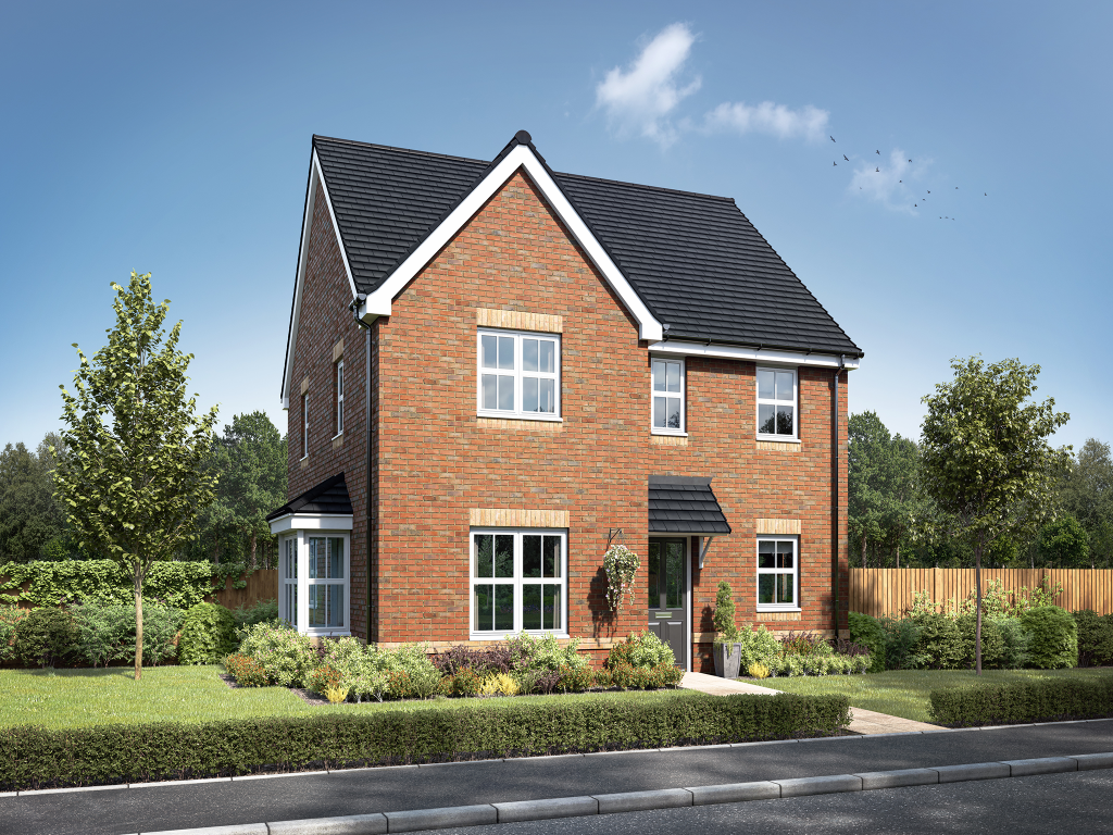
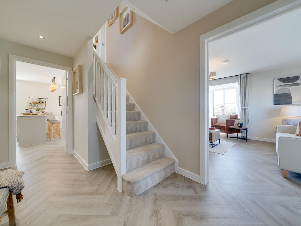
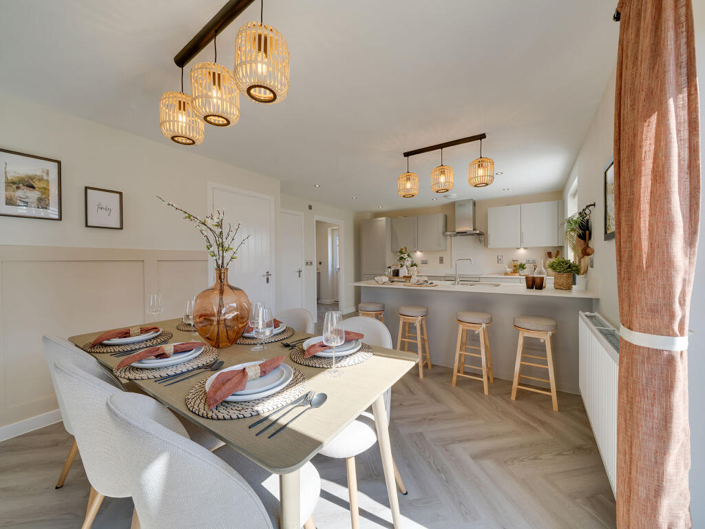
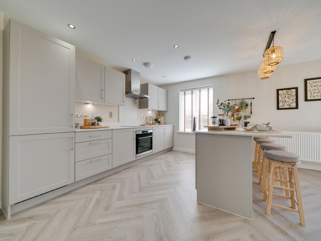
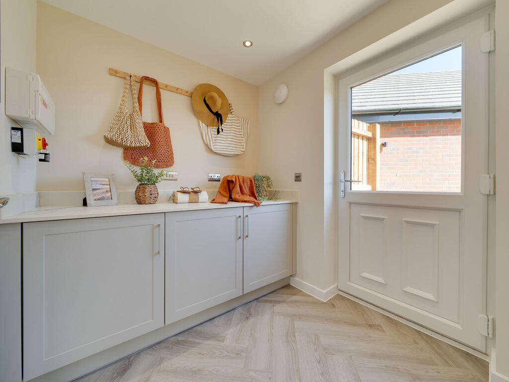

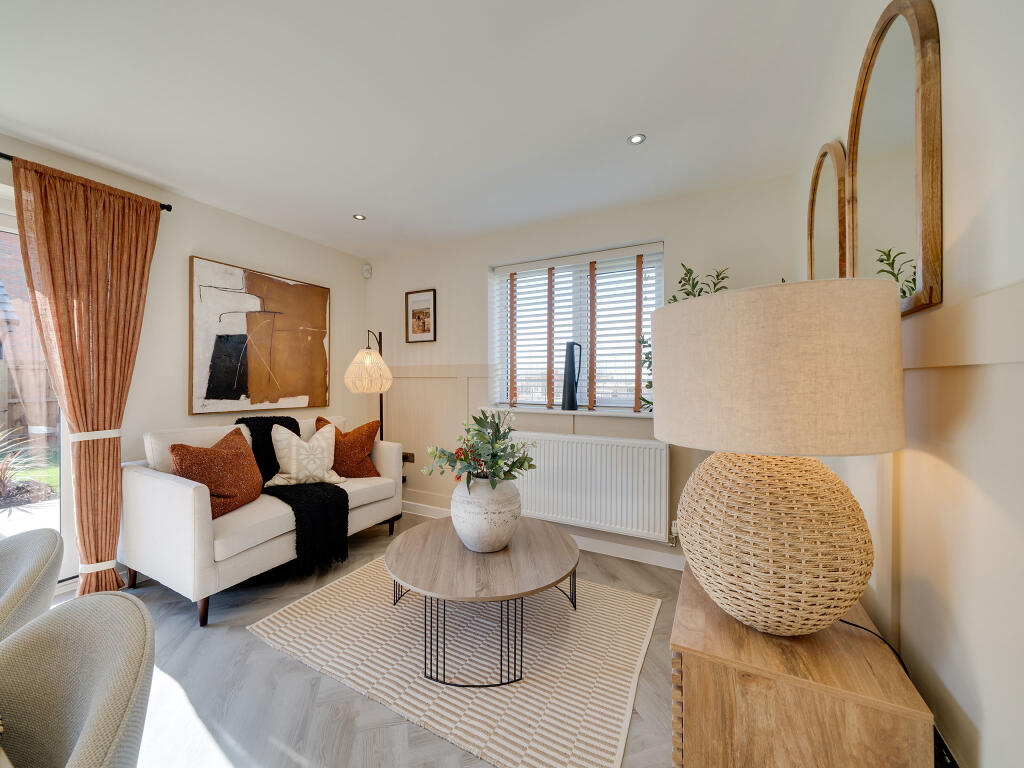
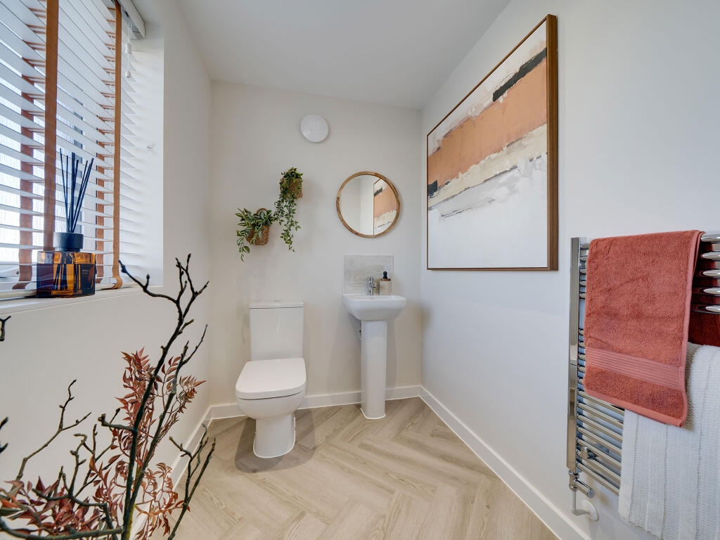
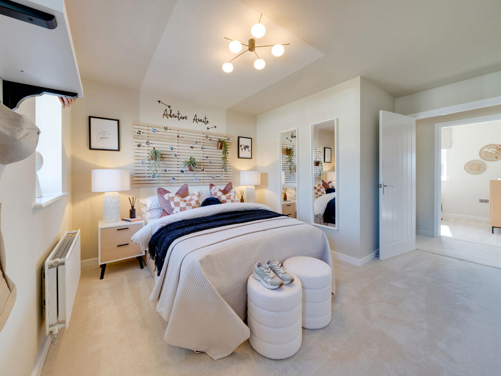
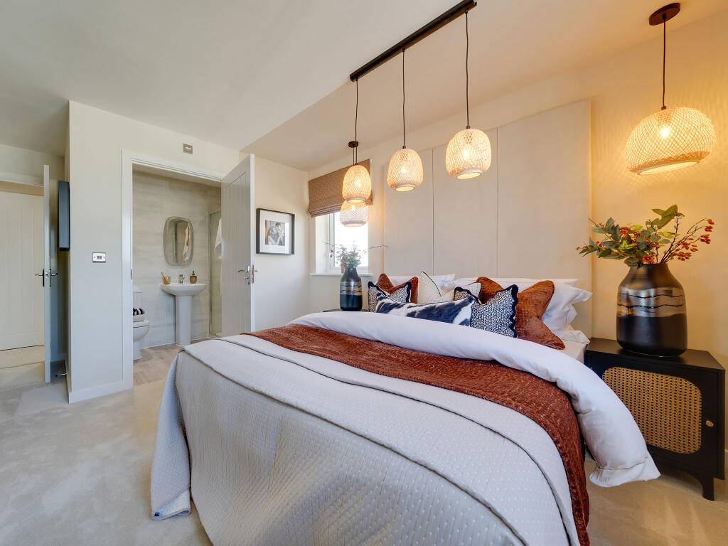
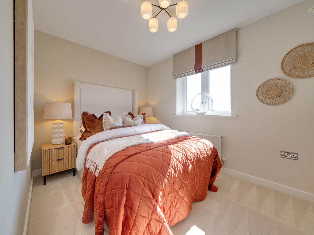
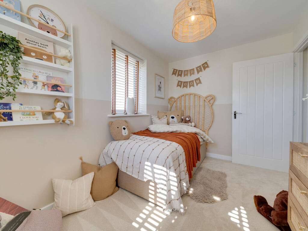
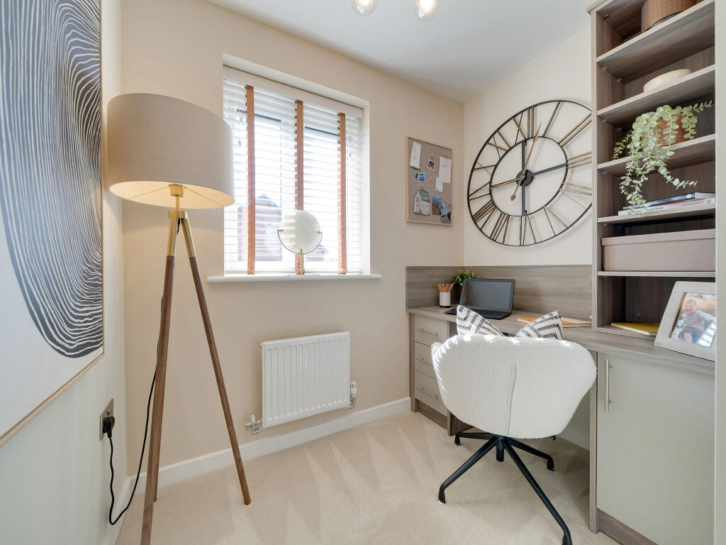
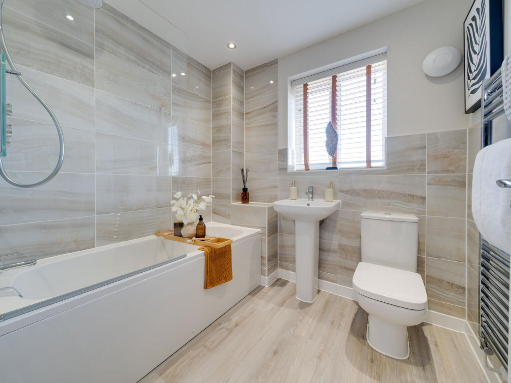
Photo 1 Photo 2 Photo 3 Photo 4 Photo 5 Photo 6 Photo 7 Photo 8 Photo 9 Photo 10 Photo 11 Photo 12 Photo 13 Photo 14
/ 14
Property details
Tenure
FREEHOLD
Local average
£392,659 (+18.4%)
Deprivation
Decile 7 (22,125 of 33,755)
Street crime
27 incidents within 1 mile (Apr 2026)
Key features
- Impressive kitchen/family/dining room with French doors to garden
- En suite to bedroom 1
- Downstairs WC and utility room with side access
- Bay window to the living room
- Plenty of storage throughout
- Family bathroom with modern fixtures and fittings
- Study upstairs
- Energy efficient
Additional details
- Parking
- Yes
- Garden
- Yes
Description
Additional Information
Tenure: FreeholdCouncil tax band: Not made available by local authority until post-occupation
Parking - Single Garage
Room Dimensions
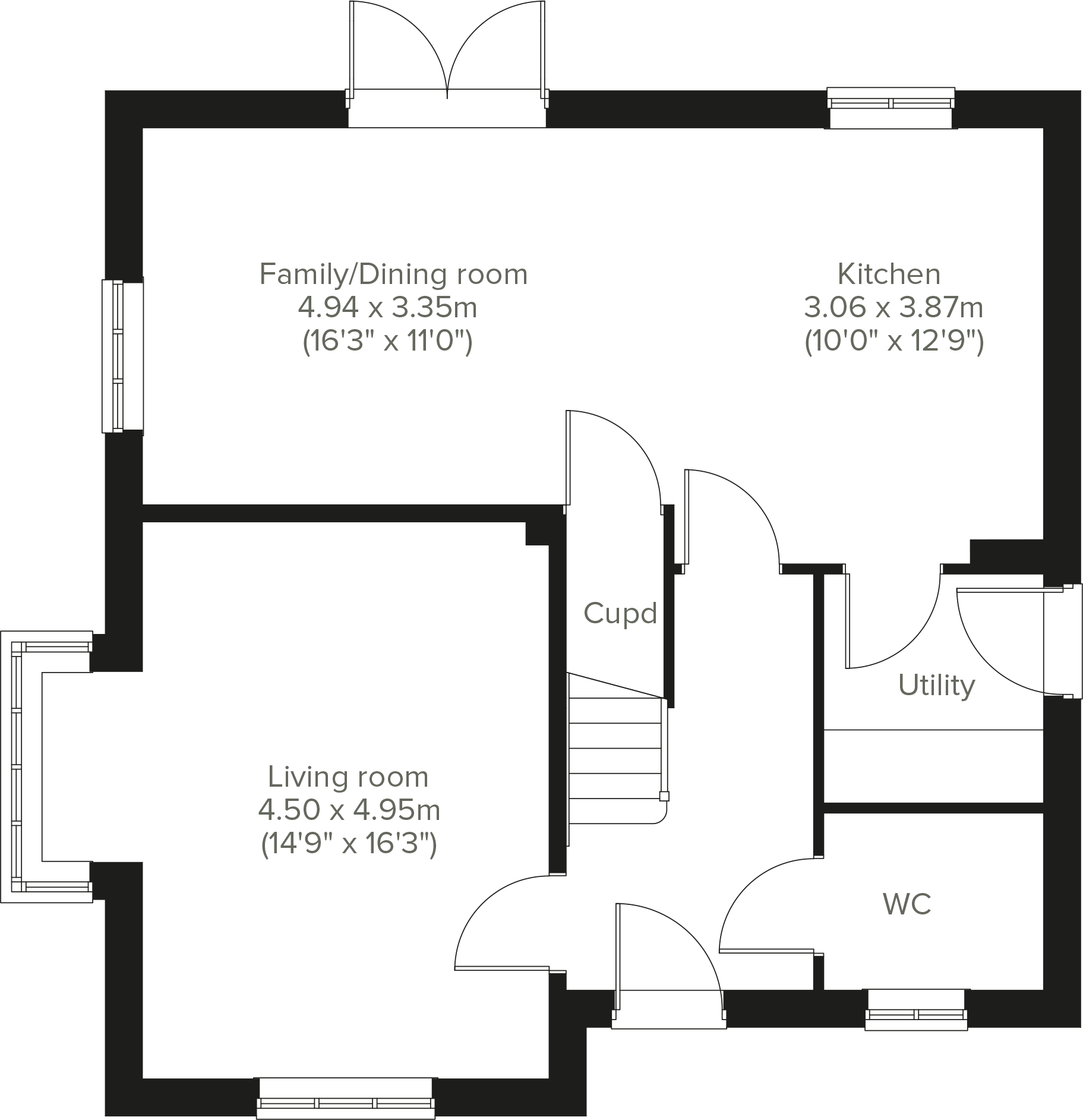
Ground Floor
Kitchen - 3.06 x 3.87 metreFamily/Dining room - 4.94 x 3.35 metreLiving room - 4.5 x 4.95 metreFirst Floor
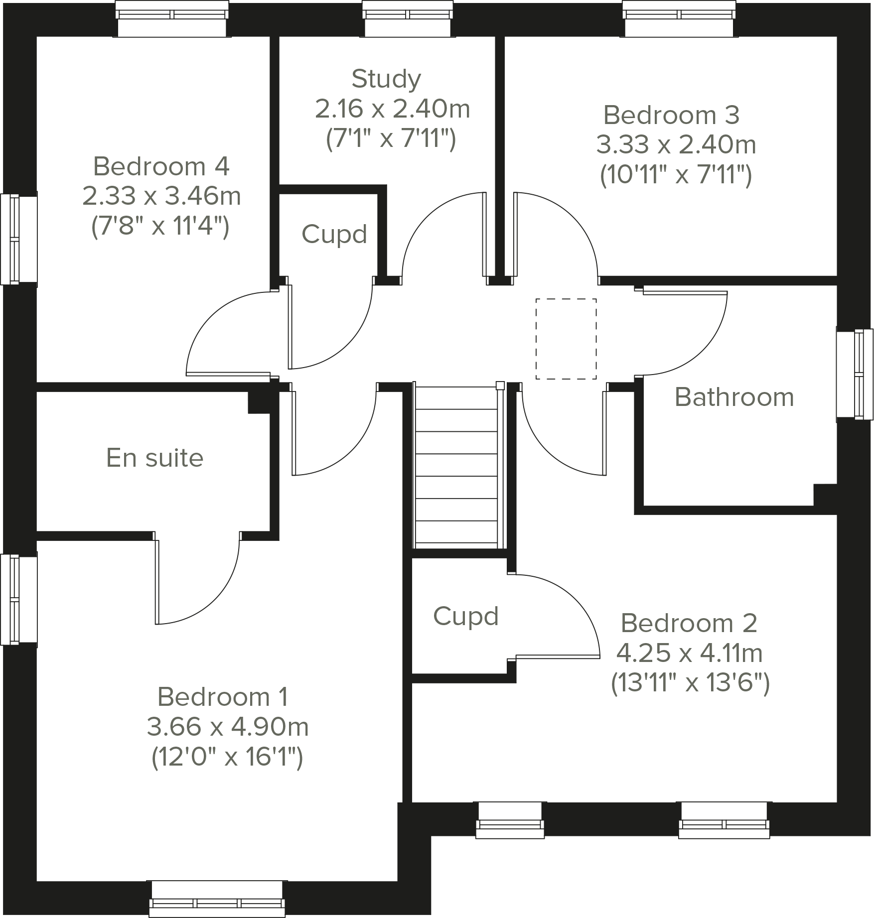
Bedroom 1 - 3.66 x 4.9 metreBedroom 2 - 4.25 x 4.11 metreBedroom 3 - 3.33 x 2.4 metreBedroom 4 - 2.33 x 3.46 metreStudy - 2.16 x 2.4 metre
Listed by
Eckford Vale
Persimmon Homes PLC
Reference: 170566658
EPC Rating & Upgrade Cost
Fetching EPC data… Refresh this page in a moment.
Flood risk
Zone: 1
Risk: Low
Job (default Low)
Floorplans
Ground Floor
First Floor
Price history
No sales history found for this property in Land Registry Price Paid data.
Sold Comparables
Same street and nearby sales within 0.25 miles (last 5 years). Data from Land Registry Price Paid.
| Address | Price | Date | Type |
|---|---|---|---|
| 29 DAVIES DRIVE, WEM, SHREWSBURY, SHROPSHIRE, SY4 5YW | £262,000 | 14/11/2023 | Detached |
| 71 TRENTHAM ROAD, WEM, SHREWSBURY, SHROPSHIRE, SY4 5HN | £215,000 | 11/08/2023 | Detached |
| 44 SOMERSET WAY, WEM, SHREWSBURY, SHROPSHIRE, SY4 5UW | £275,000 | 09/12/2022 | Detached |
| 83 PYMS ROAD, WEM, SHREWSBURY, SHROPSHIRE, SY4 5UU | £216,000 | 25/11/2022 | Detached |
| 98 LOWE HILL ROAD, WEM, SHREWSBURY, SHROPSHIRE, SY4 5UT | £299,995 | 01/08/2022 | Detached |
| 97 TRENTHAM ROAD, WEM, SHREWSBURY, SHROPSHIRE, SY4 5HW | £210,500 | 27/05/2022 | Detached |
| 48 SOMERSET WAY, WEM, SHREWSBURY, SHROPSHIRE, SY4 5UW | £245,000 | 26/05/2022 | Detached |
| 27 TRENTHAM ROAD, WEM, SHREWSBURY, SHROPSHIRE, SY4 5HN | £247,000 | 31/03/2022 | Detached |
| 82 LOWE HILL ROAD, WEM, SHREWSBURY, SHROPSHIRE, SY4 5UT | £295,000 | 03/02/2022 | Detached |
| 14 BUTLER ROAD, WEM, SHREWSBURY, SHROPSHIRE, SY4 5YP | £219,995 | 26/11/2021 | Detached |
| 82 TRENTHAM ROAD, WEM, SHREWSBURY, SHROPSHIRE, SY4 5HW | £239,000 | 23/09/2021 | Detached |
| 7 BAILEY CLOSE, WEM, SHREWSBURY, SHROPSHIRE, SY4 5UR | £260,000 | 27/08/2021 | Detached |
| 121 TRENTHAM ROAD, WEM, SHREWSBURY, SHROPSHIRE, SY4 5HW | £210,000 | 29/07/2021 | Detached |
Area average: £245,730 (13 sales)
Capital growth trend
Land Registry outcode average: last 12 months vs 5y and 10y ago (from sold prices).
House Price Index (HM Land Registry — official index, not sold-price averages): Shropshire. Series: Detached. As of March 2026.
Rental Range
Estimated market rent for Shropshire. Low = conservative, Realistic = average, Optimistic = best case.
Based on Local Authority from postcode lookup → Shropshire.
LHA (30th percentile) floor for Shropshire: £972/mo (Apr 2025 – Mar 2026)
Location
Address
86 Lowe Hill Road
Nearby
Nearest stations, universities and amenities (distance from property).
| Type | Name | Distance |
|---|---|---|
| Bus stop | Pyms Road | 0.2 miles |
| Shop | Fatboy Sound | 0.5 miles |
| Shop | Lynn at Avante | 0.5 miles |
| Bus stop | Railway Station | 0.6 miles |
| Train station | Wem | 0.7 miles |
| Train station | Prees | 3.2 miles |
| Hospital | Whitchurch Community Hospital | 8.1 miles |
Street-level crime
| Category | Count |
|---|---|
| Violence and sexual offences | 17 |
| Criminal damage and arson | 3 |
| Other theft | 2 |
| Shoplifting | 2 |
| Drugs | 1 |
| Other crime | 1 |
| Possession of weapons | 1 |
| Total incidents | 27 |
Within 1 mile during Apr 2026. Source: data.police.uk (England & Wales).
Schools nearby
Nearest open schools with Ofsted ratings (England). Closed schools are not shown. Data from Get Information about Schools and Ofsted.
| Name | Type | Distance | Ofsted |
|---|---|---|---|
| The Thomas Adams School | Secondary | 0.2 miles | Good — 15 Nov 2023 |
| St Peter's CofE Primary School | Primary | 0.5 miles | Good — 12 May 2022 |
| Woodlands School | Other | 1.7 miles | Requires improvement — 24 Apr 2024 |
| Loppington House FE Unit | Other | 2.2 miles | — (No rating) |
| Newtown CofE Primary School | Primary | 2.4 miles | Outstanding — 11 Nov 2013 |
Rental Comparables
Rental comparables are temporarily unavailable while listing-site fetches are paused. Try again later.
Rent-driven metrics
Based on Area rent estimate.
- Rent ratio — Monthly rent ÷ purchase price (1% rule). 1%+ = strong, 0.8–1% = okay, <0.8% = weak for cashflow.
- Max investor price — Rent ÷ 0.8%; the price at which rent would be 0.8% of price (Stoke-style target).
- Target investor price — Rent ÷ 1%; the price at which rent would be 1% of price (strong cashflow band).
- Gross yield — Annual rent as % of purchase price (no costs).