Rivendell
THE STREET, STEYNING, BRAMBER, WEST SUSSEX BN44 3WE
£3,800 pcm
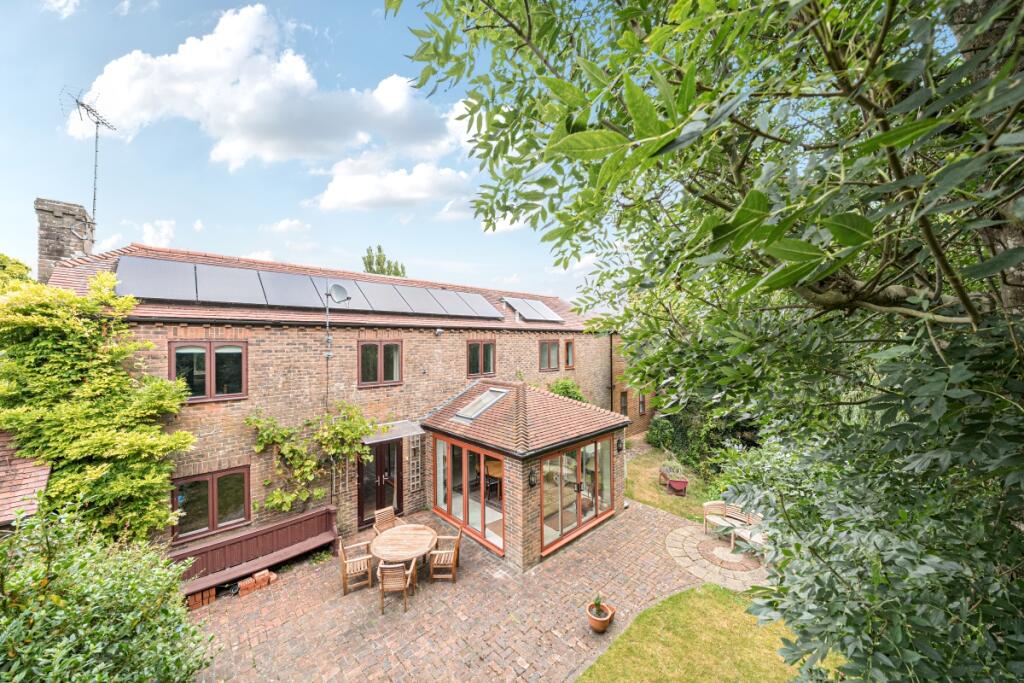
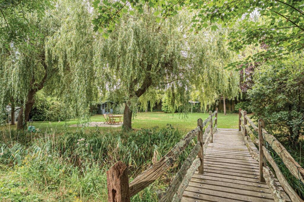
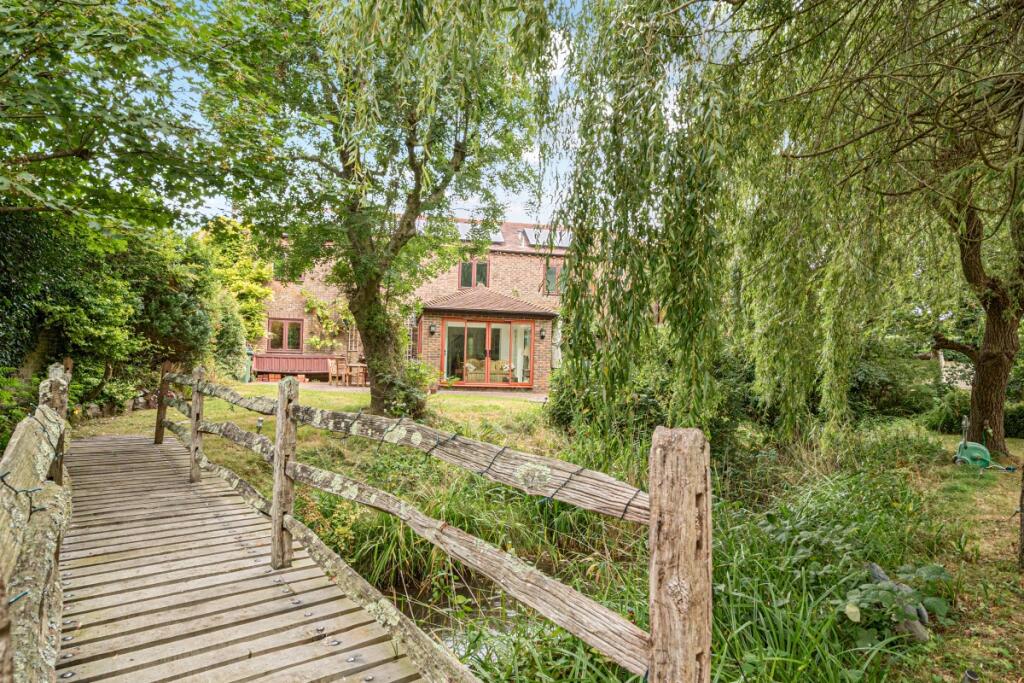
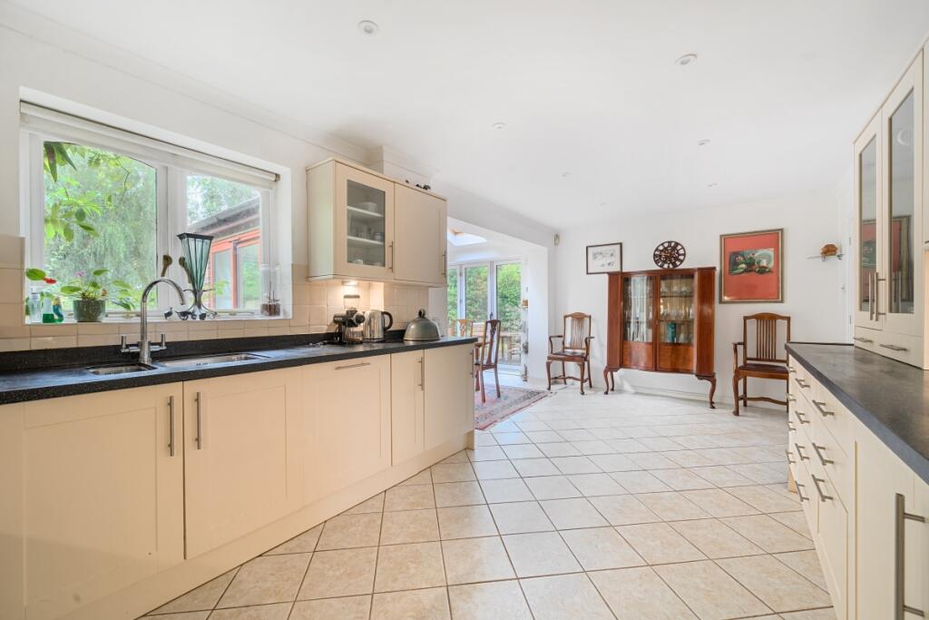
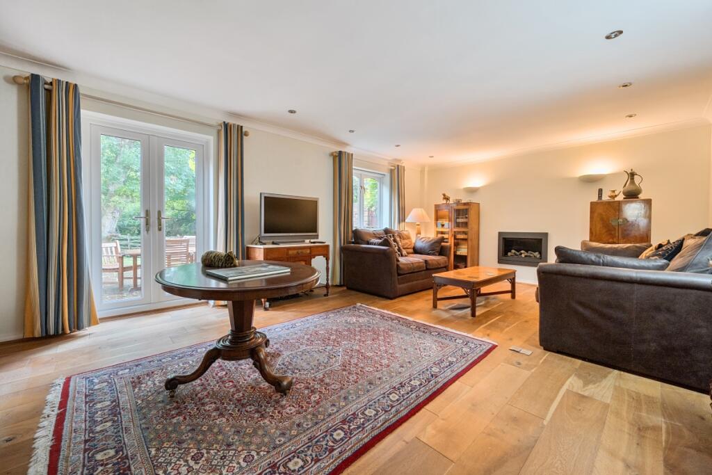
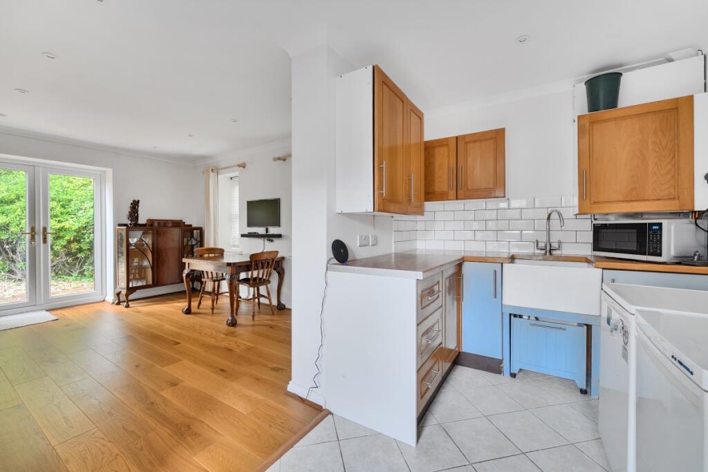
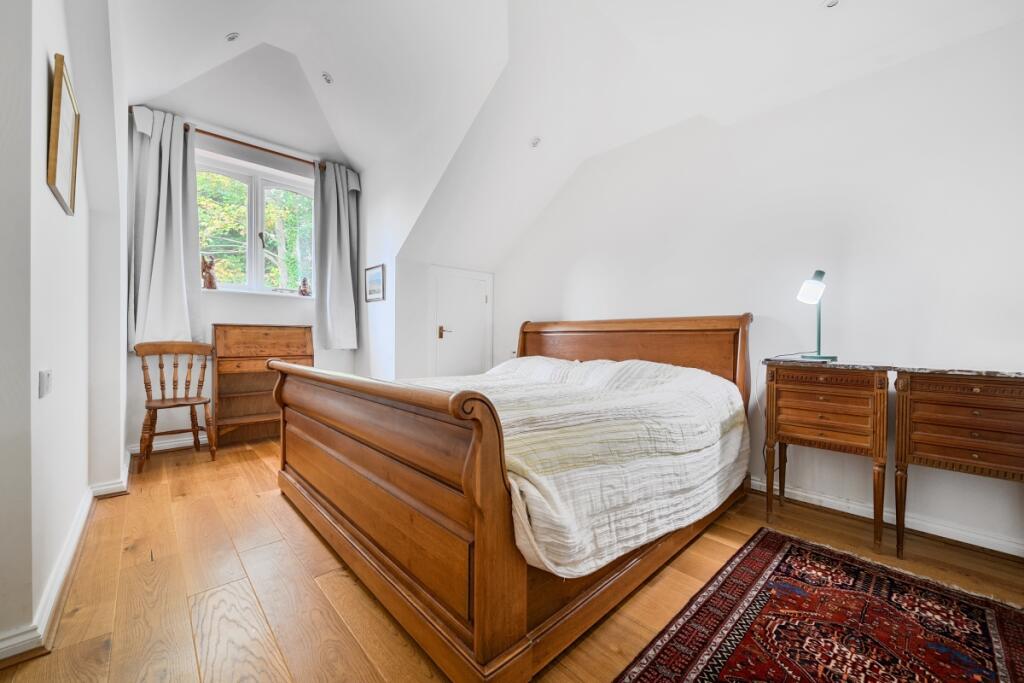
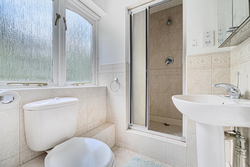
Photo 1 Photo 2 Photo 3 Photo 4 Photo 5 Photo 6 Photo 7 Photo 8 Photo 9 Photo 10 Photo 11
/ 11
Property details
Floor area
181 m²
Year built
England and Wales: 1983-1990
Deprivation
Decile 8 (25,894 of 33,755)
Street crime
29 incidents within 1 mile (Apr 2026)
Key features
- Short Let - Bills Included
- Eco Home with "A" Energy Rating
- Open plan kitchen/dining/sunroom
- Living room with Gas fireplace
- Landscaped garden with stream and bridge
- Solar Panels
- Underfloor heating
- Detached double garage
- Set in South Downs National Park
Additional details
- Parking
- Garage
- Garden
- Private garden
Description
At the heart of the house is an impressive open-plan kitchen, dining, and sun room area. Designed with a stunning vaulted ceiling and skylights, this space is flooded with natural light.
A welcoming entrance hall leads to both the open-plan living space and a stylish living room, complete with a modern recessed gas fireplace. A recent lounge extension enhances the versatility of the ground floor and includes French doors opening to the side garden and patio, along with a newly installed staircase that offers private access to the main and principle bedroom suite, this then leads onto the family bathroom and 3 further bedrooms. To check broadband and mobile phone coverage please visit Ofcom here ofcom.org.uk/phones-telecoms-and-internet/advice-for-consumers/advice/ofcom-checker
Listed by
Horsham
Countrywide Hamptons Lettings - Connells
Reference: 171374810
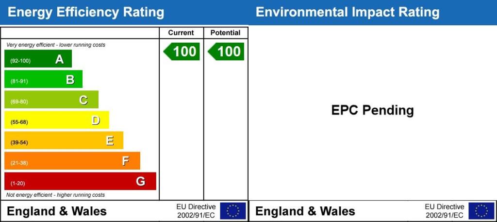
EPC ratings on this postcode
We don't have a matched EPC for this property yet. Below are efficiency scores and details for other addresses on this postcode.
| Address | Current | Potential | Floor area | Age band | Type |
|---|---|---|---|---|---|
| 1 Castle View, The Street, Bramber, STEYNING | 86 | 93 | 181 m² | — | Detached |
| 2 Castle View, The Street, Bramber, STEYNING | 85 | 92 | 181 m² | — | Detached |
| 3 Castle View, The Street, Bramber, STEYNING | 85 | 92 | 181 m² | — | Detached |
| 4 Castle View, The Street, Bramber, STEYNING | 85 | 92 | 181 m² | — | Detached |
| 5 High Street, Bramber | 49 | 66 | 129 m² | England and Wales: 1900-1929 | Flat |
| Aquarius, The Street, Bramber, STEYNING | 50 | 78 | 117 m² | England and Wales: 1950-1966 | Detached |
| Bowzees, The Street, Bramber, STEYNING | 68 | 78 | 176 m² | England and Wales: 1996-2002 | Detached |
| Bramber Fox, The Street, Bramber, STEYNING | 82 | 86 | 264 m² | England and Wales: 2012 onwards | Detached |
| Bramber Fox, The Street, Bramber, STEYNING | 83 | 89 | 208 m² | — | Detached |
| Castle Mead, The Street, Bramber, STEYNING | 75 | 80 | 271 m² | England and Wales: 1991-1995 | Detached |
| Chestnut House, The Street, Bramber, STEYNING | 69 | 82 | 175 m² | England and Wales: 1991-1995 | Detached |
| Chestnut House, The Street, Bramber, STEYNING | 62 | 78 | 168 m² | England and Wales: 1991-1995 | Detached |
| Coots, The Street, Bramber, STEYNING | 83 | 83 | 221 m² | — | Detached |
| Firs Cottage, The Street, Bramber, STEYNING | 49 | 78 | 104 m² | England and Wales: before 1900 | Detached |
| First Floor Flat Belmont, The Street, Bramber, STEYNING | 69 | 78 | 89 m² | England and Wales: 1950-1966 | Flat |
Flood risk
Zone: 1
Risk: Low
Job (default Low)
Floorplans
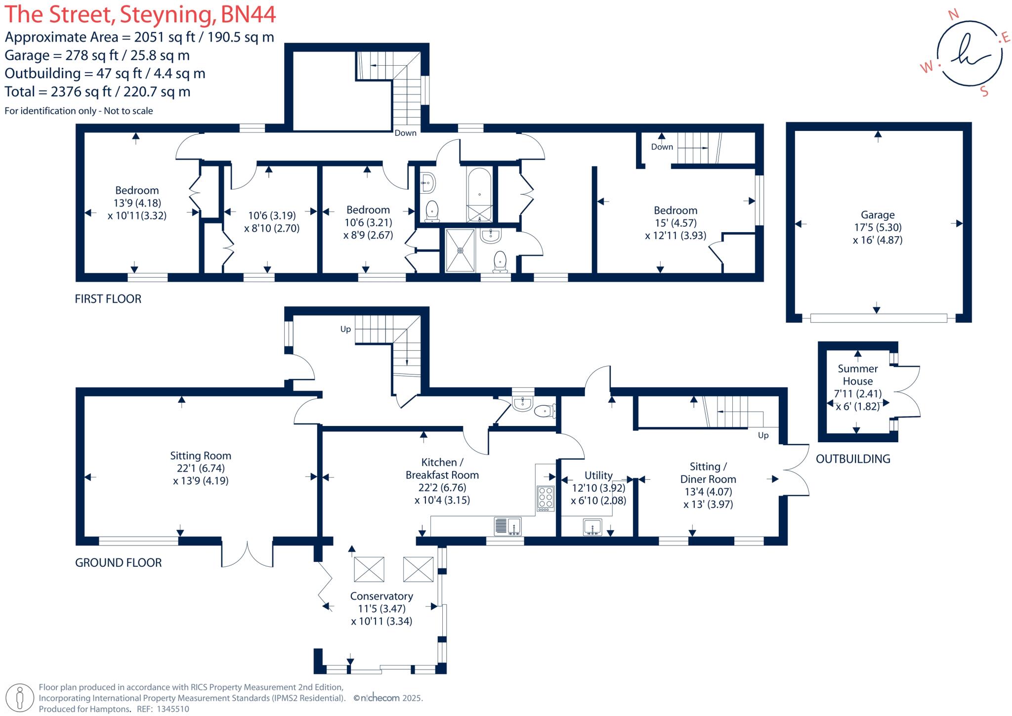
Floorplan 1
EPC Graphs
Energy Performanc...
Rental Range
Estimated market rent for Horsham. Low = conservative, Realistic = average, Optimistic = best case.
Based on Local Authority from postcode lookup → Horsham.
LHA (30th percentile) floor for Worthing: £1,461/mo (Apr 2025 – Mar 2026)
Location
Address
Bramber, Horsham, West Sussex, England, BN44 3WE, United Kingdom
Nearby
Nearest stations, universities and amenities (distance from property).
| Type | Name | Distance |
|---|---|---|
| Bus stop | Castle Hotel | 0.0 miles |
| Bus stop | St Mary's House | 0.1 miles |
| Shop | Nisa Local | 0.5 miles |
| Shop | Unknown | 0.6 miles |
| Train station | Shoreham-by-Sea | 3.8 miles |
| Train station | Lancing | 3.9 miles |
| Hospital | Aldrington House | 6.7 miles |
| Hospital | The Montefiore Hospital | 7.7 miles |
| University | University of Brighton Phoenix Halls | 8.7 miles |
| University | Jubilee 144 Lecture Theatre | 9.8 miles |
Street-level crime
| Category | Count |
|---|---|
| Violence and sexual offences | 8 |
| Criminal damage and arson | 7 |
| Anti-social behaviour | 5 |
| Burglary | 3 |
| Public order | 2 |
| Shoplifting | 2 |
| Other crime | 1 |
| Vehicle crime | 1 |
| Total incidents | 29 |
Within 1 mile during Apr 2026. Source: data.police.uk (England & Wales).
Schools nearby
Nearest open schools with Ofsted ratings (England). Closed schools are not shown. Data from Get Information about Schools and Ofsted.
| Name | Type | Distance | Ofsted |
|---|---|---|---|
| Upper Beeding Primary School | Primary | 0.5 miles | Outstanding — 3 Sep 2015 |
| Steyning Grammar School | Secondary | 1.0 miles | Requires improvement — 26 Jun 2023 |
| Steyning CofE Primary School | Primary | 1.1 miles | Good — 11 May 2018 |
| Lancing College | Other | 2.6 miles | — (No rating) |
| North Lancing Primary School | Primary | 3.0 miles | Good — 9 Jun 2024 |
Rental Comparables
Rental listings exist nearby, but none matched the 4-bedroom count for this property.
Enter House Number
Enter the house number to help us retrieve more accurate pricing history and property data.
Please log in to submit or correct the house number for this listing.
Log in to continue