Apartment 7
THE PLACE, 14, ABBEY ROAD, BIRMINGHAM, HARBORNE, WEST MIDLANDS B17 0JT
£1,300 pcm
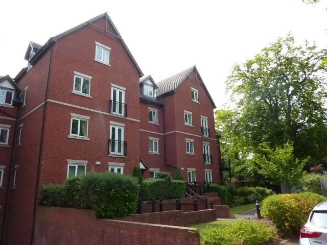
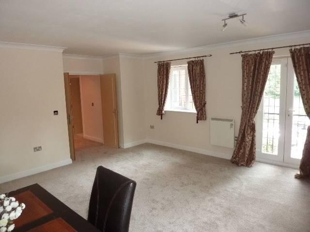
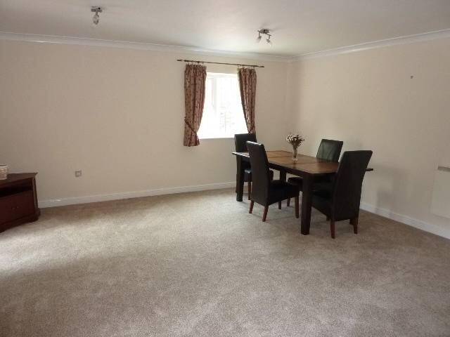
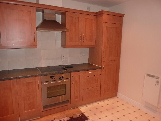
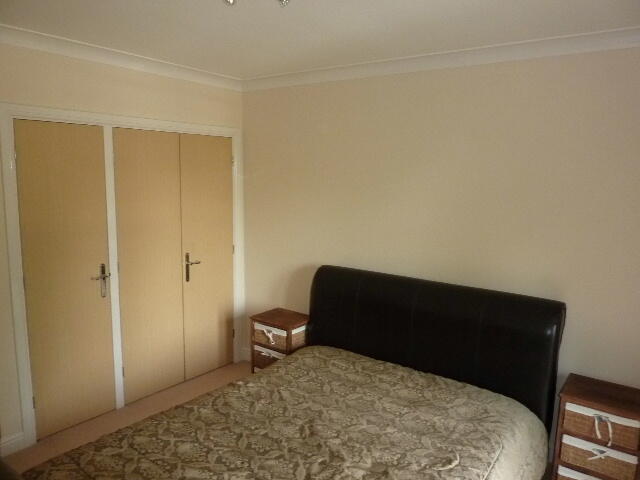

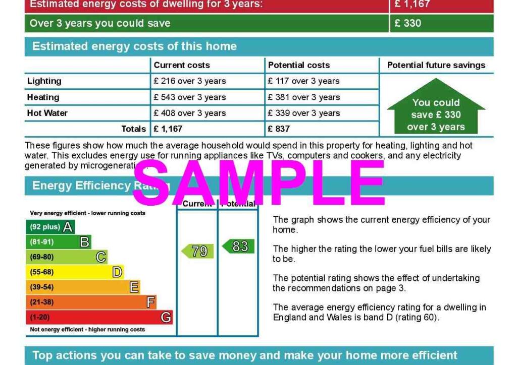
Photo 1 Photo 2 Photo 3 Photo 4 Photo 5 Photo 6 Photo 7
/ 7
Property details
Floor area
51 m²
Council tax band
E
Deprivation
Decile 6 (19,975 of 33,755)
Street crime
356 incidents within 1 mile (May 2026)
Key features
- Spacious Two Bedroom Apartment
- Two Ensuite Bathrooms
- Secure Underground Parking
- Within Walking Distance of Harborne High Street
- Private Development
- Modern Fitted Kitchen including Dishwasher
- Neutral Decor Througout
Additional details
- Heating
- Double glazing
- Parking
- Allocated
Description
The property comprises of, entrance Hall, separate W.C.modern fitted kitchen with integrated appliances including dishwasher, master bedroom with en-suite and fitted wardrobes, further bedroom with en-suite shower room and large living and dining room, double glazed throughout, Juliet balcony to living room, secure underground parking, neutral décor, furnished, Available Now
Listed by
Harborne
Fishers
Reference: 157033625
EPC ratings on this postcode
We don't have a matched EPC for this property yet. Below are efficiency scores and details for other addresses on this postcode.
| Address | Current | Potential | Floor area | Age band | Type |
|---|---|---|---|---|---|
| 9 Abbey Road, Harborne, BIRMINGHAM | 66 | 85 | 82 m² | England and Wales: 1976-1982 | Detached |
| Apartment 7 The Place, 14, Abbey Road, Harborne, BIRMINGHAM | 79 | 83 | 51 m² | England and Wales: 2003-2006 | Flat |
Flood risk
Zone: 2
Risk: In flood risk area
Environment Agency Flood Risk Areas (APSFR)
Rental Range
Estimated market rent for Birmingham. Low = conservative, Realistic = average, Optimistic = best case.
Based on Local Authority from postcode lookup → Birmingham.
LHA (30th percentile) floor for Birmingham: £748/mo (Apr 2025 – Mar 2026)
Location
Address
Malins Road
Nearby
Nearest stations, universities and amenities (distance from property).
| Type | Name | Distance |
|---|---|---|
| Shop | Guraya News | 0.0 miles |
| Bus stop | Metchley Lane / School Playing Field | 0.1 miles |
| Bus stop | Metchley Lane / Barlows Rd | 0.1 miles |
| Shop | Eden | 0.2 miles |
| Train station | University | 0.6 miles |
| Train station | Selly Oak | 1.1 miles |
| University | University of Birmingham School of Dentistry | 1.5 miles |
| University | Birmingham City University, Bournville Campus | 1.9 miles |
| Hospital | West Heath Hospital | 4.1 miles |
| Hospital | Brian Oliver Centre | 8.6 miles |
Street-level crime
| Category | Count |
|---|---|
| Violence and sexual offences | 148 |
| Shoplifting | 60 |
| Vehicle crime | 28 |
| Public order | 24 |
| Burglary | 20 |
| Criminal damage and arson | 19 |
| Other theft | 18 |
| Possession of weapons | 7 |
| Anti-social behaviour | 6 |
| Robbery | 6 |
| Theft from the person | 6 |
| Bicycle theft | 5 |
| Drugs | 5 |
| Other crime | 4 |
| Total incidents | 356 |
Within 1 mile during May 2026. Source: data.police.uk (England & Wales).
Schools nearby
Nearest open schools with Ofsted ratings (England). Closed schools are not shown. Data from Get Information about Schools and Ofsted.
| Name | Type | Distance | Ofsted |
|---|---|---|---|
| St Mary's Catholic Primary School | Primary | 0.3 miles | Good — 8 Mar 2023 |
| Harborne Primary School | Primary | 0.3 miles | Outstanding — 13 Jan 2015 |
| The Blue Coat School Birmingham | Other | 0.4 miles | — (No rating) |
| St Peters CofE Primary School | Primary | 0.5 miles | Good — 19 Dec 2013 |
| Harborne Academy | Secondary | 0.5 miles | Good — 10 Jul 2017 |
Rental Comparables
Residential lets from OpenRent and Rightmove for the area (same bedroom count). Use to validate rent estimates. Student lets are excluded.
| Title | Rent | Beds | Distance | As seen on |
|---|---|---|---|---|
| The Place, Harborne | £1,450/mo | 2 | 0 miles | Rightmove |
Average rent: £1,450/mo (1 listing)
Enter House Number
Enter the house number to help us retrieve more accurate pricing history and property data.
Please log in to submit or correct the house number for this listing.
Log in to continue