9 WINSTON DRIVE
COTTINGHAM, EAST RIDING OF YORKSHIRE HU16 5NP
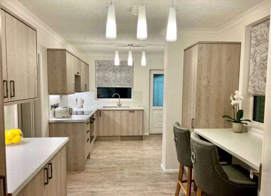
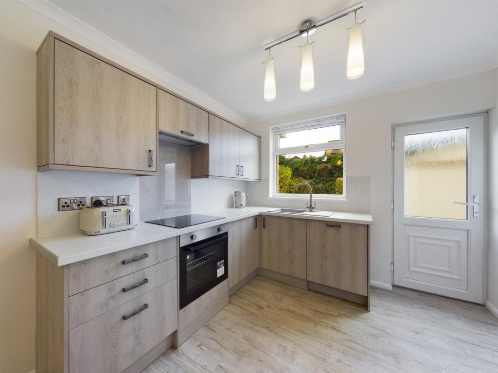
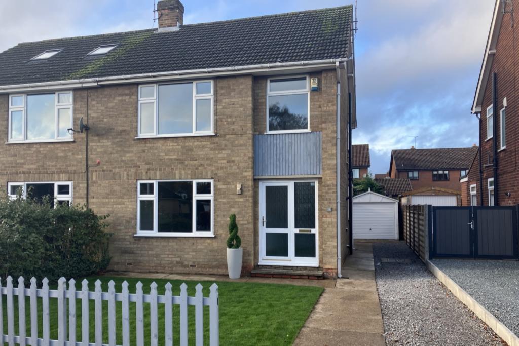
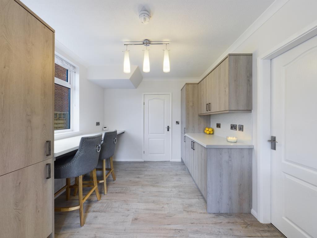
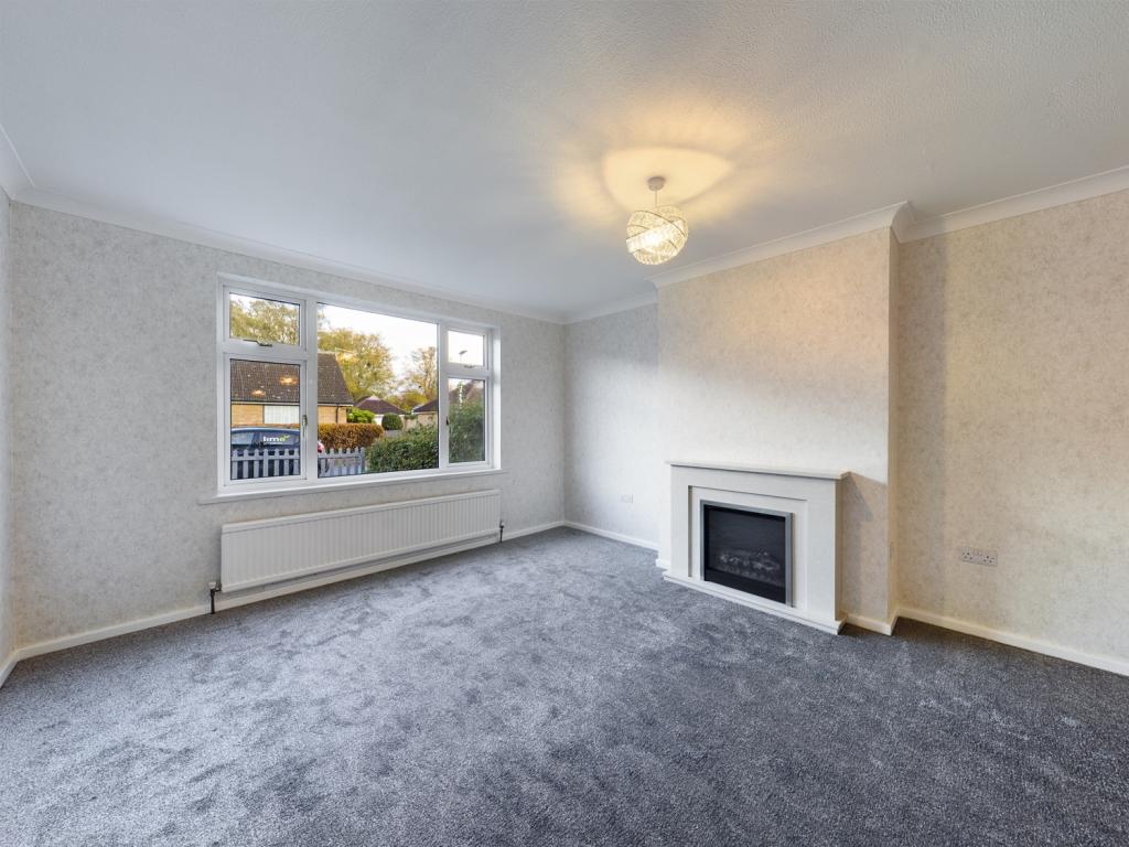
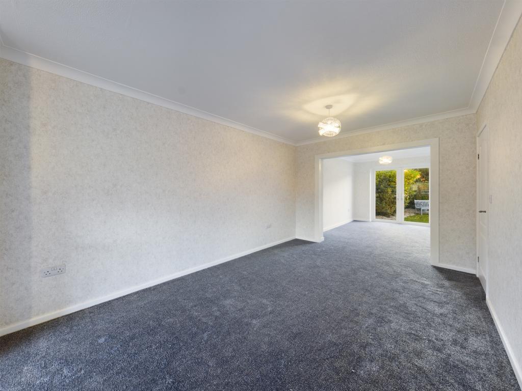
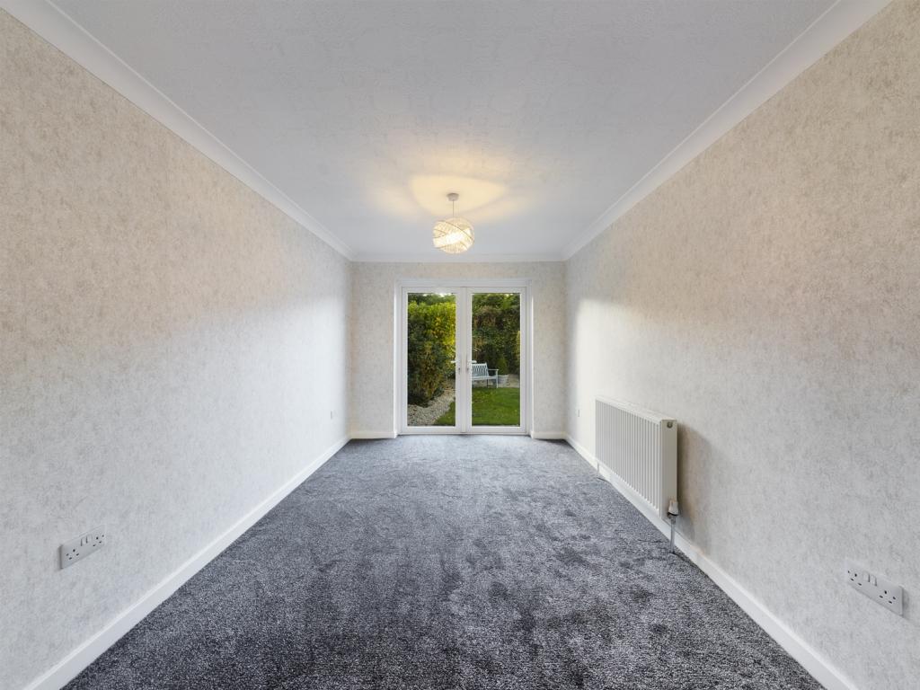
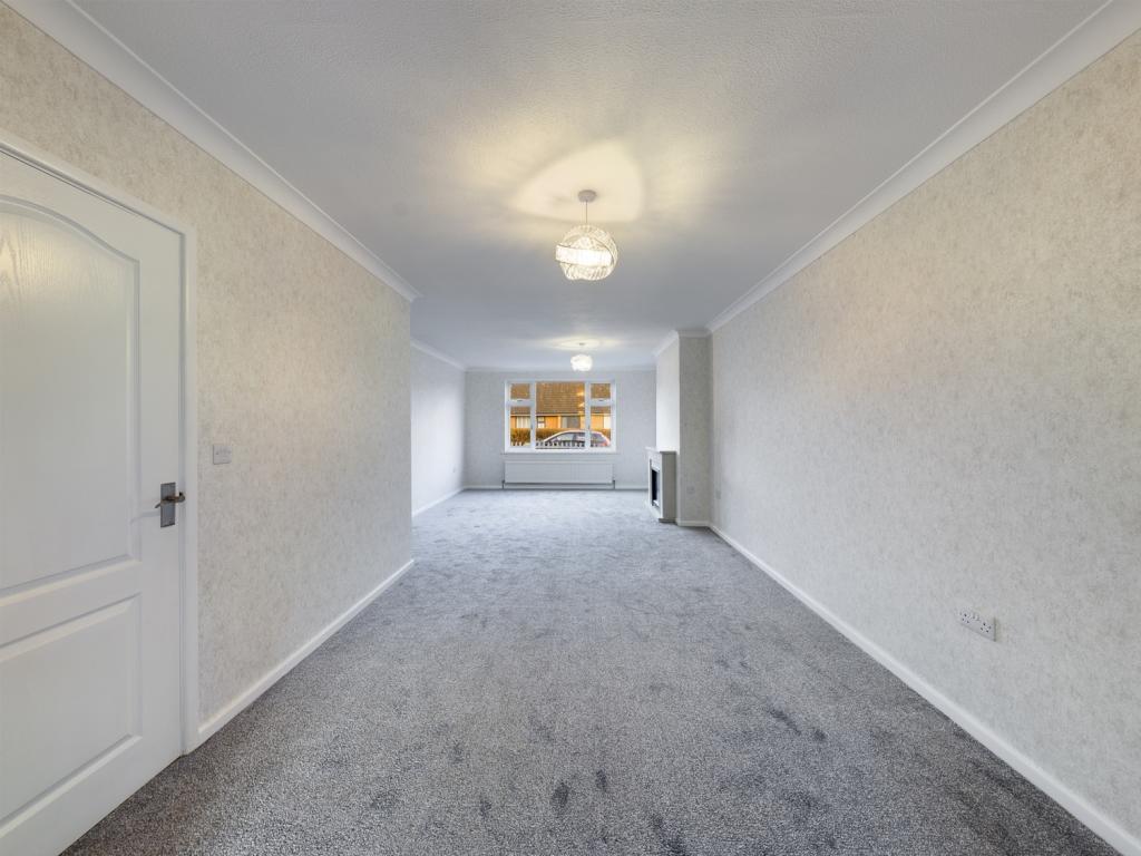
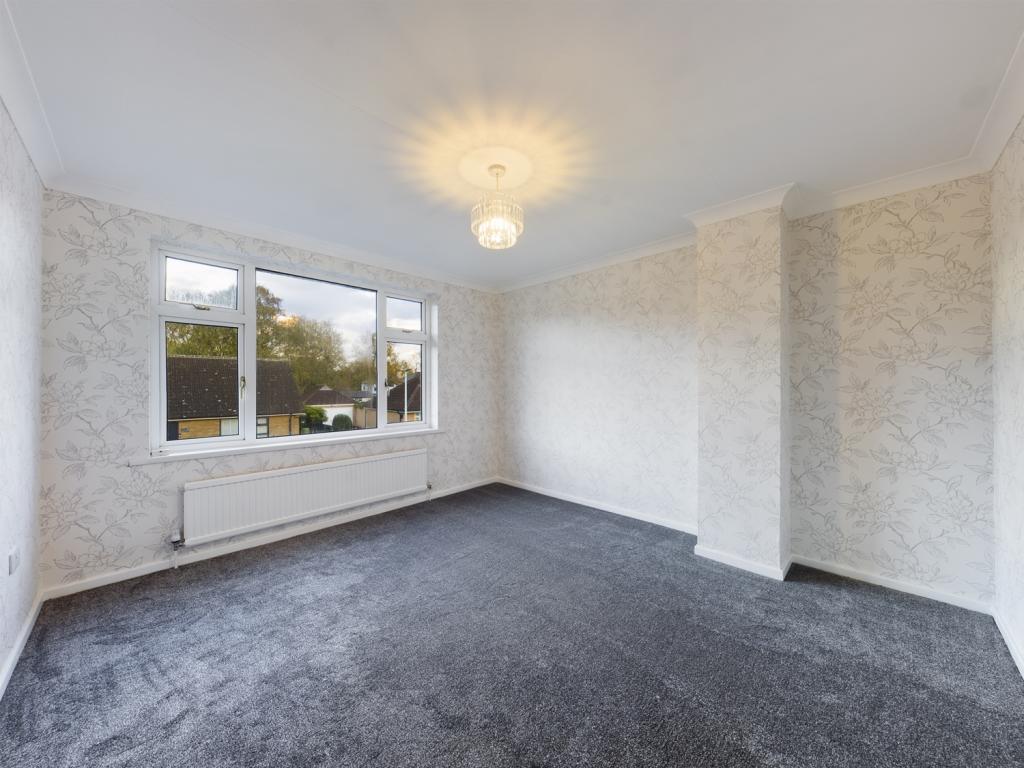
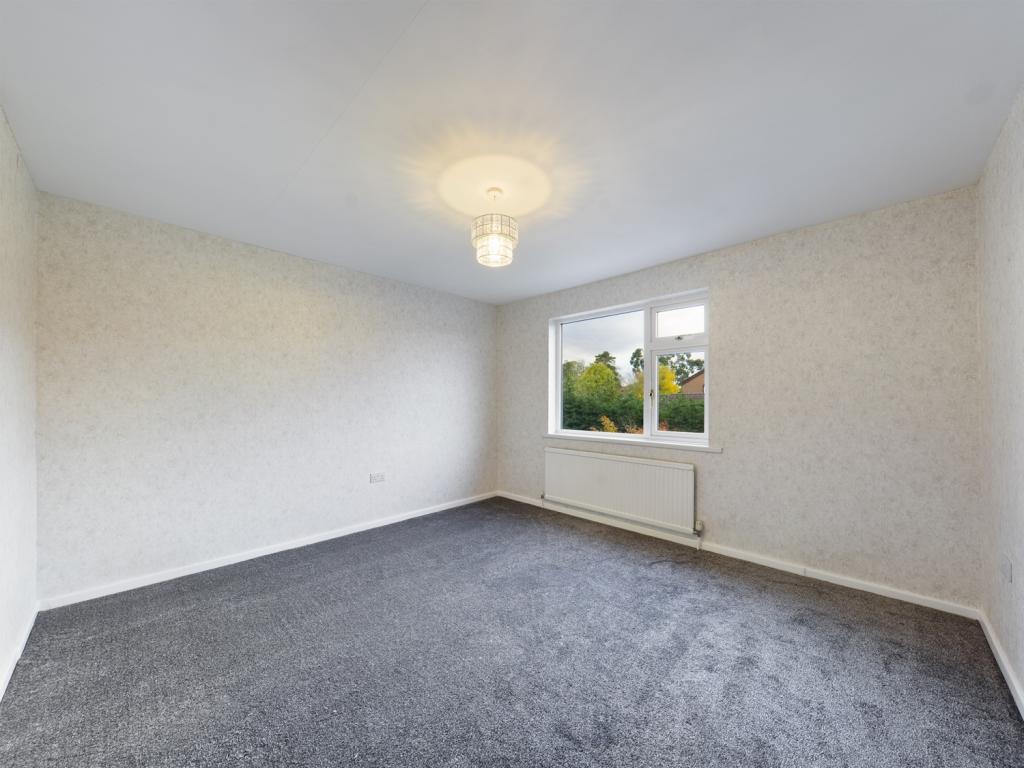
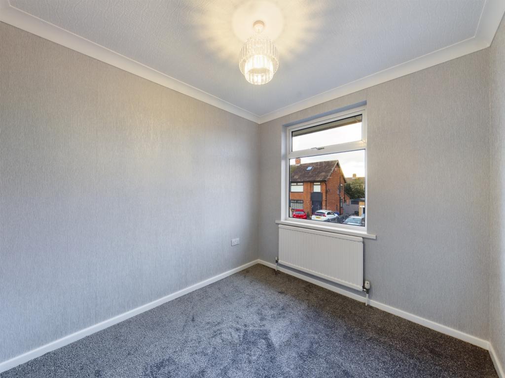
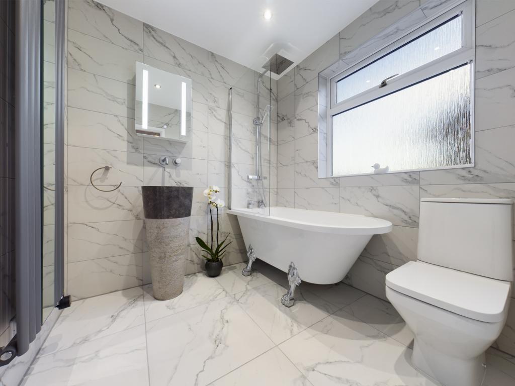
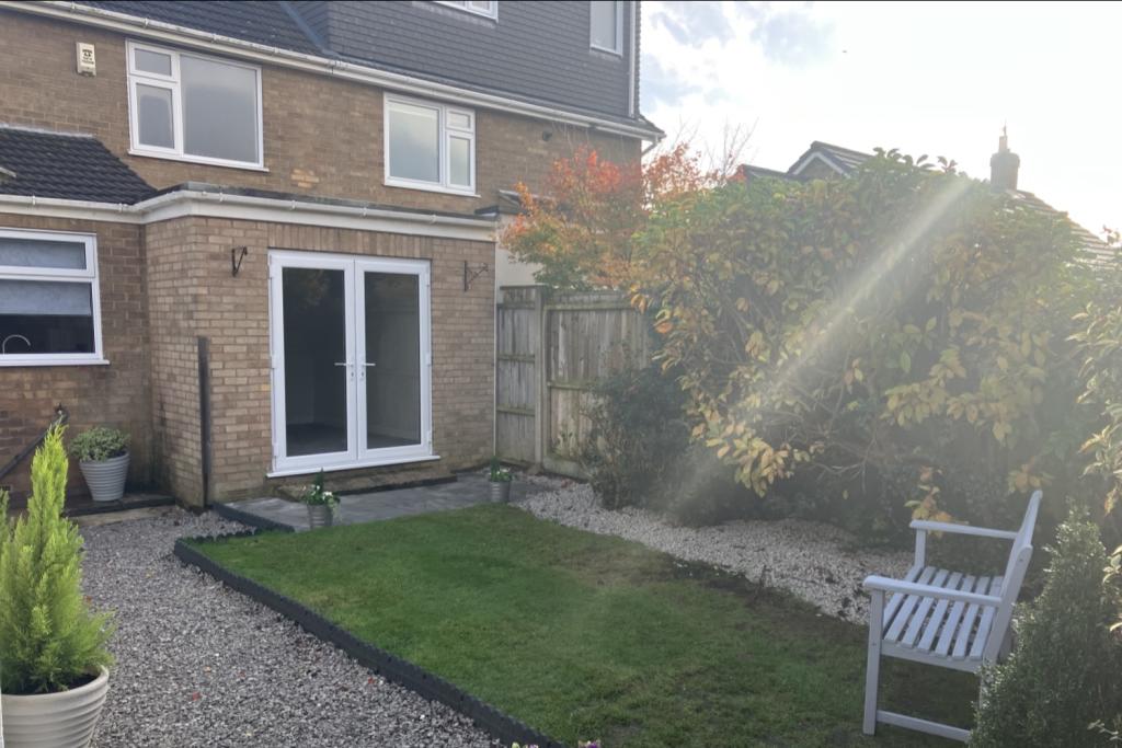
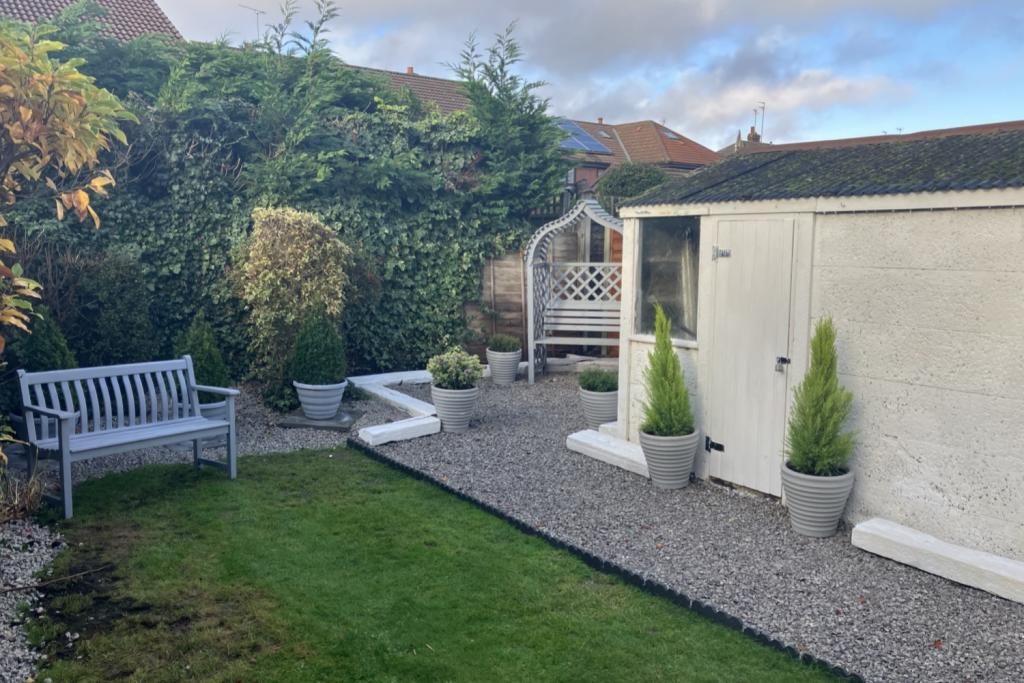
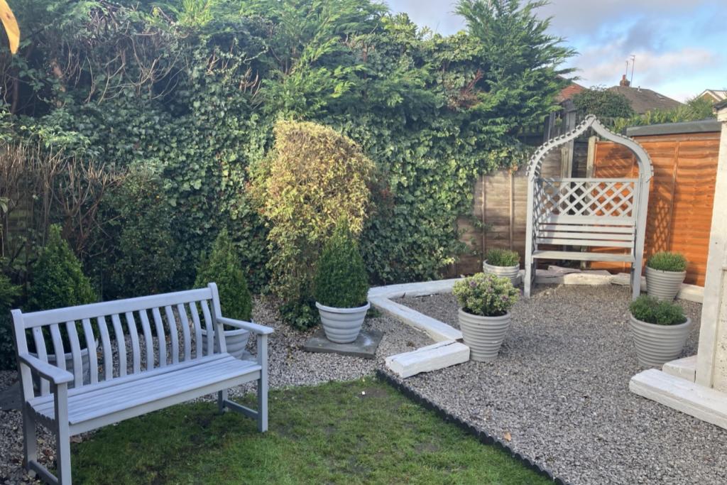
Photo 1 Photo 2 Photo 3 Photo 4 Photo 5 Photo 6 Photo 7 Photo 8 Photo 9 Photo 10 Photo 11 Photo 12 Photo 13 Photo 14 Photo 15
/ 15
Property details
Floor area
109 m²
Council tax band
D
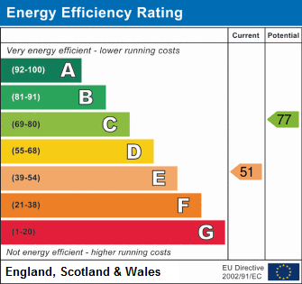
EPC rating
E
Year built
England and Wales: 1967-1975
Deprivation
Decile 10 (32,364 of 33,755)
Street crime
69 incidents within 1 mile (Apr 2026)
Key features
- Newly Renovated
- Popular Location
- Spacious Throughout
- Large Driveway
- Fully Fitted Kitchen
- Garage
Additional details
- Parking
- Yes
- Garden
- Yes
Description
Offering spacious living throughout, the property briefly consists of; a wide entrance hall that leads to the open plan lounge with fireplace, with more than enough room to accommodate dining space, a brand new fully fitted kitchen with breakfast bar and plenty of storage. There are three good sized bedrooms and a stunning family bathroom with a modern luxury finish upstairs. Externally, the property benefits from both front and rear gardens,a driveway providing off-street parking for multiple cars and a good sized garage.
The property is situated in the sought after residential location of Cottingham. It lies North West of the City Centre, ideal for transport to both hospitals, good road links to the Humber Bridge, the historic town of Beverley and the region's motorway network. There is a local train service available in the village connecting to Hull, Beverley and the East coast.
COUNCIL TAX BAND D.
Listed by
Hull
Lime Property (Hull) Limited
Reference: 131347913
EPC Rating & Upgrade Cost
Current rating: E
Potential rating: C
Inspection date: 30/11/2022
Expiry date: 29/11/2032
Current heating cost: £1,308/year
Potential heating cost: £817/year
Est. upgrade cost to C: £20,725
Recommendations
- Increase loft insulation to 270 mm (£100 - £350)
- Cavity wall insulation (£500 - £1,500)
- 50 mm internal or external wall insulation (£4,000 - £14,000)
- Floor insulation (suspended floor) (£800 - £1,200)
- Solar water heating (£4,000 - £6,000)
- Solar photovoltaic panels, 2.5 kWp (£3,500 - £5,500)
Flood risk
Zone: 2
Risk: In flood risk area
Environment Agency Flood Risk Areas (APSFR)
Floorplans
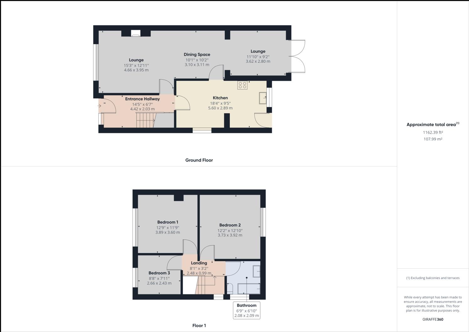
Floorplan 1
EPC Graphs
EPC 1
FENSA Certificates
This property has 3 FENSA certificate(s) on record, indicating window/door installations by FENSA-approved installers.
FENSA Certificate #3105966
Property Details
Street: 9 Winston Drive
Town: COTTINGHAM
Postcode: HU16 5NP
Installation Details
Items: 1 door
Certificate Issued: 04/04/2006
Work Completed: 14/09/2005
This certificate data was retrieved from FENSA's database
FENSA Certificate #11793339
Property Details
Street: 9 Winston Drive
Town: COTTINGHAM
Postcode: HU16 5NP
Installation Details
Items: 4 windows
Certificate Issued: 15/08/2016
Work Completed: 22/07/2016
This certificate data was retrieved from FENSA's database
FENSA Certificate #15385097 Recent
Property Details
Street: 9 Winston Drive
Town: COTTINGHAM
Postcode: HU16 5NP
Installation Details
Items: 1 door
Certificate Issued: 11/09/2022
Work Completed: 25/08/2022
This certificate data was retrieved from FENSA's database
What is FENSA? FENSA (Fenestration Self-Assessment Scheme) is a government-authorised scheme that monitors building regulation compliance for replacement windows and doors. Certificates indicate that work was completed by FENSA-approved installers.
Rental Range
Estimated market rent for East Riding of Yorkshire. Low = conservative, Realistic = average, Optimistic = best case.
Based on Local Authority from postcode lookup → East Riding of Yorkshire.
LHA (30th percentile) floor for Hull & East Riding: £549/mo (Apr 2025 – Mar 2026)
Location
Nearby
Nearest stations, universities and amenities (distance from property).
| Type | Name | Distance |
|---|---|---|
| Bus stop | Cottingham Southwood Road | 0.1 miles |
| Shop | Tesco Express | 0.2 miles |
| Shop | H. Kemp & Son Ltd. | 0.4 miles |
| Hospital | Mill View | 0.5 miles |
| Hospital | Castle Hill Hospital | 0.6 miles |
| Train station | Cottingham | 0.9 miles |
| University | University of Hull | 1.3 miles |
| Train station | Hull Paragon Interchange | 4.1 miles |
Street-level crime
| Category | Count |
|---|---|
| Violence and sexual offences | 25 |
| Shoplifting | 12 |
| Other theft | 7 |
| Burglary | 6 |
| Public order | 5 |
| Vehicle crime | 4 |
| Criminal damage and arson | 3 |
| Bicycle theft | 2 |
| Robbery | 2 |
| Anti-social behaviour | 1 |
| Drugs | 1 |
| Other crime | 1 |
| Total incidents | 69 |
Within 1 mile during Apr 2026. Source: data.police.uk (England & Wales).
Schools nearby
Nearest open schools with Ofsted ratings (England). Closed schools are not shown. Data from Get Information about Schools and Ofsted.
| Name | Type | Distance | Ofsted |
|---|---|---|---|
| Westfield Primary School | Primary | 0.2 miles | Good — 23 Apr 2024 |
| Bacon Garth Primary School | Primary | 0.4 miles | Good — 16 Sep 2024 |
| Hallgate Primary School Cottingham | Primary | 0.7 miles | Good — 21 Apr 2024 |
| Cottingham High School and Sixth Form College | Secondary | 0.7 miles | Good — 20 Jun 2017 |
| Willerby Carr Lane Primary School | Primary | 1.4 miles | Good — 16 Jul 2012 |
Rental Comparables
Loading rental comparables for this postcode. Refresh in a few minutes.