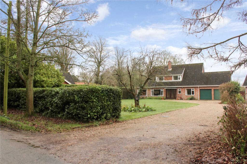
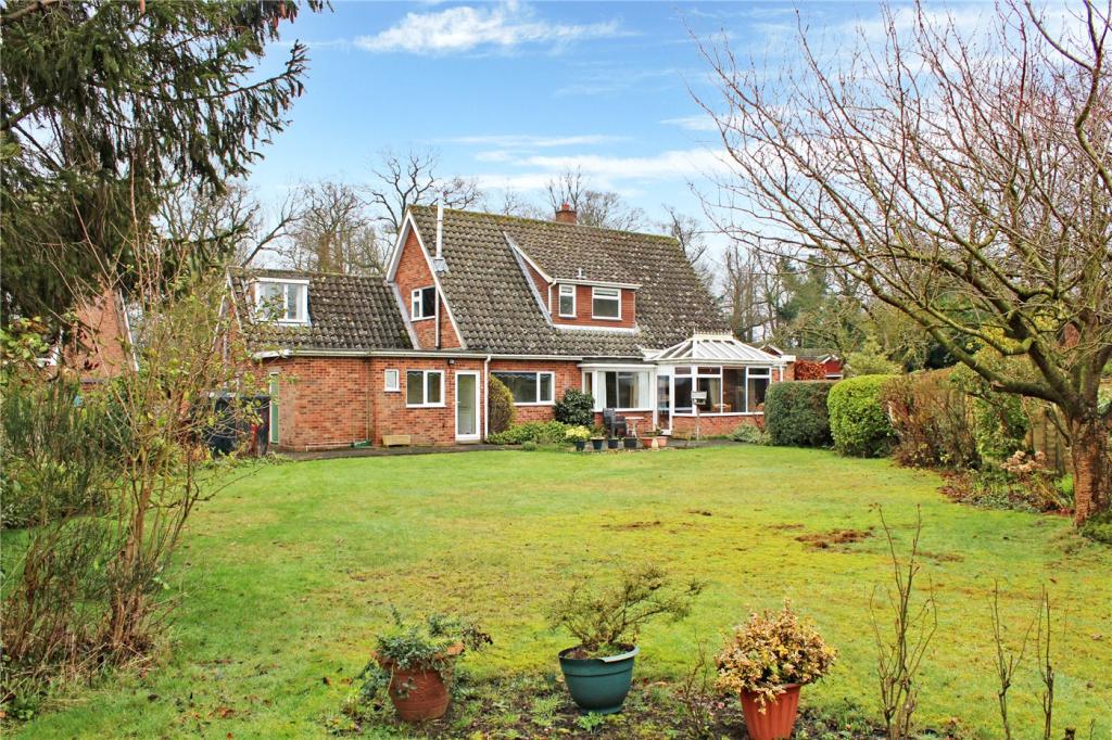
FAIRFIELD
THE STREET, NORWICH, BRAMERTON, NORFOLK NR14 7DW
£425,000
Property details
Tenure
FREEHOLD
Floor area
160 m²
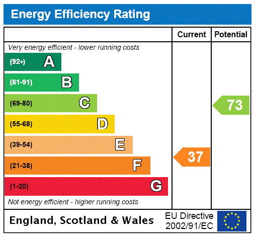
EPC rating
F
Year built
England and Wales: 1967-1975
Last sold
£415,000 Aug 2020
Price per m²
£2,656/m²
Local average
£434,600 (-2.2%)
Deprivation
Decile 8 (23,694 of 33,755)
Street crime
0 incidents within 1 mile (Apr 2026)
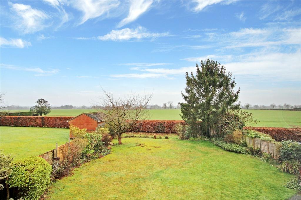
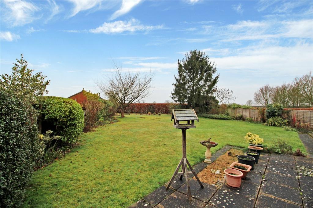
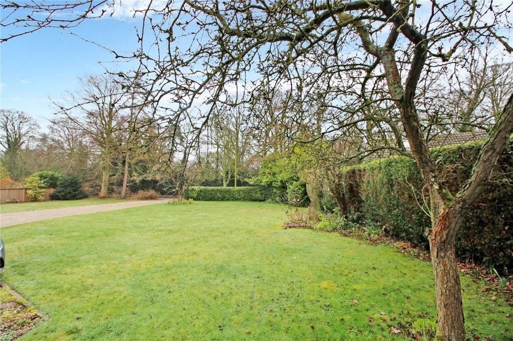
Key features
- No Onward Chain
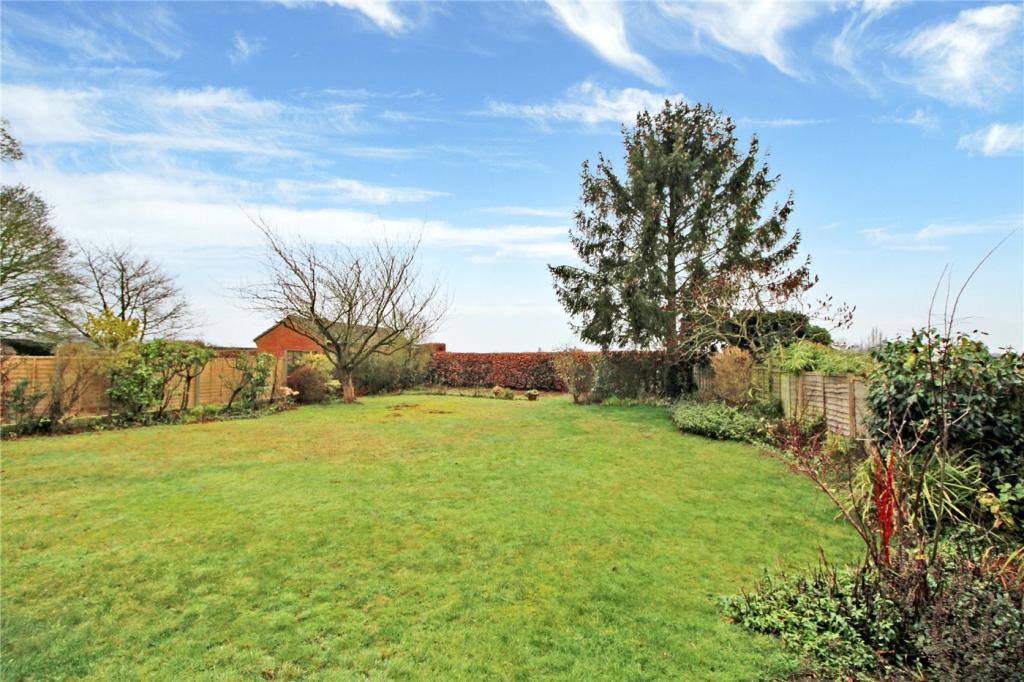
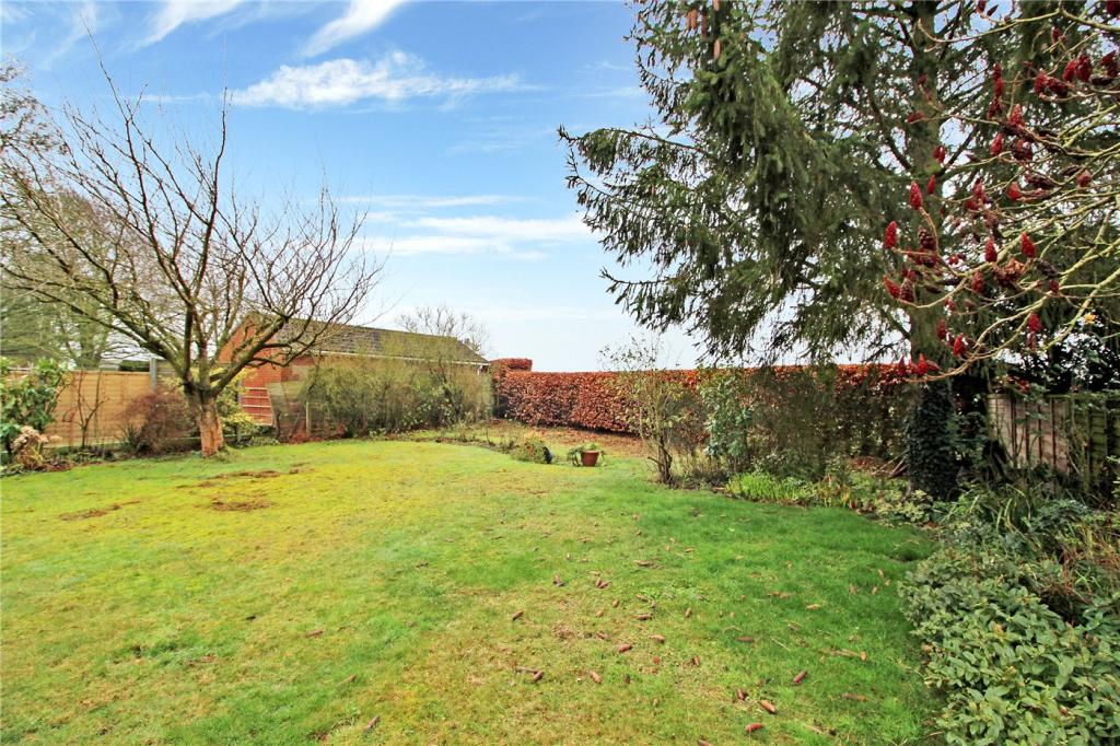
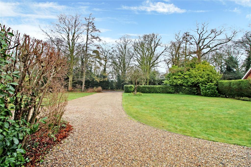
- Stunning Front & Rear Grounds
- Extensive Driveway & Double Garage
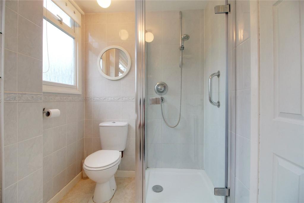
- 4 Bedrooms With 2 En-Suites
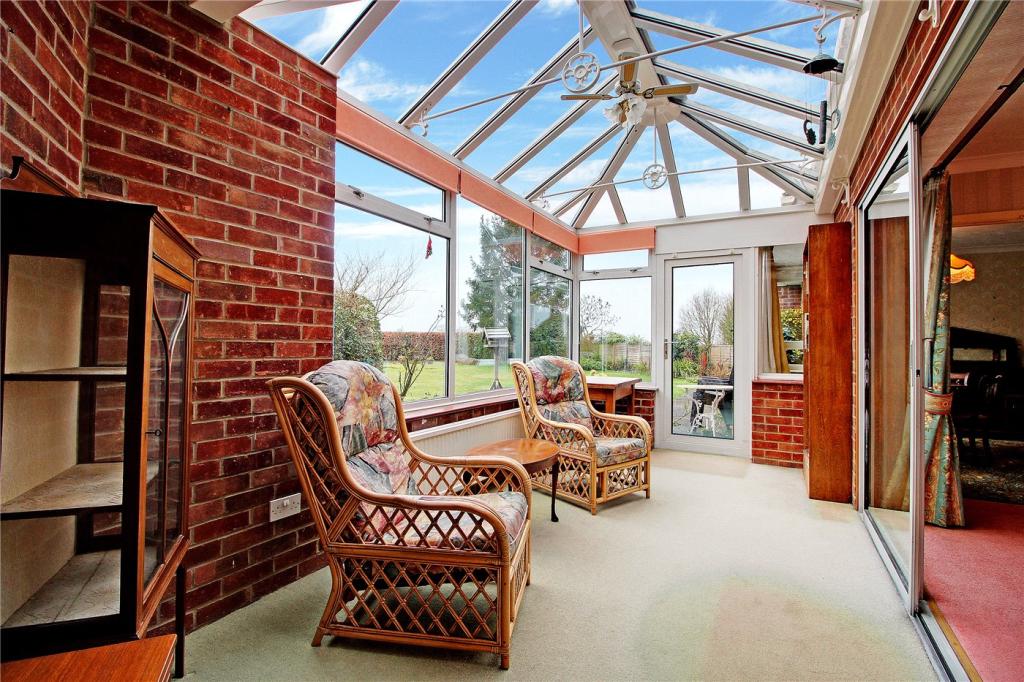
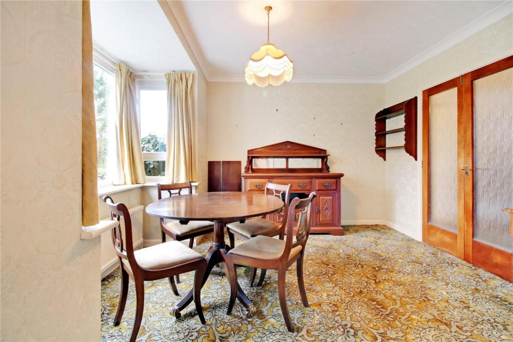
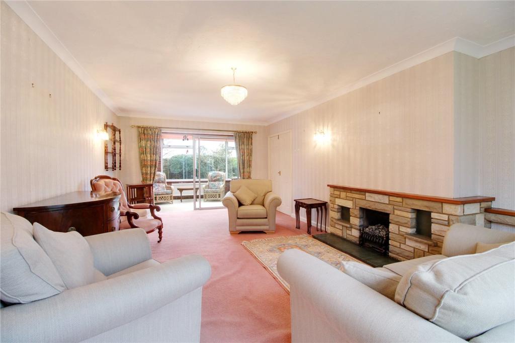
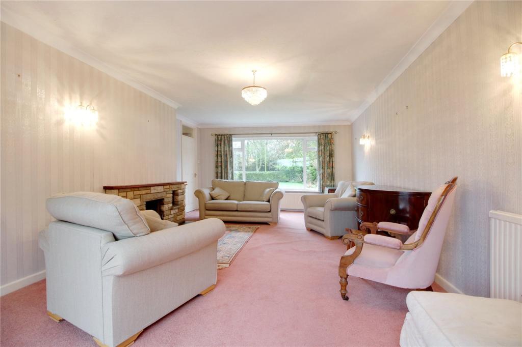
- 4 Versatile Reception Rooms
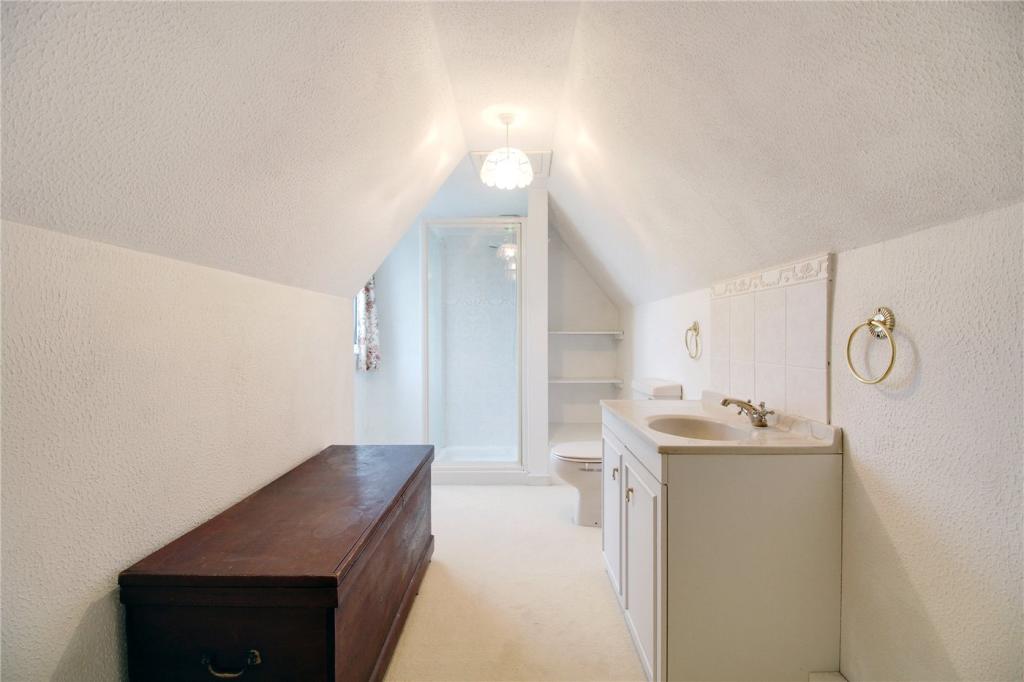
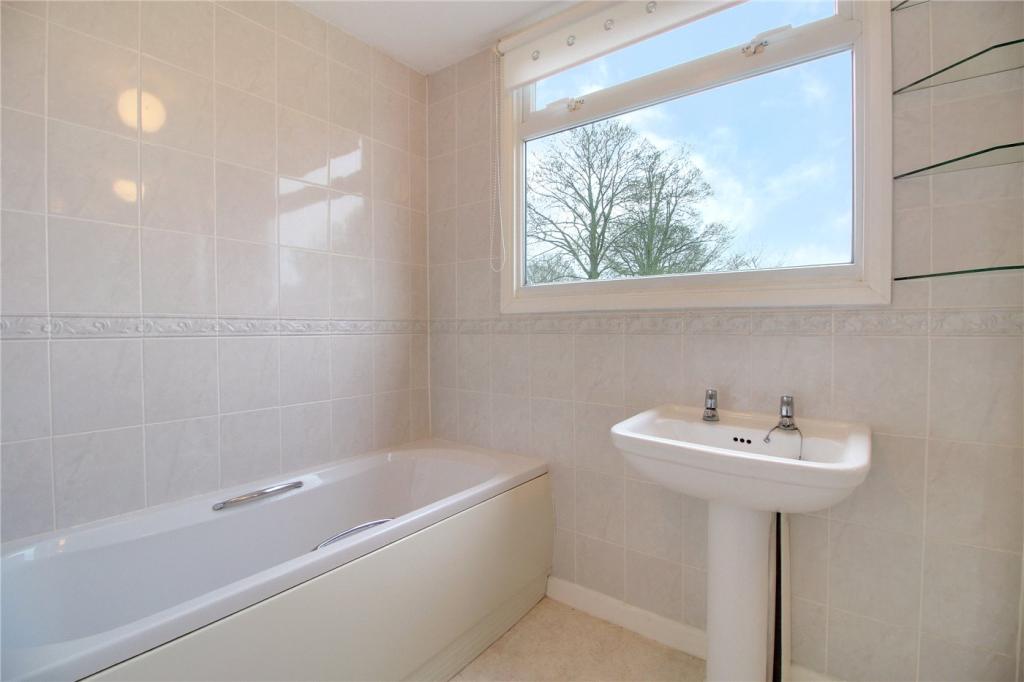
- Impressive Four Piece Family Bathroom
- Utility Room & Pantry
- Ample Storage
- Requested Location
- Easy Reach Of Norwich's City Centre
Additional details
- Parking
- Yes
- Garden
- Yes
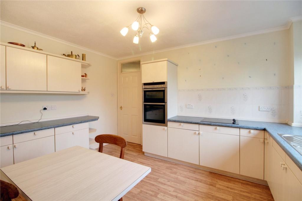
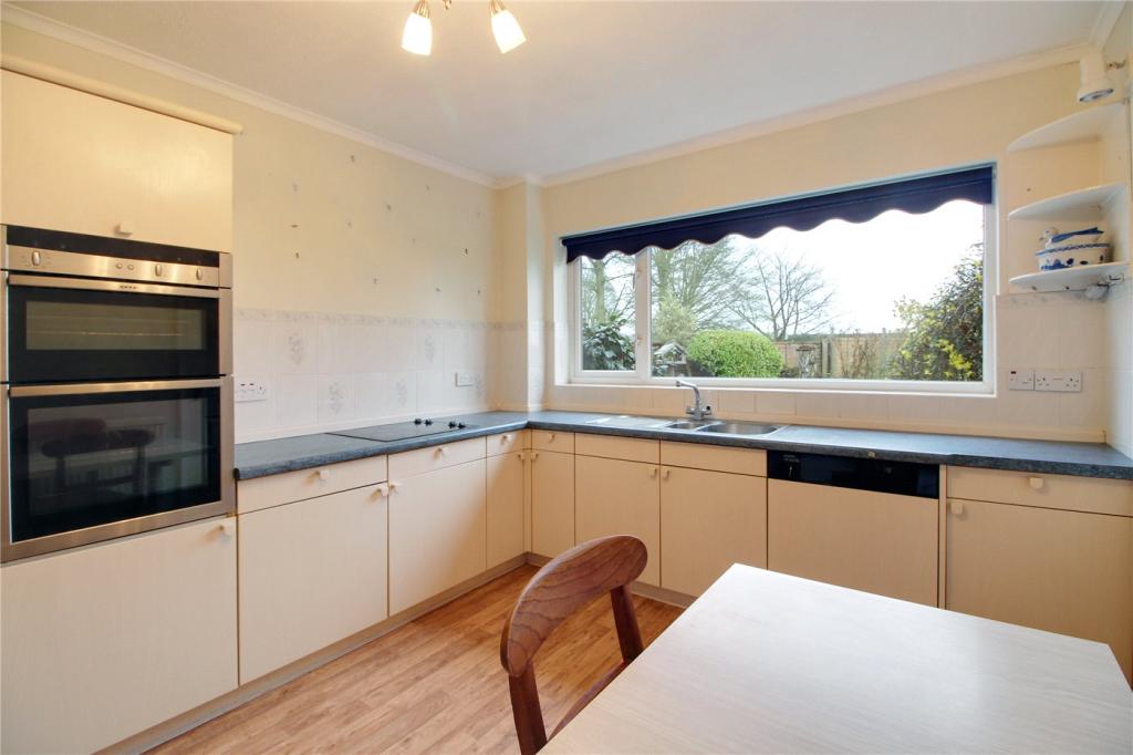
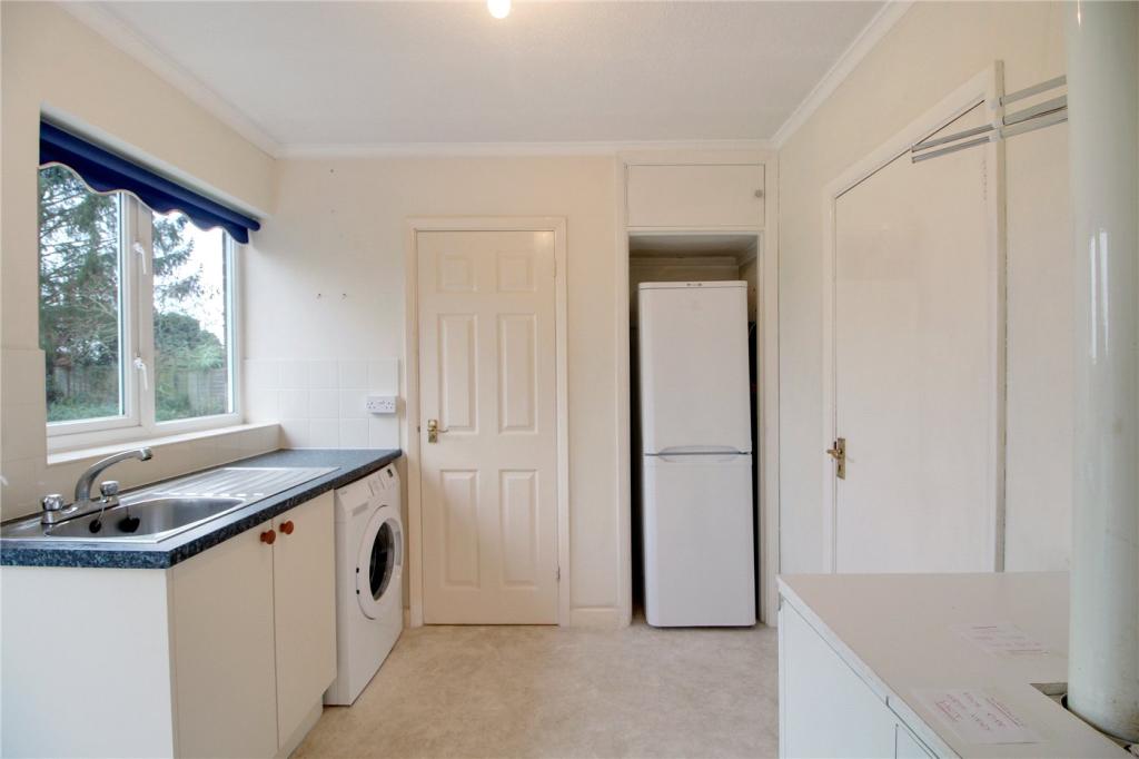
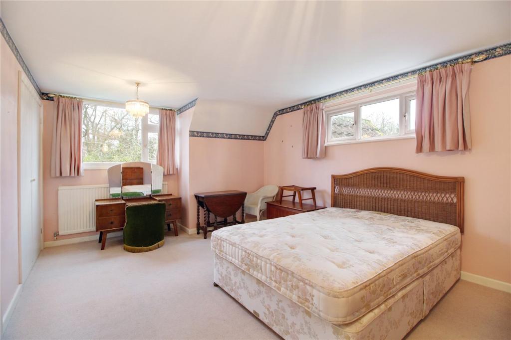
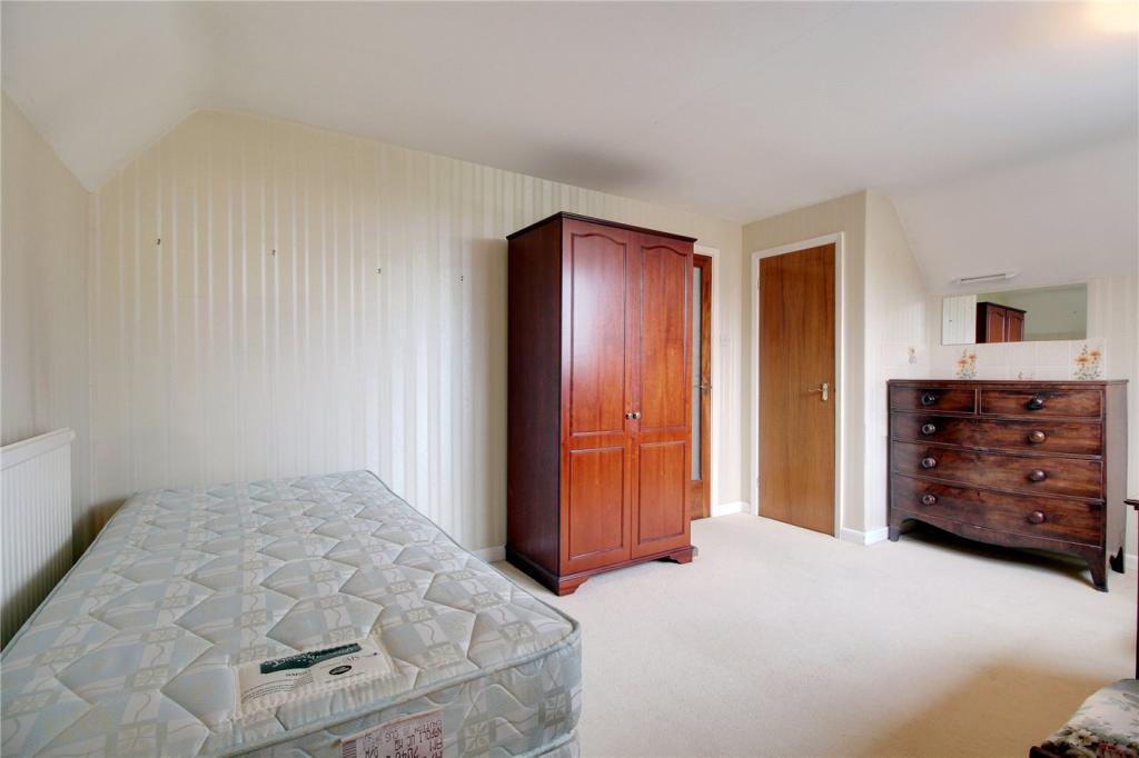
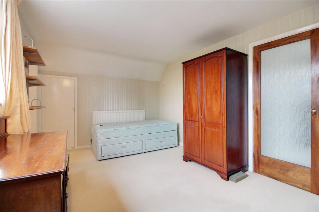
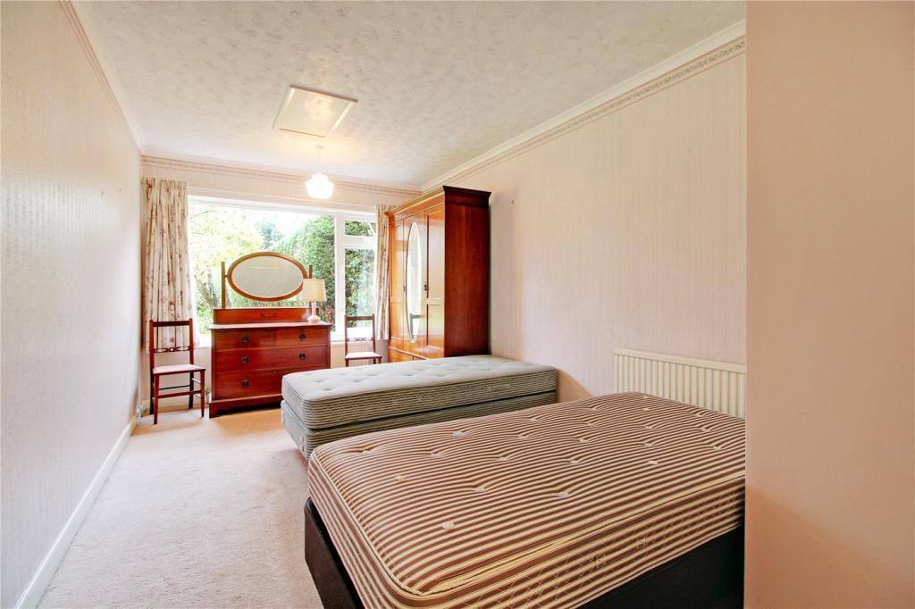
Description
Listed by
Poringland
Winkworth
Reference: 77025532
EPC Rating & Upgrade Cost
Current rating: F
Potential rating: C
Inspection date: 18/02/2020
Expiry date: 17/02/2030
Recommendations
- Room-in-roof insulation (2,700)
- Floor insulation (suspended floor) (1,200)
- Floor insulation (solid floor) (6,000)
- Low energy lighting for all fixed outlets (50)
- Hot water cylinder thermostat (400)
- Upgrade heating controls (450)
- Replace boiler with new condensing boiler (3,000)
- Solar water heating (6,000)
- Solar photovoltaic panels, 2.5 kWp (5,500)
Flood risk
Zone: 1
Risk: Low
Job (default Low)
Floorplans
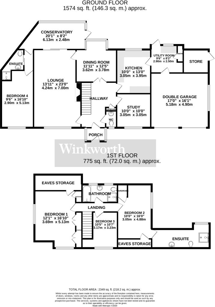
Floorplan
EPC Graphs
EPC Rating Graph
Price history
| Event | Date | Price | % change |
|---|---|---|---|
| Sold | 06/08/2020 (5 years ago) | £415,000 | — |
Source: HM Land Registry Price Paid Data. Crown copyright.
Sold Comparables
Same street and nearby sales within 0.25 miles (last 5 years). Data from Land Registry Price Paid.
| Address | Price | Date | Type |
|---|---|---|---|
| Same street SPOONER LODGE THE STREET, BRAMERTON, NORWICH, SOUTH NORFOLK, NORFOLK, NR14 7DW | £705,000 | 11/02/2026 | Detached |
| Same street DUN TRADIN THE STREET, BRAMERTON, NORWICH, SOUTH NORFOLK, NORFOLK, NR14 7DW | £610,000 | 28/05/2024 | Detached |
| Same street GARDEN HOUSE THE STREET, BRAMERTON, NORWICH, SOUTH NORFOLK, NORFOLK, NR14 7DW | £430,000 | 07/02/2024 | Detached |
| Same street SQUIRRELS DRIFT THE STREET, BRAMERTON, NORWICH, SOUTH NORFOLK, NORFOLK, NR14 7DW | £850,000 | 29/09/2023 | Detached |
| Same street ST. PETERS BARN THE STREET, BRAMERTON, NORWICH, SOUTH NORFOLK, NORFOLK, NR14 7DW | £700,000 | 23/02/2023 | Detached |
| Same street SPOONER LODGE THE STREET, BRAMERTON, NORWICH, SOUTH NORFOLK, NORFOLK, NR14 7DW | £440,000 | 17/02/2023 | Detached |
| Same street ORCHARD HOUSE THE STREET, BRAMERTON, NORWICH, SOUTH NORFOLK, NORFOLK, NR14 7DW | £1,275,000 | 12/10/2022 | Detached |
| Same street GRANGE FARM COTTAGE THE STREET, BRAMERTON, NORWICH, SOUTH NORFOLK, NORFOLK, NR14 7DW | £400,000 | 16/09/2022 | Detached |
| Same street BULRUSHES THE STREET, BRAMERTON, NORWICH, SOUTH NORFOLK, NORFOLK, NR14 7DW | £737,500 | 17/01/2022 | Detached |
| Same street YEW TREE COTTAGE THE STREET, BRAMERTON, NORWICH, SOUTH NORFOLK, NORFOLK, NR14 7DW | £690,000 | 30/06/2021 | Detached |
Street average: £683,750 (10 sales)
Capital growth trend
Land Registry outcode average: last 12 months vs 5y and 10y ago (from sold prices).
House Price Index (HM Land Registry — official index, not sold-price averages): South Norfolk. Series: Detached. As of March 2026.
Rental Range
Estimated market rent for South Norfolk. Low = conservative, Realistic = average, Optimistic = best case.
Based on Local Authority from postcode lookup → South Norfolk.
LHA (30th percentile) floor for Central Norfolk & Norwich: £1,147/mo (Apr 2025 – Mar 2026)
Location
Address
The Street
Nearby
Nearest stations, universities and amenities (distance from property).
| Type | Name | Distance |
|---|---|---|
| Bus stop | Hall, adj | 0.1 miles |
| Bus stop | Hall, opp | 0.1 miles |
| Shop | Applebee Orchard and Apiary | 0.6 miles |
| Shop | Highway Garden and Leisure | 1.0 miles |
| Train station | Brundall Gardens | 2.5 miles |
| Train station | Brundall | 2.8 miles |
| University | Broadcast House | 4.8 miles |
| Hospital | Norfolk and Norwich University Hospital:Emergency Department | 7.1 miles |
| University | Easton College | 10.1 miles |
Street-level crime
| Category | Count |
|---|---|
| Total incidents | 0 |
Within 1 mile during Apr 2026. Source: data.police.uk (England & Wales).
Schools nearby
Nearest open schools with Ofsted ratings (England). Closed schools are not shown. Data from Get Information about Schools and Ofsted.
| Name | Type | Distance | Ofsted |
|---|---|---|---|
| Rockland St Mary Primary School | Primary | 1.3 miles | Good — 15 Mar 2022 |
| Surlingham Primary School | Primary | 1.5 miles | Good — 20 Mar 2022 |
| Alpington and Bergh Apton Church of England Voluntary Aided Primary School | Primary | 1.9 miles | Outstanding — 9 Sep 2015 |
| Framingham Earl High School | Secondary | 2.2 miles | Good — 6 Nov 2014 |
| Poringland Primary School | Primary | 2.3 miles | Good — 6 Jul 2023 |
Rental Comparables
Loading rental comparables for this postcode. Refresh in a few minutes.
Rent-driven metrics
Based on Area rent estimate.
- Rent ratio — Monthly rent ÷ purchase price (1% rule). 1%+ = strong, 0.8–1% = okay, <0.8% = weak for cashflow.
- Max investor price — Rent ÷ 0.8%; the price at which rent would be 0.8% of price (Stoke-style target).
- Target investor price — Rent ÷ 1%; the price at which rent would be 1% of price (strong cashflow band).
- Gross yield — Annual rent as % of purchase price (no costs).