Oval Road
Croydon, CR0 6BL
£825 pcm
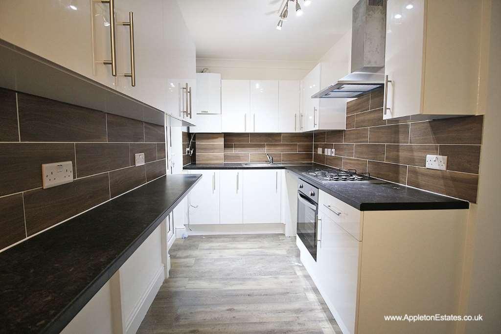
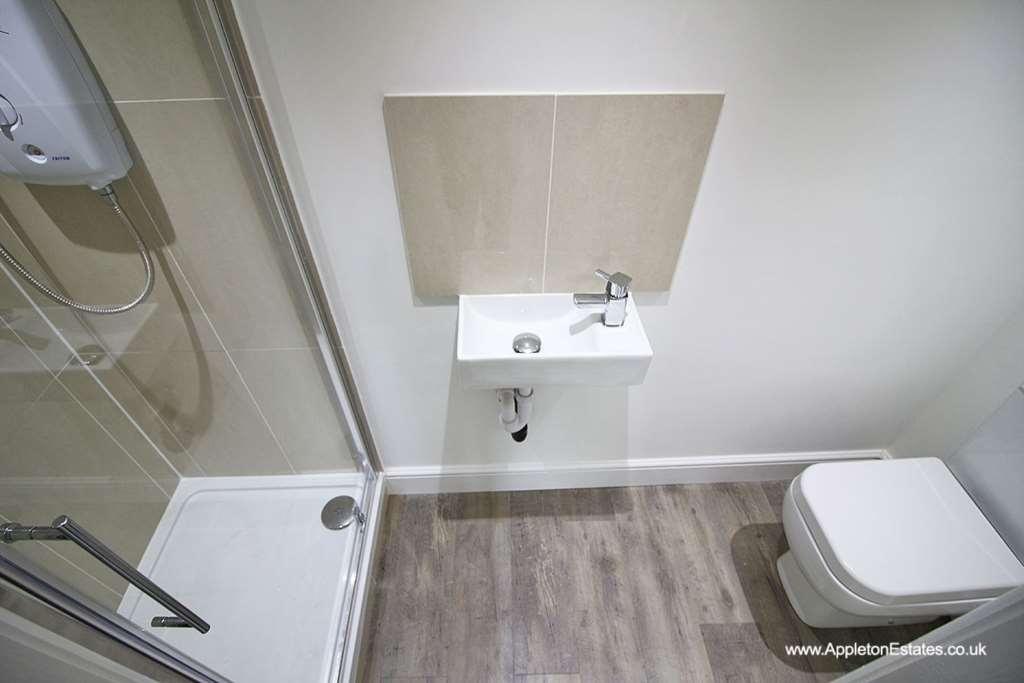
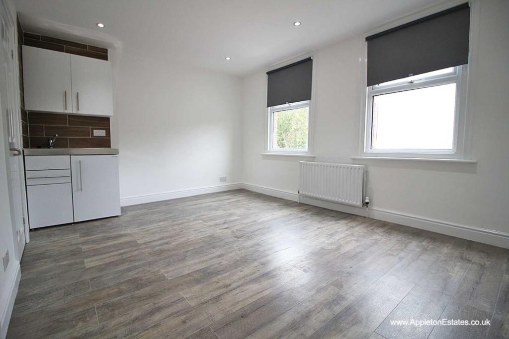
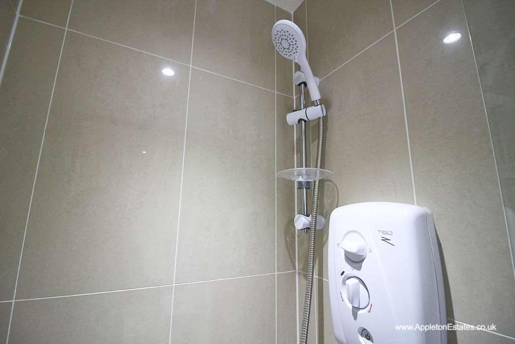
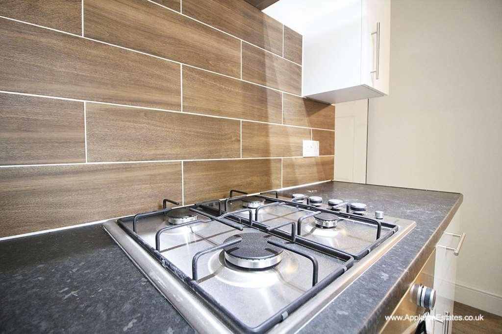
Photo 1 Photo 2 Photo 3 Photo 4 Photo 5
/ 5
Property details
Deprivation
Decile 5 (16,505 of 33,755)
Street crime
1242 incidents within 1 mile (Apr 2026)
Key features
- Stylish Studio
- ALL BILLS included
- 3 minutes WALK to EAST CROYDON STATION
- Communal Kitchen
- Communal Garden
- Private Kitchenette
- Private En-Suite
- Available NOW
Additional details
- Heating
- Double glazing, Gas central
- Garden
- Private garden
Description
Property Details:
- Studio flat with private en-suite with shower & kitchenette with fridge-freezer, storage space and kitchen sink
- SHARED larger kitchen with oven, hob, washing machine & storage
- SHARED Rear Garden
- Bills included in the rent: gas, water, electrics, council tax, wifi
- Property is available furnished/unfurnished
- Property is available now
Perfect for commuters as the property is located only 3 minute walk from East Croydon Station!
Please enquire to book in a viewing!
Location Details:
Oval Road is ideally located being just a short distance from East Croydon train station and shopping centres such as Whitgift Centre and Centrale. The property is located 0.3 miles (5 minute walk) to East Croydon station and East Croydon Tramlink Stop. High Street is only 0.7 miles (12 minute walk) from the property. Property is available beginning of April
There are direct train connections from East Croydon to London Victoria or London Bridge every 15 minutes.
Book NOW for viewings
Notice
All photographs are provided for guidance only.
Listed by
Croydon
Appleton Estates
Reference: 70237702
EPC ratings on this postcode
We don't have a matched EPC for this property yet. Below are efficiency scores and details for other addresses on this postcode.
| Address | Current | Potential | Floor area | Age band | Type |
|---|---|---|---|---|---|
| 100 Oval Road, CROYDON | 62 | 73 | 70 m² | England and Wales: 1900-1929 | Flat |
| 100b Oval Road, CROYDON | 72 | 78 | 44 m² | England and Wales: 1900-1929 | Flat |
| 100b, Oval Road, CROYDON | 60 | 77 | 42 m² | England and Wales: 1900-1929 | Flat |
| 102 OVAL ROAD, CROYDON, CROYDON | 68 | 73 | 70 m² | England and Wales: 1930-1949 | Flat |
| 102a Oval Road, CROYDON | 74 | 76 | 43 m² | England and Wales: 1900-1929 | Flat |
| 104 Oval Road, CROYDON | 74 | 79 | 75 m² | England and Wales: 1900-1929 | Flat |
| 104a Oval Road, CROYDON | 77 | 79 | 46 m² | England and Wales: 1900-1929 | Flat |
| 104a, Oval Road, CROYDON | 71 | 77 | 44 m² | England and Wales: before 1900 | Flat |
| 106 Oval Road, CROYDON | 69 | 80 | 75 m² | England and Wales: before 1900 | Flat |
| 106 Oval Road, CROYDON | 57 | 80 | 74 m² | England and Wales: 1900-1929 | Terraced |
| 106a, Oval Road, CROYDON | 67 | 75 | 32 m² | England and Wales: 1930-1949 | Flat |
| 112 OVAL ROAD, CROYDON | 75 | 80 | 74 m² | England and Wales: 1900-1929 | Flat |
| 112a Oval Road, CROYDON | 78 | 78 | 51 m² | England and Wales: 1900-1929 | Flat |
| 114, Oval Road, CROYDON | 61 | 73 | 76 m² | England and Wales: 1900-1929 | Flat |
| 114a Oval Road, CROYDON | 75 | 79 | 42 m² | England and Wales: 1930-1949 | Flat |
Flood risk
Zone: 1
Risk: Low
Job (default Low)
EPC Graphs

EPC 1
Rental Range
Estimated market rent for Croydon. Low = conservative, Realistic = average, Optimistic = best case.
Based on Local Authority from postcode lookup → Croydon.
LHA (30th percentile) floor for Outer South London: Apr 2025 – Mar 2026
Location
Address
Oval Road
Nearby
Nearest stations, universities and amenities (distance from property).
| Type | Name | Distance |
|---|---|---|
| Bus stop | Cross Road | 0.1 miles |
| Shop | Store / Atelier Amalthea | 0.1 miles |
| Shop | Oscar Dahling Antiques | 0.1 miles |
| Train station | East Croydon | 0.2 miles |
| Train station | West Croydon | 0.5 miles |
| Hospital | Diabetic Department | 1.1 miles |
| Hospital | Patient Advice and Liaison Service (PALS) | 1.1 miles |
| University | Horton Halls Reception | 5.6 miles |
| University | University of Wales Trinity Saint David London Campus | 7.1 miles |
Street-level crime
| Category | Count |
|---|---|
| Violence and sexual offences | 336 |
| Anti-social behaviour | 262 |
| Shoplifting | 173 |
| Vehicle crime | 82 |
| Drugs | 71 |
| Other theft | 64 |
| Public order | 64 |
| Criminal damage and arson | 52 |
| Burglary | 43 |
| Theft from the person | 28 |
| Possession of weapons | 23 |
| Robbery | 23 |
| Other crime | 11 |
| Bicycle theft | 10 |
| Total incidents | 1242 |
Within 1 mile during Apr 2026. Source: data.police.uk (England & Wales).
Schools nearby
Nearest open schools with Ofsted ratings (England). Closed schools are not shown. Data from Get Information about Schools and Ofsted.
| Name | Type | Distance | Ofsted |
|---|---|---|---|
| Ark Oval Primary Academy | Primary | 0.1 miles | Good — 11 Jan 2013 |
| Al-Khair Secondary Girls | Other | 0.1 miles | Good — 9 Jul 2024 |
| Al-Khair School | Other | 0.2 miles | Good — 24 Nov 2021 |
| Tunstall Nursery School | Nursery | 0.3 miles | Outstanding — 16 Mar 2016 |
| St Mary's Catholic Infant School | Primary | 0.3 miles | Good — 27 Nov 2022 |
Rental Comparables
Residential lets from OpenRent and Rightmove for the area. Bedroom counts vary — use the Beds column to compare like-for-like lets. Student lets are excluded.
| Title | Rent | Beds | Distance | As seen on |
|---|---|---|---|---|
| 1 Bed Flat, Dingwall Road, CR0 | £1,450/mo | 1 | 0.25 miles | OpenRent |
| 2 Bed Detached House, Alexandra Road, CR0 | £1,600/mo | 2 | 0.27 miles | OpenRent |
| 1 Bed Flat, St James's Road, CR0 | £1,350/mo | 1 | 0.34 miles | OpenRent |
Average rent: £1,467/mo (3 listings)
Enter House Number
Enter the house number to help us retrieve more accurate pricing history and property data.
Please log in to submit or correct the house number for this listing.
Log in to continue