56 DERWENT ROAD
BIRMINGHAM, WEST MIDLANDS B30 2UT
£550 pcm
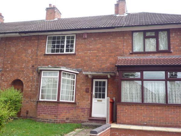
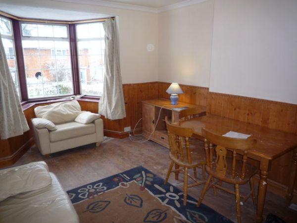
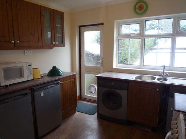
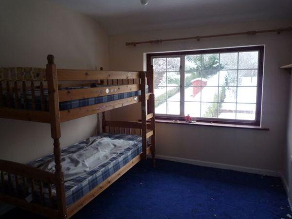
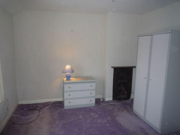
Photo 1 Photo 2 Photo 3 Photo 4 Photo 5
/ 5
Property details
Deprivation
Decile 2 (6,051 of 33,755)
Street crime
377 incidents within 1 mile (Apr 2026)
Key features
- Mid terrace residence
- Lounge, kitchen
- Three good sized bedrooms
- Rear garden
- Early viewing recommended
Additional details
- Garden
- Yes
Description
Listed by
Birmingham Kings Heath - Lettings & Sales
The Property Franchise Group
Reference: 27538976
EPC Rating & Upgrade Cost
Fetching EPC data… Refresh this page in a moment.
Flood risk
Zone: 2
Risk: In flood risk area
Environment Agency Flood Risk Areas (APSFR)
Rental Range
Estimated market rent for Birmingham. Low = conservative, Realistic = average, Optimistic = best case.
Based on Local Authority from postcode lookup → Birmingham.
LHA (30th percentile) floor for Birmingham: £823/mo (Apr 2025 – Mar 2026)
Location
Nearby
Nearest stations, universities and amenities (distance from property).
| Type | Name | Distance |
|---|---|---|
| Bus stop | Pineapple Rd / Brent Rd | 0.2 miles |
| Shop | The Co-operative Food | 0.2 miles |
| Shop | The Local | 0.2 miles |
| Hospital | Saint Andrew's Healthcare | 0.3 miles |
| Train station | Pineapple Road | 0.3 miles |
| Hospital | Park View Clinic | 0.6 miles |
| Train station | Kings Heath | 0.8 miles |
| University | University of Birmingham School of Dentistry | 1.1 miles |
| University | Birmingham City University, Bournville Campus | 1.1 miles |
Street-level crime
| Category | Count |
|---|---|
| Violence and sexual offences | 141 |
| Shoplifting | 53 |
| Vehicle crime | 36 |
| Criminal damage and arson | 33 |
| Burglary | 28 |
| Public order | 24 |
| Anti-social behaviour | 17 |
| Other theft | 15 |
| Drugs | 8 |
| Possession of weapons | 7 |
| Robbery | 7 |
| Theft from the person | 5 |
| Other crime | 2 |
| Bicycle theft | 1 |
| Total incidents | 377 |
Within 1 mile during Apr 2026. Source: data.police.uk (England & Wales).
Schools nearby
Nearest open schools with Ofsted ratings (England). Closed schools are not shown. Data from Get Information about Schools and Ofsted.
| Name | Type | Distance | Ofsted |
|---|---|---|---|
| Moor Green Primary Academy | Primary | 0.3 miles | Outstanding — 26 Feb 2019 |
| Selly Park Girls' School | Secondary | 0.4 miles | Good — 13 Feb 2023 |
| King Edward VI Camp Hill School for Girls | Secondary | 0.4 miles | Outstanding — 25 Jan 2022 |
| King Edward VI Camp Hill School for Boys | Secondary | 0.4 miles | Outstanding — 18 Jan 2024 |
| St Edward's Catholic Primary School | Primary | 0.5 miles | Good — 13 Dec 2022 |
Rental Comparables
Residential lets from OpenRent and Rightmove for the area (same bedroom count). Use to validate rent estimates. Student lets are excluded.
| Title | Rent | Beds | Distance | As seen on |
|---|---|---|---|---|
| 3 Bed Terraced House, Grove Road, B14 | £1,250/mo | 3 | 0.73 miles | OpenRent |
Average rent: £1,250/mo (1 listing)