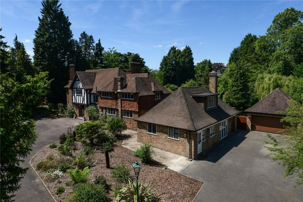
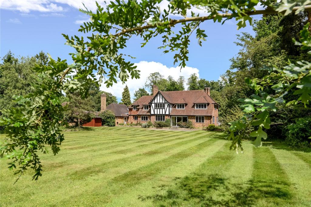
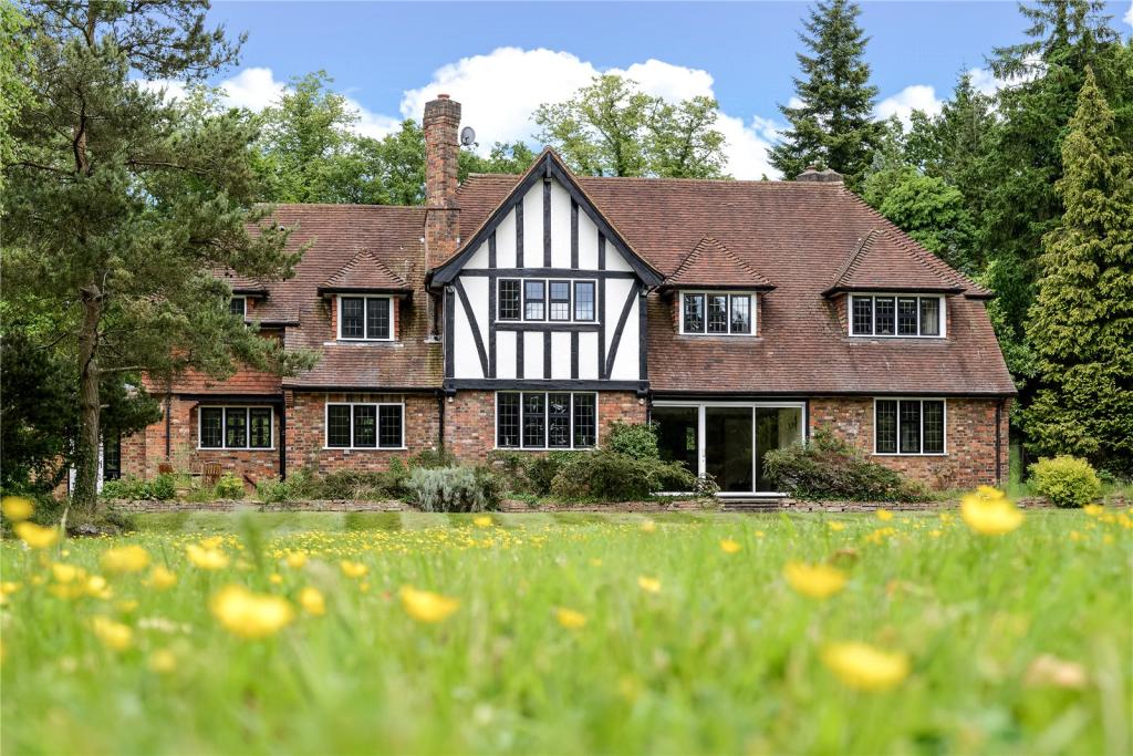
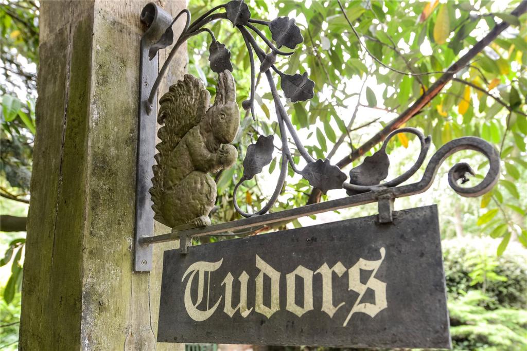
Tudors
WOOD LANE, IVER, IVER HEATH, BUCKINGHAMSHIRE SL0 0LQ
£2,250,000
Picture No. 22 Picture No. 04 Picture No. 03 Picture No. 05 Picture No. 01 Picture No. 06 Picture No. 02 Picture No. 07 Picture No. 08 Picture No. 09 Picture No. 10 Picture No. 11 Picture No. 12 Picture No. 13 Picture No. 14 Picture No. 15 Picture No. 16 Picture No. 17 Picture No. 18 Picture No. 19 Picture No. 20 Picture No. 21 Picture No. 23
/ 23
Property details
Tenure
FREEHOLD
Floor area
284 m²
Year built
England and Wales: 1930-1949
Last sold
£1,850,000 Aug 2015
Price per m²
£7,923/m²
Local average
£965,188 (+133.1%)
Deprivation
Decile 7 (21,056 of 33,755)
Street crime
33 incidents within 1 mile (Apr 2026)
Key features
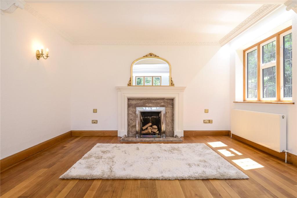
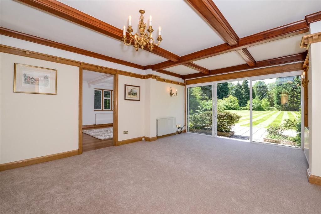
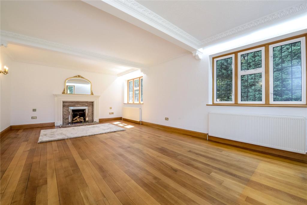
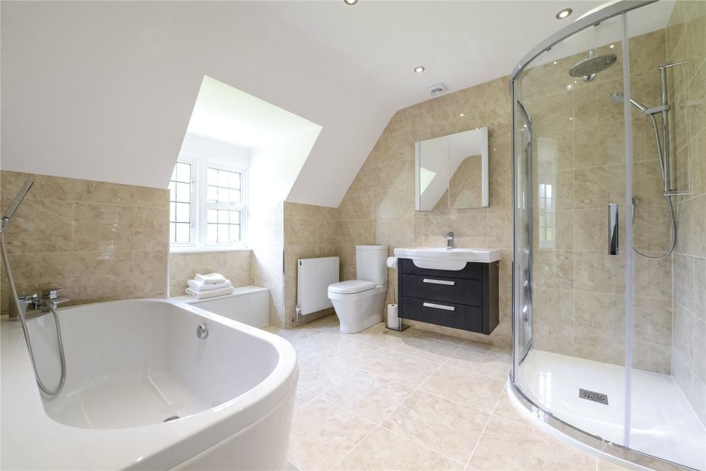
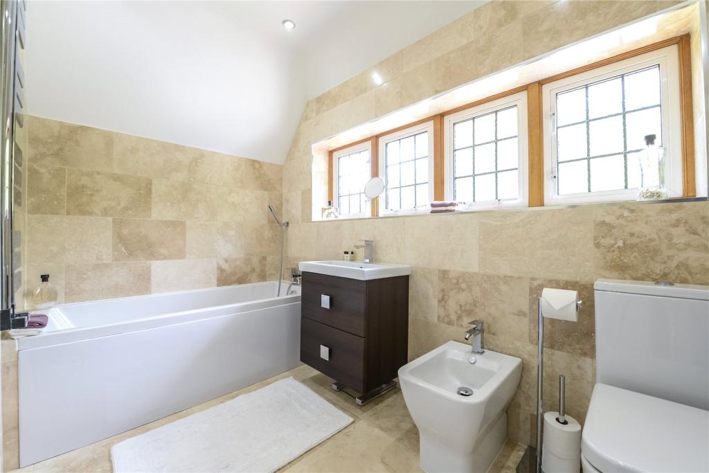
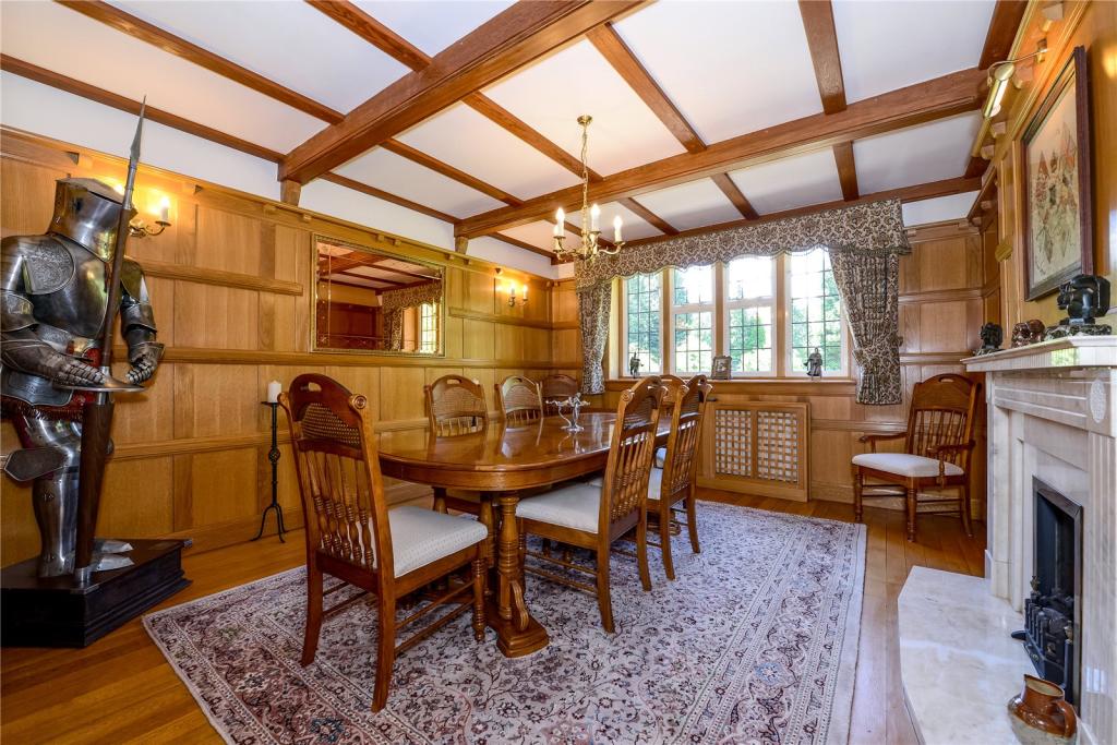
- Detached character filled family residence
- Three reception rooms
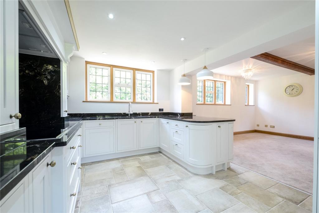
- Superb kitchen/breakfast room
- Study
- Guest cloakroom
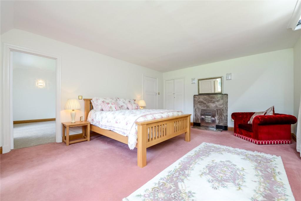
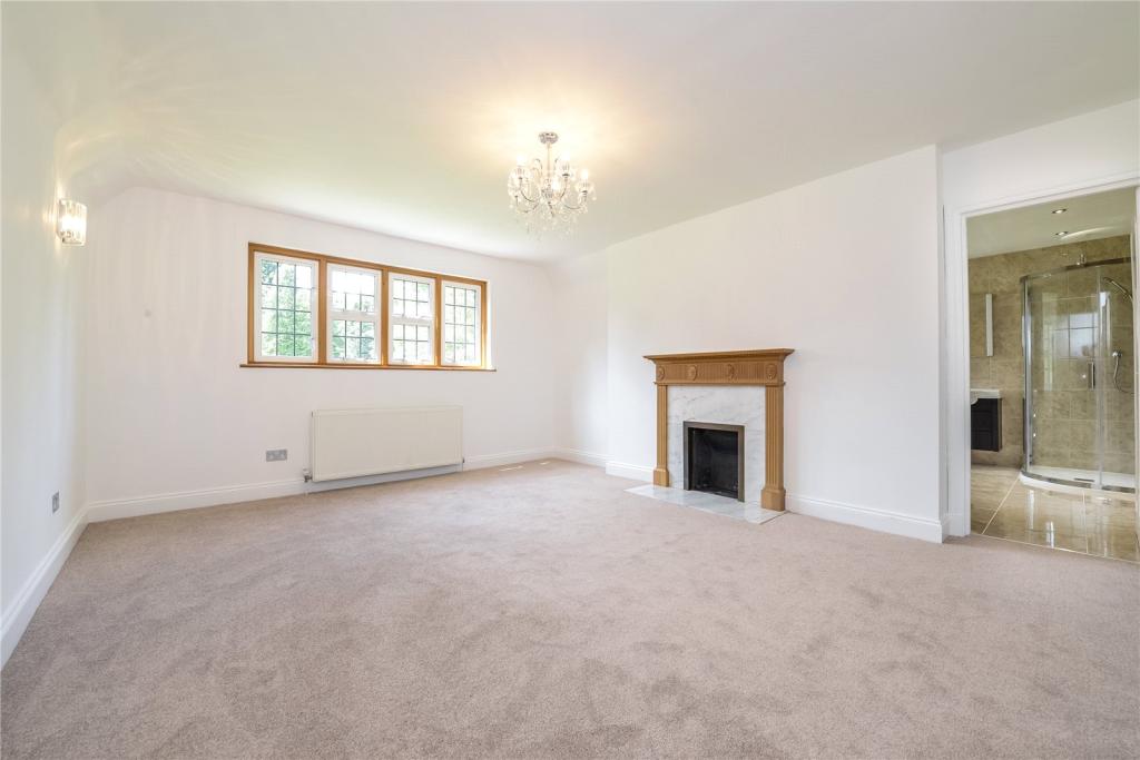
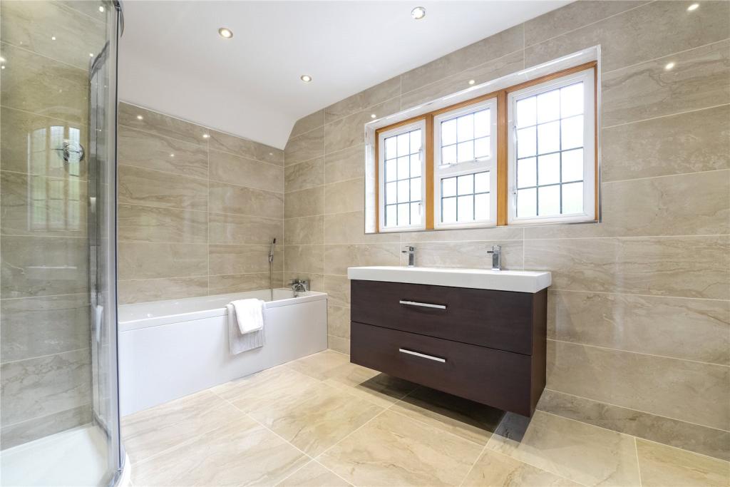
- Master en-suite bedroom
- Second en-suite bedroom
- Three further good size bedrooms
- Separate annexe housing double bedroom
- Garage
Additional details
- Parking
- Yes
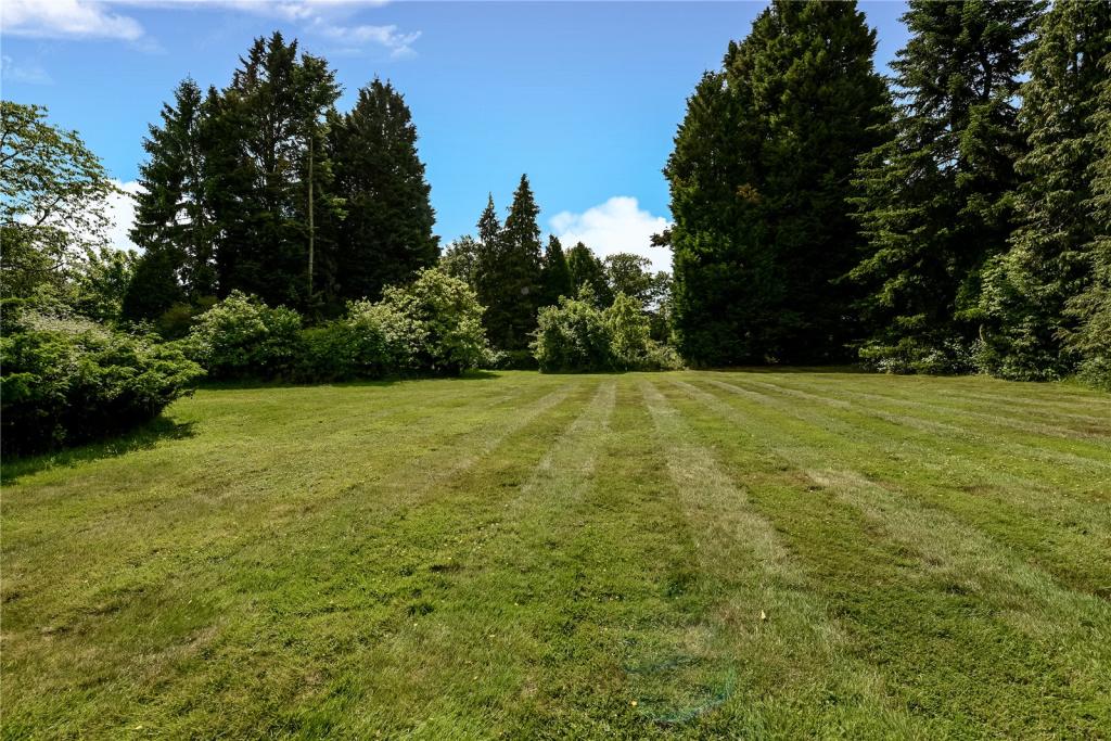
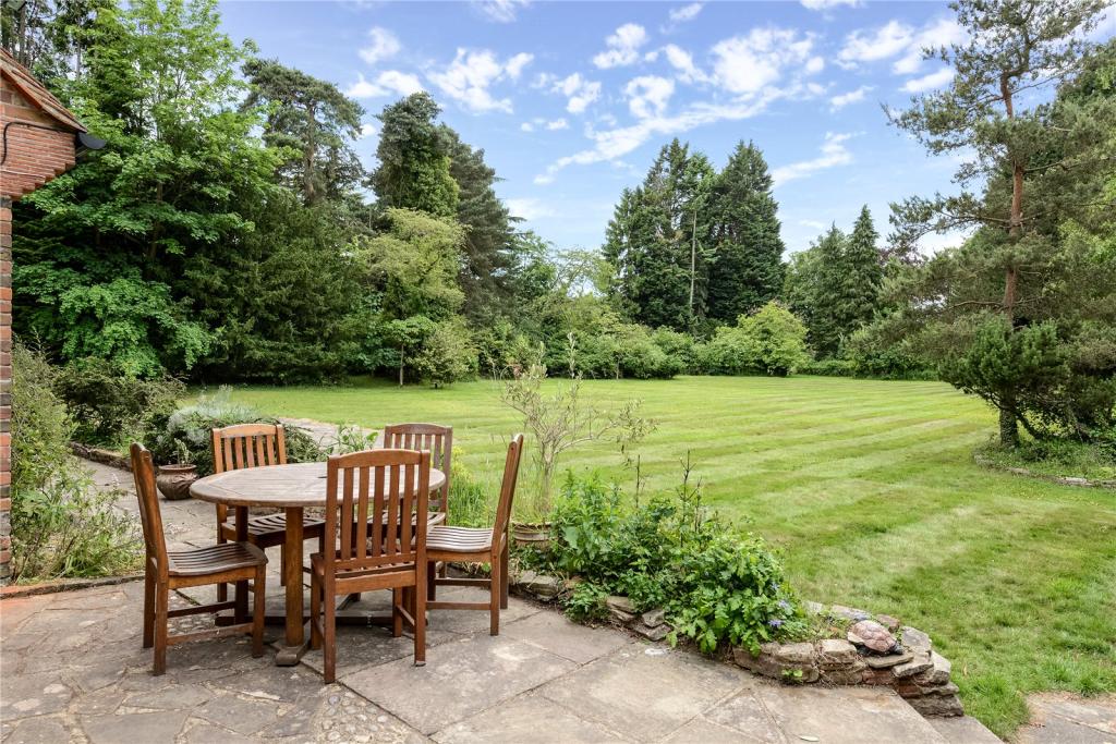
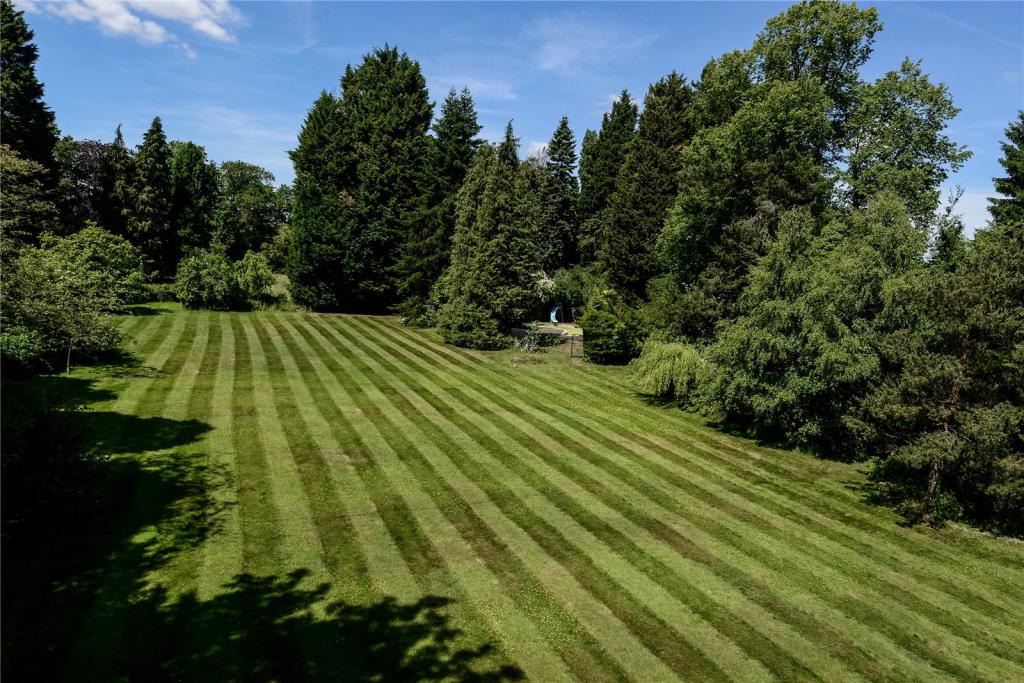
- Garden
- Yes
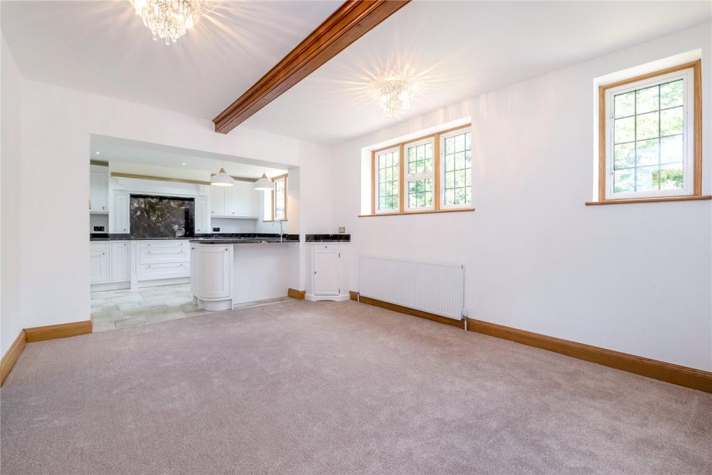
Description
Listed by
Gerrards Cross Sales
Leaders and Romans Group
Reference: 54004097
EPC ratings on this postcode
We don't have a matched EPC for this property yet. Below are efficiency scores and details for other addresses on this postcode.
| Address | Current | Potential | Floor area | Age band | Type |
|---|---|---|---|---|---|
| 12 Wood Lane, Iver Heath, IVER | 63 | 78 | 330 m² | England and Wales: 1930-1949 | Detached |
| 7, Wood Lane, Iver Heath, IVER | 28 | 65 | 268 m² | England and Wales: 1930-1949 | Detached |
| 8, Wood Lane, Iver Heath, IVER | 62 | 92 | 227 m² | England and Wales: 1900-1929 | Detached |
| 8, Wood Lane, Iver Heath, IVER | 48 | 74 | 218 m² | England and Wales: 1930-1949 | Detached |
| Carne, Wood Lane, Iver Heath, IVER | 60 | 80 | 176 m² | England and Wales: 1900-1929 | Detached |
| Iverfarne, Wood Lane, Iver Heath, IVER | 60 | 75 | 692 m² | — | Detached |
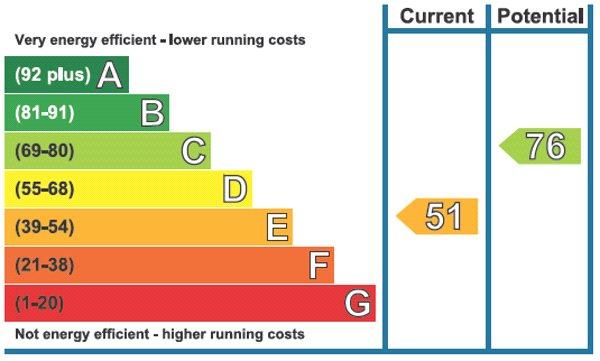
| Tudors, Wood Lane, Iver Heath, IVER | 51 | 76 | 284 m² | England and Wales: 1930-1949 | Detached |
Flood risk
Zone: 1
Risk: Low
Job (default Low)
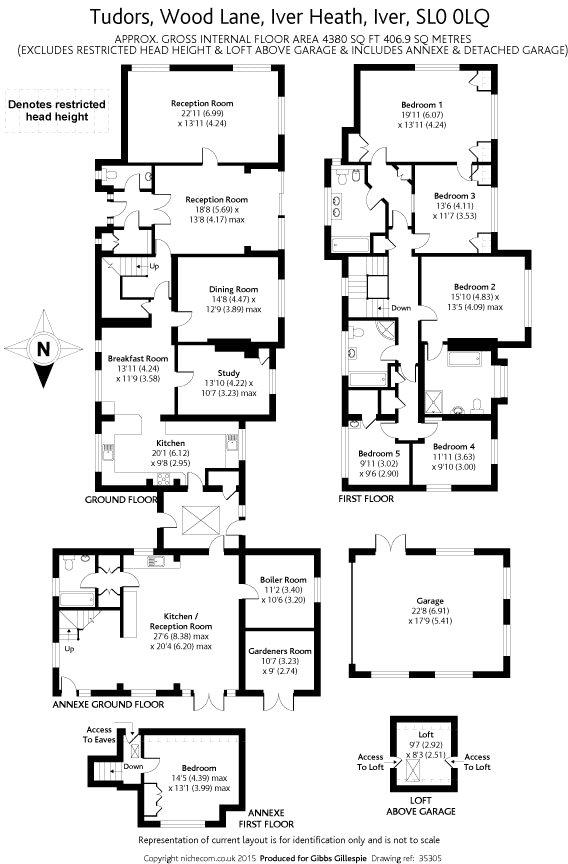
Floorplans
Picture No. 25
EPC Graphs
Picture No. 24
Price history
| Event | Date | Price | % change |
|---|---|---|---|
| Sold | 12/08/2015 (10 years ago) | £1,850,000 | — |
Source: HM Land Registry Price Paid Data. Crown copyright.
Sold Comparables
Same street and nearby sales within 0.25 miles (last 5 years). Data from Land Registry Price Paid.
| Address | Price | Date | Type |
|---|---|---|---|
| Same street 7 WOOD LANE, IVER HEATH, IVER, BUCKINGHAMSHIRE, SL0 0LQ | £1,300,000 | 06/01/2023 | Detached |
| 18 WOOD LANE CLOSE, IVER, BUCKINGHAMSHIRE, SL0 0LJ | £1,000,000 | 21/10/2022 | Detached |
| 23 WOOD LANE CLOSE, IVER, BUCKINGHAMSHIRE, SL0 0LH | £1,260,000 | 08/08/2022 | Detached |
| SIND-ORNATO UXBRIDGE ROAD, IVER, BUCKINGHAMSHIRE, SL0 0LN | £800,000 | 08/07/2022 | Detached |
| 24 WOOD LANE CLOSE, IVER, BUCKINGHAMSHIRE, SL0 0LJ | £920,000 | 19/10/2021 | Detached |
| 13 WOOD LANE CLOSE, IVER, BUCKINGHAMSHIRE, SL0 0LH | £1,180,000 | 15/10/2021 | Detached |
| 25 WOOD LANE CLOSE, IVER, BUCKINGHAMSHIRE, SL0 0LH | £1,080,000 | 30/06/2021 | Detached |
Street average: £1,300,000 (1 sale)
Area average: £1,040,000 (6 sales)
Capital growth trend
Land Registry outcode average: last 12 months vs 5y and 10y ago (from sold prices).
House Price Index (HM Land Registry — official index, not sold-price averages): Buckinghamshire. Series: Detached. As of March 2026.
Rental Range
Estimated market rent for Buckinghamshire. Low = conservative, Realistic = average, Optimistic = best case.
Based on Local Authority from postcode lookup → Buckinghamshire.
LHA (30th percentile) floor for East Thames Valley: £1,895/mo (Apr 2025 – Mar 2026)
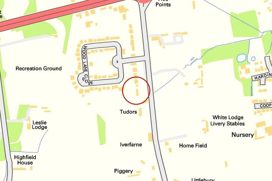
Location
Address
Wood Lane
Nearby
Nearest stations, universities and amenities (distance from property).
| Type | Name | Distance |
|---|---|---|
| Shop | Tesco Express | 0.2 miles |
| Shop | Wood Lane Nursery | 0.2 miles |
| Bus stop | Coopers Row | 0.3 miles |
| Bus stop | Swallow Street | 0.4 miles |
| Train station | Langley | 1.8 miles |
| Hospital | Wexham Park Hospital | 1.9 miles |
| Train station | Iver | 1.9 miles |
| Hospital | Spire Thames Valley Hospital | 1.9 miles |
| University | Unknown | 2.2 miles |
Street-level crime
| Category | Count |
|---|---|
| Violence and sexual offences | 10 |
| Drugs | 5 |
| Other theft | 5 |
| Anti-social behaviour | 2 |
| Burglary | 2 |
| Criminal damage and arson | 2 |
| Public order | 2 |
| Vehicle crime | 2 |
| Possession of weapons | 1 |
| Robbery | 1 |
| Shoplifting | 1 |
| Total incidents | 33 |
Within 1 mile during Apr 2026. Source: data.police.uk (England & Wales).
Schools nearby
Nearest open schools with Ofsted ratings (England). Closed schools are not shown. Data from Get Information about Schools and Ofsted.
| Name | Type | Distance | Ofsted |
|---|---|---|---|
| Iver Heath Infant School and Nursery | Primary | 0.5 miles | Good — 5 Jul 2013 |
| Iver Heath Junior School | Primary | 0.5 miles | Good — 19 Mar 2018 |
| The Iver Village Junior School | Primary | 1.1 miles | Good — 13 Jul 2016 |
| Iver Village Infant Academy | Primary | 1.2 miles | Inadequate — 3 Jul 2022 |
| West Middlesex College | Other | 1.7 miles | — (No rating) |
Rental Comparables
Rental listings exist nearby, but none matched the 5-bedroom count for this property.
Rent-driven metrics
Based on Area rent estimate.
- Rent ratio — Monthly rent ÷ purchase price (1% rule). 1%+ = strong, 0.8–1% = okay, <0.8% = weak for cashflow.
- Max investor price — Rent ÷ 0.8%; the price at which rent would be 0.8% of price (Stoke-style target).
- Target investor price — Rent ÷ 1%; the price at which rent would be 1% of price (strong cashflow band).
- Gross yield — Annual rent as % of purchase price (no costs).
Enter House Number
Enter the house number to help us retrieve more accurate pricing history and property data.
Please log in to submit or correct the house number for this listing.
Log in to continue