2 EARLS ROAD
TUNBRIDGE WELLS, KENT TN4 8EA
£650 pcm
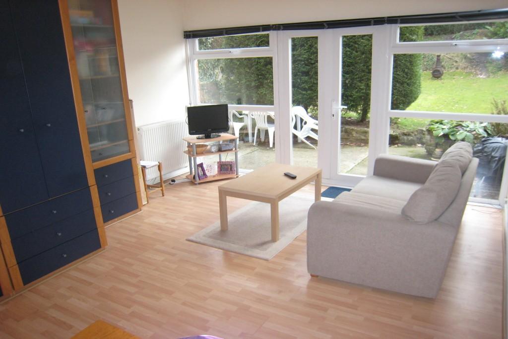
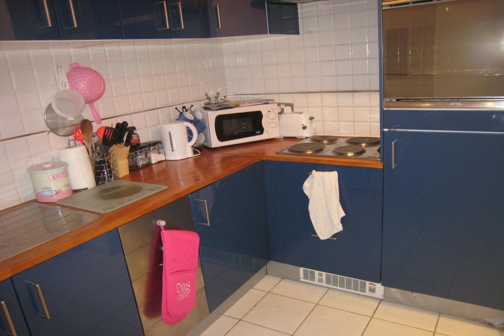
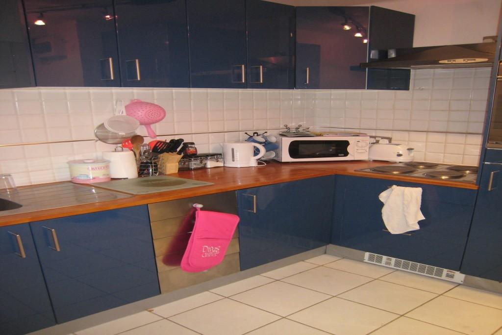
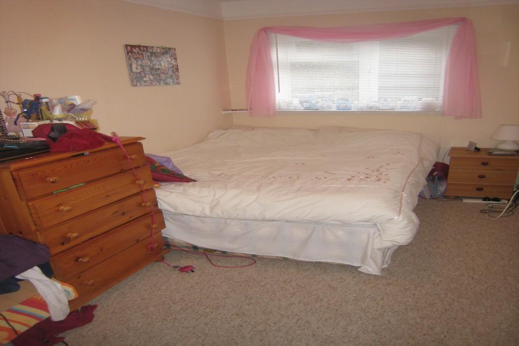
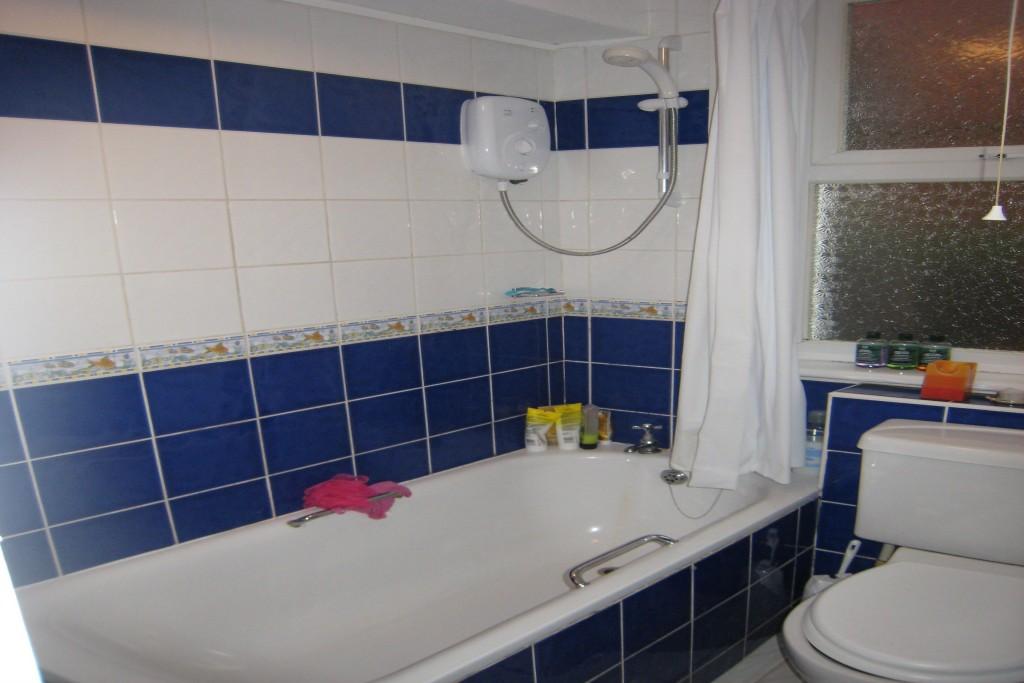
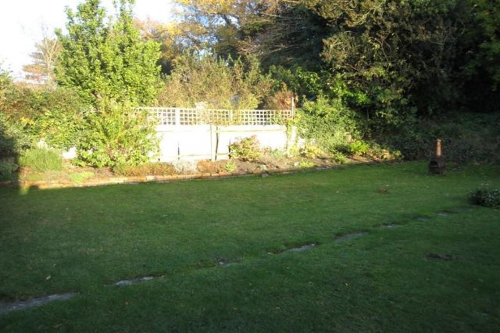
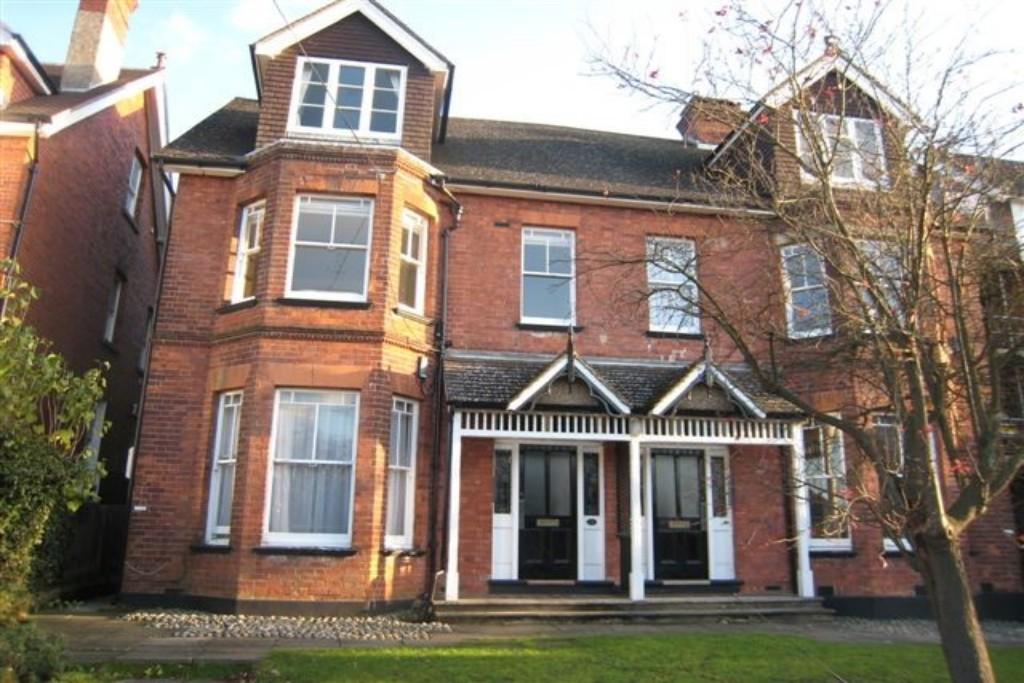
Photo 1 Photo 2 Photo 3 Photo 4 Photo 5 Photo 6 Photo 7
/ 7
Property details
Floor area
378 m²
Deprivation
Decile 10 (33,150 of 33,755)
Street crime
224 incidents within 1 mile (Apr 2026)
Additional details
- Garden
- Yes
Description
Listed by
Tunbridge Wells
Countrywide UK Lettings - Connells
Reference: 33879892
EPC Rating & Upgrade Cost
Fetching EPC data… Refresh this page in a moment.
Flood risk
Zone: 1
Risk: Low
Job (default Low)
FENSA Certificates
This property has 2 FENSA certificate(s) on record, indicating window/door installations by FENSA-approved installers.
FENSA Certificate #3456666
Property Details
Street: 2 Earls Road
Town: TUNBRIDGE WELLS
Postcode: TN4 8EA
Installation Details
Items: 3 windows
Certificate Issued: 06/02/2006
Work Completed: 23/01/2006
This certificate data was retrieved from FENSA's database
FENSA Certificate #3181548
Property Details
Street: 2 Earls Road
Town: TUNBRIDGE WELLS
Postcode: TN4 8EA
Installation Details
Items: 10 windows and 2 doors
Certificate Issued: 25/10/2005
Work Completed: 10/10/2005
This certificate data was retrieved from FENSA's database
What is FENSA? FENSA (Fenestration Self-Assessment Scheme) is a government-authorised scheme that monitors building regulation compliance for replacement windows and doors. Certificates indicate that work was completed by FENSA-approved installers.
Rental Range
Estimated market rent for Tunbridge Wells. Low = conservative, Realistic = average, Optimistic = best case.
Based on Local Authority from postcode lookup → Tunbridge Wells.
LHA (30th percentile) floor for High Weald: £798/mo (Apr 2025 – Mar 2026)
Location
Nearby
Nearest stations, universities and amenities (distance from property).
| Type | Name | Distance |
|---|---|---|
| Bus stop | Earl's Road | 0.0 miles |
| Bus stop | Oakdale Road | 0.1 miles |
| Shop | Lifestyle Ford | 0.4 miles |
| Shop | The Secret Cellar | 0.4 miles |
| Train station | Tunbridge Wells | 0.6 miles |
| Train station | Tunbridge Wells West | 0.9 miles |
| Hospital | Tunbridge Wells Nuffield Hospital | 1.2 miles |
| Hospital | Tunbridge Wells Hospital at Pembury | 2.6 miles |
| University | Tonbridge Adult Education Centre | 4.0 miles |
| University | St Piers College | 10.8 miles |
Street-level crime
| Category | Count |
|---|---|
| Violence and sexual offences | 71 |
| Anti-social behaviour | 41 |
| Shoplifting | 26 |
| Criminal damage and arson | 22 |
| Vehicle crime | 16 |
| Other theft | 13 |
| Public order | 11 |
| Drugs | 9 |
| Burglary | 4 |
| Possession of weapons | 4 |
| Theft from the person | 3 |
| Robbery | 2 |
| Bicycle theft | 1 |
| Other crime | 1 |
| Total incidents | 224 |
Within 1 mile during Apr 2026. Source: data.police.uk (England & Wales).
Schools nearby
Nearest open schools with Ofsted ratings (England). Closed schools are not shown. Data from Get Information about Schools and Ofsted.
| Name | Type | Distance | Ofsted |
|---|---|---|---|
| The Wells Free School | Primary | 0.4 miles | Good — 29 Jun 2015 |
| Rose Hill School | Other | 0.4 miles | — (No rating) |
| Bishops Down Primary and Nursery School | Primary | 0.5 miles | Requires improvement — 11 Dec 2023 |
| Bennett Memorial Diocesan School | Secondary | 0.5 miles | Outstanding — 30 Jan 2024 |
| The Skinners' School | Secondary | 0.6 miles | Good — 13 Jan 2022 |
Rental Comparables
Residential lets from OpenRent and Rightmove for the area (same bedroom count). Use to validate rent estimates. Student lets are excluded.
| Title | Rent | Beds | Distance | As seen on |
|---|---|---|---|---|
| 1 Bed Flat, Culverden Park Road, TN4 | £1,200/mo | 1 | 0.37 miles | OpenRent |
Average rent: £1,200/mo (1 listing)