Sandy Lane
Newcastle, ST5 0LT
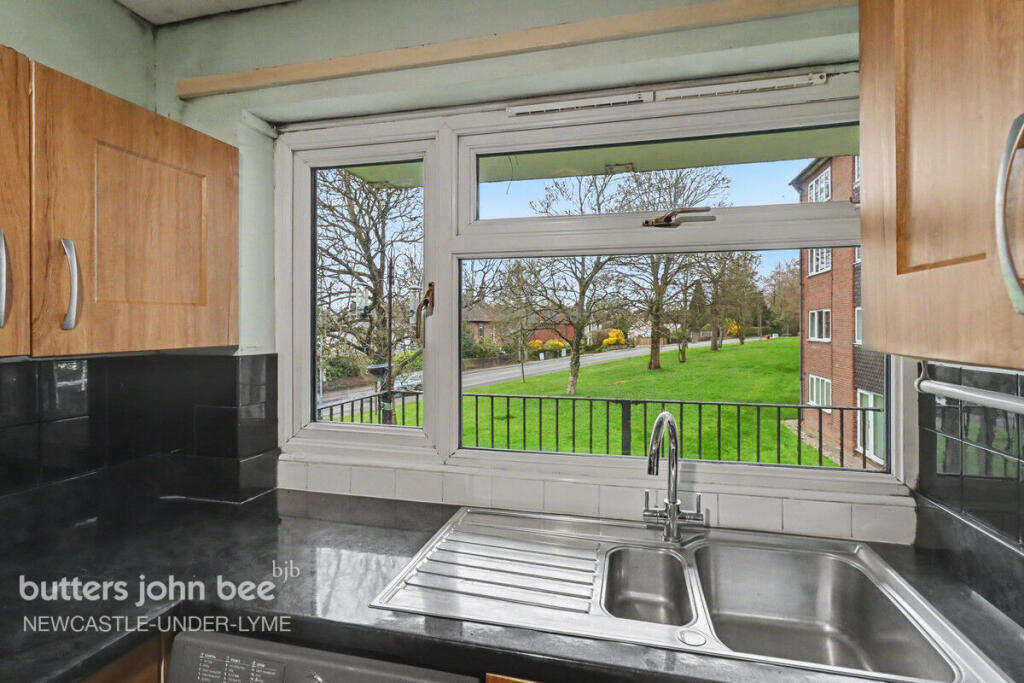
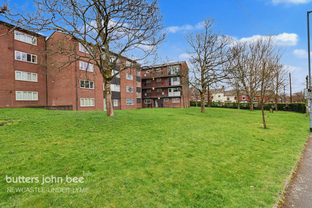
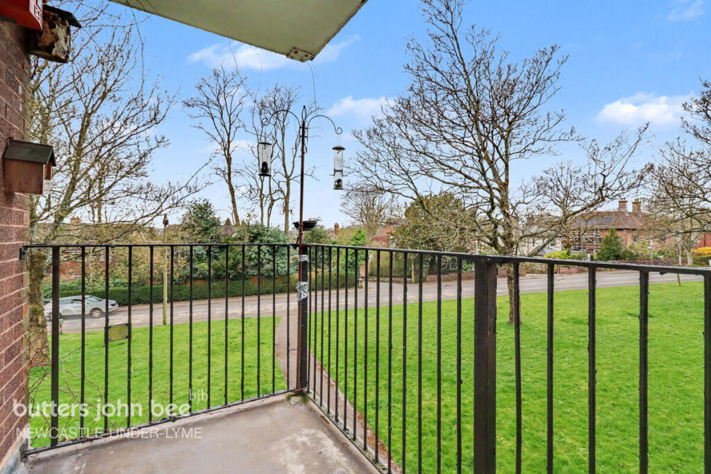
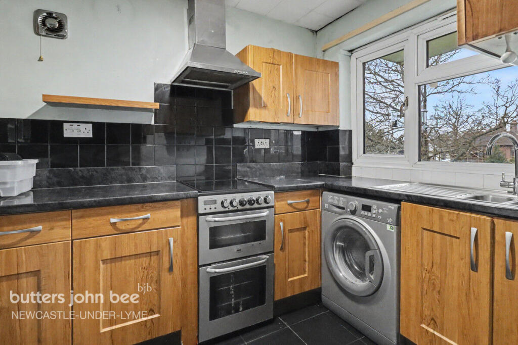
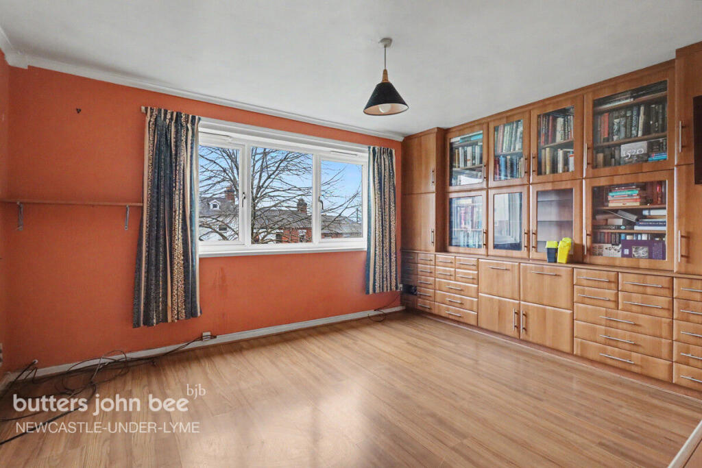
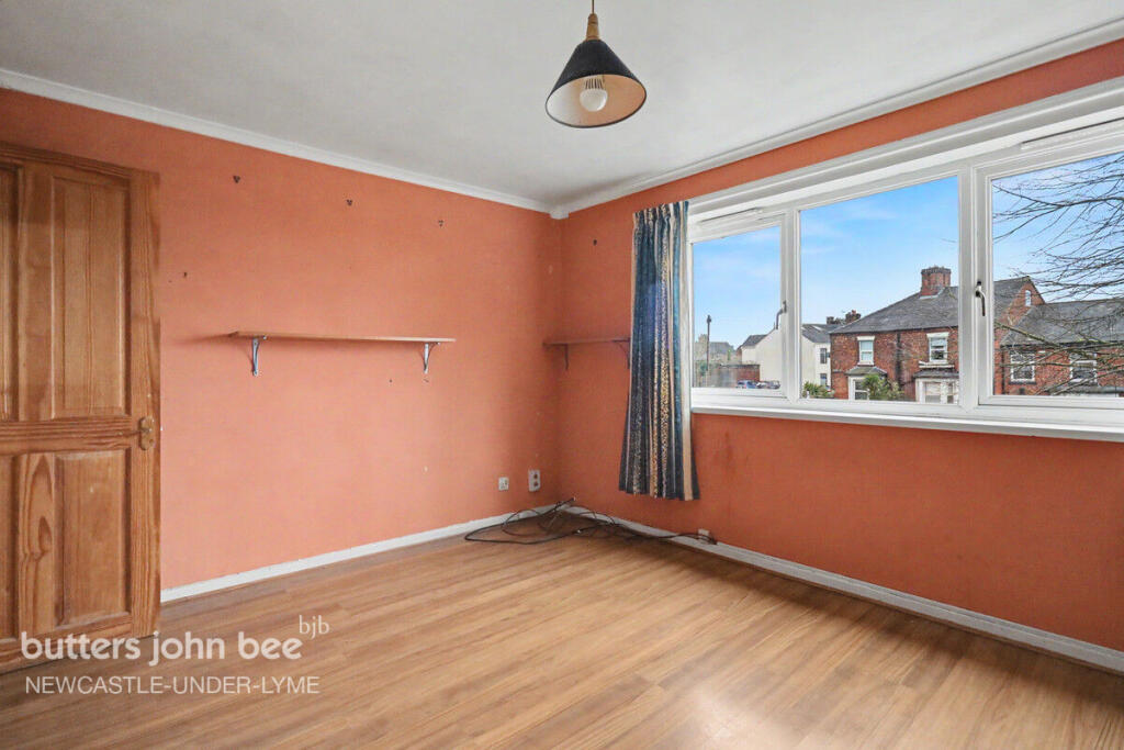
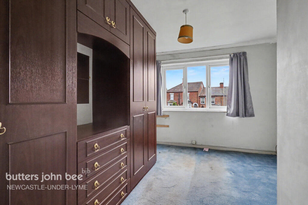
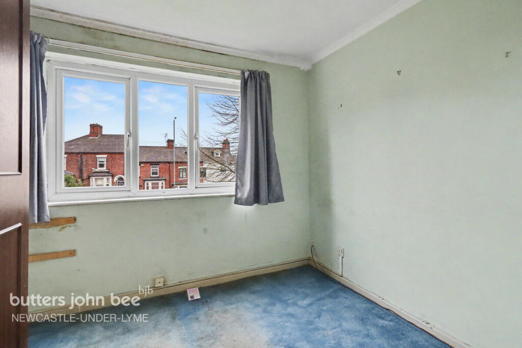
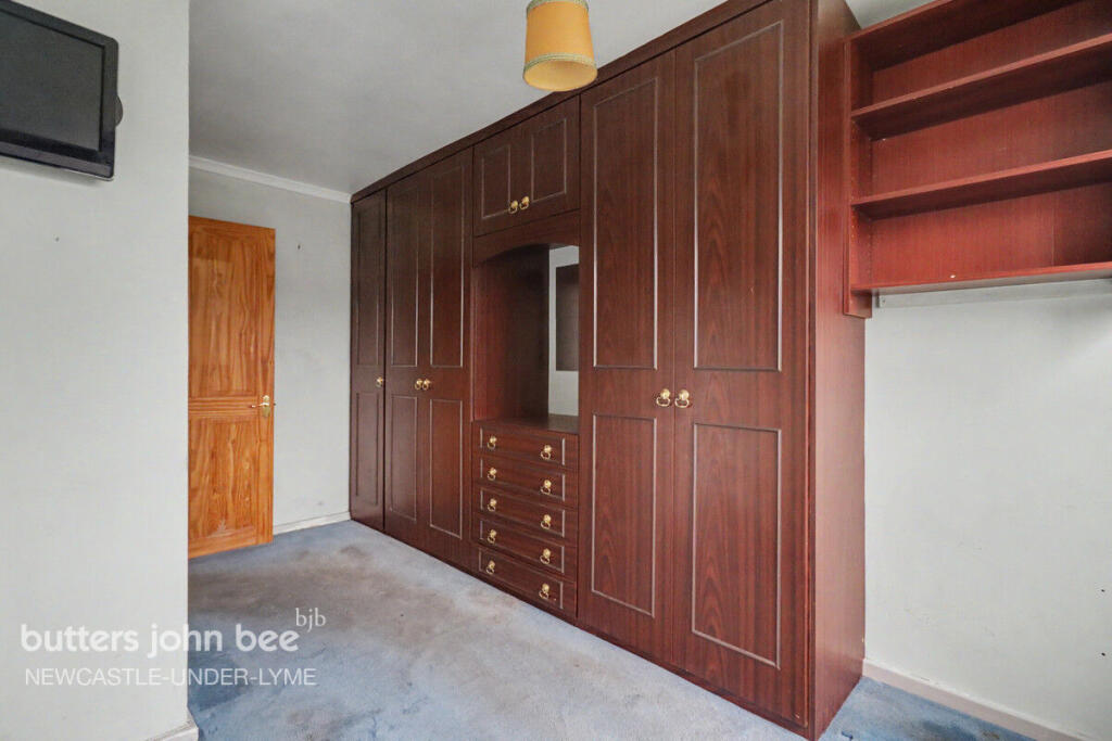
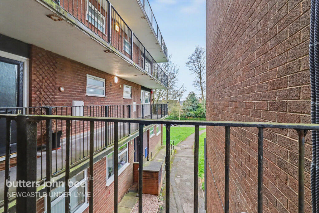
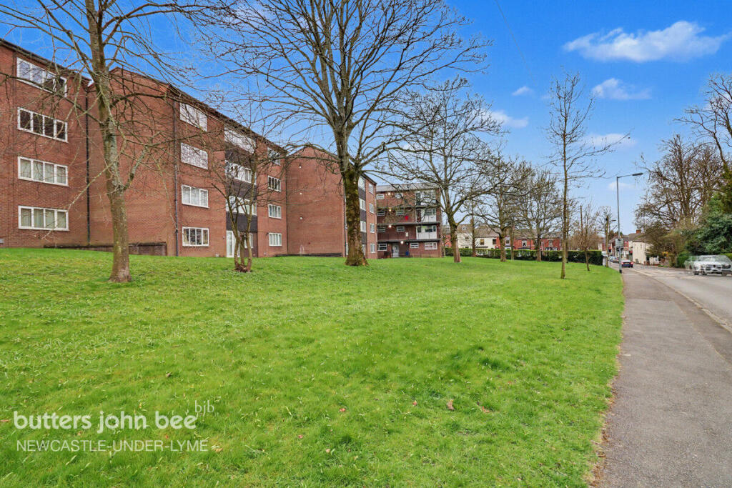
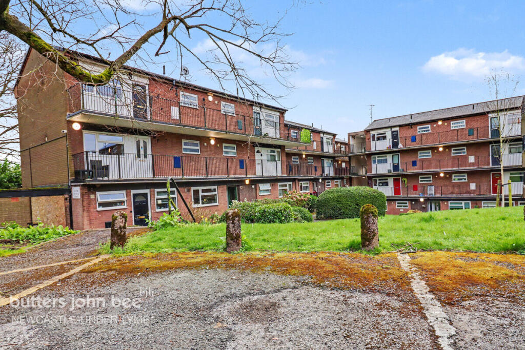
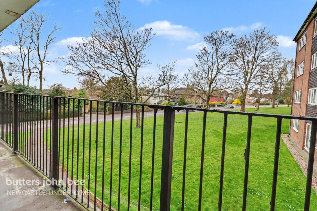
Photo 1 Photo 2 Photo 3 Photo 4 Photo 5 Photo 6 Photo 7 Photo 8 Photo 9 Photo 10 Photo 11 Photo 12 Photo 13 Photo 14
/ 14
Property details
Tenure
LEASEHOLD
Local average
£91,379 (-17.9%)
Deprivation
Decile 4 (11,363 of 33,755)
Street crime
350 incidents within 1 mile (Apr 2026)
Key features
- Investment Opportunity
- First Time Buyer
- Good Transport Links
- Close to Town Centre
- Potential To Improve
- Apartment
Additional details
- Parking
- Yes
- Garden
- Yes
Description
Situated on the first floor with ground floor access, this well-positioned one-bedroom apartment offers convenient access to Newcastle town centre along with excellent transport links, making it an ideal choice for a range of buyers.
Upon entering the property, you are welcomed into a central hallway. To the right, the fitted kitchen provides ample preparation space and pleasant views over nearby green space. A useful storage cupboard is located just adjacent, offering practical everyday convenience.
Continuing through the hallway, the bright and airy lounge features a large window that allows plenty of natural light, along with a fitted bookcase that adds both character and functionality to the space.
The bedroom is a comfortable double, benefiting from built-in storage to maximise space. Completing the property is a bathroom fitted with a three-piece suite.
While the apartment would benefit from some modernisation, it presents an excellent opportunity to create a comfortable and stylish home tailored to your taste. It is perfectly suited for first-time buyers, students, or investors seeking a well-located property with strong potential.
Externally, the property enjoys access to shared gardens and parking facilities.
Early viewing is highly recommended to appreciate the potential this property has to offer.
Listed by
Newcastle Under Lyme
Spicerhaart
Reference: 173972882
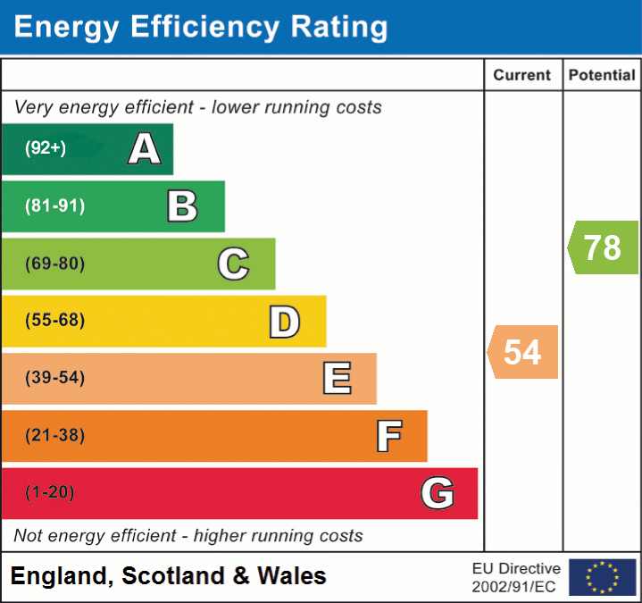
EPC ratings on this postcode
We don't have a matched EPC for this property yet. Below are efficiency scores and details for other addresses on this postcode.
| Address | Current | Potential | Floor area | Age band | Type |
|---|---|---|---|---|---|
| Flat 1/A Stoneyfields Court, Sandy Lane, NEWCASTLE | 51 | 75 | 31 m² | England and Wales: 1967-1975 | Flat |
| Flat 1/B Stoneyfields Court, Sandy Lane, NEWCASTLE | 51 | 75 | 31 m² | England and Wales: 1967-1975 | Flat |
| Flat 1/C Stoneyfields Court, Sandy Lane, NEWCASTLE | 54 | 78 | 45 m² | England and Wales: 1967-1975 | Flat |
| Flat 1/C Stoneyfields Court, Sandy Lane, NEWCASTLE | 42 | 79 | 47 m² | England and Wales: 1967-1975 | Flat |
| Flat 1/D Stoneyfields Court, Sandy Lane, NEWCASTLE | 54 | 75 | 45 m² | England and Wales: 1967-1975 | Flat |
| Flat 10/B Stoneyfields Court, Sandy Lane, NEWCASTLE | 54 | 78 | 45 m² | England and Wales: 1967-1975 | Flat |
| Flat 10/C Stoneyfields Court, Sandy Lane, NEWCASTLE | 54 | 78 | 45 m² | England and Wales: 1967-1975 | Flat |
| Flat 10/D Stoneyfields Court, Sandy Lane, NEWCASTLE | 54 | 75 | 45 m² | England and Wales: 1967-1975 | Flat |
| Flat 11/B Stoneyfields Court, Sandy Lane, NEWCASTLE | 54 | 78 | 45 m² | England and Wales: 1967-1975 | Flat |
| Flat 11/C Stoneyfields Court, Sandy Lane, NEWCASTLE | 54 | 78 | 45 m² | England and Wales: 1967-1975 | Flat |
| Flat 11/C Stoneyfields Court, Sandy Lane, NEWCASTLE | 68 | 79 | 46 m² | England and Wales: 1967-1975 | Flat |
| Flat 11/C Stoneyfields Court, Sandy Lane, NEWCASTLE | 76 | 77 | 45 m² | England and Wales: 1967-1975 | Flat |
| Flat 11/D Stoneyfields Court, Sandy Lane, NEWCASTLE | 54 | 75 | 45 m² | England and Wales: 1967-1975 | Flat |
| Flat 12/B Stoneyfields Court, Sandy Lane, NEWCASTLE | 54 | 78 | 45 m² | England and Wales: 1967-1975 | Flat |
| Flat 12/C Stoneyfields Court, Sandy Lane, NEWCASTLE | 54 | 78 | 45 m² | England and Wales: 1967-1975 | Flat |
Flood risk
Zone: 1
Risk: Low
Job (default Low)
EPC Graphs
EPC 1
Price history
| Event | Date | Price | % change |
|---|---|---|---|
| Listed for sale | — | £75,000 | — |
Source: HM Land Registry Price Paid Data. Crown copyright.
Sold Comparables
Same street and nearby sales within 0.25 miles (last 5 years). Data from Land Registry Price Paid.
| Address | Price | Date | Type |
|---|---|---|---|
| BRAMPTON COURT FLAT 4 BRAMPTON, NEWCASTLE, NEWCASTLE-UNDER-LYME, STAFFORDSHIRE, ST5 0QR | £195,000 | 20/03/2023 | Flat |
Area average: £195,000 (1 sale)
Capital growth trend
Land Registry outcode average: last 12 months vs 5y and 10y ago (from sold prices).
House Price Index (HM Land Registry — official index, not sold-price averages): Newcastle-under-Lyme. Series: Flats and maisonettes. As of March 2026.
Rental Range
Estimated market rent for Newcastle-under-Lyme. Low = conservative, Realistic = average, Optimistic = best case.
Based on Local Authority from postcode lookup → Newcastle-under-Lyme.
LHA (30th percentile) floor for Staffordshire North: £424/mo (Apr 2025 – Mar 2026)
Location
Address
Sandy Lane
Nearby
Nearest stations, universities and amenities (distance from property).
| Type | Name | Distance |
|---|---|---|
| Bus stop | Sandy Lane | 0.2 miles |
| Bus stop | The Hollies | 0.2 miles |
| Shop | Salon Geoffery | 0.2 miles |
| Shop | Mode Designer Kitchens & Bedrooms | 0.2 miles |
| Hospital | Hartshill Medical Centre | 0.6 miles |
| Hospital | North Staffordshire Hospital | 0.8 miles |
| University | University of Staffordshire Stoke Campus | 1.6 miles |
| Train station | Stoke-on-Trent | 1.6 miles |
| Train station | Longport | 1.7 miles |
Street-level crime
| Category | Count |
|---|---|
| Violence and sexual offences | 102 |
| Anti-social behaviour | 69 |
| Public order | 39 |
| Shoplifting | 31 |
| Criminal damage and arson | 23 |
| Other theft | 19 |
| Drugs | 18 |
| Burglary | 16 |
| Vehicle crime | 12 |
| Other crime | 7 |
| Possession of weapons | 7 |
| Robbery | 4 |
| Theft from the person | 2 |
| Bicycle theft | 1 |
| Total incidents | 350 |
Within 1 mile during Apr 2026. Source: data.police.uk (England & Wales).
Schools nearby
Nearest open schools with Ofsted ratings (England). Closed schools are not shown. Data from Get Information about Schools and Ofsted.
| Name | Type | Distance | Ofsted |
|---|---|---|---|
| Lyme Brook Independent School | Other | 0.2 miles | Good — 22 Oct 2023 |
| Demetae Academy | Other | 0.2 miles | Good — 30 Jun 2022 |
| May Bank Infants' School | Primary | 0.4 miles | Good — 21 Jan 2024 |
| Newcastle-under-Lyme School | Other | 0.5 miles | — (No rating) |
| Harpfield Primary Academy | Primary | 0.5 miles | Good — 10 Feb 2015 |
Rental Comparables
Residential lets from OpenRent and Rightmove for the area (same bedroom count). Use to validate rent estimates. Student lets are excluded.
Average rent: £639/mo (35 listings)
Rent-driven metrics
Based on OpenRent comparables.
- Rent ratio — Monthly rent ÷ purchase price (1% rule). 1%+ = strong, 0.8–1% = okay, <0.8% = weak for cashflow.
- Max investor price — Rent ÷ 0.8%; the price at which rent would be 0.8% of price (Stoke-style target).
- Target investor price — Rent ÷ 1%; the price at which rent would be 1% of price (strong cashflow band).
- Gross yield — Annual rent as % of purchase price (no costs).
- Cost-to-rent — Price ÷ annual rent (from OpenRent comparables). Under 14× = strong, 14–16× = acceptable, 17×+ = compressed.
- Cashflow — Rent minus mortgage, 10% maintenance, £25/mo compliance. Assumes 75% LTV, 3.95% APR (5yr fixed), 25yr term.
- ROI — Annual profit ÷ cash in (deposit + 4% purchase costs).
Enter House Number
Enter the house number to help us retrieve more accurate pricing history and property data.
Please log in to submit or correct the house number for this listing.
Log in to continue