30 TENBY DRIVE
LUTON, LUTON, LUTON LU4 9BL
£700 pcm
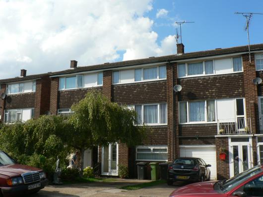
Photo 1
/ 1
Property details
Floor area
95 m²
EPC rating
C
Year built
England and Wales: 1967-1975
Deprivation
Decile 4 (10,695 of 33,755)
Street crime
320 incidents within 1 mile (Apr 2026)
Key features
- Three/Four Bedroom
- Town House
- Part Furnished
- Central Heating
- Double Glazing
- Newly Decorated
- New Carpets
- Close to Local Amenites
Description
Listed by
Luton- old
Ideal Properties (Luton)
Reference: 13321285
EPC Rating & Upgrade Cost
Current rating: C
Potential rating: B
Inspection date: 04/08/2019
Expiry date: 03/08/2029
Current heating cost: £528/year
Potential heating cost: £427/year
Est. upgrade cost to C: £12,500
Recommendations
- Upgrade heating controls (£350 - £450)
- Replace boiler with new condensing boiler (£2,200 - £3,000)
- Solar water heating (£4,000 - £6,000)
- Solar photovoltaic panels, 2.5 kWp (£3,500 - £5,500)
Flood risk
Zone: 1
Risk: Low
Job (default Low)
Rental Range
Estimated market rent for Luton. Low = conservative, Realistic = average, Optimistic = best case.
Based on Local Authority from postcode lookup → Luton.
LHA (30th percentile) floor for Luton: £1,097/mo (Apr 2025 – Mar 2026)
Location
Nearby
Nearest stations, universities and amenities (distance from property).
| Type | Name | Distance |
|---|---|---|
| Shop | Afghan | 0.1 miles |
| Shop | Hamza Supermarket | 0.2 miles |
| Bus stop | Maidenhall Beechwood | 0.3 miles |
| Train station | Leagrave | 0.6 miles |
| Hospital | Luton and Dunstable Hospital | 1.0 miles |
| Hospital | Widecombe Nursing Home | 1.7 miles |
| Train station | Luton | 2.0 miles |
| University | University of Bedfordshire | 2.3 miles |
Street-level crime
| Category | Count |
|---|---|
| Violence and sexual offences | 134 |
| Anti-social behaviour | 54 |
| Criminal damage and arson | 25 |
| Vehicle crime | 22 |
| Public order | 21 |
| Drugs | 20 |
| Other theft | 17 |
| Other crime | 10 |
| Burglary | 7 |
| Shoplifting | 5 |
| Possession of weapons | 3 |
| Robbery | 1 |
| Theft from the person | 1 |
| Total incidents | 320 |
Within 1 mile during Apr 2026. Source: data.police.uk (England & Wales).
Schools nearby
Nearest open schools with Ofsted ratings (England). Closed schools are not shown. Data from Get Information about Schools and Ofsted.
| Name | Type | Distance | Ofsted |
|---|---|---|---|
| Beechwood Primary School | Primary | 0.3 miles | Good — 14 Oct 2019 |
| Norton Road Primary School | Primary | 0.4 miles | Good — 13 May 2024 |
| St Joseph's Catholic Primary School | Primary | 0.5 miles | Good — 6 Dec 2017 |
| Downside Primary School | Primary | 0.6 miles | Good — 5 Jun 2015 |
| Challney High School for Girls | Secondary | 0.6 miles | Outstanding — 10 Feb 2020 |
Rental Comparables
Loading rental comparables for this postcode. Refresh in a few minutes.